The farms of Kings Weston

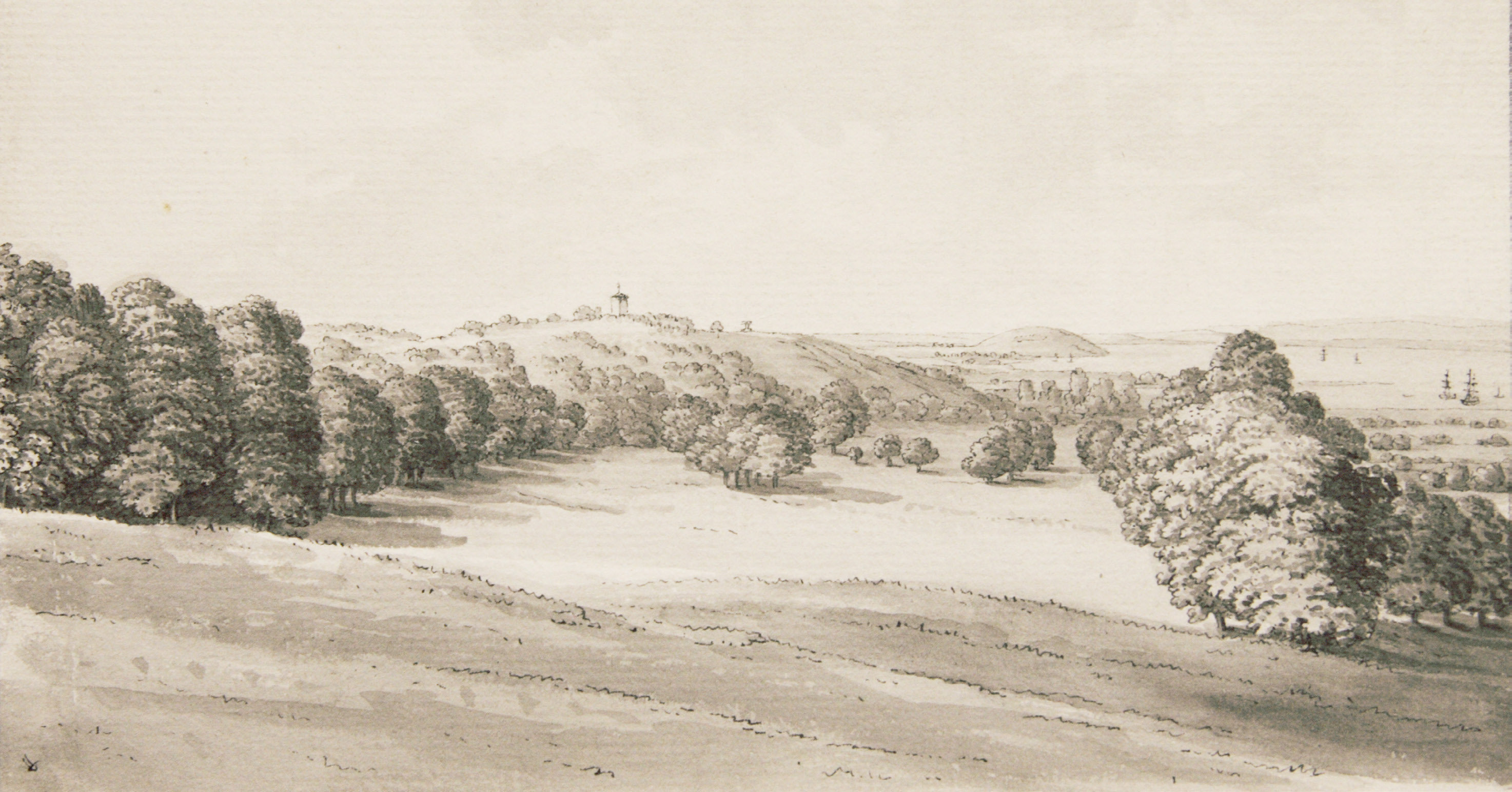
Professor Richard Coates of the University of the West of England has been a regular contributor to academic research on the Kings Weston Estate. Recently he has completed work on a paper detailing the fascinating history of the many farms that lay within the wider ownership of the families who held Kings Weston House. The majority have their foundations in the land improvements undertaken by Sir Robert Southwell and his heirs though some may have their origins in earlier times. Sir Robert was President of the Royal Society and in the 1690s he employed another of its fellows, and close friend, Robert Hooke to design a new sea wall to protect his farmlands from inundation from the Severn. After this work was completed the Southwell family could start developing the floodplain with confidence and throughout the Eighteenth Century new farms were developed for leasing onwards. 

Sea Mills Farm now on Bowerleaze, but dated 1710
Campbell Farm on Kings Weston Lane. 

Whilst the majority of the farmland owned by the Southwell’s stood to the north of Kings Weston house the estate boundary encompassed lands on the south side of the Kings Weston Ridge, stretching as far as Sneyd Park. The area now covered by Sea Mills also incorporated several farms and other buildings that contributed to the annual income of the estate. 

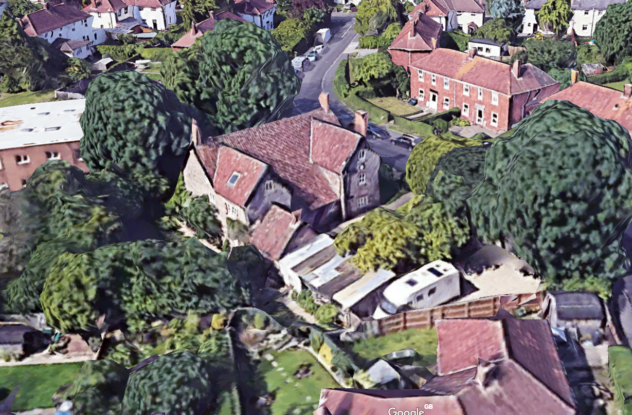
Professor Coates research identifies eighteen farms within these two areas, split by the Kingsweston ridge on which the mansion sits. Many of the buildings of these farms remain today, hidden amongst more recent housing estates. Lost fragments lie scattered in industrial estates, and other have vanished entirely, known today only through historic maps or road names.  Perhaps the most interesting collection of farms are those  that were given family names of the Southwell Family. The best preserved of these is Campbell Farm just to the north of Long Cross on Kings Weston Land. Here there is a good collection of former farm buildings that date from the Eighteenth Century and have since been converted to residential use. This farm would have formed part of the extended village of Kings Weston before it was swallowed up by the post-war Lawrence Weston housing estate.   

Katherine Watson, wife of Edward Southwell II, after whose family many of the farms were named. 

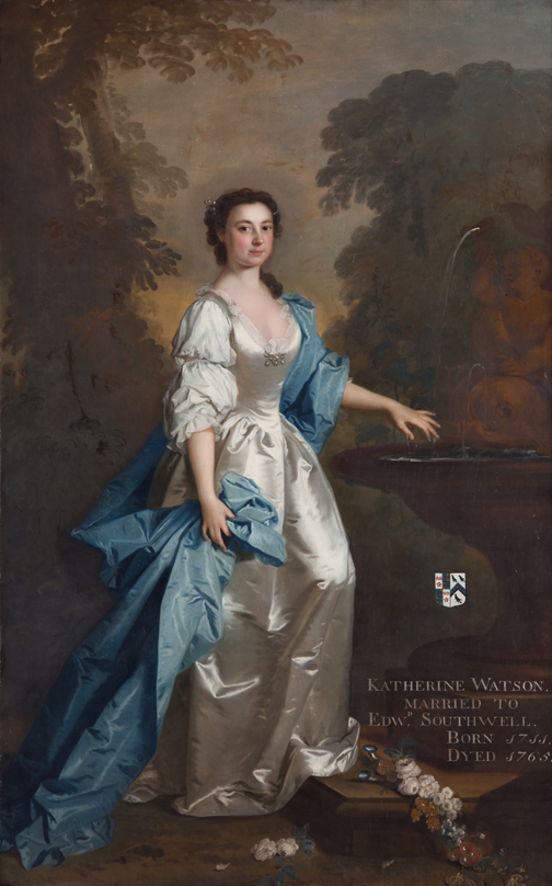
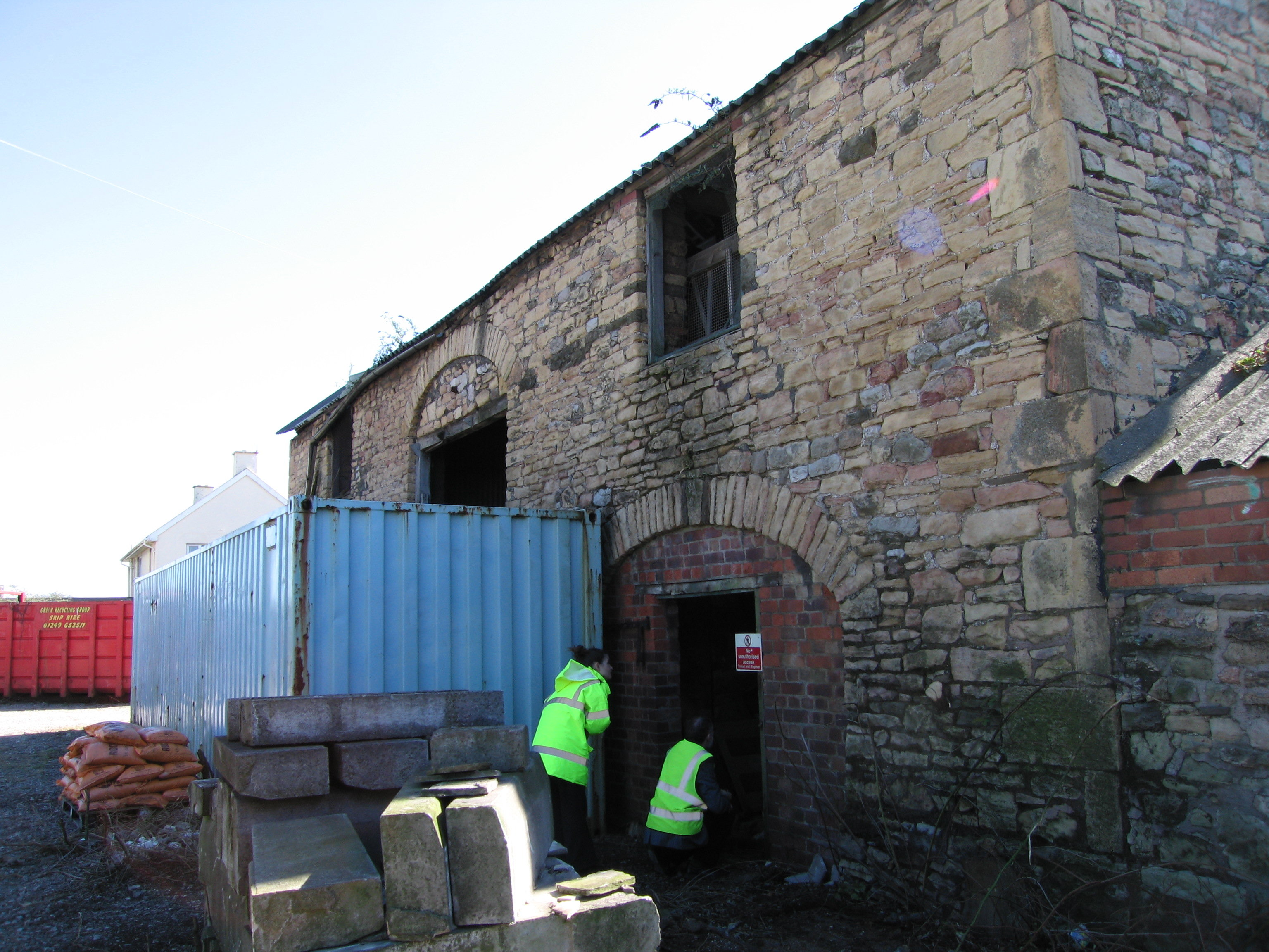
Other farms in this collection are Cromwell Farm, named after Lady Elizabeth Cromwell who married Sir Robert’s son, Edward, Rockingham Farm, named after the noble family title of Edward Southwell II’s wife Katherine, Watson Farm taking the same lady’s surname, and of course Katherine Farm itself at the far northern extremity of the Eighteenth Century estate. The last fragment of this farm is a stone barn still standing on the edge of the modern sewerage works, but the grandiose farmhouse has sadly long gone. 

If you would like to read the full paper Proffessor Coates has kindly allowed us to host it on KWAG’s website and can be viewed and downloaded here: http://www.kwag.org.uk/wp-content/uploads/2018/06/KWFindependent.pdf

Kings Weston
Katherine Farm in the 1950s from Know Your Place
The Georgian barn; the last fragment of Katherine Farm on Lawrence Weston Road.

The yew trees talk to us

the recently revealed line of yews looking up the slope towards the main path 

We’ve made a habit recently of clearing undergrowth and revealing some majestic trees in the woodland, but it’s easy to forget that this wilderness was once all part of a designed landscape; Our April  Working Party uncovered more trees that help tell that story. Just to the north side of the main path through the woods we discovered a line of three mature yew trees, clearly planted in an intentional line, and with the stumps of a fourth and fifth tree nearby and to the same spacing.

the boundary of the woods shown in 1772

Yew are something of a tell-tale species at Kings Weston; whilst their scattering may at first seem random through the woodland many relate to historic planning schemes and features. When compared with historic plans and illustrations the significance of the yews becomes more clear. The three yews we rediscovered last month run along a former boundary between the more open parkland to the east, and the long-established woodland to the west. Originally a wall formed this boundary, with a set of gates straddling the main path, but, by the 1770s this had be de-formalised and  instead an iron park fence replaced it. An estate plan from this date clearly shows the planting of trees on the outer edge of it and the yews are certainly the same ones described in plan.

the walled boundary and gates into Penpole Wood in 1710

This is not the only instance of yews indicating lost historic features. Further along the path through the woods to Penpole Point you will encounter many more, frequently grouped around certain points. A careful comparison between these locations and an earlier estate plan of 1720 suggest that these are the remains of woodland saloons where viewing corridors were cut through the trees northwards towards the Severn and Wales beyond. Whether these yews were planted as a deliberate grove, or whether they are the vestiges of a more formal hedged circle can’t be established, but their planted locations are not coincidental.

Penpole Wood in 1720 showing the main path and circular saloons with viewing alleys cut through the trees. 

Our next Working Party will reveal another designed feature in which yews feature prominently: an avenue of mixed yews and oaks leading from the ruins of Penpole Lodge to the Jubilee Clearing. This strip of land is a curiosity. In 1772 the park boundary appears to run just above the main path through the woods, so this elongated sliver of land between that path, the current boundary wall, and running as far east as to incorporate the clearing, is outside the woodland. By 1840 the park boundary had been pushed out to its current extent and the line of yews planted. The planting defining the clearing (along with more cherry laurel) appears to have been laid out at the same time. This may all have been the work of the last of the Southwell family to live at Kings Weston , the 21st Baron de Clifford. He was known to be a keen planter and the dates, between 1777 and 1832, and the enclosure Acts would fit this incursion onto the common land.

So next time you are walking through Penpole Wood keep an eye open, and next time you spot a yew ask yourself what it might be telling you about the lost historic landscape and the people who created it.

Historic letter by Sir John Vanbrugh returns to Bristol

Archivist Mark Small of Bristol Archives holds the newly delivered letter

We’ve had confirmation this month that the missing Sir John Vanbrugh letter has arrived at Bristol Archives! We remain hugely grateful to everyone who donated to our short campaign to bring the document back from the USA, and to the Friends of Bristol Museums, Art Galleries, and Archives for their partnership in securing it. The letter has now been accessioned and is available for anyone to study, though is not yet included on the public catalogue.


Architect Sir John Vanbrugh’s signature from the letter. 

The Southwell’s and the Slave Economy: Report 

The 17th of last month saw Kings Weston house host a talk, and discussion, on the slavery connections of the estate. Dr Madge Dresser, of the University of the West of England and KWAG’s chairman David Martyn tried to put the complex relationships between the Southwell family of Kings Weston and their associations with the Atlantic Trade and slavery into context. Dr Dresser began the evening by explaining the many ways in which historic estates such as Kings Weston could be said to have slavery connections. She outlined the Atlantic trade of the Seventeenth and Eighteenth Centuries and how almost every aspect of it had some relationship with slavery and the direct “triangular trade” connecting Europe, Africa, and the colonies of east-coast America.

The Oak Room was packed for the talk. 
East Florida in the Eighteenth Century, where the Southwells had plantations. 

Mr Martyn sought to tease out the members of the Southwell family and their relationships with the Atlantic Trade. Whether family members were administering government departments, promoting political causes, or involved in plantations it became clear that there were many blurred edges in how their actions could be interpreted. The most direct unequivocal involvement was Edward Southwell III’s grant from the Crown of 20,000 acres of land in East Florida to settle, and the development of that land with plantations worked by black slaves.

The debate following the two presentations mainly revolved around the extent to which Kings Weston could be considered an estate that had benefited from money derived from slavery or the Atlantic Trade. Although the East Florida plantations had collapsed in massive debt, there were members of the Southwell Family who were complicit in enabling the trade to continue. It was difficult to identify any direct financial benefit from the trade that could be linked to the house and estate, but it was largely unanimous that the connections needed to be acknowledged and accepted. The evening was rounded off with continued discussions over drinks at the bar.

Sophia Southwell, wife of Edward Southwell III, 20th Lord de Clifford, and her children by Daniel Gardner. Painted circa.1775, a time at which the family were speculating in plantations in East Florida, but amounting considerable losses. 

Recently acquired painting of Shirehampton Park.

The golf course on Shirehampton Park often puts off potential visitors, but it remains an integral part of the historic landscape. This oil painting, “In Shirehampton Park”, recently surfaced showing the pastoral scene in the Edwardian Era. The Golf course began in 1904 and extended to eighteen holes in 1907. This painting shows the scene before the setting out of the course in the eastern side of the park, and illustrates the rolling pastures dotted with parkland trees which sadly have not survived later landscaping schemes.

The artist. CW Goodridge, was apparently an amateur, but anyone with further details of him or his work would be very welcome.

“In Shirehampton Park”, CW Goodridge, early Twentieth Century  

Historic Vanbrugh Letter saved for the nation!

There has been some incredible generosity from KWAG members over the last couple of weeks in their support of our campaign to repatriate a letter written by Sir John Vanbrugh regarding the construction of Kings Weston House. We are delighted to announce that we’ve met our fundraising target of £500 to bring the letter back to Bristol in partnership with the Friends of Bristol Museum and Art Gallery. Our contribution will now be added to the £900 the Friends have granted towards the purchase, and the letter added to the collections of the Bristol Archives at B-Bond in Bristol. Once it arrives, and is appropriately conserved, the letter will be available to study by anyone, and we hope that an exhibition celebrating its acquisition might be a good way of thanking the donors.

Reconstruction of the Saloon as originally designed. 

The letter now in the process of acquisition dates from December 1713, a time when Edward Southwell was able to walk around the rough floors of the house. From a letter the same September, also in the Archive, we know that it had taken just fifteen months to build the walls of the house up to roof level and have begun leading the roof. In the December letter Vanbrugh discusses Edward Southwell’s hopes to cut costs by leaving out the stone vaults of the basement level which, apparently, were only constructed after the shell of the house was already complete. We also discover that the original plan was to have a stone floor in the great stair hall. Whilst the change to a timber floor appears to have been undertaken against Vanbrugh’s advice Southwell’s idea to extend the stair itself into the cellar was, fortunately, abandoned in favour of the “Little Stair” that was still in construction.

Vanbrugh also discusses the plans to build his intended Kitchen wing at the rear of the building; this structure was built, but later demolished and replaced a few decades later. The letter confirms Vanbrugh’s authorship of the Great Terrace and, from what he writes, he is clearly pleased with Southwell’s decision to execute his designs for it.

Whether Vanbrugh ever returned to Kings Weston in the Spring of 1714 as he promised is not known, but certainly he was keen to make a “trial with boards” to make sure the distinctive chimneys made the effect he intended.

We’re grateful to Mark Small from Bristol Archives for transcribing the whole letter and presenting it along with images of the original. It can be viewed as a PDF here.

Vanbrugh’s original design for the kitchen wing, attached to the north corner of the main house 


The Home Guard at Penpole Lodge

Another foray into the Bristol Archives has uncovered a new photo. The image shows the Home Guard in an official photograph, lined up at Penpole Point close to the end of the Second World War in 1944. These men were part of “C” Company of the 14th Battalion of the Home Guard.

The Home Guard at Penpole Point in 1944. Part of the Ethel Thomas Collection at Bristol Archives. 
The ruinous condition of Penpole Lodge in about 1950

During the war the Home guard used Penpole Woods and the Home Park at Kings Weston, at that time the District Scout Camp, for training purposes. In 1940 they even requisitioned the tower of Penpole Lodge. The Scouts, who still owned the building observed “some concern the activities of the home guard when they took over the tower” and their site warden recalls in his diary of the time that “In the autumn of this year  the Home Guard, or the LDV’s as they were then called, took over the tower as an observation post. They stayed until the Spring. Poor old tower – it bears its scars from friend and foe now. Still we won’t say too much about that; but it’s another job to be attended to after the war.” The journal now also forms part of the Bristol Archives collection.  

It is not clear exactly what damage the Home Guard might have inflicted on the tower, but this, and further vandalism by “Local toughs” in the years following the war, led to the building being ruinous by the 1950s.  

The Home Guard trained in the woodland and camouflage skills were practiced amongst the trees and undergrowth. The warden’s journal for the war years includes some humorous sketches of their activities!  

Humorous sketches abound in MR W Webber’s journal of the Scout’s district campsite (Bristol Archives ref: 45305/1) 

Memorials of Philip Miles

If you are looking for something interesting to liven up your walls and you have a penchant for Bristol then a recent auction lot might take your fancy. A portrait is shortly to be sold by Lawrences in Crewkerne, Somerset that has a strong connection with Kings Weston. The sitter is Philip Miles, who bought the estate in 1833 for the princely sum of £206,000; an extraordinary sum for the time. It will perhaps come as little surprise that Miles was Bristol’s wealthiest person and, when he died, the city’s first recorded millionaire.

Philip John Miles by Sir Thomas Lawrence, currently up for auction on the 19th Jan

When he bought Kings Weston he already owned the palatial Leigh Court on the other side of the Avon in Somerset, and had filled it full of famous Old Master paintings. For his own portrait he commissioned Sir Thomas Lawrence, the most famous portraitist of his time; this may not have just been purely for the prestige, but Lawrence was a Bristol-born artist who had made good in the capital.


The Miles’s founded their fortune as merchants, bankers, and ship owners, and owning plantations in the colonies. As might be expected for the period his business interests were heavily dependent on slavery right up to 1833, the year he bought kings Weston, and the Slavery Abolition Act.  He was also MP for Bristol between 1835 and 1837.

Philip Miles’s memorial in Abbots Leigh church, by E H Baily 

The painting up for sale is likely to have been painted before Miles moved to Kings Weston, and it is not documented as having hung in the house, but it is an important record of a man who played an important role in the history of the city and the estate.

After Philip Miles’s death his family went to the foremost sculptor of the age to have his memorial carved. Again, perhaps not be coincidence, the artist, Edward Hodges Baily, was Bristol-born. It is known that the family were keen benefactors of the Bristol Arts scene and it is likely that their patronage of Bristol artists was intentional. The monument stands today, pale and magnificent, on the north wall of the tower of Abbots Leigh church; a pair of pensive figures stare up towards a draped classical urn bathed in carved stone rays of heavenly light.    

The portrait of Philip Miles sells at Lawrence’s auction rooms on the 19th of January with an estimate of £4000-£6000. For further information, or perhaps even to make a bid, go here.

Urgent Iron Bridge Action!

Important news about the Iron Bridge!

KWAG fully supports a morning event this Sunday to bring about new attention for the plight of the Grade II Listed Iron Bridge on the estate.Frustrated locals in north Bristol are marking 800 days since a vital – and historic – footbridge was closed to pedestrians by Bristol City Council, with a public rally showing how much the bridge is loved.


Kingsweston iron bridge is a Grade II listed cast iron structure, built circa 1820 by legendary roads engineer John Loudon McAdam (who gave his name to tarmac). It forms the only safe pedestrian link between the Blaise and Kings Weston estates in north Bristol. It was used daily by hundreds of dog walkers, families, schoolchildren and ramblers until it was struck by a high-sided lorry on 4 November 2015. The bridge was swiftly scaffolded by Bristol City Council and closed to pedestrians – and has now remained this way for over 2 years and 2 months. This week marks 800 days since the bridge was last open to foot traffic.

The Facebook group Save the iron bridge – Kingsweston has over 400 members, but campaigners are growing frustrated with the Council’s slow pace and poor communication with locals. The closure affects thousands of residents of Sea Mills, Shirehampton, Combe Dingle and Lawrence Weston, as well as many visitors from the wider Bristol area.

We are urging anyone who uses or cares about the future of the bridge to join them this Sunday 14th Jan, 10-11am and attach their messages of support to the bridge. Messages will be pinned to the scaffolding around the bridge and then put on display locally. “Although Bristol Council has said it’s committed to repairing the bridge, so far we have only had words and no action,” say event organisers Ella Davies and Dan Linstead. “We appreciate budgets are tight, but we need the Council to act now rather than later.

With the footbridge closed, locals are forced to cross the notoriously busy Kingsweston road, with traffic coming fast and unexpectedly in both directions. It is only a matter of time before someone is seriously injured or worse.”

Group members and local councillors will meet at the bridge this Sunday 14th January at 10am (press photocall at 11am) to raise awareness ahead of a full council meeting on
Monday.

For more information and to join the Facebook group, visitgreenironbridge.com. contact organisers Ella Davies (ella.davies@yahoo.co.uk, 07707 125227)
or Dan Linstead (danlinstead@yahoo.co.uk, 07866 551632)

Kings Weston on the verge

The Loggia, designed in 1718 by Sir John Vanbrugh. Seen here in 1927 (Country Life)

The area recently worked on by KWAG volunteers, just below the coffee shop terrace, Is an odd corner of the Kings Weston estate. Hard up against Kings Weston Lane in its gulley to the east it has always been an abrupt edge to the Landscaped grounds.

Before the present house was built the slopes descending towards Lawrence Weston here were laid out as formal kitchen gardens, though would have been sorely exposed to the brisk winds off the Severn. The top of the slope offered spectacular panoramas across the estuary and, in 1705, a banqueting house was built on a terrace overlooking the kitchen gardens. When Sir John Vanbrugh came to rebuild the house for Edward Southwell his plans extended to major landscape interventions. The small banqueting house received a new façade in 1718, one that looked back into the park and along a vast new terraced promenade; this building forms the core of the current Loggia.   

As garden fashions changed the whole of the area below the banqueting house and Loggia were deformalised and the topography took on a form much the same as today’s. By 1772, when the area was surveyed by Isaac Taylor, only the Loggia remained, and the terraces and formal gardens swept away. In their place the open parkland swept unbroken to an area described as “verge plantations”. On his plan Taylor identified a railed fence separating the newly planted area from the recently created rolling meadowland below the house; the remains of this Georgian fence can still be found in the area recently cleared.

The view from the loggia across the meadow land. Hieronymus Grimm, 1788 (Bristol Museum and Art Gallery) 
 Taylor’s 1772 estate plan with later alterations annotated

Within the plantation new trees and shrubs were laid out as part of a pleasure walk that connected the house and Loggia with the Home Farm and Menagerie below. This planting would have been intentionally picturesque in style and some of the holly, yew, and Portuguese laurel from this era are still growing there, though the path has long become lost. Maps show there to have been many evergreens incorporated within a design intended to frame the open meadow and focus the eye on Kings Weston house commanding the ridge above it.  

As time went on the trees and shrubs grew up and the view of the Loggia from the park was sadly obscured. The pleasure walk and planting continued to be maintained until the 1930s, but since then there has been little attention spared on them. Since WWII and the cessation of regular livestock grazing, this has resulted in the gradual encroachment of self-seeded trees beyond the historic fence line and the loss of the tamed edge of the meadow. Today trees cover almost twice the area of the original verge plantation and have further obscured the house and Loggia from within certain areas of the park. It is hoped that KWAG’s work, and forthcoming work as part of the National grid contributions, will help enhance the setting of Both Grade I Listed buildings and the park as a whole.