Category Archives: Nature

Encroaching problems

As we’ve already seen from our working party progress report, encroachment of undergrowth is a major issue for the Registered Historic Landscape. Looking at Shirehampton Park as a case study reveals the scale of the issue.
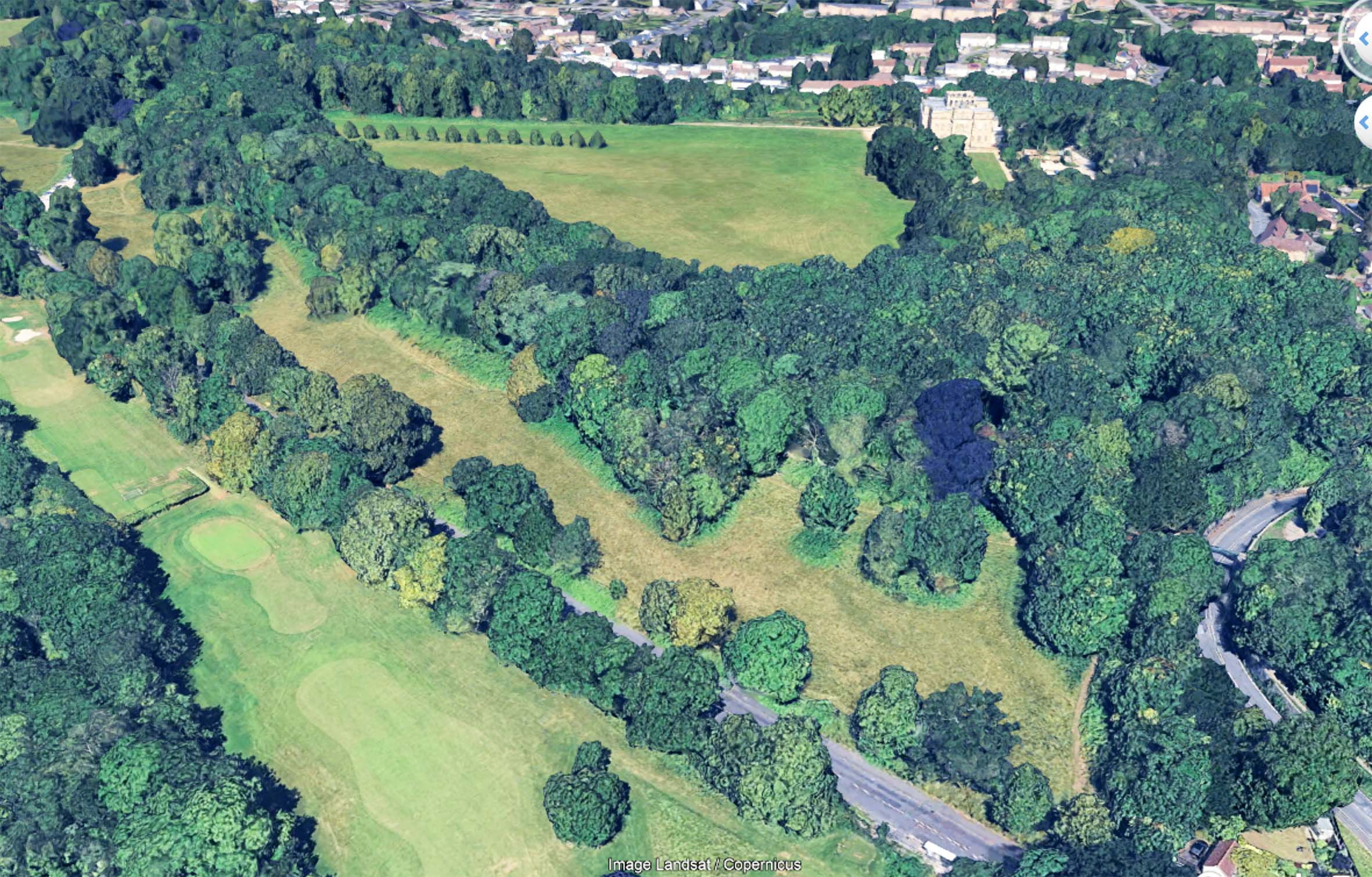
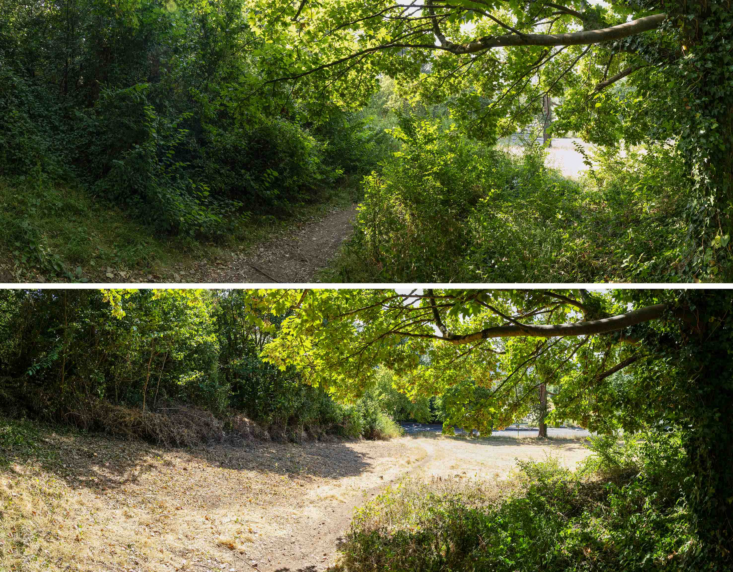
The vibrant green beneath the trees contrasts with the yellower grass. This indicates the extent of the encroachment as it appeared last year.

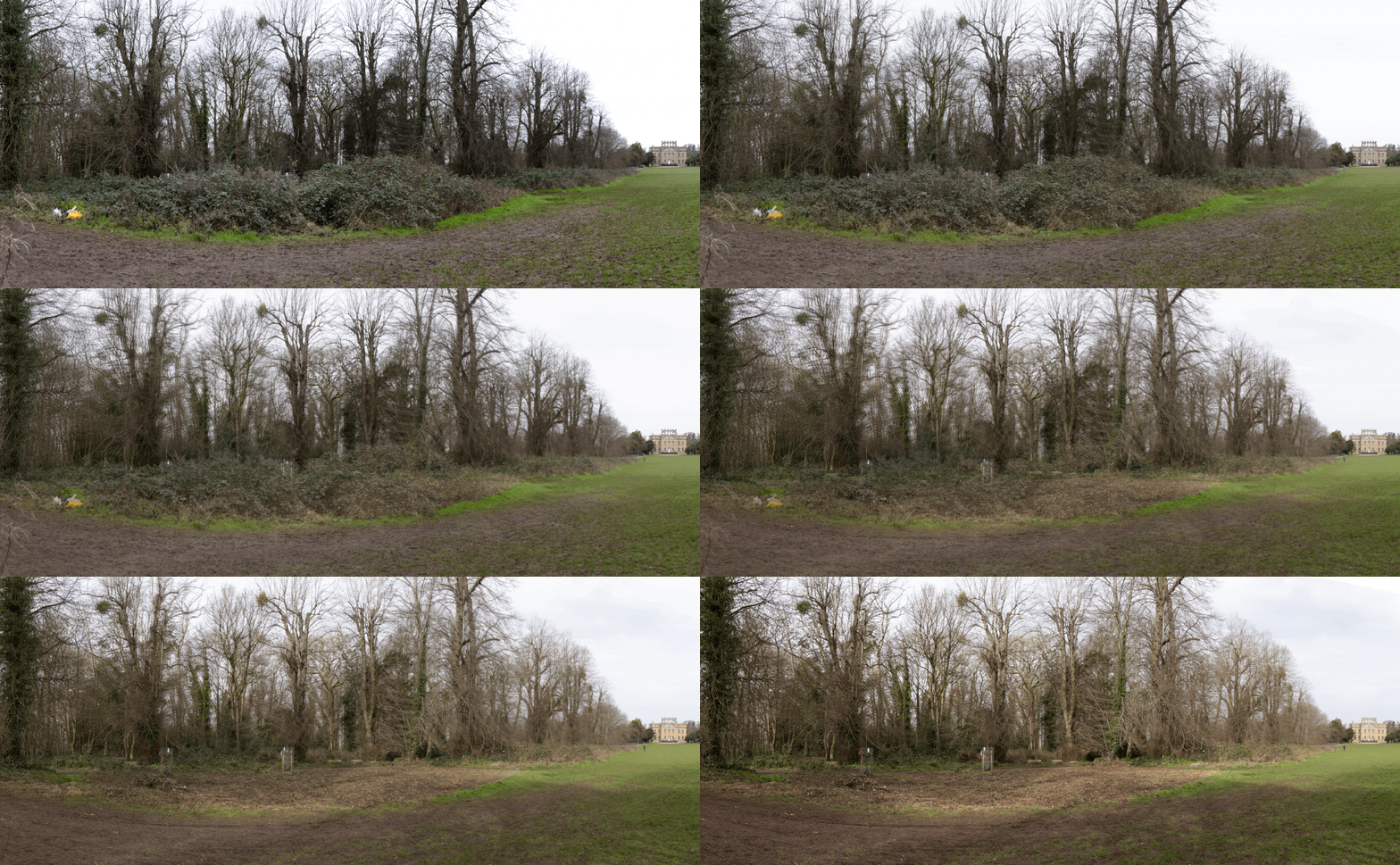
Using both our own record photos across the years, and aerial photos of the area from the last twenty years, the gradual loss of the meadowland can be starkly illustrated, but why does it matter?

As part of the Bioblitz event held at Kings Weston way back in 2012, the richness and diversity of the meadowland was a noted finding. It was described as some of the most important calcareous grasslands in the region, unique in Bristol. As encroachment bites, this exceptional habitat is gradually being replaced by less diverse habitat that already has wide distribution across the estate.
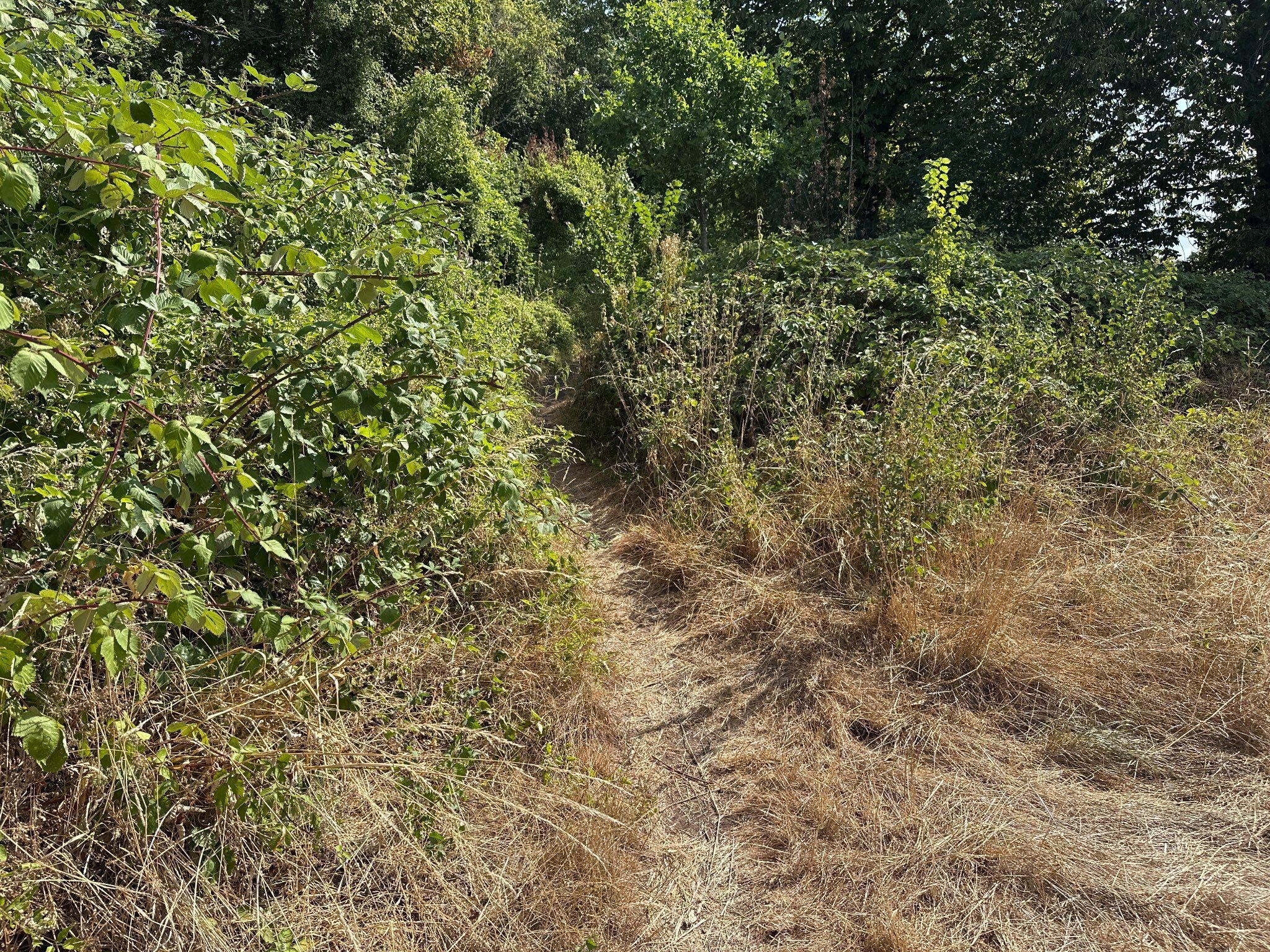
Halfway along the meadow the Public Right of  Way is becoming near impassable.

Encroachment occurs incrementally. The land has been managed by the Council with an annual hay-cut for the last twenty years or so. This is now contracted out and has led to poor implementation and little obvious oversight. Every year another few feet around the perimeter of the area is missed. Spaces between groves of trees are left un-cut. Year after year maintaining the meadowland is getting worse and worse.

It can be difficult to appreciate this incremental change. With only one cut a year few people will recall what its condition had been twelve months ago. It’s a slow decay of both the ecological value and the historic landscape.
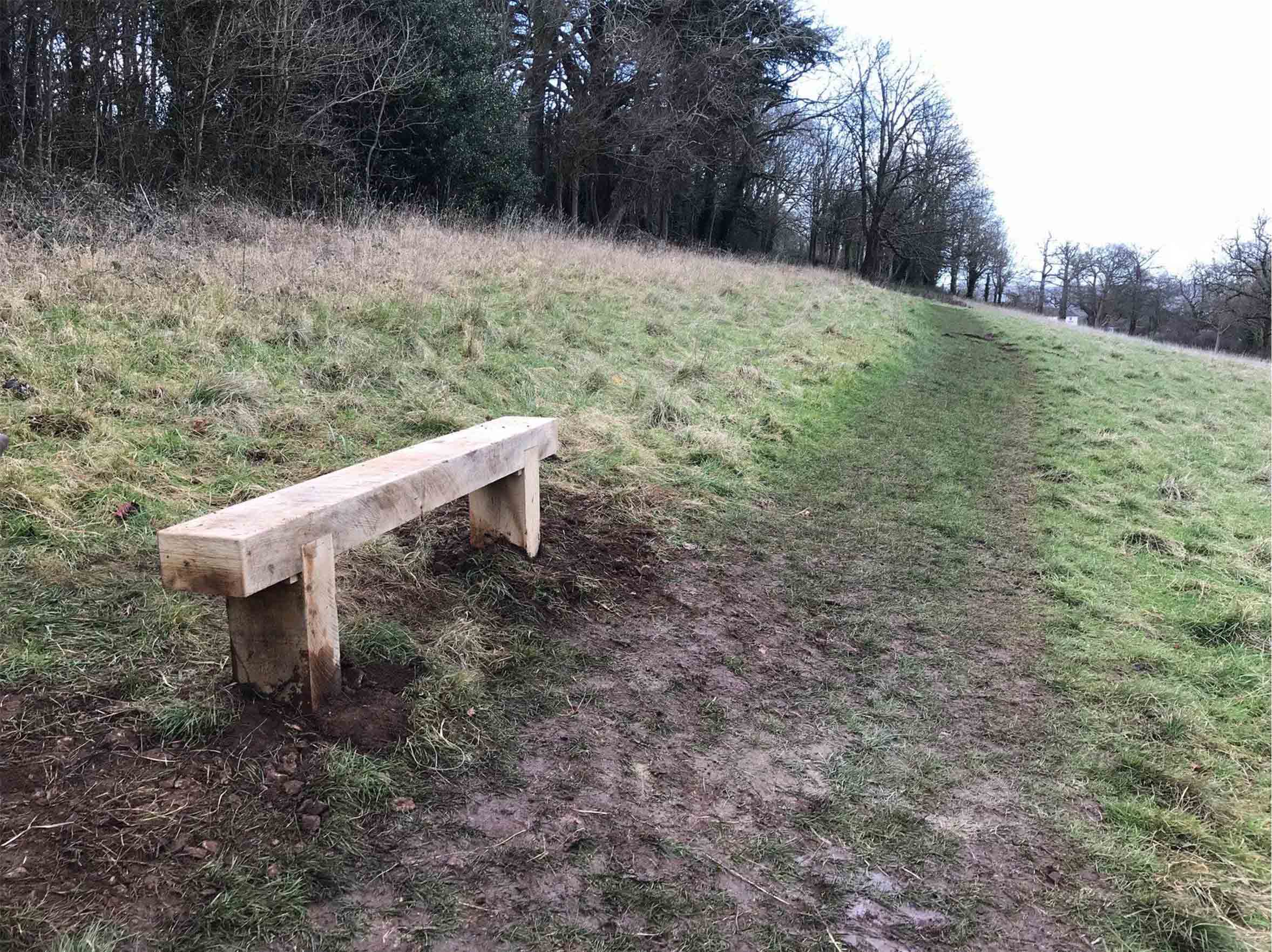
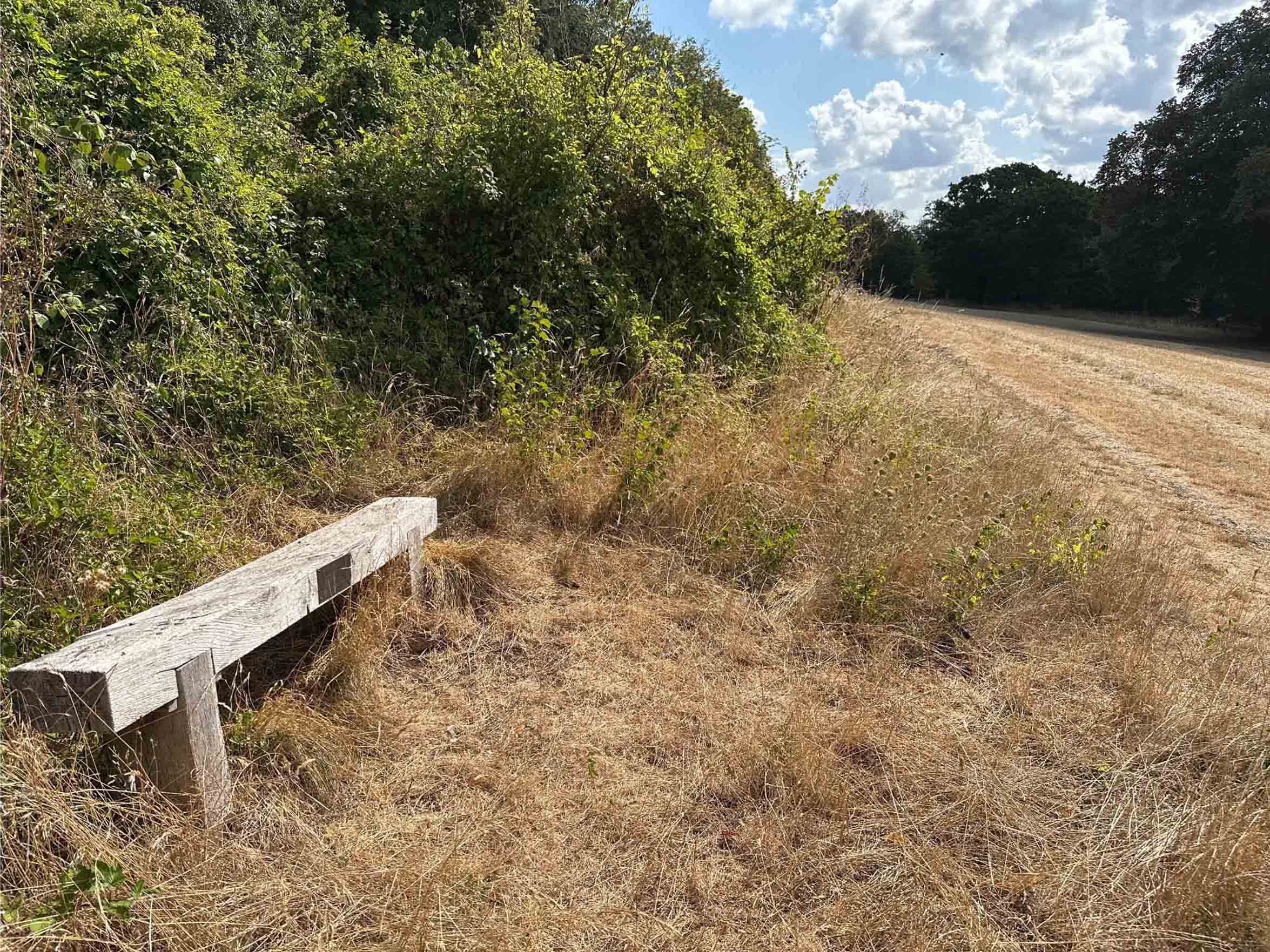
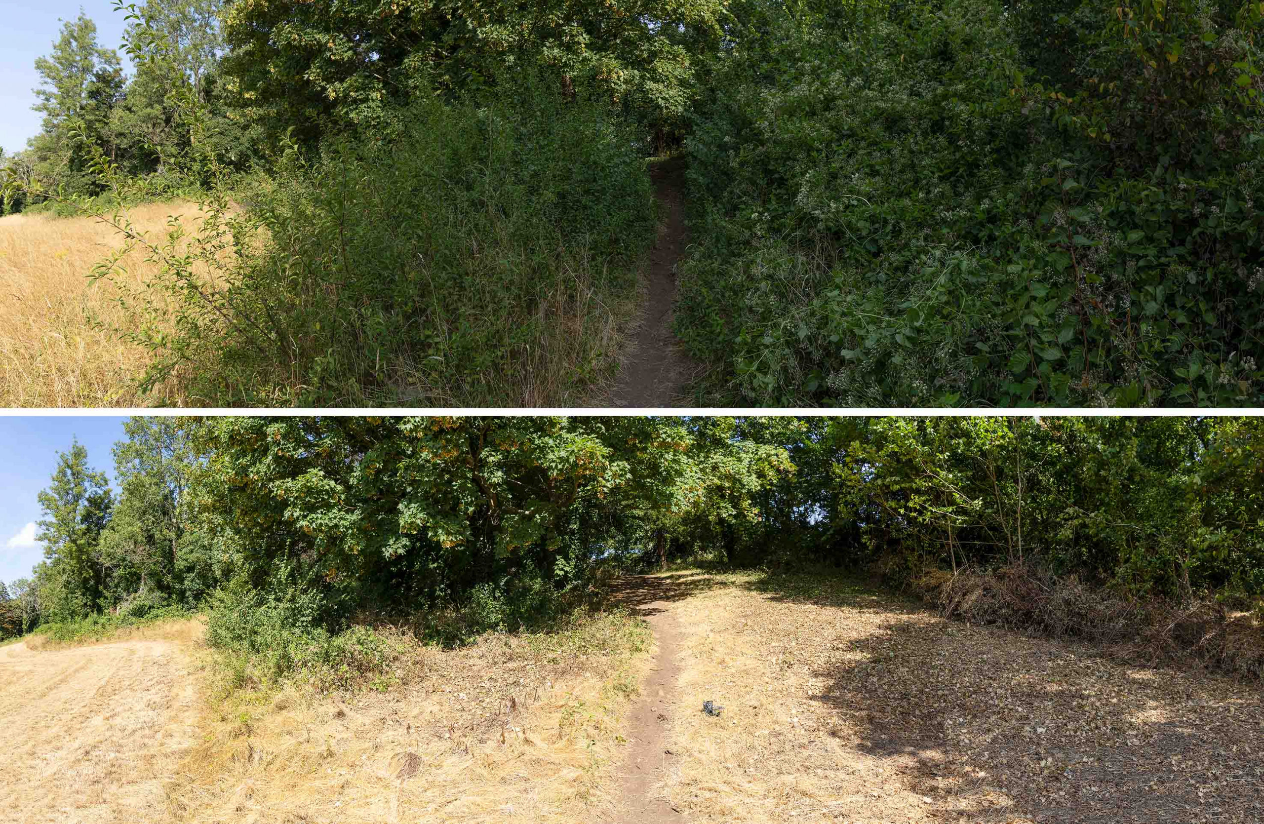
The same scene in 2018 and today, just 8 years later. A mountain of scrub and brambles now occupies the 9m from the treeline and the line of the path has been pushed around 3m downhill.

This year has seen a massive spike in brambles (if you’ll excuse the pun), but elm regrowth and other species are also part of the mix. Whilst tackling brambles is something KWAG has done in the past, we don’t have the resources to attack the current engulfment, nor does it fall into our remit to cover regular maintenance issues for which there should already be management in place.
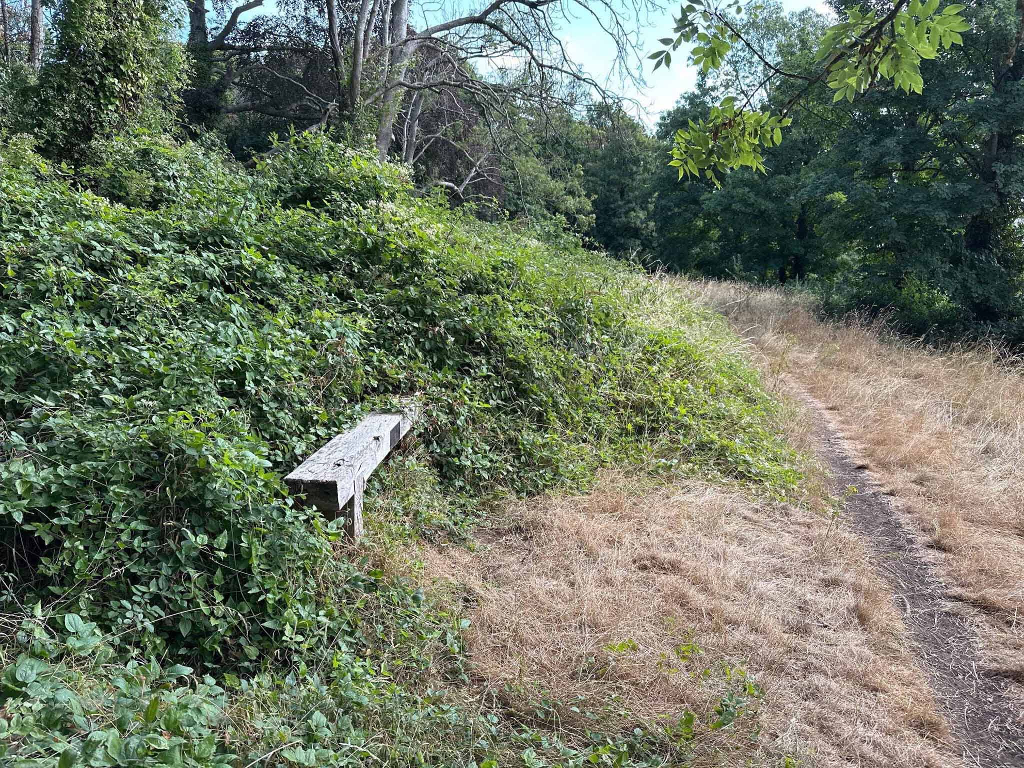
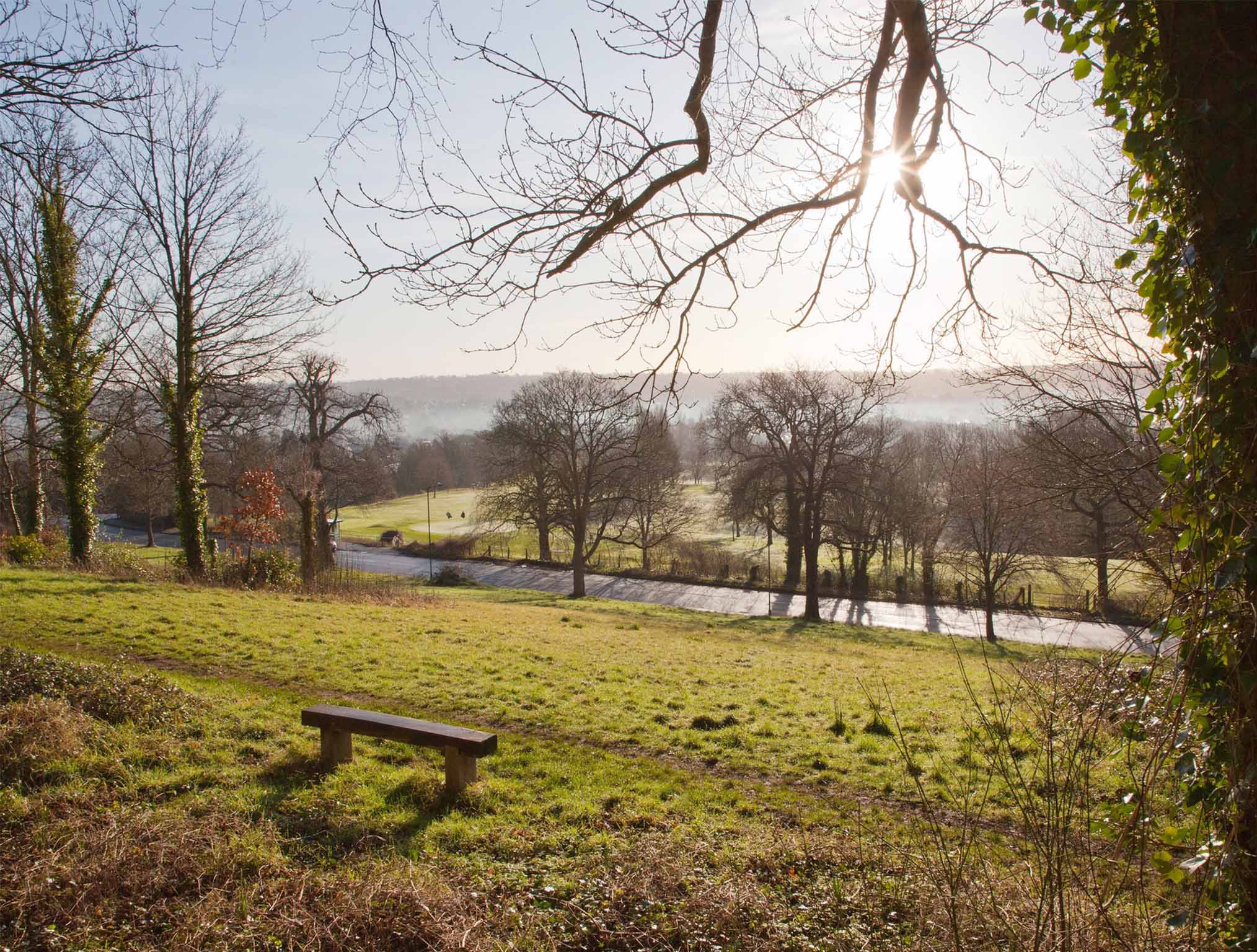
In 2017, from the Grade II Listed Viewing Terrace, the recently installed bench was conveniently positioned beside the path. Today half the bench has been engulfed in brambles and the Public Right of Way has been pushed off-course.

Two benches we installed in 2017 and 2018 are useful markers against which encroachment can be measured. Both were set up immediately adjacent to the Public Right of Way that runs from the Iron Bridge down the ridge to Shirehampton Road car park. Within just eight years, both have gone from being in open meadowland to presently being engulfed by brambles. The footpath that can clearly be seen in front of each bench can be seen pushed downhill by the onslaught of scrub.

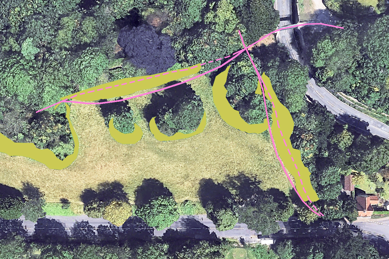
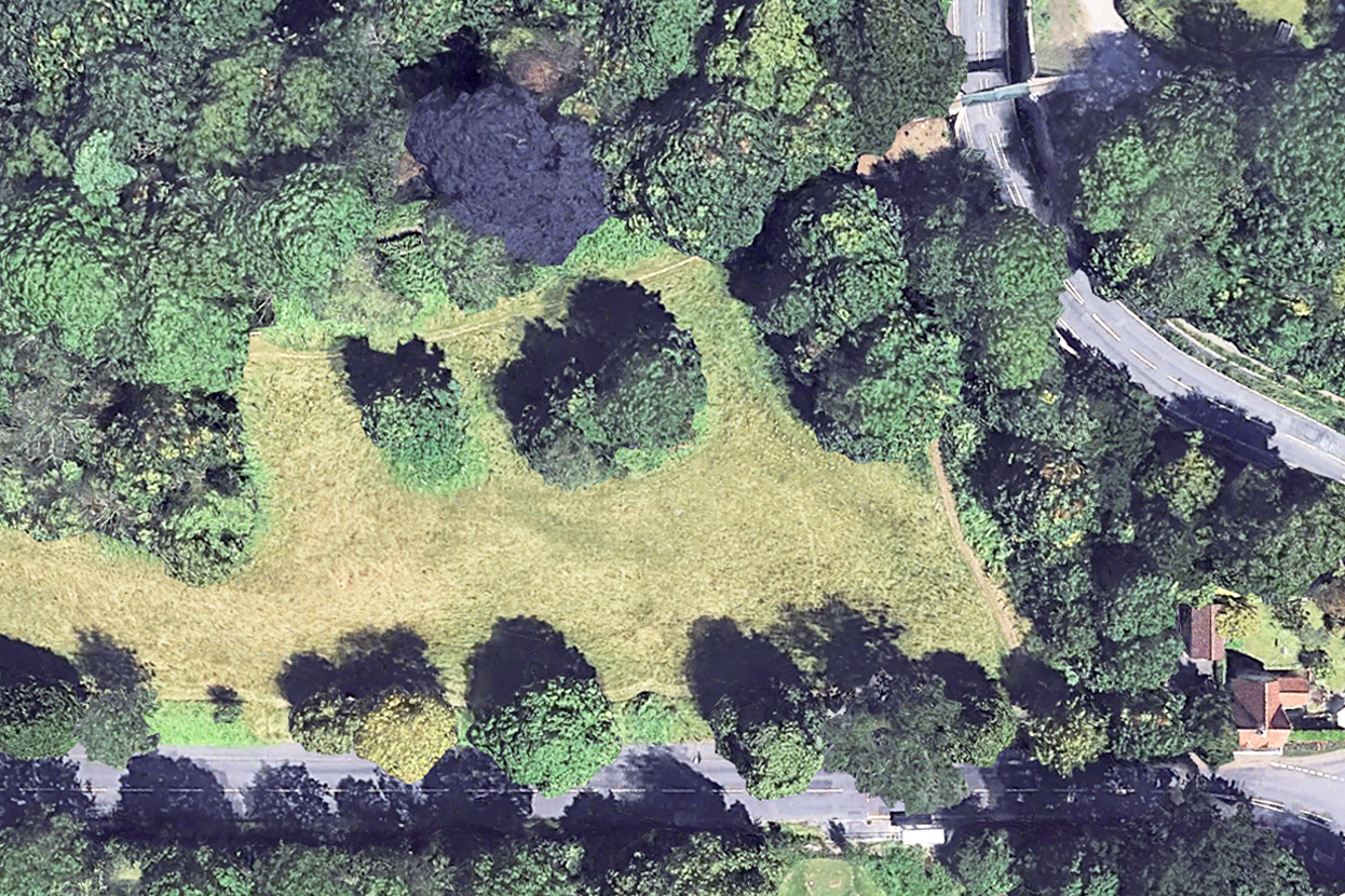
Helpfully, Google Earth has a library of aerial views taken periodically since it was established. These help chart the gradual advance of scrub. Taking past surveys from 2005 and 2006 and comparing them with the most recent aerial survey in 2025, the extent of meadowland loss. In most areas there has been a ribbon of between five and six metres lost to scrub along the top edges of the slope and around outcrops of trees, but in one location undergrowth has come forward more than 20m.
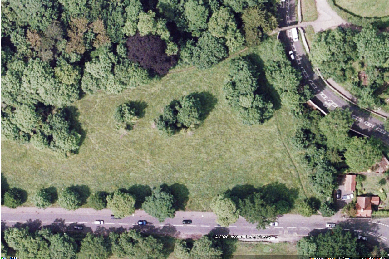
2005: Aerial view looking down on the eastern end of the meadow. Shirehampton Road runs along the bottom of the view and the Iron Bridge is in the top-right corner.
2025: The same scene last year. Scrub and bramble appear as vibrant green areas beneath the trees.
Analysis diagram illustrating the area of encroachment between the two dates. The pink lines show how the Public Rights of Way have been distorted from their 2005 course (dashed) to where they are today (solid line)

We calculate  around 7000 square metres of meadow, or 1.7 acres has been lost from Shirehampton Park alone in the last two decades, most within the last ten years. But the issue is more widespread, with the lawn in front of Kingsweston House, the field below it, Penpole Point, Kingsweston Hill, Napier Miles Fields, the Tump, and event the area in front of The Echo all having their historic character eroded. 

Since KWAG was founded in 2011, we’ve been asking repeatedly for the issues of encroachment to be addressed beyond the basic annual hay cut. Occasionally the ancient Lime Avenue will be dealt with, or parts of the field below the house, perhaps the ridges around Shirehampton Road Car Park, but work is reactive, unpredictable, and to no obvious plan. We remain deeply, and increasingly concerned over the declining condition of the estate in this respect.
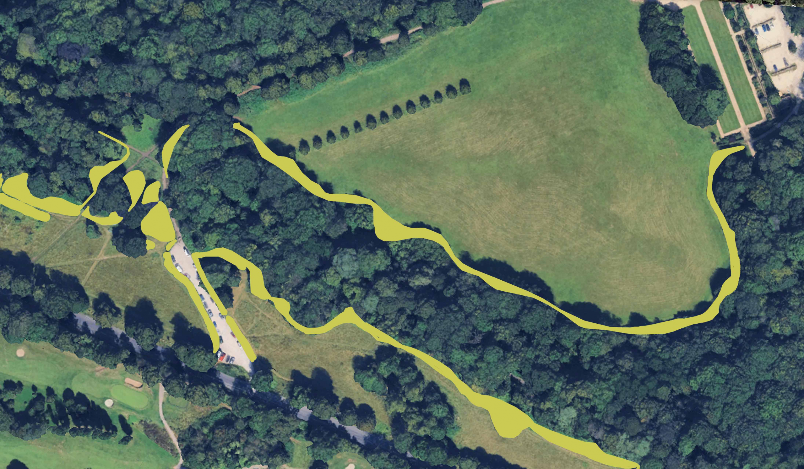
Similar assessment of encroachment around The Circle and along Shirehampton Park edge between 2006 and 2025

Working Party update: Pushing back the tide above Shirehampton Park

Encroachment  of scrub and bramble over much of the estate has been long identified as one of  the biggest threats to the historic designed parkland. Whilst KWAG has sought  to help in small areas, it remains the Council’s duty to deal with the issue at  such a wide scale. Our July Working Party was one small element in addressing  the issue.

Our work focused on the far east end of the meadow overlooking Shirehampton Park. Here, just on the west side of the Iron Bridge, two Public Rights of Way (PROW) join. The one coming directly uphill from Shirehampton Roads being the focus of our attentions.

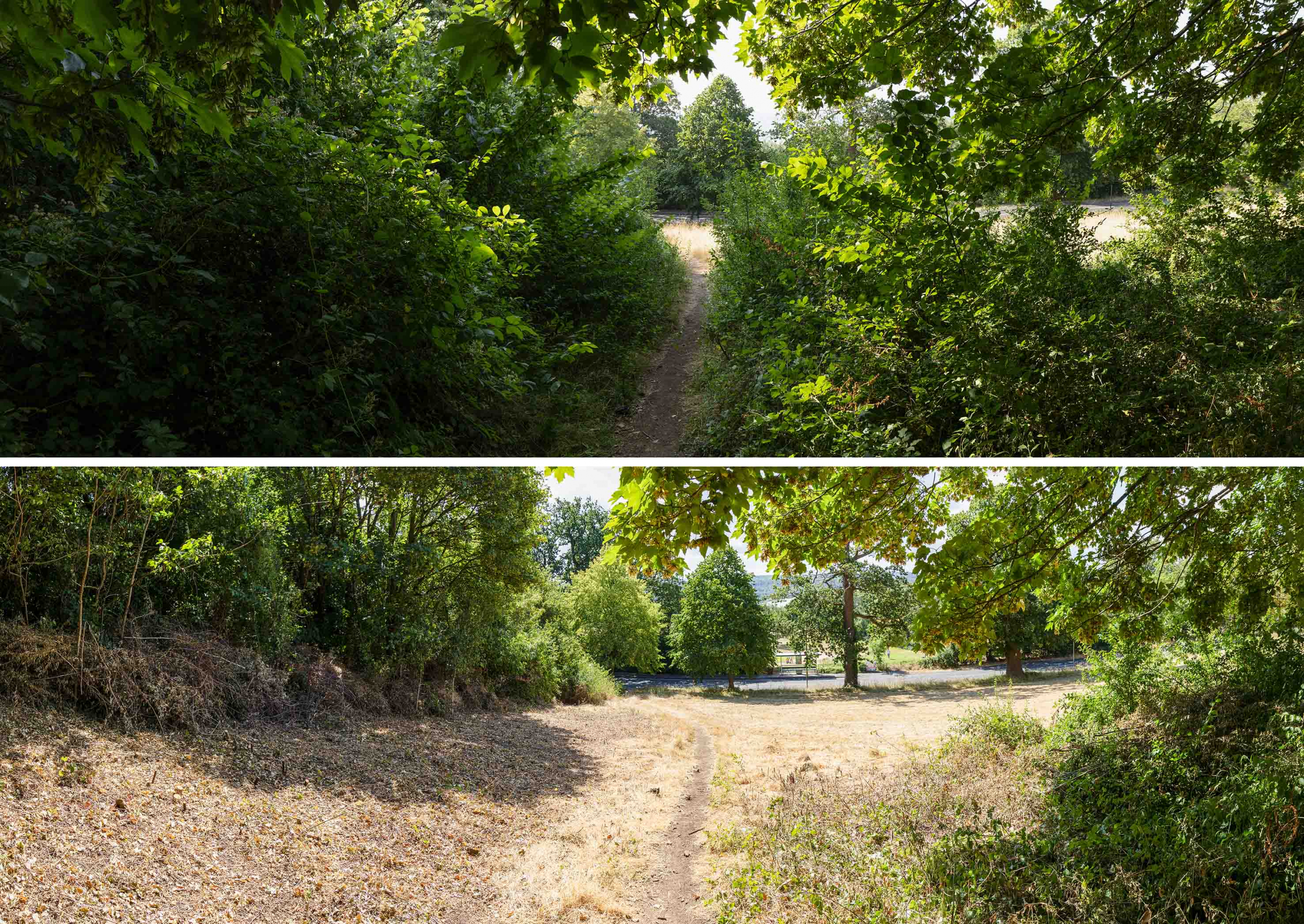
The view downhill towards Shirehampton Road before and after volunteer work last month

Our work focused on the far east end of the meadow overlooking Shirehampton Park. Here, just on the west side of the Iron Bridge, two Public Rights of Way (PROW) join. The one coming directly uphill from Shirehampton Roads being the focus of our attentions.

What’s called the “definitive map” that shows PROW indicates that this should travel in a direct line between the bottom of the bank to the steps behind the Echo, but successive years of sloppy mowing had allowed scrub to grow, progressively pushing the PROW off its legal alignment and threatening the open grassland. Worse, the path itself was threatened with being blocked by the growth.

The view in the opposite direction looking along the Public Right of Way heading towards the Echo.

Work focussed on removing this scrub, mostly elm regrowth, Old Man’s Beard, and sloe, and pushing the edges back to their historic extent. The turnout on the day was perfect to tackle the relatively modest area, and we exceeded expectations in how much we’d achieve.

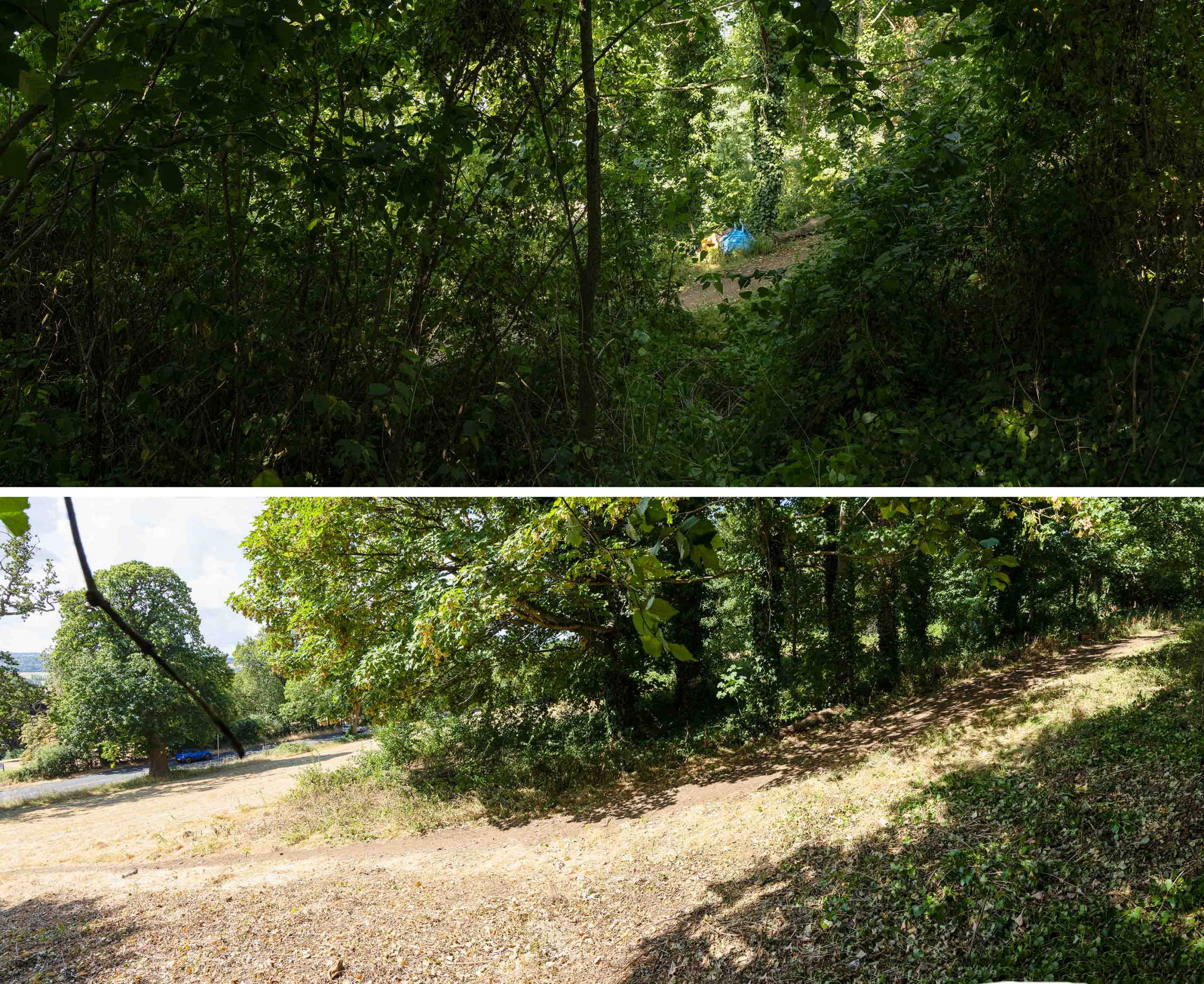
Across the slope, with Shirehampton Road to the left. The treeline has been pushed back to its 2012 extent.

A huge thank you to everyone who made it on a scorching hot day. The group managed to get the work done quickly enough to avoid the worst of the heat, and we were able to retire for a well earned early lunch.

The results speak for themselves. Although the track still meanders around the distorted route, it’s clear and the way opened out to allow the important meadowland more space to regenerate.

Another view looking downslope illustrating how close the path was to becoming blocked

Woodland Works Warmly Welcomed

We’ve had some positive news from Jacob Hill, Nature Conservation Officer in the Council parks team. A small amount of funding has come forward to start works on the Woodland Management Plan and its proposals.

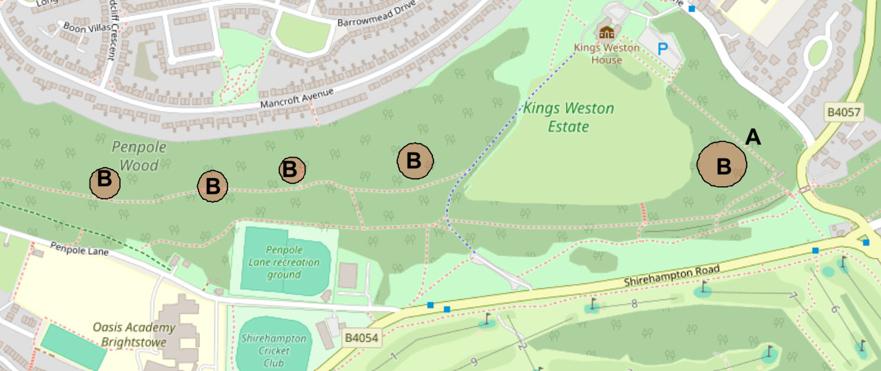
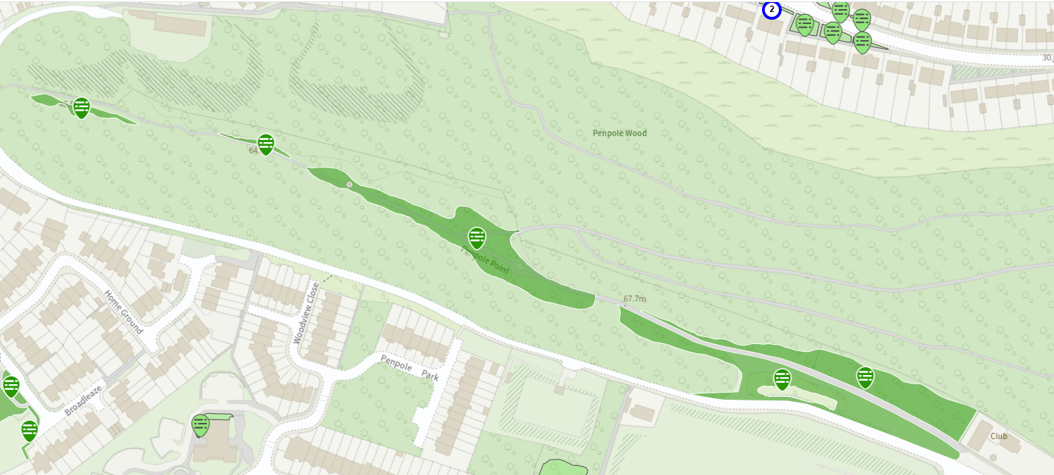
One of the main tasks now being programmed is the crown lift and removal of overshading branches from around the recently restored pond near the Echo (point A on the map), this is proposed to include monolithing the sycamore on the north-west side of the pond which has a basal cavity running up the main stem. Pruning was chosen over felling for these trees as it was felt that they offer significant value for nature as mature and healthy specimens and they did not qualify for felling on safety grounds.

Contractors will be engaged with a mandate to make significant cutting of cherry laurel in the Thirty Acre Wood portion of the estate. This is an are included in the Grade II Registered Historic Landscape, but less frequented and more valued for its ecological value.

A large compartment of cherry laurel to the west of the Echo Path has also been earmarked for removal. Laurel felling will also progress within Penpole Wood, in location on the steep slope to the north side of the main path (B on the map). These are areas KWAG has been reluctant to approach because of the gradient and risk to volunteers, so the proposals are warmly welcomed.

Working Party update: Hot and bothered in Penpole Wood

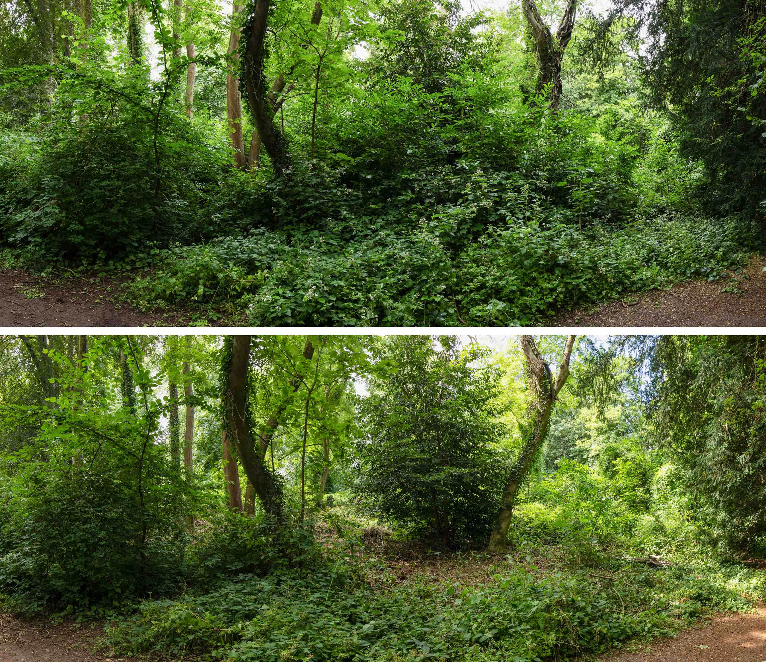
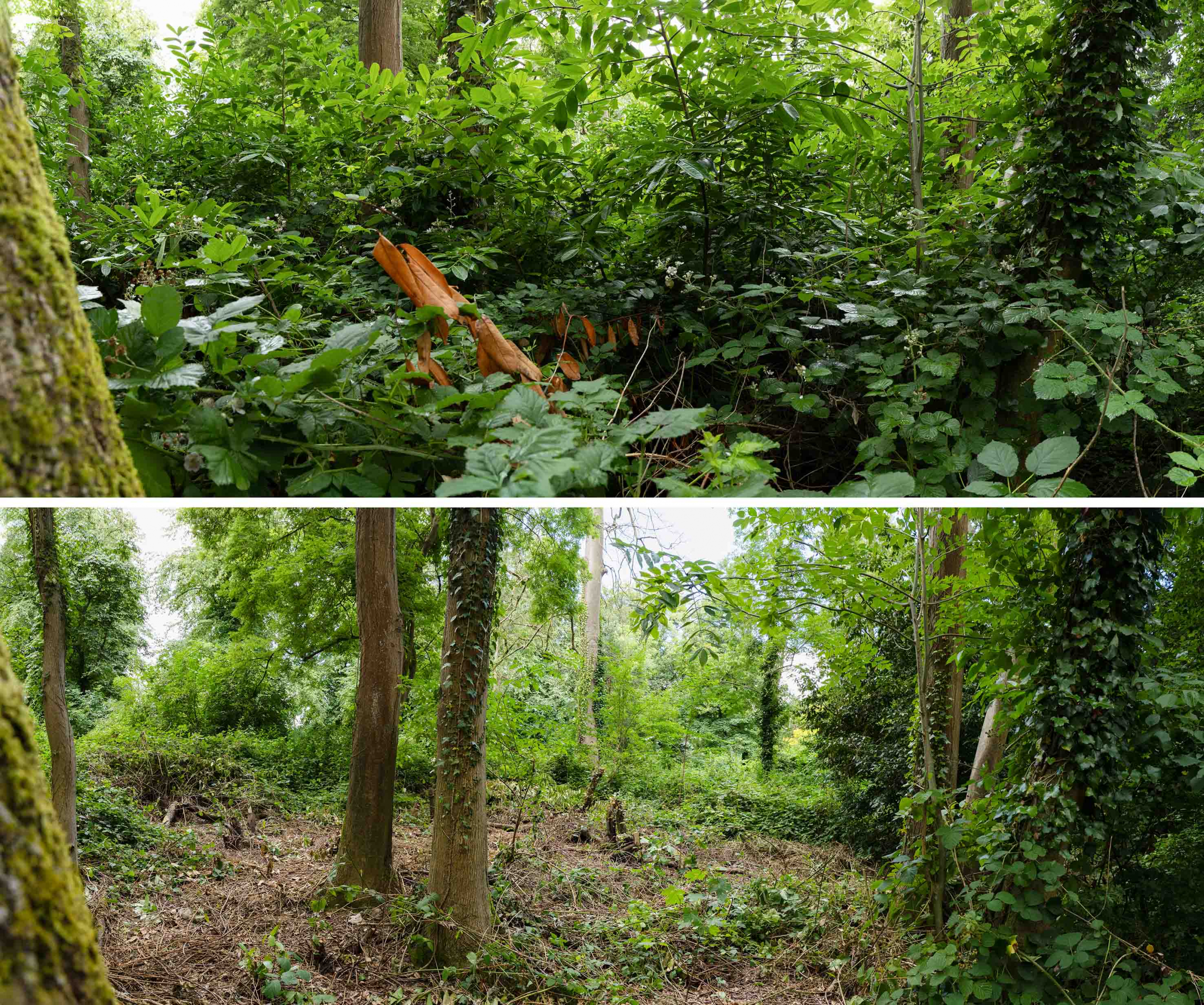
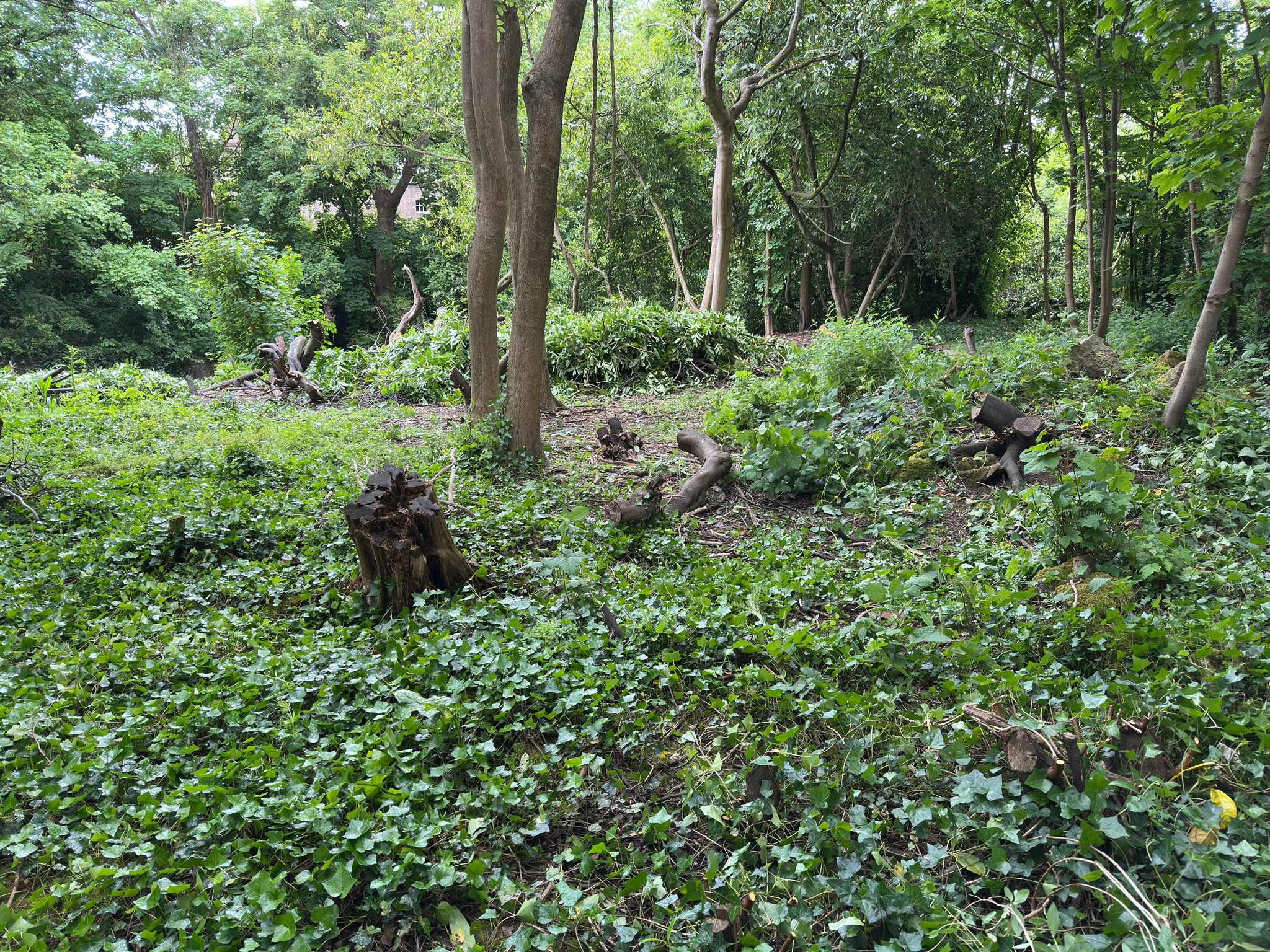
The summer always see our working parties operate with diminished numbers; holidays, sport, and hot weather have all taken their part this season. Nevertheless, a small band set to work on cherry laurel regrowth that’s been gradually making its way back into the area since 2016; yes, it really has been a decade since we removed the forest of invasive species form the natural woodland.

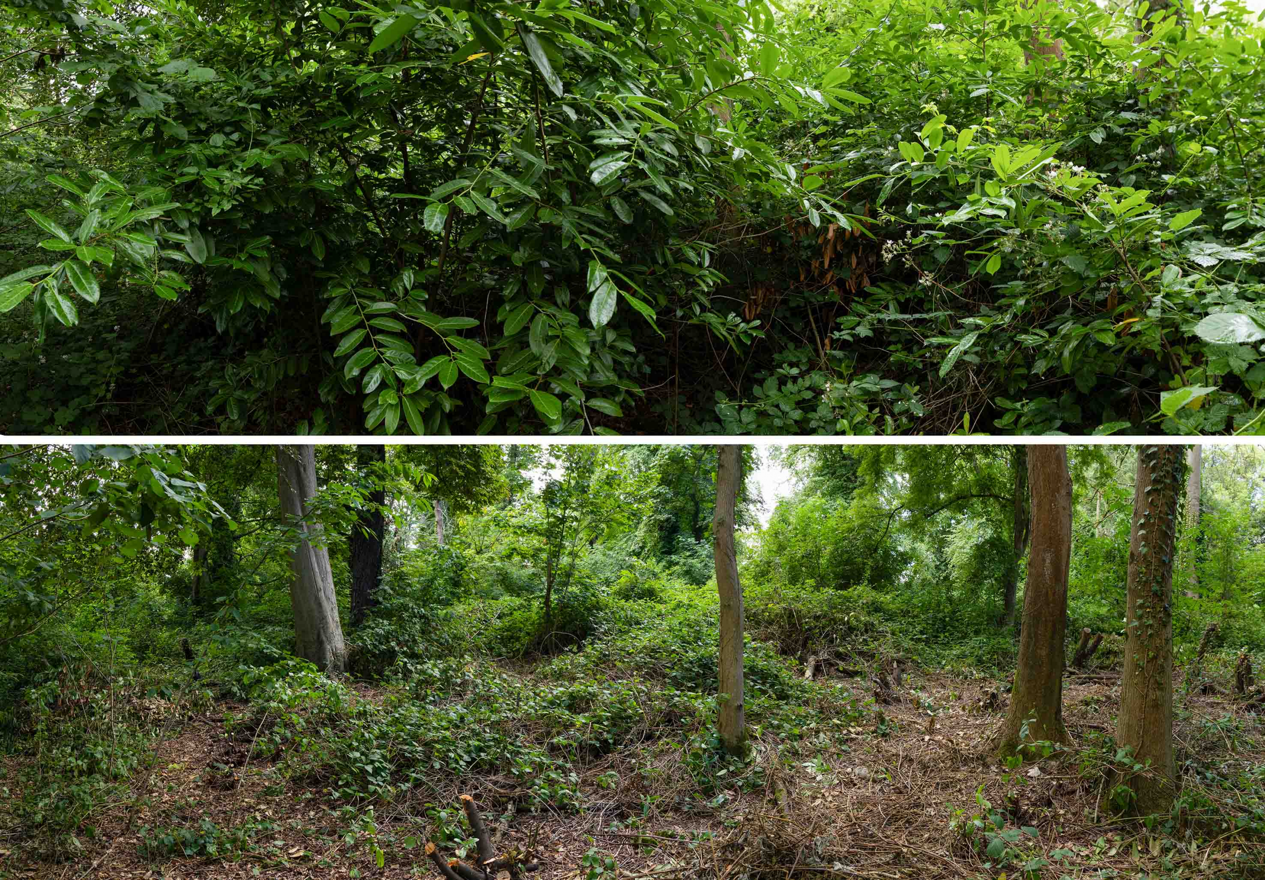
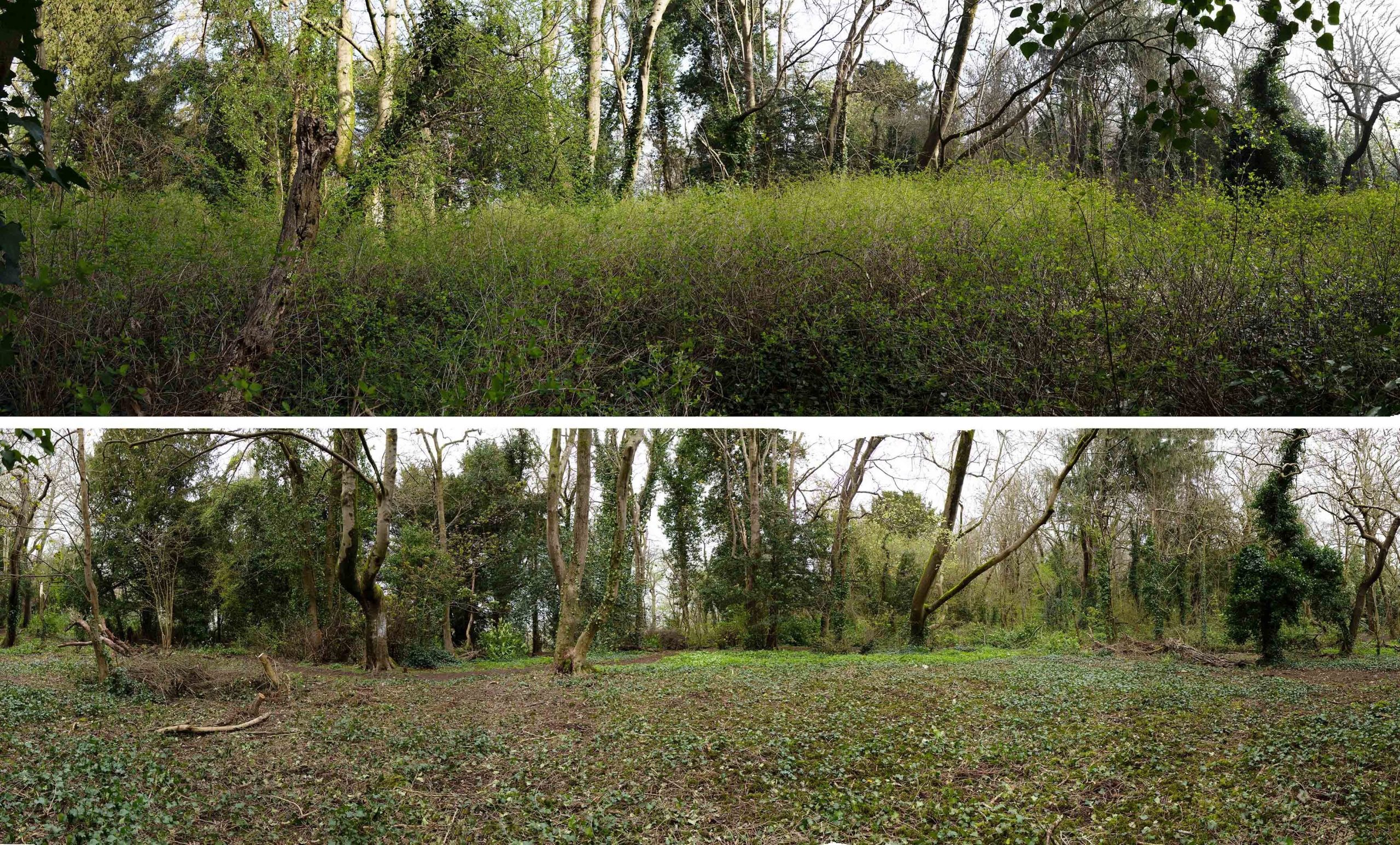
Before and after views looking in the direction of the avenue into Penpole Wood from the edge of the main path through the same.

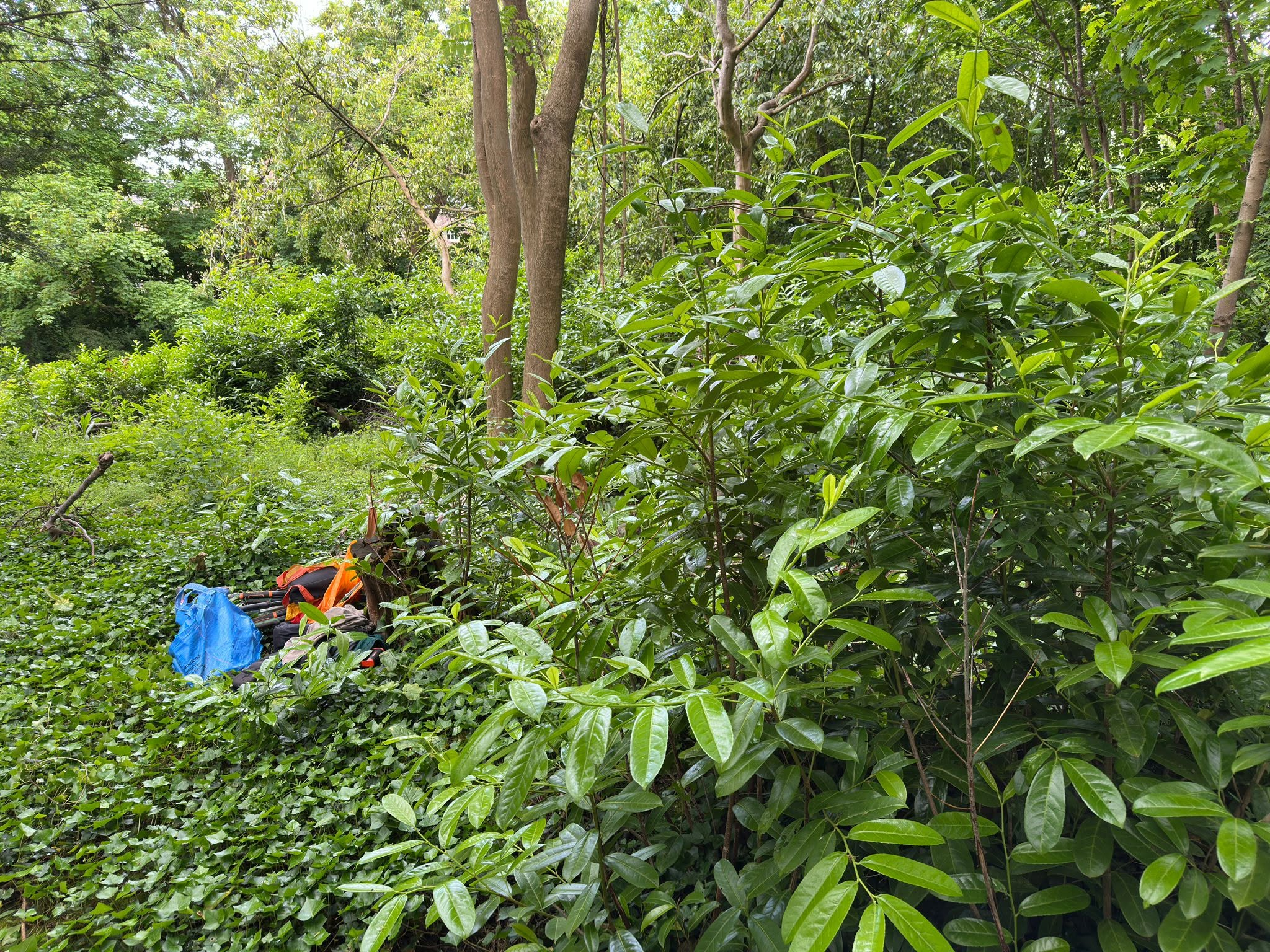
Surprisingly, ten years’ growth was not as bad as might be imagined. Effective treatment of the laurel stumps by the Council back then appears to have held them back. Despite that, there remained challenges.

The growing cherry laurel had offered the perfect climbing frame for brambles, and pulling these from the bushes was a challenge in its own right. Still in bird nesting season, we didn’t tackle any that were dense enough to support nests.

The panorama from the main path through the woods looking south. Laurels here were nowhere near the size of those felled a decade ago, but threatened to get out of hand once more.

The final effect was not as transformative as the original felling, but has retarded the cherry laurel again, perhaps for another decade. The area is, again, more open for native species to flourish, a number of specimens of the one-tree-per child planting scheme still growing strong.

The view westwards through the area, in the direction of Penpole Point

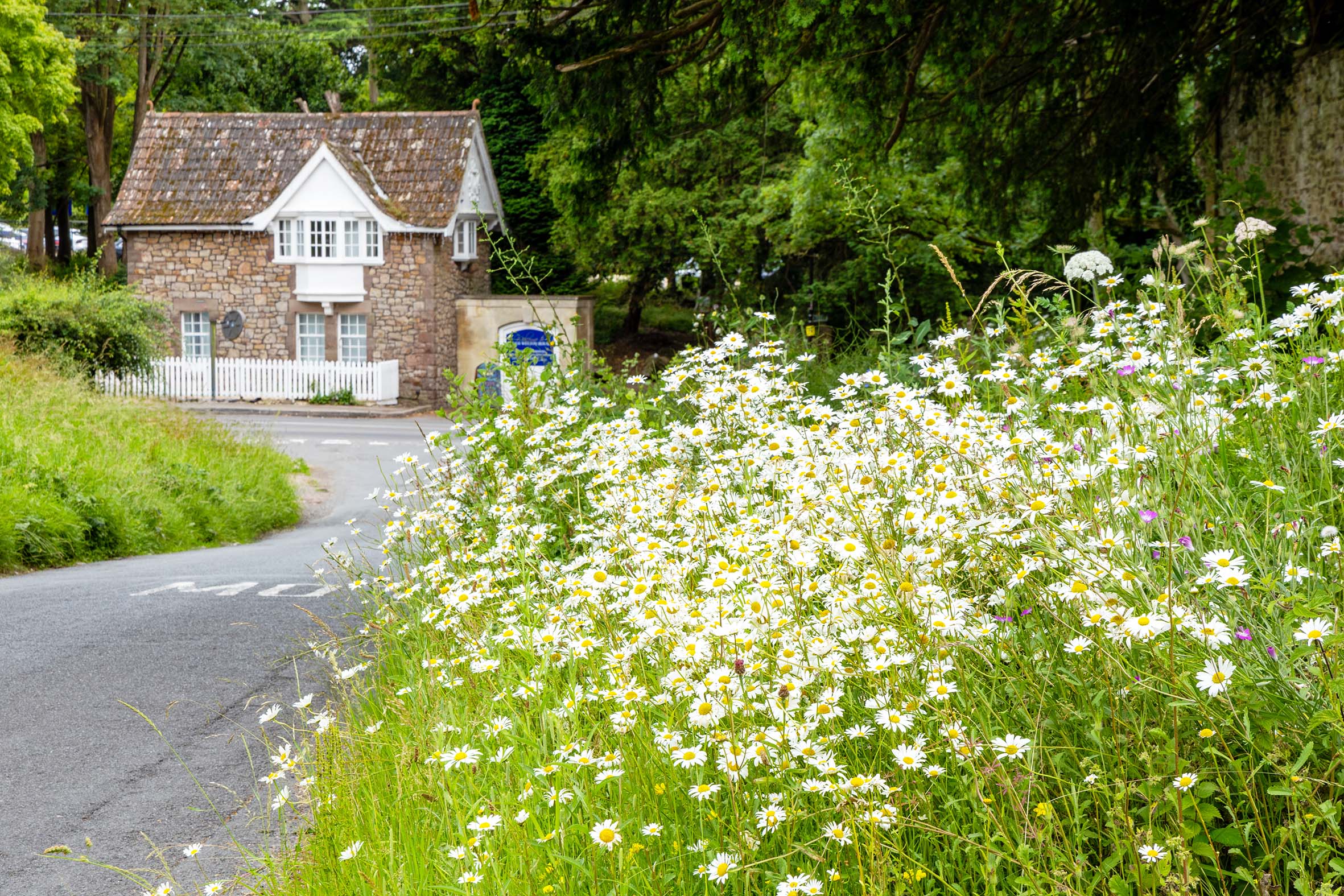
Wildflowers return on Napier Miles Road

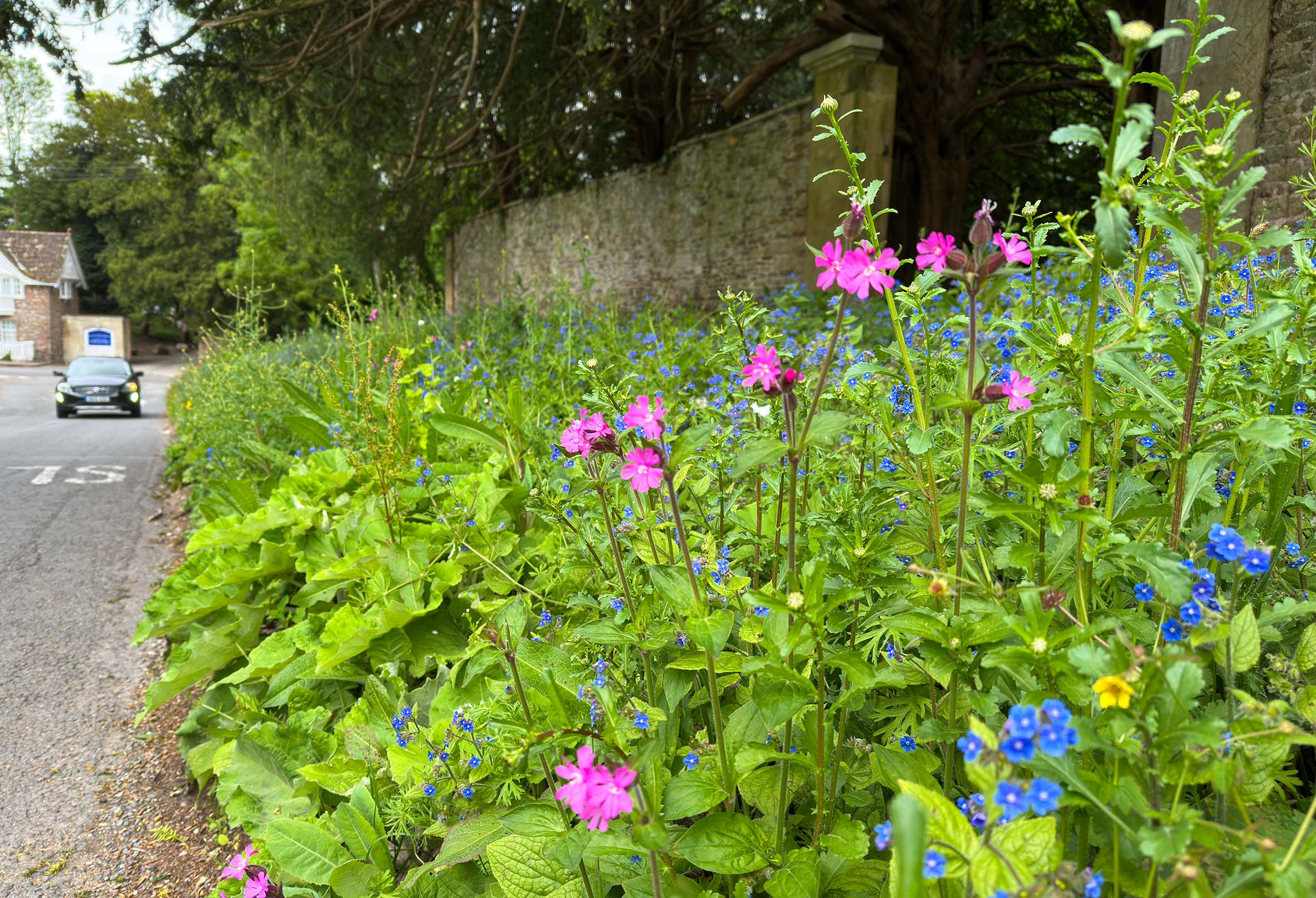
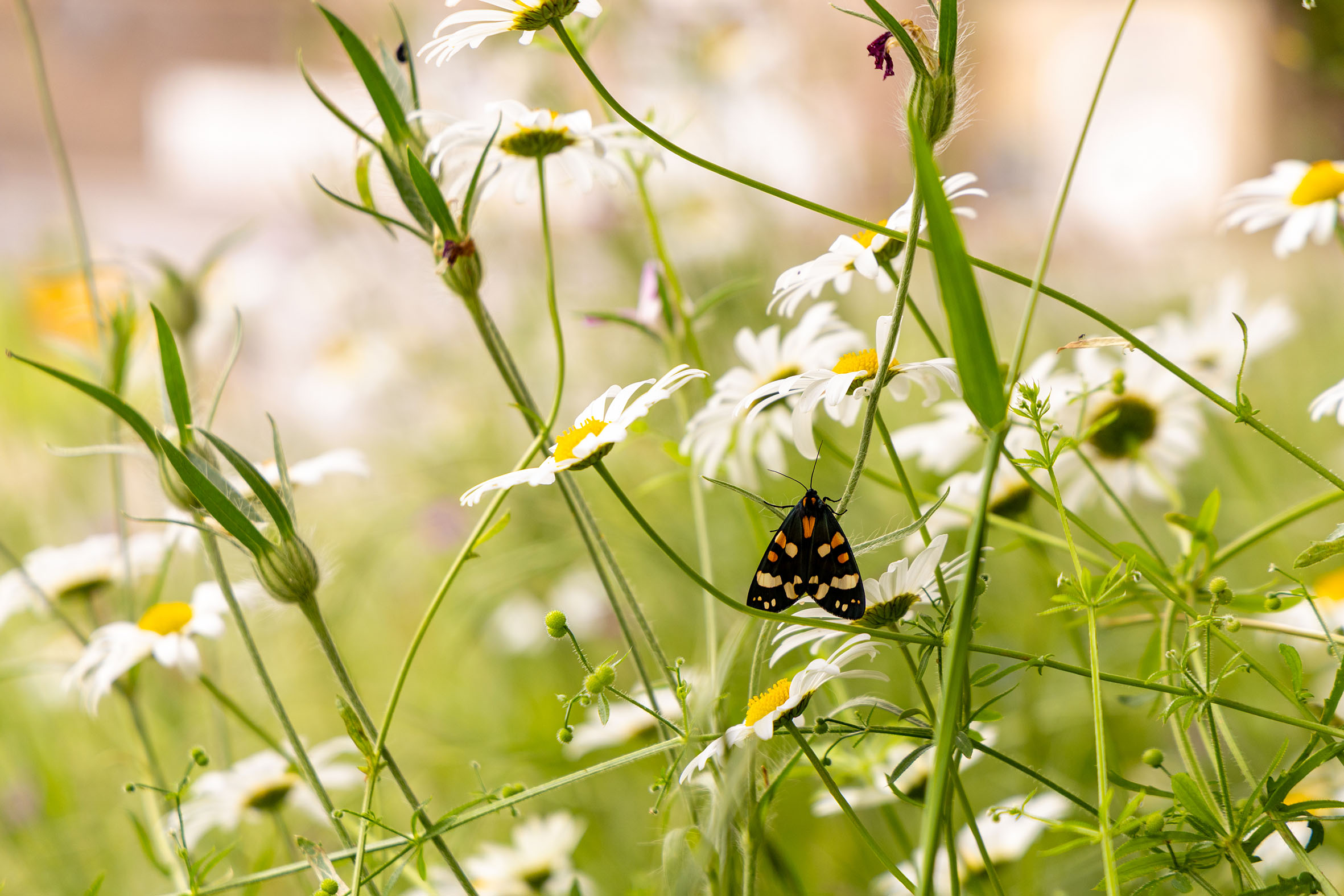
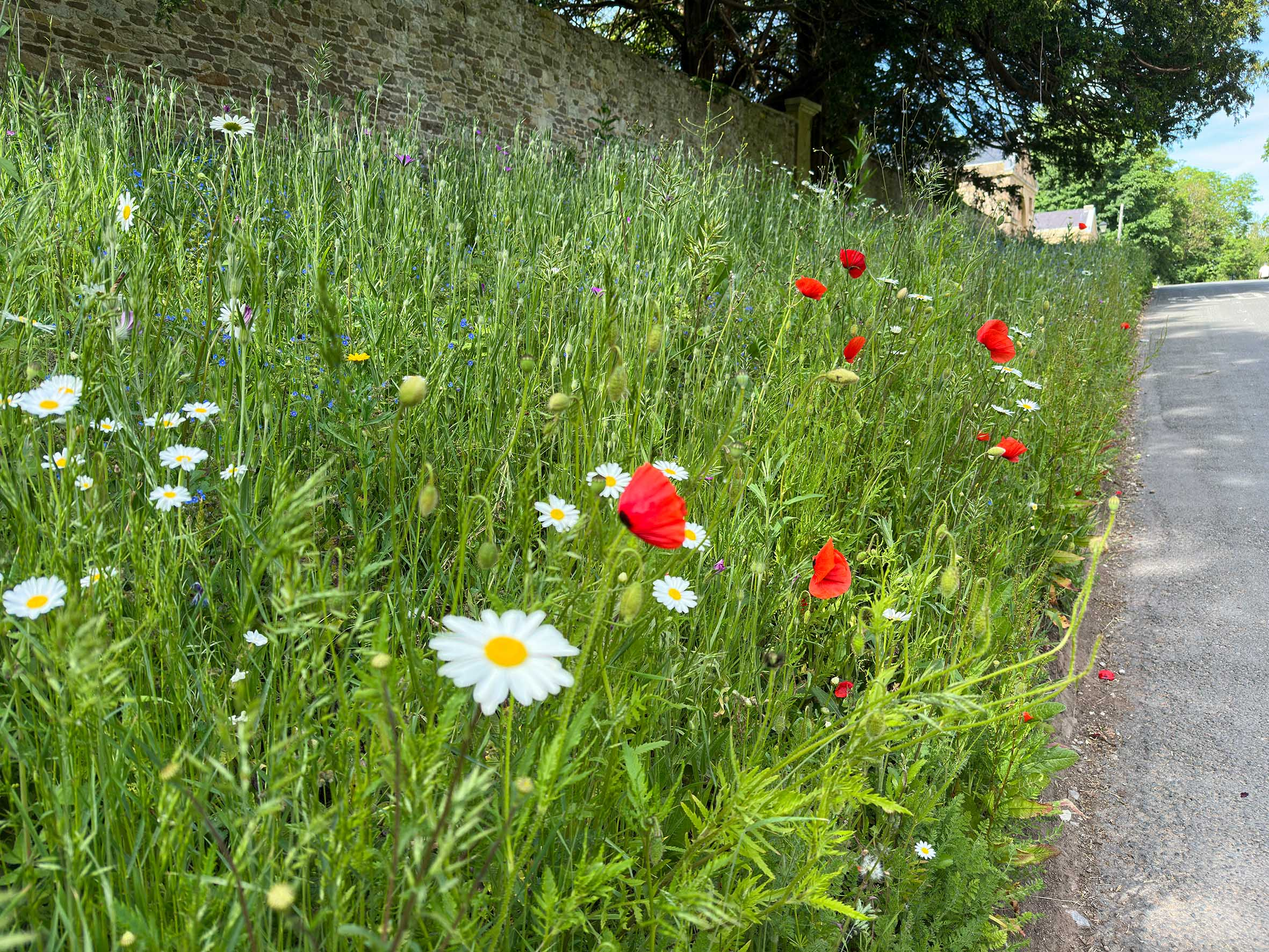
We’d rather assumed that the wildflower seed we’d sown along Napier Miles Road had been suffocated by the blue-flowered Green Alkanet that had taken immediate advantage of the freshly-tilled soil. However, plenty of perennials have persevered and have started putting on a show this year. We’re really pleased with this and we’ll endeavour to keep it maintained, hoping that eventually the Green Alkanet will become less dominant.

Working Party update: Another pass through the View Garden

It was a bit of a surprise that it’s been two years already since we cleared through the old View Garden on the north side of Napier Miles Road. Since then things have changed remarkably from the barren space left beneath the cherry laurels we felled. There’s definitely been a lot of new green growth coming up in the area despite some of that growth being resurgent cherry laurel.

May’s working party sought to keep on top of that regrowth and ensure the area doesn’t succumb again to this invasive species.

Before and after work at the View Garden looking west towards Kings Weston House across Kings Weston lane.

New commitment to conserving Penpole Point

The Council are proposing to put the larger sections onto a ‘1 cut’ to be cut by the ride-on mower during late Summer going forwards. However, they also think that an earlier cut too would be beneficial, at least this year.

During the later cut (from September), they can cut back the encroaching brambles.  They also discussed that it would be beneficial for the grass arisings to be raked off where possible. We agreed that these could be the Council’s week-day Nature Nurture sessions but KWAG would also offer to help with the task once we know when it was happening.

The areas of grassland adjacent to Pen Pole point (which are more sloped) and two smaller areas west of this (which have more coverage by tree saplings) will be mapped as ‘hand cut’ areas, and Nature Nurture volunteers will look to build in some scything and tree-popping sessions along there this year.

This is all terrific news as encroachment of scrub onto the grassland here has been a key concern for us for many years. The past mowing regime has been intermittent and often neglected, the only area having a clear strategy being the area KWAG cleared of brambles and sowed with meadow flower seed around the Dial.

This new commitment to maintaining and restoring the area is really welcomed, and we hope it will free-up our volunteers to tackle other areas of the estate.  

Wildlife pond update

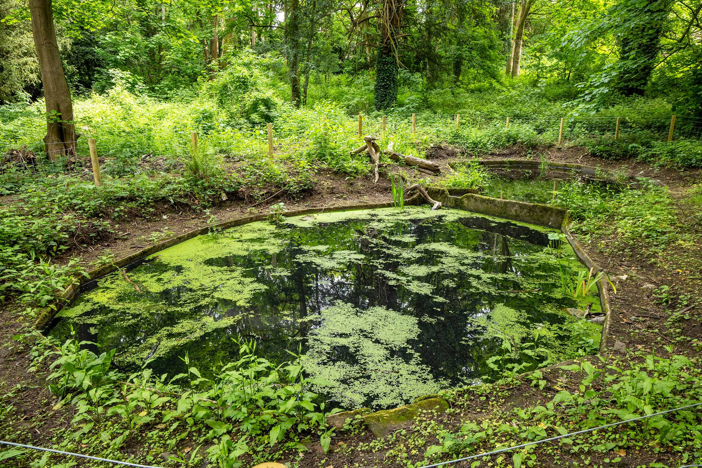
If you pass up to Vanbrugh’s Echo from the house, you’ll notice the wildlife ponds that have been gradually restored over the last few months. A project supported by KWAG and the Nature Nurture team in Bristol City Council, it’s been a progressing since the end of last year when volunteers worked to empty the last of the mud and logs from it.

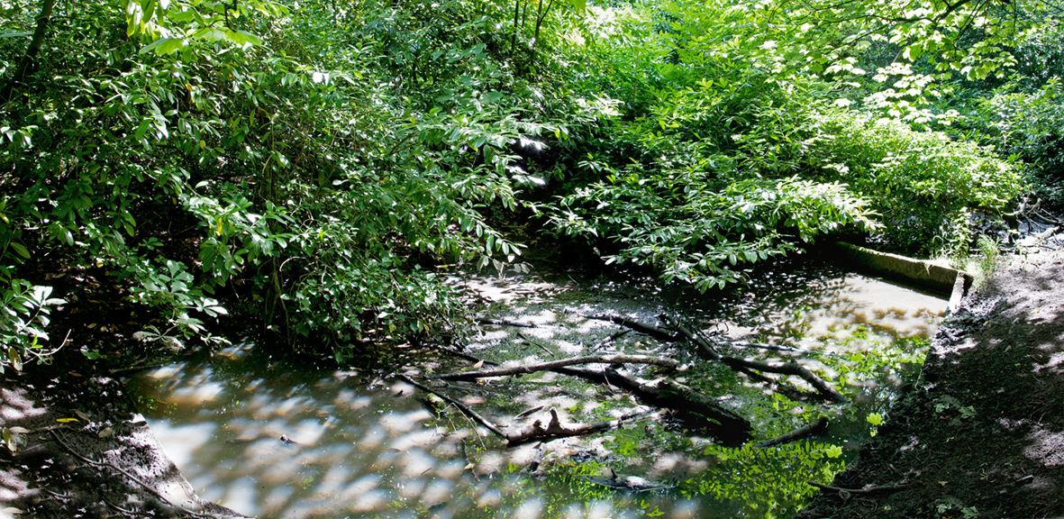
The ponds near the Echo in 2014, choked, stagnant, and poisoned by cherry laurel and before KWAG’s first restoration.

This  was not the first time the ponds have been salvaged. Back in 2014 KWAG  volunteers removed all of the cherry laurel in this section of the wood and  followed-up by emptying the ponds. Unfortunately, they gradually accumulated  branches and the frequency of dogs enjoying the waters meant that it was unable  to thrive.

As  part of the latest restoration overhanging branches have been cut back to allow  more light to penetrate the woodland here. The council volunteers erected a  fence around the ponds and followed up with the placement of a number of native  pond plants just last month.

The results speak for themselves and we hope that this will become an important element of the historic landscape as wildlife habitat.

Seen from a similar angle today, the nature ponds are now looking fantastic after their recent revival.

Working Party update: Jubilee Clearing cleared!  

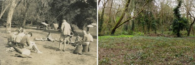
Jubilee Clearing has long been a memorable spot for local people from Shirehampton and Sea Mills. After the death of the last squire, Philip Napier Miles, large parts of Penpole Wood and fields beyond were sold to Bristol District Scouts. Between 1937 and 1947 the clearing became the favoured campsite of the district’s scouts.

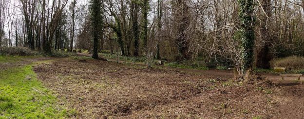
The view on entering the clearing from Penpole Lane on the south edge.

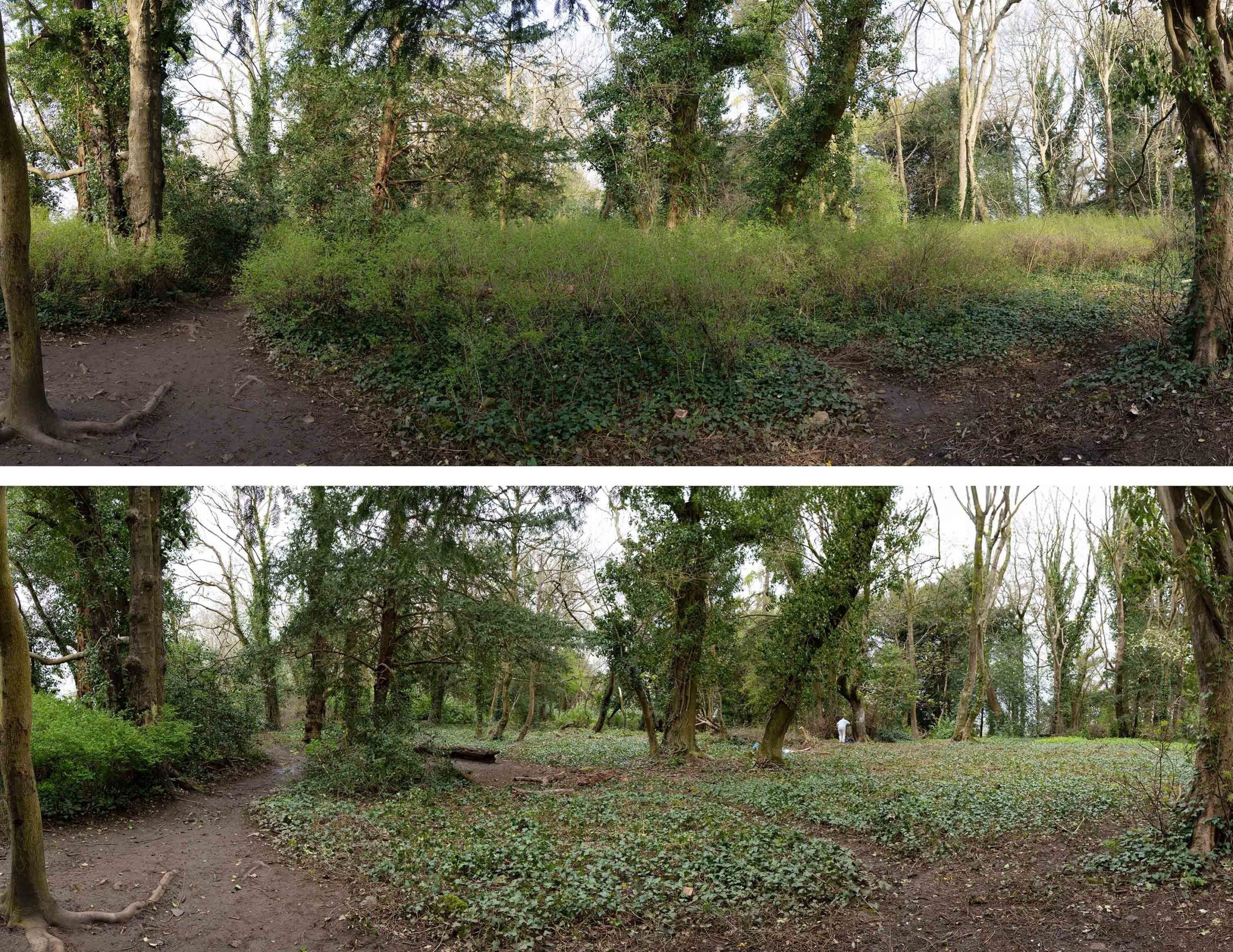
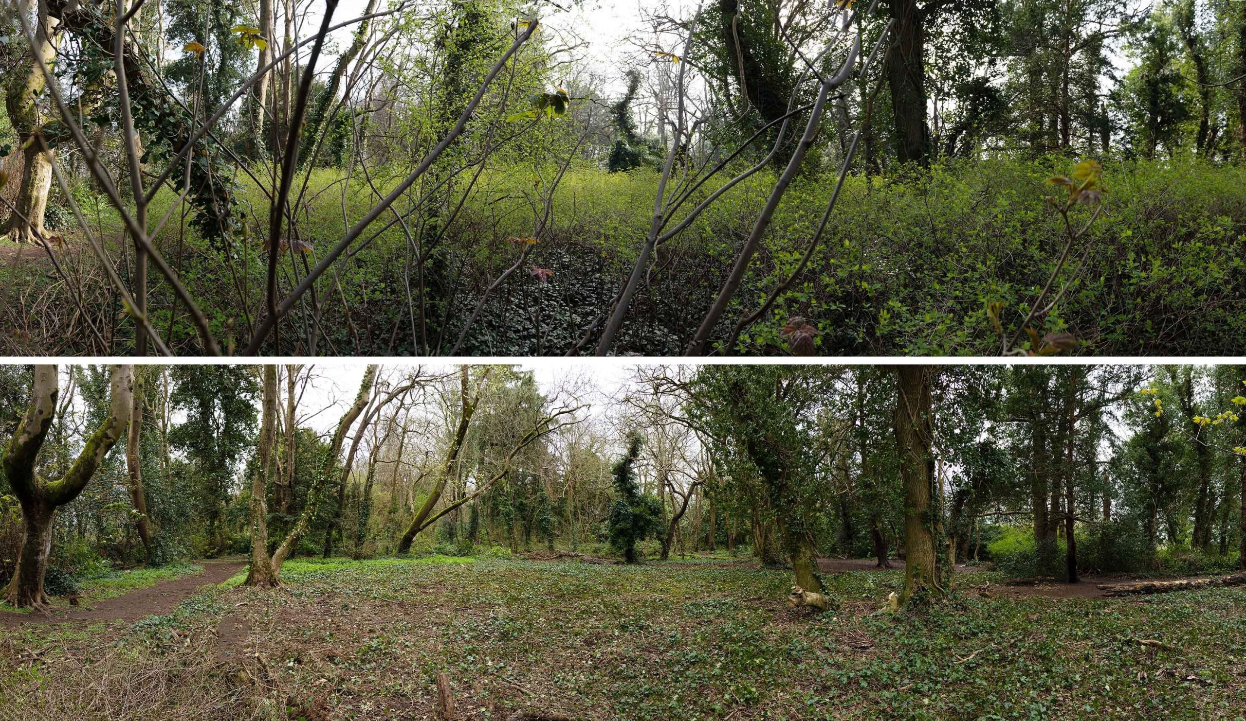
Since the compulsory purchase of the Scout’s land by the Council, little has been done to protect the character of the woodland clearing – until now. The Snowberry that’s invaded the area is not native, and had obscured the open character of the area. With the recommendation of the wildlife and woodland officers, the restoration of the clearing for both heritage and ecology is a project we’ve been keen to engage with.

A good band of volunteers set out to clear the invasive shrub from the area in mid-March. Knowing that bird nesting season was upon us, we were exceptionally careful in approaching the task, though, with the Snowberry yet to leaf, there was little cover to attract birds.

The view east across the historic clearing. Some of the original imported evergreen specimin trees can be seen on the far edge. 

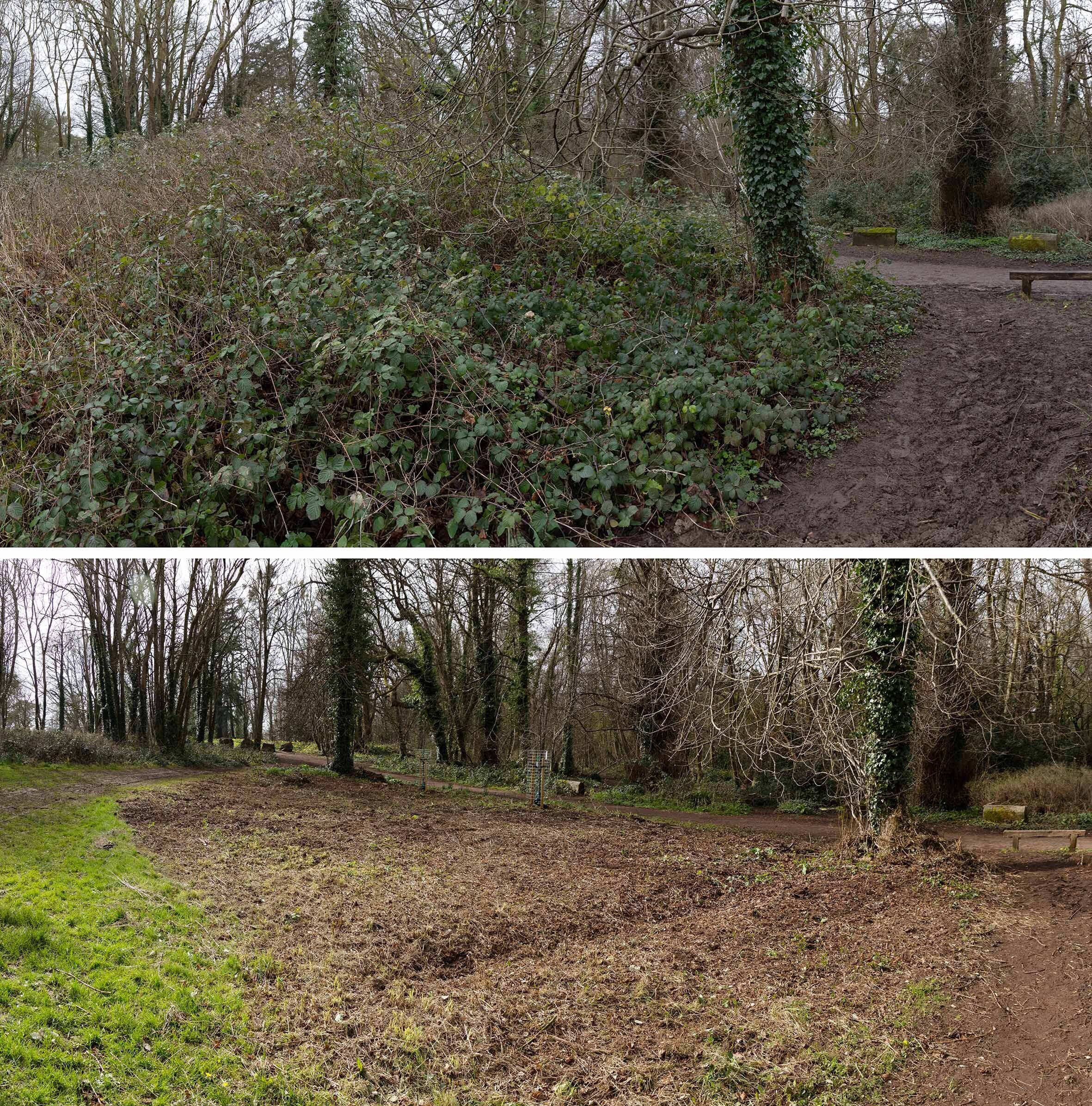
The removal has been surprisingly effective. The transformation now hits you immediately you enter the area, views through and across it restoring the sense of openness. We recognise that the snowberry is a tenacious plant, and will need repeated cutting, but this is a major step in restoring the character. The ground-cover beneath it is largely moss or ivy, the only species able to grow below the dense coverage. This month we hope to try and improve the biodiversity further by preparing the way for seeding of suitable shade-loving grasses and wildflowers.

Looking across Jubilee Clearing from the south, before and after work. 

Working Party update: Bramble rooting on the lime avenue 

In retrospect, perhaps February’s working party was a bit of a challenging job. We hoped to root out a large patch of brambles, the first along the ancient avenue of lime trees leading towards the house. Through a combination of limited resources and tools that were less than ideal, we struggled to meet the target we’d set for ourselves. The poor ground conditions, clinging wet mud, and rain hardly helped matters.

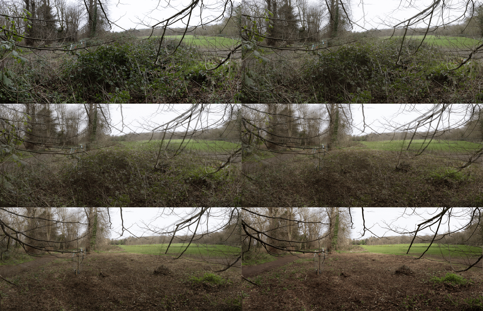
Animated image showing the scene before and after work. The drive down the lime avenue is on the left.  

We did manage to complete a significant part of the work on the day, but had to admit defeat when the rain began in earnest later on. Fortunately, a few volunteers were able to donate more of their time a couple of weeks later to complete the job.    

Now the two recently replanted trees on the avenue are better revealed, and there’s a definite improvement in the open character between the main drive and the open lawns leading to the house. It’s our hope that, having taken the brambles out by the root, we’ll have a much better chance of them not returning with such vigour this year.

Before and after work on the brambles looking from the lawn back towards the drive and the Circle beyond it. 

Whilst this will stem the encroachment of only a small part of the avenue, we’ll be unable to continue this work during bird nesting season. This will also give us time to rethink how we approach the job.

Animated image showing the work on the lime avenue looking towards Kings Weston house on the right.