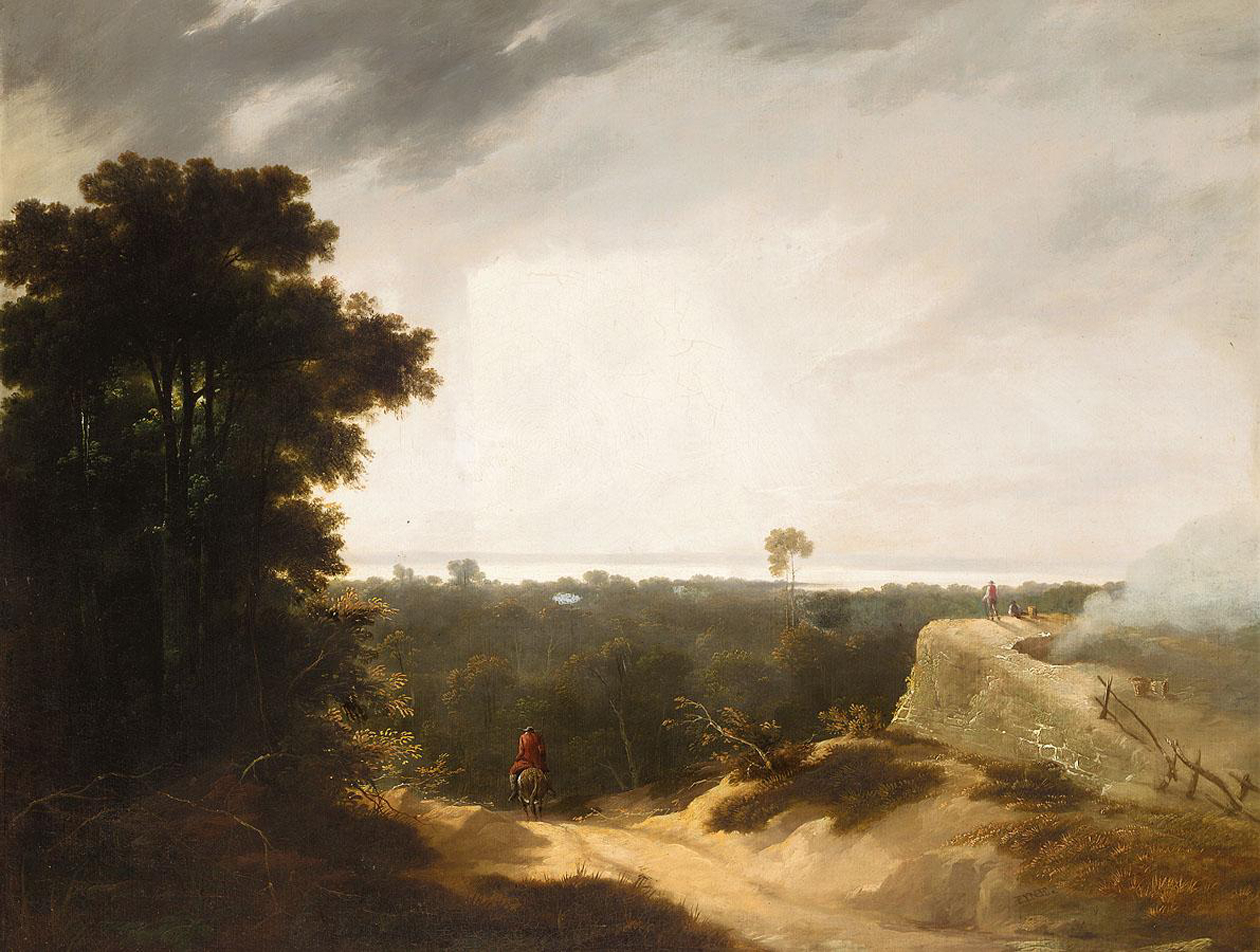
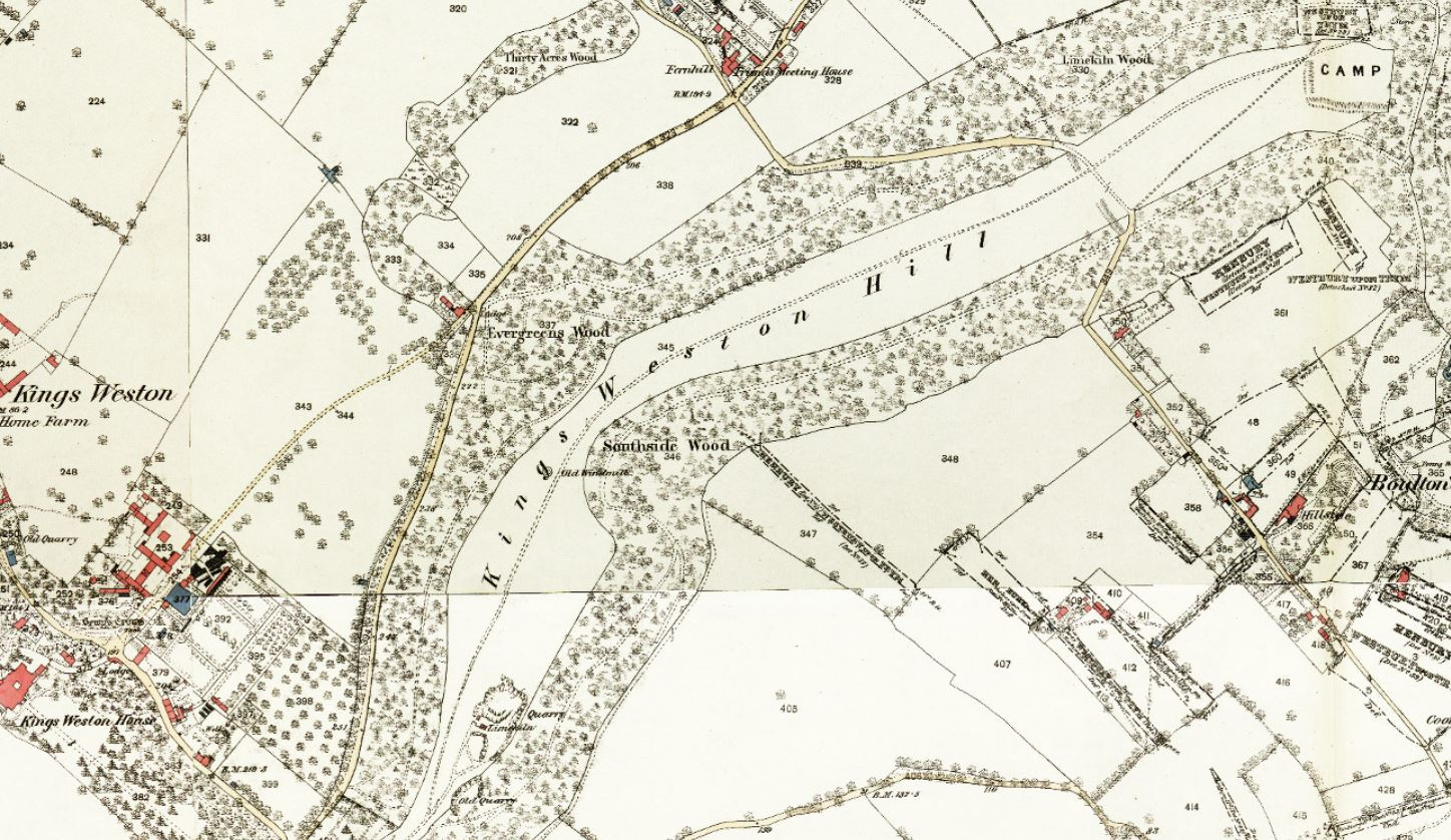
Since the closure of the iron bridge four years ago we’ve somewhat neglected the eastern part of the historic kings Weston estate incorporating Kingsweston Hill. The boundary identified by Historic England between the Kings Weston and Blaise Castle estates runs across the middle of the hill along the line of the reputed Roman Road that zig-zags between Sea mills and Lawrence Weston. However the eastern end of the Hill, including the Bronze Age encampment really falls within the historic bounds of Kings Weston. Until the 1800s the hill remained open grazed downland and the prehistoric monuments that stood there stood out in high relief on the horizon.
The hill has been treated as common land for centuries, but it’s never known to have actually held that status officially. In the 1840s there were alarmed newspaper reports that the Miles family, who’d recently taken up residence in Kings Weston house, had set up gates and fences and were preventing the public from accessing that which they considered their own. The situation was rapidly resolved, but the privacy-loving miles family can’t have been comfortable with the constant traffic across the hill to take in the views.
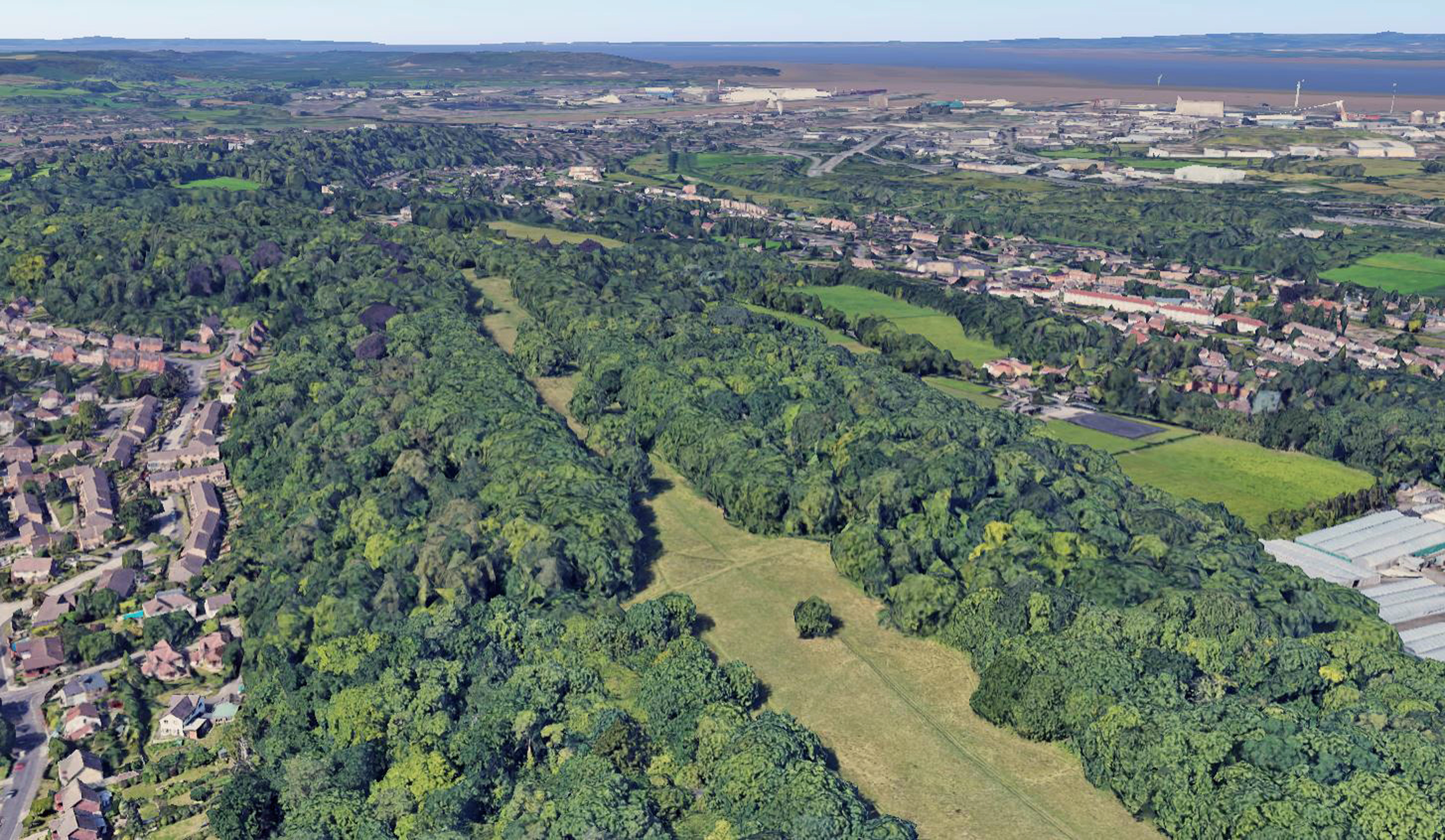
It was these views, particularly the ones looking northward across the Severn towards Wales, that were a popular attraction for Bristol residents keen to escape the city for a few hours recreation. The hill was famed for much of the Nineteenth Century for its panoramic aspect, but today these have been replaced by dense woodland plantations established by the Miles family and the Southwells’ before them.
Already by the 1830s Limekiln Wood on the north side of the hill was well established, replacing the historic grassland, and Evergreens Wood and Southside Wood on the opposite side of the hill, followed. The lime kiln that gave the northern wood its name was established already in the Seventeenth Century and its setting-up is mentioned in documents written by Sir Robert Southwell. Limestone quarried from the slopes was ideal for burning to extract lime used in the building trade and agriculture. The kiln has long vanished, but formed an atmospheric landmark until the 1840s.