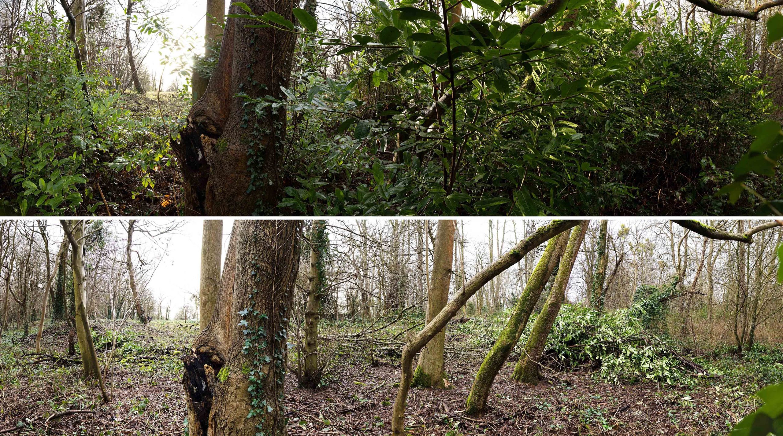
Deep in Penpole Wood lie the half-forgotten remains of a small cottage. Now just a few fragments of wall and some undulations in the forest floor, this was once the Keeper’s home.
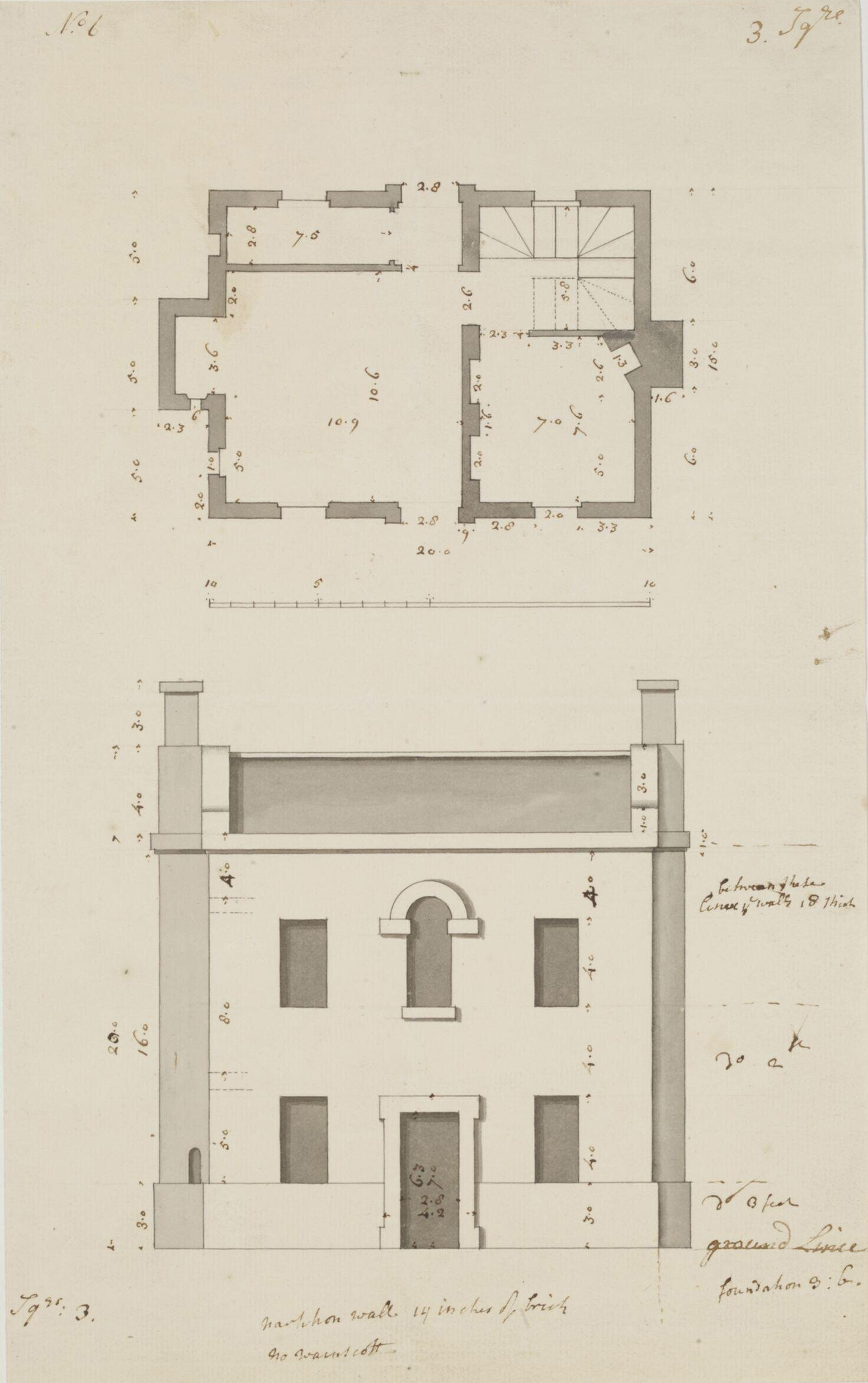
As far as we’ve been able to ascertain, the house was built after 1845, so would have been an addition made by the Miles Family who then owned the Kings Weston estate. It may even have been designed by Philip William Skinner Miles, who considered himself something of an amateur architect and is responsible for much minor work around the parkland.
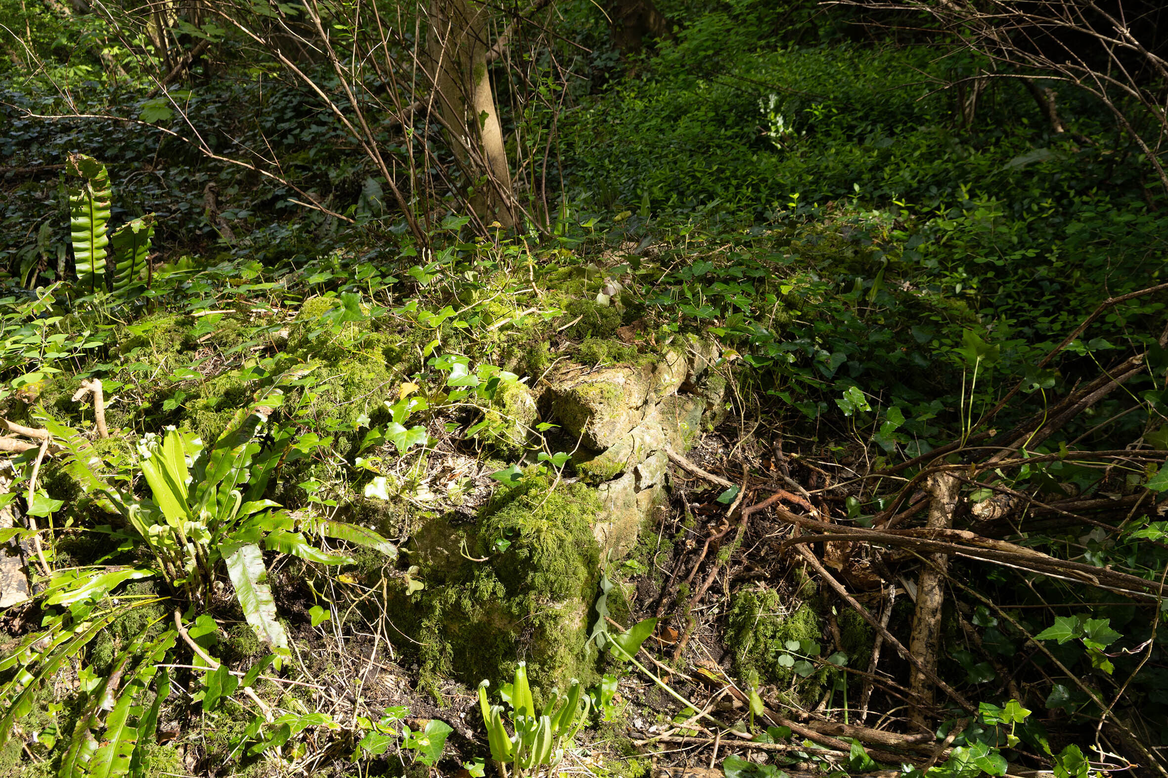
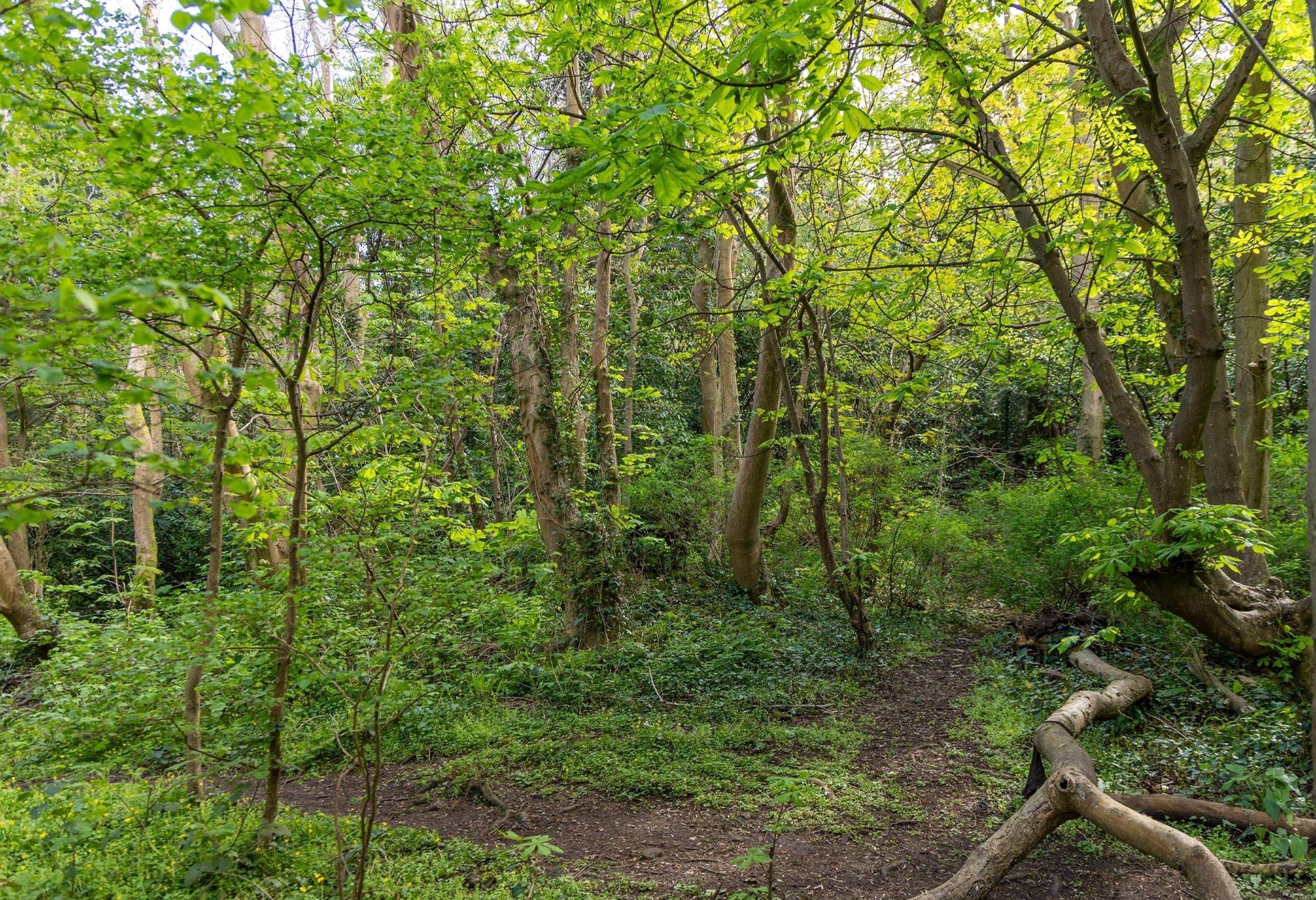
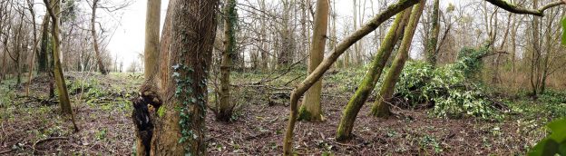
the south-west corner of the cottage survives as a few courses of stone amongst the forest floor.
The location at the foot of the Penpole Ridge once enjoyed views northward across open fields of the parkland, but today’s woodland margins have long extended to encompass it. It is assumed that any game shooting would have taken place in these fields with pheasant or other birds bred in the woodland before release. The location of a gamekeeper’s cottage on the boundary between these two areas makes sense in this context.
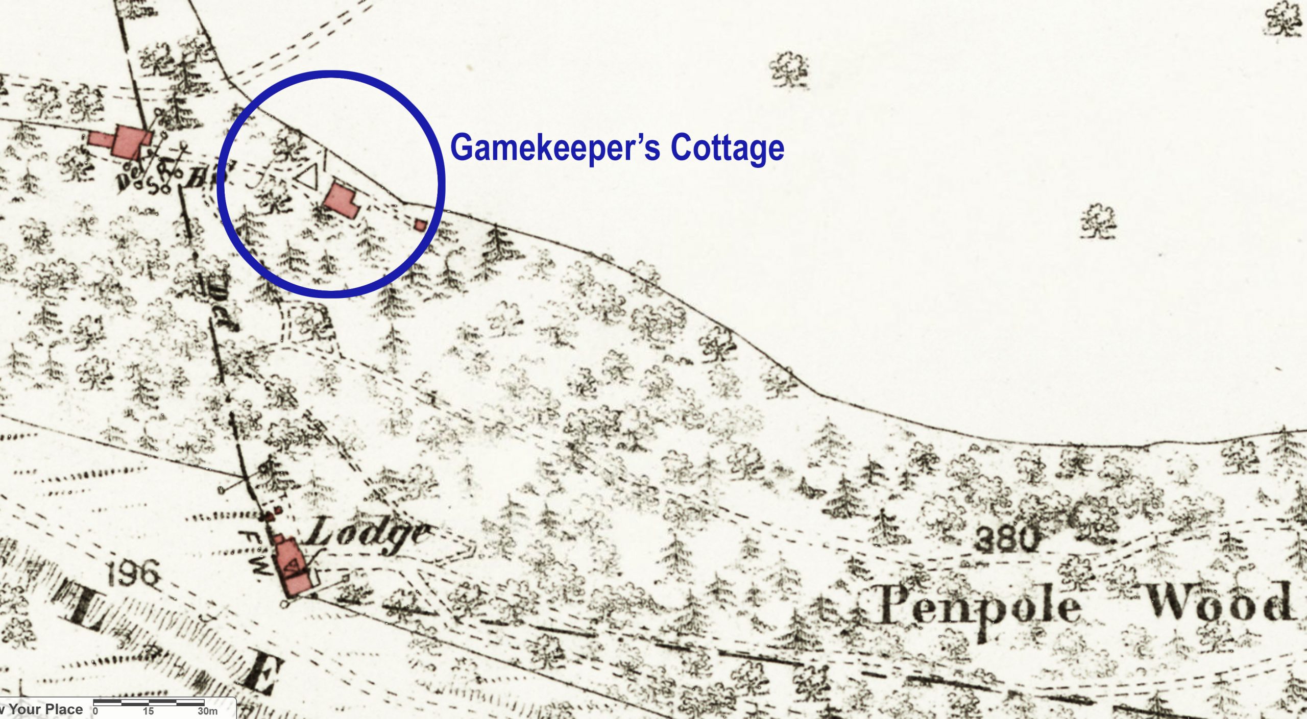
1884 map with the location of the cottage marked, being sited downhill almost directly north of Penpole Lodge.
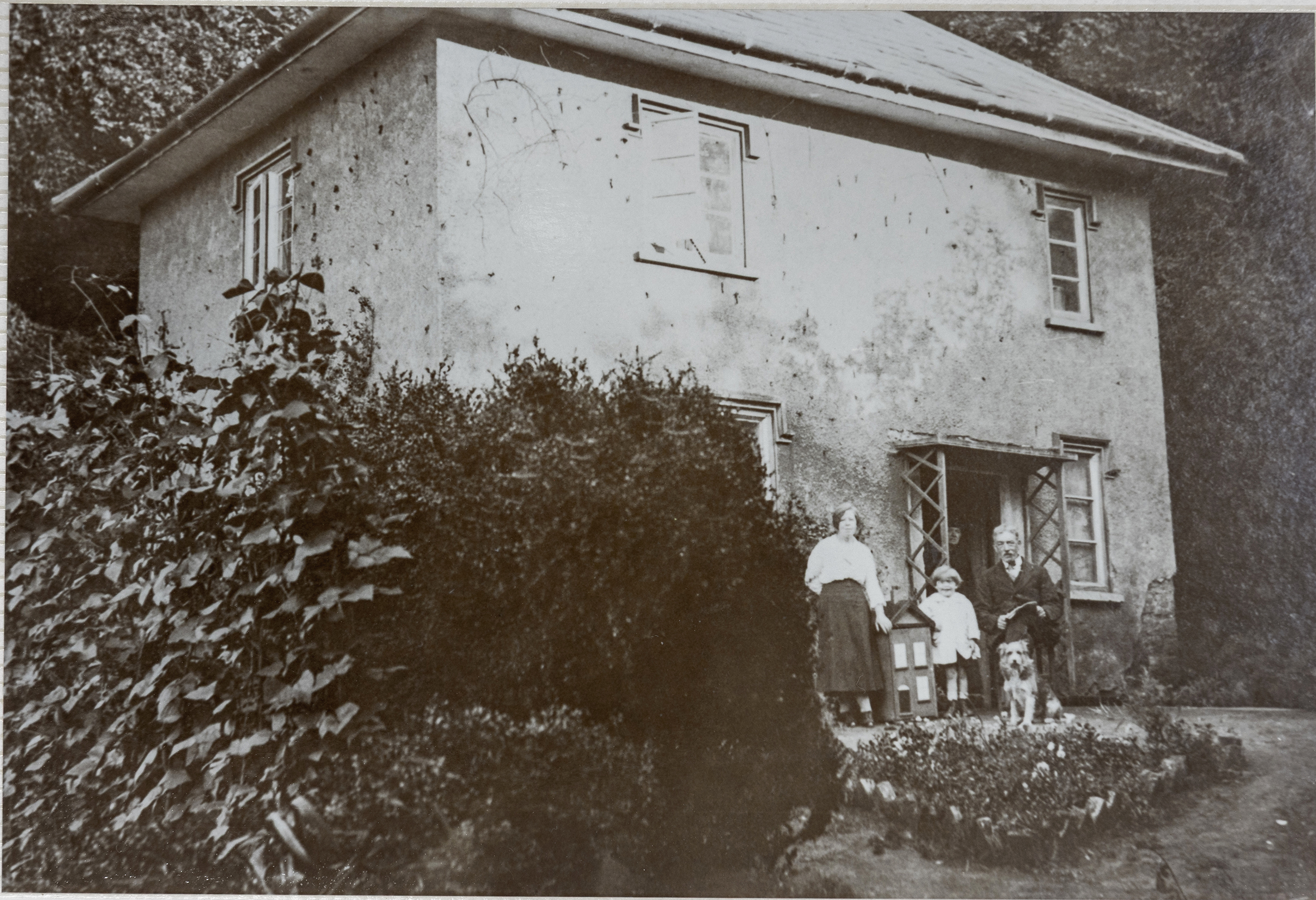
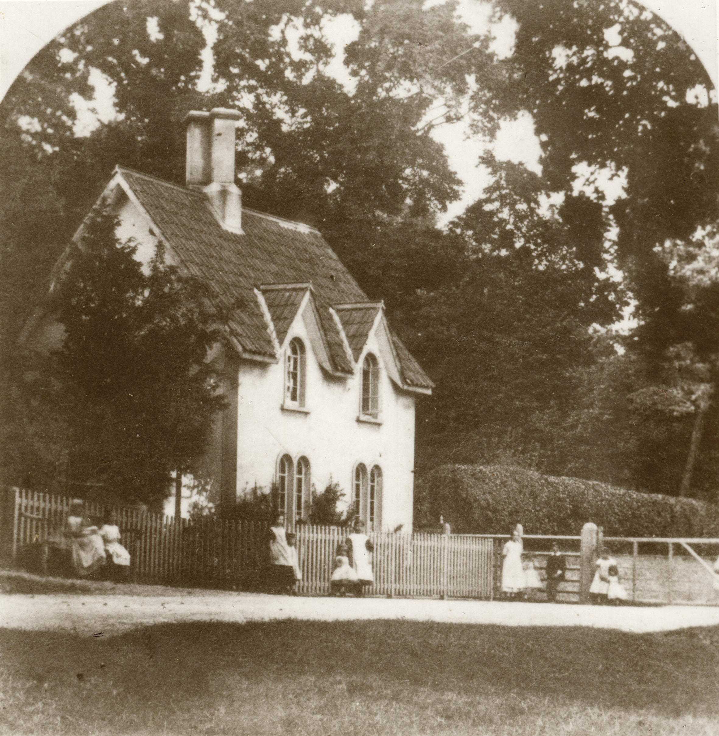
The cottage itself was small, but not without some architectural pretention. From early photos we can see it was of two storeys and its main frontage to the north and west were carefully composed with attractively proportioned casement windows and Tudor-style drip-mouldings carried across each. It had a smart hipped roof, slate-covered, and a pair of tall chimneys, again in the Tudor manner. The whole building was finished in rough-cast render, some which still clings to the walls today. It must have had quite a picturesque effect when viewed from the fields, sitting with a heavily wooded backdrop, with its a small garden and smoke drifting from its prominent chimneys a sign of domestic life within.
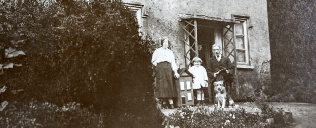
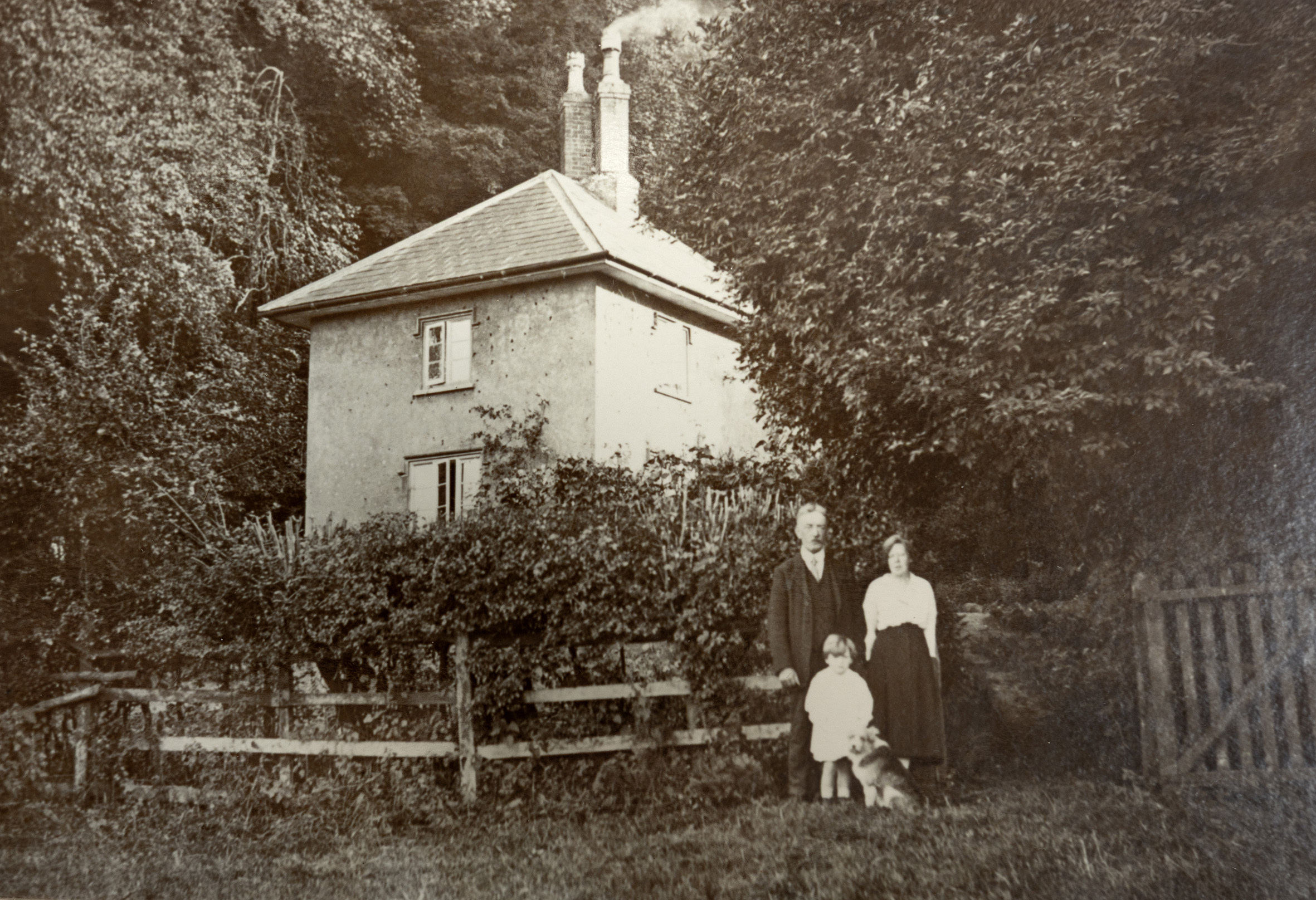
Keeper’s Cottage from the west, with the McEwen family and their dog Gyp.
These two photographs record the Keepers Cottage in 1921 when it was the home of the McEwen family. Arthur McEwan was head of the family and is seen with his wife Lilian, and their children Winifred and Arthur John, the latter just glimpsed at the door. The dog was Gyp.
Winifred, later Mrs Pople, remembers that in her childhood she carried buckets of water down the steep path from Penpole Lodge where Mrs Turk kept a tank filled with drinking water. Her mother, only 4’ 11”, nearly fell down the well they used, so the water tank was installed by Squire Miles as a safer, if less convenient, source.
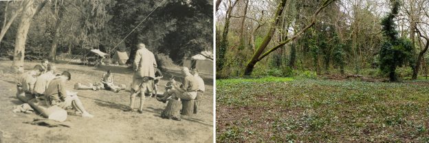
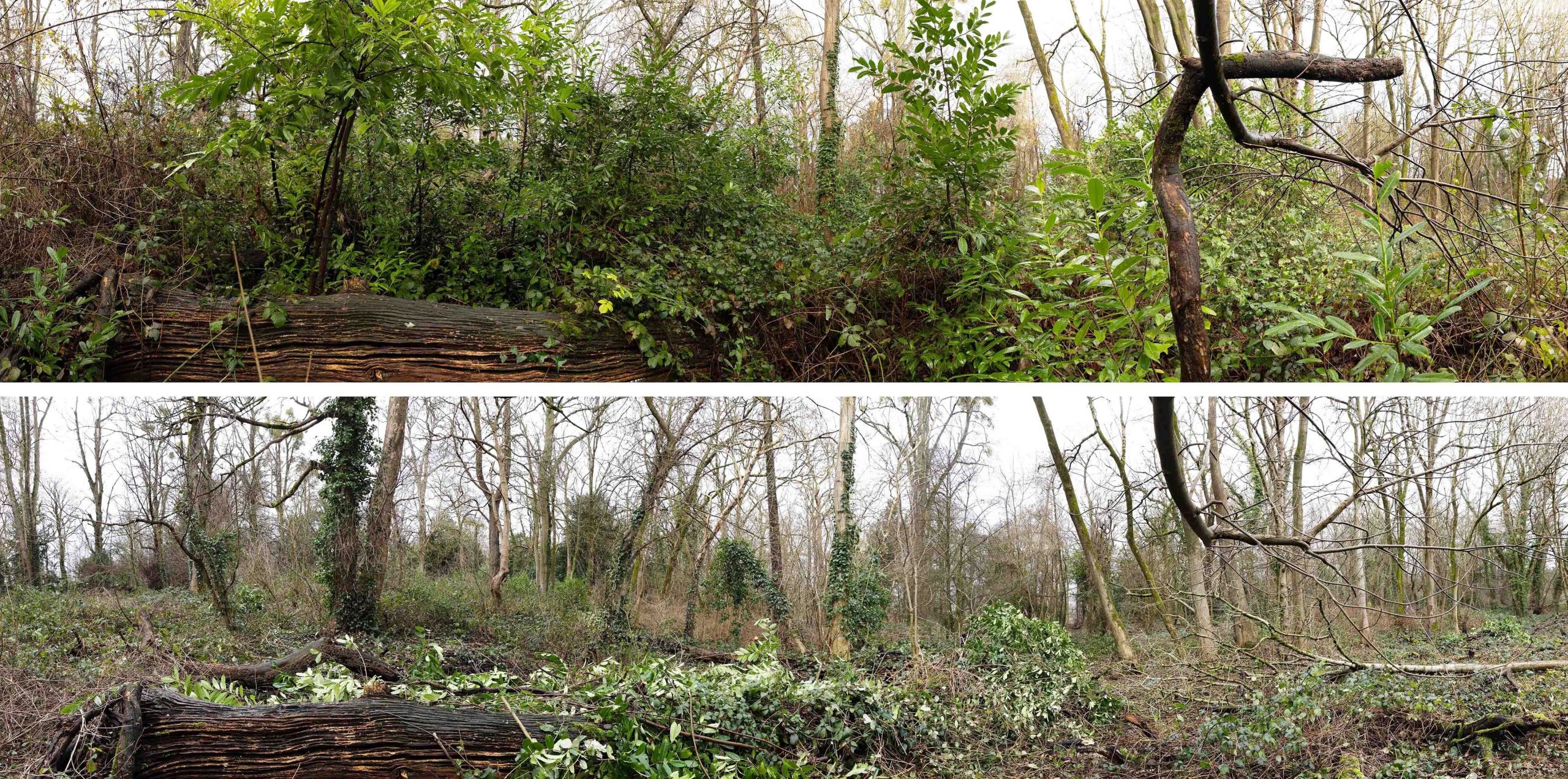
The Keepers Cottage with the McEwen family outside in 1921A similar angle today, the cottage now rubble under the forest floor.
The house remained occupied until WWII. By then the district Scout groups owned the land and the cottage and it was referred to as the Lower Lodge. With the outbreak of the war parts of their property were commandeered by the RAF and the Home Guard. The wardens wrote that “We had viewed with some concern the activities of the Home Guard when the took over the Lower (lodge)” and it suffered badly during this time.
A few tiles were damaged by the explosion of a high explosive bomb nearby, but the house survived only to become the target of “local roughs”. By 1944 it had suffered badly from “wanton destruction” in the absence of regular use and, when the woods were sold to the Council in 1947, it’s unlikely that it was in habitable condition. It’s believed at this time the Council took the place down to prevent it from becoming the focus of more vandalism.
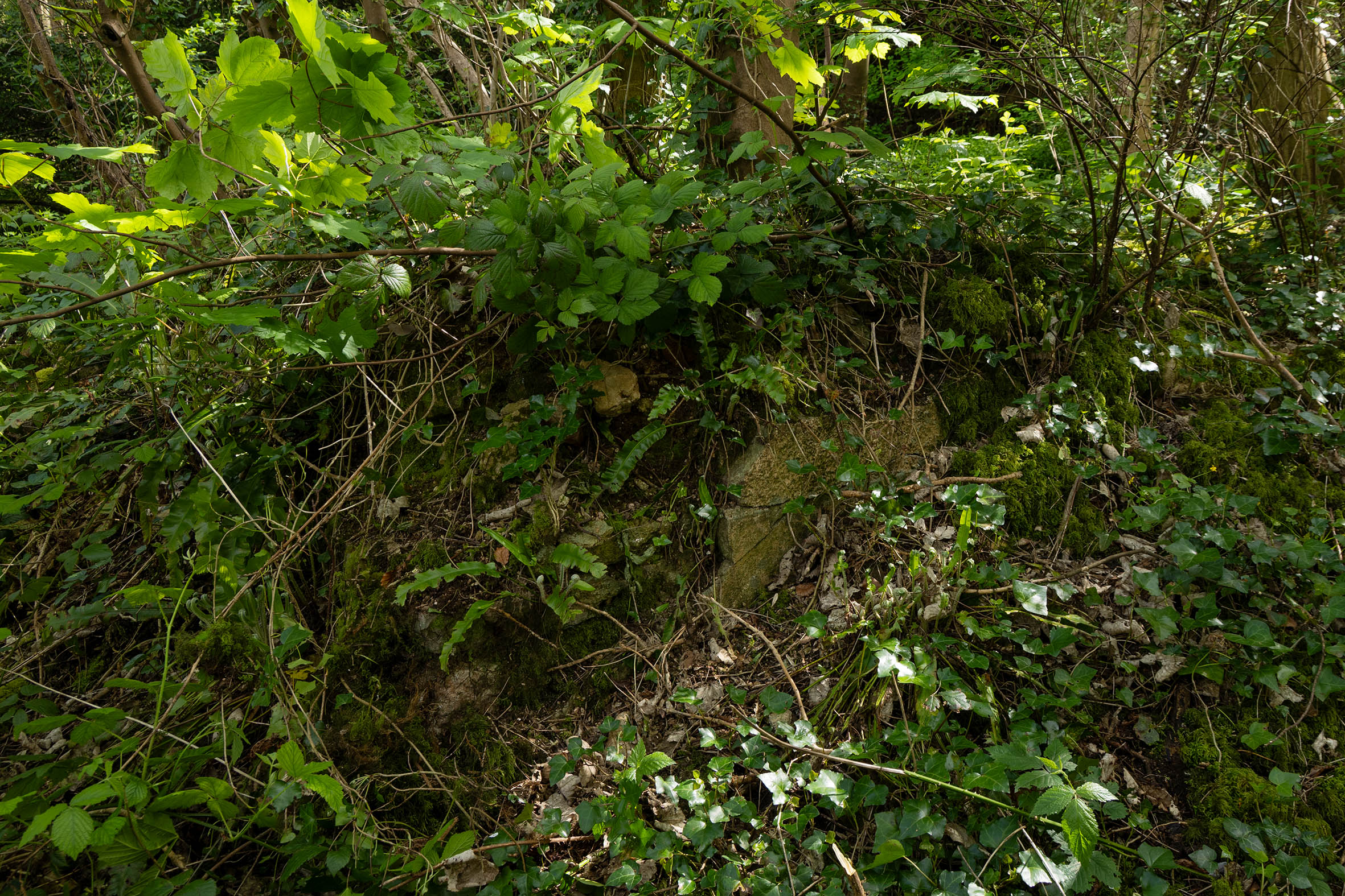
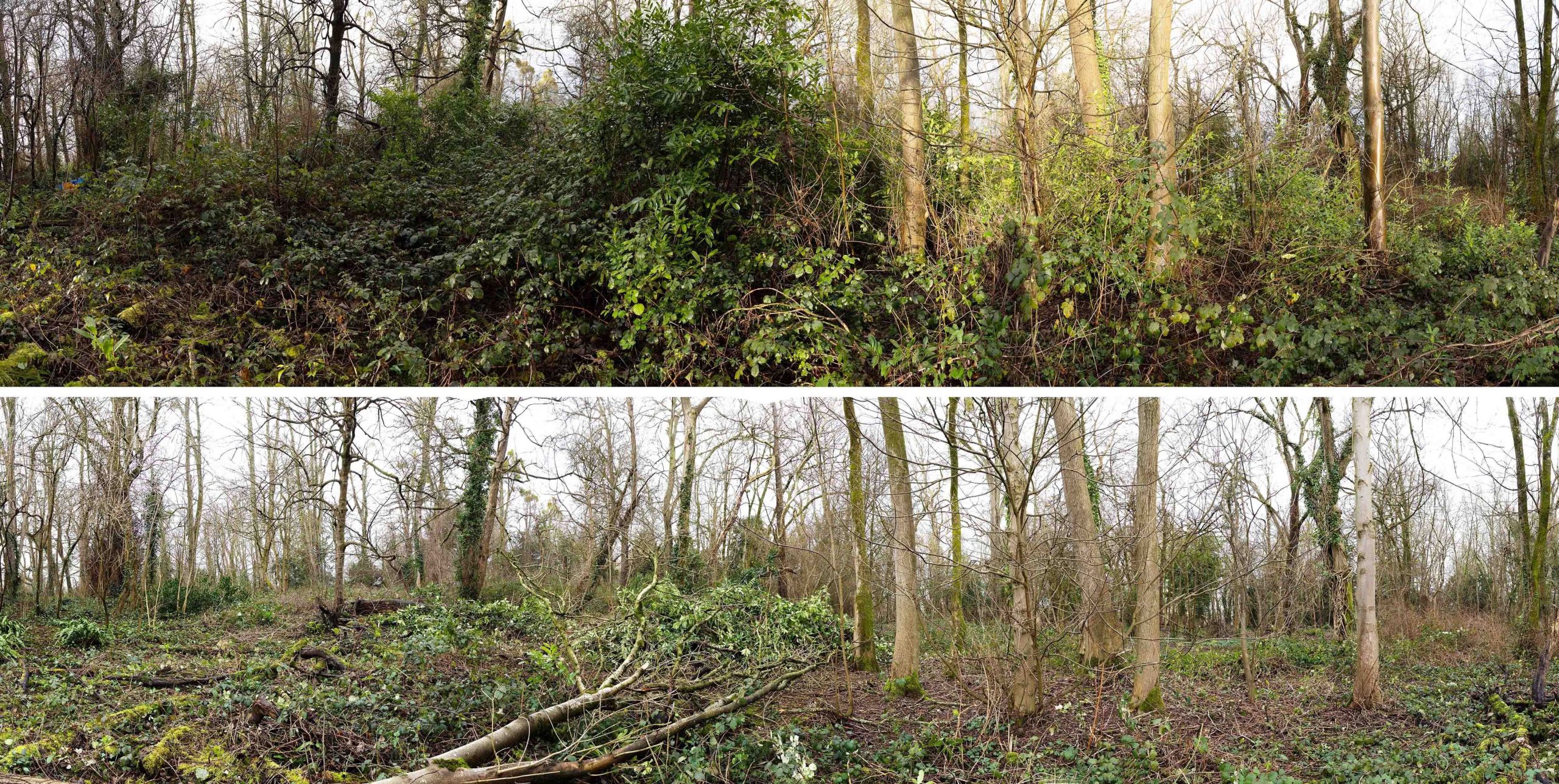
the north-west corner of the cottage under the greenery. Part of the original render clings on.
The walls survive to shin-height though sycamores now fight their way through the old floors. In the future it would be a good job for KWAG to clear around these ruins, measure and record them, and make sure there is some preservation before they are lost for all time.
Here’s an attractive new addition to our library of historic images. A watercolour painting captures the scene at Penpole Point in the middle of the 19th Century. This was at the peak of its appeal, when people came from miles around to enjoy the sunset from the Point, and before cheap rail travel rendered such simple pleasures less enduring.
The work was painted by Thomas Remnant Charleton (1756-1849) in his final decade, and long after his retirement from military service to Bath. This image joins many others that recorded the natural wonder of Penpole Point at this time, before the views were lost to industry and overgrowth.
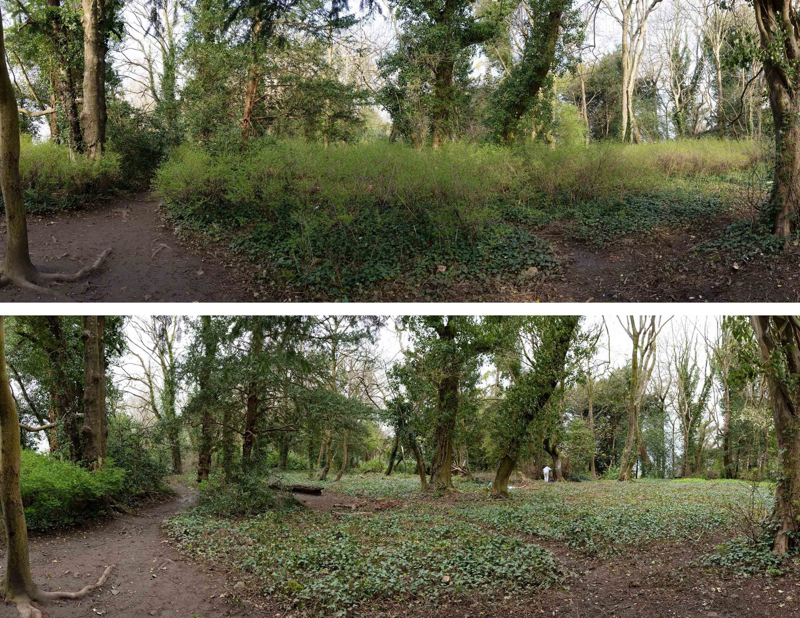
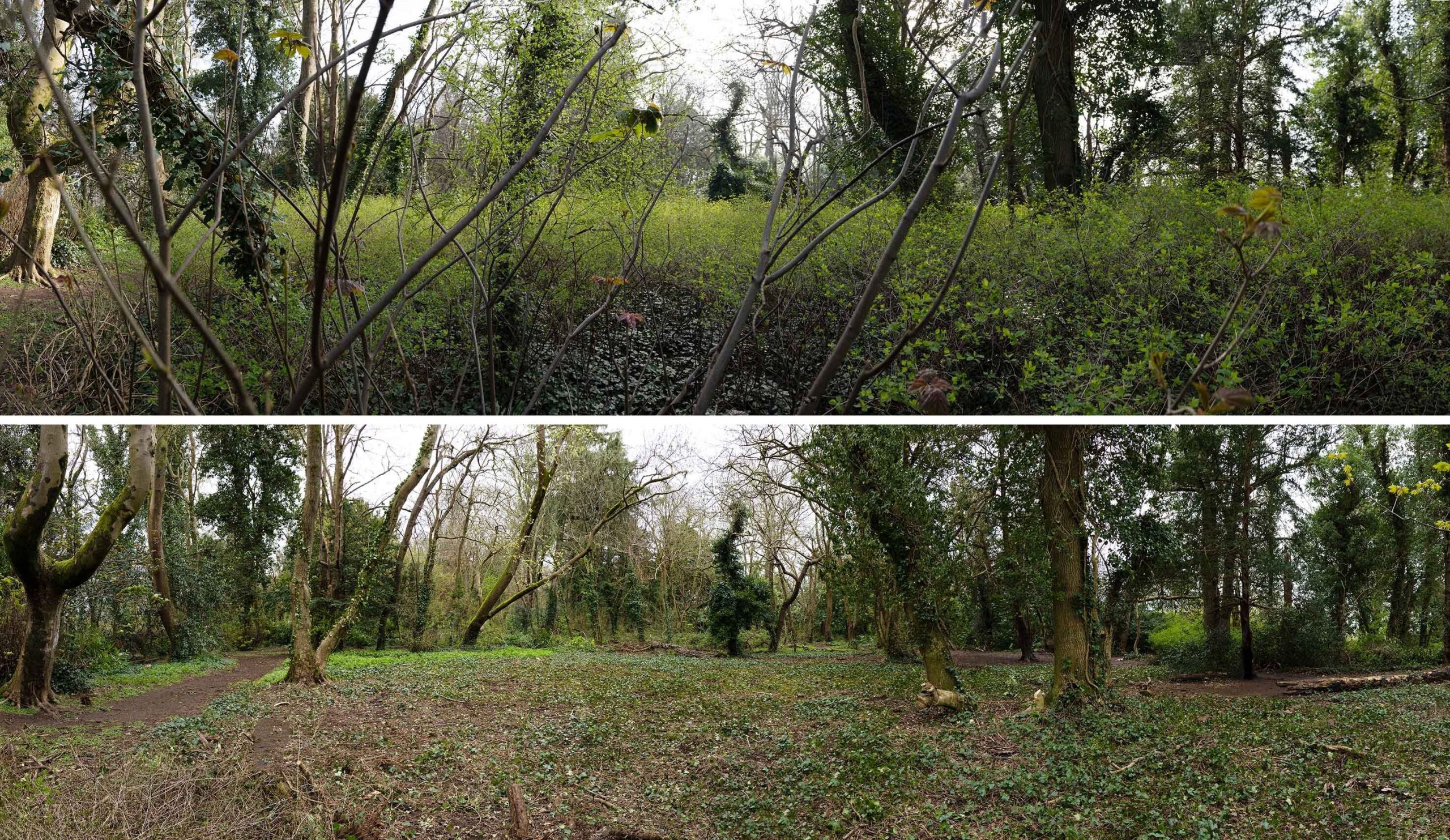
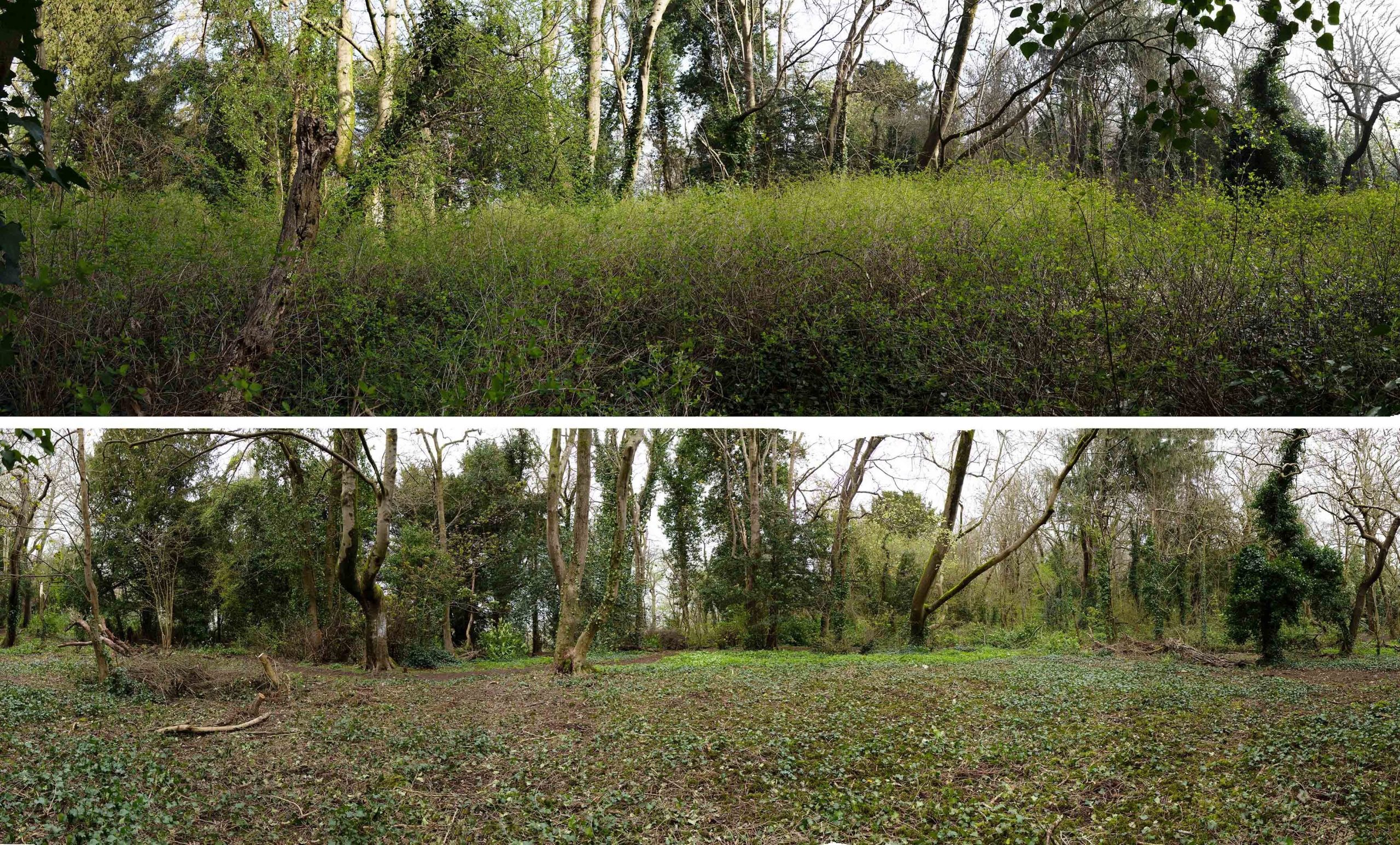
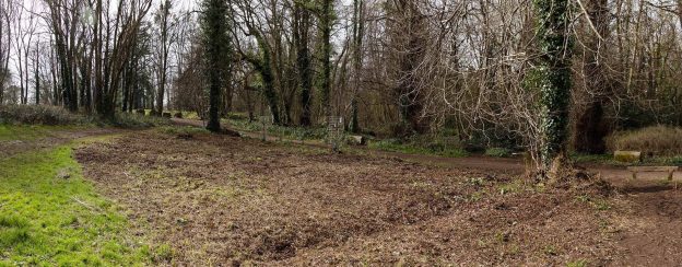
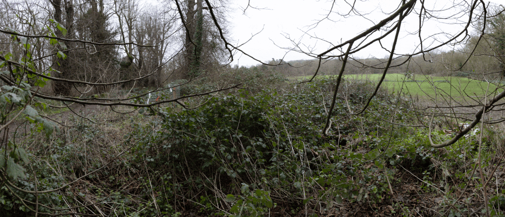
Jubilee Clearing has long been a memorable spot for local people from Shirehampton and Sea Mills. After the death of the last squire, Philip Napier Miles, large parts of Penpole Wood and fields beyond were sold to Bristol District Scouts. Between 1937 and 1947 the clearing became the favoured campsite of the district’s scouts.
The view on entering the clearing from Penpole Lane on the south edge.
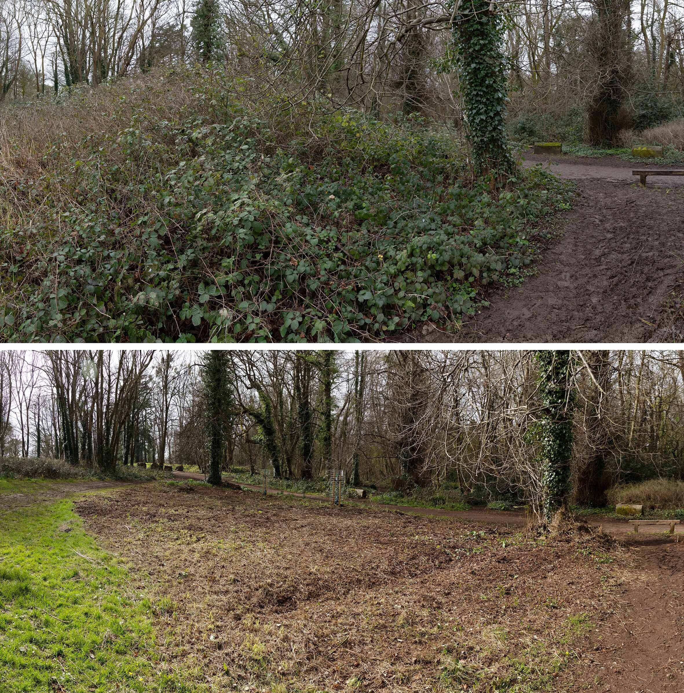
Since the compulsory purchase of the Scout’s land by the Council, little has been done to protect the character of the woodland clearing – until now. The Snowberry that’s invaded the area is not native, and had obscured the open character of the area. With the recommendation of the wildlife and woodland officers, the restoration of the clearing for both heritage and ecology is a project we’ve been keen to engage with.
A good band of volunteers set out to clear the invasive shrub from the area in mid-March. Knowing that bird nesting season was upon us, we were exceptionally careful in approaching the task, though, with the Snowberry yet to leaf, there was little cover to attract birds.
The view east across the historic clearing. Some of the original imported evergreen specimin trees can be seen on the far edge.
The removal has been surprisingly effective. The transformation now hits you immediately you enter the area, views through and across it restoring the sense of openness. We recognise that the snowberry is a tenacious plant, and will need repeated cutting, but this is a major step in restoring the character. The ground-cover beneath it is largely moss or ivy, the only species able to grow below the dense coverage. This month we hope to try and improve the biodiversity further by preparing the way for seeding of suitable shade-loving grasses and wildflowers.
Looking across Jubilee Clearing from the south, before and after work.
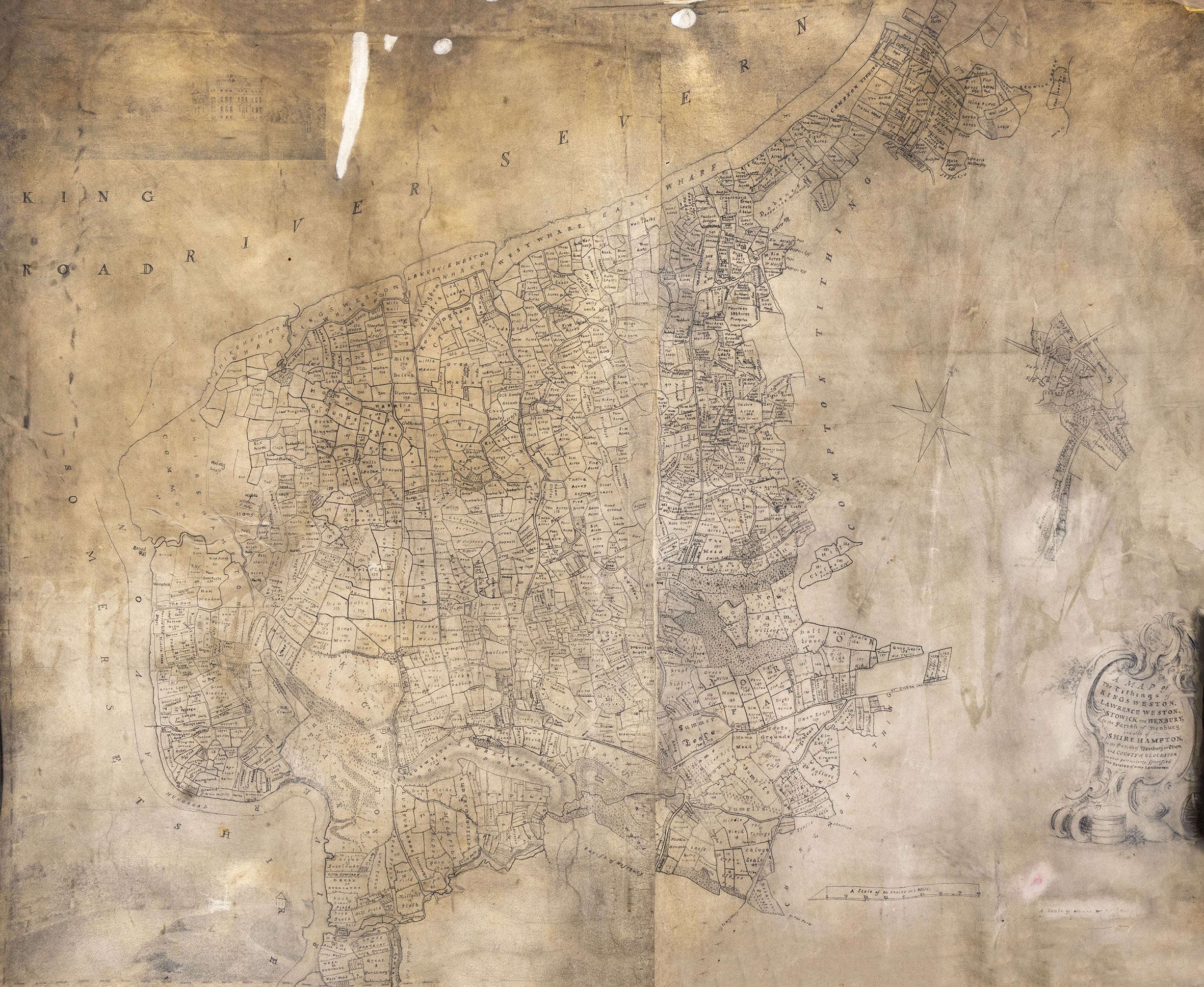
It was a bit of a surprise to find that well-rummaged archives can still turn up some historic Kings Weston gems. A recent return to Bristol Archives turned up, by chance, an interesting new estate plan. Perhaps we’d seen it before and thought it was a copy of a better known one, or perhaps we’d never thought it would be of any interest, but when it was delivered to the reading room by the archivists it was great interest.
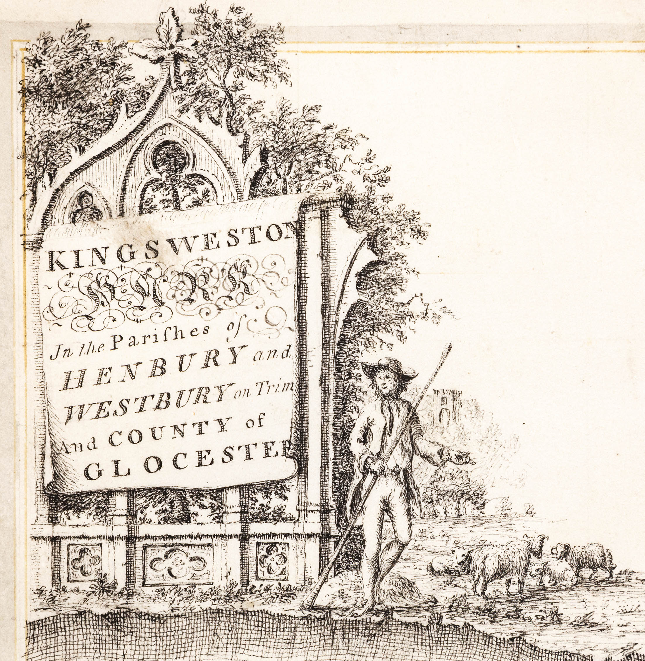
The whole of the large velum plan showing the estates of the Southwell family around Kings Weston house.One of the ornamental title blocks added by Isaac Taylor to his earlier bound estate survey.
We’ve regularly used snippets and details of another estate plan, drawn in 1772 by a surveyor called Isaac Taylor, to illustrate some of our stories, and you’ll find it as a base layer on the Know Your Place website. On the website it’s been carefully pieced together from the many double-page spreads from the book in which they’re bound. Sadly, this means that some of the picturesque details around the map are missed off.
The new estate map is also drawn by Tailor, but is instead a single rolled large-format map of the entirety of the Kings Weston estate. It is dated 1773, the date after the bound series of maps and no doubt commissioned by the Southwell Family as an alternative way of keeping track of their estates. Unlike the 1772 survey, this later version is at a larger scale. It’s also different in showing clear signs of having been updated and altered in a different hand. These changes appear to reflect changes in ownership of parcels of land and redraw detail that has become feint or worn through use.
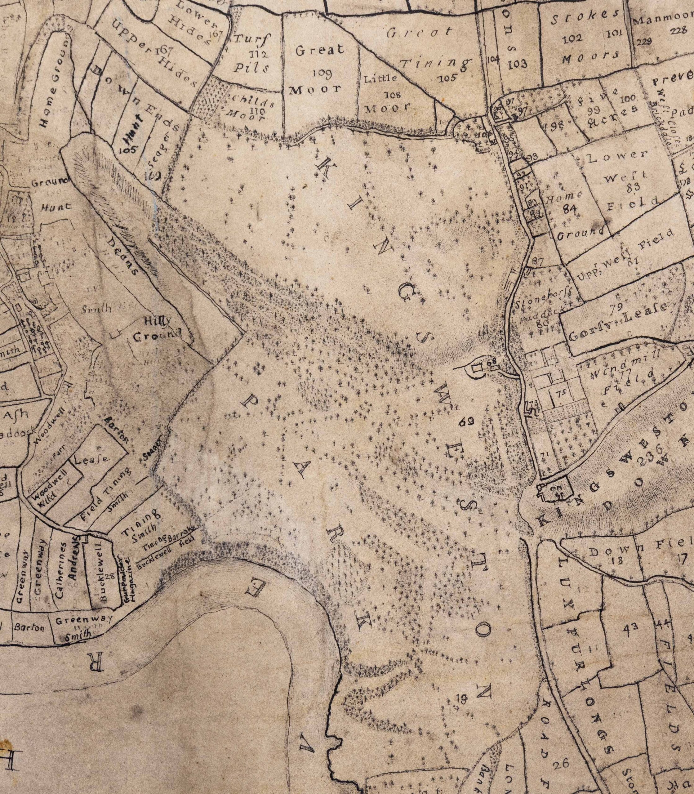
Detail of the new estate plan showing the park around the house.
The 1773 survey is a vast and unwieldy document. It certainly shows the enormous scale of the estate in a more complete way than the individual portions in the bound volume, although without quite such the fitness of drawing. The cartouche carrying the details of the map is less elaborate, but there’s something else almost hidden under the dirt that’s accumulated on the velum over the centuries – drawings!
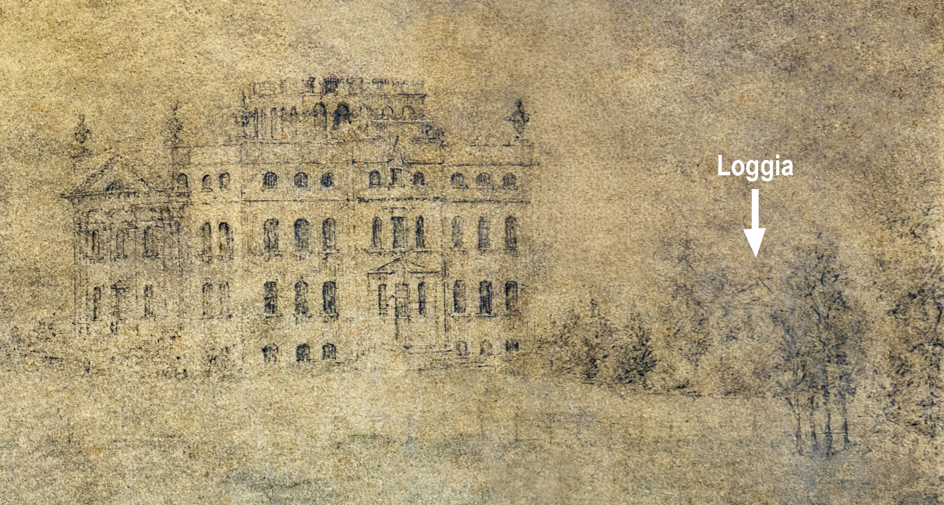
There are two, one in each corner on the left hand side. Sadly, they are very dirty and difficult to make out. The lower one is a scene on the Avon at Lamplighters, but very little detail is discernible to be of much interest. The other is more interesting to the Kings Weston story, being a rare early depiction of the house itself from the south. The drawing is better preserved, but is still badly stained and dirty. The house is recognisable on the right hand side, with the pediment of the Loggia just visible over the top of the shrubbery. Also discernible is the avenue of lime trees approaching from the left. The planting differs little from today, though trees and shrubs have definitely matured from the illustrated state.
The images presented here have been enhanced to try and bring out some of the detail.
Detail of the new drawing showing the top of the Loggia above the tree line. Note also the difference on the design of the top of the garden front of the house.
In retrospect, perhaps February’s working party was a bit of a challenging job. We hoped to root out a large patch of brambles, the first along the ancient avenue of lime trees leading towards the house. Through a combination of limited resources and tools that were less than ideal, we struggled to meet the target we’d set for ourselves. The poor ground conditions, clinging wet mud, and rain hardly helped matters.
Animated image showing the scene before and after work. The drive down the lime avenue is on the left.
We did manage to complete a significant part of the work on the day, but had to admit defeat when the rain began in earnest later on. Fortunately, a few volunteers were able to donate more of their time a couple of weeks later to complete the job.
Now the two recently replanted trees on the avenue are better revealed, and there’s a definite improvement in the open character between the main drive and the open lawns leading to the house. It’s our hope that, having taken the brambles out by the root, we’ll have a much better chance of them not returning with such vigour this year.
Before and after work on the brambles looking from the lawn back towards the drive and the Circle beyond it.
Whilst this will stem the encroachment of only a small part of the avenue, we’ll be unable to continue this work during bird nesting season. This will also give us time to rethink how we approach the job.
Animated image showing the work on the lime avenue looking towards Kings Weston house on the right.
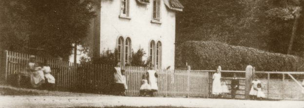
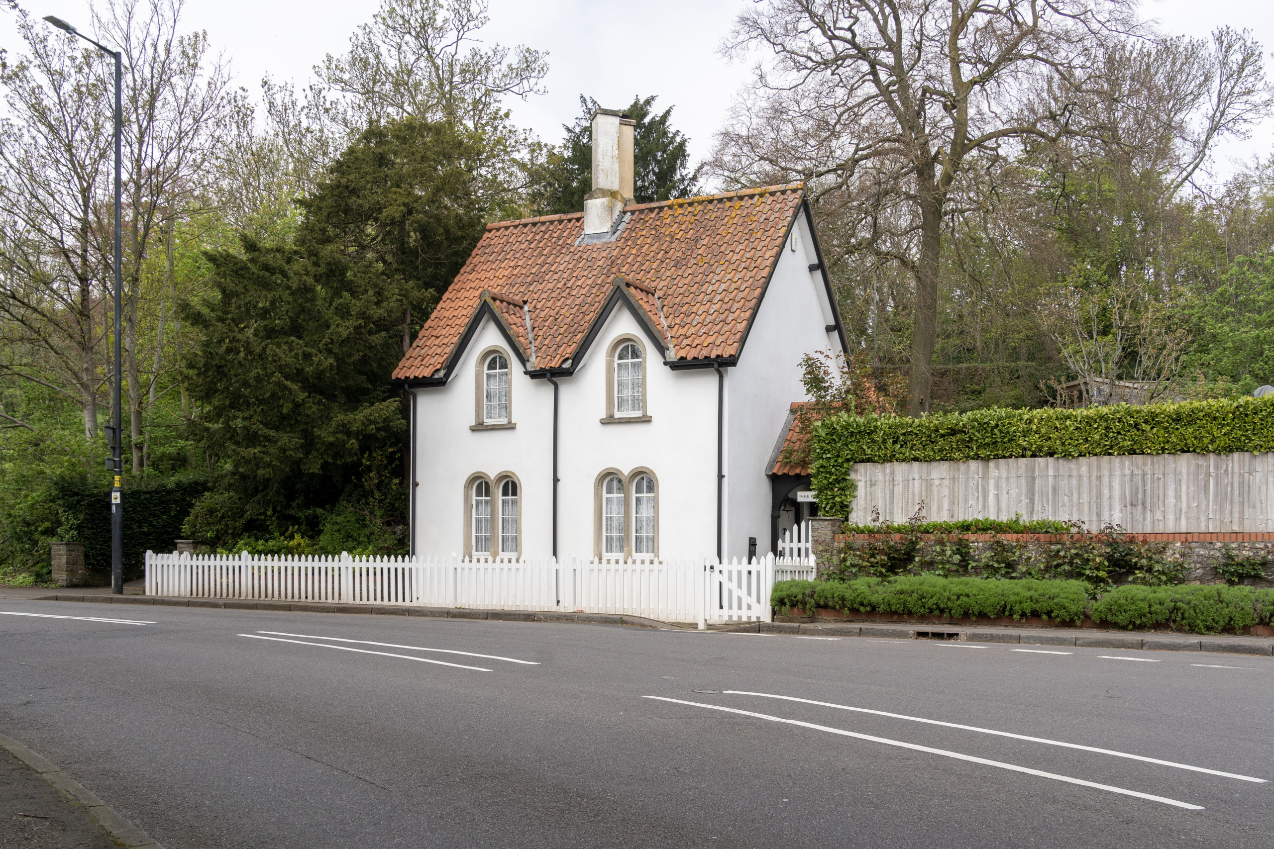
Before now, we’ve looked at the history of most of the lodge houses that guarded the perimeter of Kings Weston estate and the architects involved in them. This has included Penpole Lodge by Vanbrugh, Shirehampton Lodge by Robert Mylne, Wood Lodge, probably by Thomas Wright, and Henbury Lodge by Thomas Hopper; but the history of Park Lodge is less clear.
Park Lodge much as it appears today
Park Lodge is today a Grade II Listed building and will be familiar to thousand who pass it daily on the corner of Shirehampton Road and Kingsweston Road. Sat behind a white picket fence, the building is a pleasant but not extravagant cottage. It fits broadly into the Cottage orné style of buildings designed for picturesque effect. Its steep pitched pantile roofs and dormers give it an alert posture and its arch-headed window add a little light ornamental appearance. A a pair of tall conjoined chimney stacks punctuate the centre point of the roof profile.
The lodges weren’t toll houses, but demarked the boundary of the landscaped parkland and controlled access through the estate after dark. Each of the roadside lodges were equipped with gates that could be closed at dusk, despite it being the public highway. In this way the Southwell and Miles family could assert the impression of authority over the landscape despite having to allow traffic to travel through their lands to Shirehampton, Lawrence Weston, and Henbury.
Park Lodge in the 1820s from the east. From a painting now within the collections of Neath Antiquarian Society.
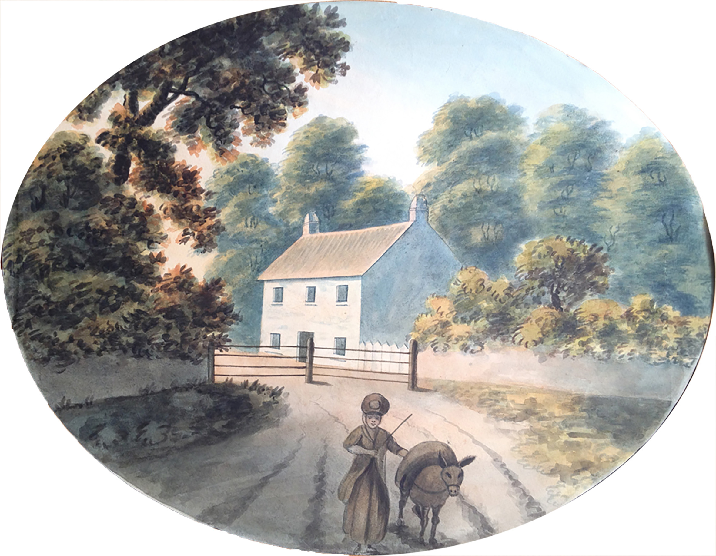
However picturesque Park Lodge might be, it’s far from being as architecturally noteworthy as its partner lodges and its history is less well documented. It appears first on the 1772 estate plan by Isaac Taylor, complete with its wooden gates, but this was a very different building to the one we see today.
We’re fortunate that two illustrations exist to show the earlier building, one even less architecturally satisfying than the present one. The first is an undated watercolour of around 1820. The scene looks west from Shirehampton Road at its junction with Kings Weston Road, roughly where the bus stop is today.
A small cottage with a simple symmetrical frontage faces onto the road with a central door and five identical square windows. A simple tiled pitched roof is anchored at either gable by a squat little chimney. In front of it are the gates, shown on the eastern side of the building. The bucolic character of the scene is set off by a woman driving her loaded donkey in the direction of the artist. The lodge’s backdrop is dominated by mature trees, perhaps the verge plantations shown on the 1772 plan. To its right the estate wall encloses a lower shrubbery, perhaps the cottage gardens.
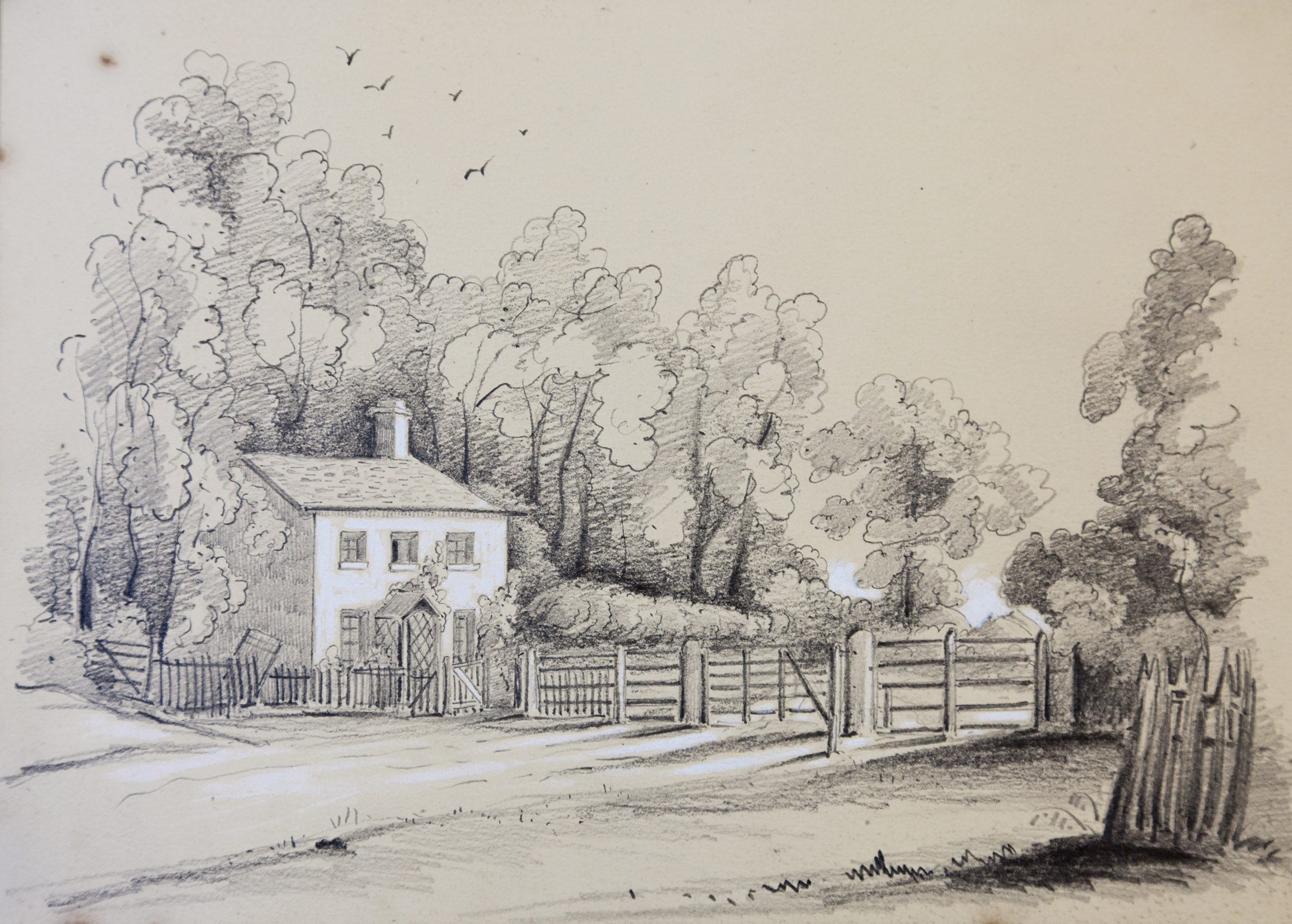
The view looking east from the edge of Shirehampton Park in 1846. Shirehampton Road exits the park from the left and through the gates across the road. Bristol Archives Ref: 13424/5
The general accuracy of the image is confirmed by another painting around twenty years later, helpfully dated 1846. It’s from an artist’s sketchbook belonging to Edward Emra Earle, of Westbury-on-Trym and shows the opposing view, from the west. The small ground floor windows have perhaps been enlarged, and a simple porch with trellis added around the front door. The park gates are shown in more detail, suggesting how imposing they might have been to anyone unaware they were permitted passage through them.
Clearly, this little building’s no longer with us having taken on its present appearance later in the Victorian era. By the 1870s, when it is first recorded photographically, it had been transformed, but did any of the earlier building survive? The ‘new’ lodge looks very different, but it’s footprint must surely be similar to the earlier building. Was it simply altered?
Park Lodge in about the 1870s from a very similar perspective to the 1846 sketch.
One of many small houses drawn by Sr John Vanbrugh, this one held by the V&A.
If it was a reconfiguration of the old building, the interior had been heavily changed, with chimneys being taken from the end gables and centred together in the middle of the roof. The central front door has also gone, replaced on the end of the building.
A date for these changes is uncertain, but drawings held in Bristol Archives show similar reconfiguration was made to Henbury Lodge in 1863. These alterations were penned by William Skinner Miles, then-owner of Kings Weston; this would explain why the architectural effect of Park Lodge was a more ammeter production than might be expected.
The question remains, why was the most prominent of the park lodges not treated in a more architectural manner? Arriving from Bristol, the main approach to the front of Kings Weston house would have been through this gate and down the drive from The Circle. The lodge and gates would have been visually prominent for anyone approaching Kingsweston Hill from the south.
One theory is that it had been something more when first built, only to have been reduced to an visually inauspicious cottage by the early 19th Century. Sir John Vanbrugh’s drawings are littered with sketches for small unpretentious cottages of similar scale and symmetry; could Park Lodge have begun life as one of these?
It was invigorating to see so many new volunteers join us in January to re-cut cherry laurel regrowth close to The Circle. It was 2016 when we last went through the compartment to fell the forest of laurel that had grown to choke out natural species. Gratifyingly, it’s been slow to try making a comeback, mainly due to the Council following through with poisoning at the time.
Above: Looking into the woods westward from The Circle
However, the laurel remains a persistent weed and has begun to get going again, so last month’s work helps to knock it back again.
The area sits at the northern, back, side of The Circle, a patch lined on the south with the Avenue to Penpole and the north by the main path to the Point. Most of the work could be done with loppers, but there were a few extra bits that needed the saw taken to them again.
Looking back to The Circle in the direction of the car park from the main path through the woods.
We also took the opportunity to get back on top of some natural spacing, clearing competing saplings around trees that stand a better chance of maturing. This should keep the avenue to Penpole clear and in good shape for a little longer.
A huge thank you to everyone who helped out, and we hope to see you all this month.
A broad panorama from The Circle looking west towards Penpole
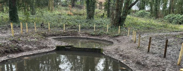
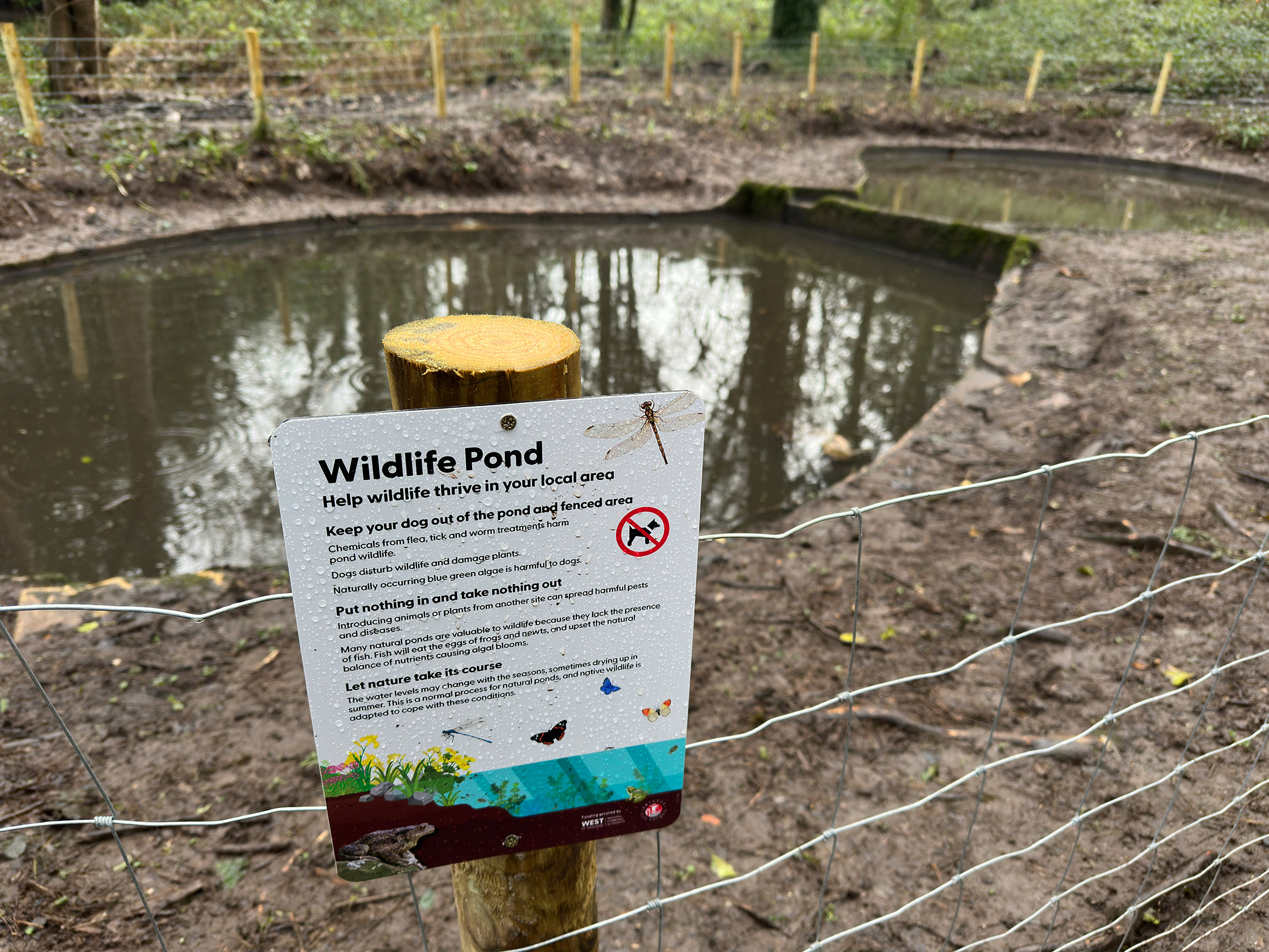
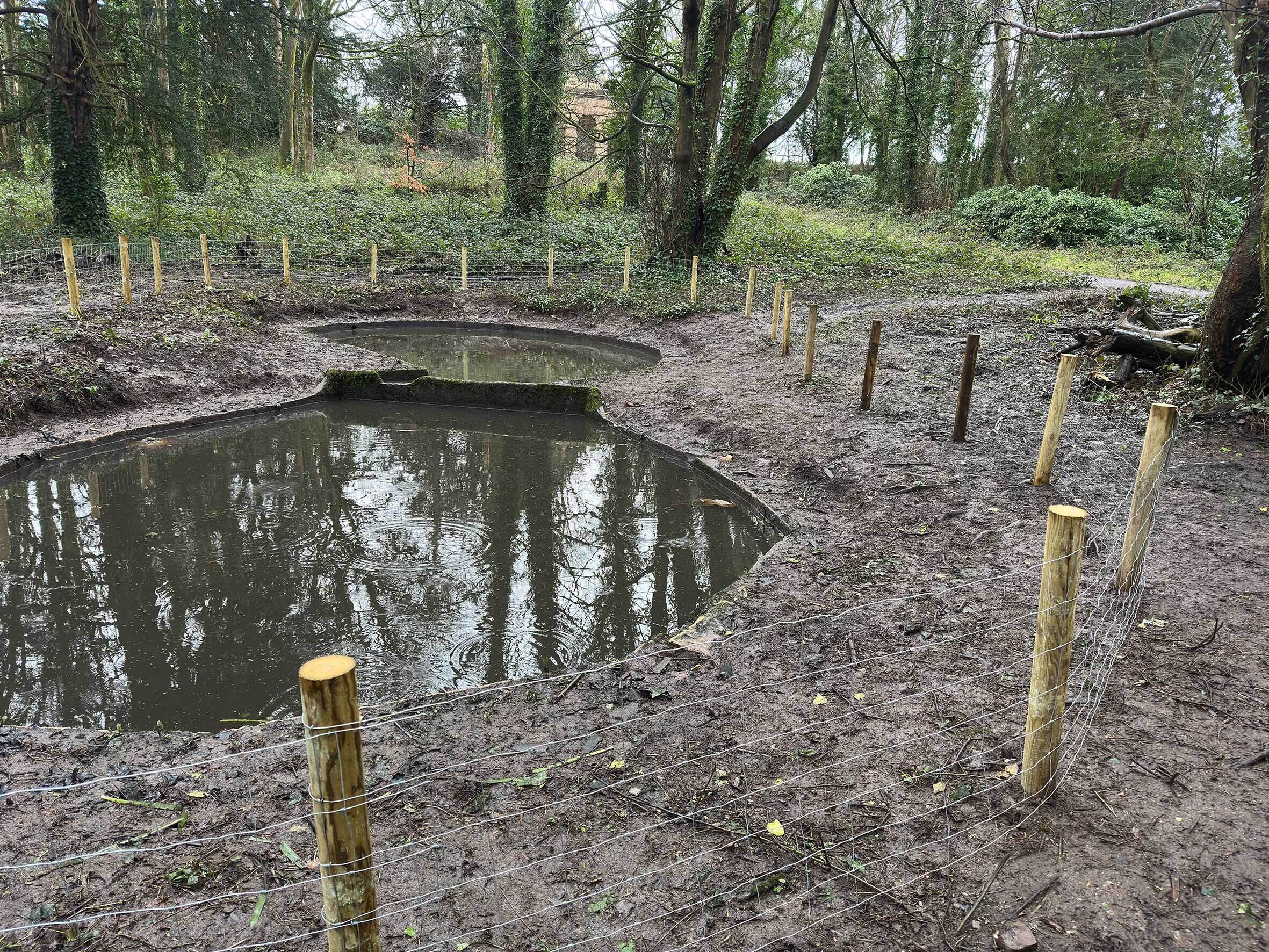
At the end of January, Bristol City Council park rangers held true to their promise to provide a fence around the recently cleared ponds close to the Echo. This is to ensure the progress made in emptying it of mud and logs is not undone as it was after we last cleared it.
Unfortunately, silt, sticks and logs thrown in for fun, and dogs regularly enjoying a dip prevented earlier work from flourishing. This, and the regular autumn dump of leaves and a large dead tree finally finished any aspiration to revive it.
Now, a fence with timber posts and large gauge mesh fence should help protect the wildlife and give the ponds a chance to thrive. They’ve now filled-up with water very nicely after the recent wet weather, and are brim-full, ready to start receiving some native pond plants the Council will be providing soon.
We look forward to Spring when the project should be finished, and we hope wildlife will begin to make its return.
Both notable families of Kings Weston, the Southwell’s in the eighteenth Century and the Miles’s in the Nineteenth, were heavily involved in politics. As might be expected from any wealthy landholder, they were keen to protect their own interests as much as serve in the country’s interests. It’s not surprising therefore, to find that five owners of the estate would serve in the House of Commons, and two in the House of Lords.
Members of the Southwell family were also involved in court life and as part of Government outside of their constituency responsibilities. What’s perhaps odd to us today is that many communities they were elected to represent were very remote from their home.
Edward Southwell II of Kings Weston (1739-1754), MP for Bristol 1739-1754
Sir Robert Southwell retired to Kings Weston from Court life in London in 1679, relinquishing his Government roles and choosing not to stand again for elected as MP for Penryn in Cornwall where he’d served for six years. After William III took the throne he returned to government and was elected for Lostwithiel in 1685.
In 1702 his Son, Edward (1671-1730) was put forward as a candidate at Rye. The election went against him, but after a legal hearing in the elections committee the vote was overturned in his favour because of ‘illegal’ interference in the election. Again, Rye was very far from the Southwell’s interests and was probably what we’d consider a safe seat. Similar might be said for later elections as MP for Tregony in 1713, where he served a matter of months before a General Election, before finding favour in Preston.
As the 18th century progressed, power gradually transferred from the monarch to the House of Commons. Politics came more polarised, voters expected better representation, and political parties were a growing force. The importance of local people representing local interests also increased. Edwad Southwell II (1739-1754) was the first of his family to represent a local constituency.
When Edward was 33, one of the two MPs for Bristol, Thomas Coster, was reported in ill health and subsequently died. Even before the death was announced, Edward had already determined t throw his lot in and seek election to the vacant seat.
We’re fortunate to have a journal he kept, detailing the various machinations in the lead-up to the election in December. This gives a fascinating insight into the process and how Edward built alliances to gain support.
At the start of October, he begins:
“I had private acts and many affairs to settle to my steward Francis Benning at Kingsweston which inclined me to undertake the journey from London, but on the news he sent me of Mr Coster’s (The member of parliament) desperate state of health, I determined upon the journey after consulting my wife at how I should act in case of being invited to stand at the election, who freely bid me neither regard her nor her condition (she being then 6 months gone with child) nor my son, whereover my honour or credit or the service of my Country required my absence of stay. “
Kings Weston house in 1746, during which time Edward Southwell II was MP for the city.
On arrival in Bristol 6th October he headed directly to the Tolsey on Corn Street where the magistrates of the city sat and much business where:
“Mr Berkeley stand me and I promised him and Mr Chester my Interest for the County which being so publick was much taken notice of. NB. Mr Coster was buried the night before at the Cathedral abd every bell in the City tolled for him from morning till night.”
He was disappointed to find that there was initially a lukewarm response to his interest, his closeness to Government and court life being held in some suspicion:
“Upon finding the name of a courtier was so obnoxious, I cooled much in my ambition of standing, I considered I was the King’s Servant, I had ever owed and paid him a personal duty and had ever gone to his court, and that I had my own principles and character to maintain as well as my duty to my country, and determined I would never yield up my respect to the King”
A handbill printed for Southwell’s supporters to circulate around the city.
This might not have been an attractive attitude for the former supporters of Mr Coster, who were clearly looking for a more liberal representative in line with Whig politics. The Whig’s opposed absolute monarchy, championed parliamentary power, and individual liberty. He was forced into a position of defending his independence in order to find favour with them. Edward wrote,
“that if Mr Coster’s friends set up a man in my station, the magistrates could be able to make no opposition and that the party would take a moderate man, and were not as violent as I imagined. I told him I ever had and ever would pay a personal duty and respect to his Magesty and his Royal Family, that my place of Secretary of State for Ireland was for life and worth little more that 200 guineas per annum, and that I had refused applying for my father’s additional sallery of £300 pounds because I never would accept aan pension, but I would live independent.”
Mr Coster’s friends came round to the prospect of a gentleman of status representing them, declaring him their candidate albeit cautiously.
By November, election fever had taken over the City and Southwell found himself campaigning against Henry Coombe. Naturally, every opportunity was taken by candidates to influence voters and their supporters. Handbills and pamphlets were common, usually from alleged anonymous advocates of the candidates, particularly if they were more vicious in nature.
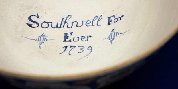
The punch bowl made at Brislington pottery in 1739, probably used to curry favour and influence voters.
The house at Kings Weston came into its own at these times, offering the perfect showcase of the Southwell’s taste wealth, and influence, where voters could be entertained on a lavish scale. The Gloucester Journal reported “The Honourable Mr Southwell has kept open house at Shirehampton ever since he has declared. There are constantly employed a baker, a butcher, and two brewers to provide for the reception of all comers and goers”
Another testament to the interest the election created is a punch bowl now in Bristol’s Museum and Art Gallery. It was commissioned from the Brislington pottery, famed for their tin-glazed ‘delft’ wares, and would have been recognisable as an expensive item at the time. Decorated in rich colours in the Chinese style of the outside, it’s only when the guests would have drained most of the contents they would discover the slogan “Southwell for ever” and the election date inside the bowl. Perhaps once they’d drunk so much, they might have been more susceptible to the political message held within.
Inside the punch bowl, the political motivation behind its manufacture becomes clear
He was declared winner on 12th December, 2651 votes to Combe’s 2203. His journal, now held in Bristol Archives, then transforms from a record of the campaign to a catalogue of the petitions and constituency work that were the inevitable outcome of political position.
Southwell remained true to his promise of independence, showing no consistency in supporting either Whig or Tory, Administration or Opposition, positions. Although perhaps true to the wishes and interests of Bristol, Southwell’s unreliability attracted few friends in the House. The 2nd Lord Egmont, related to Southwell by marriage, wrote dismissively of his kinsman:
“Southwell is a weak man. Has an affectation of being supposed to act according to his conscience, which directs him to vote one day for a proposition in a committee, and the very reverse the next day and in the House. They think him an honest man at Bristol but they have no opinion of his understanding and I believe if occasion were, he might be easily changed—But if not he will be as often for us as against us!”
Despite frustrating other politicians, Southwell maintained support from Bristol’s voters, representing the city until 1754, when, due to ill health, he chose not to stand. He died the following year.
It would be the same 2nd Lord Egmont who’d criticised him who would support Edwards son, Edward II (1738-1776) for election to Bridgewater in 1761. Seeing an opportunity to represent his native Gloucestershire, he declared as candidate two years later. He represented the county for thirteen years before being elevated to the House of Lords in April 1776 and vacating the seat.
December might not be the favoured time of year to be splashing about in ponds, but that’s just what we did at the tail end of last year. Our plan was to continue work that the Council had begun with a mini-digger, but by hand. It hadn’t been possible for the digger to reach into the middle of the pond and so the Council turned to our volunteers for help.
The two ponds are concrete-lined and probably date to the 1960s or 70s. The lower pond, the larger of the two, had to be emptied of water so people could get in to do the dirty work of shovelling-out mud and hauling branches away. In the event it worked out easy to scoop the water up into the top pond, from where it would need to be transferred back afterwards.
There was a great turnout for the event with some new faces, so a big thank you to everyone for making this such quick work. The lower pond was certainly an easy job and was finished in a brief space of time. The debris was carried away as far as possible, continuing piles already set up by the Council workers.
The top pond, however, was more of a challenge. Once most of the water had been thrown back to fill the lower pond, there was a dirty sloppy silty mess that was more challenging to scoop out. With most of it poured into buckets and taken away we called it a day at about 1pm, a job well done.
The next phase in the restoration of these ponds as natural habitat will be the erection of a small fence to prevent dogs disturbing the wildlife and discourage rubbish being thrown in again.