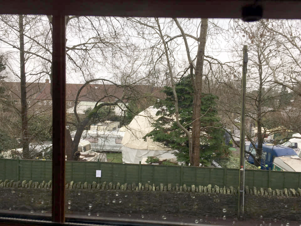
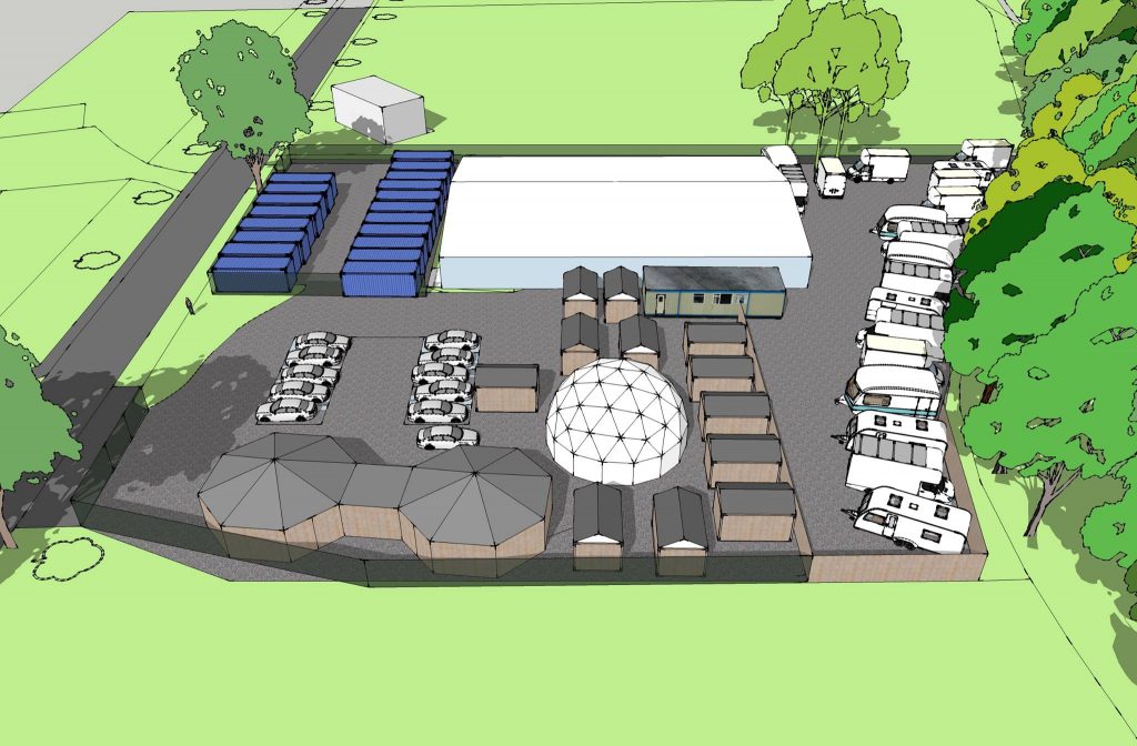
Some of you will already have heard this good news through our Facebook page, but we are delighted to hear that all of our worries over the use of the land around the Karakal warehouse on Penpole lane have just evaporated in time for Christmas.
Keith Sawyer of Karakal wrote to us and confirmed that he has just managed to exchange contracts, with Matthew Webb, whose family have owned the site for about thirty years, and now owns the area of land around the Karakal industrial unit. The planning appeal for shipping containers has since been withdrawn, and YardArts will be unable to move onto the site; Keith has confirmed this to us and we join in him in his celebration and relief that the whole plot is in his hands. Karakal have only ever had rights of access and parking on the land around their unit since 1987 and, although they have always been keen to, have never been able to agree on a realistic price for the land with its owner.
Yardarts at Kingswood
They have shared our exasperation over many of the planning applications over the last few years that would have impacted on their business. We’ve been in contact with Mr Sawyer for a while and we are reassured that he has no plans to expand Karakal and that the land is now in safe hands. Naturally we were unaware of negotiations while they were happening, but we are incredibly grateful for Keith having emailed us just 10 mins after the exchange to let us know!
It will be great to be able to direct our time and effort towards more constructive projects in the coming year rather than dealing with the planning problems we’ve been reporting on since 2011! We hope you will join us in celebrating this news!.
Finally a BIG thank you to everyone who has supported us in objecting to the planning applications on this site; It’s been frustrating and draining, but all of your letters of objection have made a difference and have fended off development . We couldn’t keep going without your help and support!
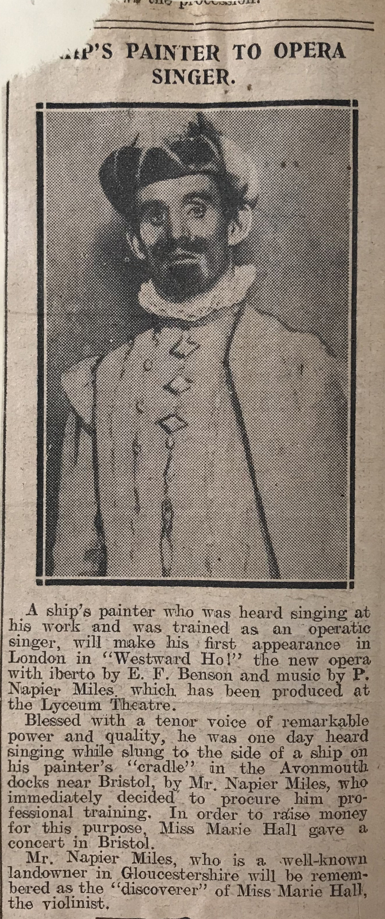
In 1913, Philip Napier Miles of Kings Weston house, premiered his first opera, Westward Ho! in the West End. Napier Miles was a well-known amateur composer and promoted music and singing in the local area and across Bristol as a whole. The notable violinist Marie Hall had been one of his most celebrated discoveries, but the gentleman shown here is more of an enigma.
This newspaper report from the Daily Graphic describes a ships painter from Avonmouth who was raised to West End opera singer by Napier Miles, but fails to name him! Does anyone know his name, or anything more about this story?
The west end of the Vanbrugh Room with sheets hung up over the library shelves
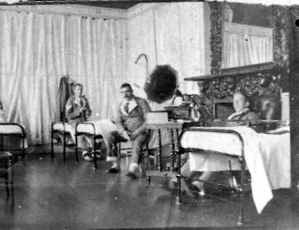
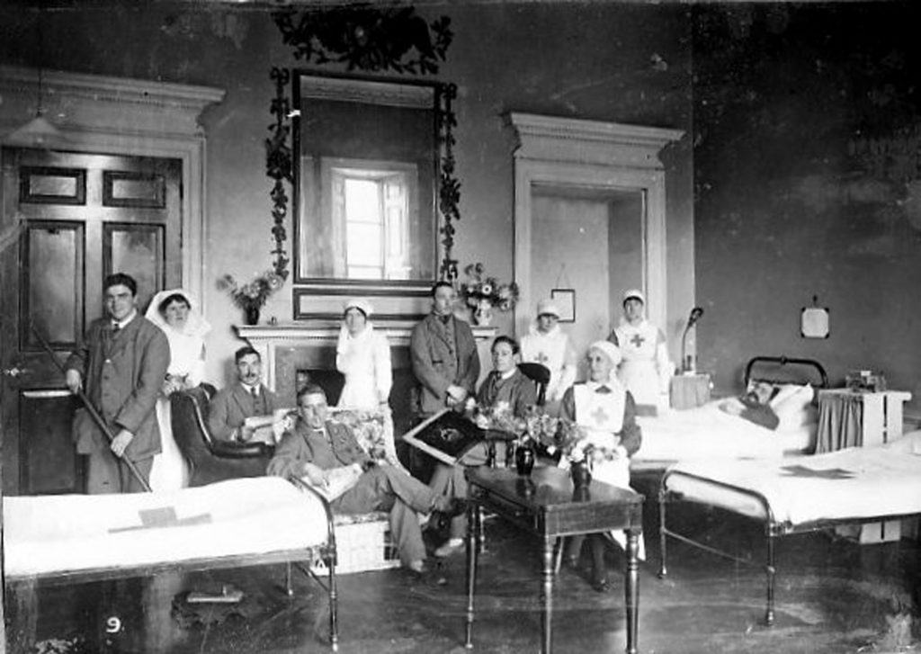
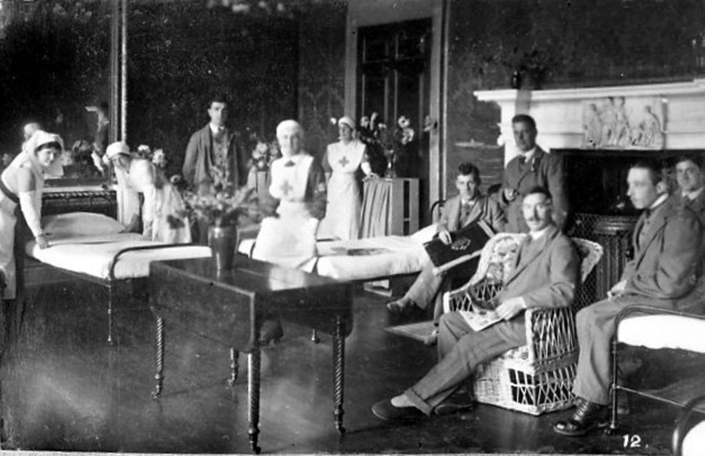
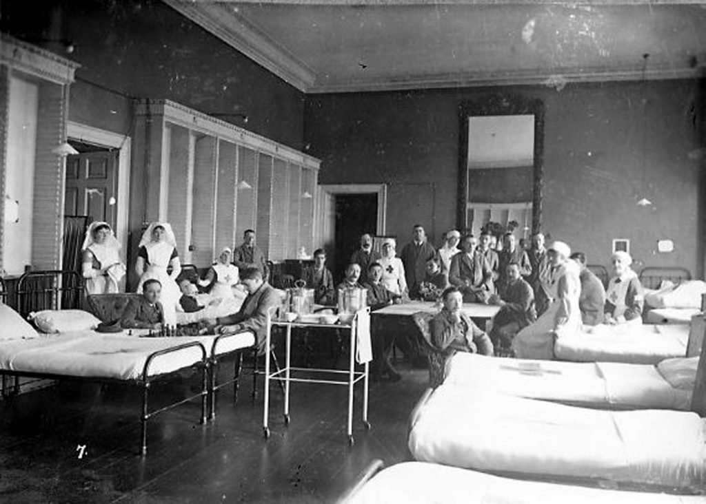
In poignantly timely discovery, days before the centenary of Armistice Day, we found a series of photographs of Kings Weston dating to the First World War. We’ve previously shared photos of the outside of the house during its time as an Auxiliary Hospital caring for the wounded sent back from the front; this new series of images shows the grand state rooms reutilised as hospital wards.
The ante-room, now the Breakfast Room has changed remarkably little. The wounded and nurses relax for the photographer.
The interiors are shown emptied of their ornamental furniture and paintings and laid out with beds for soldiers. The Vanbrugh Room, “breakfast room”,and Drawing Room (now the oak room) are all seen in duty as wards, where Red Cross nurses tend to their patients. The largest of the wards, now the Vanbrugh Room is seen with empty bookcases and around sixteen simple iron beds. All the images show small groups of wounded servicemen surrounded by the volunteer Red Cross nurses who tended to them. Surprisingly the rooms are adorned with numerous vases of flowers.
The Drawing Room before the marble fireplace was removed and the windows in the main front re-opened. Notice the quantities of cut flowers.
Some of the photos are numbered and we’d be keen to find the rest. If anyone knows where these originally came from we’d be keen to find out, and we’re trying to speak to the Avon and Somerset Constabulary archives from where the images first came.
We’ve also collated the known records of Red Cross nurses who worked at the house from the national database of First World War volunteers which can be found in thisPDF. Many were local ladies who wanted to make their contribution to the war effort, including three members of the Moore family from Penlea in Shirehampton. It’s likely that some of these nurses are those who appear in rediscovered photos.
The Vanbrugh Room looking towards the wall that now features the mural. A group shot showing patients and nurses posing for the camera.
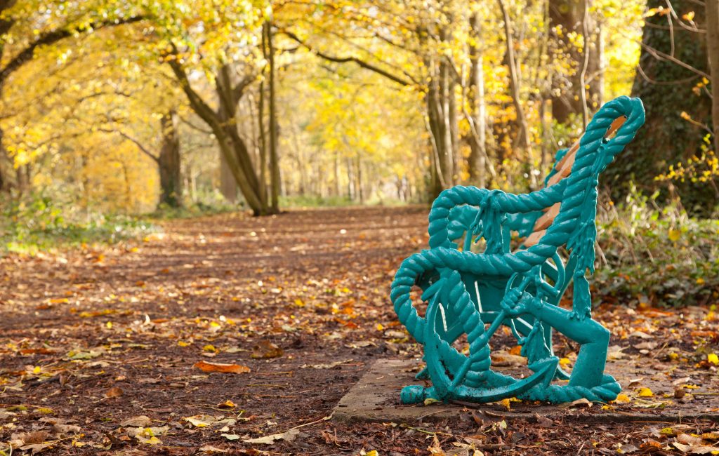
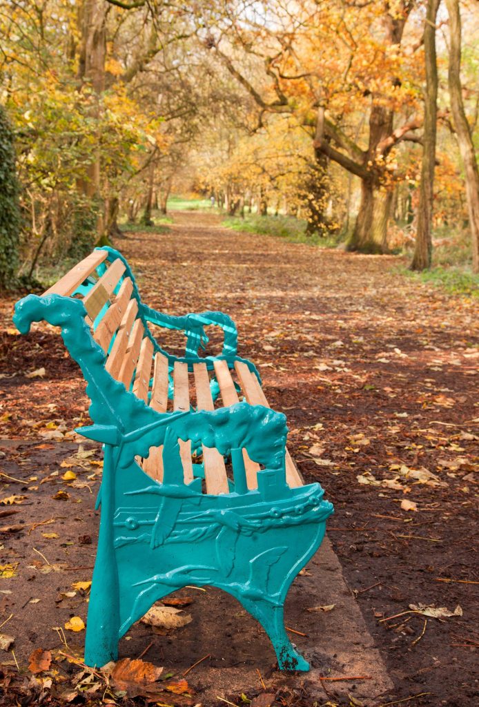
Recent visitors to Kings Weston cannot have missed the appearance of a new cast iron bench on the South Walk;It’s almost luminous colour was something of surprise when it was installed as part of the closing project of the Forgotten Landscape project.KWAG have worked with Forgotten Landscape and their artist, Deborah Aguirre Jones, on the design and the location for this bench, one of several installed at special locations in the area.
The arm & anchor of the Miles Family of Kings Weston house incorporated into the design of the new bench on the South Walk
The east end of the bench looking down the path
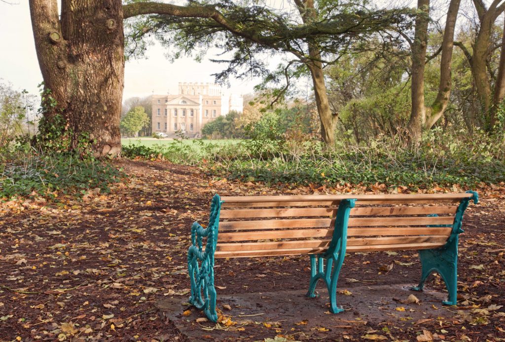
The design of the bench ends is different at either end; on the west side the arm and anchor motif is the arms of the Miles family who lived at Kings Weston house between 1834 and 1936 and developed the docks and Avonmouth. On the east side the natural and landscape qualities of the area are celebrated, including one of the wind turbines that feature in the view from the South walk. The location was carefully picked in partnership with the artist. From the bench you can enjoy a view of Kings Weston house with the Severn estuary beyond, framed beneath one of the huge cedars that line the path; a prospect that KWAG’s volunteers restored afew years ago.
This bench is a one-off artwork in the park, and doesn’t set the pattern for future installations on the estate, rather it will remain as a unique and special addition that we all hope people will enjoy for generations to come.
The bench with the framed view of the house beyond
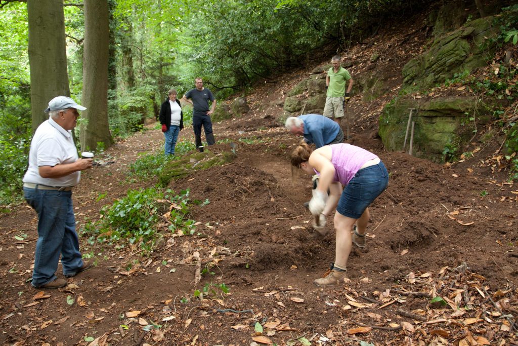
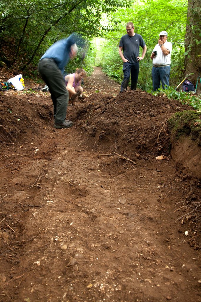
The hope was that trial excavations in August 2018 might uncover some trace of the Georgian arbour suggested in this location by a 1772 estate plan.Once the site was bare of cherry laurel three locations were identified for trial trenches: one at either end of the long site, and one inthe centre to the south of the large flat rocks exposed on the surface. The two outer trenches were excavated to about 18-26 inches each and yielded little more than fine brown natural earth with occasional stones. No interpretable features were observed in either of these trenches and they were quickly closed
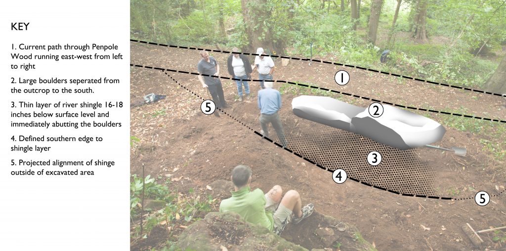
The central trench revealed that the large rocks were not part of the underlying bedrock, but appeared to have separated from the natural outcrops above it and was resting on the level area adjacent to the path. The present path runs immediately along the northern edge of this feature and is built-up on a man-made terrace in areas, though utilises natural topography in others. The trench was dug through rich brown soft earth which appears to have accumulated across the site from wash-off from the slopes above. It was clearly deeper and embanked immediately below the natural rock across the back of the site where deposits naturally collected
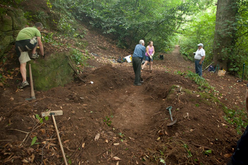
KWAG volunteers working on excavations.
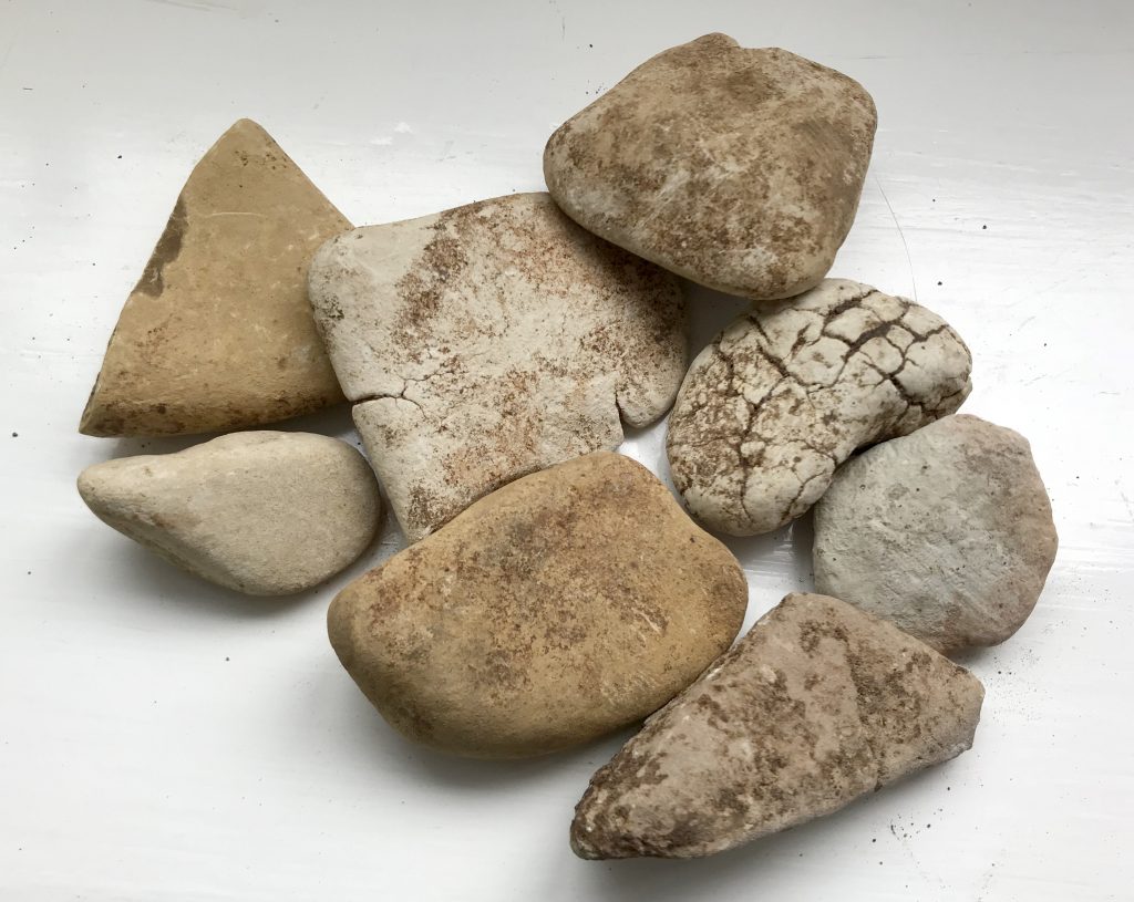
sample of river shingle from the excavation
At a depth of approximately 20 inches there was a clear layer of rounded river shingle, unusually pale or white, and smooth in nature. Shingle varied in size between 2-inches to grit. This surface was a distinctive and unbroken horizon which was tracked-back in a northward direction where it met the back edge of the boulders. An abrupt edge in the surface was identified to the south of the trench three feet out from the boulder. The trench was enlarged east,west, and south to discover the extent of the shingle surface and explore the context between it and the natural cliff to the back of the site.
View looking west showing the shingle surface and distinctive edge aligned with the modern path beyond.
The surface continued east and west, maintaining a clear delineation along its southern edge, and ran approximately parallel to the main path to the North. The eastern end began tracking around the boulder though its southern edge became indistinct and it was not possible to determine if the feature curved northwards with confidence. The west end of the feature continued in a straight line and apparently in alignment with the existing path further off inthe same direction. The discovery of some rocks along the straight edge of the shingle feature could suggest they’d been intended to delineate that edge; although found at depths consistent with the shingle layer these were only haphazardly and sporadically found, and not conclusively associated with the defined edge.
Following recording the trench was locally dug deeper through the shingle layer to establish its depth and any build-dup. The opportunity was also sought to explore whether hole in the shingle surface was a post-hole. The Layer was surprisingly thin, no more than an inch in depth, and with nosub-base. Shingle was spread across the natural earth and no further features were identified below it. The possible post-hole had no corresponding features below the shingle surface that supported that initial interpretation.
Aside from the shingle, and anashy deposit from a bonfire close to the surface in the western trench, there was no stratification, or obvious levels or horizons visible in trench sections; the whole typically being the same consistent soft brown soil. There were no finds recovered associated with any of the features, though there was some isolated fragments of roof slate and a single clay tile in upper layers
The site viewed from the east. The rocky outcrop at the back of the site, on the left, the low boulder along the path, on the right, and the alignment of the shingle feature matching that of the modern path stretching into the distance beyond.
The shingle layer was clearly imported material, possibly from gravel beds around Shirehampton and Avonmouth, and can be interpreted as a path surface. Although a very shallow spread of stone the distinctive edge suggests it’s related to the main path on the north side of the boulder. There was no evidence on the modern path of similar stone being used,but this could have been obscured by later re-surfacing. There are two possibilities regarding the excavated path surface; firstly it could have been an earlier course of the current path passing to the south of the boulder;alternatively the pleasure walk may have split around the boulder, revealing it as a rustic feature within the path. The terracing on the north side of the boulder to accommodate the path, and the regularly planted trees along it supports the latter of these two theories
Interpretation of the site looking north from the top of the rocky outcrop
It was surprising that there were so few features identifiable across the rest of the site; there was certainly nothing that could relate to the distinctively crescent-moon shaped structure shown in the approximate area in 1772.That the excavated path was such a strongly linear feature suggests that the exposed rocks were a feature to be enjoyed as they were passed-by, rather than a place to dwell. If structures, or other designed garden features once occupied this site there was no identifiable remains left to be discovered by our volunteers. It was not practical to continue excavation directly down to find the natural bedrock which was so clearly exposed in the surrounding area,though future exploration may help our understanding of the natural geology and topography, and how it might have been utilised and adapted by Georgian gardendesigners.