Category Archives: heritage

Surveying the State Rooms

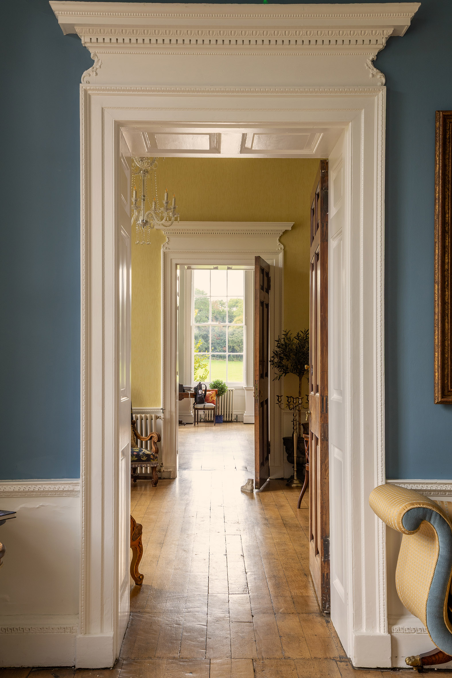
The enfilade looking from the Dining Room through the house

As  has become traditional in the run-up to Heritage Open Days, this month we’ll  look at aspects of the interior of Kings Weston house. Every year the tours  pass from the Saloon, the grand entrance hall of the house, into a series of  chambers known as the State Rooms. These rooms were not intended for regular  family use, but were instead designed accommodate and entertain distinguished  guests and for the conspicuous display of the owner’s wealth and taste. These  were generally modelled on sequences of rooms in royal palaces, designed to  control access to the monarch and provide sequentially more private chambers for audience with increasingly high-ranking and trusted confidants.

Kings Weston was designed with its own version; a series of three state  rooms arranged ‘enfilade’, that is to say,  aligned in such a way as to enjoy an unbroken vista down the length of the  house framed through sequential doorways. This formal arrangement emphasised  the length of the house and  heightened  the expectation of any visitor permitted to pass on to the next more intimate  space.
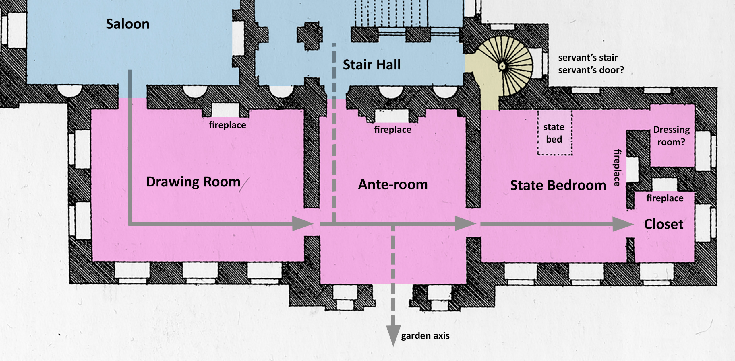
Diagram showing the layout of the house as built  circa 1716. The chain of State Rooms occupies the sheltered south side of the house, arranged to enjoy views across the formal gardens.

The rooms usually became increasingly opulent from one end of the sequence to the other. The culmination of this would be the State bedroom. Had the sovereign or another high-ranking aristocrat ever visited they would have been accommodated in this room, but at all other times it was purely a showcase for your finest paintings, possessions, textiles, and furniture.

Kings  Weston’s State rooms began off the south side of the Saloon with a large  reception room later known as the Drawing Room. Although we have general  arrangement plans for the principal floor, we have very little to go on in  understanding their original appearance when Edward Southwell first moved in in  1716.

The room we see today retains its original proportions but was subject to major redesign beginning in 1768. This included the replacement of the fireplace in its symmetrical location on its northern wall, the infilling of the two western windows (subsequently re-opened), and the elaborate decoration of the ceiling by famous plasterer Thomas Stocking. All this work was designed by the architect Robert Mylne for his client Edward Southwell (the third).
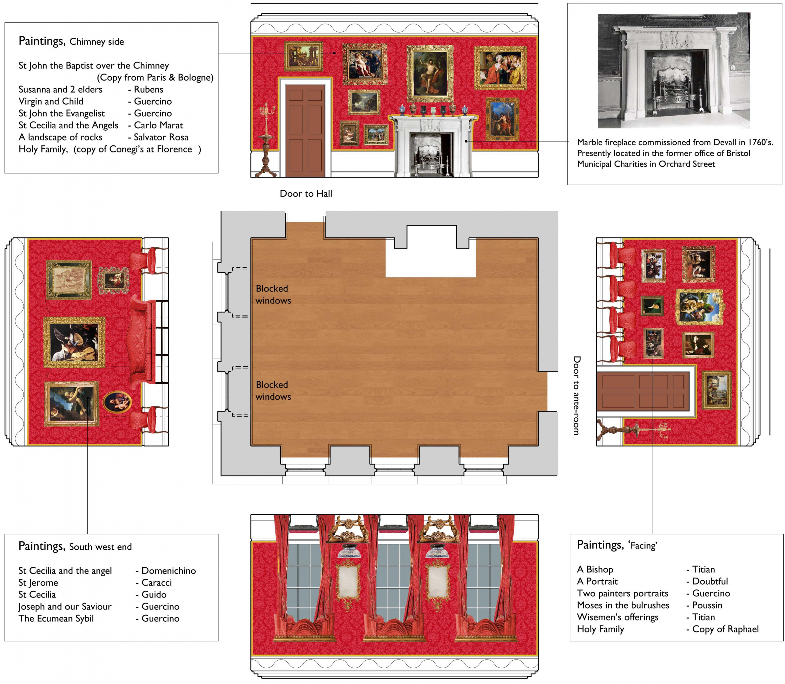
Diagram suggesting how the Drawing Room would have been decorated when it was recorded in the probate inventory of 1777

We know from an inventory of the house taken in 1777 that the room was lavishly decorated, it’s walls hung with silk crimson damask, picked out with carved gilded edging, and hung with Old Master paintings. Its centrepiece was a pure white marble fire surround commissioned from John Devall, who had supplied similar to a number of Royal Palaces.
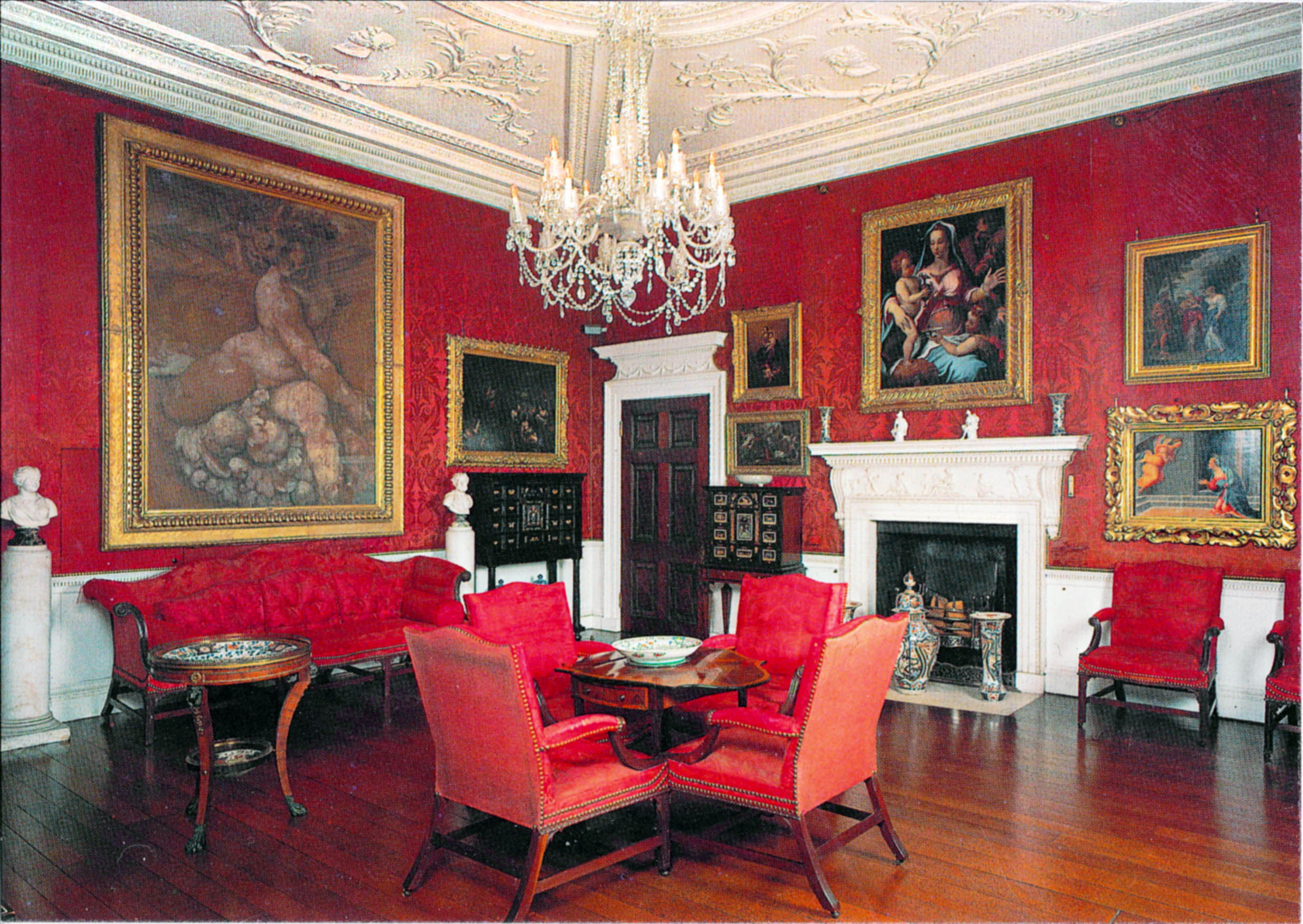
The Drawing Room at Corsham Court gives a great impression of how the Drawing Room was decorated after 1768

Sadly, today’s visitor will find no such Rolls-Royce of fireplaces in the room today. When the house was purchased by Bristol Municipal Charities in 1936 with the intention of converting it into a new home for Queen Elizabeth Hospital School, they began stripping out many of the historic fixtures. The State Rooms were intended for use as classrooms, and fireplaces replaced by radiators and wallspace enough for a blackboard required.
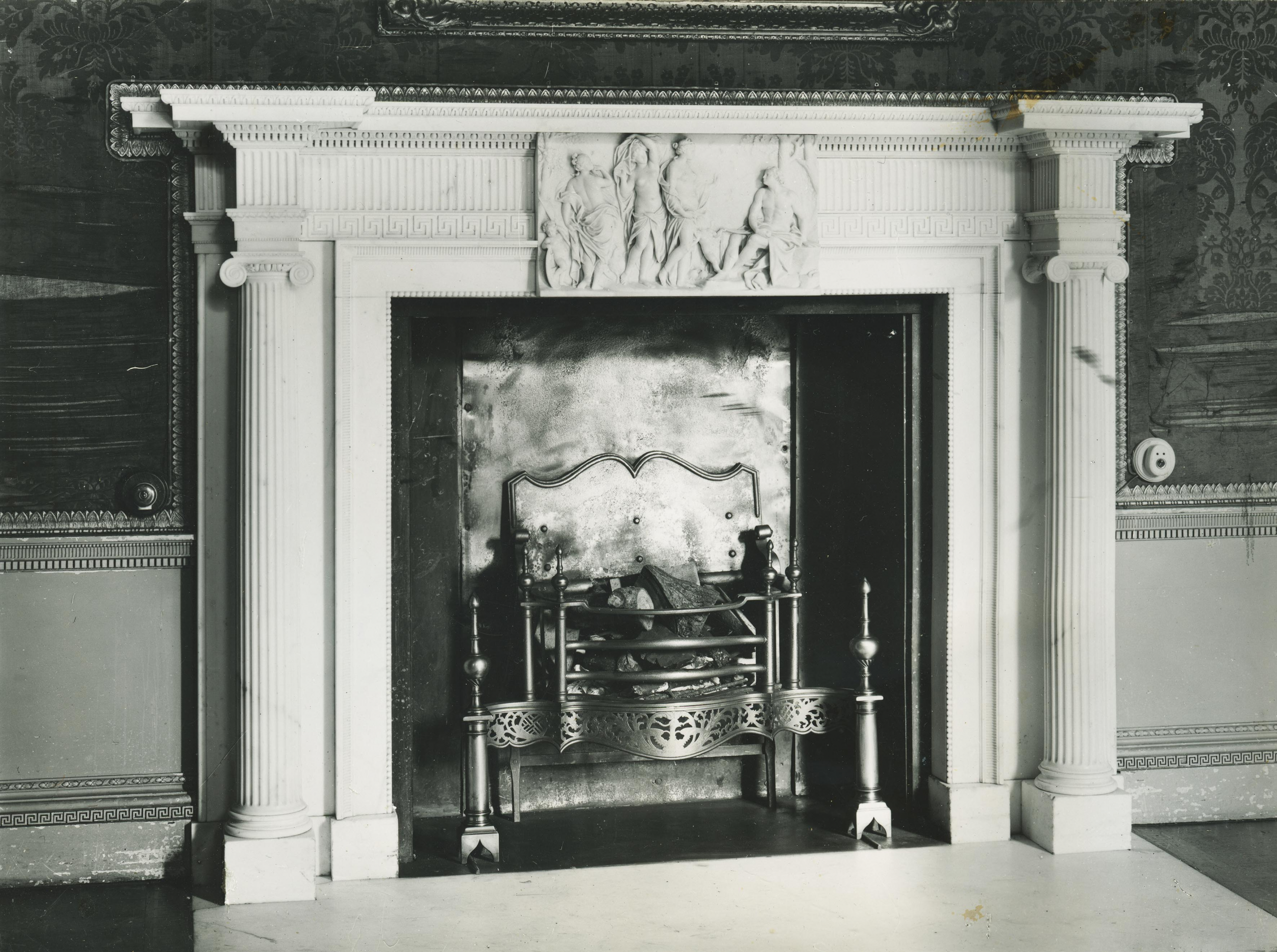
The Drawing Room fire surround recorded in 1927before it was dismantled. Note the fraying condition of the original silk wall coverings and the gilded detail around its edges.

The Drawing Room fireplace was dismantled and lost to Kings Weston, but it remains in Bristol to this day. The Charities set the chimney surround up in the Board Room of their new offices in Orchard Street, just off College Green. And there it is still today, though the Charities have moved out and sold the building for residential conversion, so it now rather incongruously augments a one-bed flat. Perhaps, one day, it, or a facsimile, might return to its place at Kings Weston.

The ceiling of the Drawing Room is one of the most remarkable in the house. Swagged with plaster flowers, each individually moulded, it is both beautiful and exquisitely executed. No doubt the design was that of Robert Mylne, but it’s floral theme must have been designed to please Edward Southwell III’s wife, Sophia Campbell. She was fascinated by botany and loved flowers especially. It can be no coincidence that they play such a strong role in decorating the interiors at Kings Weston.
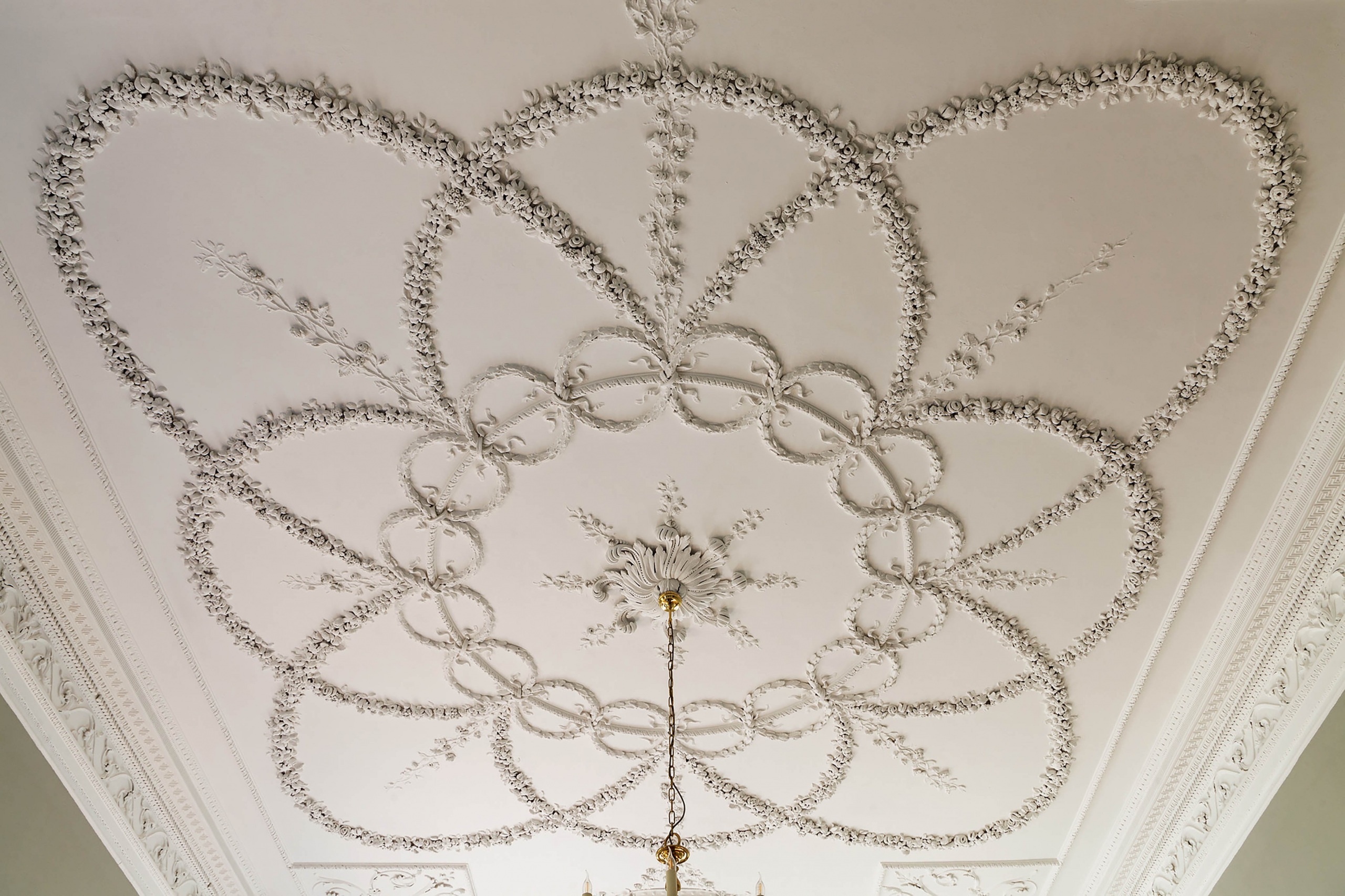
The spectacular and intricate floral ceiling of the Drawing Room from 1768

The next in the sequence of State Rooms  has never gone by any more elaborate title than the Ante-Room. Smaller and more intimate than its neighbour, it takes the place of an Audience Chamber or  Privy Chamber in more ostentatious houses. At Kings Weston it is aligned to the garden axis looking directly up the hill towards The Echo and could have been used as a separate private entrance for anyone fortunate enough to inhabit the State Rooms. Indeed, with access directly into the stair hall on the opposite wall, it’s likely that it provided more direct garden access for the family when the rest of the State Rooms were not  in use.
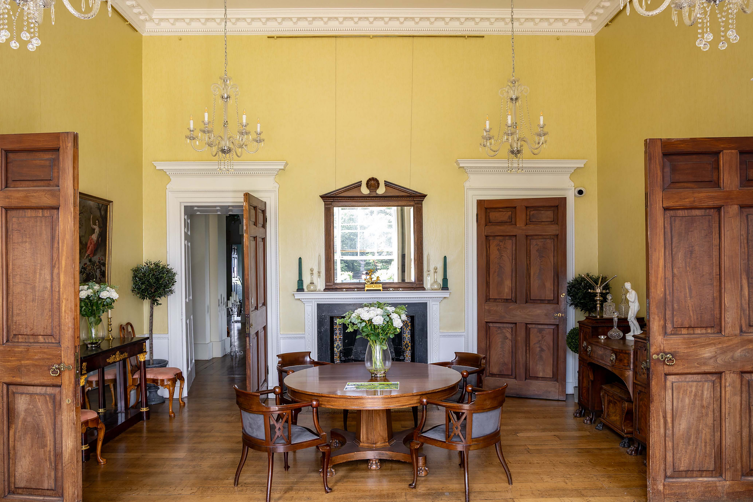
The Ante-Room is a picture of symmetry and order. Despite it’s grand pretentions, the door on the right of the fireplace only ever accessed a cupboard

Like the Drawing Room, we have little information that can be relied upon to help imagine how the Ante Room appeared as originally completed, and, similarly, it was redecorated in the 1760s. It matched the Drawing Room with Crimson damask, and gilded borders, and Old Masters proliferated, through the fire surround and ceilings were less ambitious, delicate marquetry around the hearth slab being a discrete but expensive hint at the room’s status.

Today, the last in the chain of State Rooms is the Canaletto Room, earlier the Dining Room. It occupies three window bays and, since the Victorian era, extends through the back of the house with an arched opening that delineates the earlier proportions. Before this though it was the culmination of the visitor’s passage through the State Rooms and the location of the State Bedroom. The bedroom was smaller than the present room, occupying just two bays, with smaller compartments behind it on its east side. 
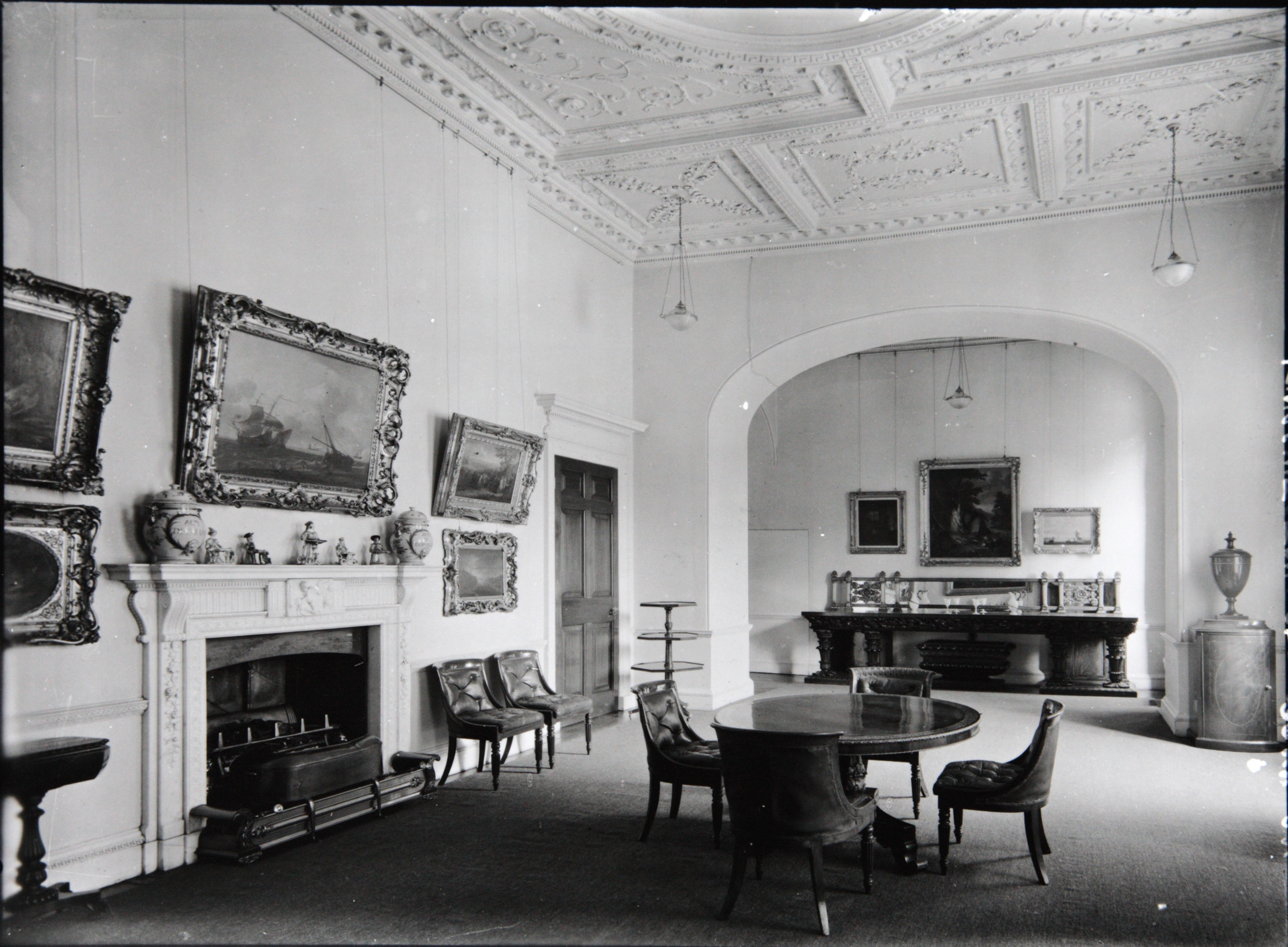
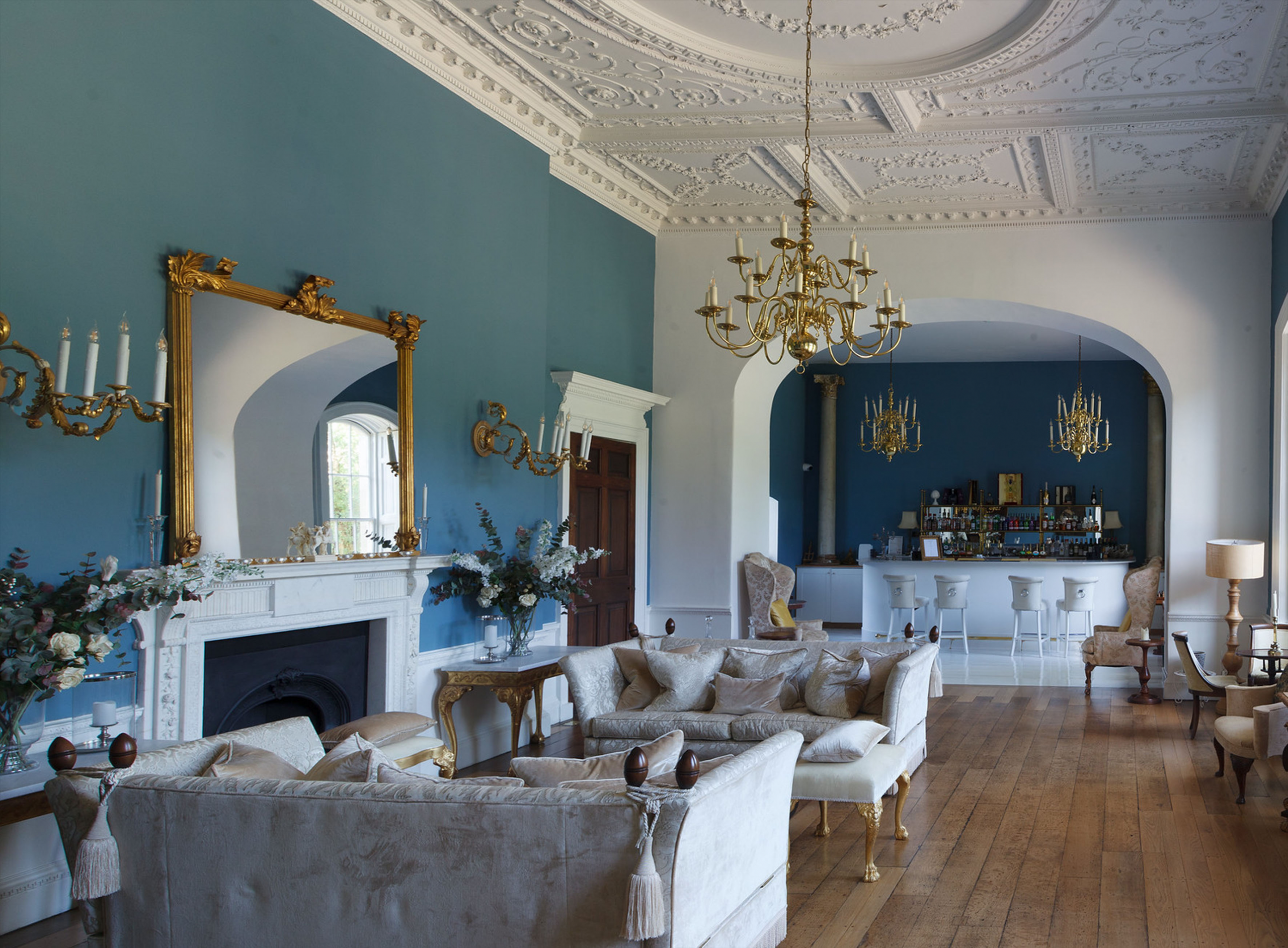
The Dining Room in 1927 exhibiting the tastes and interests of the last private owner of Kings Weston House, Philip Napier Miles and his wife Sybil. This photo was key in returning the fire surround to its original location.
The same view today, with the marble fire surround restored and returned to its original location.

It was common practice for Kings in the late 17th and early 18th centuries to hold a levée, a ceremony allowing intimate access to the monarch as he rose from bed in the morning. In these ceremonies the bed became a focus for expressions of wealth and often took the form an elaborate architecturally-scaled structures. The State Bedroom at Kings Weston replicated the arrangement found in Royal palaces in microcosm and would have been furnished with the Southwell Family’s most elaborate and expensive furniture and works of art. The State Bed itself was set up against the north wall.

Through the State Bedroom was probably the smallest and most intimate of spaces, a closet. Its importance is implied by its alignment as a continuation of the enfilade. There are many examples of such closets where more precious artefacts and object d’art were housed in a richly panelled interiors, accessible only to the hosts most trusted and honoured guests.
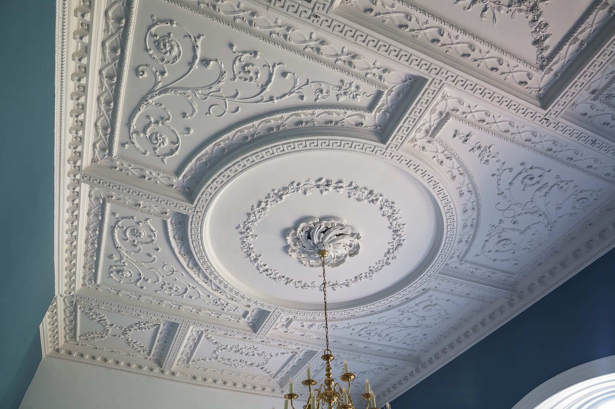
The Dining Room ceiling designed in 1764 by Robert Mylne, architect, for his client Edward Southwell III. It was implemented by Thomas Stocking, one of the foremost plasterers of his era. 

All of this felt distinctly outdated by the middle of the 18th Century. Fashions changed, and a State Bedroom no longer met the need to entertain guests. It was opened-out under the superintendence of Mylne as architect into a much larger single room, intended for holding lavish meals. Two aspects of this redesign are worth focussing on in depth.

Firstly, the design of the ceiling; It was an early example of a Neoclassical design, derived from ancient Greek and Roman architecture. Suitably for a room designed for dining, swags of grape vines are a prominent motif in the plasterwork; Grapes provide both food and wine. But here too is a warning for anyone who might want to take advantage of such abundance. The visitor will have to look carefully to spot them, but intertwined amongst the tendrils, one in each of four quarters of the design, are snakes: a reminder of the reproductions for anyone tempted by the sin of gluttony. 
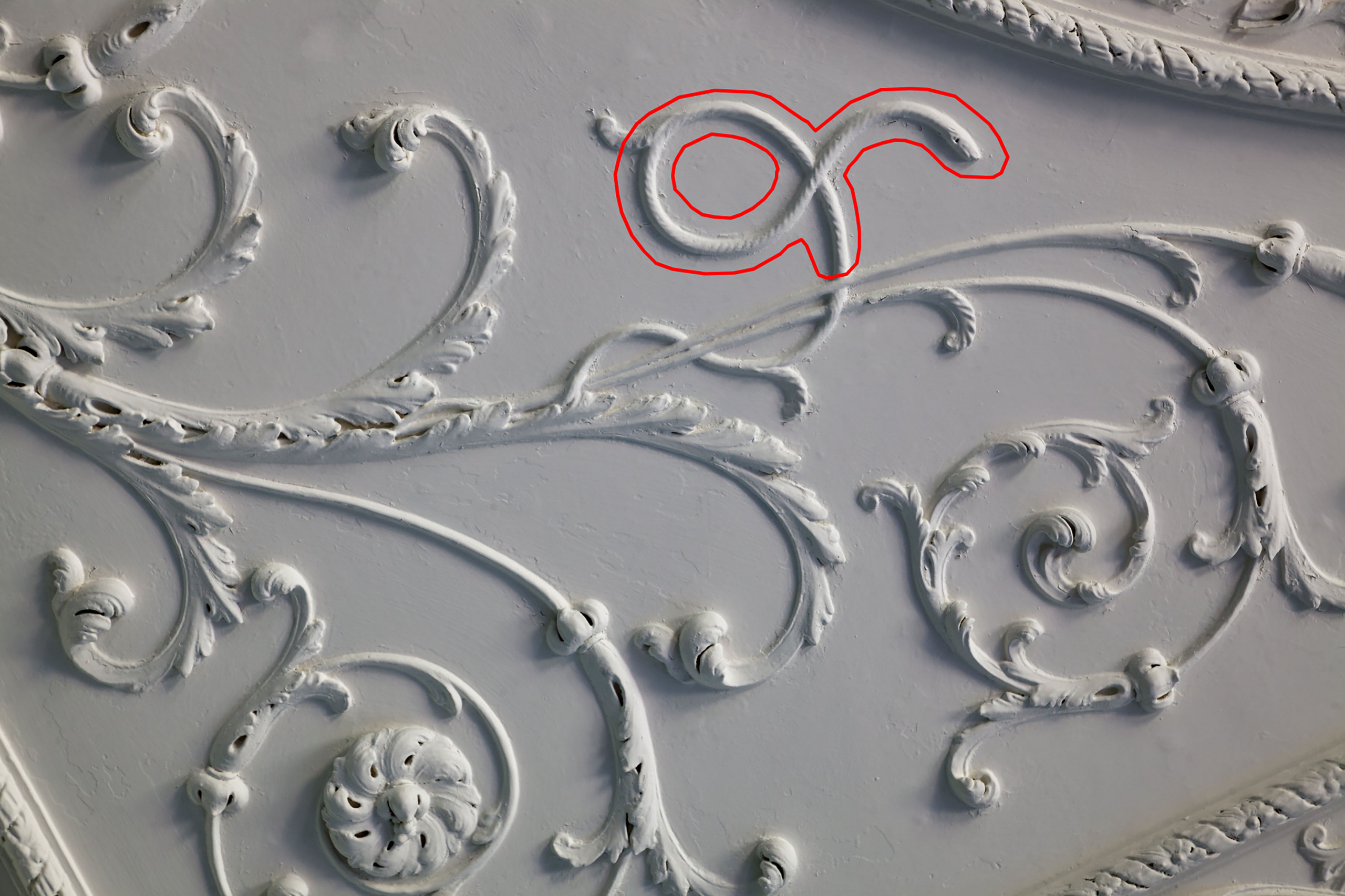
One of the four snakes hidden in the ceiling, warning the observant not to engage in the sin of gluttony.

More symbolism is at play in the marble fire surround. This was only rediscovered in 2021. We were invited into the cellar by Norman Routledge, then lessee of the house, to look at a collection of broken marble fragments filling a metal crate. We were able to lay them out on the floor and piece them together, ultimately realising that it was near complete, if in a poor condition. Photos originally taken by Country Life aided identification and confirmed it had once graced the Dining Room. It was Norman who undertook to have it restored and returned to centre-stage as the focus of the room.
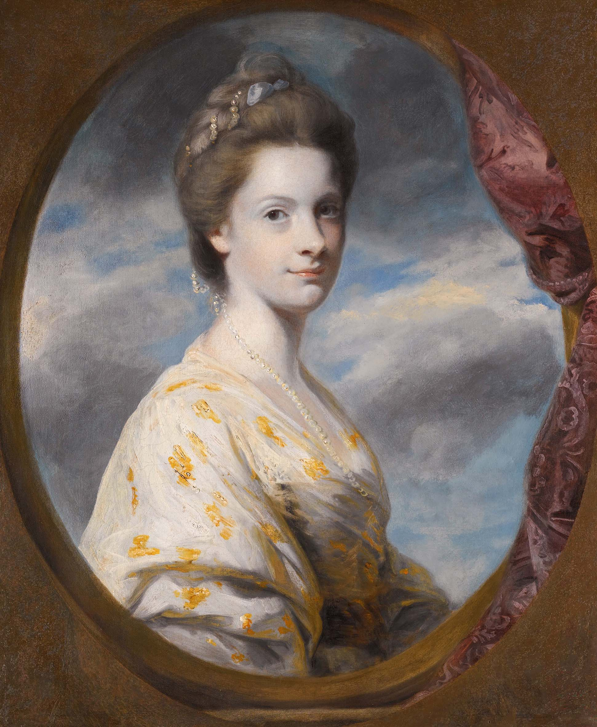
Sophia Southwell, nee Campbell, around the time she Married into the family in 1765.

Another of the fire surrounds commissioned from John Devall dates from the completion of the room in 1765; This was also the year that Edward Southwell III married Sophia.  Careful study of the carving reveals more about the couple’s relationship. Roses cascade  down the pilasters either side of the hearth. Then, as still today, roses are symbolic of passionate love and desire, but the message is even more personal; Amongst the roses, on just one side, one tiny detail changes. Easily overlooked, two tiny flowers lie almost hidden. These are forget-me-nots, the symbolism asking us to forget-not the love between Southwell and his new bride.
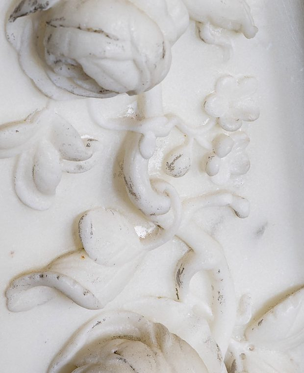
The inclusion of a pair of tiny forget-me-knots in the fire surround design suggests the nature of the couple’s relationship

Home brew: The fall and rise of Vanbrugh’s Brewhouse

Now a private residence, the contribution of the Brewhouse to the historic estate can easily be overlooked. A Grade I Listed building since 1959, it’s relationship with Kings Weston house, the house it once served, has been confused by a series of changes in landscaping, some which are surprisingly historic.

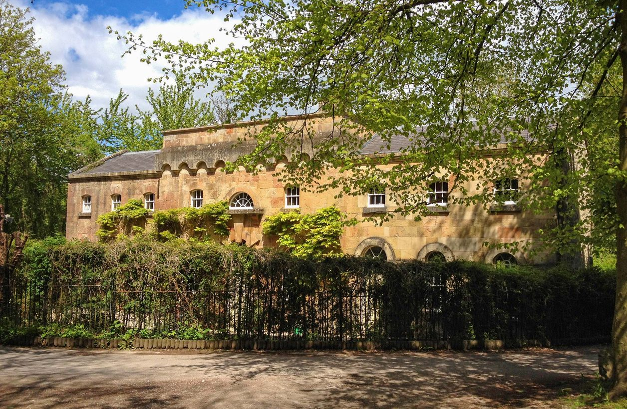
Sir John Vanbrugh’s Brewhouse seen across the yew hedge a few years ago.

Today, the building sits behind railings and a yew hedge, but would once have been part of a suite of service buildings, stables, carriage houses and stores that lined a formal service court. This layout had been dictated by the earlier Tudor mansion, but was given greater formality when Edward Southwell sought to reinvent himself through new architectural works around his estate.

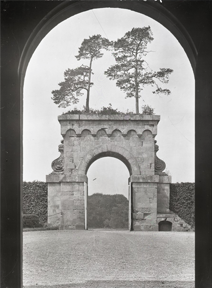
 The gate to Eastbury Park, Dorset perhaps re-uses plans rejected for Kings Weston.

As we know, it was the Queen’s architect, Sir John Vanbrugh to whom he turned to design a new mansion, and other buildings were added to the original commission in short succession. Many of the original architects and contractors drawings survive, most as part of the  famous Kings Weston Book of Drawings, held in Bristol Archives. However, there are no plans or details that can be related to the Brewhouse.

In attributing the brewhouse to Vanbrugh we are left, instead, to make assumptions based on its design. Vanbrugh was a very individual architect, creating a palette of unique and idiosyncratic architectural details that might be considered his signature. Fortunately the Brewhouse is one of the buildings that follow precedents set by some of his other buildings.     

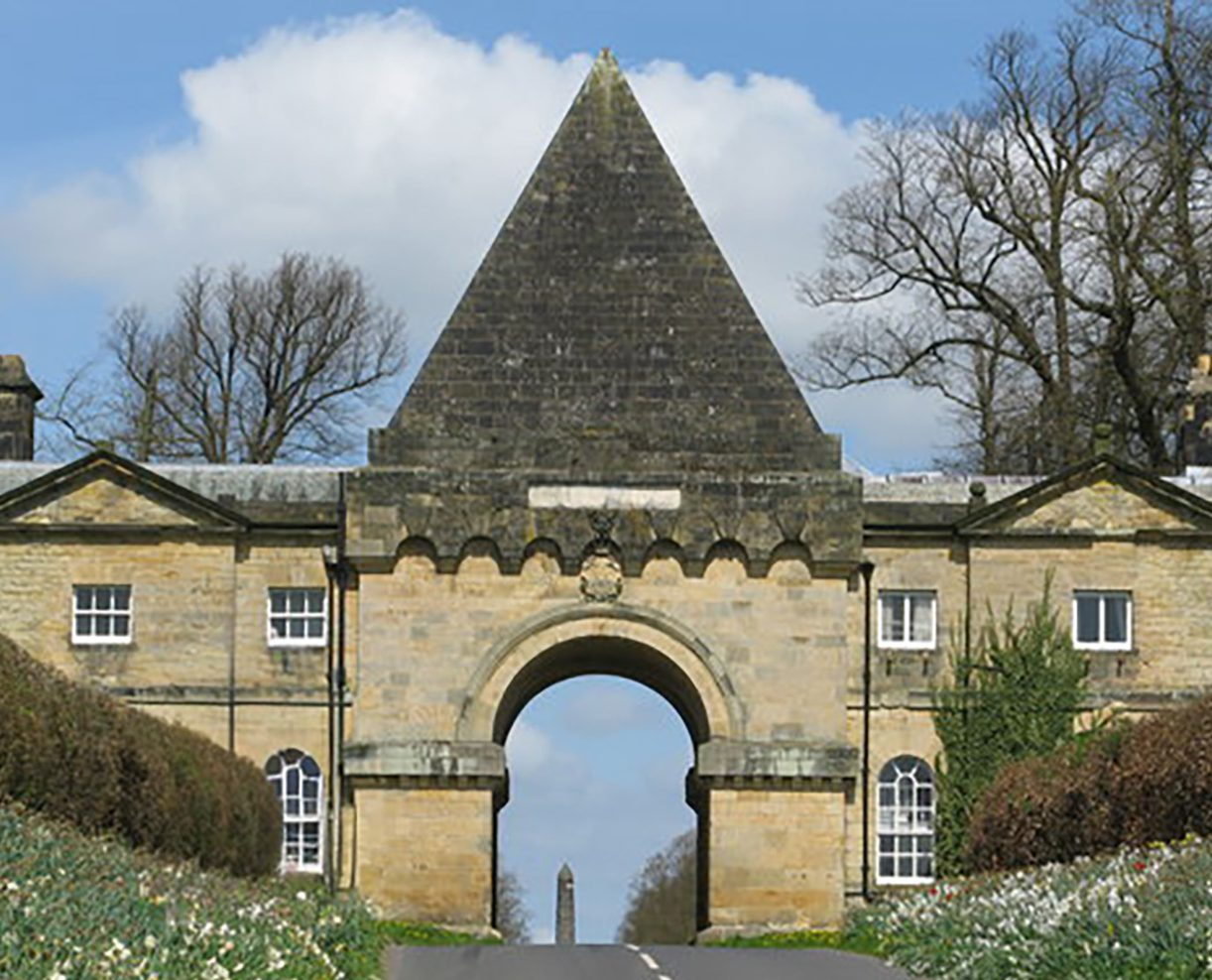
The Pyramid gate at Castle Howard, designed in 1716. It inspired the gate planned for Kings Weston in the following year.

Though a relatively simple and robust building, its most characteristic feature is probably the cornice or repeated arches held aloft on little coved brackets. This is a particular  leitmotif of Vanbrugh’s work, being repeated on numerous of his buildings, including the Pyramid Gate at Castle Howard and the entrance gate to the now-lost Eastbury Park in Dorset. He used it to imbue his architecture with his “castle air”, providing romantic allusions to medieval architecture that suggested ancient pedigrees to buildings he used it upon.

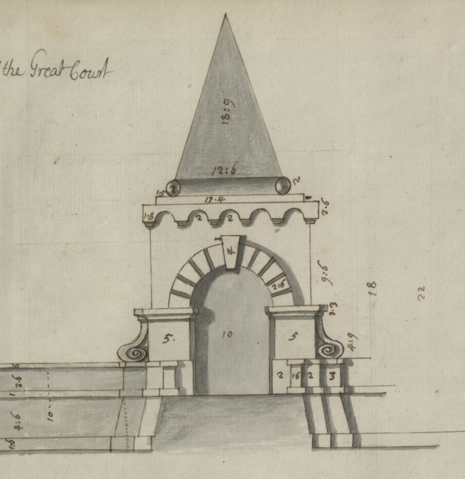
It was also present on other buildings at Kings Weston, though ones now lost or never realised. Vanbrugh’s abandoned idea for a miniature version of the Pyramid Gate followed it a year later, but was not progressed beyond paper. The kitchen wing that once stretched out from the back of the mansion had a tall chimney that was also given this treatment.

The proposed gate to the Great Court in front of Kings Weston house, a design not implemented.

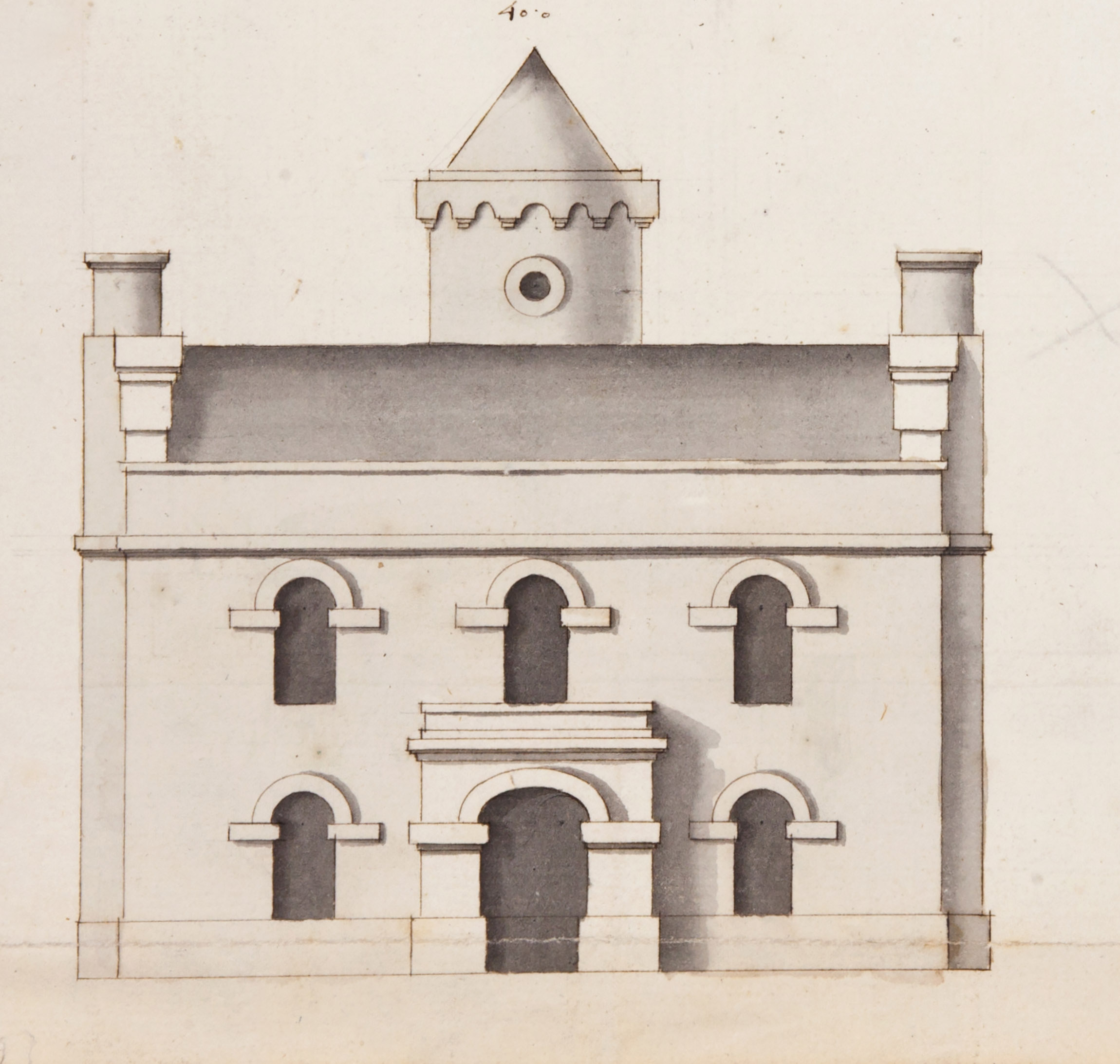
A plan for an Ale House (not to be confused with the Brewhouse) had a cylindrical turret with witches-hat spire and similar motifs, but as-built, as the Kingsweston inn, it adopted a different disposition. Arched ground floor windows and doorways on part of the Brewhouse might also be related back to the unexecuted 1717 proposal for Kingsweston Inn.

Of course, the arched window,  part of the centrepiece of the main front of the Brewhouse, has parallel with the prominently placed arch window in the pediment of the main front of Kings Weston house.

Vanbrugh designs for Kingsweston Inn, the Ale House, with features intended to evoke medieval architecture.

Even without direct evidence, the authorship of the Brewhouse as a Vanbrugh building is almost certain. Dating is more difficult. Most of the motifs were used throughout Vanbrugh’s architectural career. We know that Edward Southwell invited his architect back in about 1720 after completion of the main house, to undertake work on various buildings in the park. An estate plan of that year suggests the formal stable courtyard that was once prelude to  formal entrance courtyard was already in place, but can’t be relied on for detail, and it’s unclear whether the exact building we know today had already been built.

What is certain is that the buildings functions were essential for the operation of a mansion and estate. Beer was an essential component in satisfying household consumption by servants and labourers, and may also have made it to the table of the Southwell’s themselves. Small beer, a weaker brew, was an everyday alternative to drinking water, one that could often be more reliably safe than that drawn from wells or collected off lead roofs.

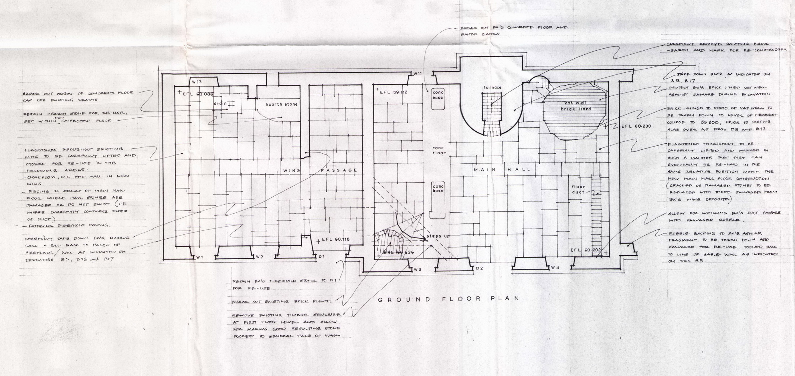
Niall Philip’s drawings of the exiting building are an important record of features before the Brewhouse’s restoration as a family home in 1991. The plan and section drawings are carefully annotated with revealing details.

The central portion of the present building was designed for the purpose of brewing. The northern wing was dedicated to baking bread: another basic essential. Both processes involved fire, and it was common practice to ensure they were kept at a comfortable distance in case any accidents might get out of hand.  A look at the rear of the building reveals the stout chimney that exhausted the fire used to boil water for the brewing process. A smaller chimney served the bakehouse.

Before conversion to a house in 1991 there were many features internally that also evidenced its historic use; most of these were retained. A photo survey undertaken in 1987 is revealing, helping to understand how the building operated.

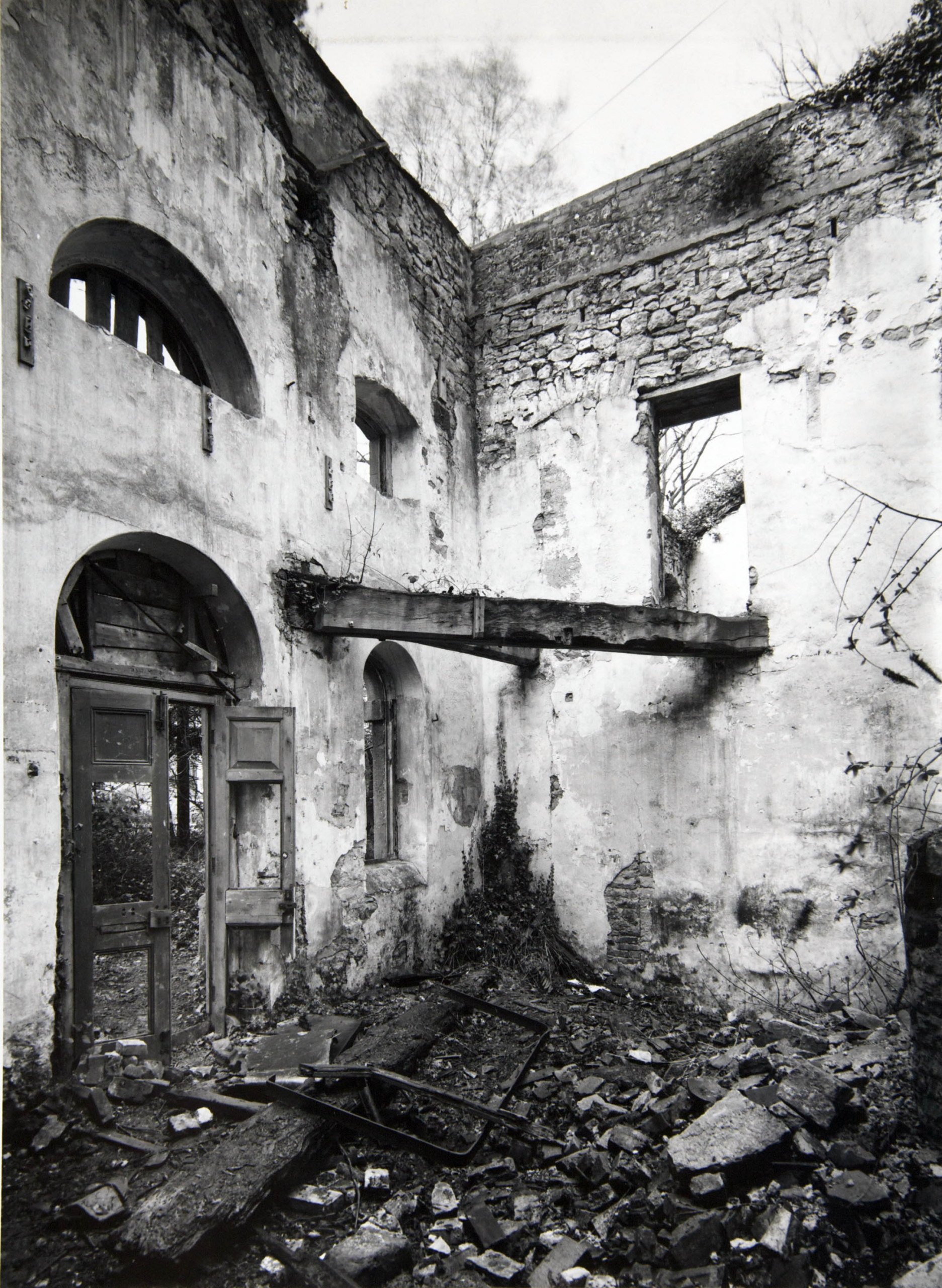
 The decaying Brewhouse in the late 1960s, when threatened by demolition. The original panel doors are still in place, as is the diagonal beam that held a platform accessed from the room beyond.
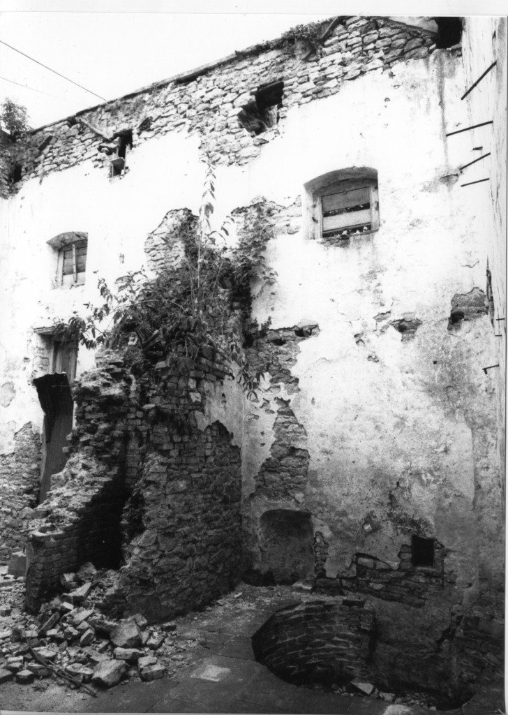
The north-east wall recorded after the clearance of debris in about 1987. The brickwork of  the fireplace and brew kettle is the main feature, with the circular pit beside it.

A tall cylindrical brick structure is likely to have housed the brew kettle . A circular recess at floor level beside it may have accommodated the mash tun, requiring less hot water and without direct heating. A lower section of floor, accessed down several steps, is perhaps where the fermentation tanks were housed. The whole was floored in stone slabs.

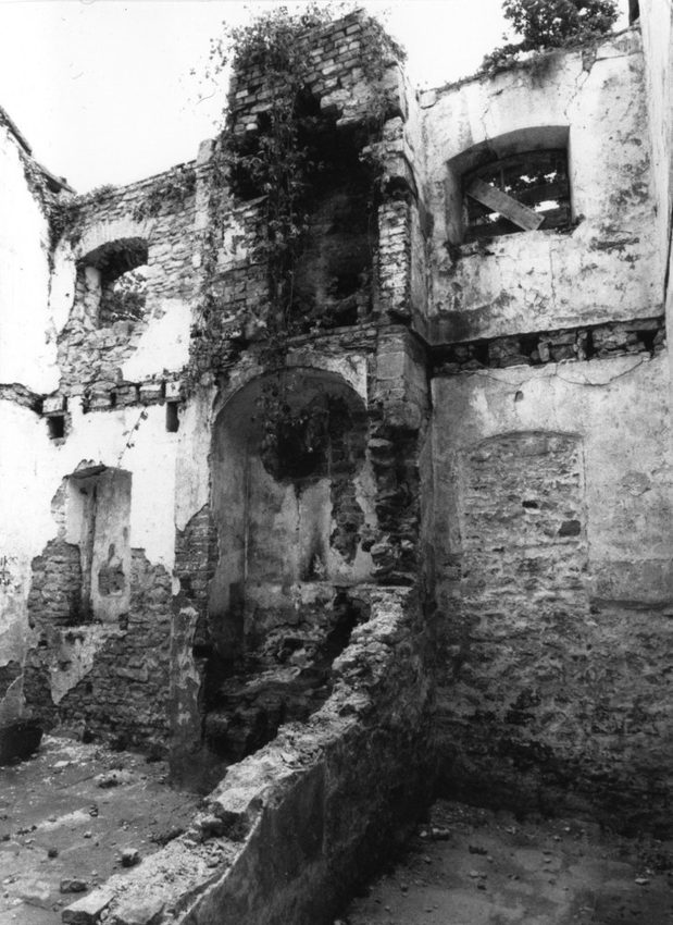
Adjacent, much of the oven remained against the back wall in the old bakehouse. Between the two rooms there was a passage that once accessed a stair up to a first floor level above the bakehouse; perhaps this was used for the storage of flour? It also opened through to the brewhouse at high level and a timber beam supporting a platform in just one corner. Would the grain for brewing also have been stored here? Water for brewing could be conveniently drawn from a wall at the rear of the building.

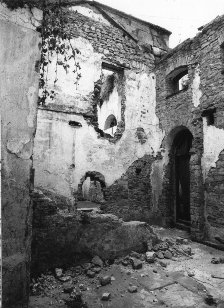
looking southwards across the bakehouse towards the party wall this the Brewhouse. The ruined wall of the passage stand between the two.

The southern wing of the building is entirely modern, a reconstruction introduced in 1991 to replicate the original wing to the north. It’s an odd affair, but we have little evidence that this is authentic or not. It’s been suggested that no evidence for this wing was found during the formation of foundations for the replacement wing. Though there was a good deal of keyed stonework on the end elevation there was no sign of a roof or floors ever having been present.

The oven chimney in the bakehouse survives in about 1987

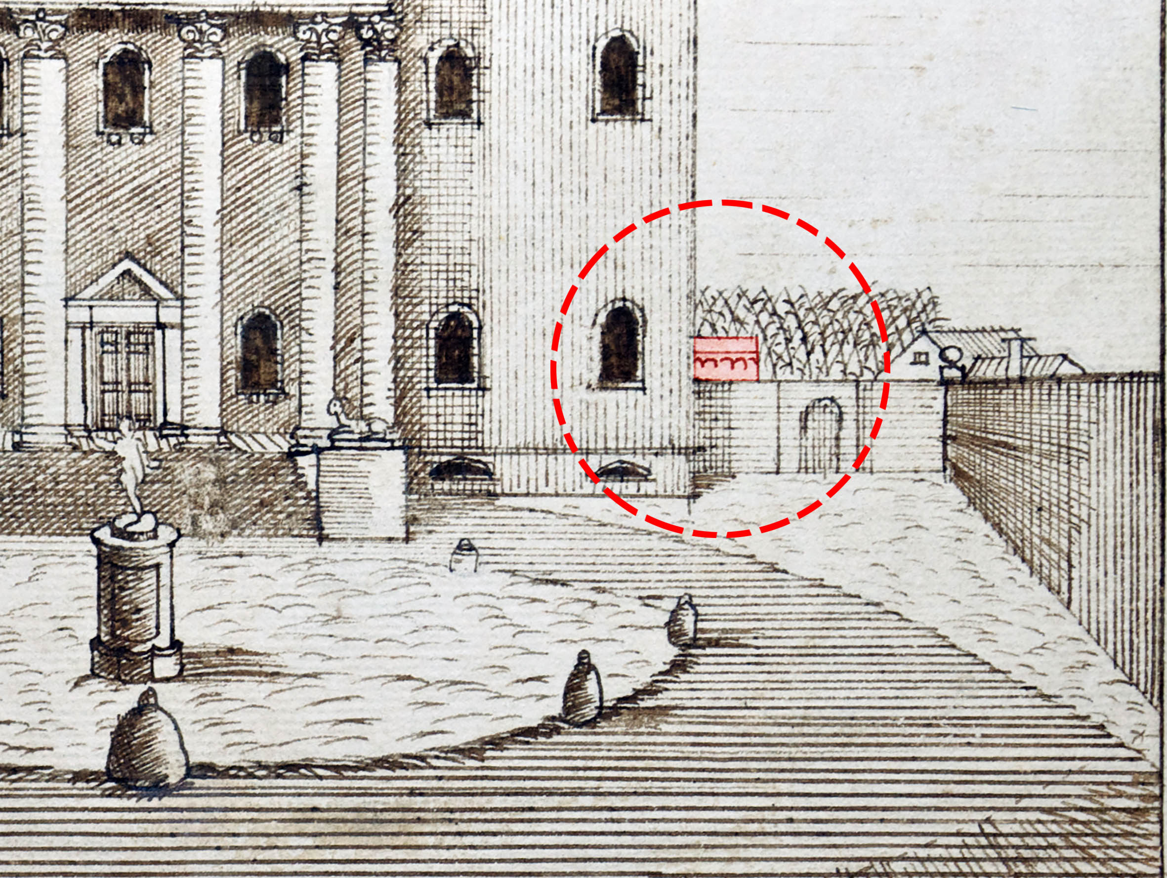
This presents something of a conundrum. There’s no firm evidence for the condition of the building between its original construction and the 1840s, over 120 years later. The central block appears fleetingly, recognisable through that signature cornice, above the high walls of the Great Court in 1746. The building is entirely absent from the estate survey made in 1772. This, however, provides context for the potential demolition of surrounding structures of the outer courtyard.

On his return from the Grade Tour of Europe in 1761, Edward Southwell III undertook a major design overhaul of the park and Kings Weston house itself. Part of this redesign was the removal of the formal garden structure and the small village of service buildings at the back of the mansion. This was intended to open out the gardens into a naturalistic landscaped parkland.

The stables, coach houses, walled garden, and other services were transferred to the other side of Kings Weston Lane and installed in brand new, modern, integrated new complex on what is now Napier Miles Road.

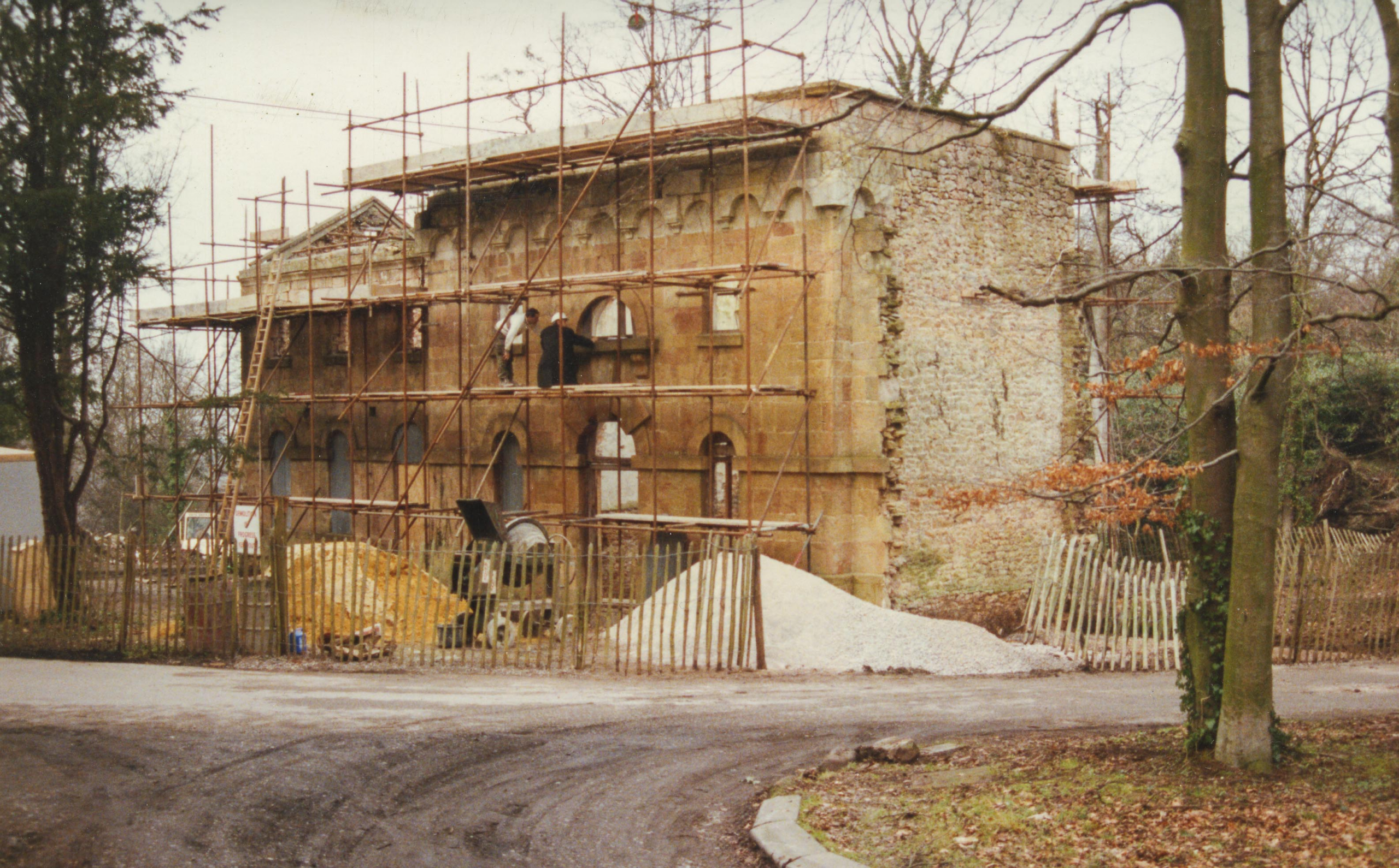
Work gets underway on converting the Brewhouse to a home in 1991. Note the lack of features in the end wall beyond the rough buttresses

Exactly why the brewhouse escaped demolition is unclear. Its omission from the 1772 survey implies that removal was a foregone conclusion, but the plan was never implemented. Perhaps the building functions were too important to be moved so far away from the main house. Perhaps no alternative water source was available to replace the dedicated well. Without further evidence we’ll probably never be certain.

The building’s last use might have been as a generator house after the bake and brew houses became obsolete. A concrete base with upstands and bolt fixings was still visible in the building until conversion. This might have supported a generator supplying electricity to the house before it was connected to a direct supply in the 20th Century.

Detail of a drawing of the main front of Kings Weston house with the unmistakable presence of the Brewhouse showing above the courtyard wall.

By the 1960s the building was already in a derelict condition, being slated for demolition again in 1970 when the technical college sought to make the site safe before its departure. It survived again, but without a plan for restoration until 1988. In this year, Bristol Building Preservation Trust appointed trusted Conservation Architect Niall Philips to convert the building as a new house. The salvation plan was slow to materialise, eventually being commenced in 1991.

The successful conversion of the building has now secured this important building. The sensitivity taken in the conversion should be applauded. Regardless of the unanswered questions about the original form, the symmetry of the building we see today is a clear ornament to the historic park.

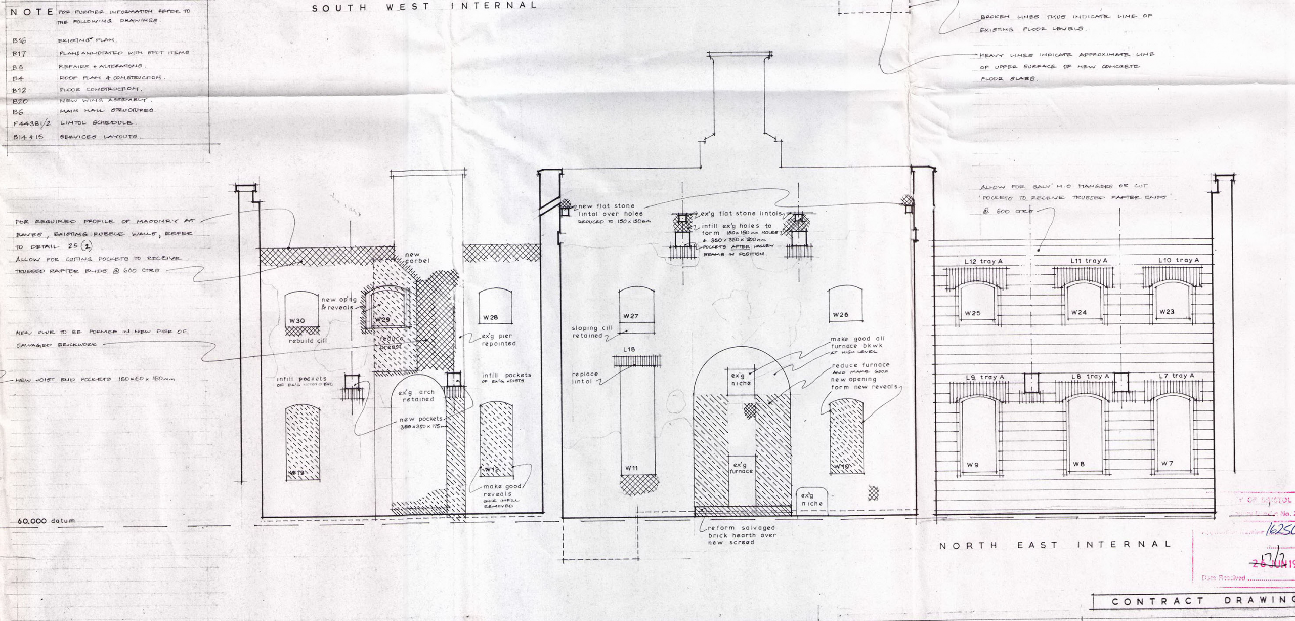
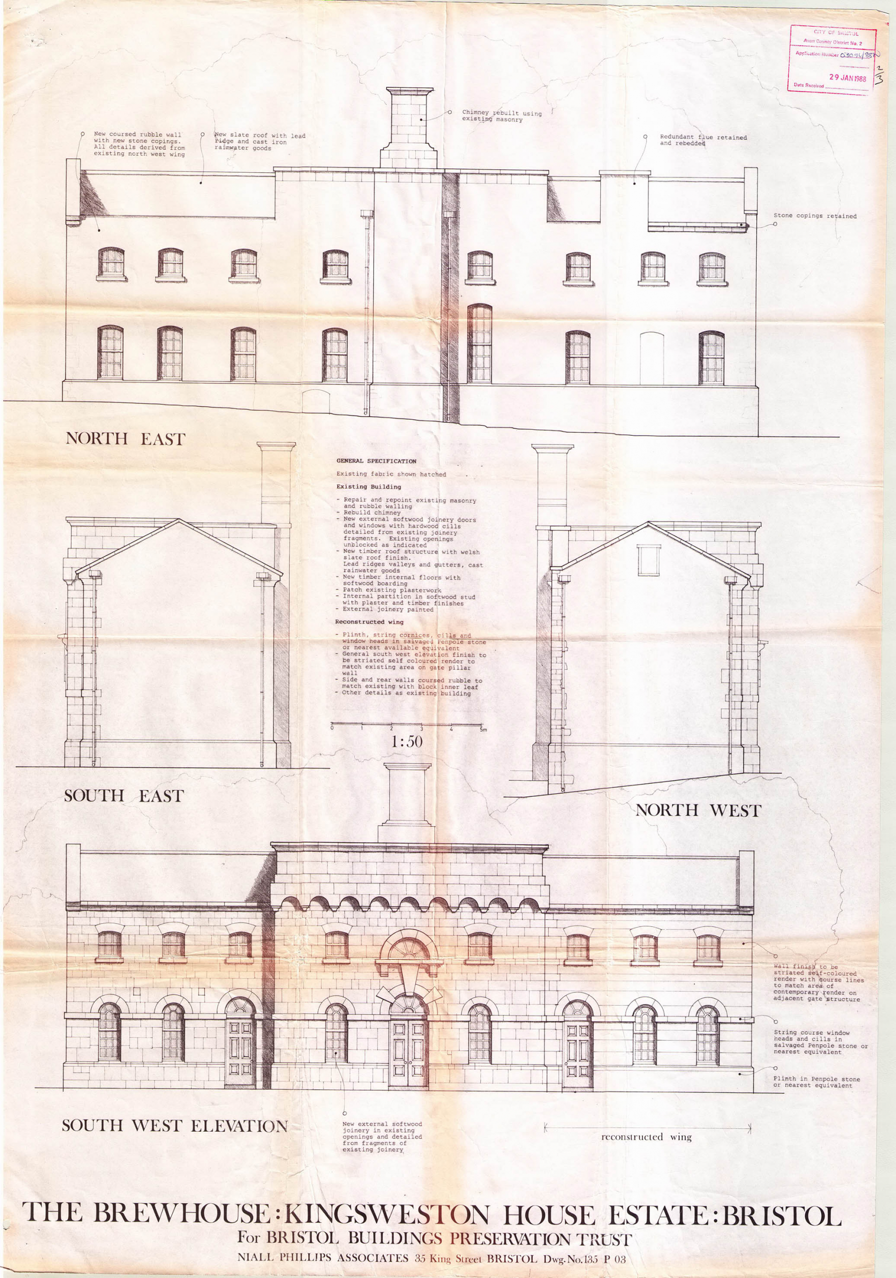
Elevations of the Brewhouse as-restored in 1991.

Kings Weston: From Royal estate to Restoration park

The early history of Kings Weston is less apparent to the casual visitor to the estate today. The Tudor manor was swept away by Sir John Vanbrugh, and the landscape bears little relation to how it would have appeared in the period between it and the Roman era before it.

We’ve recently been exploring  tantalising documentary evidence that helps fill in some of the lack of physical evidence. We begin with the Domesday Book, the famous gazetteer of landholdings made in around 1086 for King William I, to record his newly conquered realm.

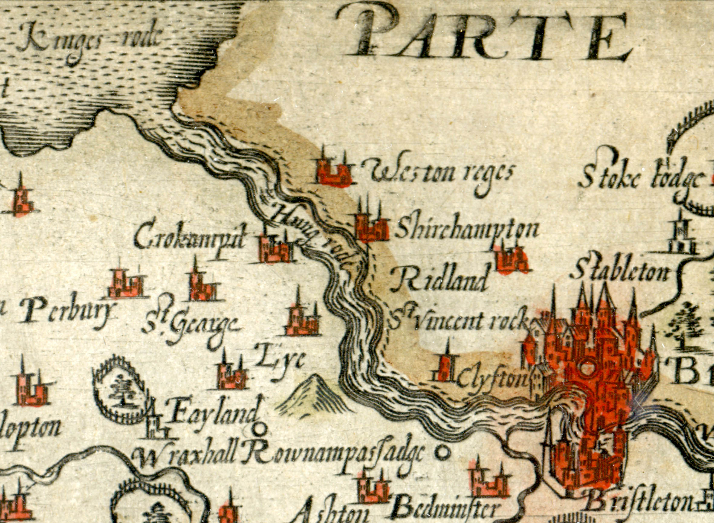
Kings Weston labelled as Weston Reges on Saxton’s map of Somerset from 1637.

Kingsweston is named here as part of the Hundred of Berkeley. The Hundred was a legal and administrative area established by the late Saxon period and this particular Hundred was divided into two; a principal area around Berkeley itself, and a detached portion including the Tithing of Kings Weston.

At the time of the great survey the Berkely lands were owned by the Crown, the Domesday book recording that William the Conqueror had seized them from the late King Edward (the Confessor) on his invasion of England.

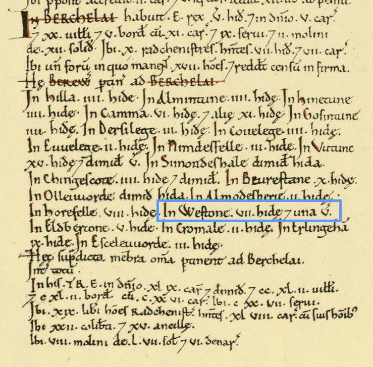
Excerpt from the Domesday Book with Westone in the Hundred of Berkeley highlighted.

“Westone” is recorded in the Domesday Book, indicating that its royal ownership had not yet been reflected in its name. The Berkely Hundred was by the king and ten “riding men” probably knights and sub-lords under the King.  The prefix of Kings Weston illustrates that it was held by William directly, and a royal estate.

Complication is added by Kings Weston being under the religious authority of Henbury Parish and therefore the neighbouring landholder, the Bishop of Worcester. The Bishop held a portion of Henbury Parish, Westbury on Trym, Shirehampton, and a selection of random fields within the boundary of the Kings Weston lands.

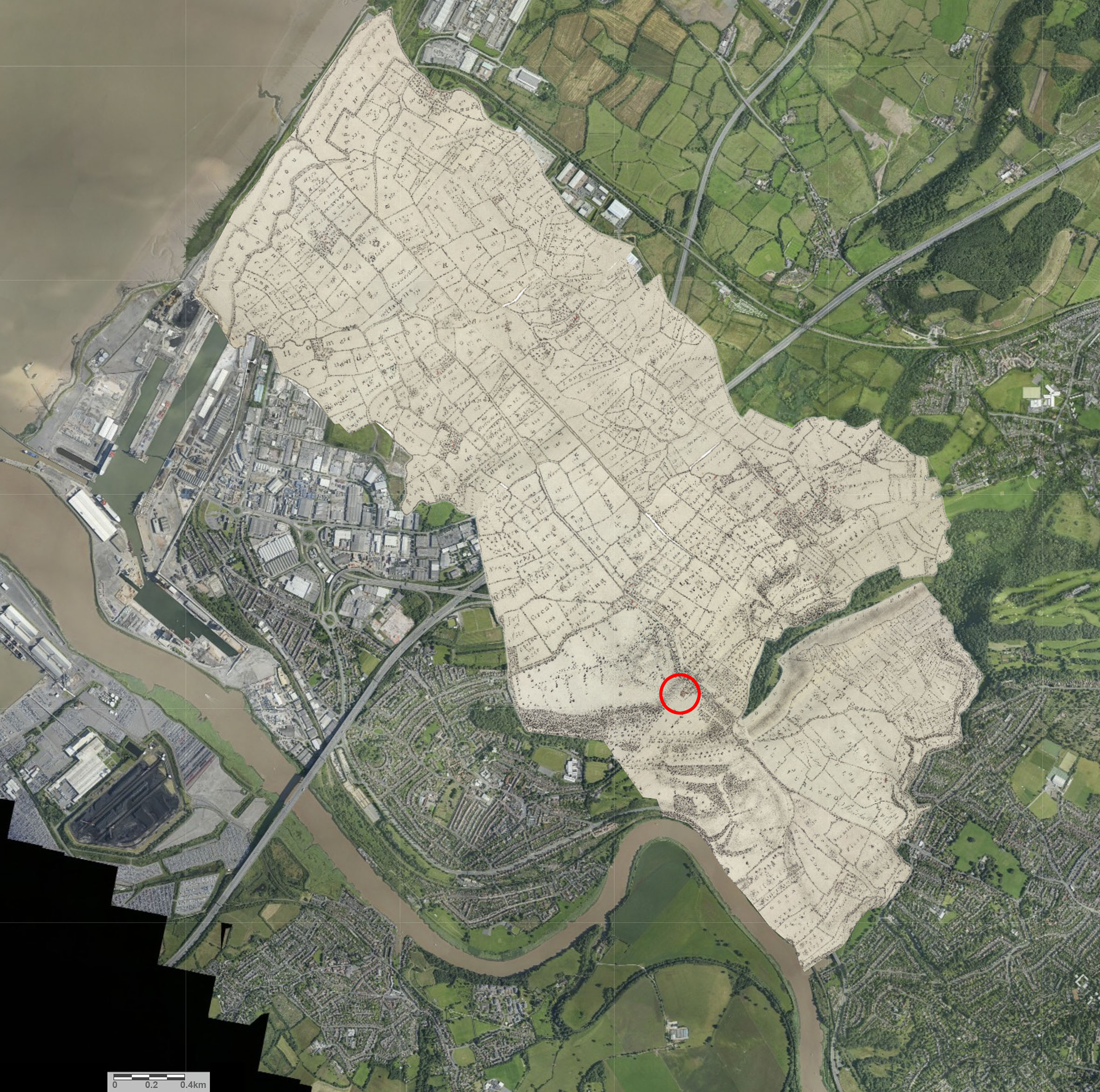
The likely extent of the ancient royal estate of Kings Weston as delineated by the 1772 estate map and overlaid on a modern aerial plan. This was the property of Edward the Confessor before being seized by William the Conqueror and his heirs. Kings Weston house is ringed in red. Between it and the Avon, Shirehampton was a detached portion of the Hundred of Henbury, estates held by the Bishop of Worcester.

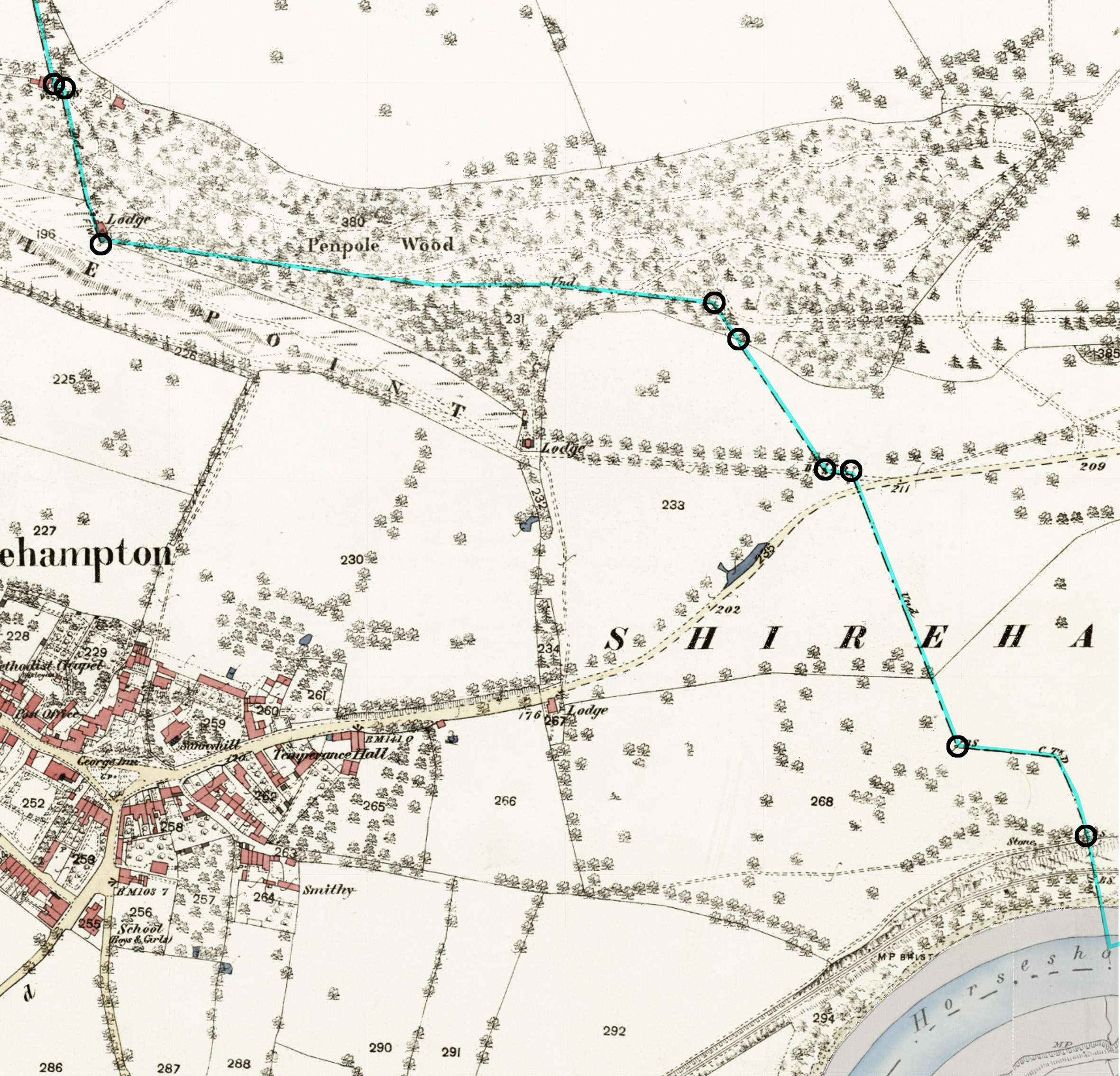
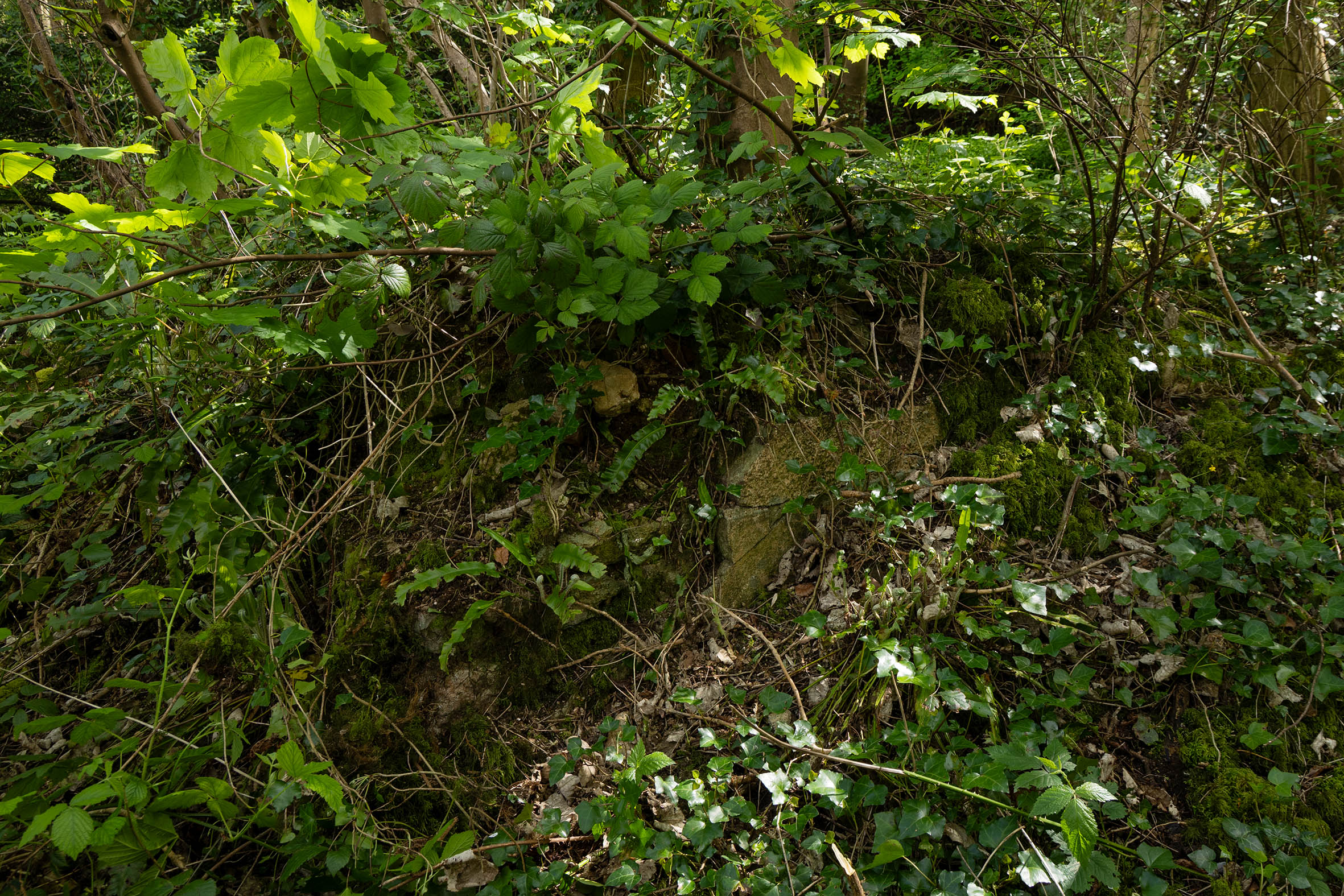
The Saxon boundary between the Royal and Episcopal Hundreds can still be traced across Kings Weston. Later boundary stones are dotted through Penpole Wood and across Shirehampton Golf course. The ruins of Penpole Lodge mark an angle in the boundary where to arrives across the levels from the Severn and turns to follow a ridge, partially natural and partially cut through the woodland and running east. A boundary stone hidden near the White Oak marks another change of direction before the alignment is lost beneath sports pitches, reappearing again as a shallow bank and ditch running across the golf course.

The ancient boundary between the Hundreds of Berkeley and Henbury passes through the Kings Weston estate. It was still an administrative boundary at the time of the first edition of the Ordnance Survey maps in the1880s. Known boundary stones are marked with circles along the highlighted blue line.

No doubt this division between secular and religious lords was of significance in the Saxon era, and along with the King’s ownership of the Barton Regis Hundred that included Bristol, ensured direct control of the lands on the north side of the Avon for many miles along its length, and along the banks of the Severn for significant stretches. The threat of Viking attack from Ireland would have been very real for the inhabitants of Kings Weston who were exposed to the coast and river.

The account of the Domesday Book wraps all of the Berkely Hundred lands into a single account, but helpfully identifies the extent of the Weston tithing as being 7 hides and one virgate, about 870 acres. This, however, would have included only the taxable arable land and not the full boundary.

Kings Weston was still held by the Crown in Henry III’s time but, before 1284, it was granted to Anselm de Gournay along with Beverstone in Gloucestershire. Whilst de Gournay favoured Beverstone as his principal residence it’s likely there would have been a manor house at Kings Weston from which this portion of the estate was administered, and where he would have stayed when visiting his estates. A messuage, a significant house, was recorded at kings Weston in 1360 when the estate had found its way into the hands of the Berkely family.

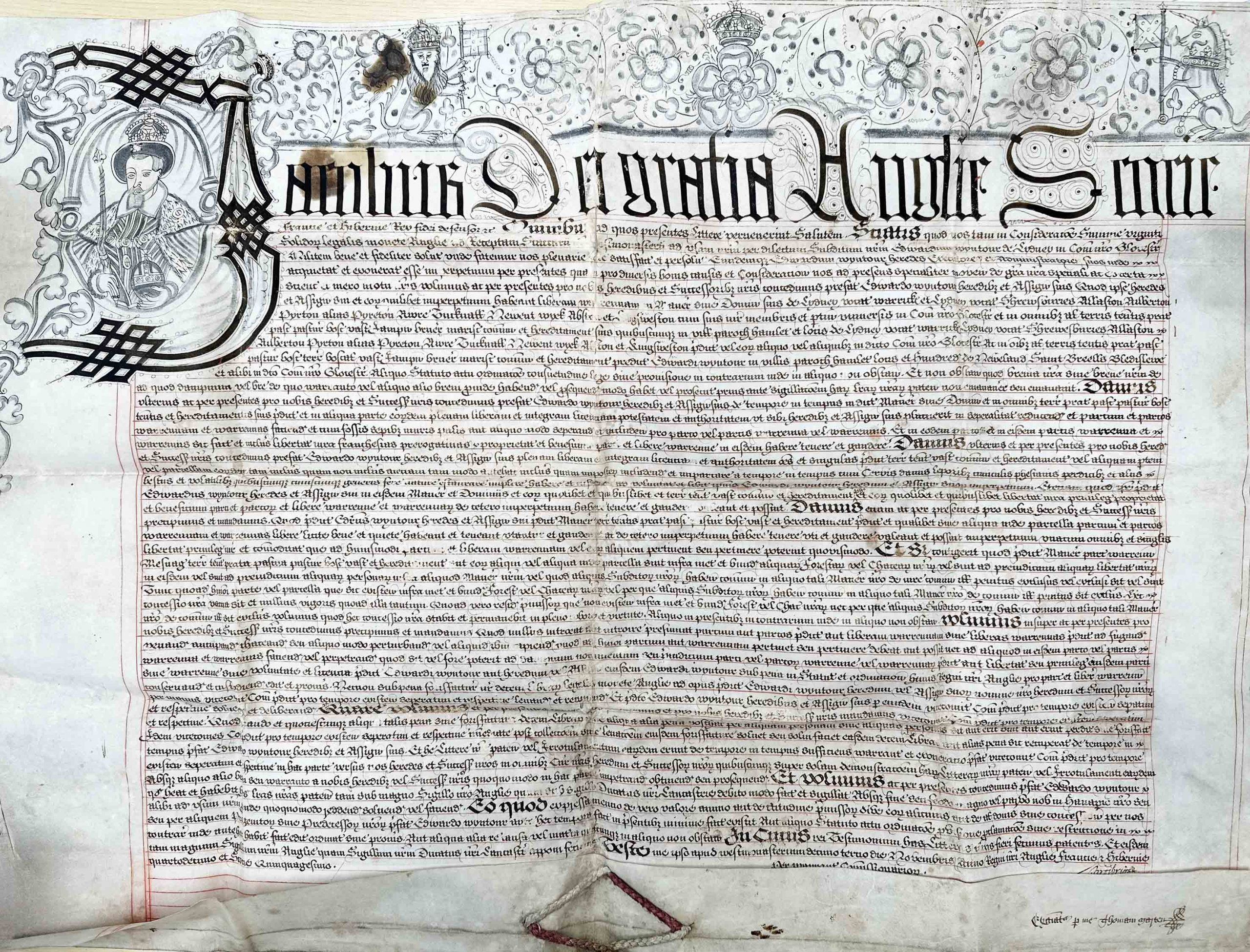
The charter granting Sir Edward Wyntour free warren for his estates including that of Kings Weston.

Such a manor house would likely benefit from a chapel, either for private worship or as a chapel of ease for the local community. This returns us to the recent works at the View Garden on Napier Miles Road, the reputed location of such a chapel. As well as anecdotal evidence, the presence of a chapel is supported by later documentary sources. A 1614 parish deed in Gloucestershire Archives records “a tenement called the Chappell” in Kingsweston was assigned to new tenants along with other property. The “Parson of Kingsweston” was identified as the man responsible for the maintenance of the sea wall where the Kings Weston tithing met the Severn, though it’s unclear who wis was or whether the chapel still existed.

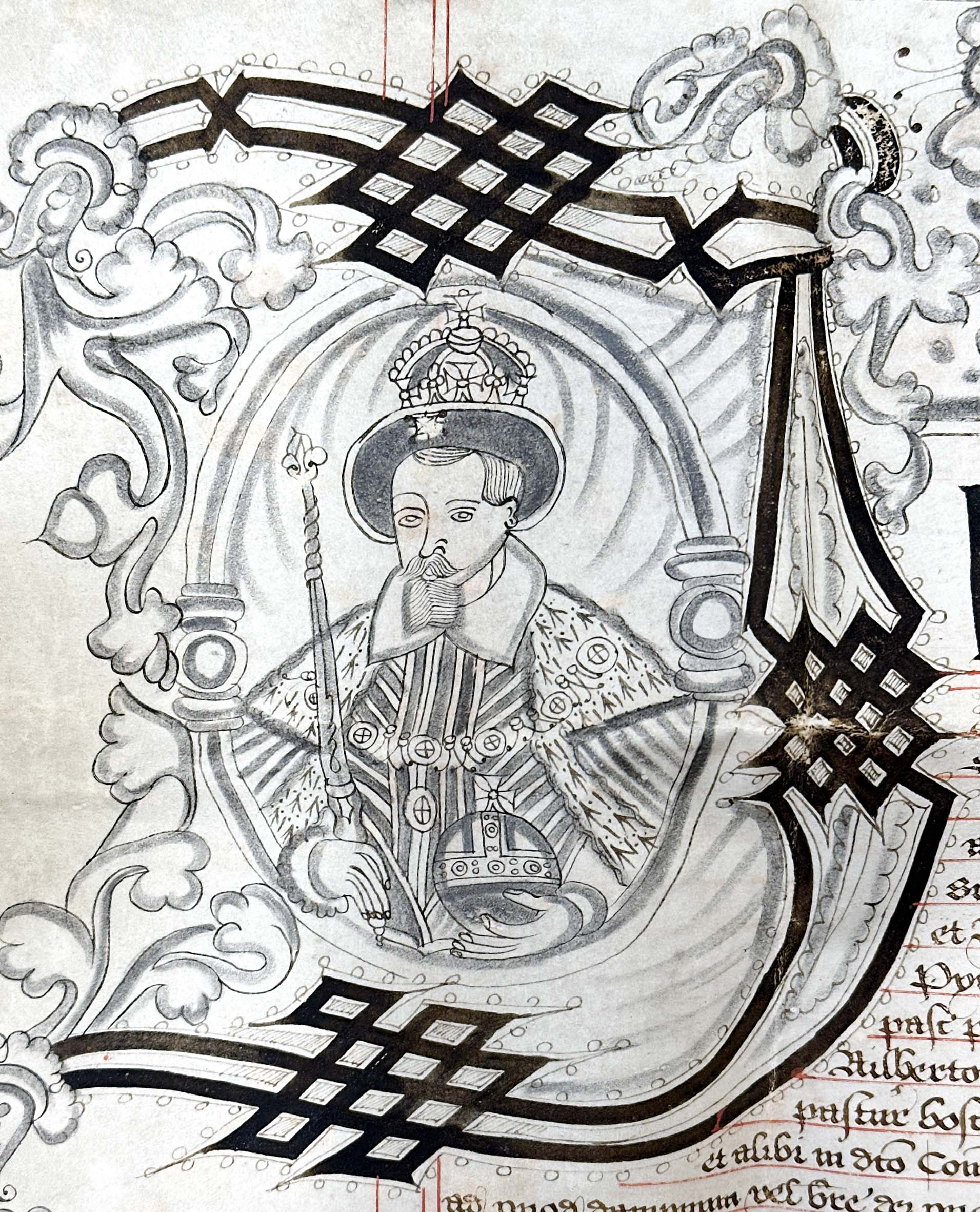
Detail depicting King James I who granted this valuable liberty.

Another significant document held in the Gloucestershire Archives is the charter granted by James I licencing Sir Edward Wyntour the free warren to for his estates. The Wyntour family had purchased Kings Weston in about 1570 and were likely responsible for rebuilding the manor house on an extravagant scale. Kings Weston was just one of many estates they owned on both sides of the Severn. Their principal seat was at Lydney. King James’s charter allowed Wyntour to protect his lands by forming walls and excluding outsiders from interfering with his small game. The warrens were specifically for breeding of rabbits for food and fur and the charter was a much prized royal privilege.

Whilst not a licence to impark the estate or stock it with deer, it does mark the beginning of the enclosure of the land around the mansion for private use. By the time the estate was purchased by Sir Robert Southwell in 1679 it justified the description of a park. Sir Robert’s friend and brother in law, Sir John Perceval, noted “Yesterday my brother and I went to visit Kings Weston, where we found a great deal of very good land, an old house, low built, but very convenient, though at your arrival I believe you will make some alteration therein; many things, especially some of the park wall, will cost you money in the reparation thereof.”

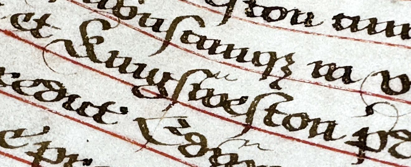
Kings Weston named in the grant of free warren.

New fragments: Some more bizarre historic bits

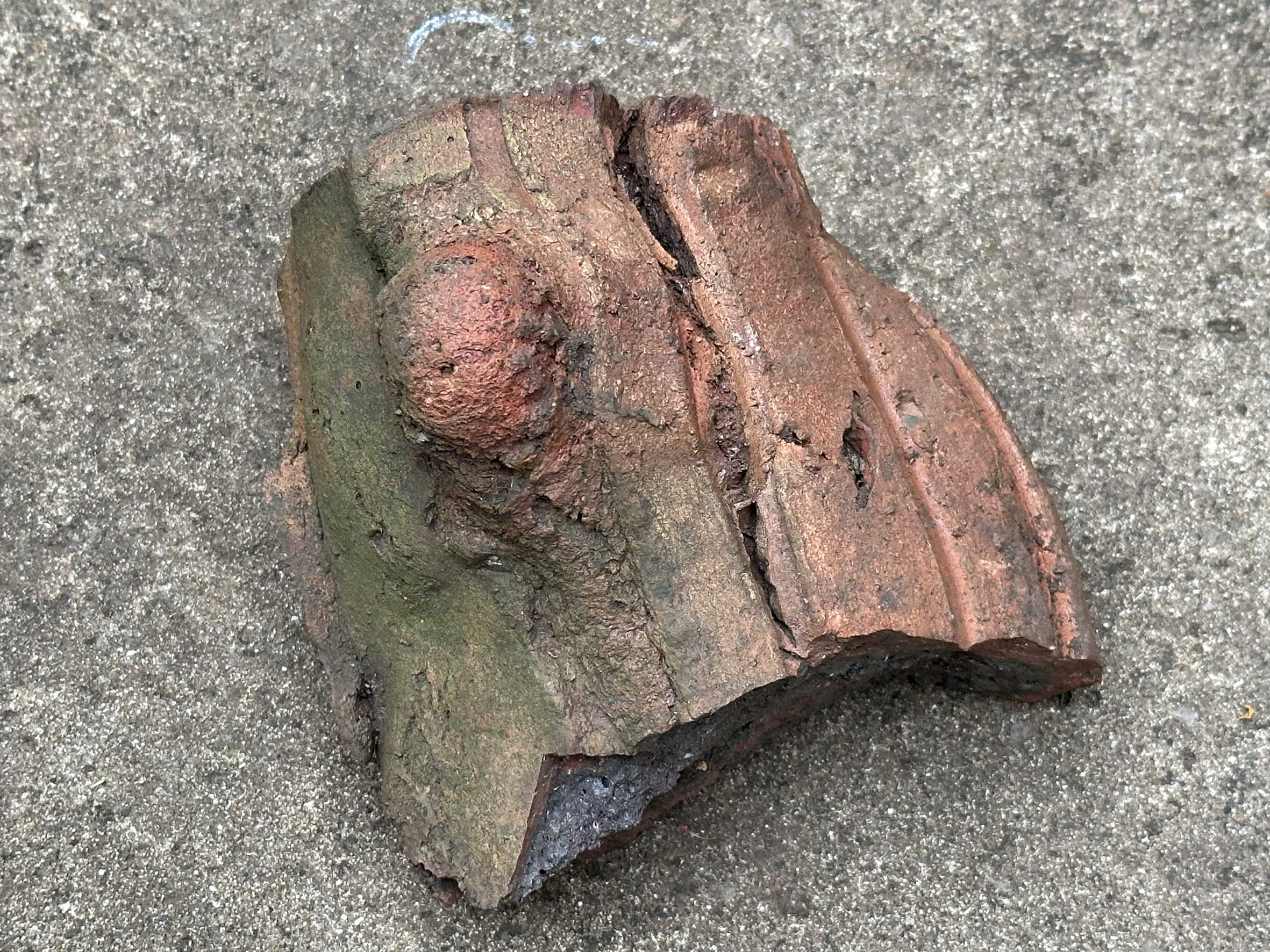
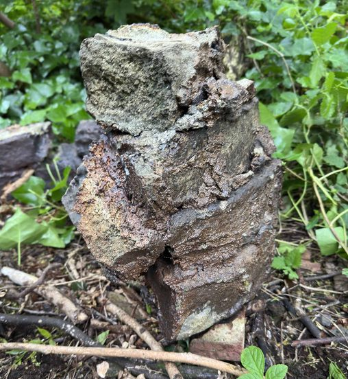
another fragment of the rustically modelled artefact

During our 2024 efforts in the View Garden and the subsequent archaeological investigation we uncovered a number of curious artefacts. This time we found a few new fragments.

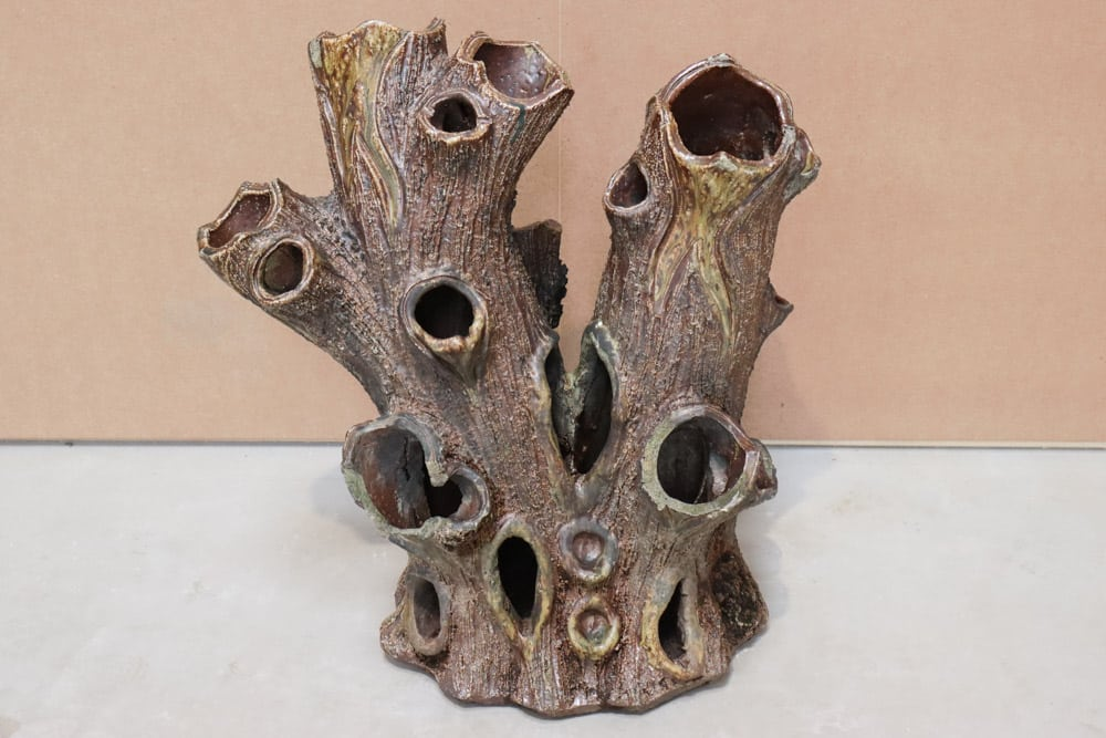
One was fired clay, similar to parts we’ve uncovered before, and that we now think were ornamental strawberry planters, or stump planters.

 An example of a Victorian strawberry planter

These were made as rustic ornaments, designed to look like decaying stumps, and in which strawberry or other small plants were panted. There were several UK manufacturers of these and they came in a variety of sizes.  These may well have been bought by the Miles family to decorate their recently set-out garden and provide fresh berries for the tables of kings Weston house.

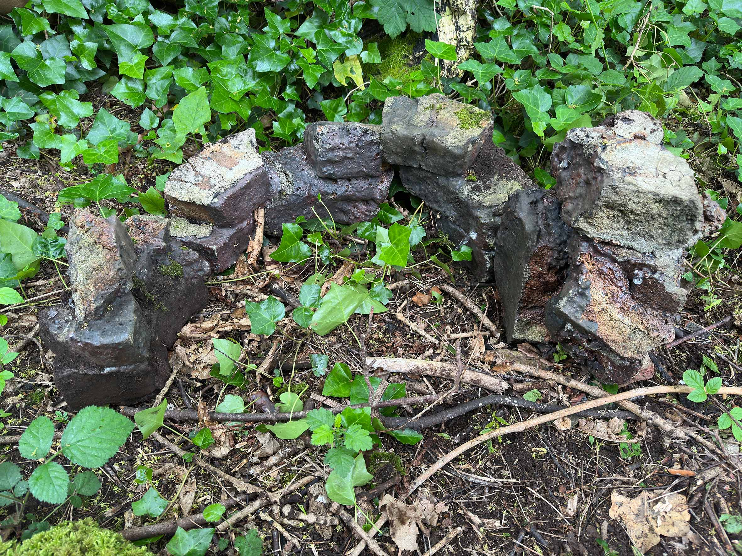
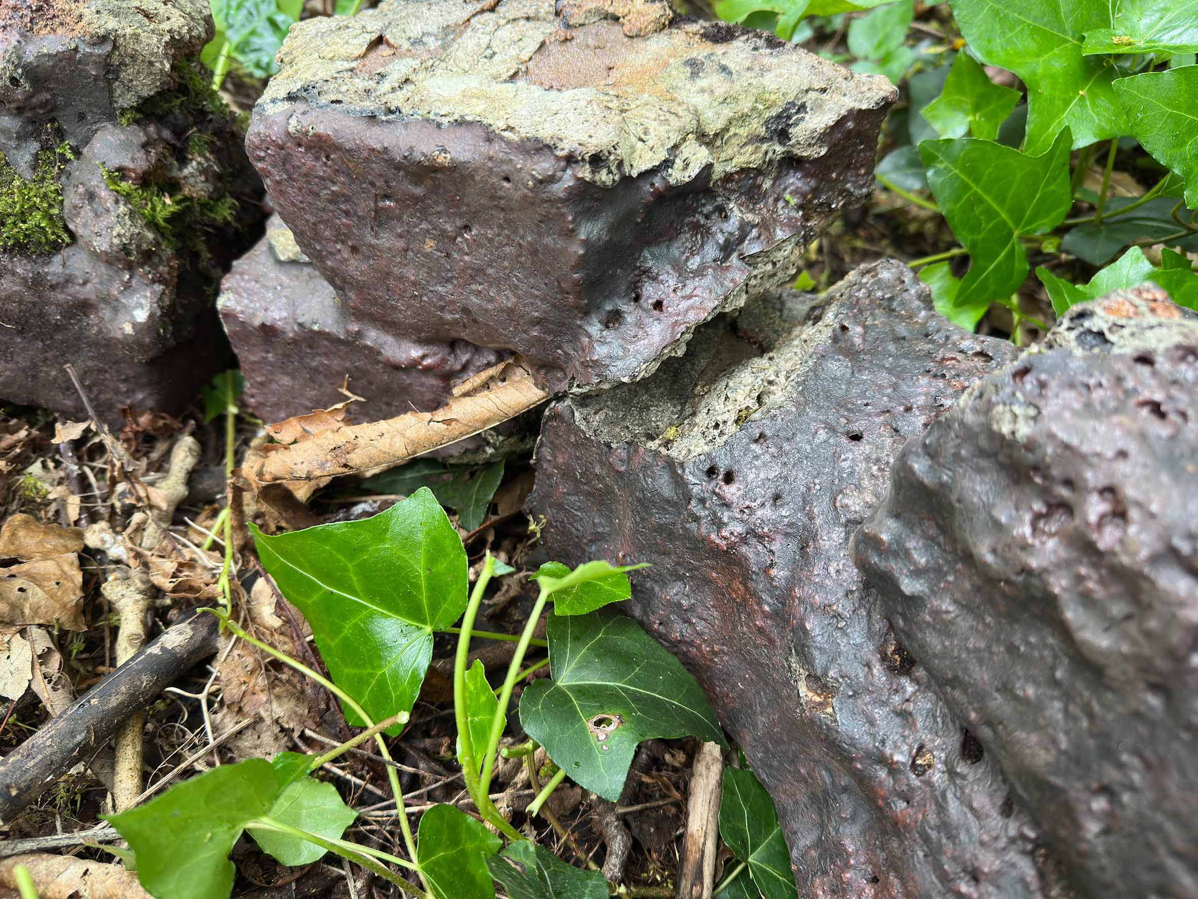
Other fragments have a less obvious function. Previously we’d thought that a number of bricks slathered in a molten glaze were part of the same ornamental planters, but these are now thought to be from a different source.

Collecting together a number of these  distinctive fragments it’s clear that they once formed a continuous circular  structure of about 2ft in diameter. It was built with roughly cut bricks  mortared together with lime mortar and then, somehow, the dark treacly glaze  or molten slag applied and fired onto the whole thing. The parts recovered show  that  there were gaps between some of the  bricks from the start

The structure looks like it had some sort of industrial origin, but perhaps the rustic finish and irregular construction were intentional. Was it another planter or something else? If anyone has any suggestions, we’d love to know. 

Setting the bricks out on the ground they show that they were once part of a circular structure.

‘Adorable magnificent view’: Lost prospects from a once famous hill

Last month we mentioned Kingsweston Hill in passing, and the “Evergreens Wood” marked on old maps. It’s worth reflecting more on the Hill, and its once-famous attractions now lost to us. Common Land until the 1830s, its public status was challenged by the Enclosure Acts which sowed the seeds of its change in character.

The hill was once open downland, grazed by sheep and bare. Compared to the present appearance it was a wild and exposed place. Siting a windmill at its summit reflects the position wide open to the winds reaching up the Severn Estuary.

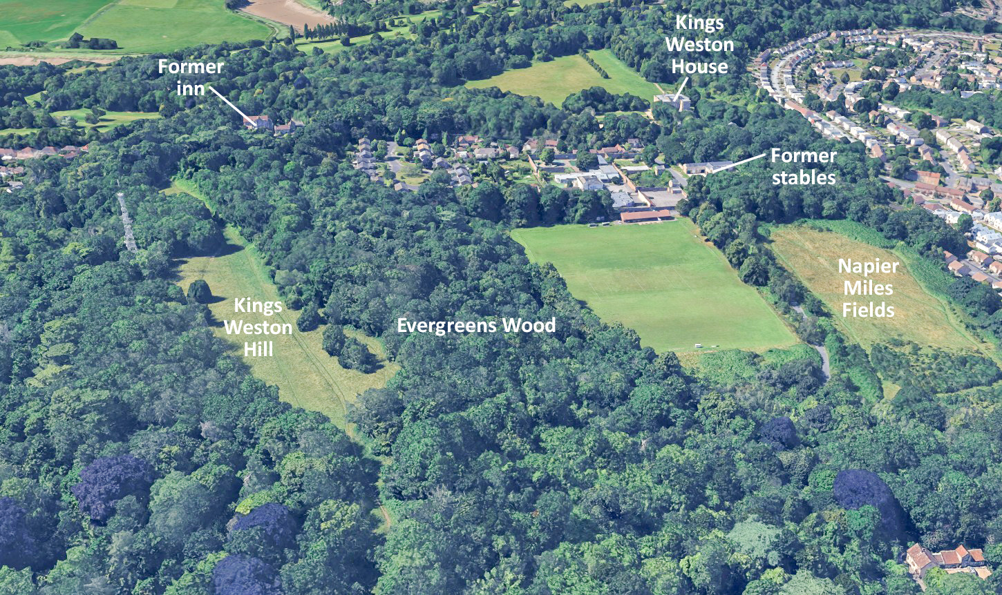
Aerial view looking west along Kingsweston Hill, with some familiar landmarks indicated.

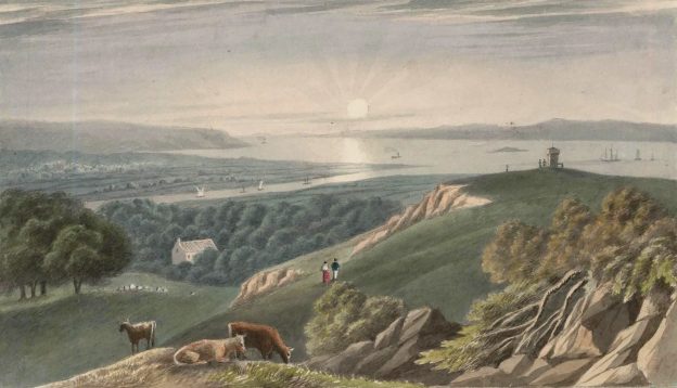
It was probably already a popular resort from the city by the time the Kingsweston Inn (sometimes called the breakfasting house) was built in the 1720s to cater for visitors and “which is much, resorted to on account of its situation”. The open views stretched all around you from the top, right across to Wales in the north, towards Somerset and the Avon Gorge to the South, and stretching as far as Chepstow and down the Bristol channel in the direction of the New World.

The sublime character of the spot, the raw nature of the hill and the beauty of the views, became one of the most famous attractions of Kings Weston in the Eighteenth Century. There are many documented visits and descriptions throughout this period.

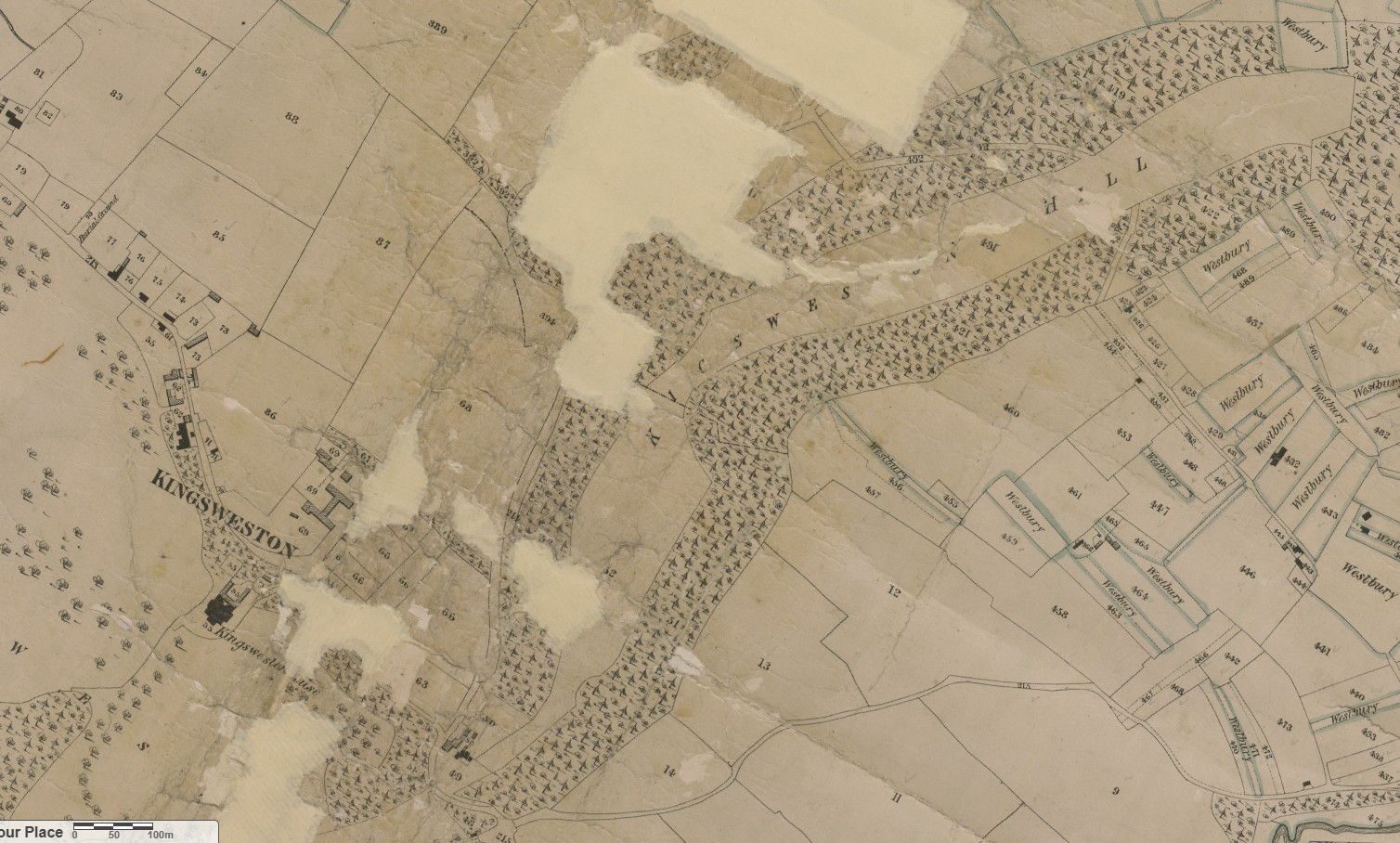
This excerpt from the 1840s tithe map shows north and south slopes of Kingsweston Hill already cloaked in new plantations.

John Wesley, preacher and founder of the Methodist Movement, was a frequent visitor to Kings Weston, writing of it often in diaries and letters. He recounts one such occasion in 1739 when his spreading notoriety for open-air preaching saw himself becoming a local attraction:

“On Holy Thursday, many of us went to Kings-Weston Hill, 4 or 5 miles from Bristol. As we were sitting on the grass, two gentlemen went by, and by way of jest, sent up many persons to us from the neighbouring villages: To whom therefore I took occasion to speak on these words, ‘Thou has ascended up on high’”.

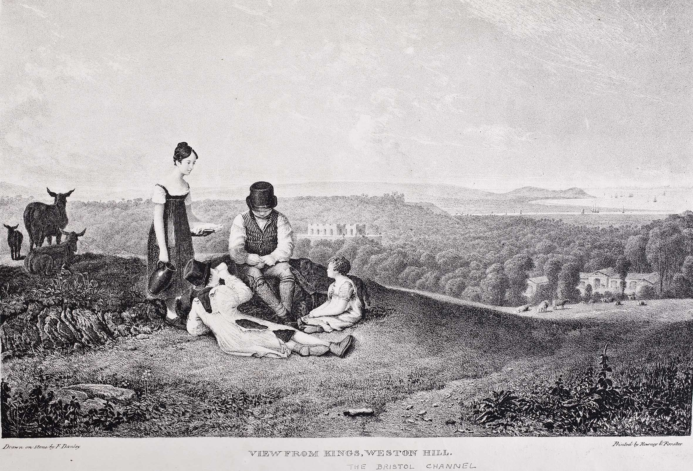
One of a series of popular lithographic prints published by the artist Francis Danby. This one shows the general appeal of the view from Kings Weston Hill and its popularity with patrons.

‘A six week tour thru the southern counties of England and Wales’, a travel guide published in1769 by Arthur Young remarks on the breadth of the views;  

“for a prospect, you must go up the hill, a little beyond where the breakfasting house for the hot-well company is situated; you look down from the hill to the west upon some fine woods, in the midst of which, Mr. Southwell’s house appears. In front is a very fine valley, two miles broad, beautifully intersected with hedges and trees, and bounded by the Severn, which is here ten miles over; you command Kingroad, with a fleet of shipping, generally lying at anchor; and, lastly, the Welsh mountains terminate the whole. Behind there is an extensive view of the country, well scattered with villages: the windings of the Severn are seen 20 miles, and those of the Avon quite to Bristol. The prospect extends into Somersetshire, Gloucestershire, Monmouthshire, Glamorganshire, Brecknockshire, Radnorshire, and even to Pembrokeshire; and, upon the whole, is inferior to nothing”.

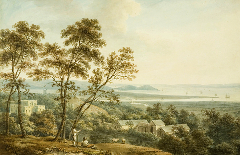
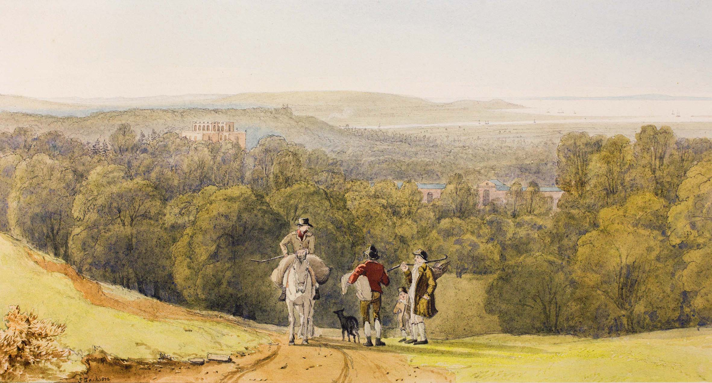
 Samual Jackson’s well-known painting from Kingsweston Hill from the 1790s

In the 1780s, another such book, The Bristol and Hotwell Guide, lauded:

“There is scarcely a spot in the kingdom that affords a more pleasing and extensive  view of land and water than is seen from This hill.”

The same decade saw the publication of a poem named after the hill by a Thomas Hobhouse, further raised the national profile of Kingsweston Hill and its views.

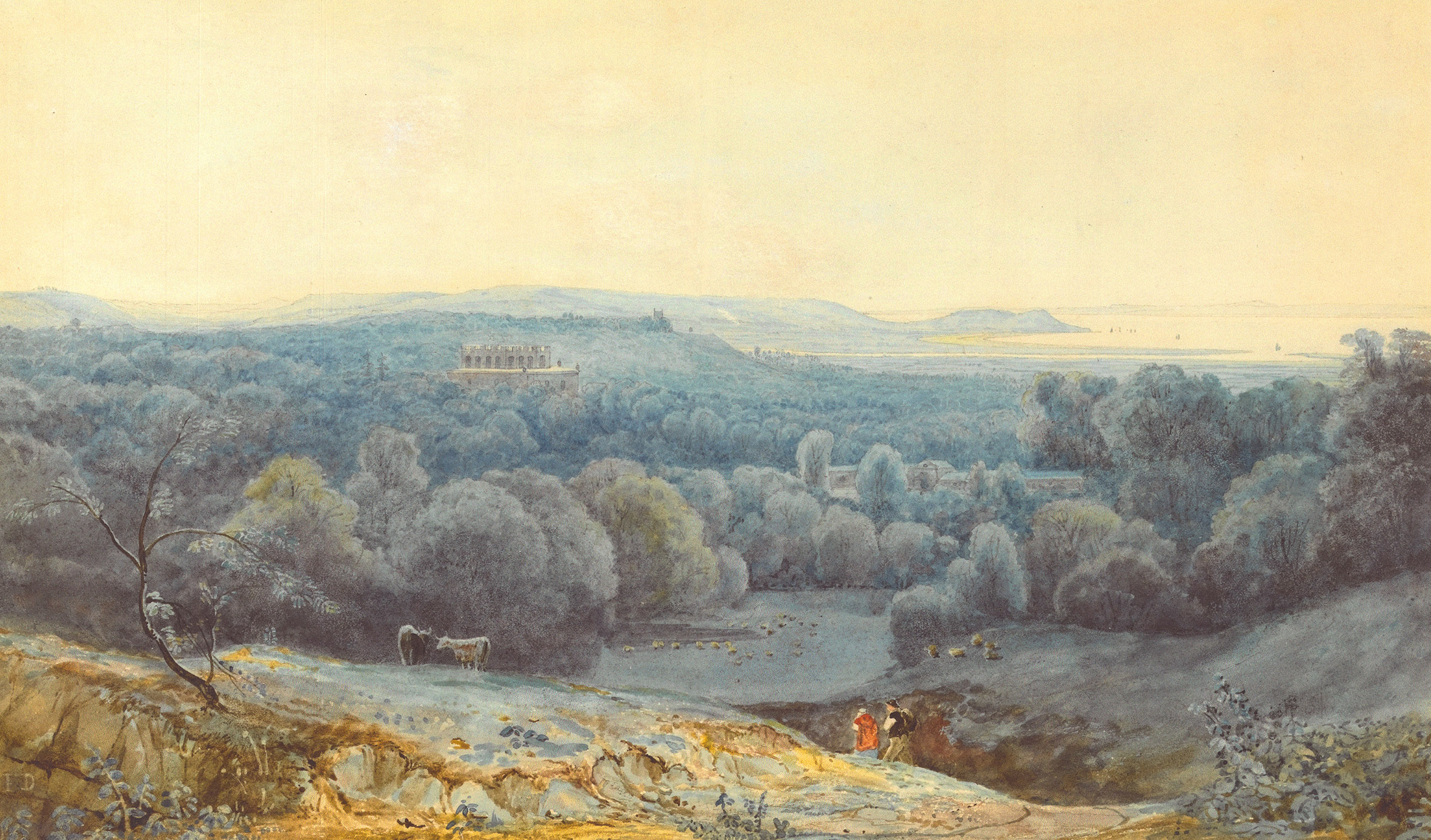
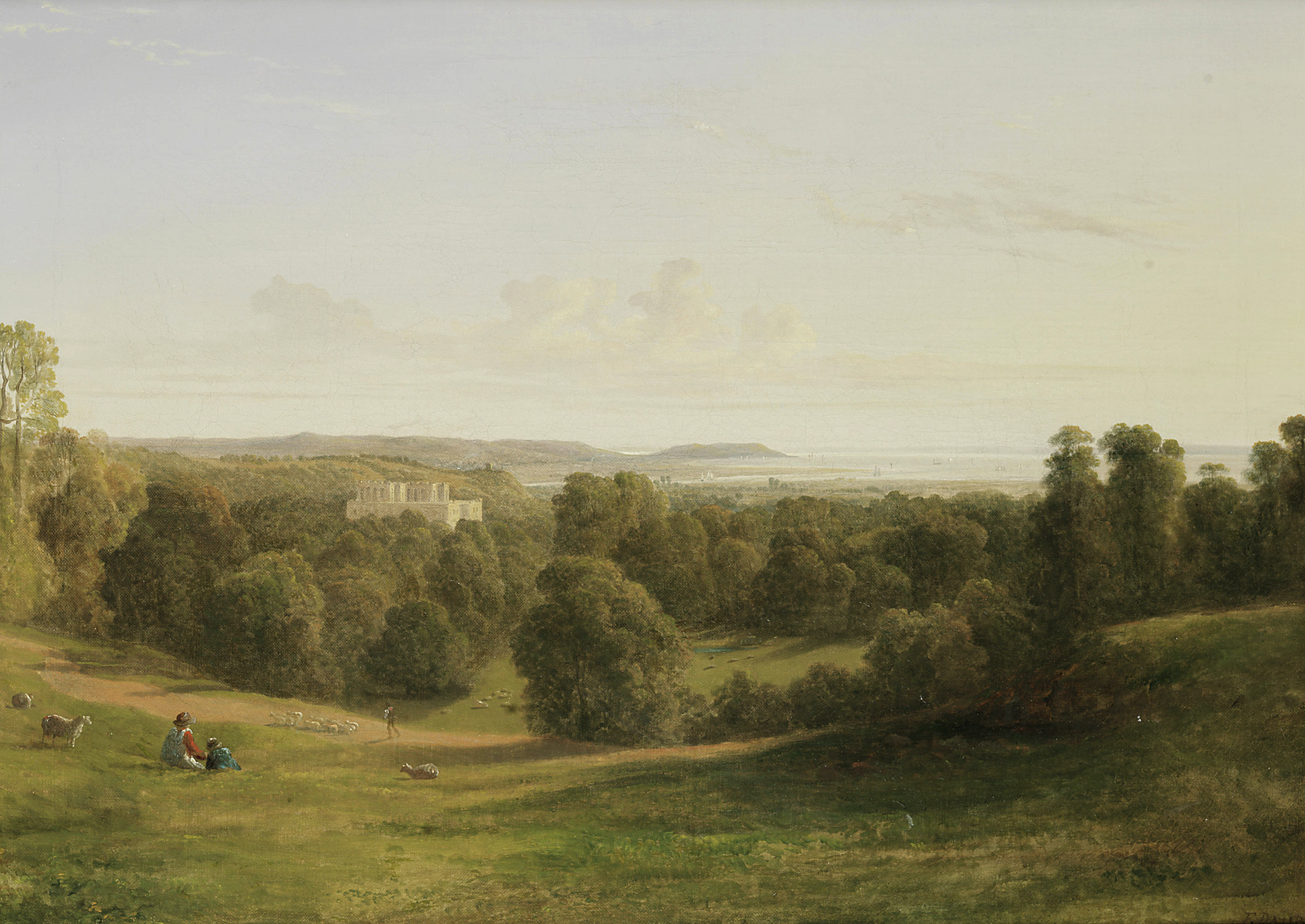
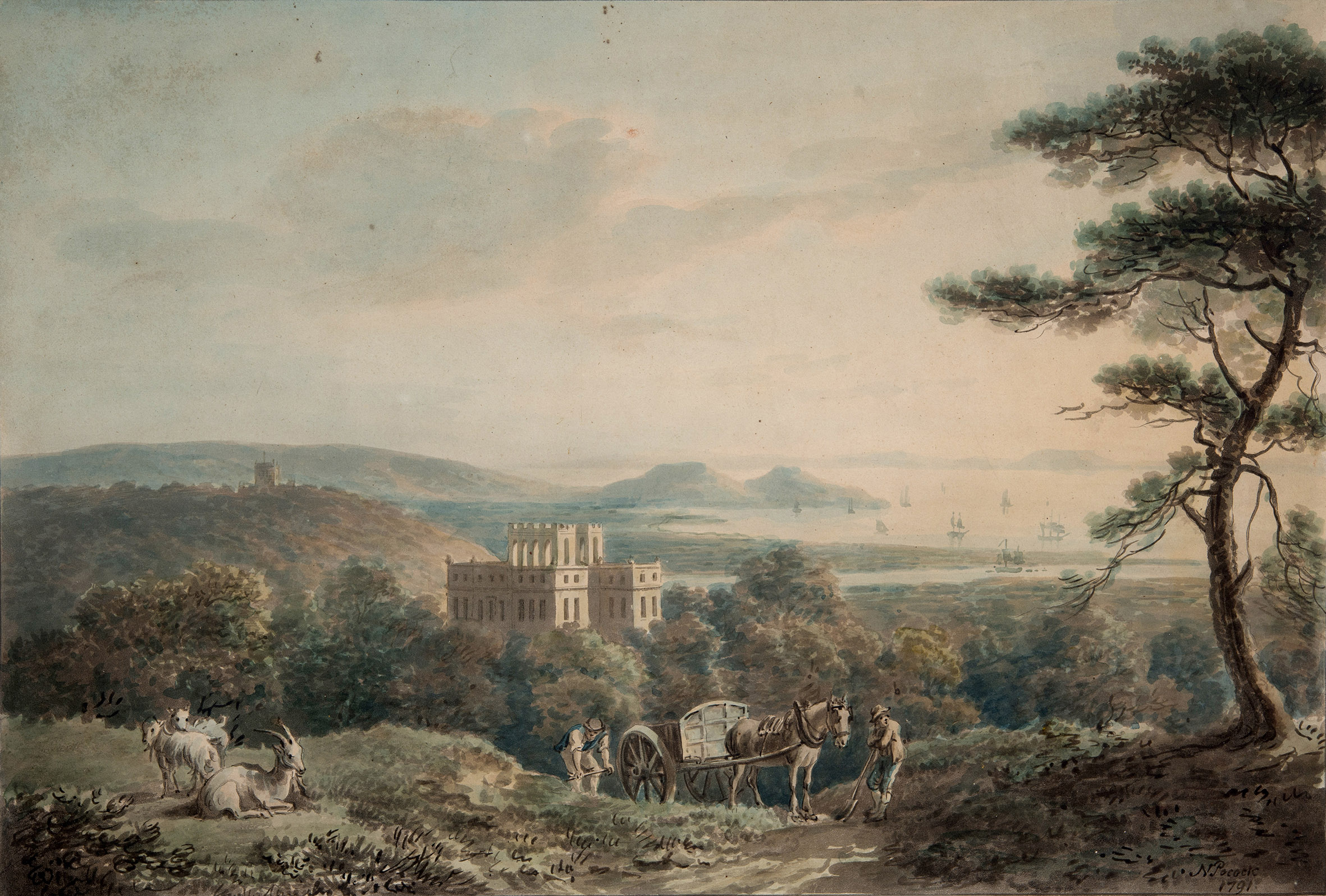
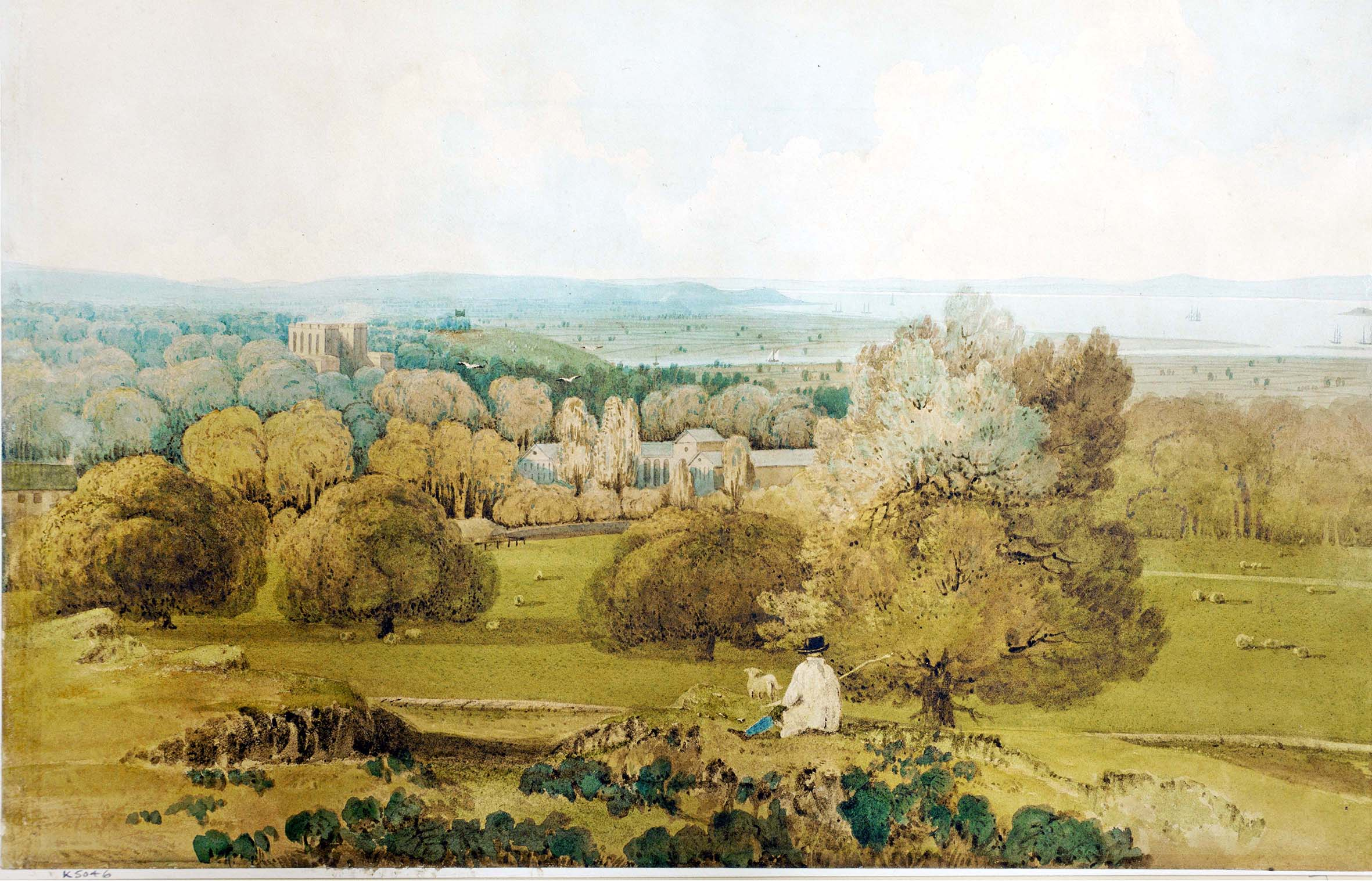
The picturesque prospects led to a brisk trade in paintings and artworks developing around the turn of the 19th Century, with many versions of the view across the Severn recorded by artists of the Bristol School. This was Kingsweston Hill at the height of its notoriety.

A Francis Danby watercolour of evening light seen from Kingsweston Hill, circa 1815.

Many of these views took advantage of a common spot now engulfed within Evergreens Wood on the north side of the Hill. The location was along the path along the northern edge of the hilltop from where the visitor could enjoy the views westward towards the Bristol Channel with the vast scale of the natural landscape put into perspective by the diminutive (relatively speaking) mansion and buildings of Kings Weston house in the middle distance.

Watercolour looking across Kings Weston and Penpole Point by Samuel Jackson, circa 1820.

Trying to find the site today is confounded by the dense woodlands that have grown-up since. This is in large part to the Enclosure Act of 1812 that saw the whole of the hill ‘privatised’ in the ownership of the Southwell family, then the Lords de Clifford. The Act was not enacted formally until 1822, after which Edward Southwell, 21st Baron de Clifford set about making his mark on it and making it an extension of the Kings Weston landscaped parkland.

Oil Painting “View over the mouth of the Avon and kings Weston House” by Francis Danby. Circa 1815.

Of Lord de Clifford, it was written

“The great enjoyments of Lord de Clifford when at home was planting shrubs and trees. Many thousands were planted under his directions. I can picture him now as I often saw him, a little insignificant man riding on a very quiet horse followed by John Webb, his favourite groom, to superintend operations.”

One focus for this avid planting spree appears to have been Kingsweston Hill. New carriage rides were constructed encircling the hill, routes that can still be enjoyed,  and these were planted heavily with new trees.

Whether the Lord’s intention was to deliberately obscure the views that attracted so many public visitors to his land isn’t known, but this was certainly the end result. Evergreens Wood was planted along the side of the hill with yews, cherry laurel, conifers, arbutus, and Evergreen Oak that might be better suited to north-facing slopes.

Coloured print by Nicholas Pocock showing the view from kingsweston Hill  1791.

Whilst the view from Penpole Point remained celebrated, the frequency with which the views from Kingsweston Hill are mentioned falls off rapidly after the 1830s, perhaps as rapidly as the new evergreens grew up. With the purchase of the estate by the Miles family in the same decade they sought to prevent all public access to the hill, but the strength of feeling against this from across Bristol saw them relent.

Watercolour by Samuel Jackson, dating from the 1820s

The botanist Charles James Fox Bunbury makes no mention of views from the hill on his visit In September 1870. He wrote:

“Kate and I had a long walk with Miles through his beautiful woods, clothing the ridge of the hill eastward of the house, and joining on the woods of Blaise castle. The luxuriant growth of evergreens is remarkable: above all the arbuti are more numerous and larger and finer than I have seen anywhere else except Killarney.”  

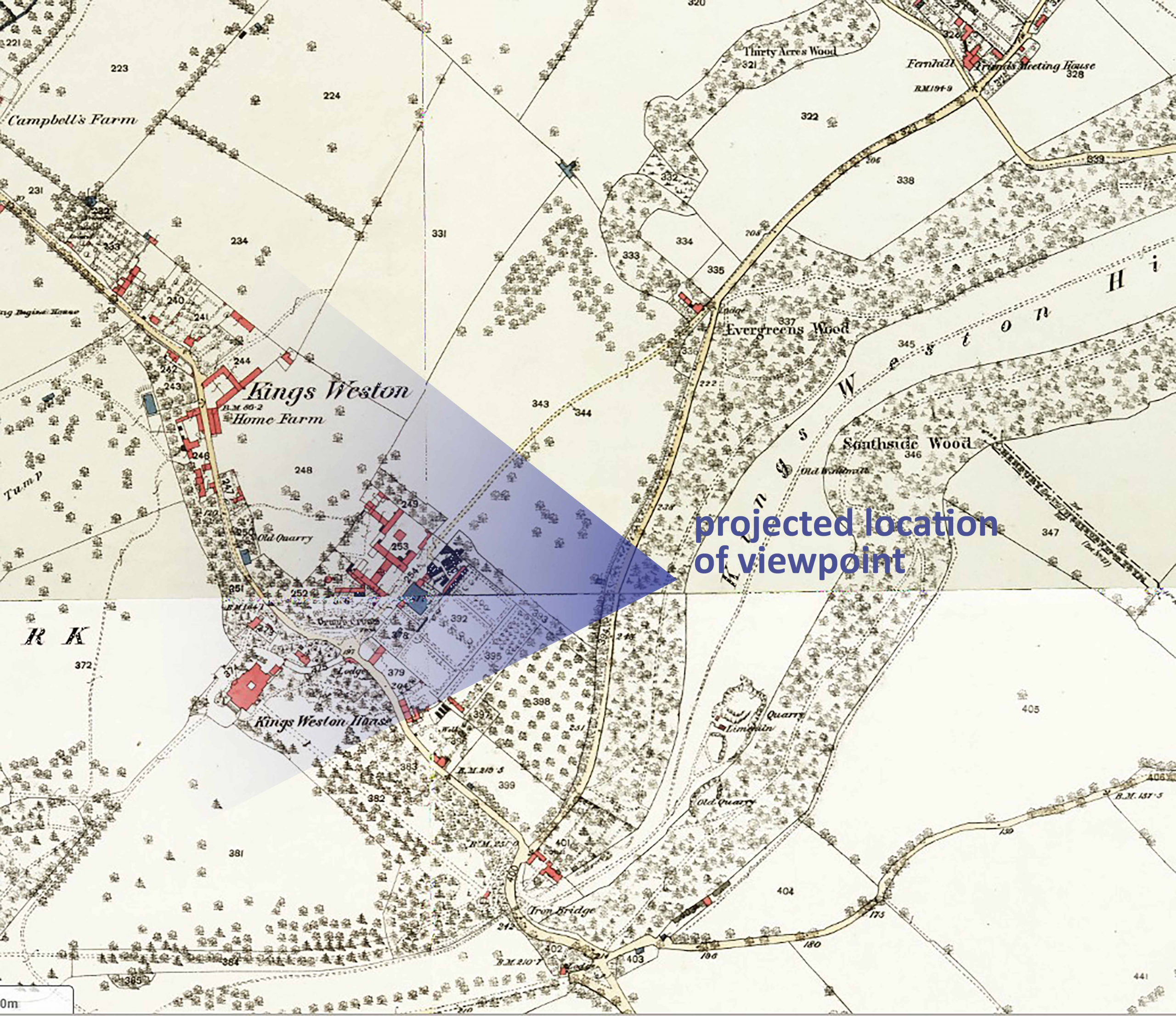
1880s ordnance Survey map showing the projected location from where artists painted.
Views of the Georgian stables are now rare from this angle.

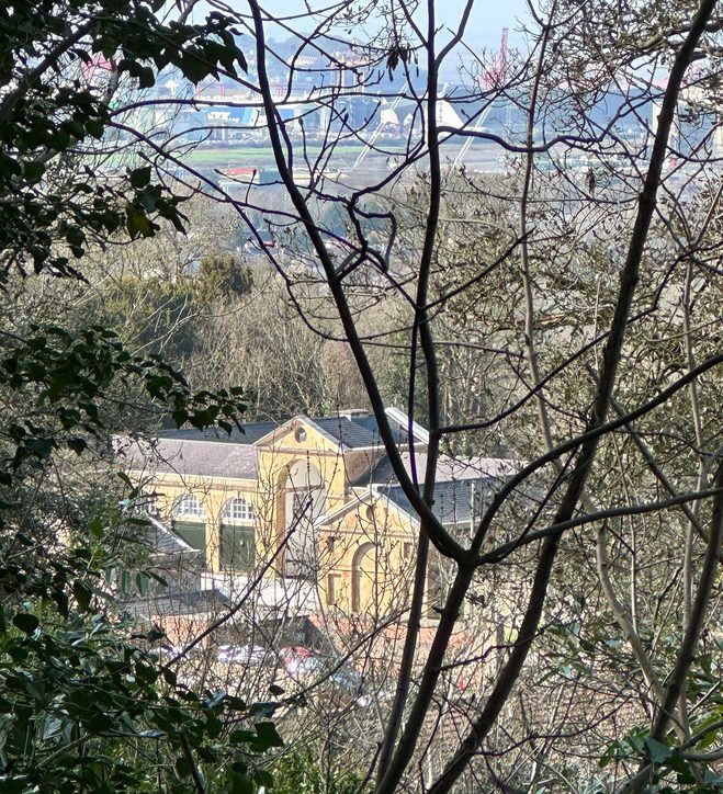
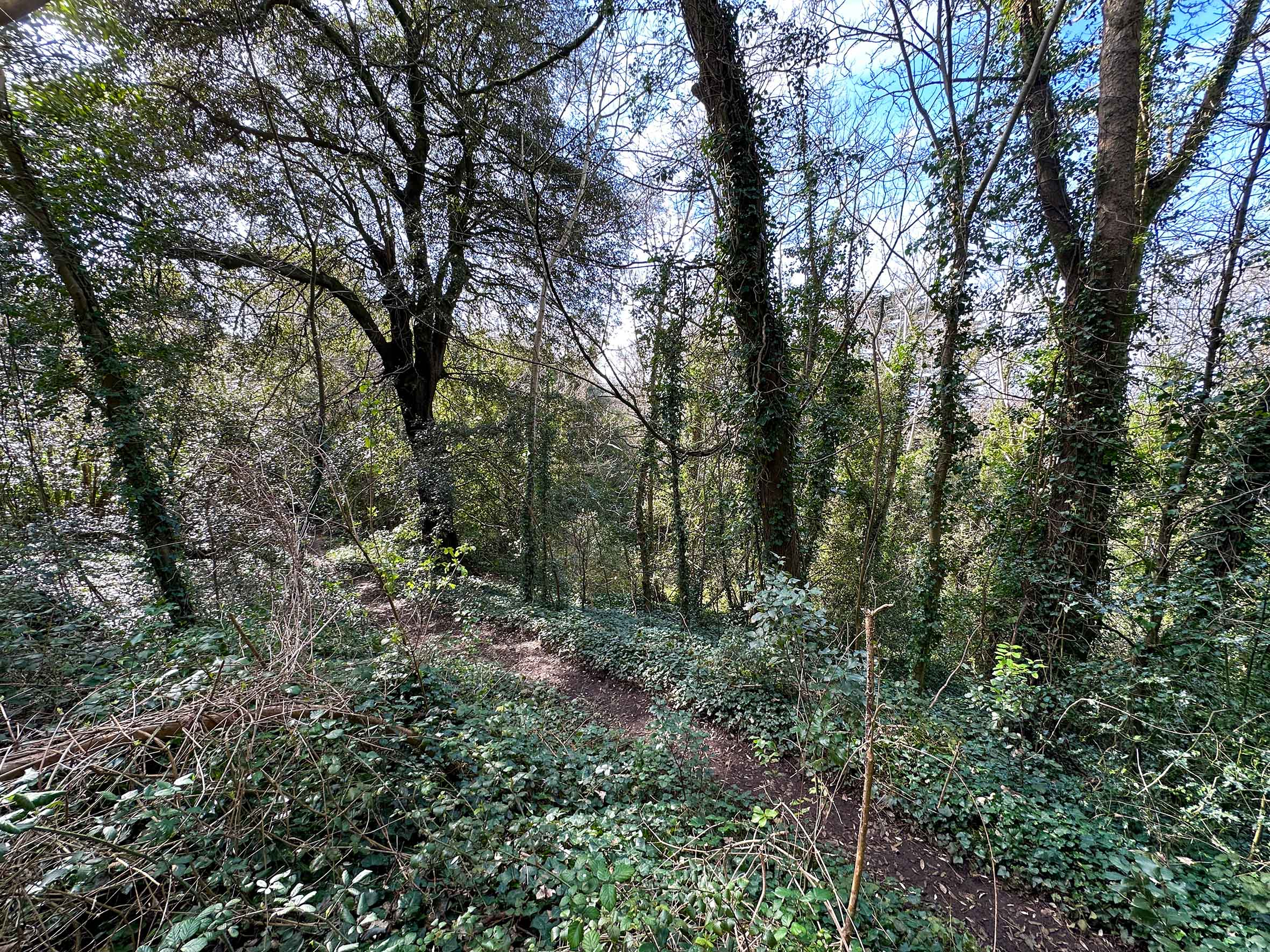
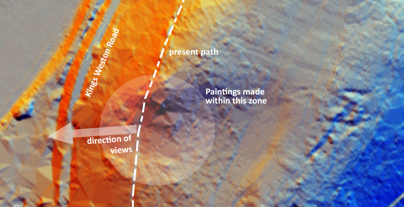
And so, the character of Kingsweston Hill has been permanently changed by these plantations. No longer can views be enjoyed, barely even glimpsed through the dense dark foliage. The exact location once enjoyed by Bristol’s artists remains uncertain, but the clearest impression of where it once was can only be gleaned using Lidar plans. A shallow valley in the side of the ridge now unrecognisable beneath the trees, and associated with it some rougher topography, is likely to represent the celebrated spot. If one looks through the dense canopy of trees that now cloak the slope, you might just glimpse a view out, and again marvel at how high you are suspended above the Severn estuary.  

The approximate location where artists once sat to record the Kingsweston landscape from the hill.
Coloured Lidar plans showing the modern topography with the possible location favoured by artists of the Bristol School

The Keeper’s Cottage recalled

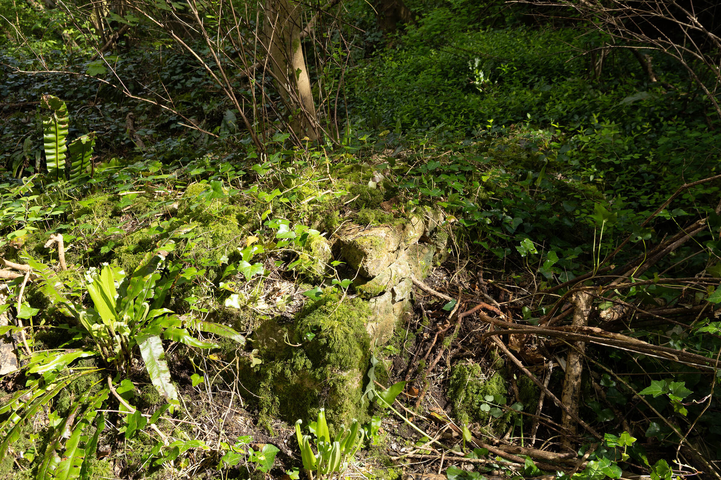
Deep in Penpole Wood lie the half-forgotten remains of a small cottage. Now just a few fragments of wall and some undulations in the forest floor, this was once the Keeper’s home.

As far as we’ve been able to ascertain, the house was built after 1845, so would have been an addition made by the Miles Family who then owned the Kings Weston estate. It may even have been designed by Philip William Skinner Miles, who considered himself something of an amateur architect and is responsible for much minor work around the parkland.

the south-west corner of the cottage survives as a few courses of stone amongst the forest floor.  

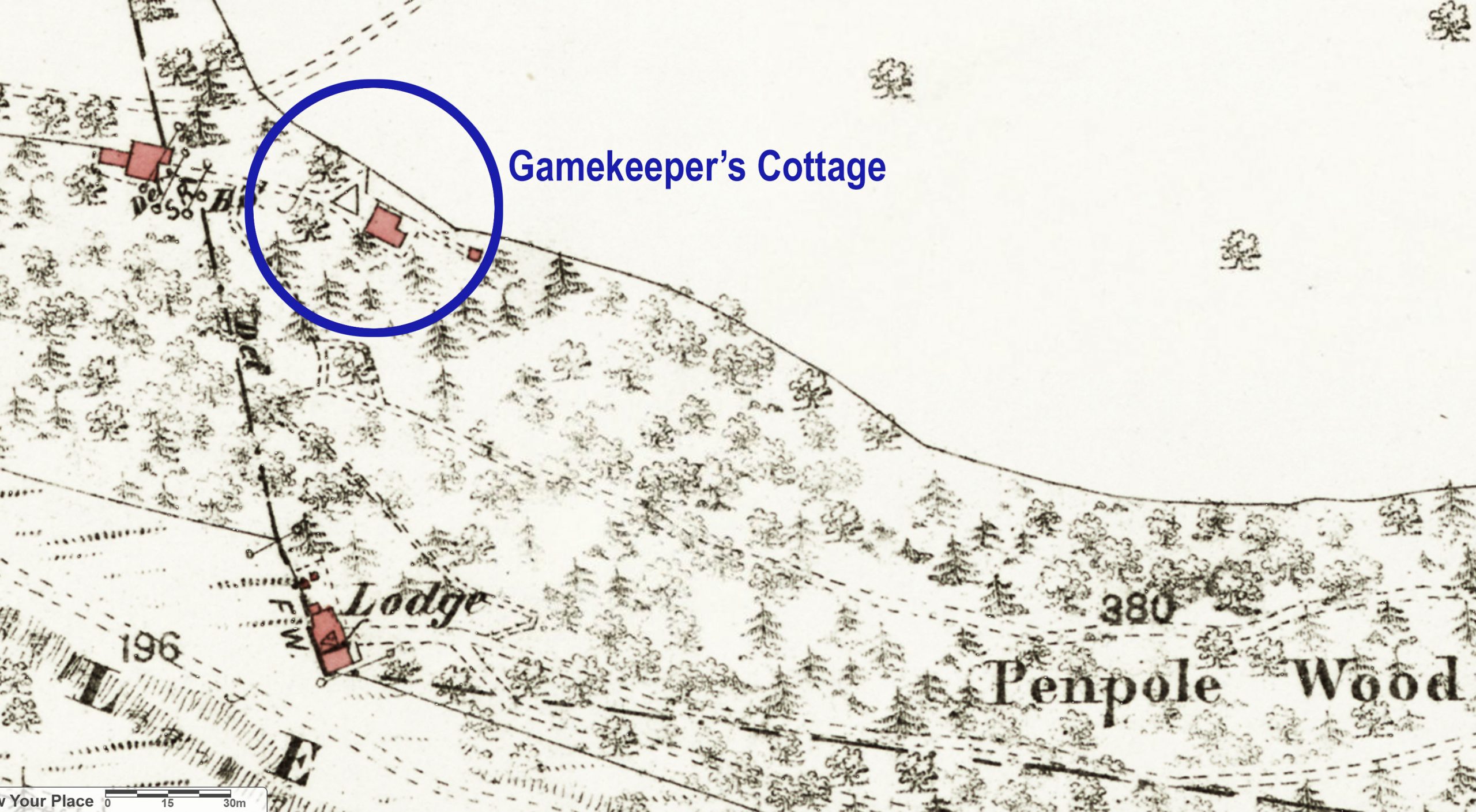
The location at the foot of the Penpole Ridge once enjoyed views northward across open fields of the parkland, but today’s woodland margins have long extended to encompass it. It is assumed that any game shooting would have taken place in these fields with pheasant or other birds bred in the woodland before release. The location of a gamekeeper’s cottage on the boundary between these two areas makes sense in this context.

1884 map with the location of the cottage marked, being sited downhill almost directly north of Penpole Lodge.

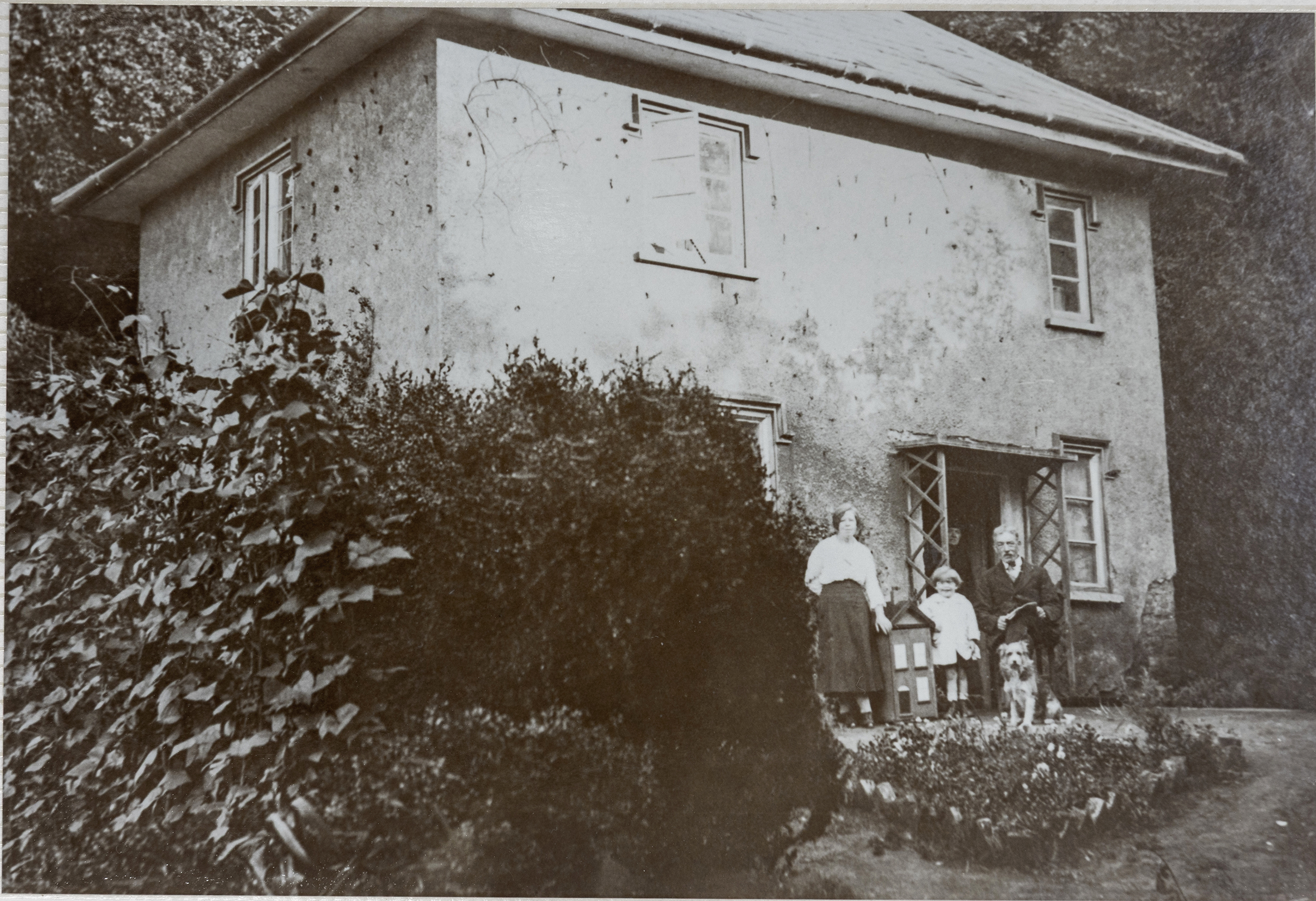
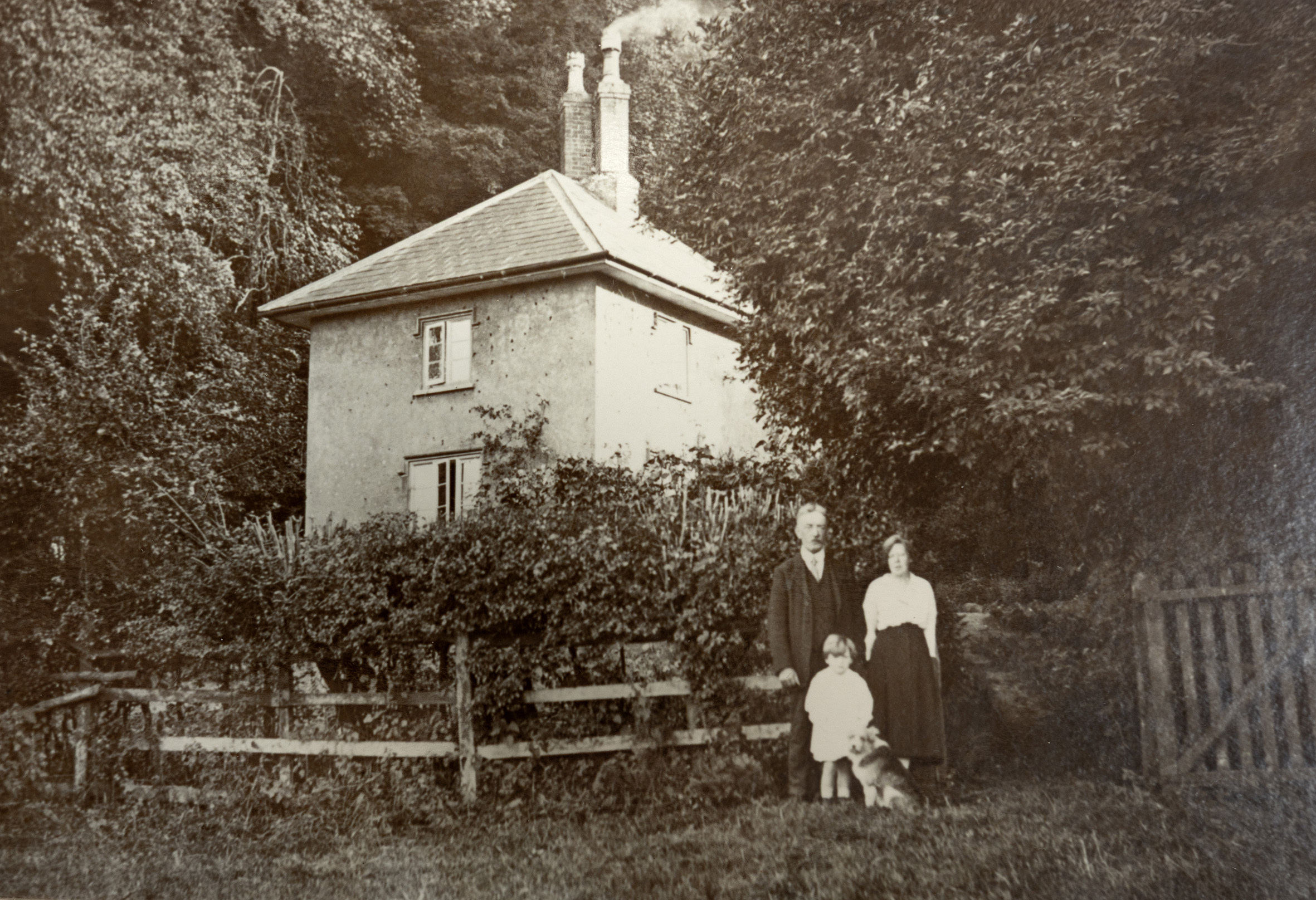
The cottage itself was small, but not without some architectural pretention. From early photos we can see it was of two storeys and its main frontage to the north and west were carefully composed with attractively proportioned casement windows and Tudor-style drip-mouldings carried across each. It had a smart hipped roof, slate-covered, and a pair of tall chimneys, again in the Tudor manner. The whole building was finished in rough-cast render, some which still clings to the walls today.  It must have had quite a picturesque effect when viewed from the fields, sitting with a heavily wooded backdrop, with its a small garden and smoke drifting from its prominent chimneys a sign of domestic life within.

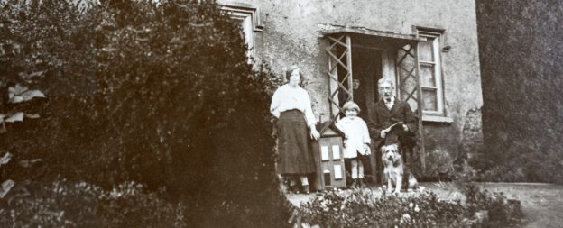
Keeper’s Cottage from the west, with the McEwen family and their dog Gyp. 

These two photographs record the Keepers Cottage in 1921 when it was the home of the McEwen family.  Arthur McEwan was head of the family and is seen with his wife Lilian, and their children Winifred and Arthur John, the latter just glimpsed at the door. The dog was Gyp.

Winifred, later Mrs Pople, remembers that in her childhood she carried buckets of water down the steep path from Penpole Lodge where Mrs Turk kept a tank filled with drinking water. Her mother, only 4’ 11”, nearly fell down the well they used, so the water tank was installed by Squire Miles as a safer, if less convenient, source.  

The Keepers Cottage with the McEwen family outside in 1921
A similar angle today, the cottage now rubble under the forest floor. 

The house remained occupied until WWII. By then the district Scout groups owned the land and the cottage and it was referred to as the Lower Lodge. With the outbreak of the war parts of their property were commandeered by the RAF and the Home Guard. The wardens wrote that “We had viewed with some concern the activities of the Home Guard when the took over the Lower (lodge)” and it suffered badly during this time.

A few tiles were damaged by the explosion of a high explosive bomb nearby, but the house survived only to become the target of  “local roughs”. By 1944 it had suffered badly from “wanton destruction” in the absence of regular use and, when the woods were sold to the Council in 1947, it’s unlikely that it was in habitable condition. It’s believed at this time the Council took the place down to prevent it from becoming the focus of more vandalism.  

the north-west corner of the cottage under the greenery. Part of the original render clings on. 

The walls survive to shin-height though sycamores now fight their way through the old floors. In the future it would be a good job for KWAG to clear around these ruins, measure and record them, and make sure there is some preservation before they are lost for all time.   

Picturing Penpole (again!)

Here’s an attractive new addition to our library of historic images. A watercolour painting captures the scene at Penpole Point in the middle of the 19th Century. This was at the peak of its appeal, when people came from miles around to enjoy the sunset from the Point, and before cheap rail travel rendered such simple pleasures less enduring.
 
The work was painted by Thomas Remnant Charleton (1756-1849) in his final decade, and long after his retirement from military service to Bath. This image joins many others that recorded the natural wonder of Penpole Point at this time, before the views were lost to industry and overgrowth.

Working Party update: Jubilee Clearing cleared!  

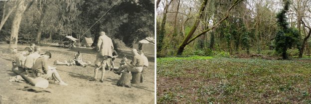
Jubilee Clearing has long been a memorable spot for local people from Shirehampton and Sea Mills. After the death of the last squire, Philip Napier Miles, large parts of Penpole Wood and fields beyond were sold to Bristol District Scouts. Between 1937 and 1947 the clearing became the favoured campsite of the district’s scouts.

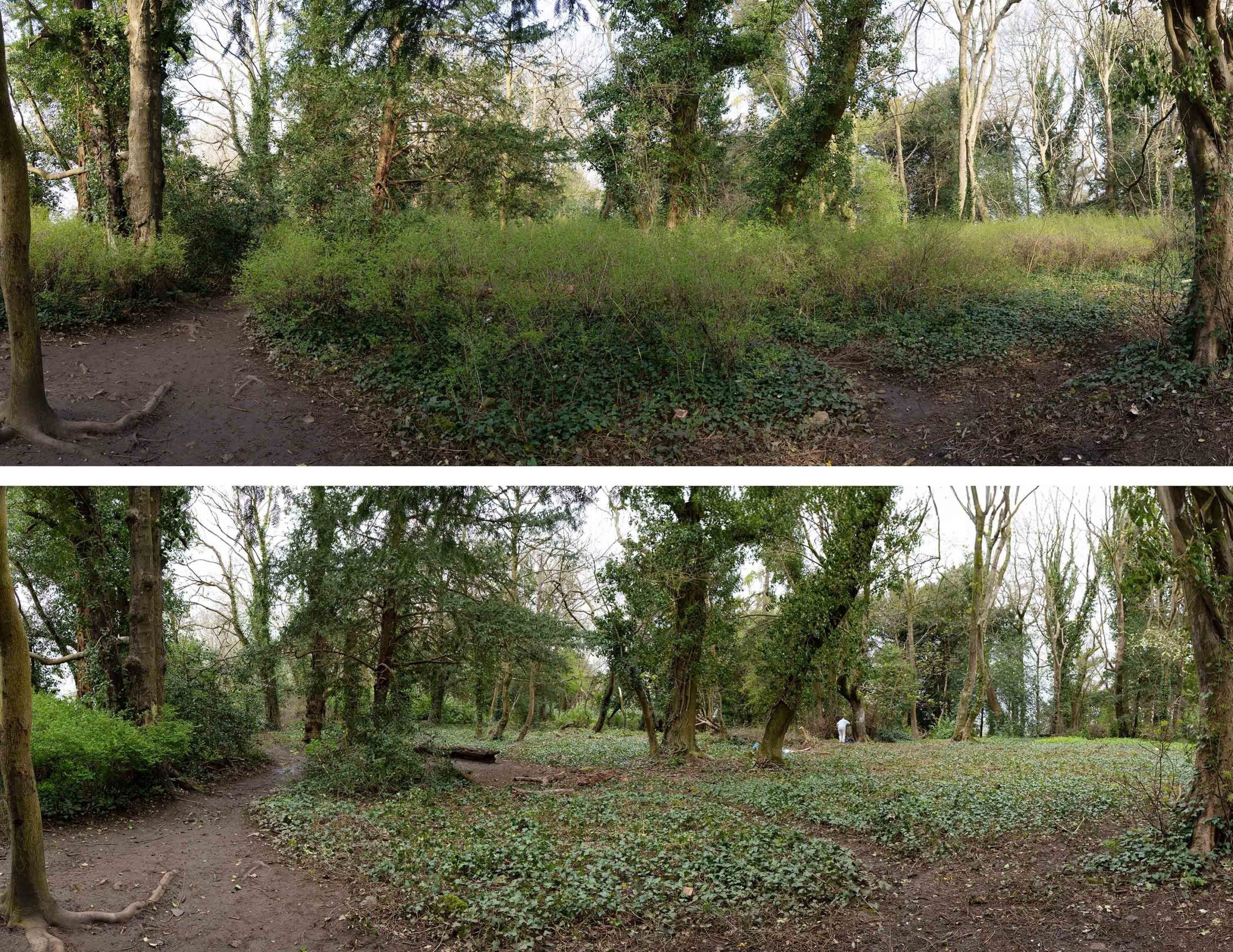
The view on entering the clearing from Penpole Lane on the south edge.

Since the compulsory purchase of the Scout’s land by the Council, little has been done to protect the character of the woodland clearing – until now. The Snowberry that’s invaded the area is not native, and had obscured the open character of the area. With the recommendation of the wildlife and woodland officers, the restoration of the clearing for both heritage and ecology is a project we’ve been keen to engage with.

A good band of volunteers set out to clear the invasive shrub from the area in mid-March. Knowing that bird nesting season was upon us, we were exceptionally careful in approaching the task, though, with the Snowberry yet to leaf, there was little cover to attract birds.

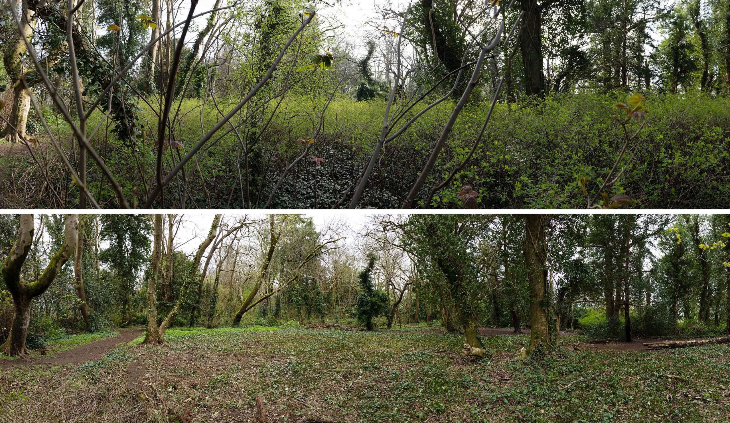
The view east across the historic clearing. Some of the original imported evergreen specimin trees can be seen on the far edge. 

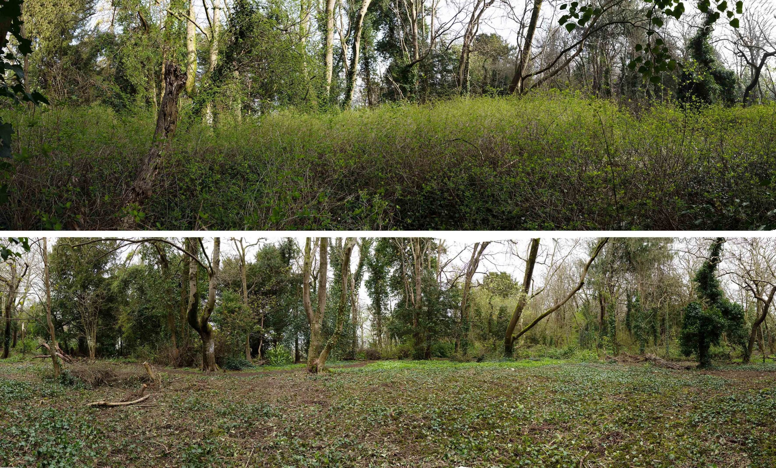
The removal has been surprisingly effective. The transformation now hits you immediately you enter the area, views through and across it restoring the sense of openness. We recognise that the snowberry is a tenacious plant, and will need repeated cutting, but this is a major step in restoring the character. The ground-cover beneath it is largely moss or ivy, the only species able to grow below the dense coverage. This month we hope to try and improve the biodiversity further by preparing the way for seeding of suitable shade-loving grasses and wildflowers.

Looking across Jubilee Clearing from the south, before and after work. 

Dirty discovery in Bristol Archives

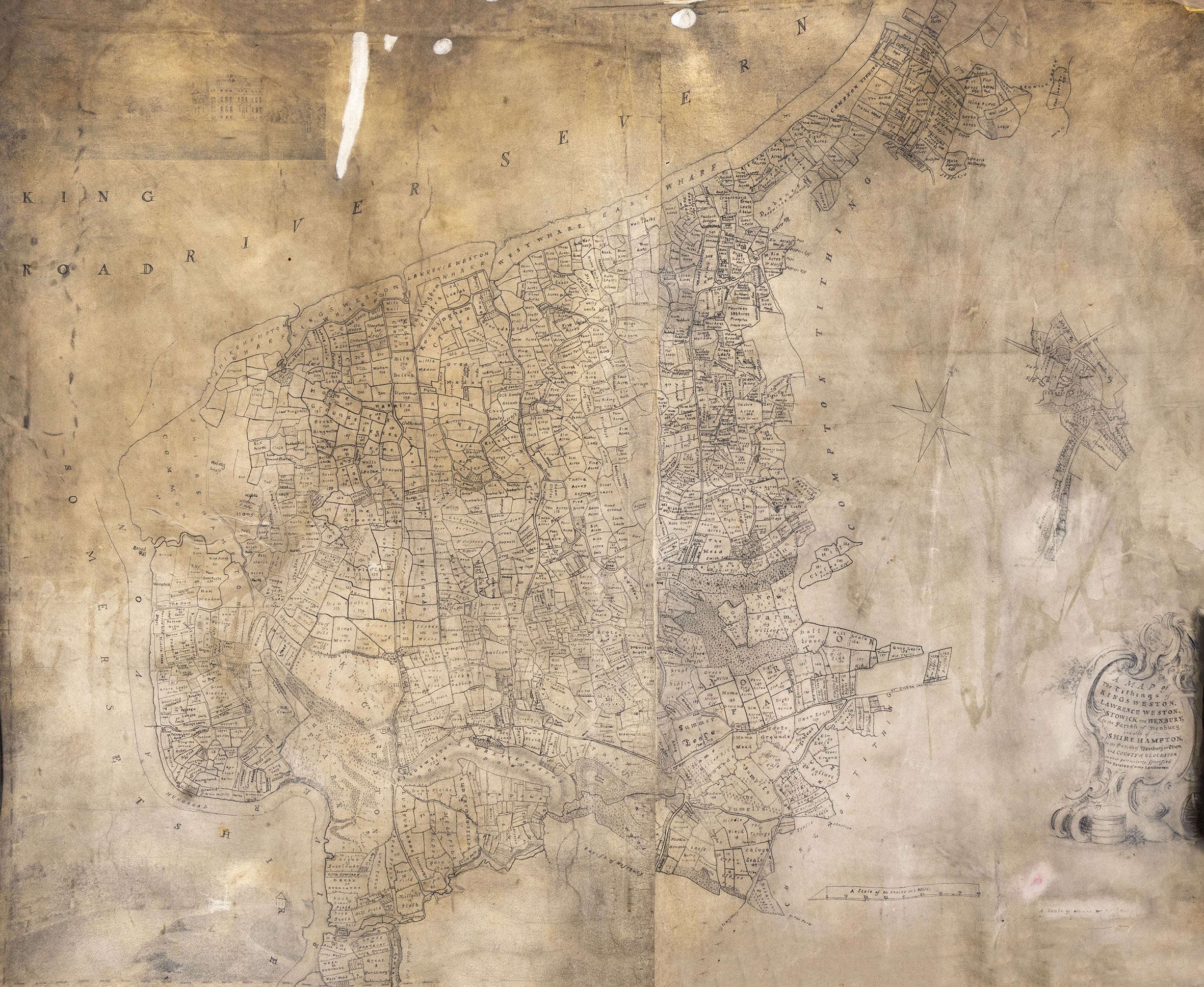
It was a bit of a surprise to find that well-rummaged archives can still turn up some historic Kings Weston gems. A recent return to Bristol Archives turned up, by chance, an interesting new estate plan. Perhaps we’d seen it before and thought it was a copy of a better known one, or perhaps we’d never thought it would be of any interest, but when it was delivered to the reading room by the archivists it was great interest.

The whole of the large velum plan showing the estates of the Southwell family around Kings Weston house.
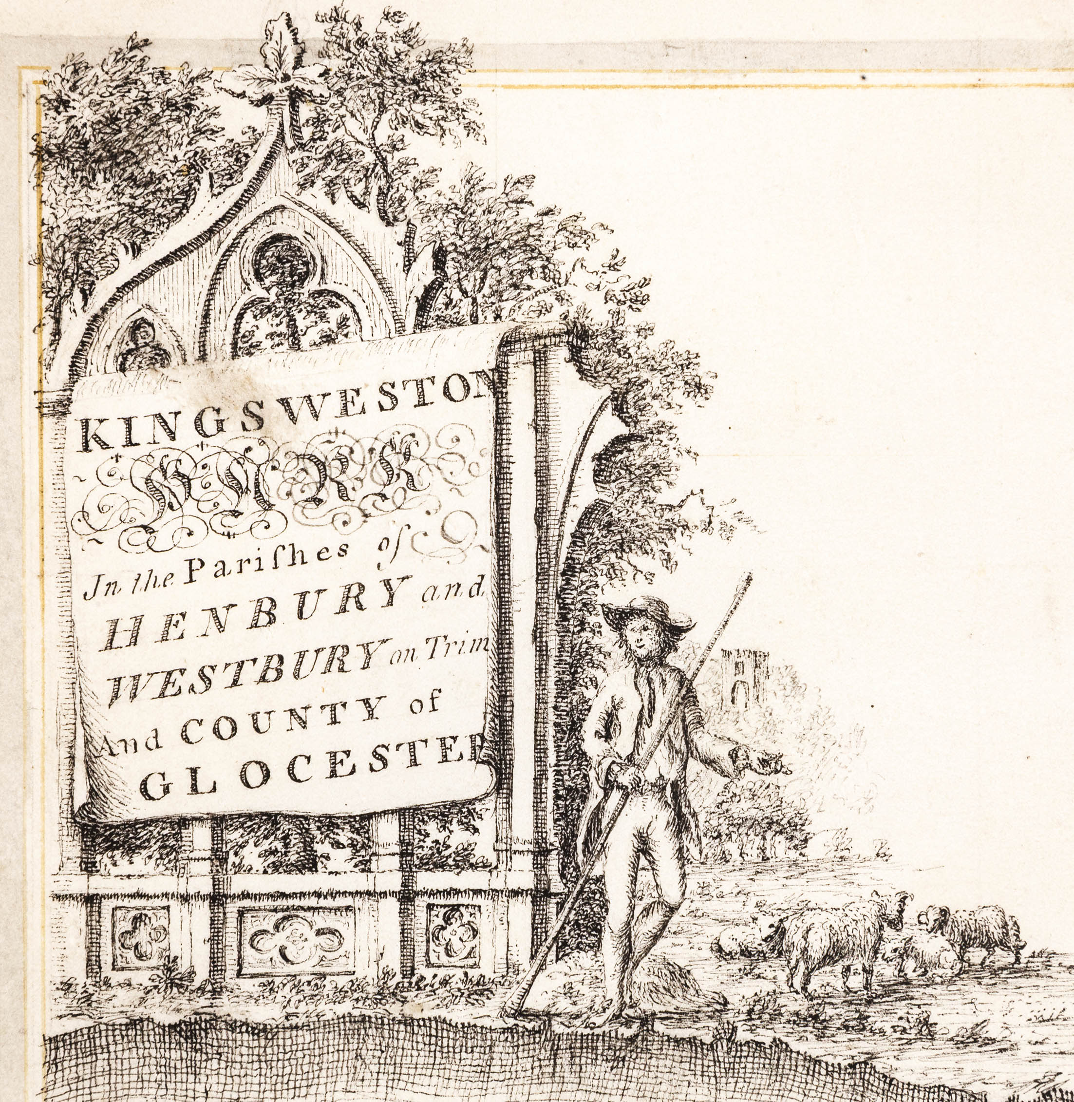
One of the ornamental title blocks added by Isaac Taylor to his earlier bound estate survey. 

We’ve regularly used snippets and details of another estate plan, drawn in 1772 by a surveyor called Isaac Taylor, to illustrate some of our stories, and you’ll find it as a base layer on the Know Your Place website. On the website it’s been carefully pieced together from the many double-page spreads from the book in which they’re bound. Sadly, this means that some of the picturesque details around the map are missed off.
 
The new estate map is also drawn by Tailor, but is instead a single rolled large-format map of the entirety of the Kings Weston estate. It is dated 1773, the date after the bound series of maps and no doubt commissioned by the Southwell Family as an alternative way of keeping track of their estates. Unlike the 1772 survey, this later version is at a larger scale. It’s also different in showing clear signs of having been updated and altered in a different hand. These changes appear to reflect changes in ownership of parcels of land and redraw detail that has become feint or worn through use.
 

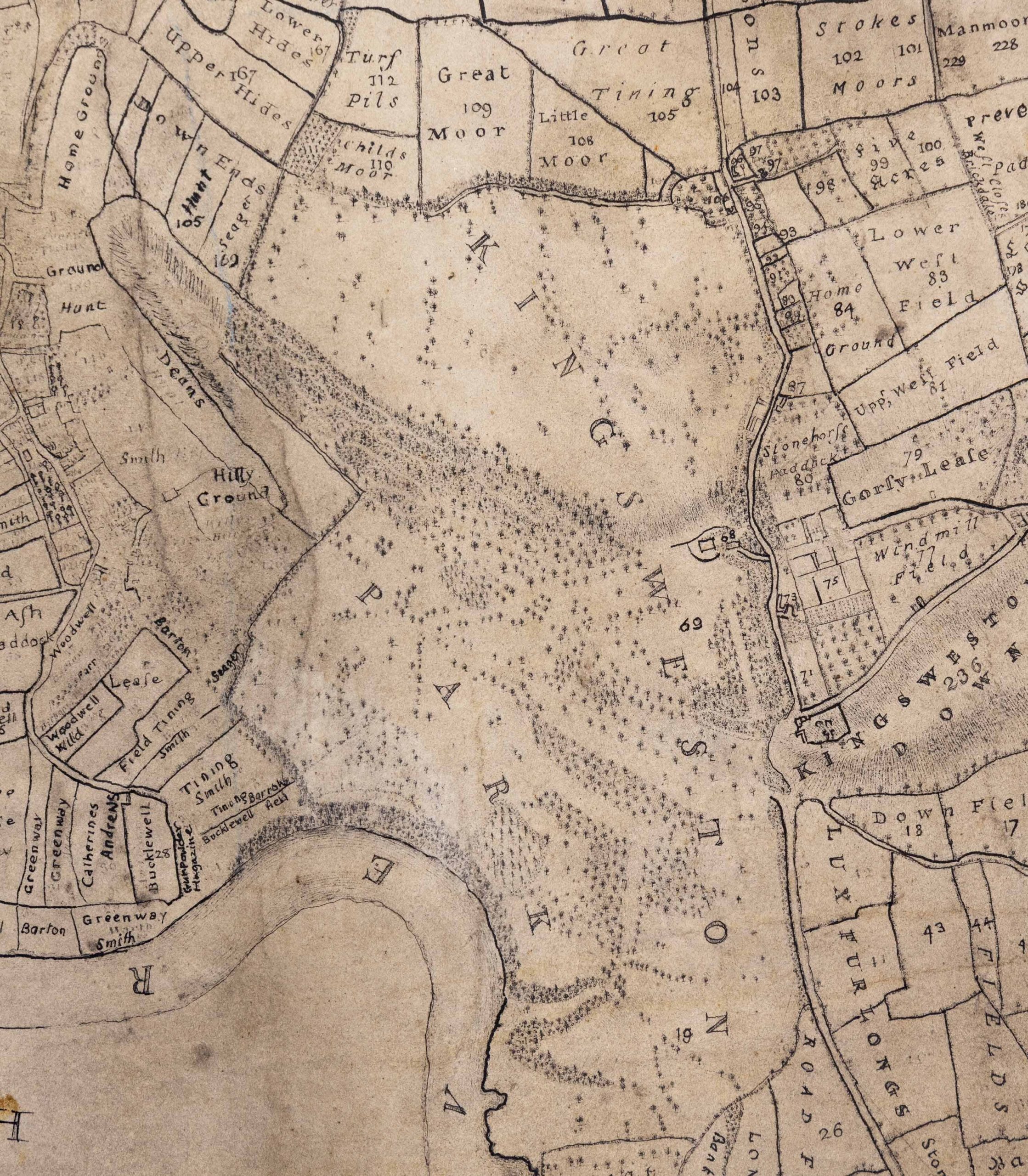
Detail of the new estate plan showing the park around the house. 


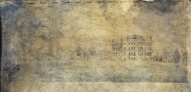
The 1773 survey is a vast and unwieldy document. It certainly shows the enormous scale of the estate in a more complete way than the individual portions in the bound volume, although without quite such the fitness of drawing. The cartouche carrying the details of the map is less elaborate, but there’s something else almost hidden under the dirt that’s accumulated on the velum over the centuries – drawings!
 
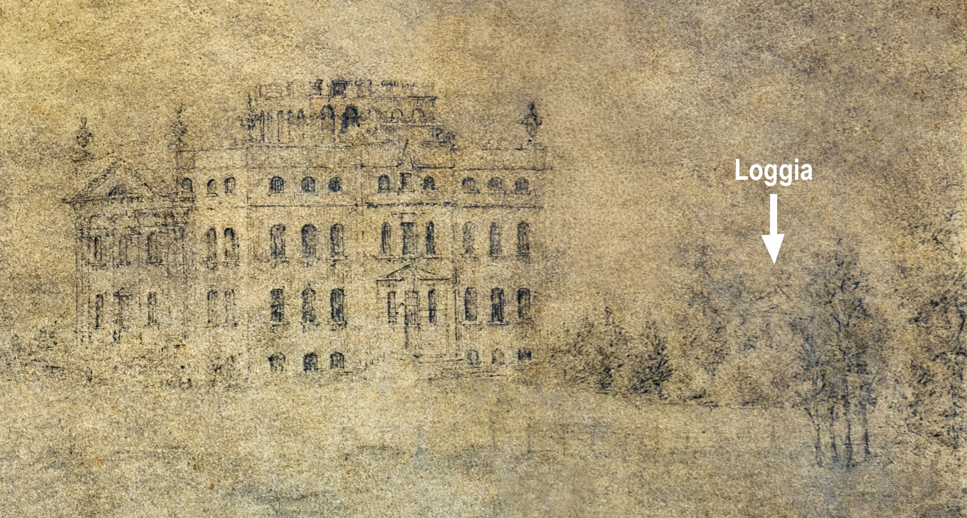
There are two, one in each corner on the left hand side. Sadly, they are very dirty and difficult to make out. The lower one is a scene on the Avon at Lamplighters, but very little detail is discernible to be of much interest. The other is more interesting to the Kings Weston story, being a rare early depiction of the house itself from the south.
The drawing is better preserved, but is still badly stained and dirty. The house is recognisable on the right hand side, with the pediment of the Loggia just visible over the top of the shrubbery. Also discernible is the avenue of lime trees approaching from the left. The planting differs little from today, though trees and shrubs have definitely matured from the illustrated state.
 
The images presented here have been enhanced to try and bring out some of the detail.
Detail of the new drawing showing the top of the Loggia above the tree line. Note also the difference on the design of the top of the garden front of the house. 

Park Lodge in history

Before now, we’ve looked at the history of most of the lodge houses that guarded the perimeter of Kings Weston estate and the architects involved in them. This has included Penpole Lodge by Vanbrugh, Shirehampton Lodge by Robert Mylne, Wood Lodge, probably by Thomas Wright, and Henbury Lodge by Thomas Hopper; but the history of Park Lodge is less clear.

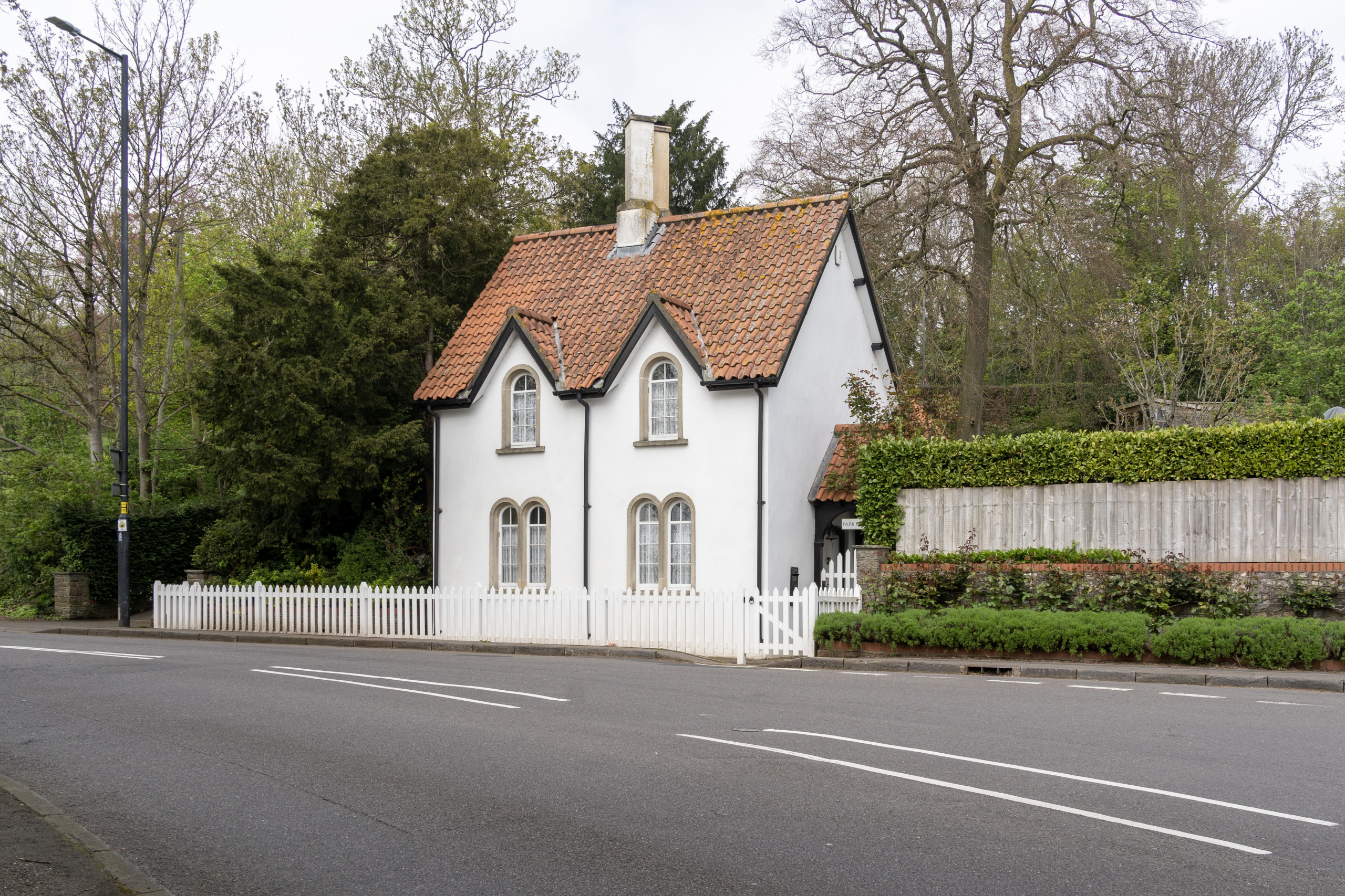
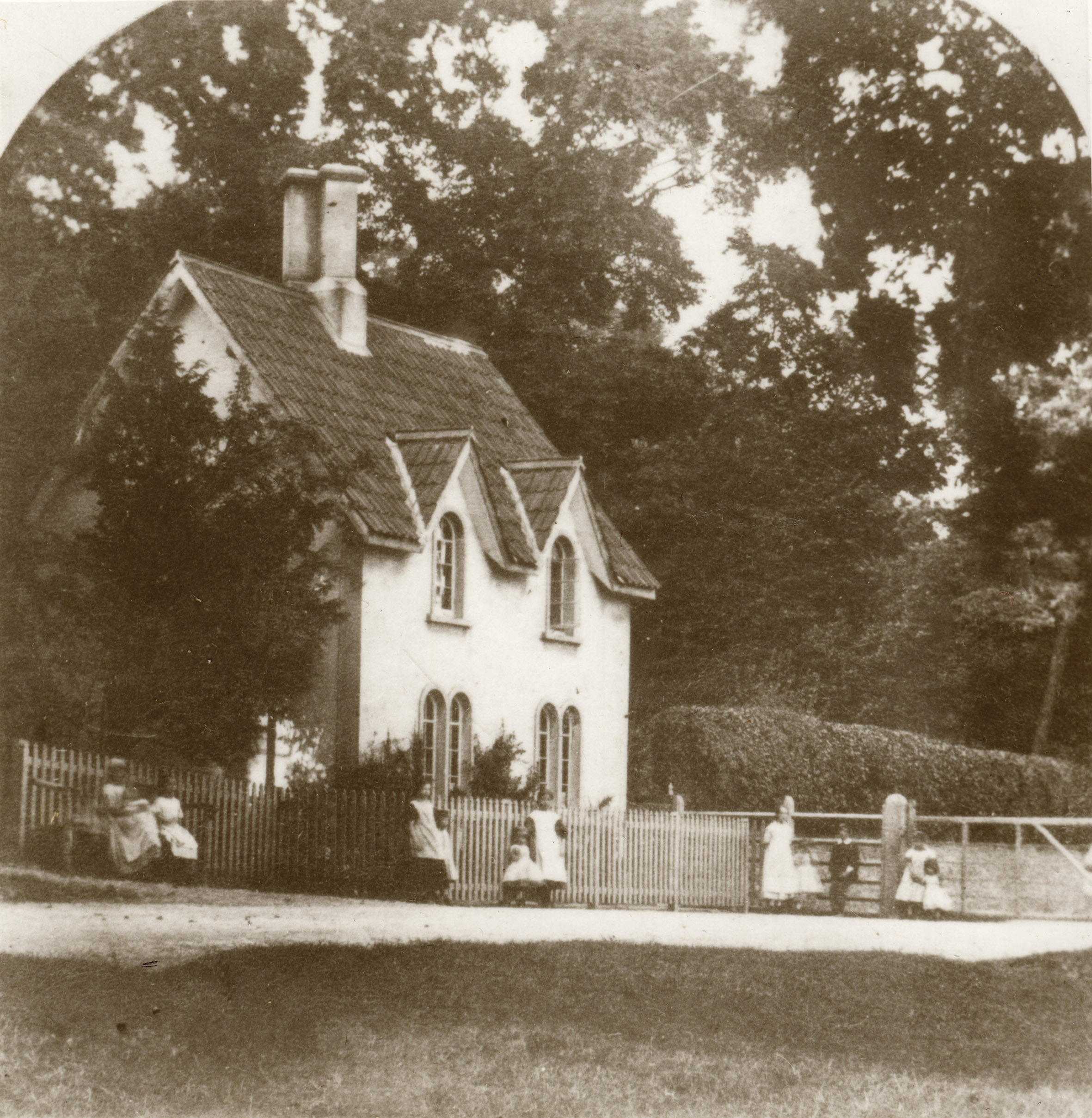
Park Lodge much as it appears today

Park Lodge is today a Grade II Listed building and will be familiar to thousand who pass it daily on the corner of Shirehampton Road and Kingsweston Road. Sat behind a white picket fence, the building is a pleasant but not extravagant cottage. It fits broadly into the  Cottage orné style of buildings designed for picturesque effect. Its steep pitched pantile roofs and dormers give it an alert posture and its arch-headed window add a little light ornamental appearance. A a pair of tall conjoined chimney stacks punctuate the centre point of the roof profile.
 
The lodges weren’t toll houses, but demarked the boundary of the landscaped parkland and controlled access through the estate after dark. Each of the roadside lodges were equipped with gates that could be closed at dusk, despite it being the public highway. In this way the Southwell and Miles family could assert the impression of authority over the landscape despite having to allow traffic to travel through their lands to Shirehampton, Lawrence Weston, and Henbury.

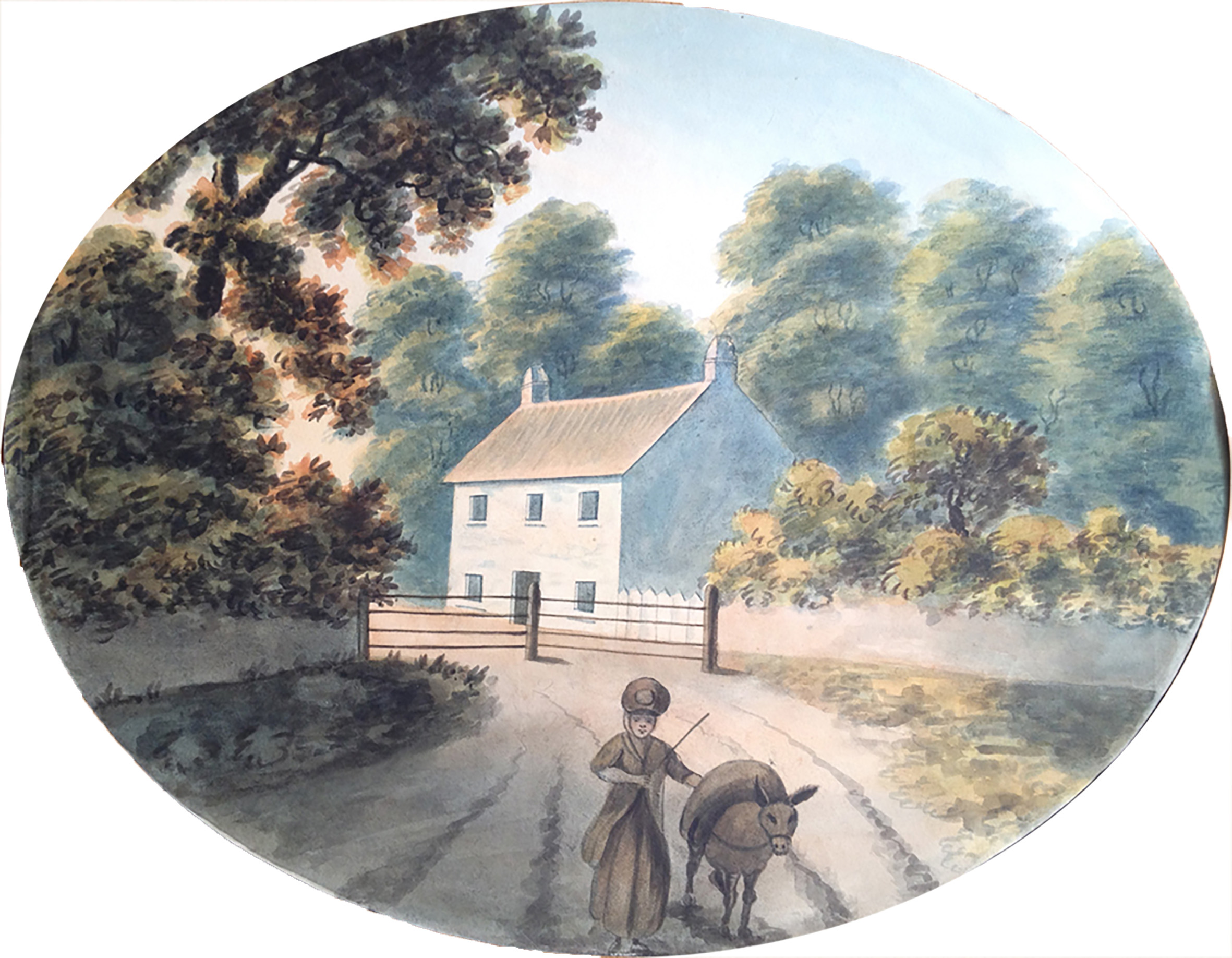
Park Lodge in the 1820s from the east. From a painting now within the collections of Neath Antiquarian Society. 

However picturesque Park Lodge might be, it’s far from being as architecturally noteworthy as its partner lodges and its history is less well documented. It appears first on the 1772 estate plan by Isaac Taylor, complete with its wooden gates, but this was a very different building to the one we see today.
 
We’re fortunate that two illustrations exist to show the earlier building, one even less architecturally satisfying than the present one. The first is an undated watercolour of around 1820. The scene looks west from Shirehampton Road at its junction with Kings Weston Road, roughly where the bus stop is today.
 
A small cottage with a simple symmetrical frontage faces onto the road with a central door and five identical square windows. A simple tiled pitched roof is anchored at either gable by a squat little chimney. In front of it are the gates, shown on the eastern side of the building. The bucolic character of the scene is set off by a woman driving her loaded donkey in the direction of the artist. The lodge’s backdrop is dominated by mature trees, perhaps the verge plantations shown on the 1772 plan. To its right the estate wall encloses a lower shrubbery, perhaps the cottage gardens.

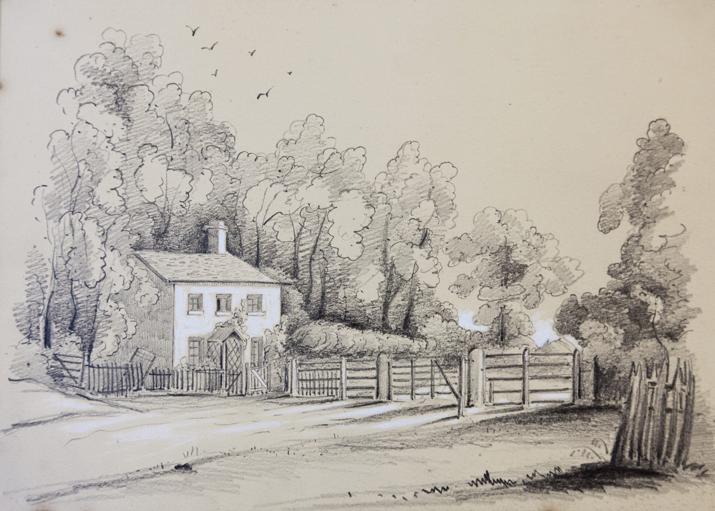
The view looking east from the edge of Shirehampton Park in 1846. Shirehampton Road exits the park from the left and through the gates across the road. Bristol Archives Ref: 13424/5

The general accuracy of the image is confirmed by another painting around twenty years later, helpfully dated 1846. It’s from an artist’s sketchbook belonging to Edward Emra Earle, of Westbury-on-Trym and shows the opposing view, from the west.  The small ground floor windows have perhaps been enlarged, and a simple porch with trellis added around the front door. The park gates are shown in more detail, suggesting how imposing they might have been to anyone unaware they were permitted passage through them.
 
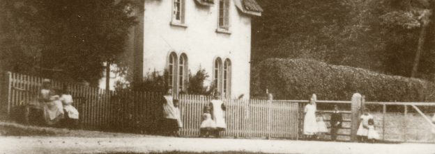
Clearly, this little building’s no longer with us having taken on its present appearance later in the Victorian era. By the 1870s, when it is first recorded photographically, it had been transformed, but did any of the earlier building survive? The ‘new’ lodge looks very different, but it’s footprint must surely be similar to the earlier building. Was it simply altered?

Park Lodge in about the 1870s from a very similar perspective to the 1846 sketch.
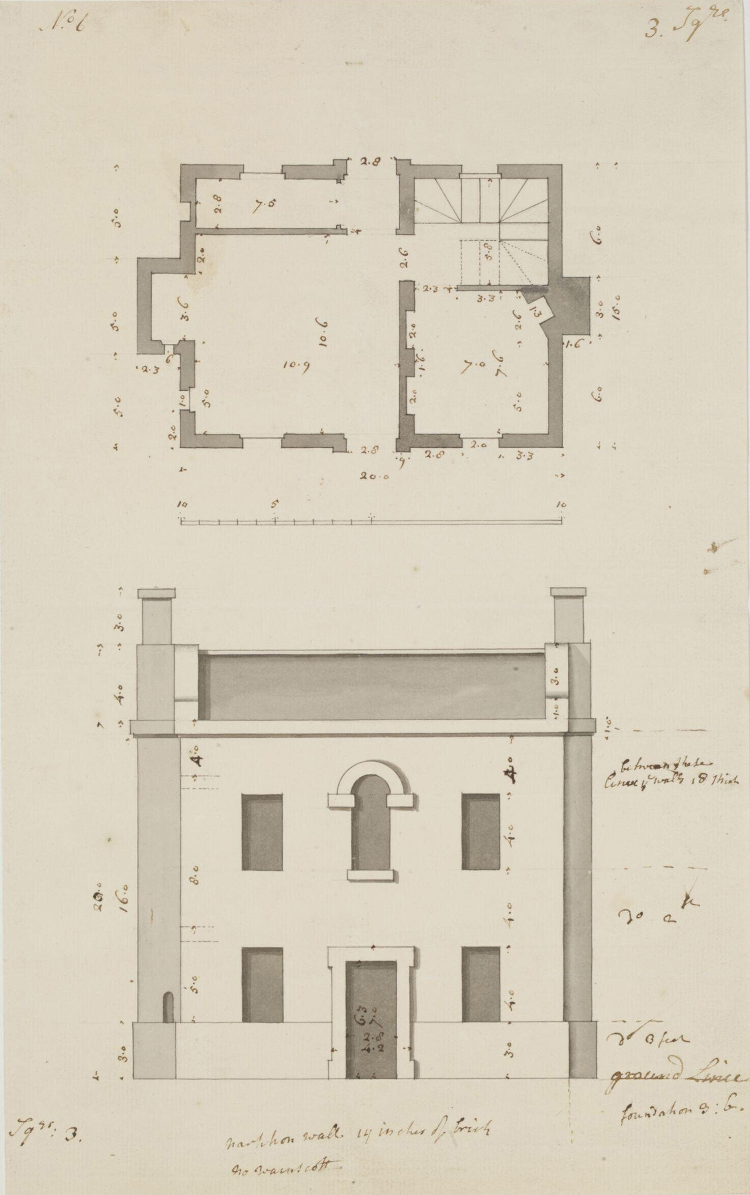
One of many small houses drawn by Sr John Vanbrugh, this one held by the V&A.

If it was a reconfiguration of the old building, the interior had been heavily changed, with chimneys being taken from the end gables and centred together in the middle of the roof. The central front door has also gone, replaced on the end of the building.
 
A date for these changes is uncertain, but drawings held in Bristol Archives show similar reconfiguration was made to Henbury Lodge in 1863. These alterations were penned by William Skinner Miles, then-owner of Kings Weston; this would explain why the architectural effect of Park Lodge was a more ammeter production than might be expected.
 
The question remains, why was the most prominent of the park lodges not treated in a more architectural manner? Arriving from Bristol, the main approach to the front of Kings Weston house would have been through this gate and down the drive from The Circle. The lodge and gates would have been visually prominent for anyone approaching Kingsweston Hill from the south.
 
One theory is that it had been something more when first built, only to have been reduced to an visually inauspicious cottage by the early 19th Century. Sir John Vanbrugh’s drawings are littered with sketches for small unpretentious cottages of similar scale and symmetry; could Park Lodge have begun life as one of these?