
Tag Archives: historic

Encroaching problems

As we’ve already seen from our working party progress report, encroachment of undergrowth is a major issue for the Registered Historic Landscape. Looking at Shirehampton Park as a case study reveals the scale of the issue.
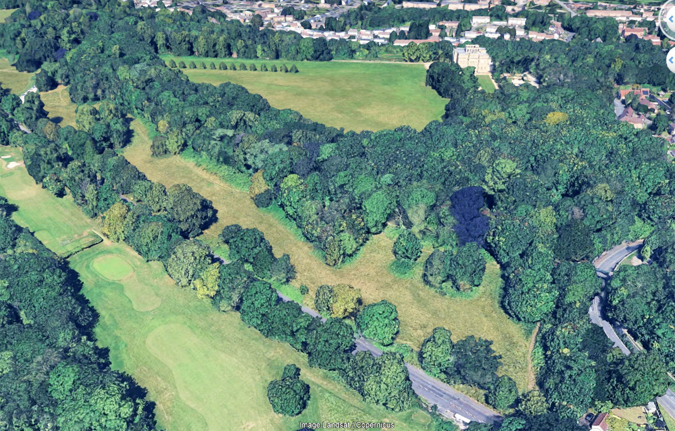
The vibrant green beneath the trees contrasts with the yellower grass. This indicates the extent of the encroachment as it appeared last year.

Using both our own record photos across the years, and aerial photos of the area from the last twenty years, the gradual loss of the meadowland can be starkly illustrated, but why does it matter?

As part of the Bioblitz event held at Kings Weston way back in 2012, the richness and diversity of the meadowland was a noted finding. It was described as some of the most important calcareous grasslands in the region, unique in Bristol. As encroachment bites, this exceptional habitat is gradually being replaced by less diverse habitat that already has wide distribution across the estate.
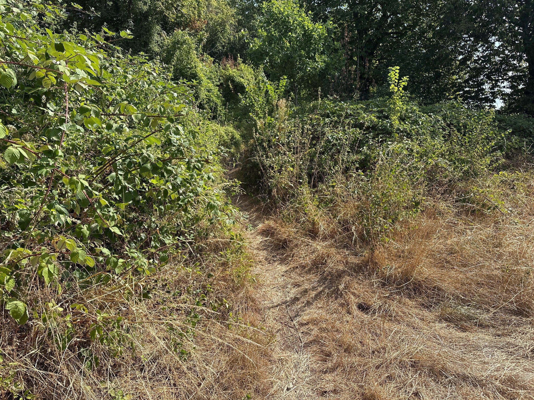
Halfway along the meadow the Public Right of  Way is becoming near impassable.

Encroachment occurs incrementally. The land has been managed by the Council with an annual hay-cut for the last twenty years or so. This is now contracted out and has led to poor implementation and little obvious oversight. Every year another few feet around the perimeter of the area is missed. Spaces between groves of trees are left un-cut. Year after year maintaining the meadowland is getting worse and worse.

It can be difficult to appreciate this incremental change. With only one cut a year few people will recall what its condition had been twelve months ago. It’s a slow decay of both the ecological value and the historic landscape.
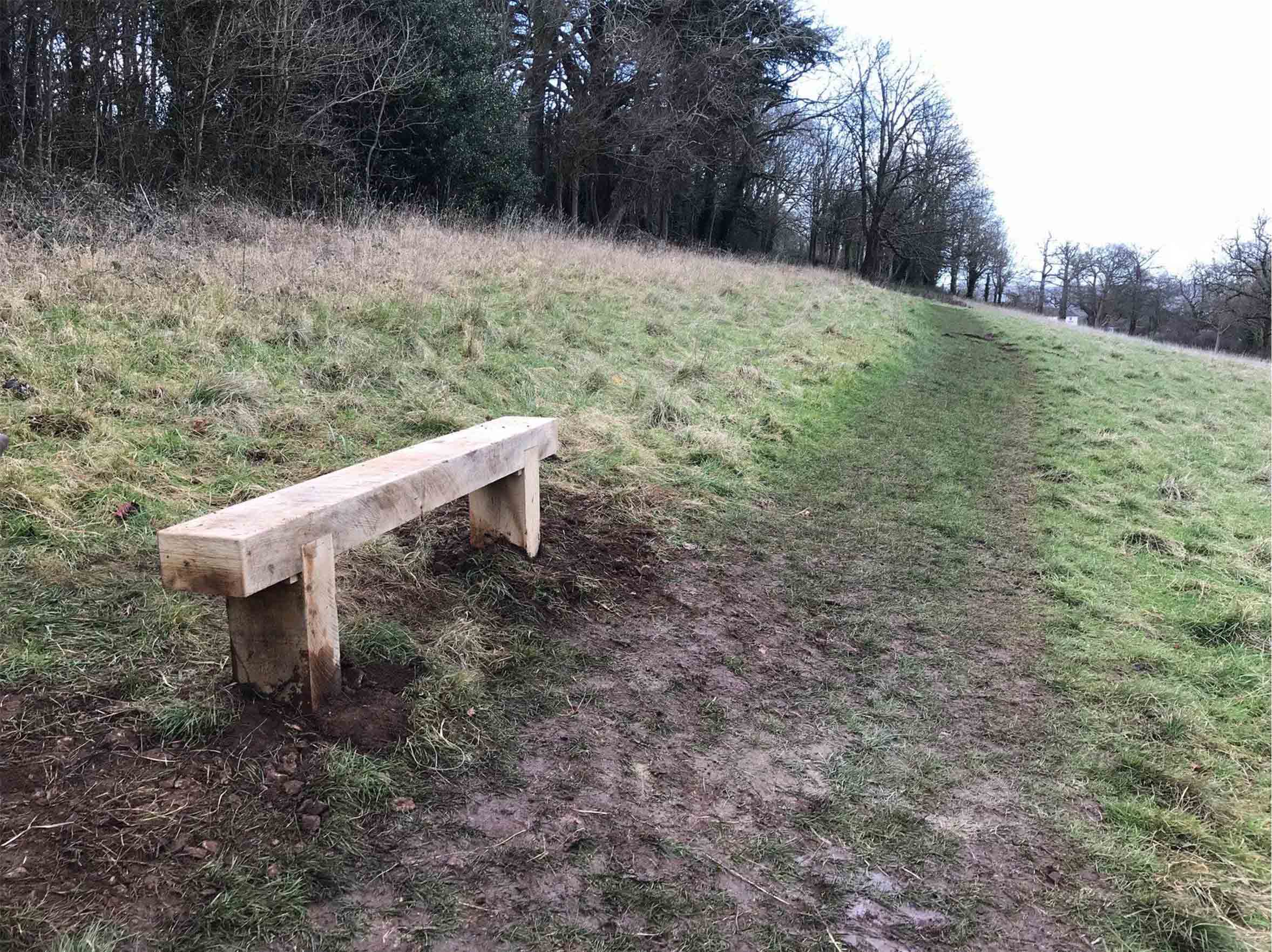
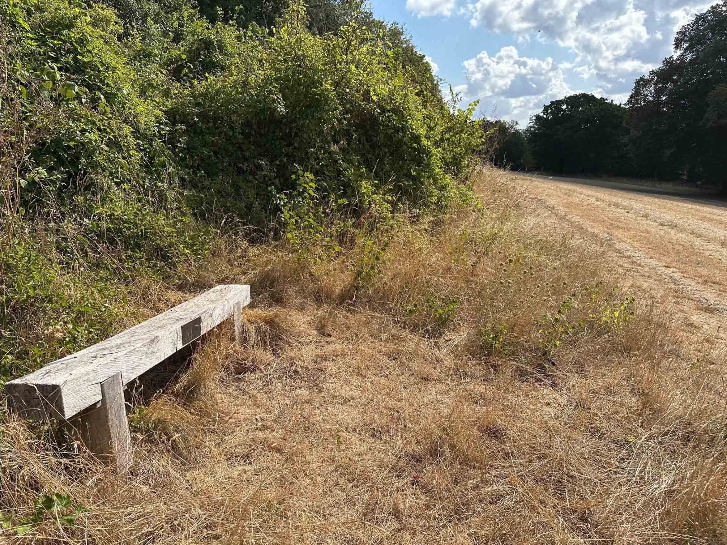
The same scene in 2018 and today, just 8 years later. A mountain of scrub and brambles now occupies the 9m from the treeline and the line of the path has been pushed around 3m downhill.

This year has seen a massive spike in brambles (if you’ll excuse the pun), but elm regrowth and other species are also part of the mix. Whilst tackling brambles is something KWAG has done in the past, we don’t have the resources to attack the current engulfment, nor does it fall into our remit to cover regular maintenance issues for which there should already be management in place.
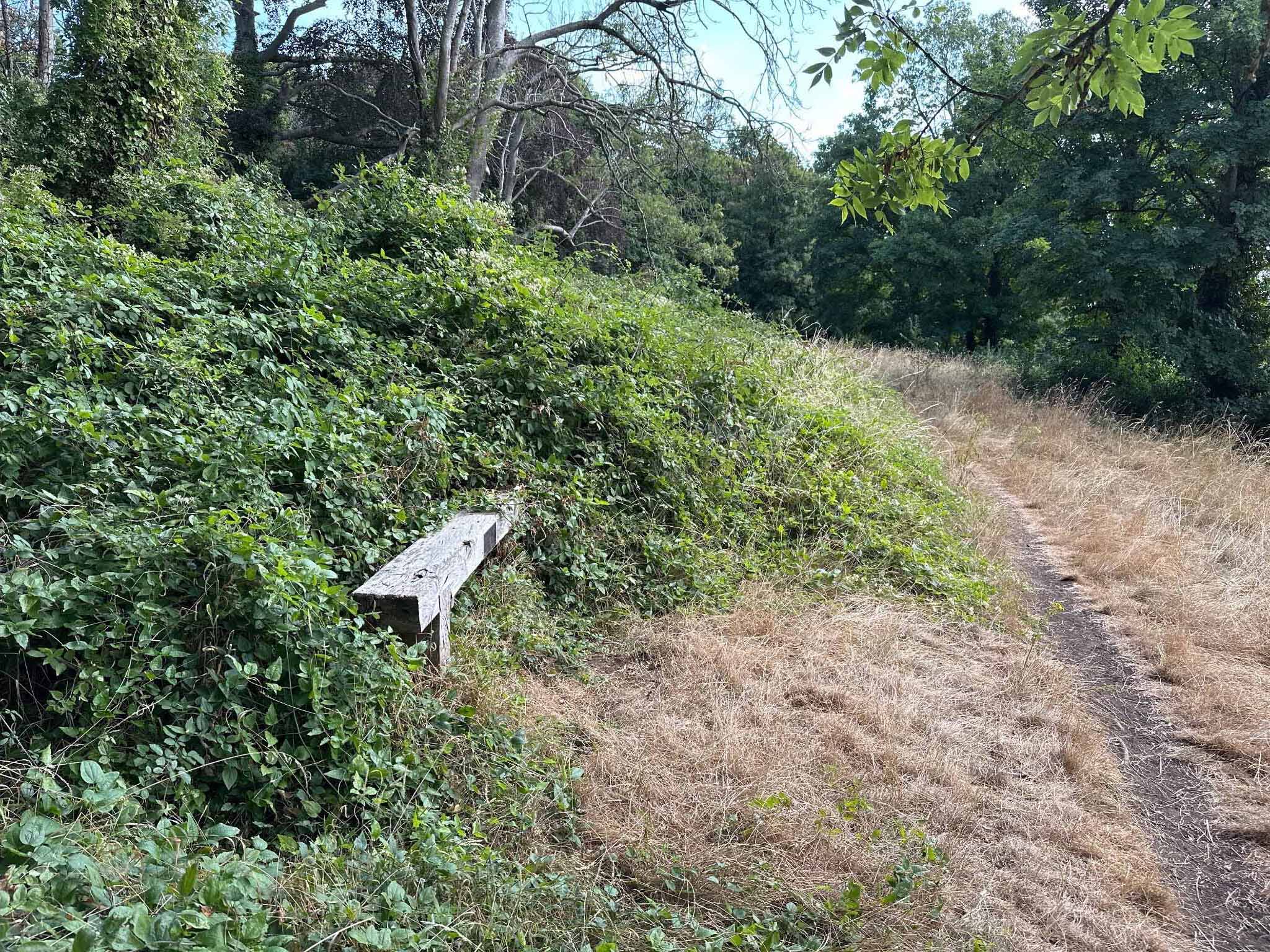
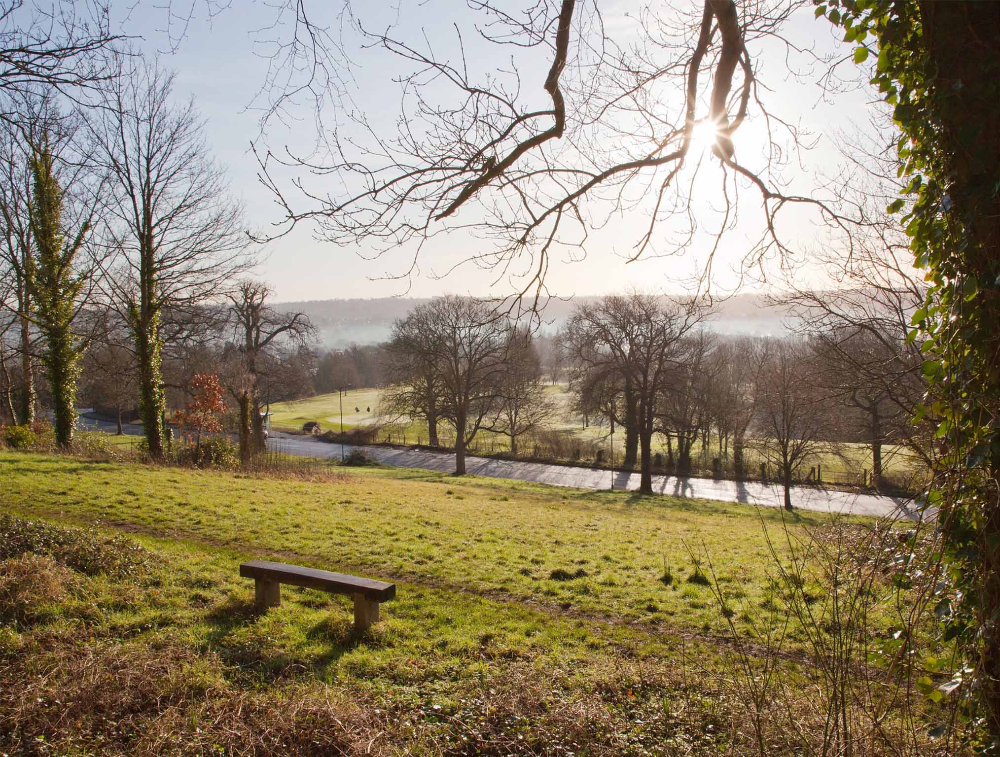
In 2017, from the Grade II Listed Viewing Terrace, the recently installed bench was conveniently positioned beside the path. Today half the bench has been engulfed in brambles and the Public Right of Way has been pushed off-course.

Two benches we installed in 2017 and 2018 are useful markers against which encroachment can be measured. Both were set up immediately adjacent to the Public Right of Way that runs from the Iron Bridge down the ridge to Shirehampton Road car park. Within just eight years, both have gone from being in open meadowland to presently being engulfed by brambles. The footpath that can clearly be seen in front of each bench can be seen pushed downhill by the onslaught of scrub.

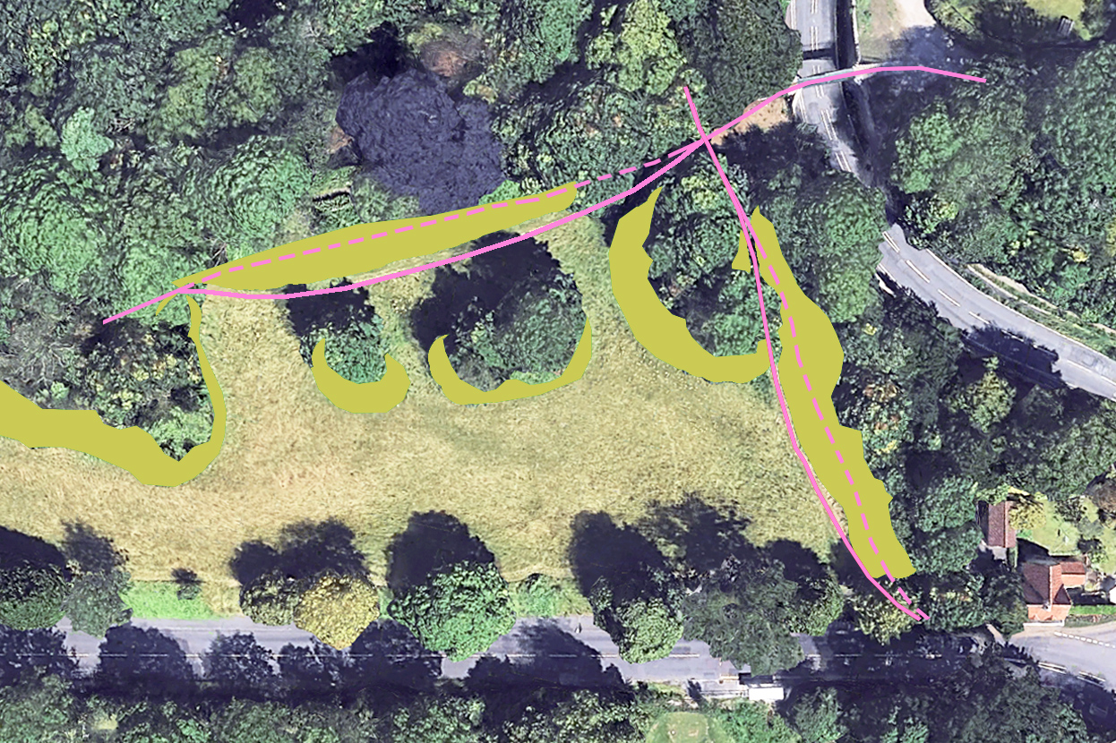
Helpfully, Google Earth has a library of aerial views taken periodically since it was established. These help chart the gradual advance of scrub. Taking past surveys from 2005 and 2006 and comparing them with the most recent aerial survey in 2025, the extent of meadowland loss. In most areas there has been a ribbon of between five and six metres lost to scrub along the top edges of the slope and around outcrops of trees, but in one location undergrowth has come forward more than 20m.
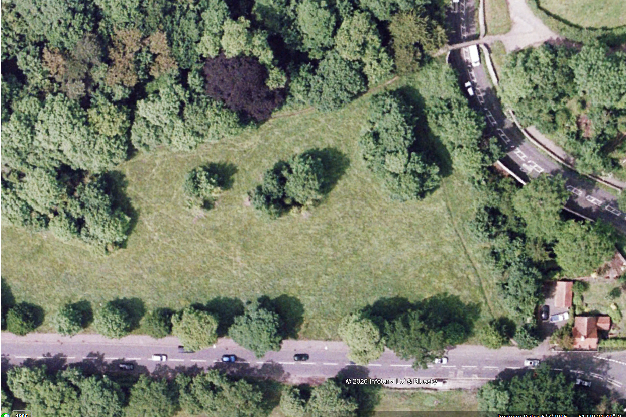
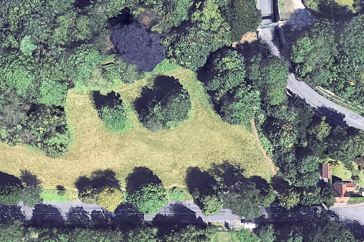
2005: Aerial view looking down on the eastern end of the meadow. Shirehampton Road runs along the bottom of the view and the Iron Bridge is in the top-right corner.
2025: The same scene last year. Scrub and bramble appear as vibrant green areas beneath the trees.
Analysis diagram illustrating the area of encroachment between the two dates. The pink lines show how the Public Rights of Way have been distorted from their 2005 course (dashed) to where they are today (solid line)

We calculate  around 7000 square metres of meadow, or 1.7 acres has been lost from Shirehampton Park alone in the last two decades, most within the last ten years. But the issue is more widespread, with the lawn in front of Kingsweston House, the field below it, Penpole Point, Kingsweston Hill, Napier Miles Fields, the Tump, and event the area in front of The Echo all having their historic character eroded. 

Since KWAG was founded in 2011, we’ve been asking repeatedly for the issues of encroachment to be addressed beyond the basic annual hay cut. Occasionally the ancient Lime Avenue will be dealt with, or parts of the field below the house, perhaps the ridges around Shirehampton Road Car Park, but work is reactive, unpredictable, and to no obvious plan. We remain deeply, and increasingly concerned over the declining condition of the estate in this respect.
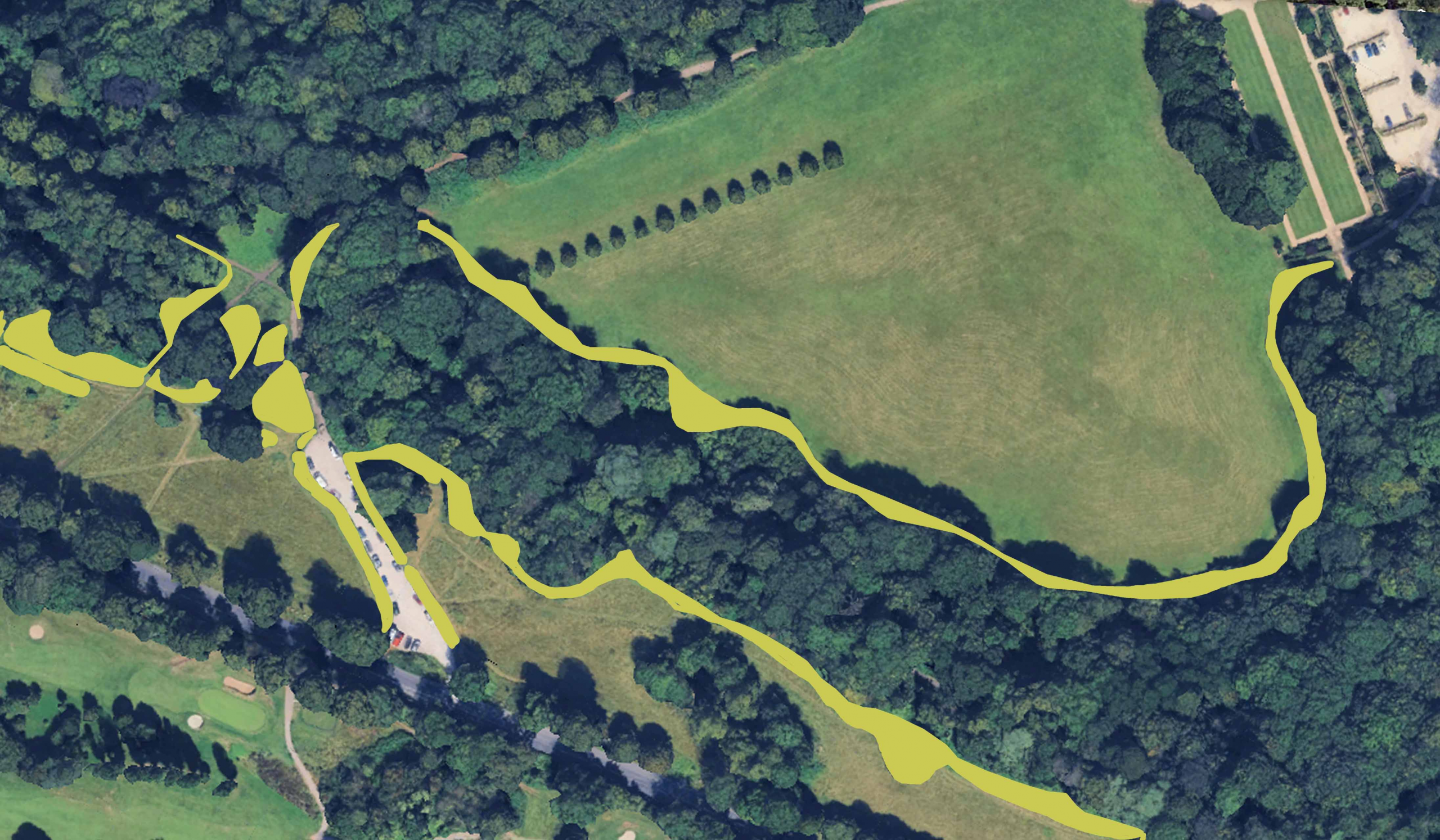
Similar assessment of encroachment around The Circle and along Shirehampton Park edge between 2006 and 2025

An Edwardian Slideshow

A fascinating series of slides has recently come on the market showing Shirehampton in the early years of the 20th Century. Amongst this treasure-trove were a number of interest to Kings Weston and that we’ll detail here. Fortunately, each was recorded by the original owner with the date and location, without which their value might have been lost to posterity.
 
The first is something of an alternative angle on Shirehampton Park captured in 1904. Rather than the once-famous views over Horseshoe bend the picturesque scene is stolen by a young gentleman in a straw boater poised atop the trunk of an elderly oak tree. The broken fence and pile of branches in the foreground suggest it’s recently succumbed to age and the saw, the young man using the opportunity for a unique and novelty photograph. The dramatic view of Horseshoe Bend and Sea Mills is no longer easily obtained. The location has vanished, possibly impacted by the enlargement of the railway cutting below the view, but certainly lost when the Portway was driven through the estate.

The next three slides are all geographically clustered around what’s now Shirehampton Cricket Club ground, sandwiched between Shirehampton Road and Penpole Lane. Indeed, a “comic cricket match” is the subject of the first. Some research was needed in uncover what this involved and answers were provided from the Western Daily Press on 26th August 1904. It describes:

“ A fancy cricket match took place in Shirehampton Park on Wednesday between the members of the local club and the Tradesmens’ Association. The characters of the various players were unique and highly amusing, A procession started from the George inn, and went to Avonmouth accompanied by the Shirehampton brass band, and collections were taken en-route and in the field, the proceeds going to the Bristol Royal Infirmary. Besides the comic cricket match various old English sports were indulged in”.
  

The slide is somewhat blurred, but the costume efforts of the players are on show, many seemingly sporting top hats. The view looks across the cricket pitch towards Shirehampton Road and the rush pool, though both are out of sight in the view.

The cricket ground appears to have hosted other sports, with it being described as an athletics ground on some later ordnance survey maps. A small shed on the far west of the field looks to have been a store for other club’s use and is the backdrop to a slide taken in 1906. This is titled Bristol Athletic Club, Easter, Shirehampton. Newspaper’s don’t record the meet, but one from June the same year describes the club at Shirehampton and hosting a series of events, mainly running races, but also tug-o-war. Sadly, none of the names from the Easter meet are recorded. One hopes that the gun brandished by one chap with a tobacco pipe is in fact a starting pistol!

Bounding the cricket pitch along Shirehampton Road was once the Rush Pool. A natural pond, it was an attractive local landmark once used by cattle and horses. Rather than its usual visitors we have here Jack the dog posing for the camera in 1905. Jack, identifiable from other slides in the series, looks quite unimpressed with situation he’s found himself in. Behind him Shirehampton Road winds through the park passing the site of today’s war memorial in the centre of the view. Beyond it, too distant to be made out clearly, would be Kings Weston house itself.  Today, this scene has changed entirely through road widening, infilling of the pond, and the growth of many trees.

Working Party Progress: Finishing at the View Garden 

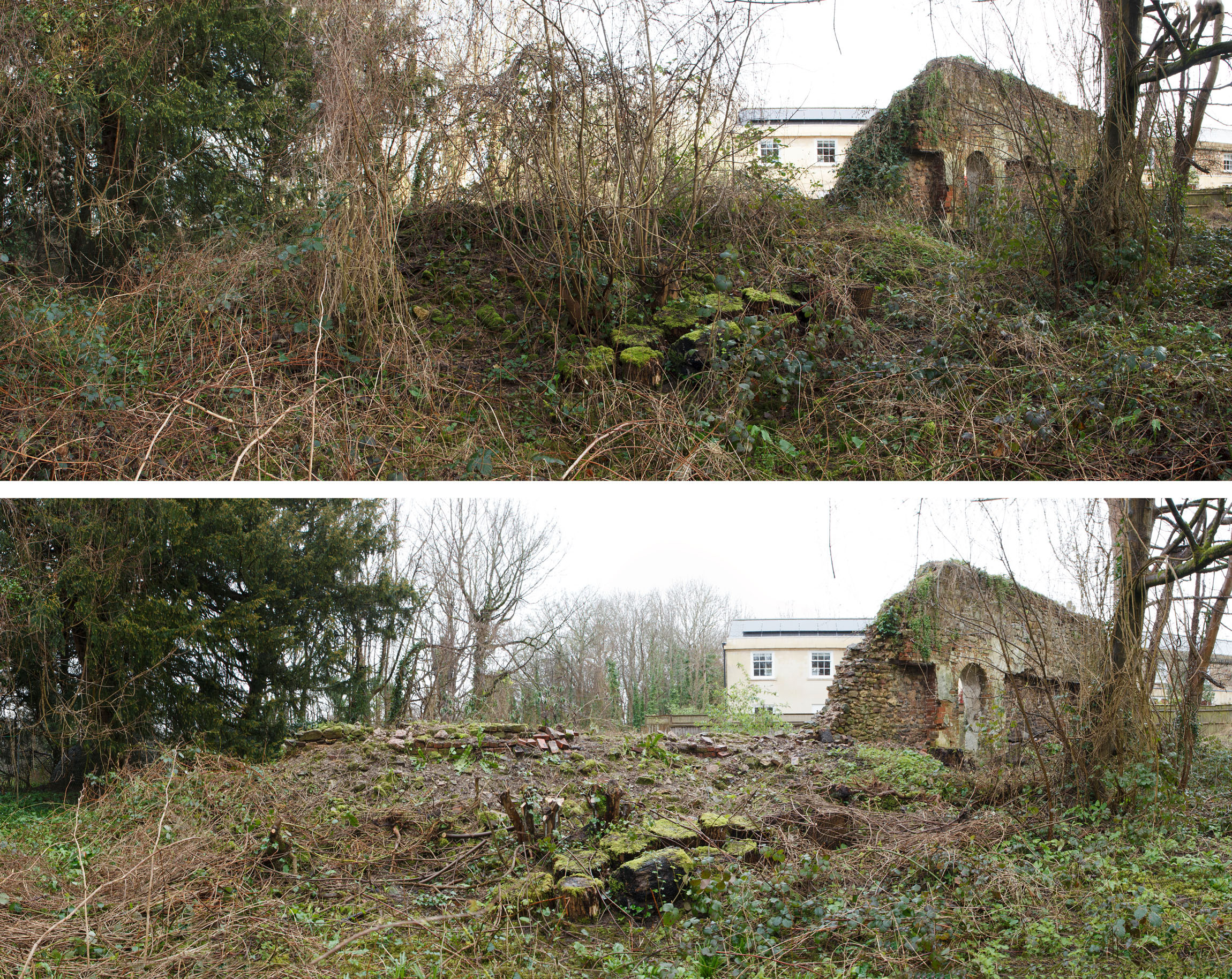
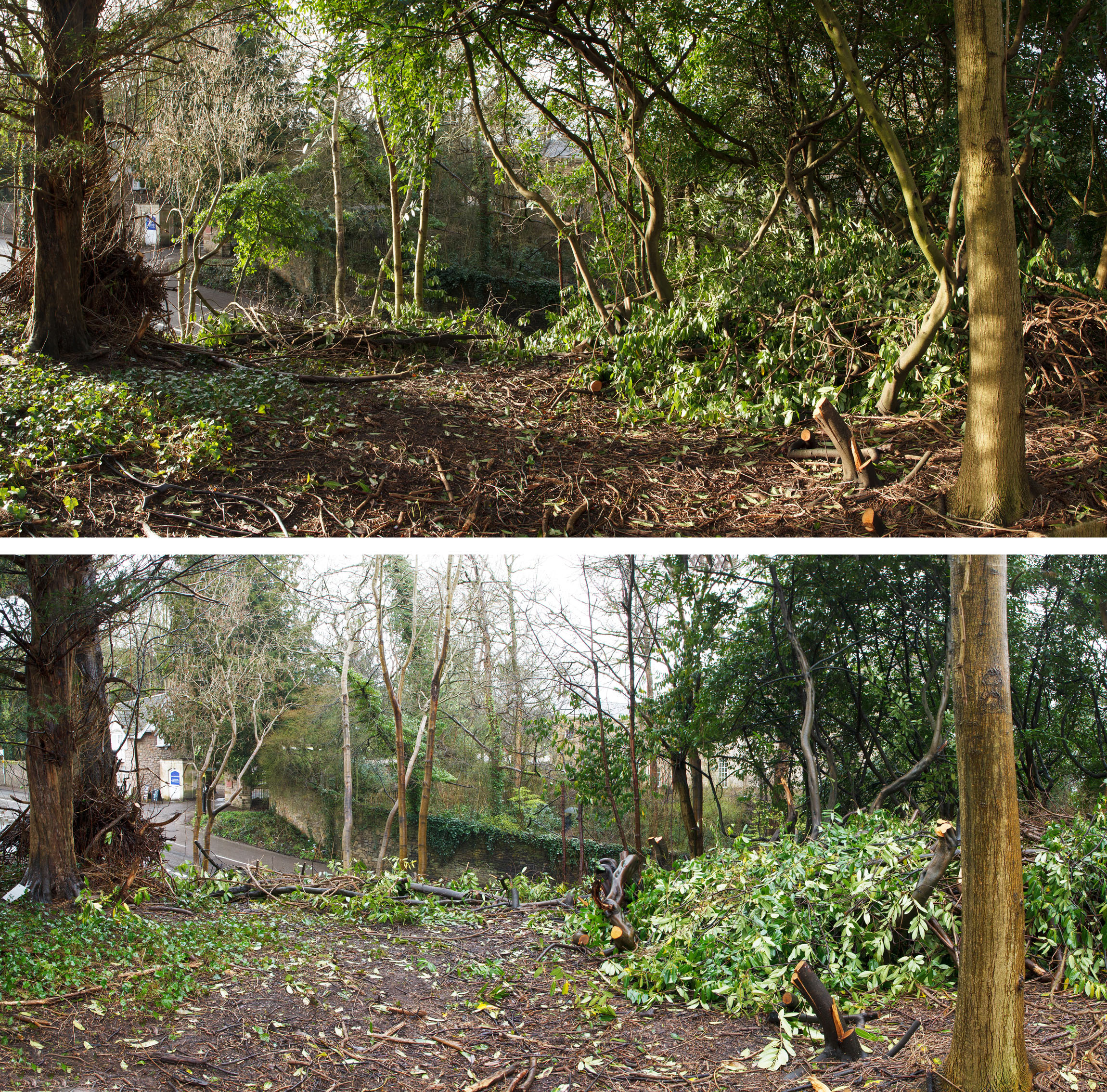
Volunteers concluded work on the old View Garden in February, with a final tidying-up of the laurels and woodland, and a focus on preparation for wildflower meadow planting. We undertook natural spacing with the woodland area, selecting the most viable saplings and shoots of trees and clearing around them to allow them to thrive in the future. This woodland management technique is the same as we started with the Forestry Commission in Penpole Wood in about 2015 and should ensure strong growth and positive regeneration of the woodland floor. We hope that this area, the glasshouse wall and verge, is back as it was when we last passed through in 2016.

incredible to think that it’s just been seven years since the glasshouse wall was last cleared by KWAG volunteers. 

A few stray laurels were felled to complete work at the corner of Kings Weston Lane and Napier Miles Road, whilst around half of the volunteers took to digging out the roots of brambles long the verges. This will be critical in ensuring that the wildflower seeding planned for the end of this month has the best chance of thriving. We’re grateful to our regular volunteer Mike, who has undertaken to return week after week to get on top of the job and organised the specification and funding for the seeding project.

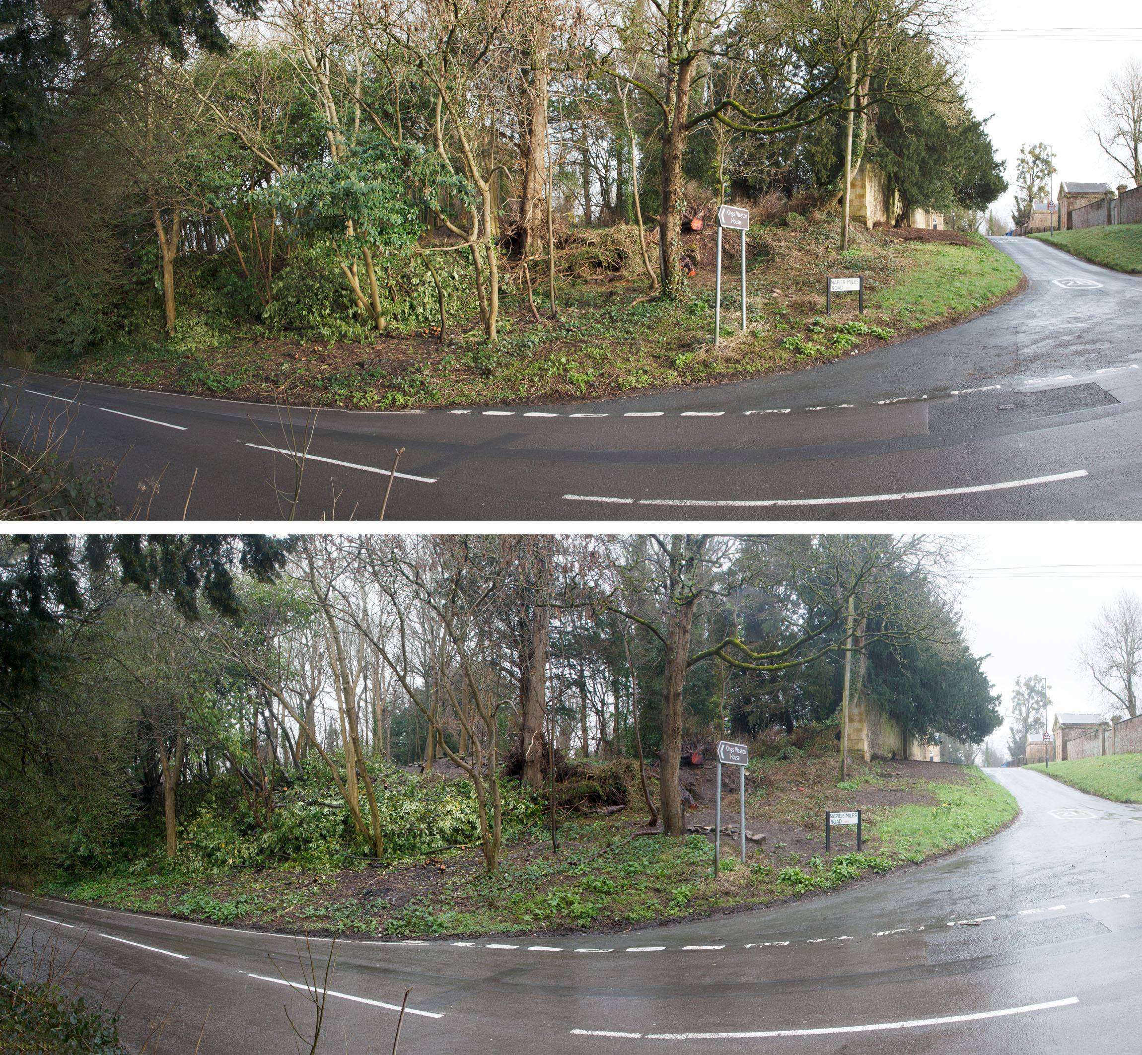
A couple more cherry laurels are cleared back from the edge
The view from Kings Weston Lane showing the removal of laurels and the preparation work along Napier Miles Road, for the sowing of meadow seed.