Author Archives: David Martyn

‘Adorable magnificent view’: Lost prospects from a once famous hill

Last month we mentioned Kingsweston Hill in passing, and the “Evergreens Wood” marked on old maps. It’s worth reflecting more on the Hill, and its once-famous attractions now lost to us. Common Land until the 1830s, its public status was challenged by the Enclosure Acts which sowed the seeds of its change in character.

The hill was once open downland, grazed by sheep and bare. Compared to the present appearance it was a wild and exposed place. Siting a windmill at its summit reflects the position wide open to the winds reaching up the Severn Estuary.
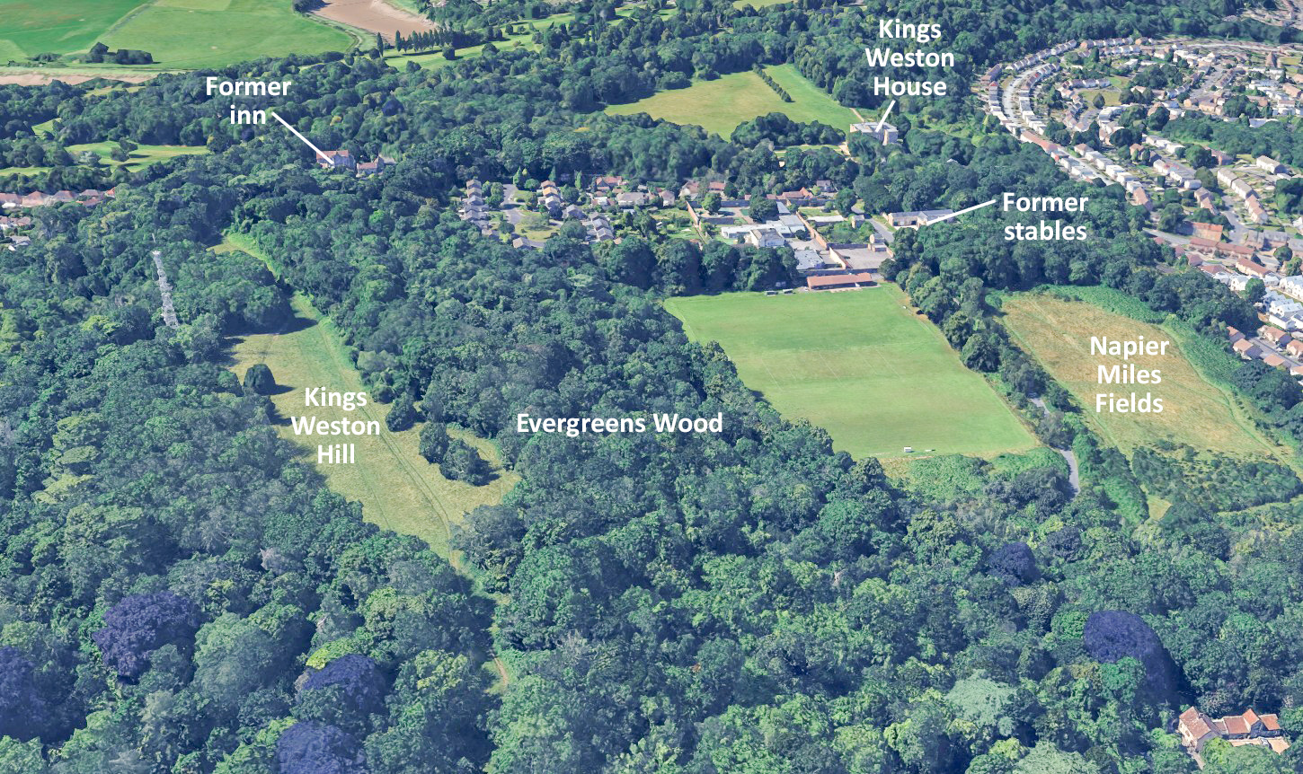
Aerial view looking west along Kingsweston Hill, with some familiar landmarks indicated.

It was probably already a popular resort from the city by the time the Kingsweston Inn (sometimes called the breakfasting house) was built in the 1720s to cater for visitors and “which is much, resorted to on account of its situation”. The open views stretched all around you from the top, right across to Wales in the north, towards Somerset and the Avon Gorge to the South, and stretching as far as Chepstow and down the Bristol channel in the direction of the New World.

The sublime character of the spot, the raw nature of the hill and the beauty of the views, became one of the most famous attractions of Kings Weston in the Eighteenth Century. There are many documented visits and descriptions throughout this period.
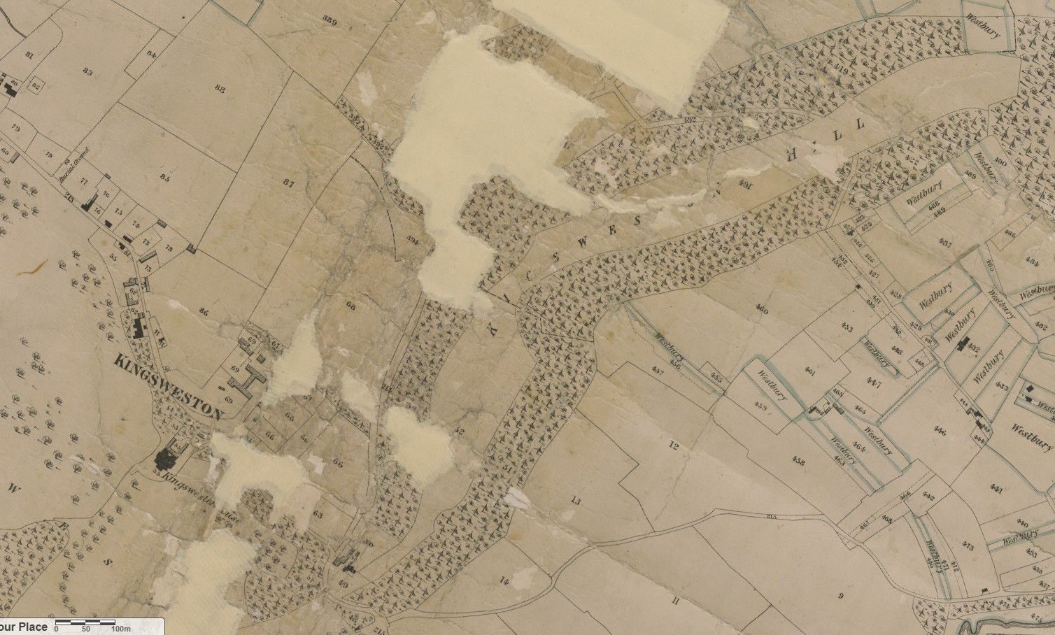
This excerpt from the 1840s tithe map shows north and south slopes of Kingsweston Hill already cloaked in new plantations.

John Wesley, preacher and founder of the Methodist Movement, was a frequent visitor to Kings Weston, writing of it often in diaries and letters. He recounts one such occasion in 1739 when his spreading notoriety for open-air preaching saw himself becoming a local attraction:

“On Holy Thursday, many of us went to Kings-Weston Hill, 4 or 5 miles from Bristol. As we were sitting on the grass, two gentlemen went by, and by way of jest, sent up many persons to us from the neighbouring villages: To whom therefore I took occasion to speak on these words, ‘Thou has ascended up on high’”.
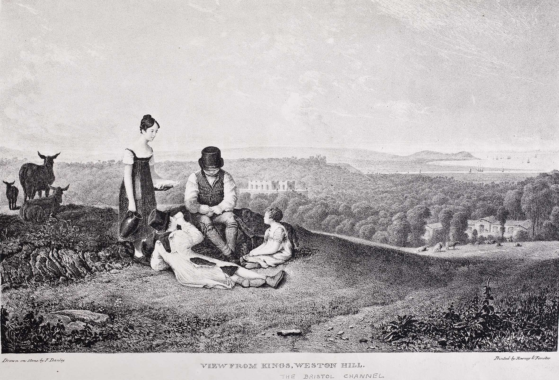
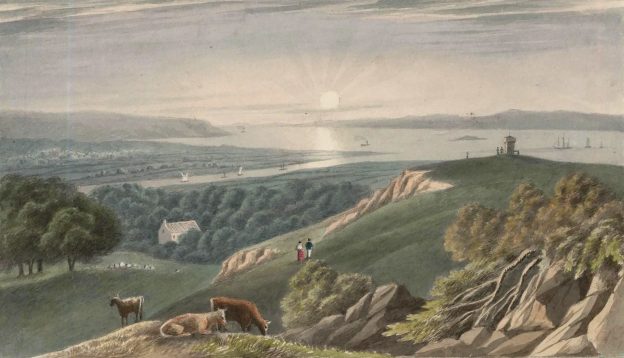
One of a series of popular lithographic prints published by the artist Francis Danby. This one shows the general appeal of the view from Kings Weston Hill and its popularity with patrons.

‘A six week tour thru the southern counties of England and Wales’, a travel guide published in1769 by Arthur Young remarks on the breadth of the views;  

“for a prospect, you must go up the hill, a little beyond where the breakfasting house for the hot-well company is situated; you look down from the hill to the west upon some fine woods, in the midst of which, Mr. Southwell’s house appears. In front is a very fine valley, two miles broad, beautifully intersected with hedges and trees, and bounded by the Severn, which is here ten miles over; you command Kingroad, with a fleet of shipping, generally lying at anchor; and, lastly, the Welsh mountains terminate the whole. Behind there is an extensive view of the country, well scattered with villages: the windings of the Severn are seen 20 miles, and those of the Avon quite to Bristol. The prospect extends into Somersetshire, Gloucestershire, Monmouthshire, Glamorganshire, Brecknockshire, Radnorshire, and even to Pembrokeshire; and, upon the whole, is inferior to nothing”.
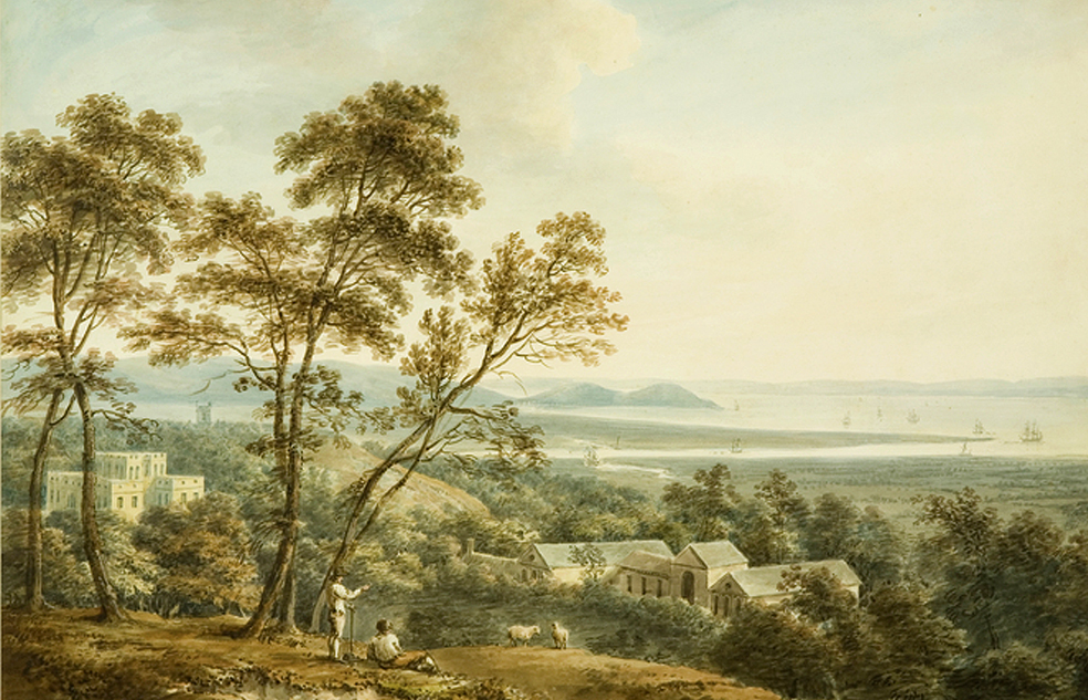
 Samual Jackson’s well-known painting from Kingsweston Hill from the 1790s

In the 1780s, another such book, The Bristol and Hotwell Guide, lauded:

“There is scarcely a spot in the kingdom that affords a more pleasing and extensive  view of land and water than is seen from This hill.”

The same decade saw the publication of a poem named after the hill by a Thomas Hobhouse, further raised the national profile of Kingsweston Hill and its views.

The picturesque prospects led to a brisk trade in paintings and artworks developing around the turn of the 19th Century, with many versions of the view across the Severn recorded by artists of the Bristol School. This was Kingsweston Hill at the height of its notoriety.
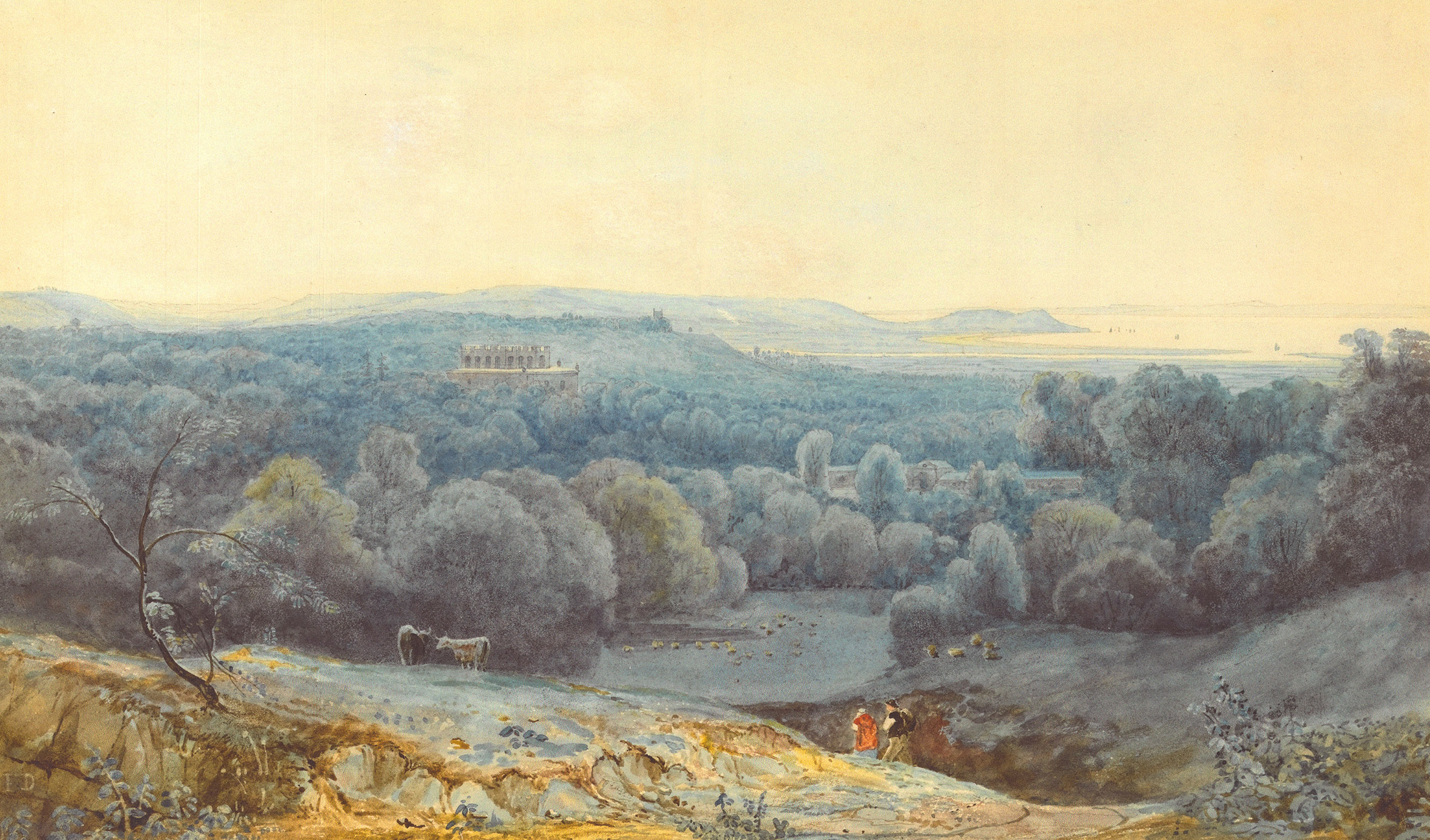
A Francis Danby watercolour of evening light seen from Kingsweston Hill, circa 1815.

Many of these views took advantage of a common spot now engulfed within Evergreens Wood on the north side of the Hill. The location was along the path along the northern edge of the hilltop from where the visitor could enjoy the views westward towards the Bristol Channel with the vast scale of the natural landscape put into perspective by the diminutive (relatively speaking) mansion and buildings of Kings Weston house in the middle distance.
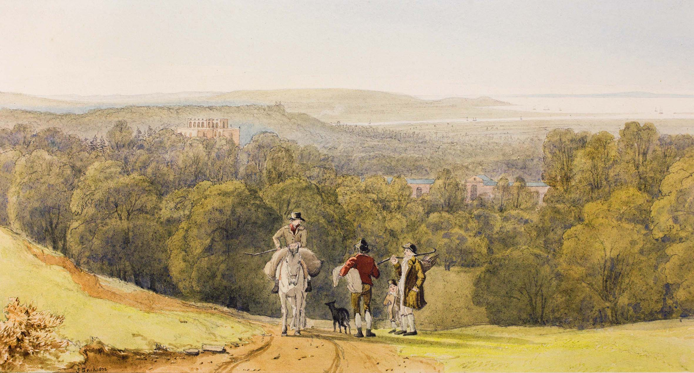
Watercolour looking across Kings Weston and Penpole Point by Samuel Jackson, circa 1820.

Trying to find the site today is confounded by the dense woodlands that have grown-up since. This is in large part to the Enclosure Act of 1812 that saw the whole of the hill ‘privatised’ in the ownership of the Southwell family, then the Lords de Clifford. The Act was not enacted formally until 1822, after which Edward Southwell, 21st Baron de Clifford set about making his mark on it and making it an extension of the Kings Weston landscaped parkland.
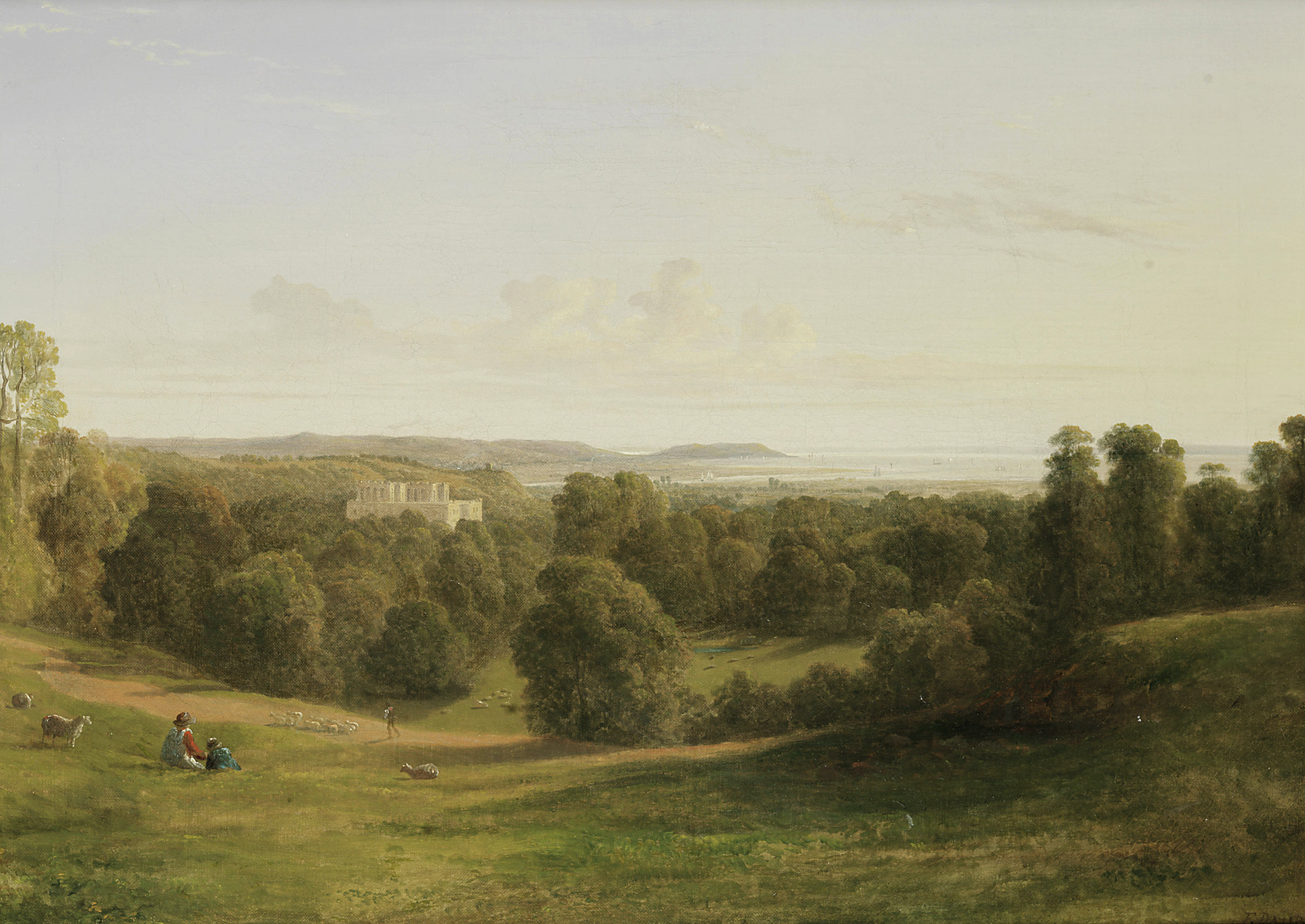
Oil Painting “View over the mouth of the Avon and kings Weston House” by Francis Danby. Circa 1815.

Of Lord de Clifford, it was written

“The great enjoyments of Lord de Clifford when at home was planting shrubs and trees. Many thousands were planted under his directions. I can picture him now as I often saw him, a little insignificant man riding on a very quiet horse followed by John Webb, his favourite groom, to superintend operations.”

One focus for this avid planting spree appears to have been Kingsweston Hill. New carriage rides were constructed encircling the hill, routes that can still be enjoyed,  and these were planted heavily with new trees.

Whether the Lord’s intention was to deliberately obscure the views that attracted so many public visitors to his land isn’t known, but this was certainly the end result. Evergreens Wood was planted along the side of the hill with yews, cherry laurel, conifers, arbutus, and Evergreen Oak that might be better suited to north-facing slopes.
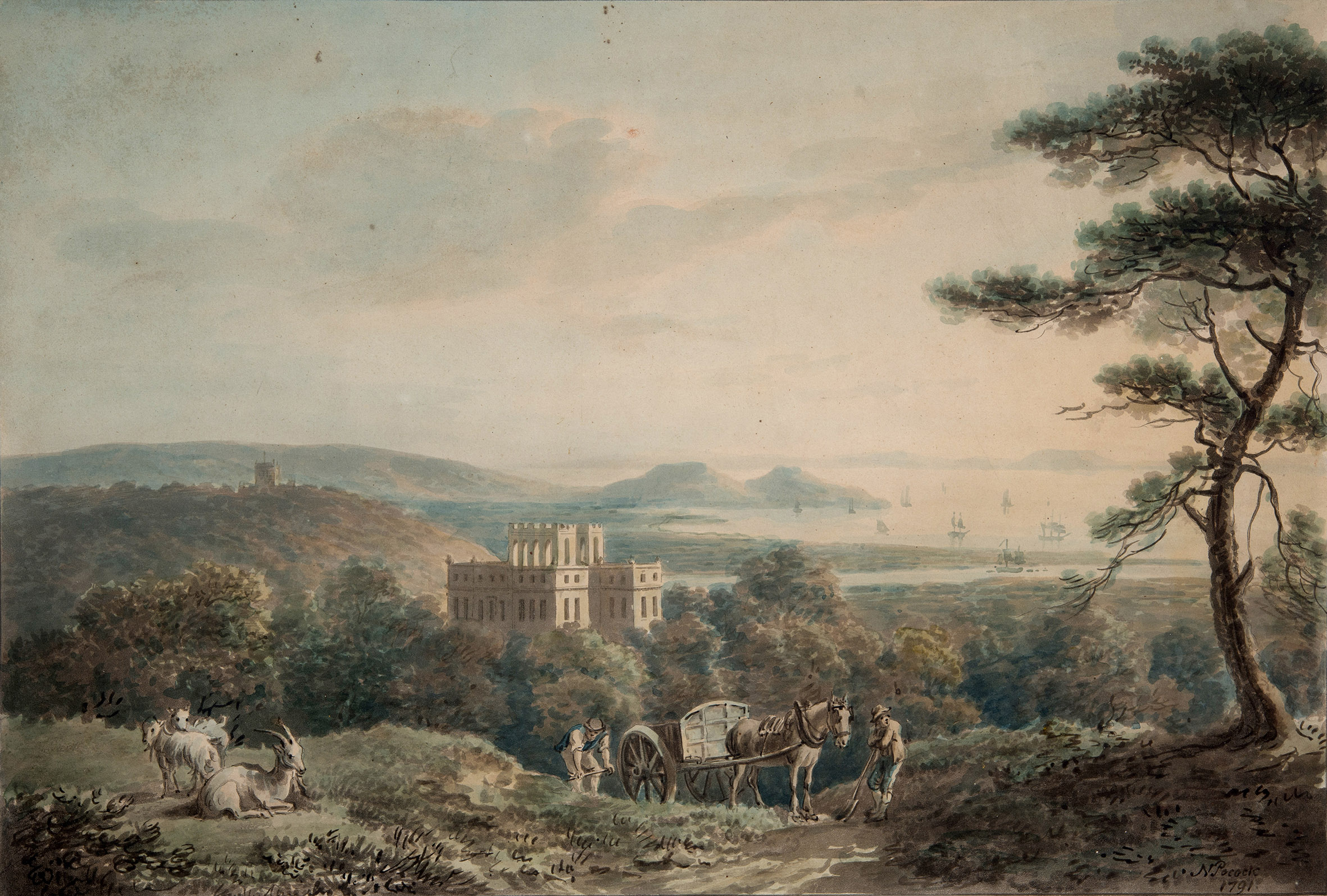
Coloured print by Nicholas Pocock showing the view from kingsweston Hill  1791.

Whilst the view from Penpole Point remained celebrated, the frequency with which the views from Kingsweston Hill are mentioned falls off rapidly after the 1830s, perhaps as rapidly as the new evergreens grew up. With the purchase of the estate by the Miles family in the same decade they sought to prevent all public access to the hill, but the strength of feeling against this from across Bristol saw them relent.
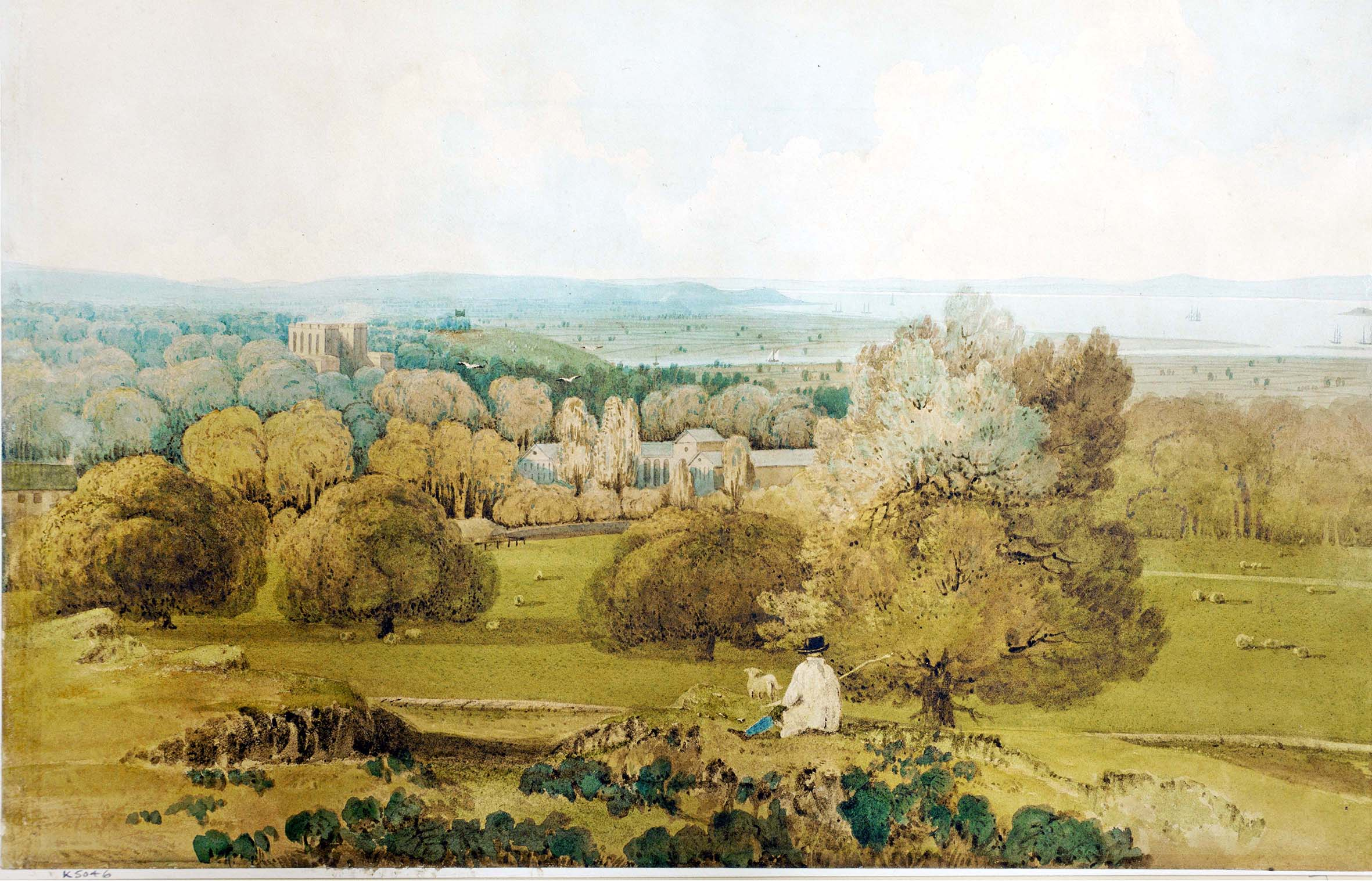
Watercolour by Samuel Jackson, dating from the 1820s

The botanist Charles James Fox Bunbury makes no mention of views from the hill on his visit In September 1870. He wrote:

“Kate and I had a long walk with Miles through his beautiful woods, clothing the ridge of the hill eastward of the house, and joining on the woods of Blaise castle. The luxuriant growth of evergreens is remarkable: above all the arbuti are more numerous and larger and finer than I have seen anywhere else except Killarney.”  
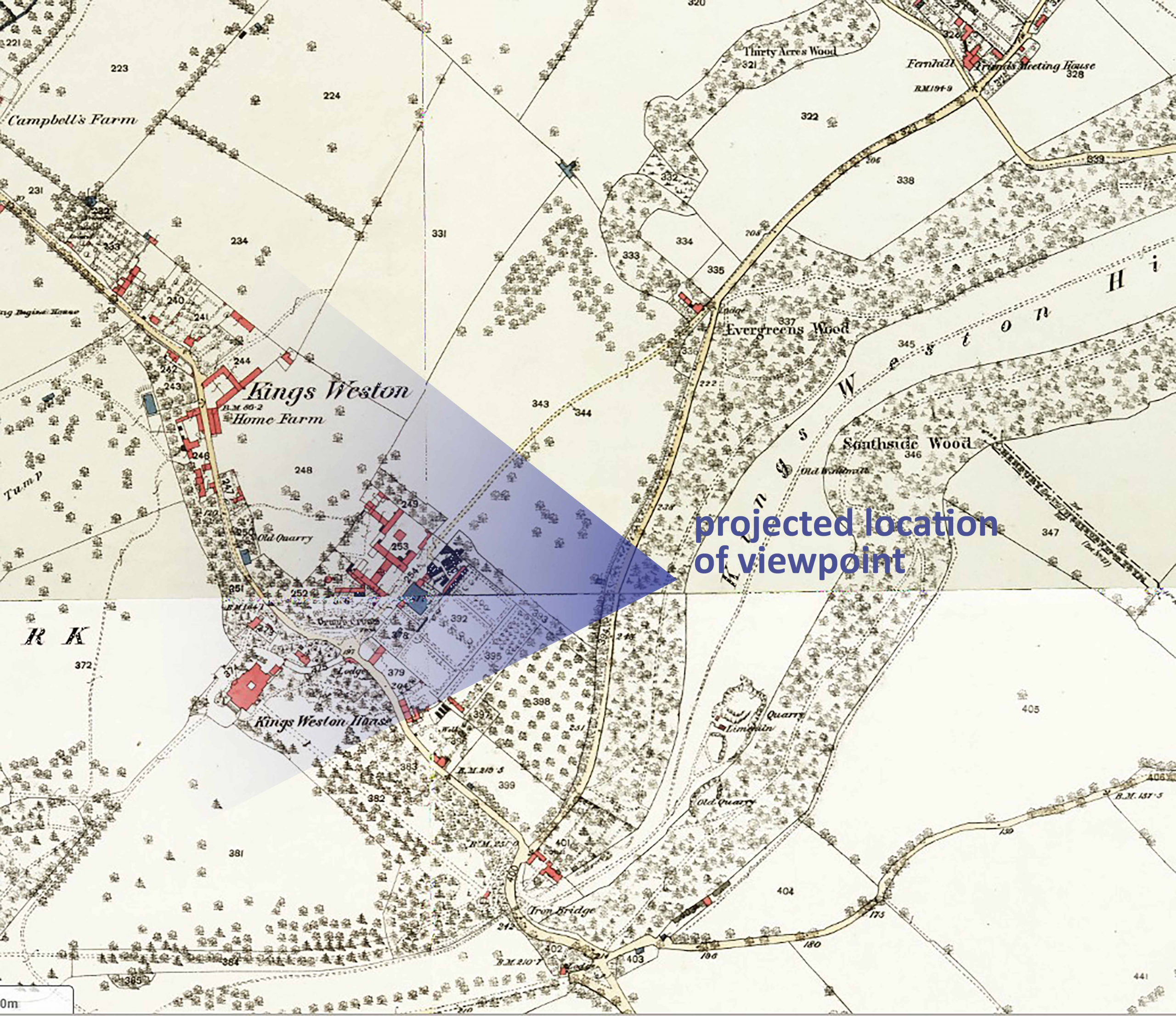
1880s ordnance Survey map showing the projected location from where artists painted.
Views of the Georgian stables are now rare from this angle.

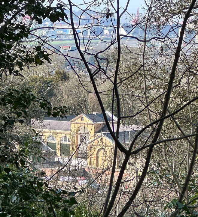
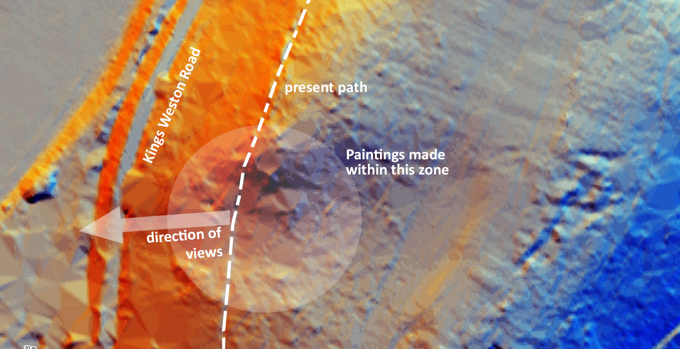
And so, the character of Kingsweston Hill has been permanently changed by these plantations. No longer can views be enjoyed, barely even glimpsed through the dense dark foliage. The exact location once enjoyed by Bristol’s artists remains uncertain, but the clearest impression of where it once was can only be gleaned using Lidar plans. A shallow valley in the side of the ridge now unrecognisable beneath the trees, and associated with it some rougher topography, is likely to represent the celebrated spot. If one looks through the dense canopy of trees that now cloak the slope, you might just glimpse a view out, and again marvel at how high you are suspended above the Severn estuary.  
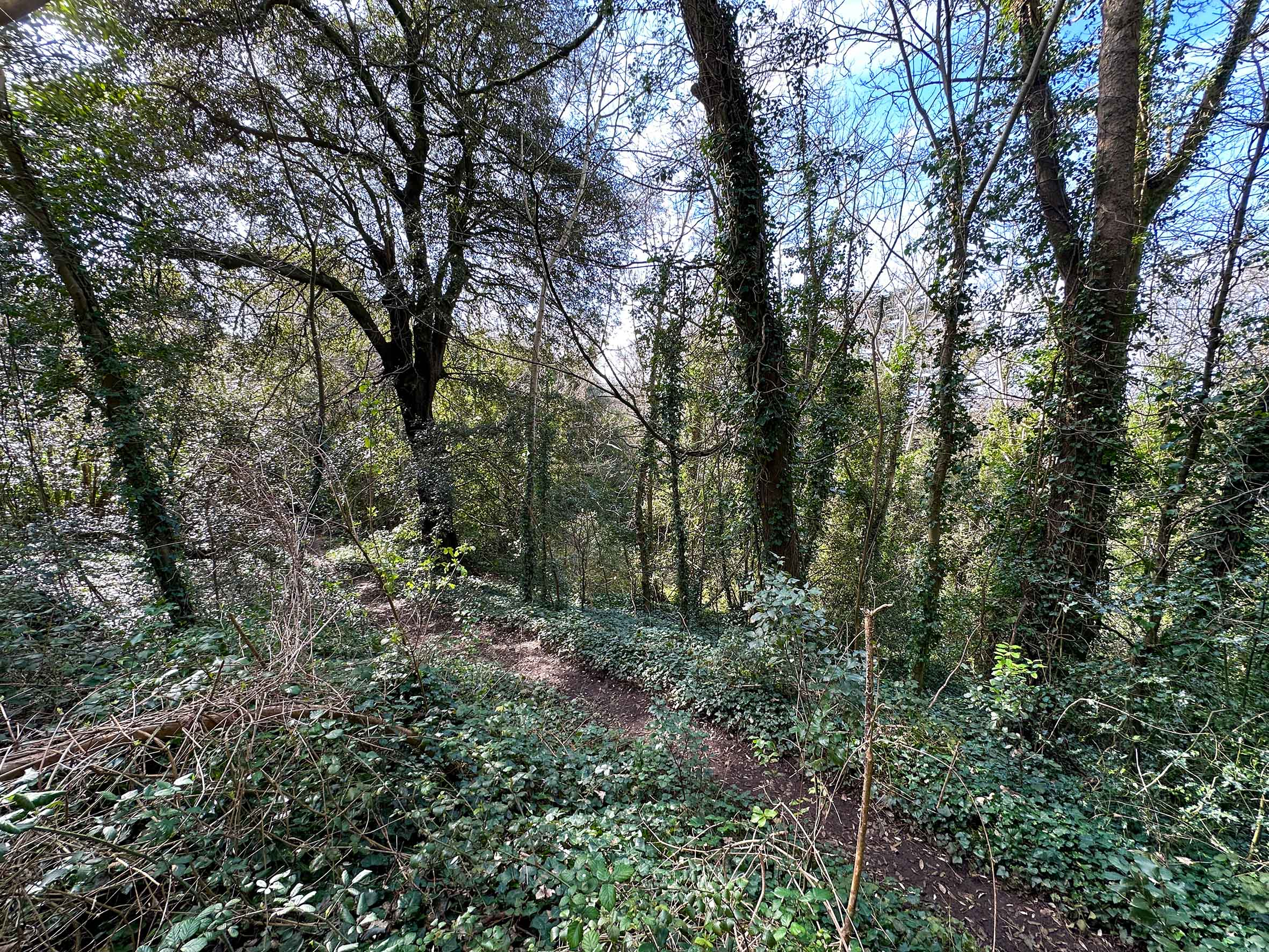
The approximate location where artists once sat to record the Kingsweston landscape from the hill.
Coloured Lidar plans showing the modern topography with the possible location favoured by artists of the Bristol School

New commitment to conserving Penpole Point

The Council are proposing to put the larger sections onto a ‘1 cut’ to be cut by the ride-on mower during late Summer going forwards. However, they also think that an earlier cut too would be beneficial, at least this year.

During the later cut (from September), they can cut back the encroaching brambles.  They also discussed that it would be beneficial for the grass arisings to be raked off where possible. We agreed that these could be the Council’s week-day Nature Nurture sessions but KWAG would also offer to help with the task once we know when it was happening.

The areas of grassland adjacent to Pen Pole point (which are more sloped) and two smaller areas west of this (which have more coverage by tree saplings) will be mapped as ‘hand cut’ areas, and Nature Nurture volunteers will look to build in some scything and tree-popping sessions along there this year.

This is all terrific news as encroachment of scrub onto the grassland here has been a key concern for us for many years. The past mowing regime has been intermittent and often neglected, the only area having a clear strategy being the area KWAG cleared of brambles and sowed with meadow flower seed around the Dial.

This new commitment to maintaining and restoring the area is really welcomed, and we hope it will free-up our volunteers to tackle other areas of the estate.  

Wildlife pond update

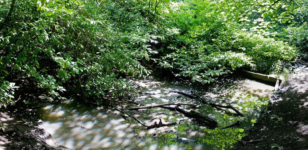
If you pass up to Vanbrugh’s Echo from the house, you’ll notice the wildlife ponds that have been gradually restored over the last few months. A project supported by KWAG and the Nature Nurture team in Bristol City Council, it’s been a progressing since the end of last year when volunteers worked to empty the last of the mud and logs from it.

The ponds near the Echo in 2014, choked, stagnant, and poisoned by cherry laurel and before KWAG’s first restoration.

This  was not the first time the ponds have been salvaged. Back in 2014 KWAG  volunteers removed all of the cherry laurel in this section of the wood and  followed-up by emptying the ponds. Unfortunately, they gradually accumulated  branches and the frequency of dogs enjoying the waters meant that it was unable  to thrive.

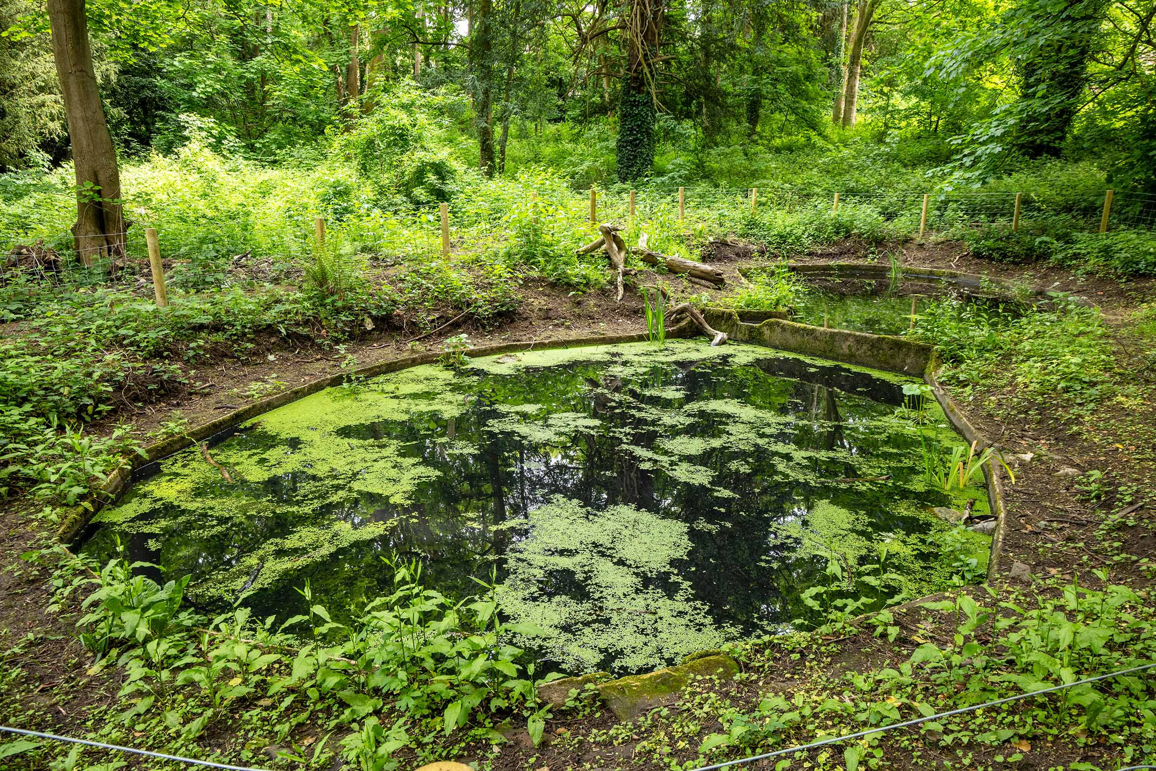
As  part of the latest restoration overhanging branches have been cut back to allow  more light to penetrate the woodland here. The council volunteers erected a  fence around the ponds and followed up with the placement of a number of native  pond plants just last month.

The results speak for themselves and we hope that this will become an important element of the historic landscape as wildlife habitat.

Seen from a similar angle today, the nature ponds are now looking fantastic after their recent revival.

Working Party update: Jubilee Clearing progress

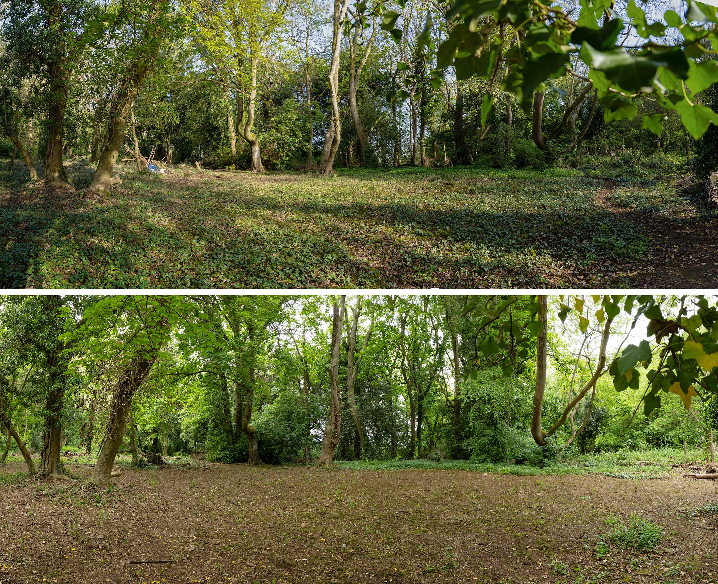
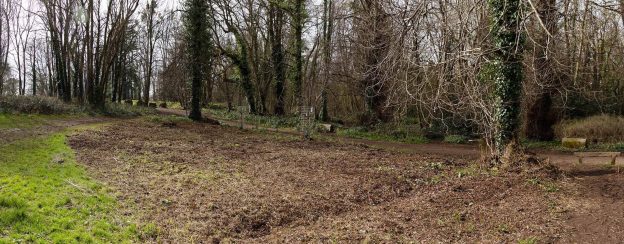
Looking in the direction of Kings Weston house across the lost clearing.

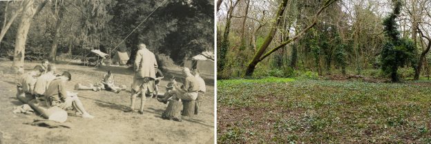
Last month we continued work on the restoration of Jubilee Clearing as a more diverse habitat and as the historic site of the arboretum and the later Scouts camping ground. The invasive snowberry was cleared in March leaving a blighted forest floor. Anywhere overshadowed by the snowberry has suffered from suffocation, only ivy and moss have been able to grow and further retarding any natives that might grow.

With the area exposed to the sun the drier conditions will no longer be supportive for moss, and the ivy continued to suffocate any other growth. Volunteers worked to clear back the whole area to encourage greater diversity of species.

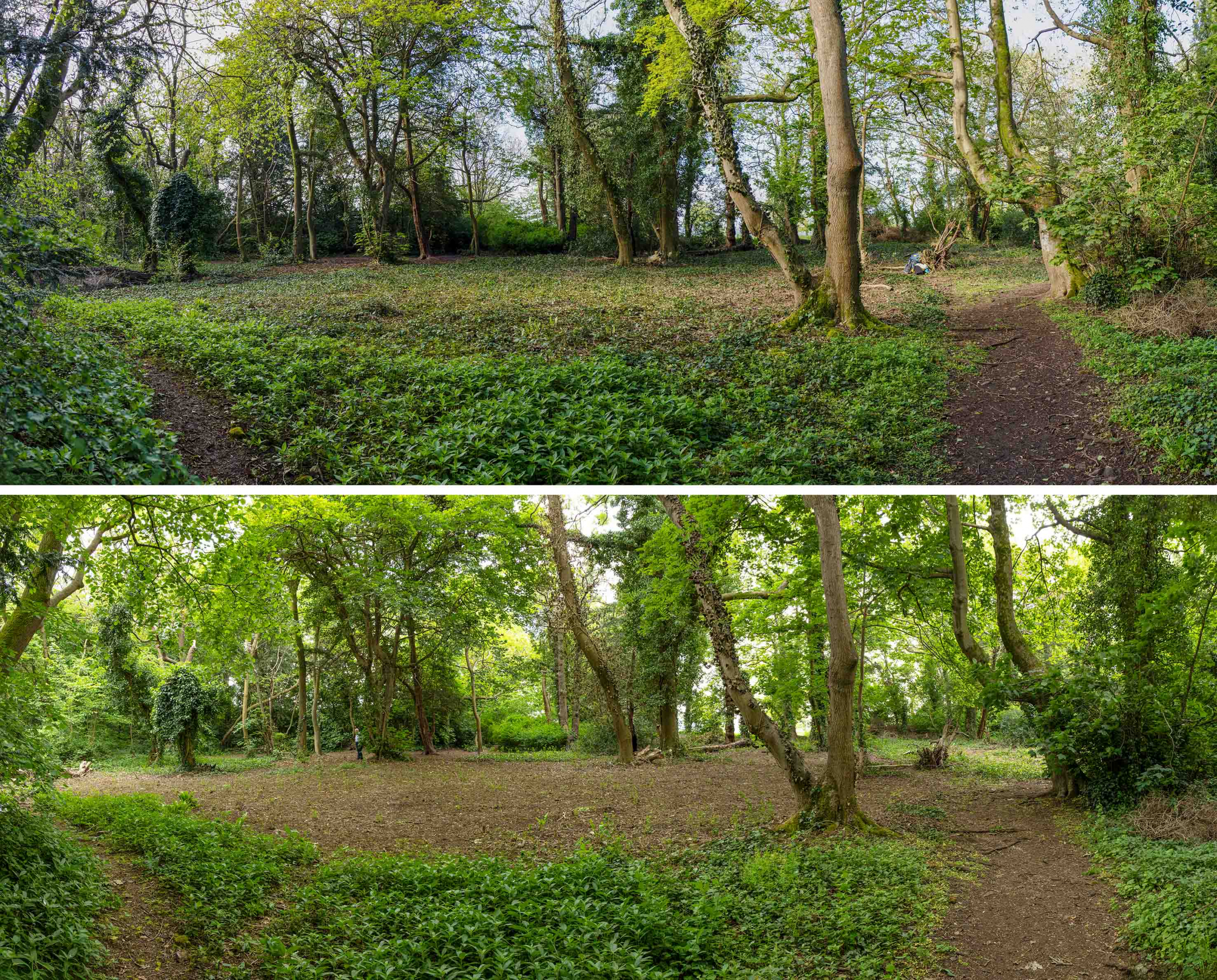
The clearing from the north, looking in the direction of Penpole Lane

Raking-off the worst of the material, the way was prepared for the re-seeding of the area with a native woodland-edge glass and flowers. Whilst these are a new introduction, the area has been so long covered that a viable seed-bank in the soil is unlikely.

Raking-off the worst of the material, the way was prepared for the re-seeding of the area with a native woodland-edge glass and flowers. Whilst these are a new introduction, the area has been so long covered that a viable seed-bank in the soil is unlikely.

The clearing from the south-east, looking in the direction of Avonmouth

The Keeper’s Cottage recalled

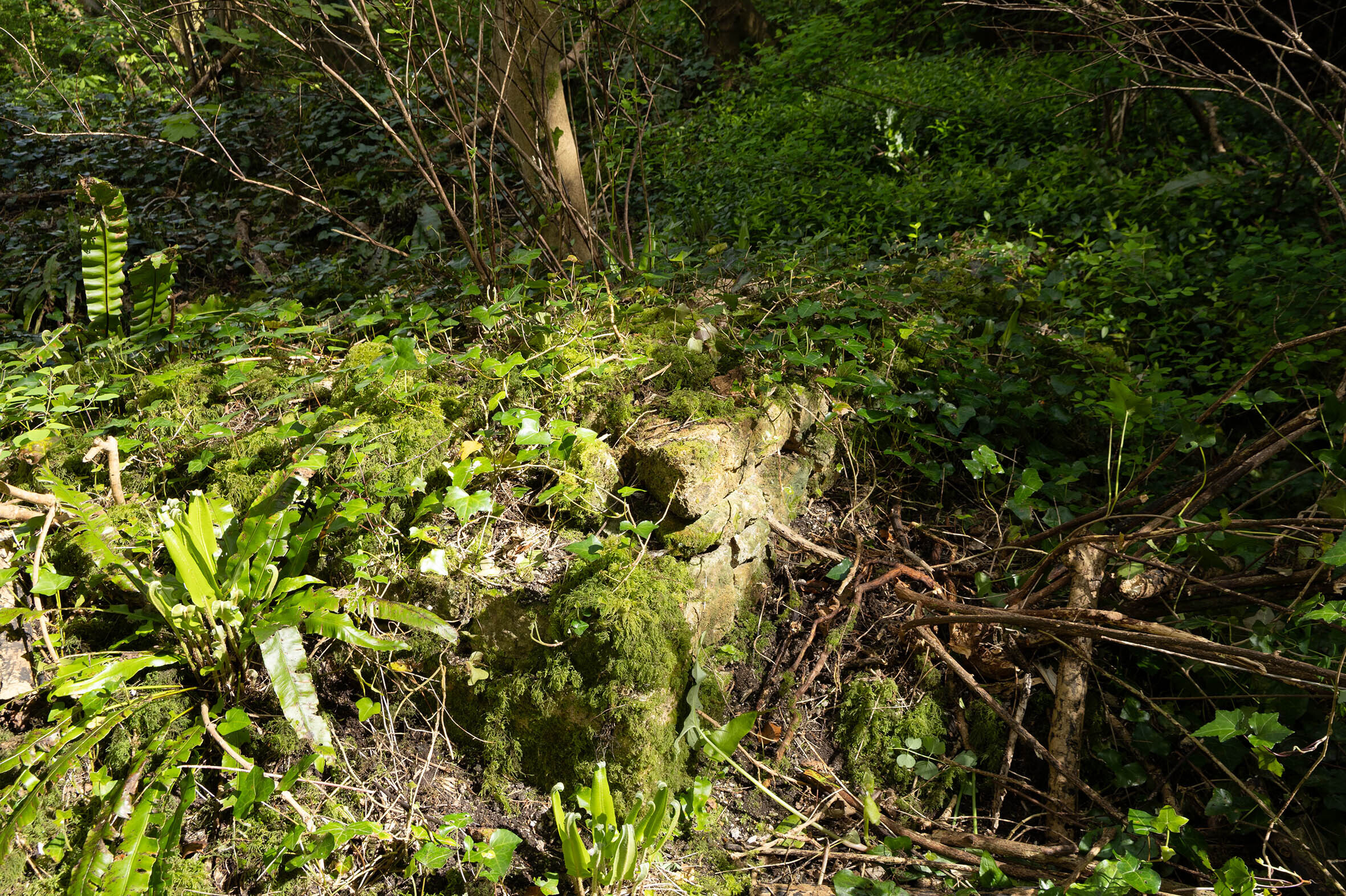
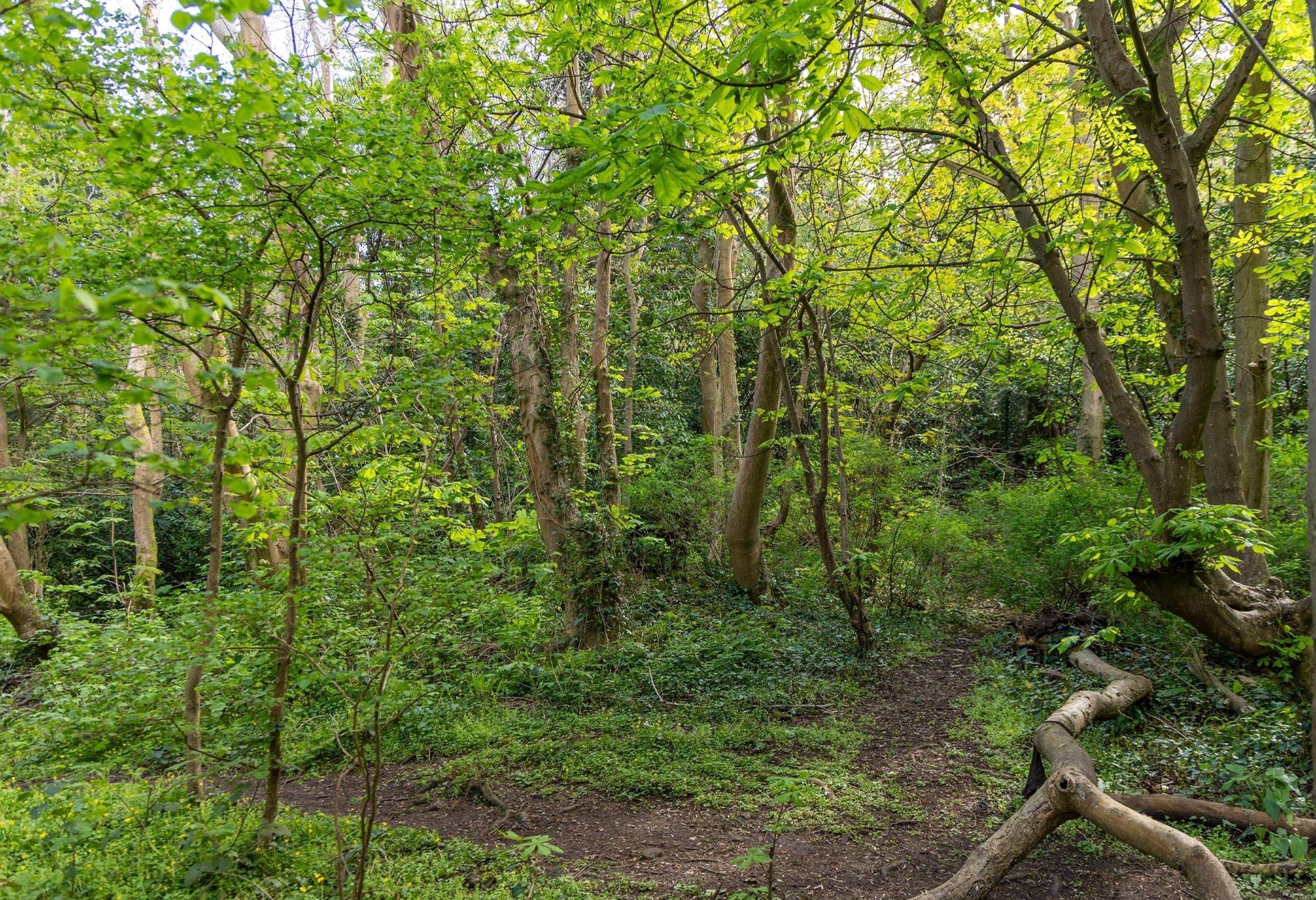
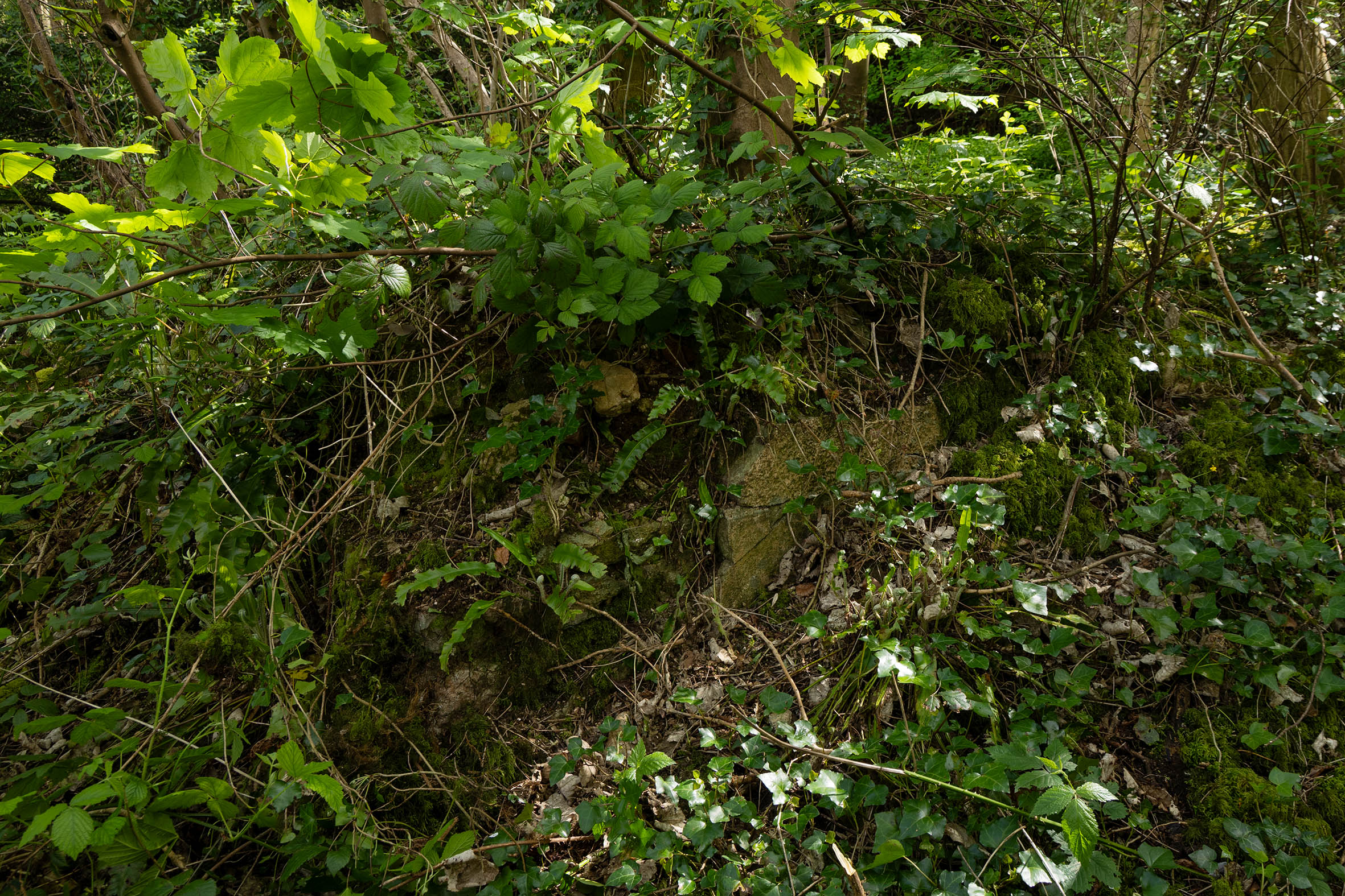
Deep in Penpole Wood lie the half-forgotten remains of a small cottage. Now just a few fragments of wall and some undulations in the forest floor, this was once the Keeper’s home.

As far as we’ve been able to ascertain, the house was built after 1845, so would have been an addition made by the Miles Family who then owned the Kings Weston estate. It may even have been designed by Philip William Skinner Miles, who considered himself something of an amateur architect and is responsible for much minor work around the parkland.

the south-west corner of the cottage survives as a few courses of stone amongst the forest floor.  

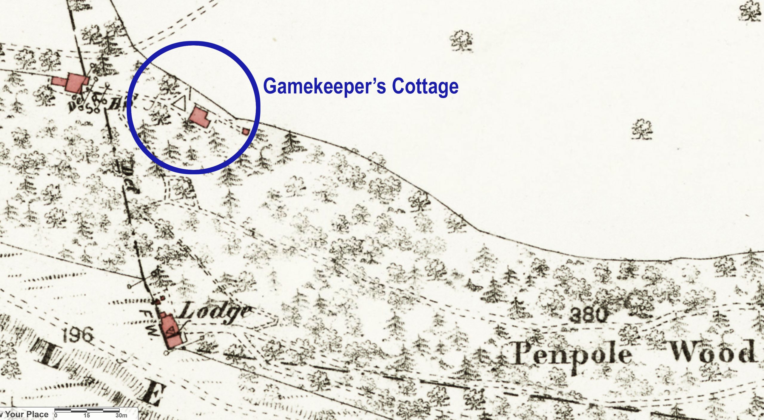
The location at the foot of the Penpole Ridge once enjoyed views northward across open fields of the parkland, but today’s woodland margins have long extended to encompass it. It is assumed that any game shooting would have taken place in these fields with pheasant or other birds bred in the woodland before release. The location of a gamekeeper’s cottage on the boundary between these two areas makes sense in this context.

1884 map with the location of the cottage marked, being sited downhill almost directly north of Penpole Lodge.

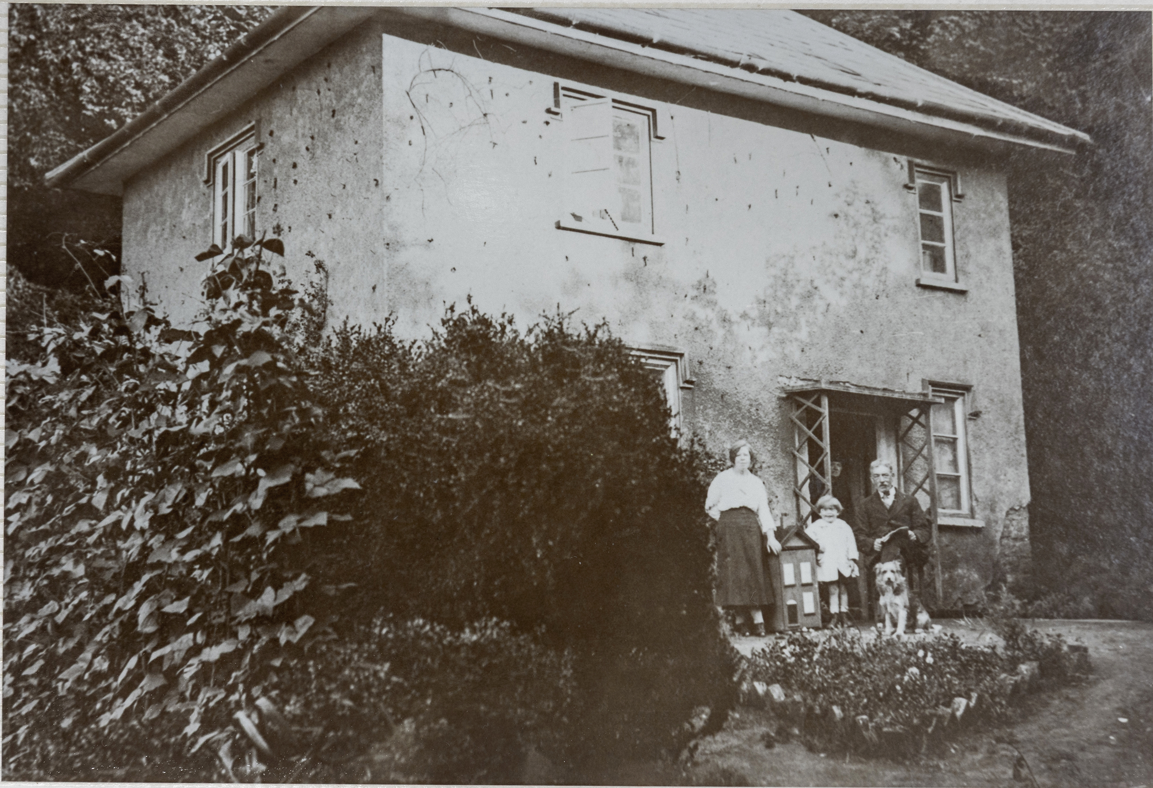
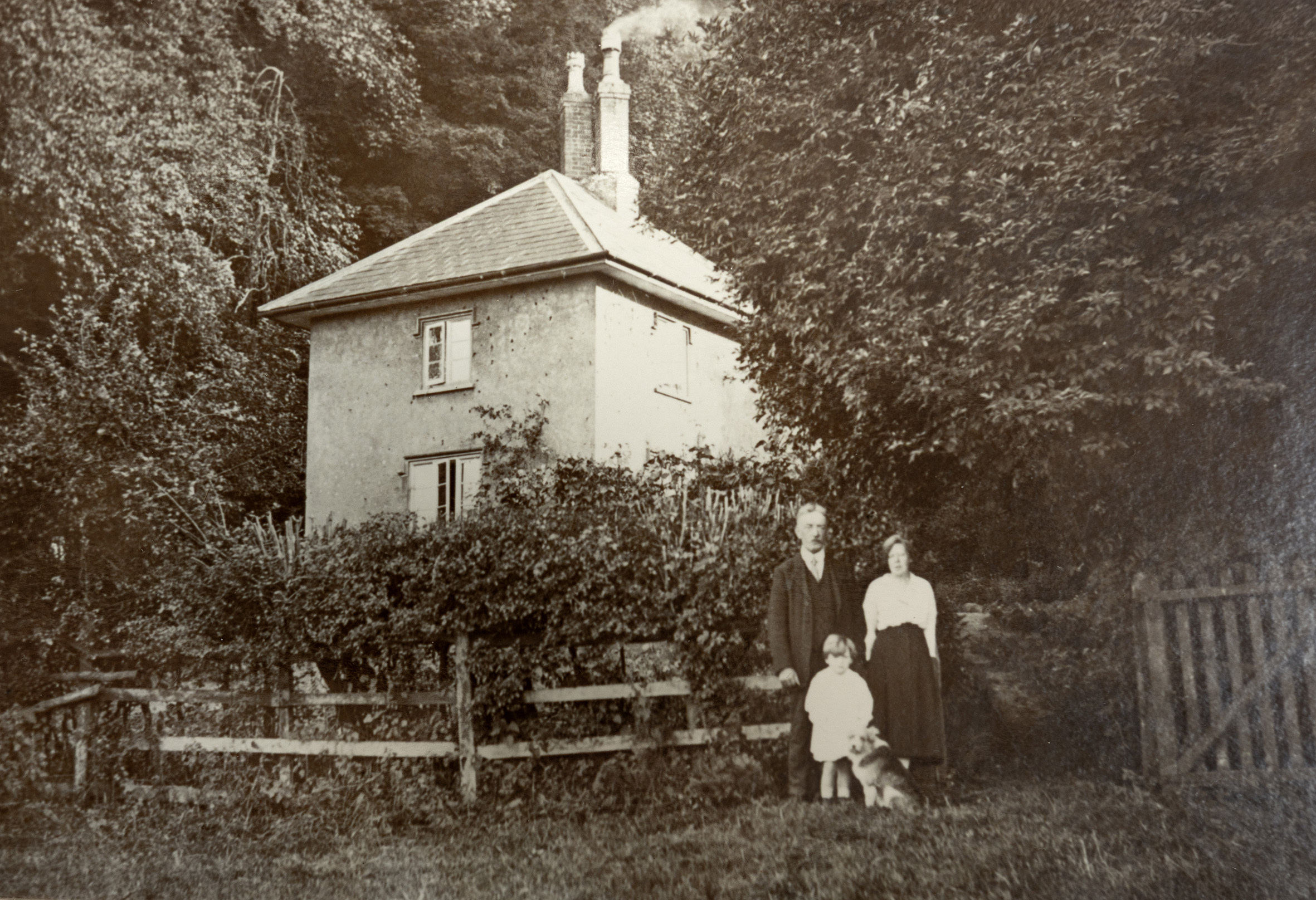
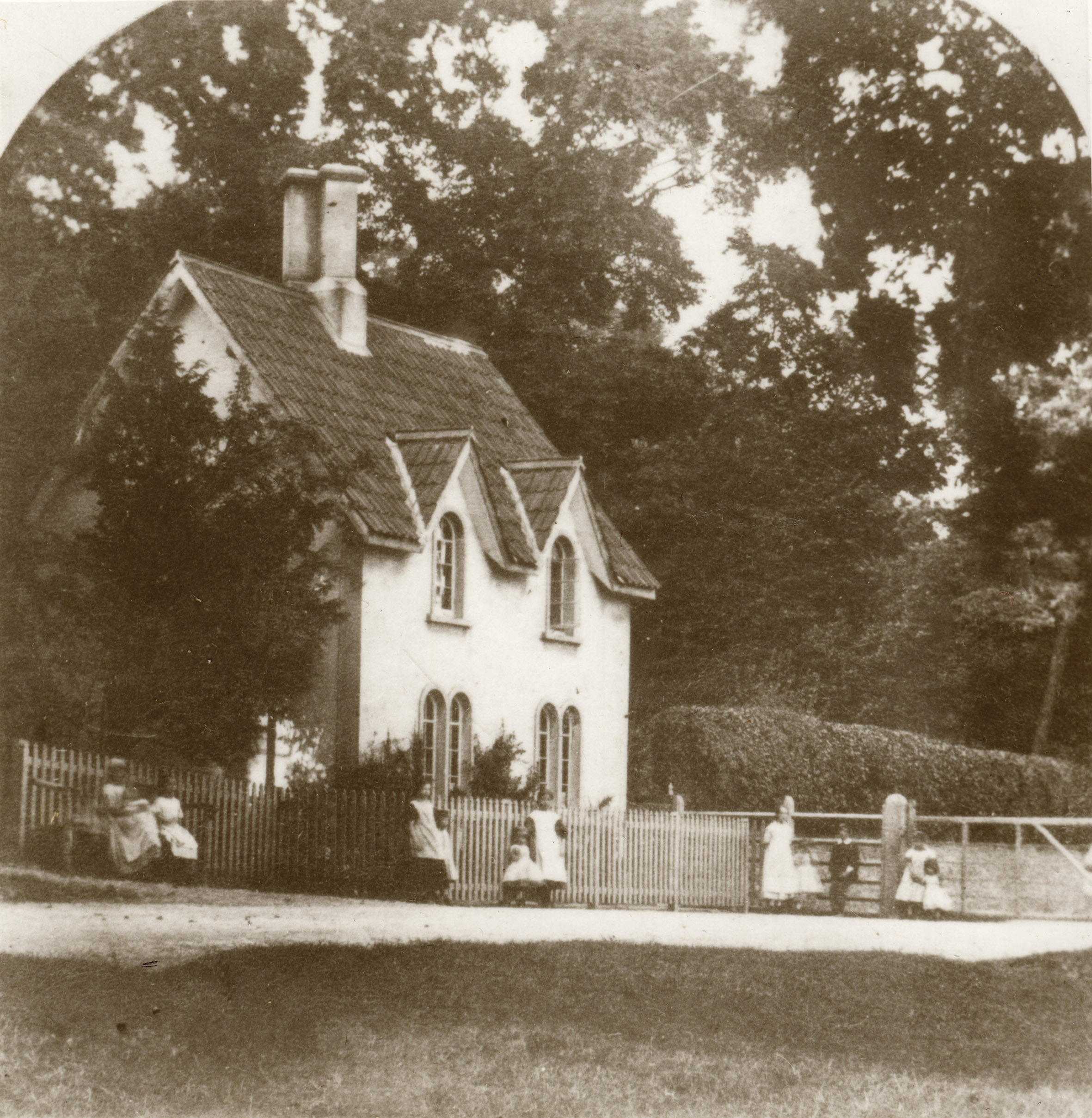
The cottage itself was small, but not without some architectural pretention. From early photos we can see it was of two storeys and its main frontage to the north and west were carefully composed with attractively proportioned casement windows and Tudor-style drip-mouldings carried across each. It had a smart hipped roof, slate-covered, and a pair of tall chimneys, again in the Tudor manner. The whole building was finished in rough-cast render, some which still clings to the walls today.  It must have had quite a picturesque effect when viewed from the fields, sitting with a heavily wooded backdrop, with its a small garden and smoke drifting from its prominent chimneys a sign of domestic life within.

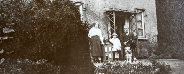
Keeper’s Cottage from the west, with the McEwen family and their dog Gyp. 

These two photographs record the Keepers Cottage in 1921 when it was the home of the McEwen family.  Arthur McEwan was head of the family and is seen with his wife Lilian, and their children Winifred and Arthur John, the latter just glimpsed at the door. The dog was Gyp.

Winifred, later Mrs Pople, remembers that in her childhood she carried buckets of water down the steep path from Penpole Lodge where Mrs Turk kept a tank filled with drinking water. Her mother, only 4’ 11”, nearly fell down the well they used, so the water tank was installed by Squire Miles as a safer, if less convenient, source.  

The Keepers Cottage with the McEwen family outside in 1921
A similar angle today, the cottage now rubble under the forest floor. 

The house remained occupied until WWII. By then the district Scout groups owned the land and the cottage and it was referred to as the Lower Lodge. With the outbreak of the war parts of their property were commandeered by the RAF and the Home Guard. The wardens wrote that “We had viewed with some concern the activities of the Home Guard when the took over the Lower (lodge)” and it suffered badly during this time.

A few tiles were damaged by the explosion of a high explosive bomb nearby, but the house survived only to become the target of  “local roughs”. By 1944 it had suffered badly from “wanton destruction” in the absence of regular use and, when the woods were sold to the Council in 1947, it’s unlikely that it was in habitable condition. It’s believed at this time the Council took the place down to prevent it from becoming the focus of more vandalism.  

the north-west corner of the cottage under the greenery. Part of the original render clings on. 
The walls survive to shin-height though sycamores now fight their way through the old floors. In the future it would be a good job for KWAG to clear around these ruins, measure and record them, and make sure there is some preservation before they are lost for all time.   

Picturing Penpole (again!)

Here’s an attractive new addition to our library of historic images. A watercolour painting captures the scene at Penpole Point in the middle of the 19th Century. This was at the peak of its appeal, when people came from miles around to enjoy the sunset from the Point, and before cheap rail travel rendered such simple pleasures less enduring.
 
The work was painted by Thomas Remnant Charleton (1756-1849) in his final decade, and long after his retirement from military service to Bath. This image joins many others that recorded the natural wonder of Penpole Point at this time, before the views were lost to industry and overgrowth.

Working Party update: Jubilee Clearing cleared!  

Jubilee Clearing has long been a memorable spot for local people from Shirehampton and Sea Mills. After the death of the last squire, Philip Napier Miles, large parts of Penpole Wood and fields beyond were sold to Bristol District Scouts. Between 1937 and 1947 the clearing became the favoured campsite of the district’s scouts.

The view on entering the clearing from Penpole Lane on the south edge.

Since the compulsory purchase of the Scout’s land by the Council, little has been done to protect the character of the woodland clearing – until now. The Snowberry that’s invaded the area is not native, and had obscured the open character of the area. With the recommendation of the wildlife and woodland officers, the restoration of the clearing for both heritage and ecology is a project we’ve been keen to engage with.

A good band of volunteers set out to clear the invasive shrub from the area in mid-March. Knowing that bird nesting season was upon us, we were exceptionally careful in approaching the task, though, with the Snowberry yet to leaf, there was little cover to attract birds.

The view east across the historic clearing. Some of the original imported evergreen specimin trees can be seen on the far edge. 

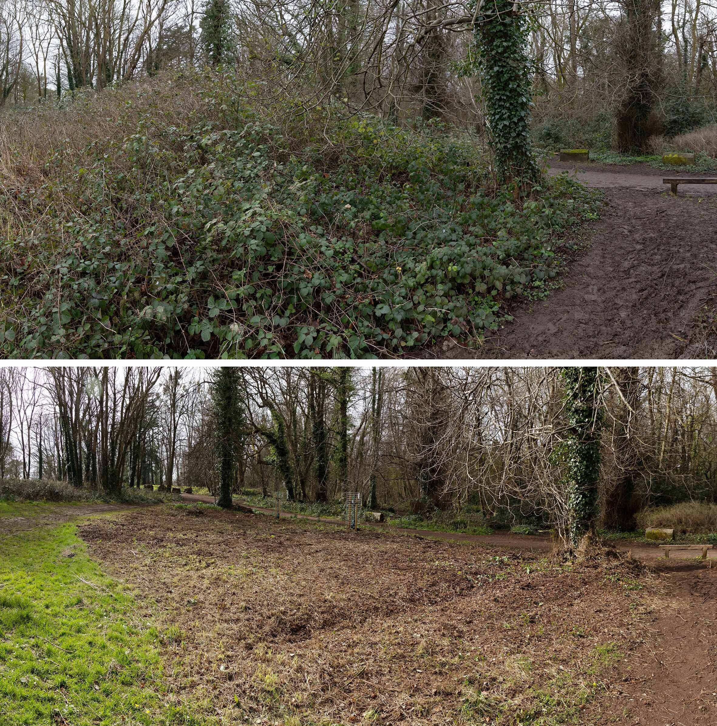
The removal has been surprisingly effective. The transformation now hits you immediately you enter the area, views through and across it restoring the sense of openness. We recognise that the snowberry is a tenacious plant, and will need repeated cutting, but this is a major step in restoring the character. The ground-cover beneath it is largely moss or ivy, the only species able to grow below the dense coverage. This month we hope to try and improve the biodiversity further by preparing the way for seeding of suitable shade-loving grasses and wildflowers.

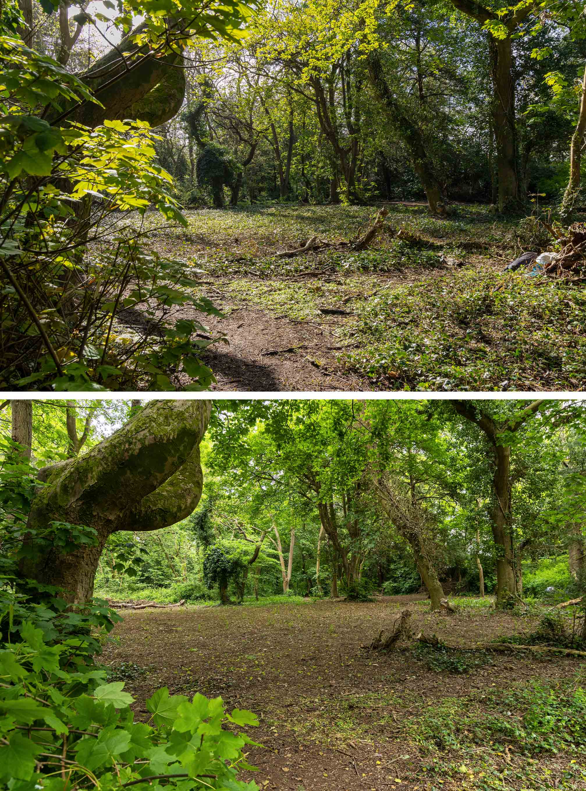
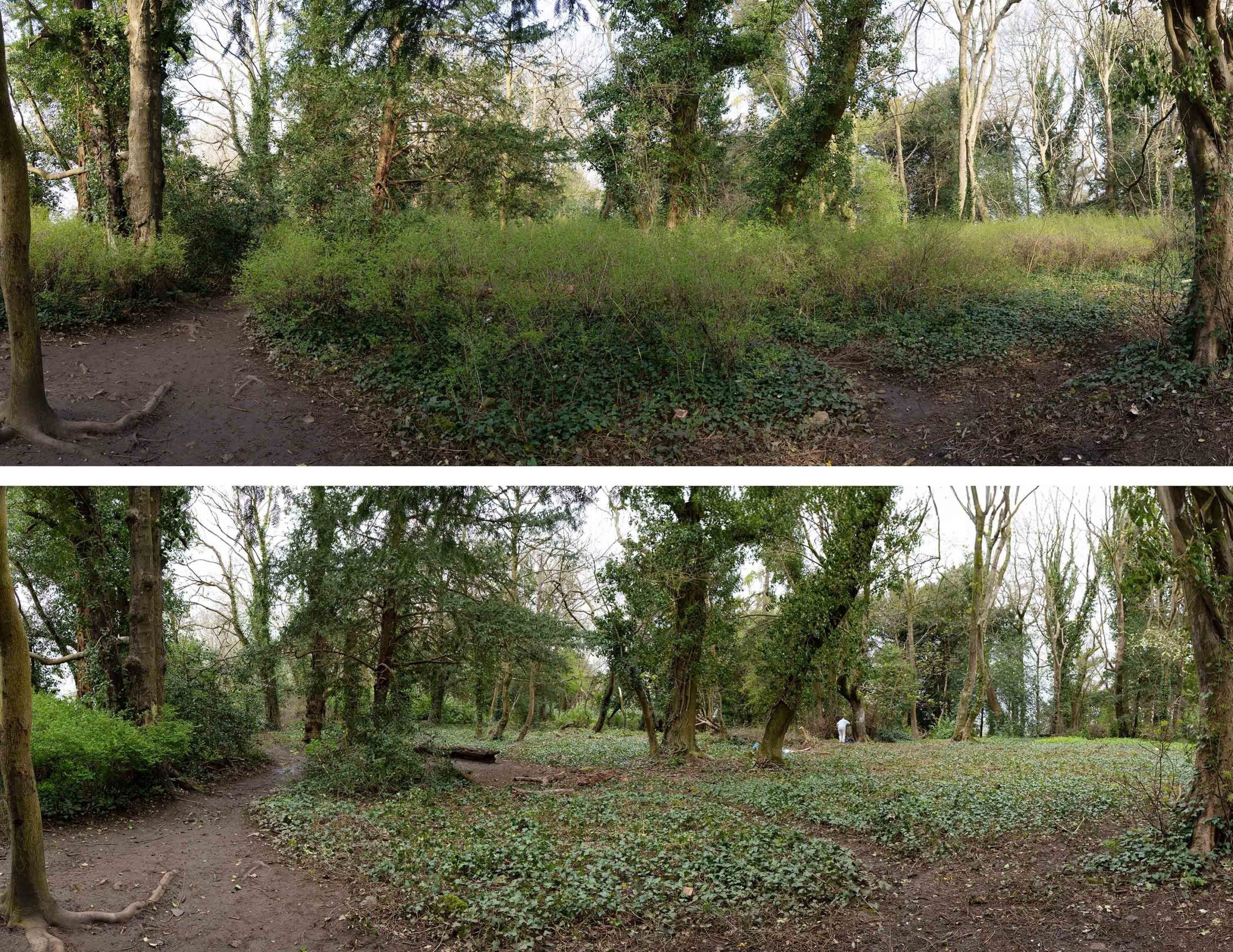
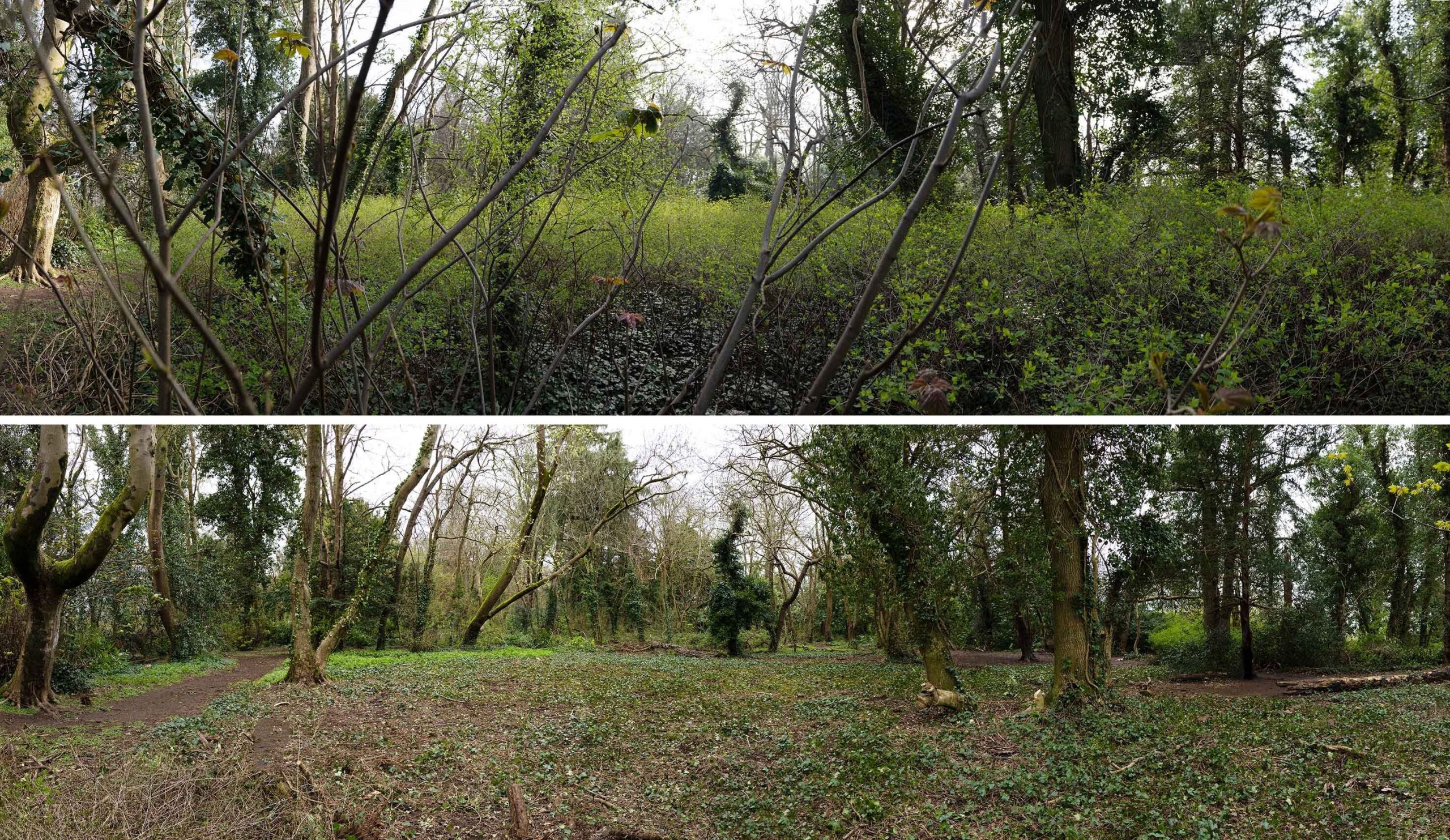
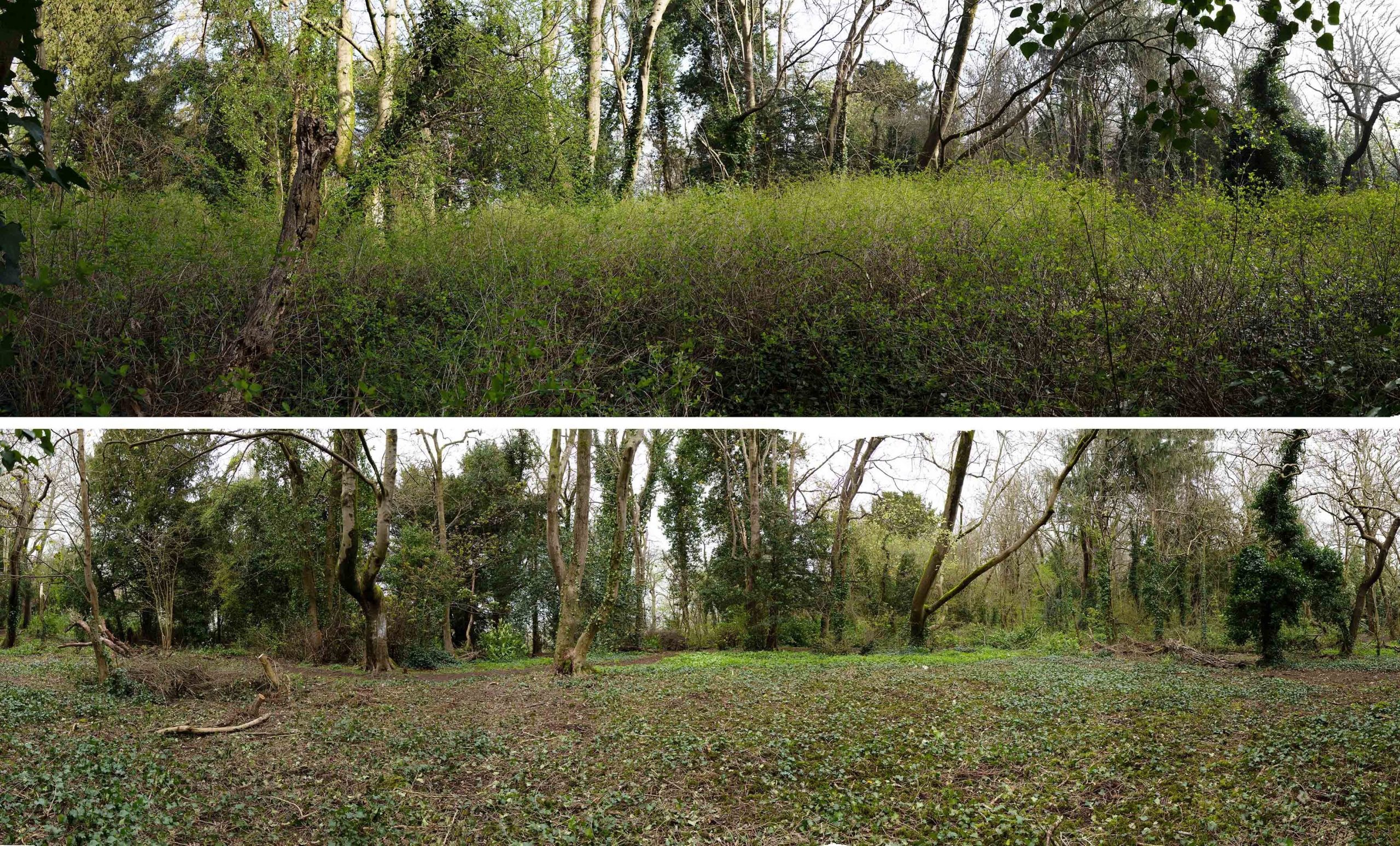
Looking across Jubilee Clearing from the south, before and after work. 

Dirty discovery in Bristol Archives

It was a bit of a surprise to find that well-rummaged archives can still turn up some historic Kings Weston gems. A recent return to Bristol Archives turned up, by chance, an interesting new estate plan. Perhaps we’d seen it before and thought it was a copy of a better known one, or perhaps we’d never thought it would be of any interest, but when it was delivered to the reading room by the archivists it was great interest.

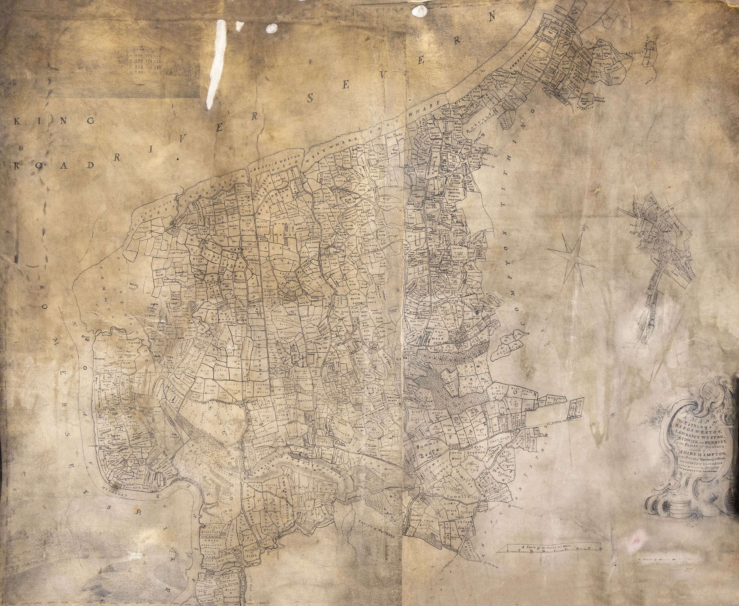
The whole of the large velum plan showing the estates of the Southwell family around Kings Weston house.
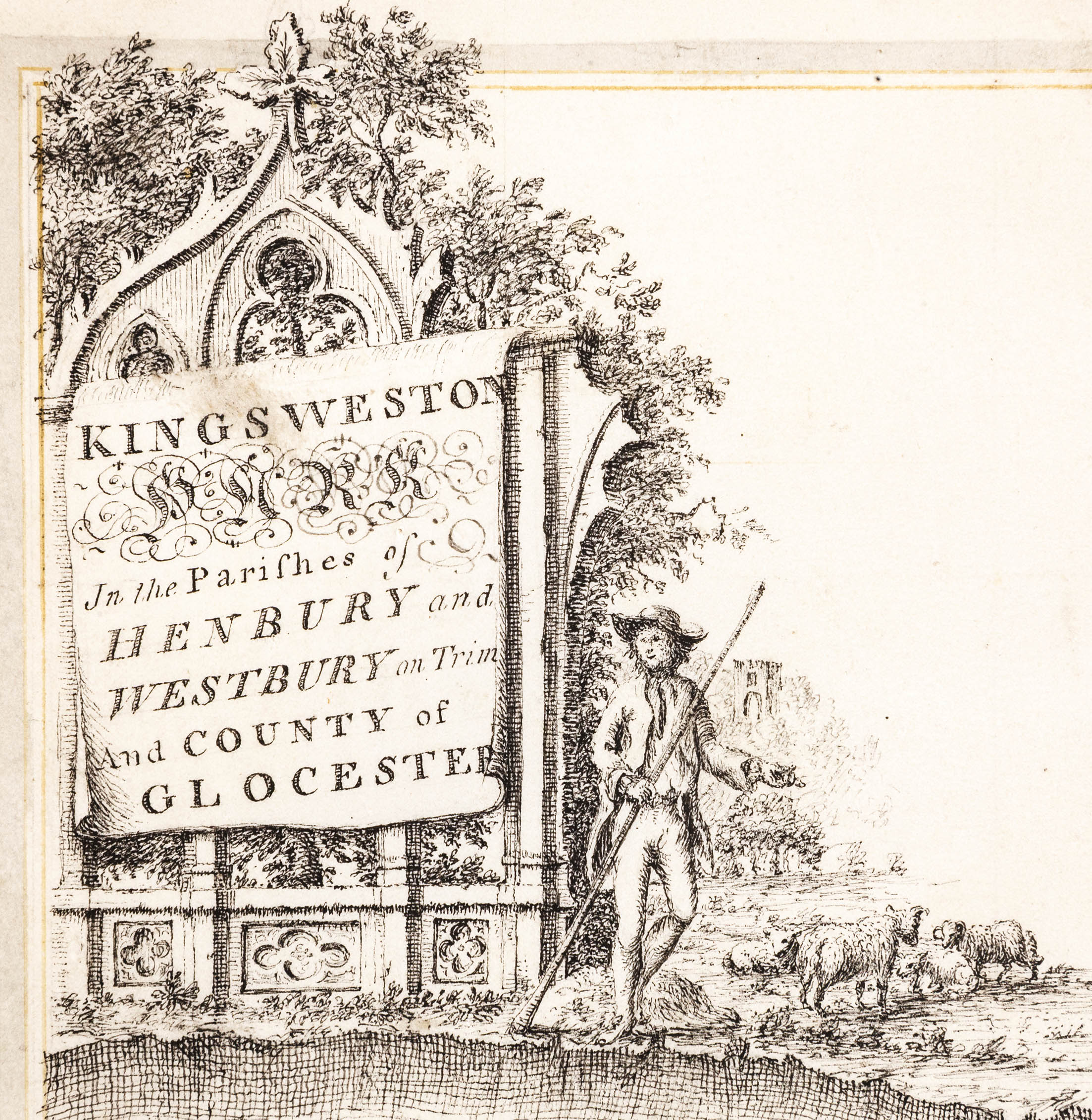
One of the ornamental title blocks added by Isaac Taylor to his earlier bound estate survey. 

We’ve regularly used snippets and details of another estate plan, drawn in 1772 by a surveyor called Isaac Taylor, to illustrate some of our stories, and you’ll find it as a base layer on the Know Your Place website. On the website it’s been carefully pieced together from the many double-page spreads from the book in which they’re bound. Sadly, this means that some of the picturesque details around the map are missed off.
 
The new estate map is also drawn by Tailor, but is instead a single rolled large-format map of the entirety of the Kings Weston estate. It is dated 1773, the date after the bound series of maps and no doubt commissioned by the Southwell Family as an alternative way of keeping track of their estates. Unlike the 1772 survey, this later version is at a larger scale. It’s also different in showing clear signs of having been updated and altered in a different hand. These changes appear to reflect changes in ownership of parcels of land and redraw detail that has become feint or worn through use.
 

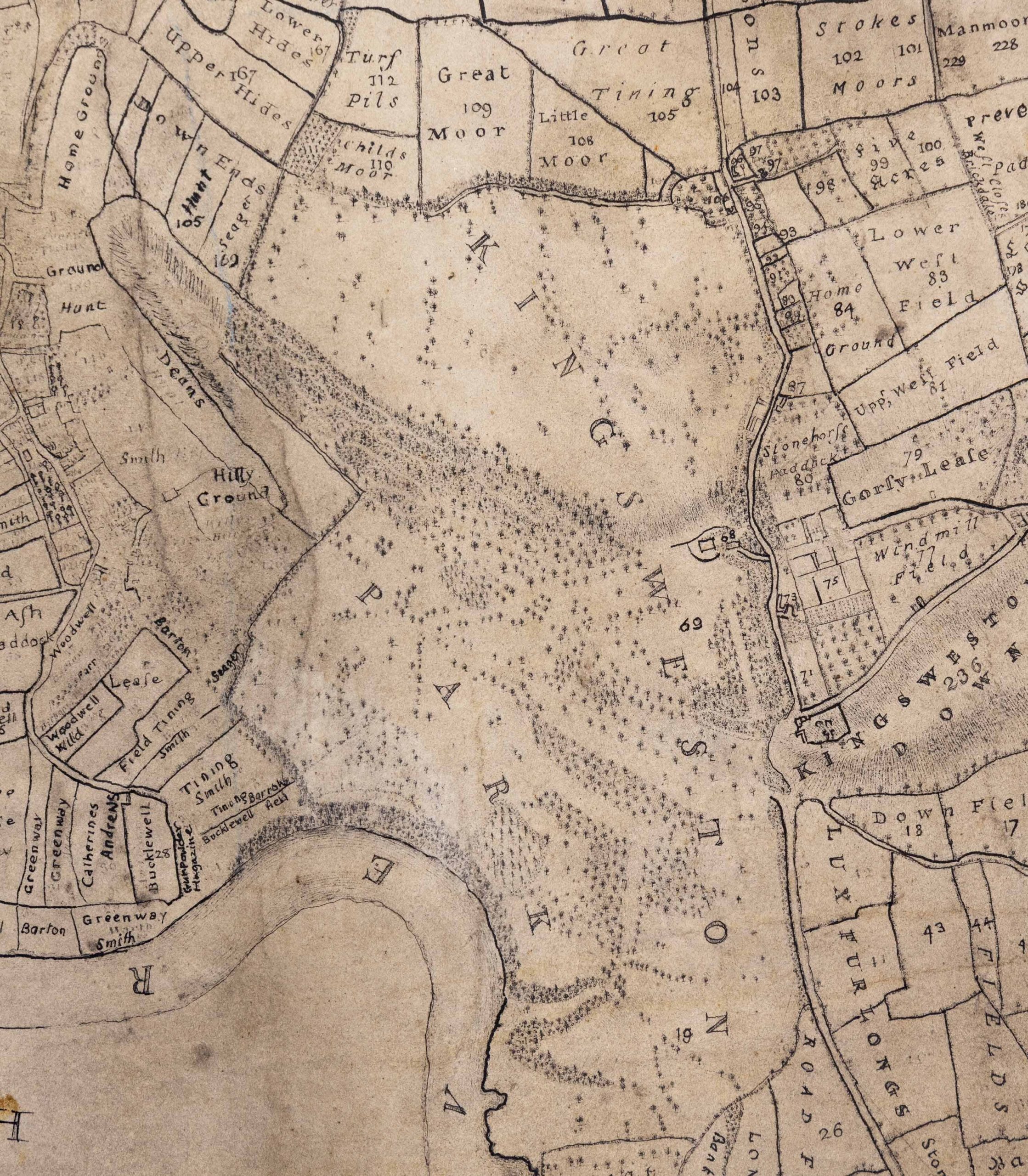
Detail of the new estate plan showing the park around the house. 


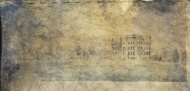
The 1773 survey is a vast and unwieldy document. It certainly shows the enormous scale of the estate in a more complete way than the individual portions in the bound volume, although without quite such the fitness of drawing. The cartouche carrying the details of the map is less elaborate, but there’s something else almost hidden under the dirt that’s accumulated on the velum over the centuries – drawings!
 
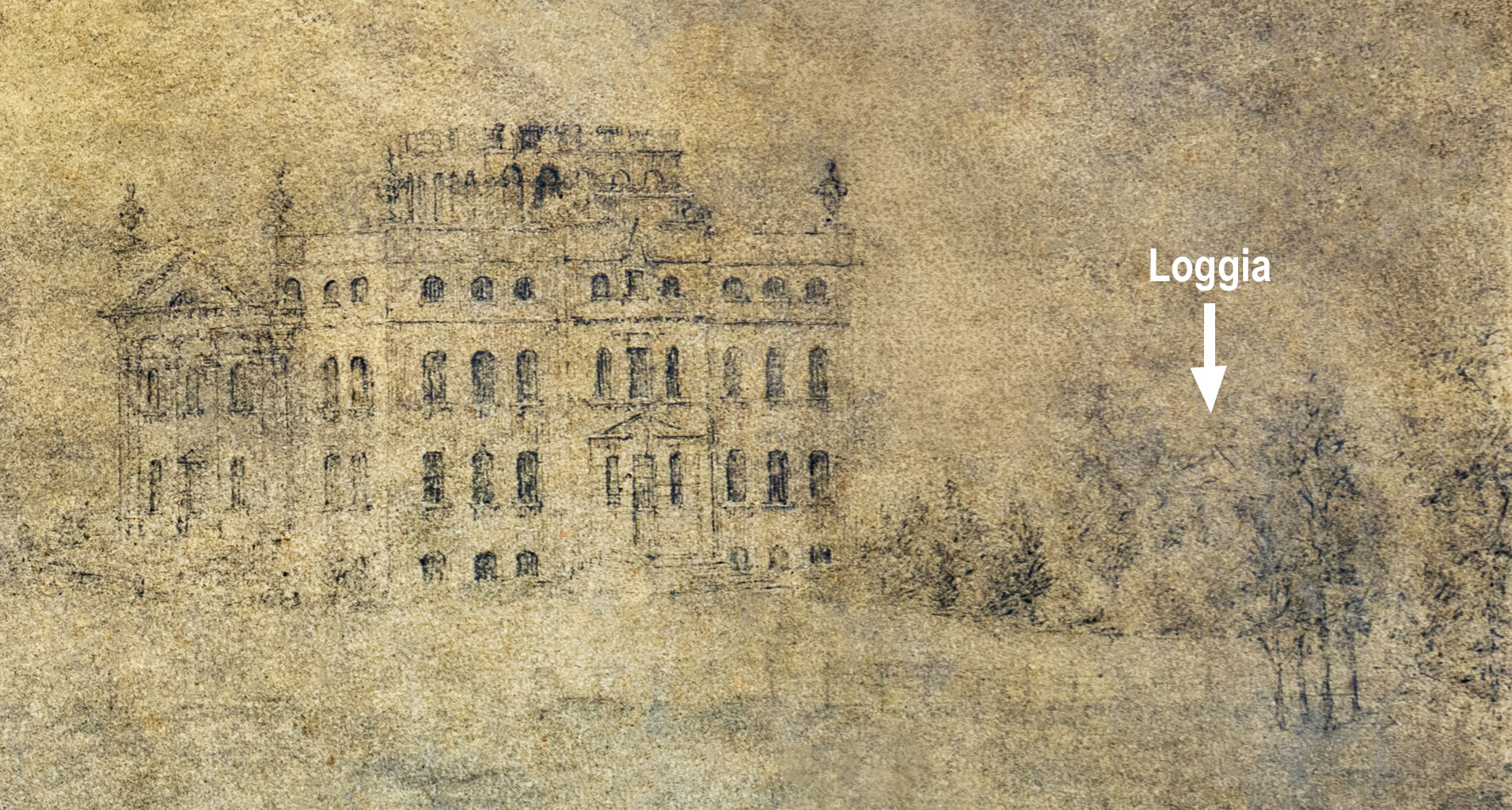
There are two, one in each corner on the left hand side. Sadly, they are very dirty and difficult to make out. The lower one is a scene on the Avon at Lamplighters, but very little detail is discernible to be of much interest. The other is more interesting to the Kings Weston story, being a rare early depiction of the house itself from the south.
The drawing is better preserved, but is still badly stained and dirty. The house is recognisable on the right hand side, with the pediment of the Loggia just visible over the top of the shrubbery. Also discernible is the avenue of lime trees approaching from the left. The planting differs little from today, though trees and shrubs have definitely matured from the illustrated state.
 
The images presented here have been enhanced to try and bring out some of the detail.

Detail of the new drawing showing the top of the Loggia above the tree line. Note also the difference on the design of the top of the garden front of the house. 

Working Party update: Bramble rooting on the lime avenue 

In retrospect, perhaps February’s working party was a bit of a challenging job. We hoped to root out a large patch of brambles, the first along the ancient avenue of lime trees leading towards the house. Through a combination of limited resources and tools that were less than ideal, we struggled to meet the target we’d set for ourselves. The poor ground conditions, clinging wet mud, and rain hardly helped matters.

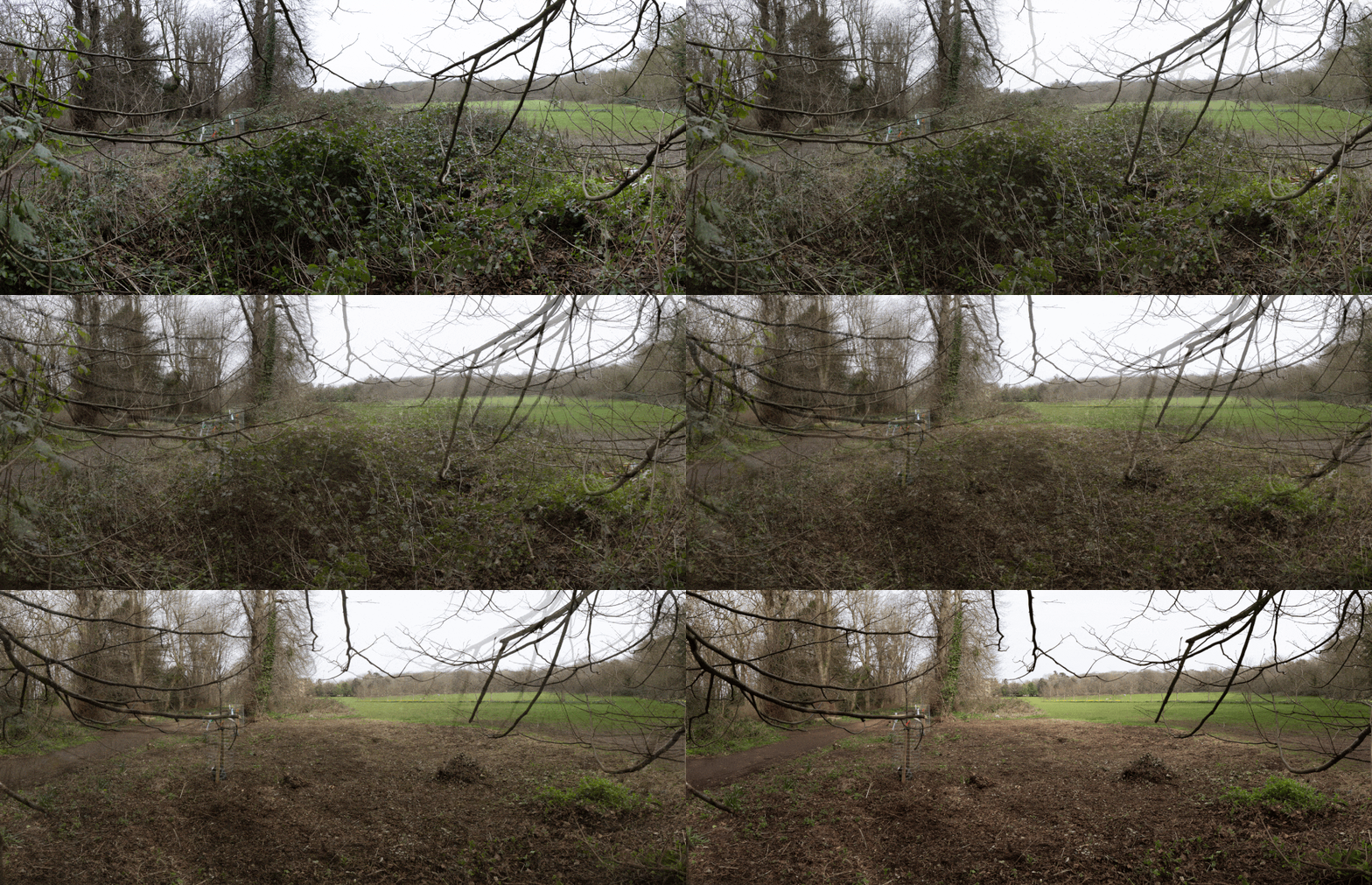
Animated image showing the scene before and after work. The drive down the lime avenue is on the left.  

We did manage to complete a significant part of the work on the day, but had to admit defeat when the rain began in earnest later on. Fortunately, a few volunteers were able to donate more of their time a couple of weeks later to complete the job.    

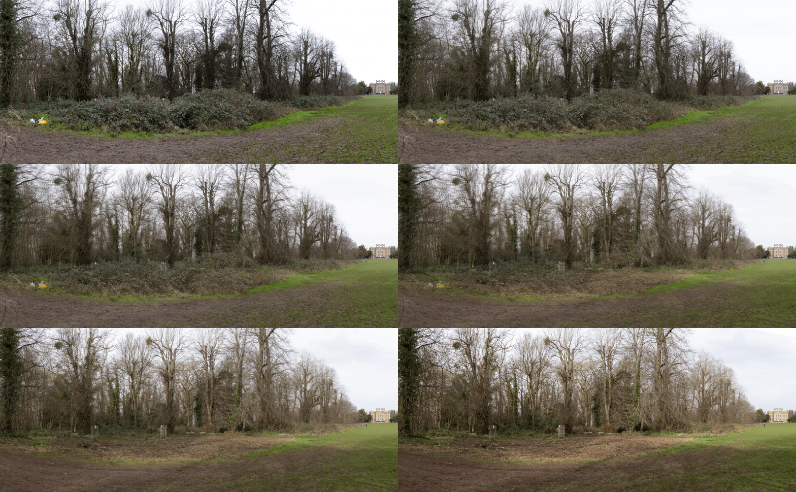
Now the two recently replanted trees on the avenue are better revealed, and there’s a definite improvement in the open character between the main drive and the open lawns leading to the house. It’s our hope that, having taken the brambles out by the root, we’ll have a much better chance of them not returning with such vigour this year.

Before and after work on the brambles looking from the lawn back towards the drive and the Circle beyond it. 

Whilst this will stem the encroachment of only a small part of the avenue, we’ll be unable to continue this work during bird nesting season. This will also give us time to rethink how we approach the job.

Animated image showing the work on the lime avenue looking towards Kings Weston house on the right. 

Park Lodge in history

Before now, we’ve looked at the history of most of the lodge houses that guarded the perimeter of Kings Weston estate and the architects involved in them. This has included Penpole Lodge by Vanbrugh, Shirehampton Lodge by Robert Mylne, Wood Lodge, probably by Thomas Wright, and Henbury Lodge by Thomas Hopper; but the history of Park Lodge is less clear.

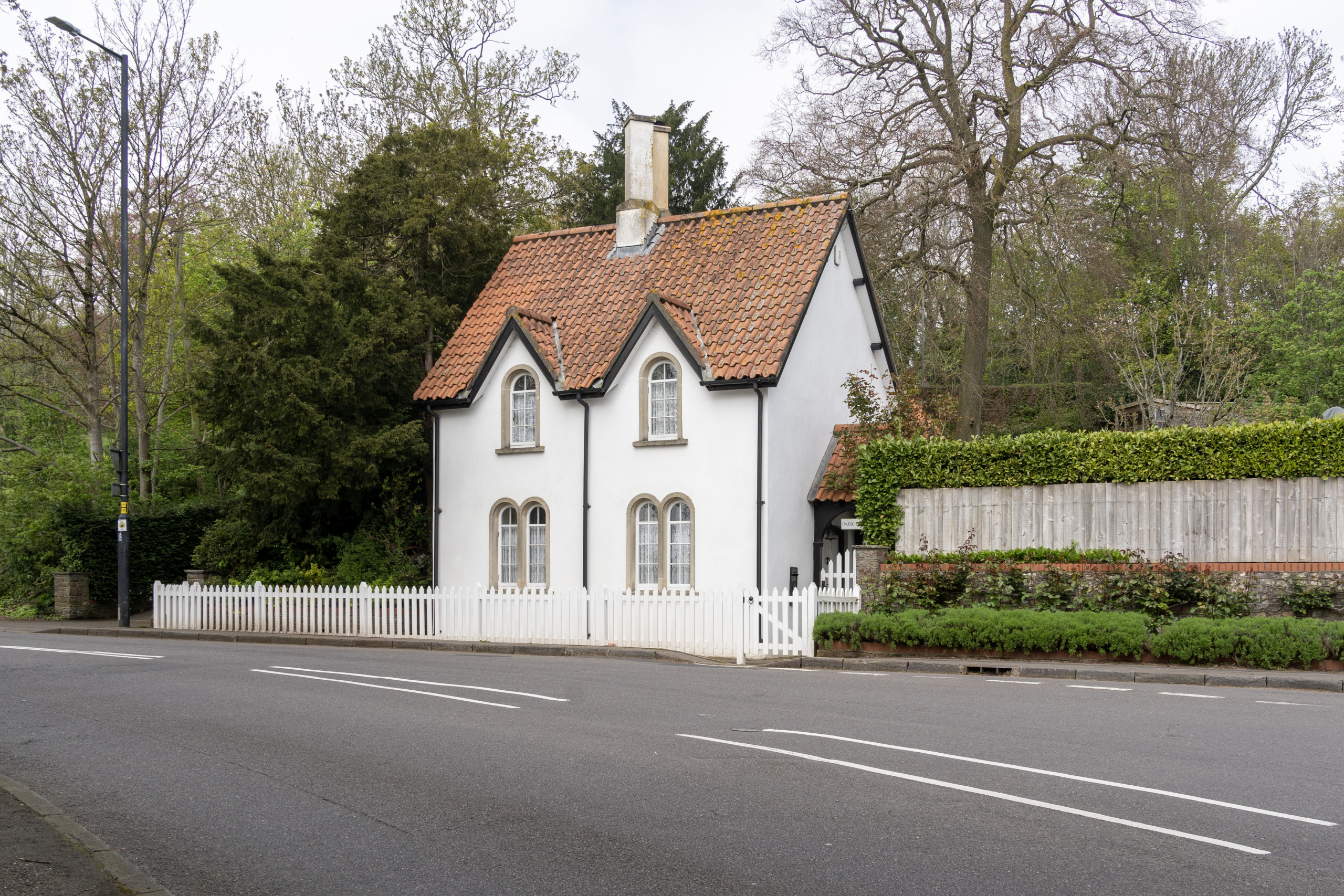
Park Lodge much as it appears today

Park Lodge is today a Grade II Listed building and will be familiar to thousand who pass it daily on the corner of Shirehampton Road and Kingsweston Road. Sat behind a white picket fence, the building is a pleasant but not extravagant cottage. It fits broadly into the  Cottage orné style of buildings designed for picturesque effect. Its steep pitched pantile roofs and dormers give it an alert posture and its arch-headed window add a little light ornamental appearance. A a pair of tall conjoined chimney stacks punctuate the centre point of the roof profile.
 
The lodges weren’t toll houses, but demarked the boundary of the landscaped parkland and controlled access through the estate after dark. Each of the roadside lodges were equipped with gates that could be closed at dusk, despite it being the public highway. In this way the Southwell and Miles family could assert the impression of authority over the landscape despite having to allow traffic to travel through their lands to Shirehampton, Lawrence Weston, and Henbury.

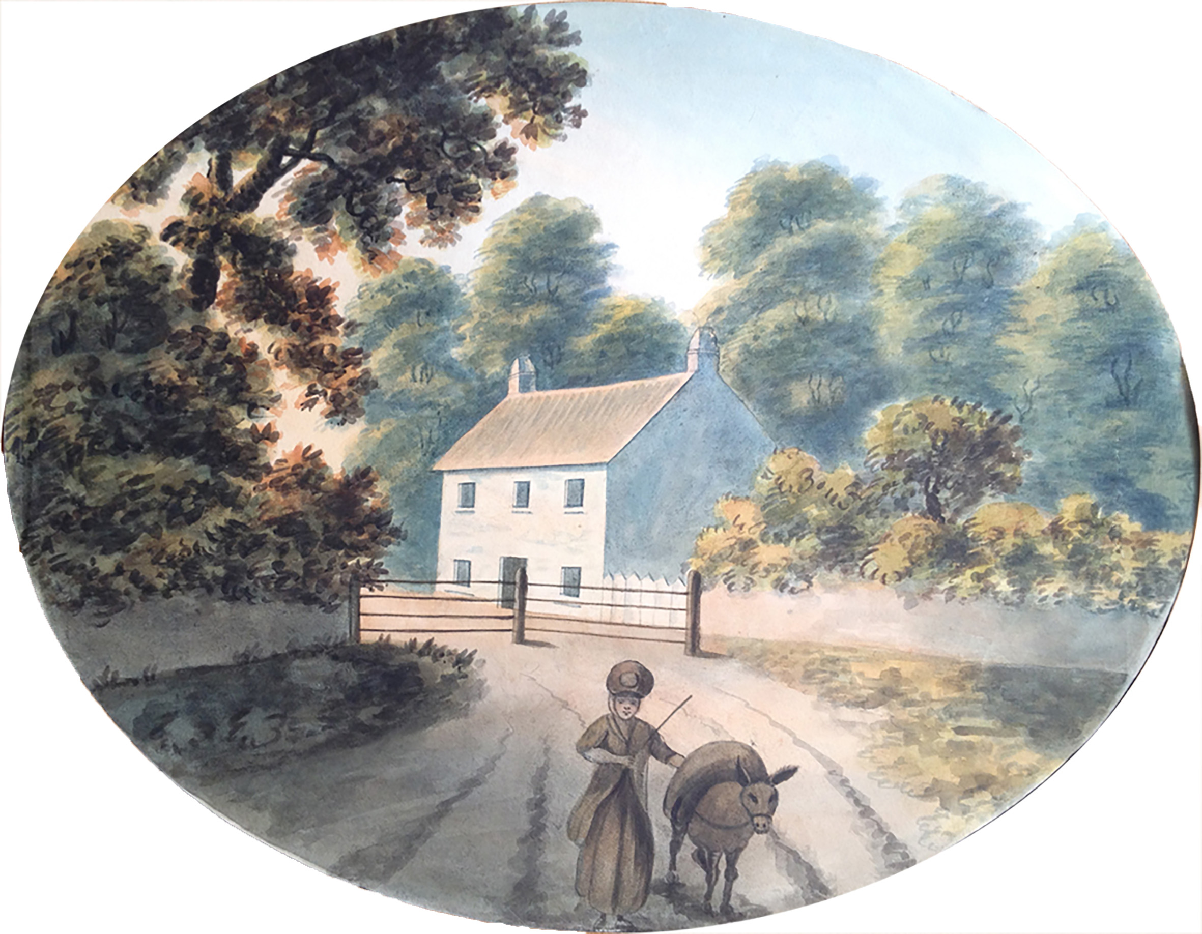
Park Lodge in the 1820s from the east. From a painting now within the collections of Neath Antiquarian Society. 

However picturesque Park Lodge might be, it’s far from being as architecturally noteworthy as its partner lodges and its history is less well documented. It appears first on the 1772 estate plan by Isaac Taylor, complete with its wooden gates, but this was a very different building to the one we see today.
 
We’re fortunate that two illustrations exist to show the earlier building, one even less architecturally satisfying than the present one. The first is an undated watercolour of around 1820. The scene looks west from Shirehampton Road at its junction with Kings Weston Road, roughly where the bus stop is today.
 
A small cottage with a simple symmetrical frontage faces onto the road with a central door and five identical square windows. A simple tiled pitched roof is anchored at either gable by a squat little chimney. In front of it are the gates, shown on the eastern side of the building. The bucolic character of the scene is set off by a woman driving her loaded donkey in the direction of the artist. The lodge’s backdrop is dominated by mature trees, perhaps the verge plantations shown on the 1772 plan. To its right the estate wall encloses a lower shrubbery, perhaps the cottage gardens.

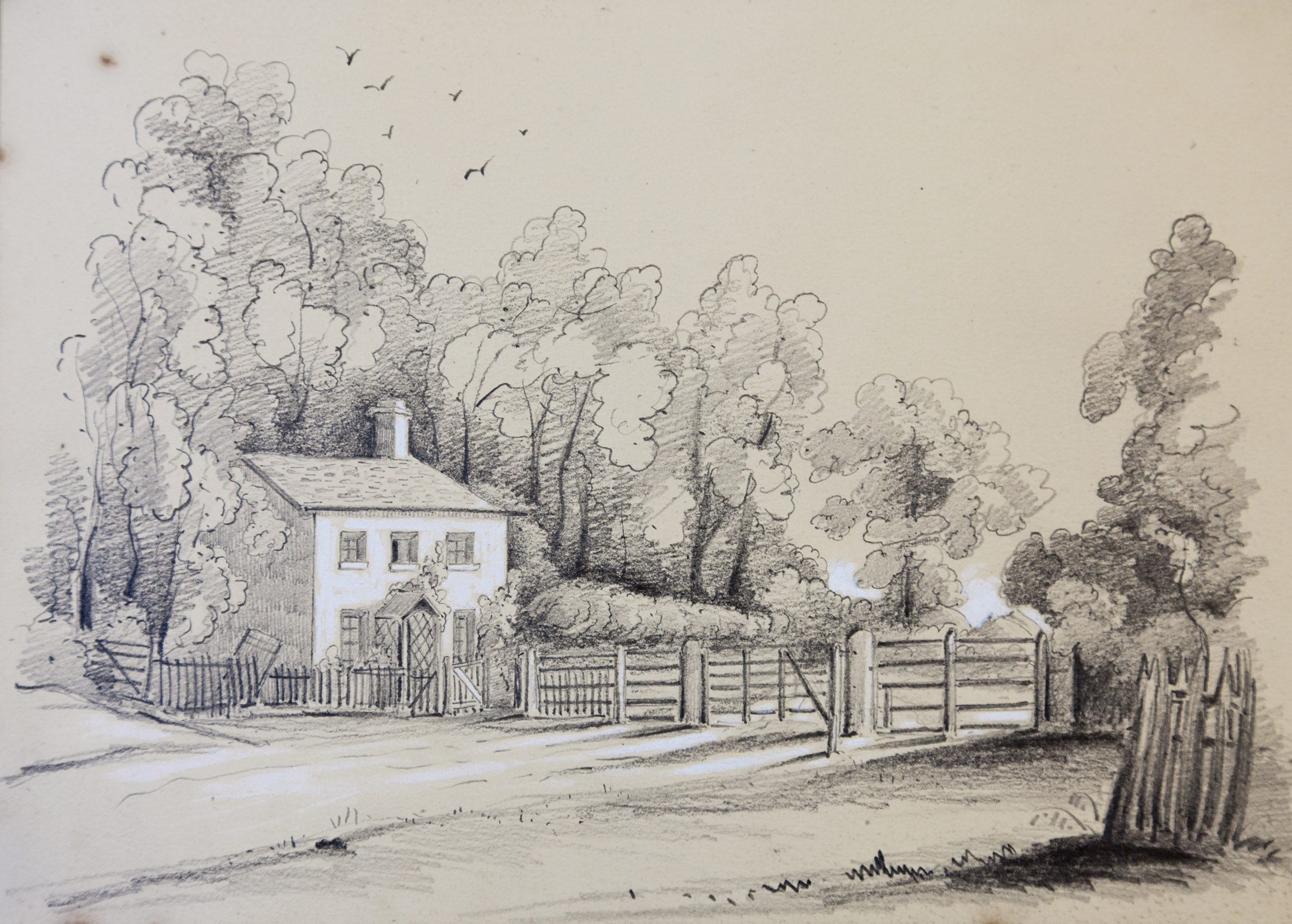
The view looking east from the edge of Shirehampton Park in 1846. Shirehampton Road exits the park from the left and through the gates across the road. Bristol Archives Ref: 13424/5

The general accuracy of the image is confirmed by another painting around twenty years later, helpfully dated 1846. It’s from an artist’s sketchbook belonging to Edward Emra Earle, of Westbury-on-Trym and shows the opposing view, from the west.  The small ground floor windows have perhaps been enlarged, and a simple porch with trellis added around the front door. The park gates are shown in more detail, suggesting how imposing they might have been to anyone unaware they were permitted passage through them.
 
Clearly, this little building’s no longer with us having taken on its present appearance later in the Victorian era. By the 1870s, when it is first recorded photographically, it had been transformed, but did any of the earlier building survive? The ‘new’ lodge looks very different, but it’s footprint must surely be similar to the earlier building. Was it simply altered?

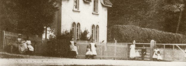
Park Lodge in about the 1870s from a very similar perspective to the 1846 sketch.
One of many small houses drawn by Sr John Vanbrugh, this one held by the V&A.

If it was a reconfiguration of the old building, the interior had been heavily changed, with chimneys being taken from the end gables and centred together in the middle of the roof. The central front door has also gone, replaced on the end of the building.
 
A date for these changes is uncertain, but drawings held in Bristol Archives show similar reconfiguration was made to Henbury Lodge in 1863. These alterations were penned by William Skinner Miles, then-owner of Kings Weston; this would explain why the architectural effect of Park Lodge was a more ammeter production than might be expected.
 
The question remains, why was the most prominent of the park lodges not treated in a more architectural manner? Arriving from Bristol, the main approach to the front of Kings Weston house would have been through this gate and down the drive from The Circle. The lodge and gates would have been visually prominent for anyone approaching Kingsweston Hill from the south.
 
One theory is that it had been something more when first built, only to have been reduced to an visually inauspicious cottage by the early 19th Century. Sir John Vanbrugh’s drawings are littered with sketches for small unpretentious cottages of similar scale and symmetry; could Park Lodge have begun life as one of these?