
Monthly Archives: August 2026

Surveying the State Rooms

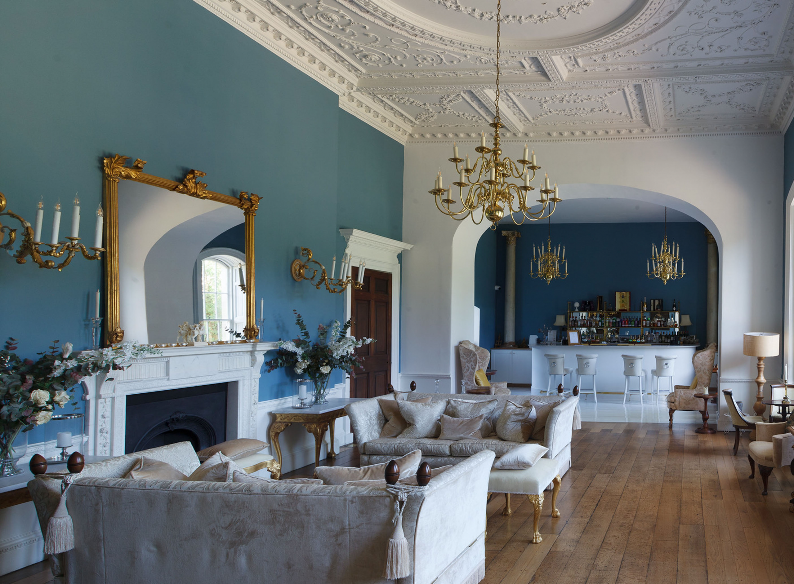
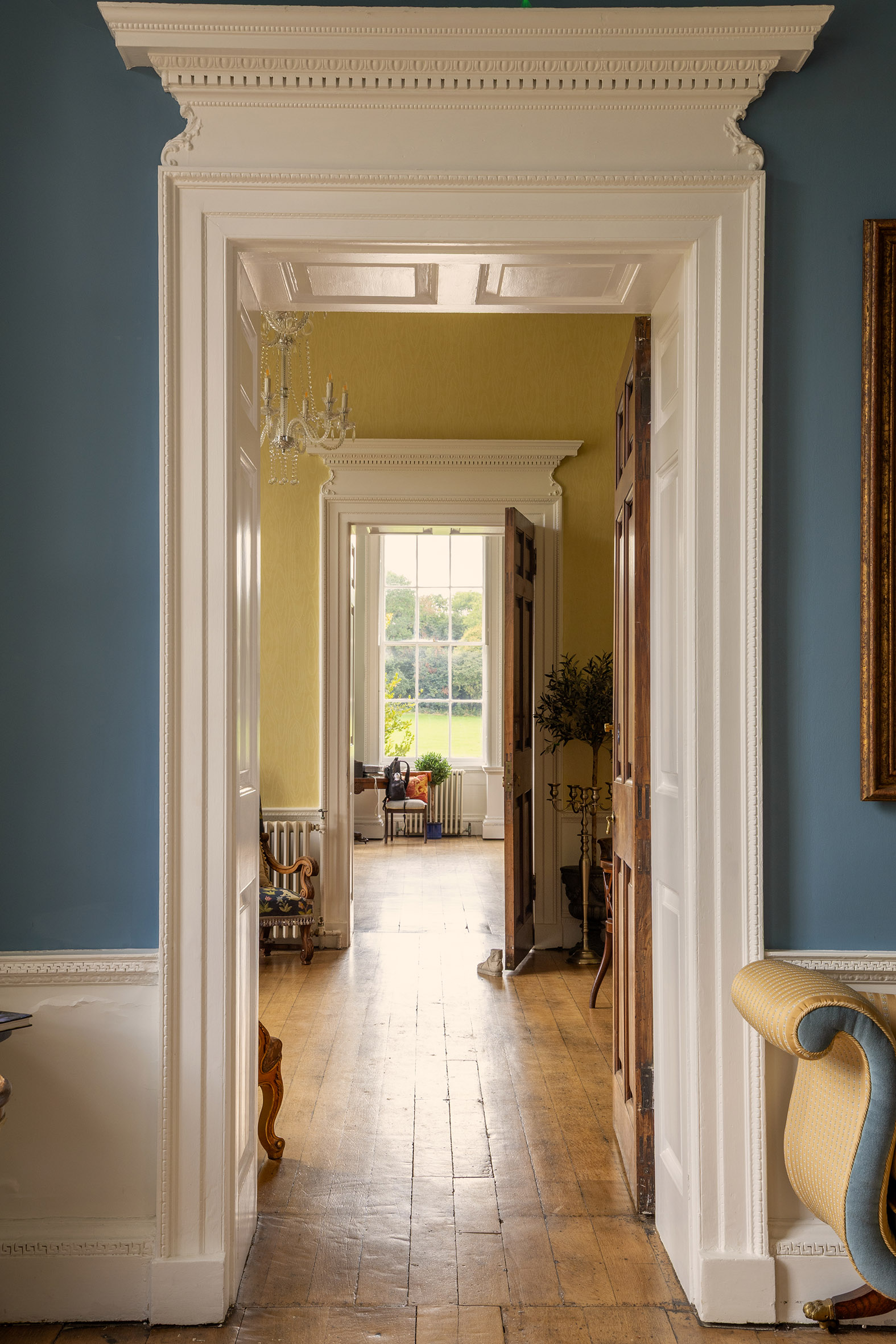
The enfilade looking from the Dining Room through the house

As  has become traditional in the run-up to Heritage Open Days, this month we’ll  look at aspects of the interior of Kings Weston house. Every year the tours  pass from the Saloon, the grand entrance hall of the house, into a series of  chambers known as the State Rooms. These rooms were not intended for regular  family use, but were instead designed accommodate and entertain distinguished  guests and for the conspicuous display of the owner’s wealth and taste. These  were generally modelled on sequences of rooms in royal palaces, designed to  control access to the monarch and provide sequentially more private chambers for audience with increasingly high-ranking and trusted confidants.

Kings Weston was designed with its own version; a series of three state  rooms arranged ‘enfilade’, that is to say,  aligned in such a way as to enjoy an unbroken vista down the length of the  house framed through sequential doorways. This formal arrangement emphasised  the length of the house and  heightened  the expectation of any visitor permitted to pass on to the next more intimate  space.
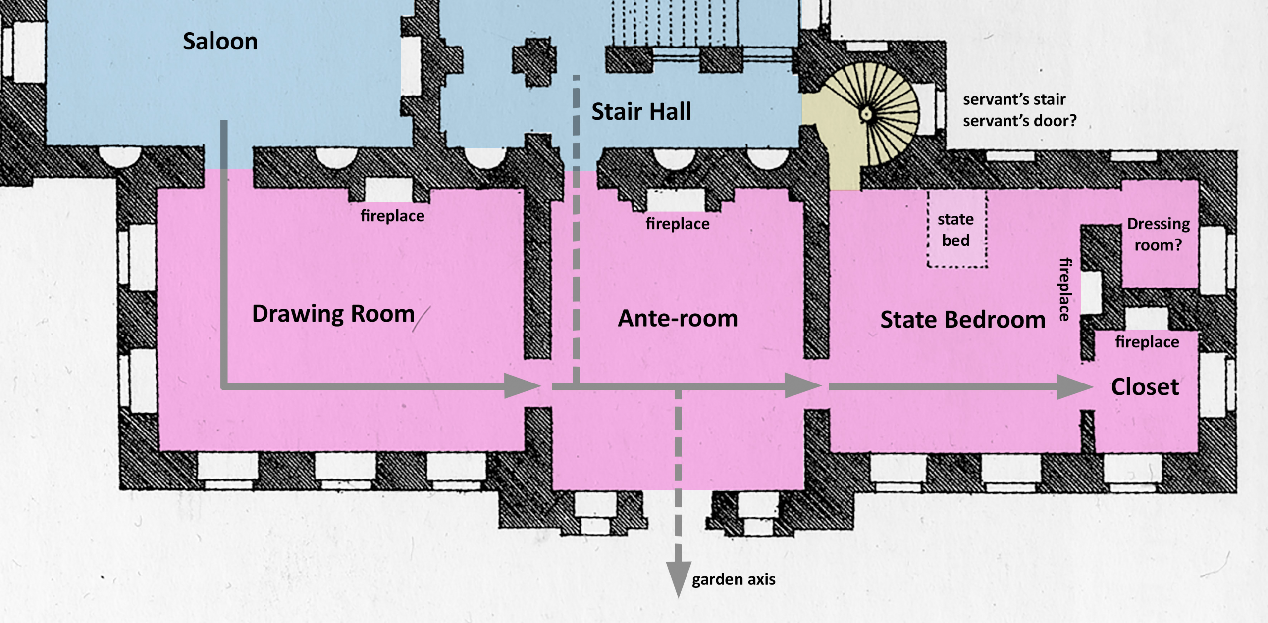
Diagram showing the layout of the house as built  circa 1716. The chain of State Rooms occupies the sheltered south side of the house, arranged to enjoy views across the formal gardens.

The rooms usually became increasingly opulent from one end of the sequence to the other. The culmination of this would be the State bedroom. Had the sovereign or another high-ranking aristocrat ever visited they would have been accommodated in this room, but at all other times it was purely a showcase for your finest paintings, possessions, textiles, and furniture.

Kings  Weston’s State rooms began off the south side of the Saloon with a large  reception room later known as the Drawing Room. Although we have general  arrangement plans for the principal floor, we have very little to go on in  understanding their original appearance when Edward Southwell first moved in in  1716.

The room we see today retains its original proportions but was subject to major redesign beginning in 1768. This included the replacement of the fireplace in its symmetrical location on its northern wall, the infilling of the two western windows (subsequently re-opened), and the elaborate decoration of the ceiling by famous plasterer Thomas Stocking. All this work was designed by the architect Robert Mylne for his client Edward Southwell (the third).
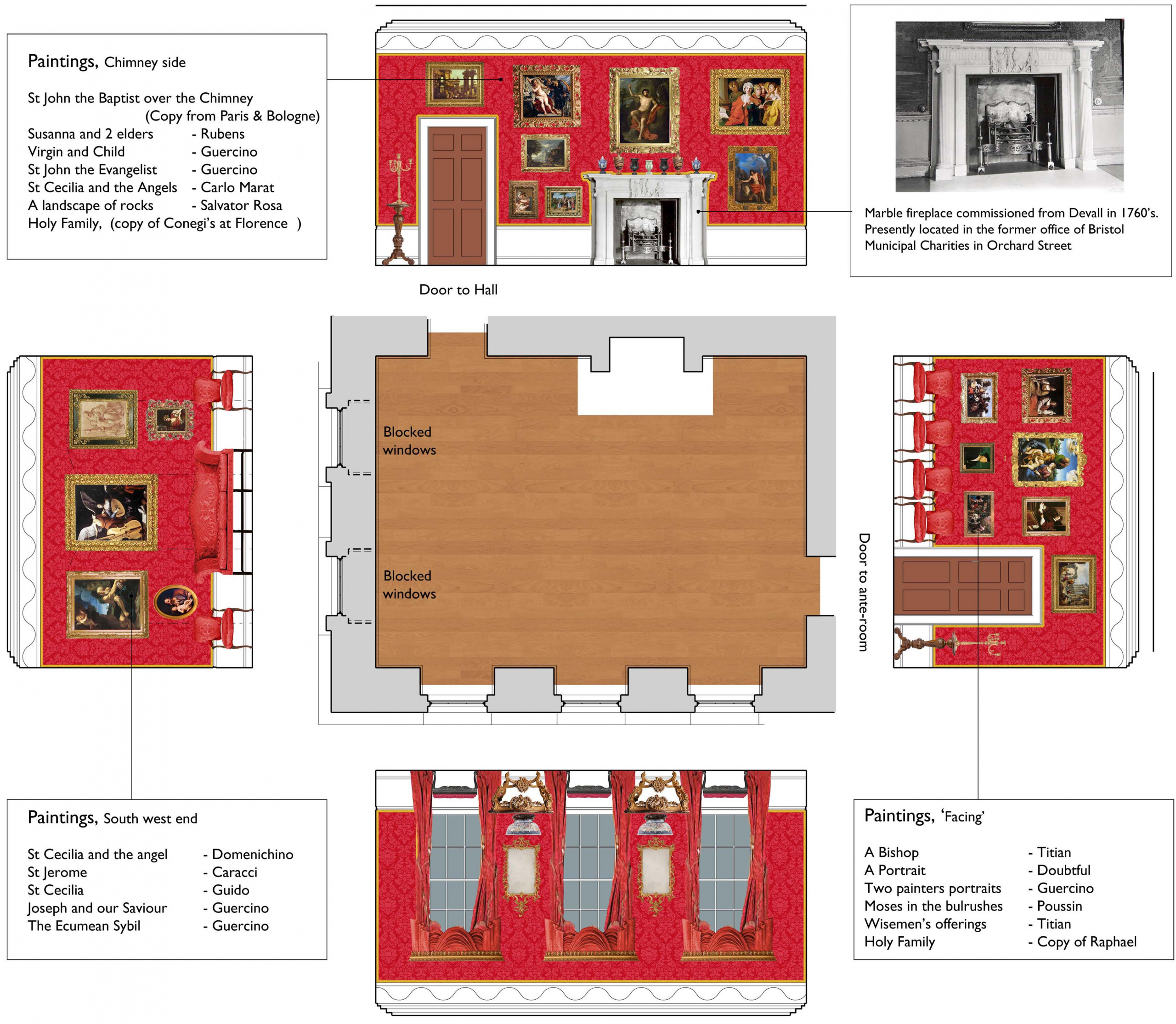
Diagram suggesting how the Drawing Room would have been decorated when it was recorded in the probate inventory of 1777

We know from an inventory of the house taken in 1777 that the room was lavishly decorated, it’s walls hung with silk crimson damask, picked out with carved gilded edging, and hung with Old Master paintings. Its centrepiece was a pure white marble fire surround commissioned from John Devall, who had supplied similar to a number of Royal Palaces.
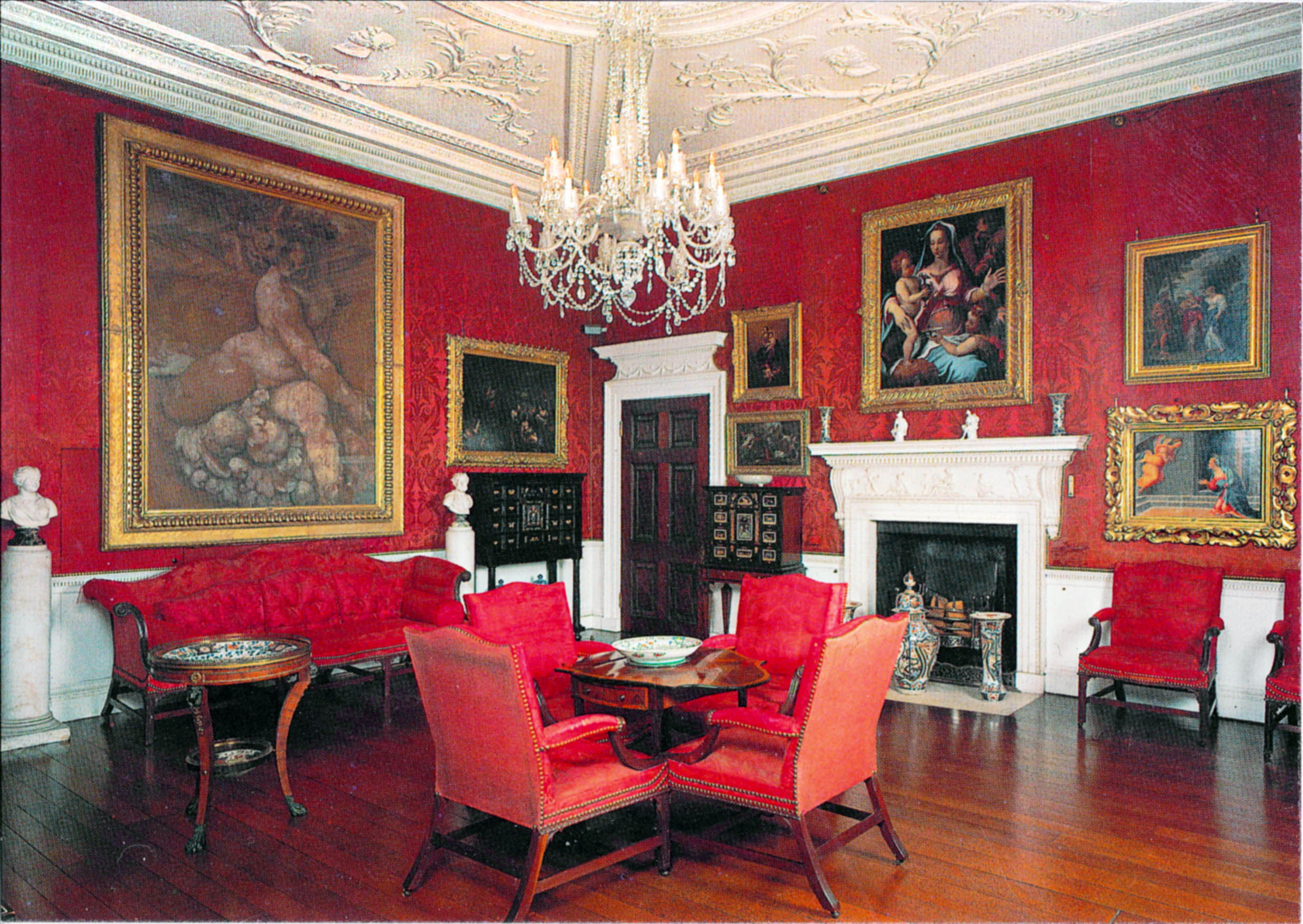
The Drawing Room at Corsham Court gives a great impression of how the Drawing Room was decorated after 1768

Sadly, today’s visitor will find no such Rolls-Royce of fireplaces in the room today. When the house was purchased by Bristol Municipal Charities in 1936 with the intention of converting it into a new home for Queen Elizabeth Hospital School, they began stripping out many of the historic fixtures. The State Rooms were intended for use as classrooms, and fireplaces replaced by radiators and wallspace enough for a blackboard required.
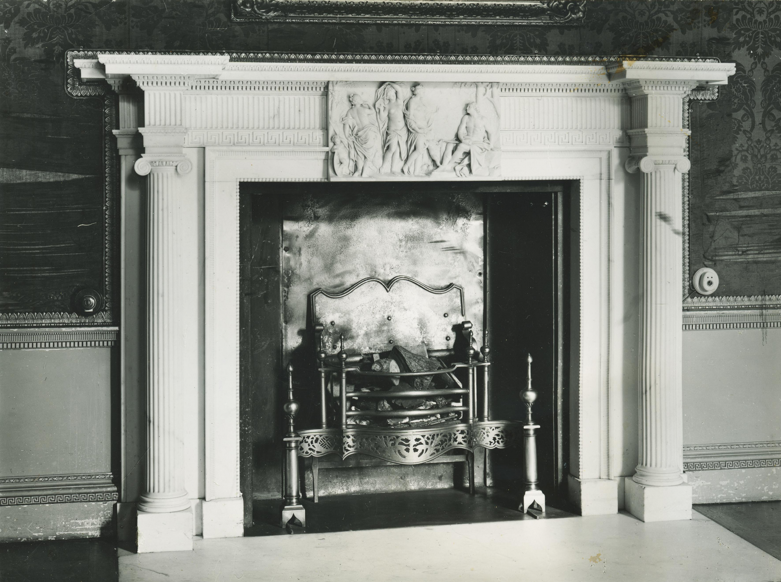
The Drawing Room fire surround recorded in 1927before it was dismantled. Note the fraying condition of the original silk wall coverings and the gilded detail around its edges.

The Drawing Room fireplace was dismantled and lost to Kings Weston, but it remains in Bristol to this day. The Charities set the chimney surround up in the Board Room of their new offices in Orchard Street, just off College Green. And there it is still today, though the Charities have moved out and sold the building for residential conversion, so it now rather incongruously augments a one-bed flat. Perhaps, one day, it, or a facsimile, might return to its place at Kings Weston.

The ceiling of the Drawing Room is one of the most remarkable in the house. Swagged with plaster flowers, each individually moulded, it is both beautiful and exquisitely executed. No doubt the design was that of Robert Mylne, but it’s floral theme must have been designed to please Edward Southwell III’s wife, Sophia Campbell. She was fascinated by botany and loved flowers especially. It can be no coincidence that they play such a strong role in decorating the interiors at Kings Weston.
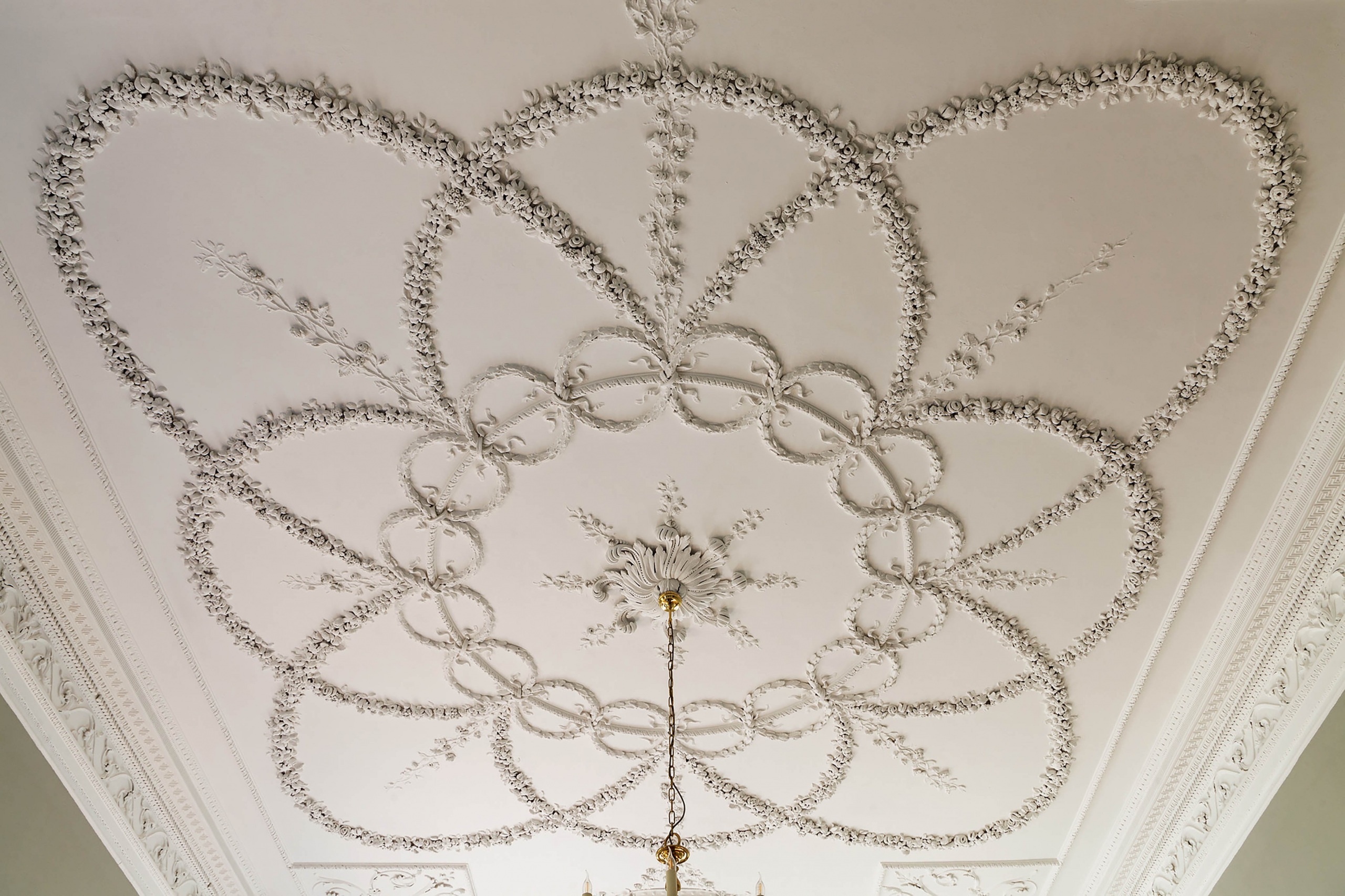
The spectacular and intricate floral ceiling of the Drawing Room from 1768

The next in the sequence of State Rooms  has never gone by any more elaborate title than the Ante-Room. Smaller and more intimate than its neighbour, it takes the place of an Audience Chamber or  Privy Chamber in more ostentatious houses. At Kings Weston it is aligned to the garden axis looking directly up the hill towards The Echo and could have been used as a separate private entrance for anyone fortunate enough to inhabit the State Rooms. Indeed, with access directly into the stair hall on the opposite wall, it’s likely that it provided more direct garden access for the family when the rest of the State Rooms were not  in use.
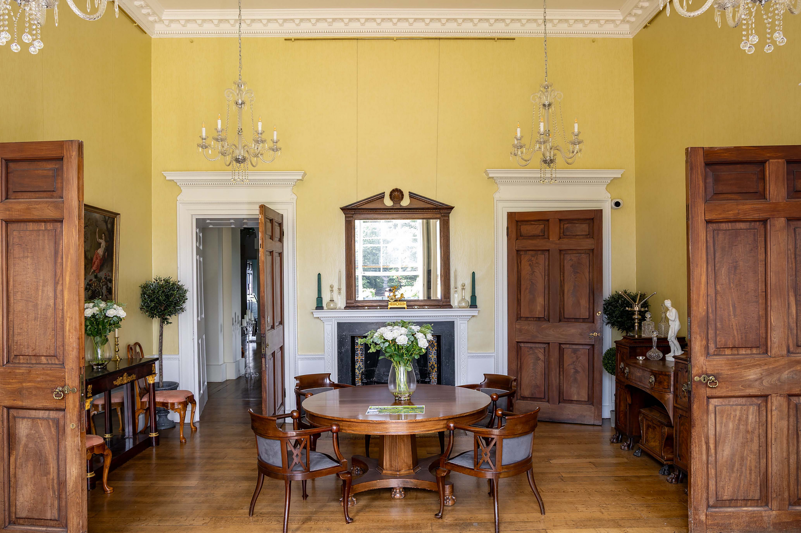
The Ante-Room is a picture of symmetry and order. Despite it’s grand pretentions, the door on the right of the fireplace only ever accessed a cupboard

Like the Drawing Room, we have little information that can be relied upon to help imagine how the Ante Room appeared as originally completed, and, similarly, it was redecorated in the 1760s. It matched the Drawing Room with Crimson damask, and gilded borders, and Old Masters proliferated, through the fire surround and ceilings were less ambitious, delicate marquetry around the hearth slab being a discrete but expensive hint at the room’s status.

Today, the last in the chain of State Rooms is the Canaletto Room, earlier the Dining Room. It occupies three window bays and, since the Victorian era, extends through the back of the house with an arched opening that delineates the earlier proportions. Before this though it was the culmination of the visitor’s passage through the State Rooms and the location of the State Bedroom. The bedroom was smaller than the present room, occupying just two bays, with smaller compartments behind it on its east side. 
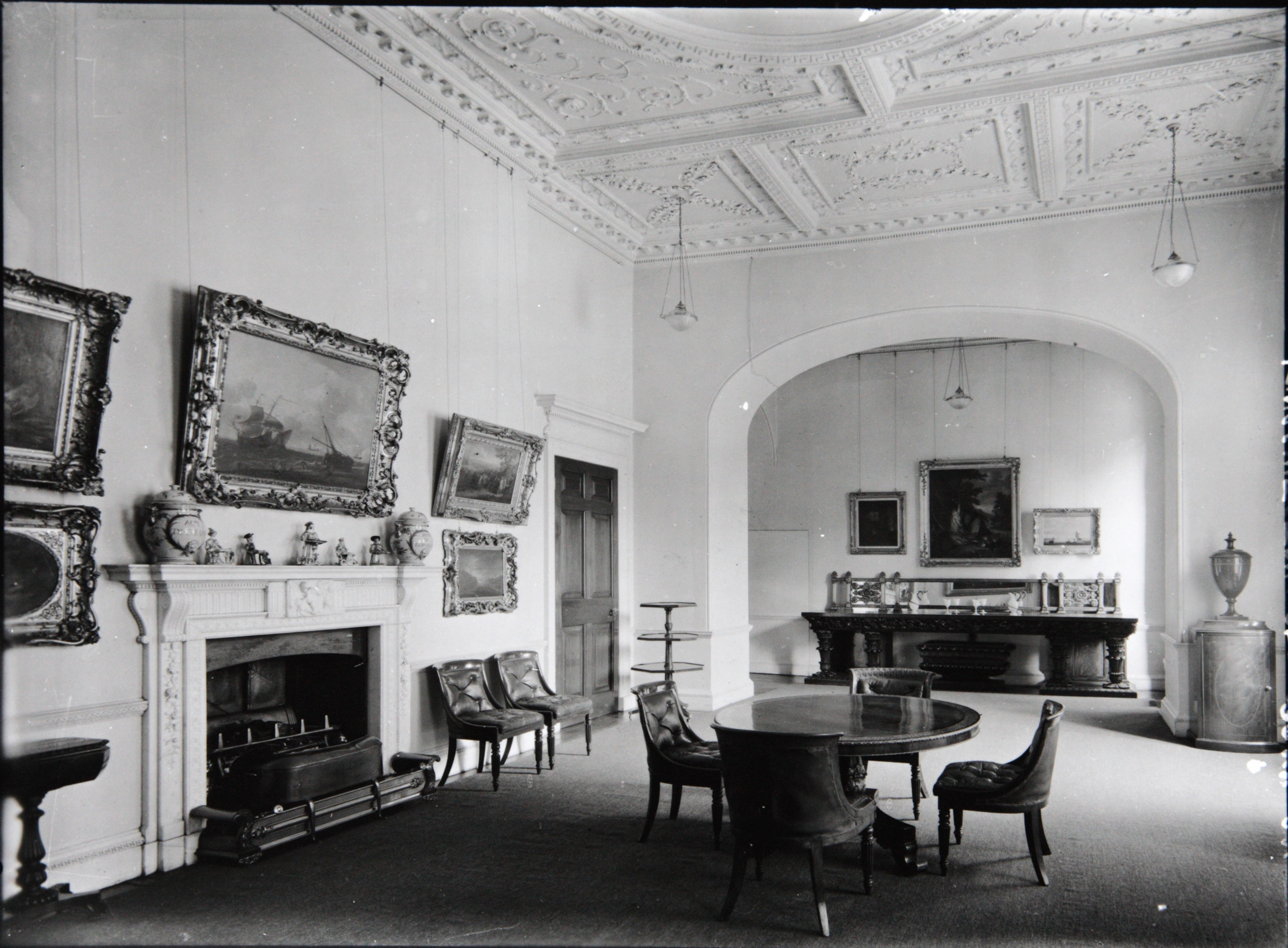
The Dining Room in 1927 exhibiting the tastes and interests of the last private owner of Kings Weston House, Philip Napier Miles and his wife Sybil. This photo was key in returning the fire surround to its original location.
The same view today, with the marble fire surround restored and returned to its original location.

It was common practice for Kings in the late 17th and early 18th centuries to hold a levée, a ceremony allowing intimate access to the monarch as he rose from bed in the morning. In these ceremonies the bed became a focus for expressions of wealth and often took the form an elaborate architecturally-scaled structures. The State Bedroom at Kings Weston replicated the arrangement found in Royal palaces in microcosm and would have been furnished with the Southwell Family’s most elaborate and expensive furniture and works of art. The State Bed itself was set up against the north wall.

Through the State Bedroom was probably the smallest and most intimate of spaces, a closet. Its importance is implied by its alignment as a continuation of the enfilade. There are many examples of such closets where more precious artefacts and object d’art were housed in a richly panelled interiors, accessible only to the hosts most trusted and honoured guests.
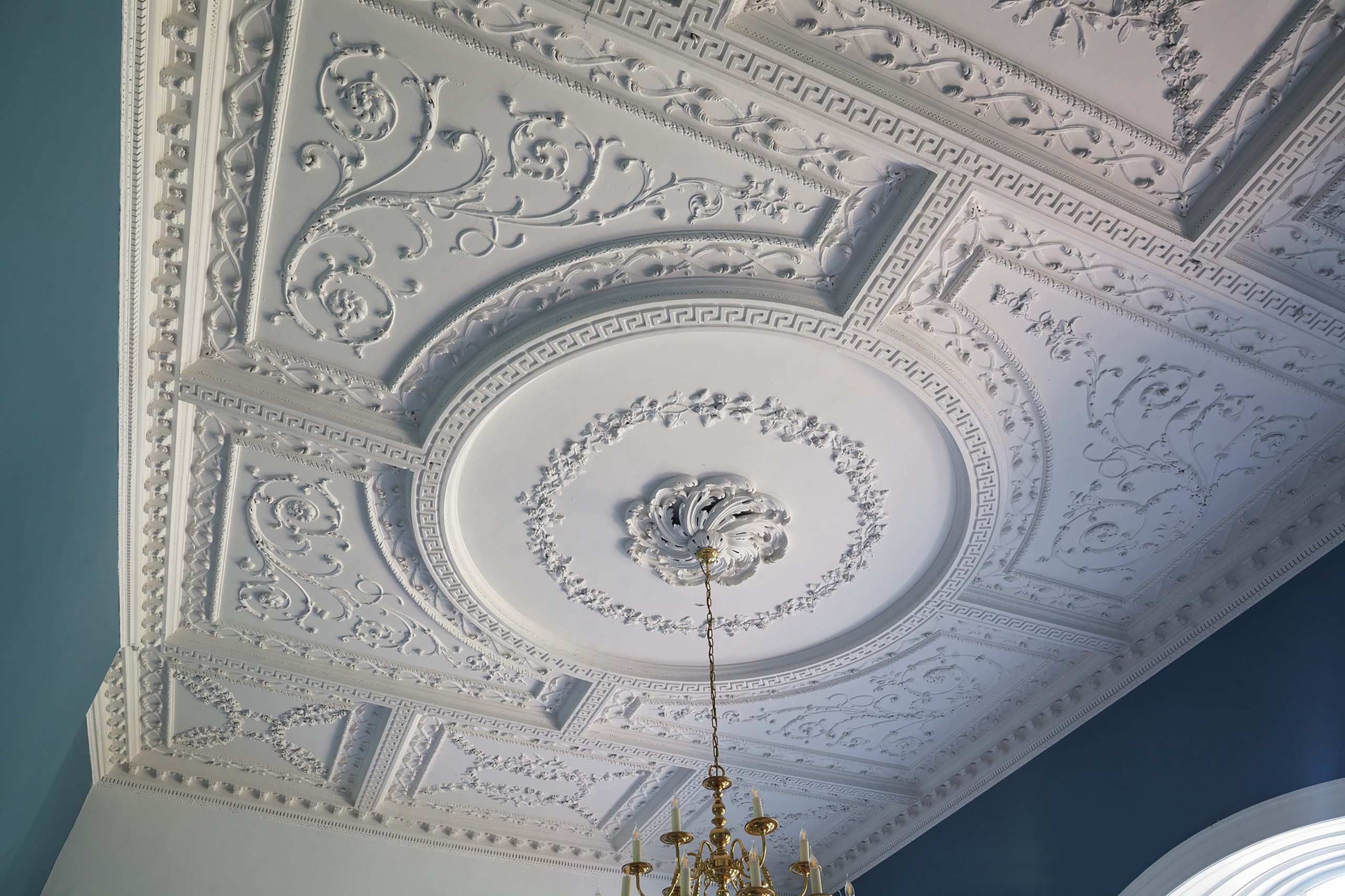
The Dining Room ceiling designed in 1764 by Robert Mylne, architect, for his client Edward Southwell III. It was implemented by Thomas Stocking, one of the foremost plasterers of his era. 

All of this felt distinctly outdated by the middle of the 18th Century. Fashions changed, and a State Bedroom no longer met the need to entertain guests. It was opened-out under the superintendence of Mylne as architect into a much larger single room, intended for holding lavish meals. Two aspects of this redesign are worth focussing on in depth.

Firstly, the design of the ceiling; It was an early example of a Neoclassical design, derived from ancient Greek and Roman architecture. Suitably for a room designed for dining, swags of grape vines are a prominent motif in the plasterwork; Grapes provide both food and wine. But here too is a warning for anyone who might want to take advantage of such abundance. The visitor will have to look carefully to spot them, but intertwined amongst the tendrils, one in each of four quarters of the design, are snakes: a reminder of the reproductions for anyone tempted by the sin of gluttony. 
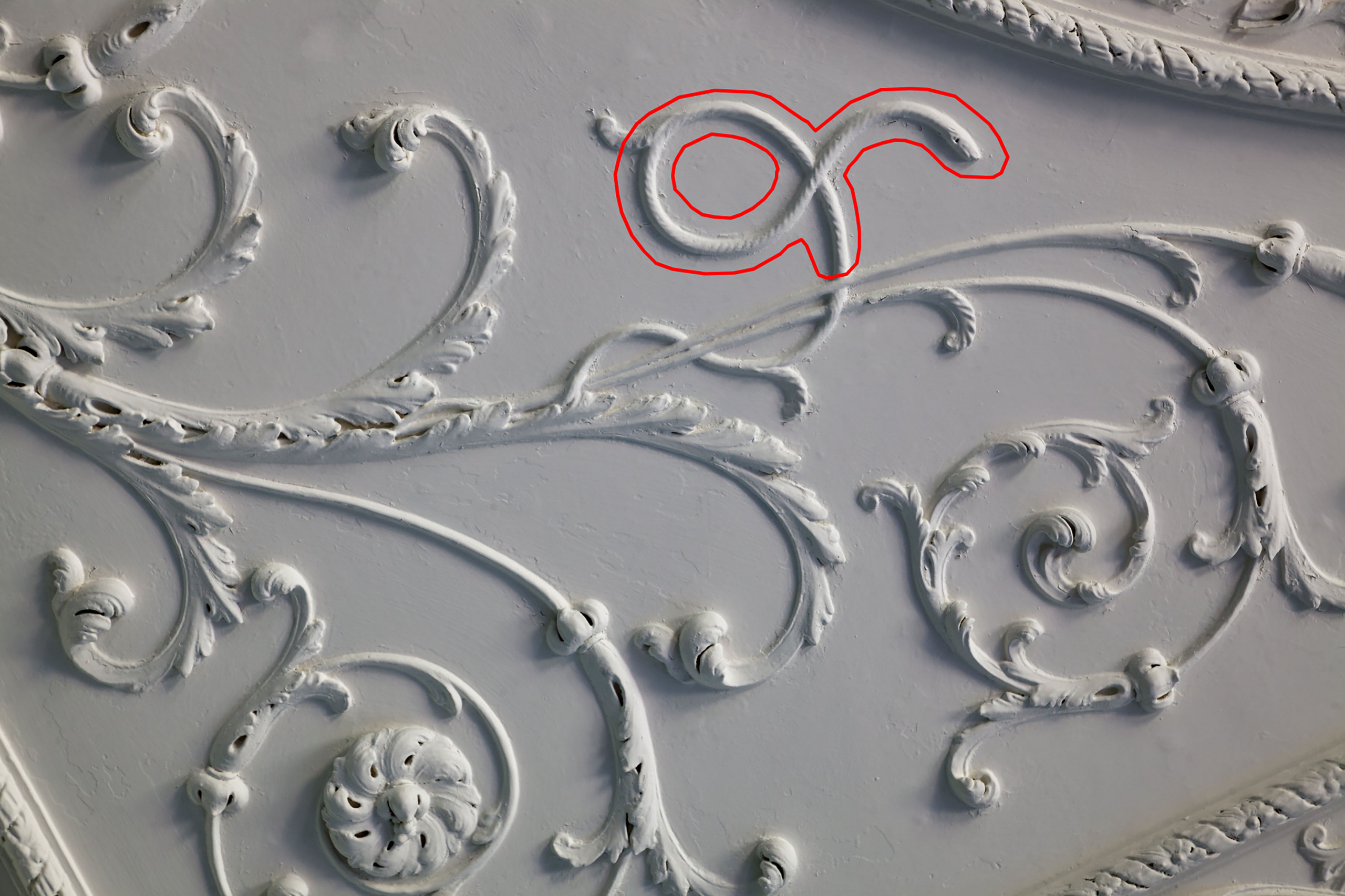
One of the four snakes hidden in the ceiling, warning the observant not to engage in the sin of gluttony.

More symbolism is at play in the marble fire surround. This was only rediscovered in 2021. We were invited into the cellar by Norman Routledge, then lessee of the house, to look at a collection of broken marble fragments filling a metal crate. We were able to lay them out on the floor and piece them together, ultimately realising that it was near complete, if in a poor condition. Photos originally taken by Country Life aided identification and confirmed it had once graced the Dining Room. It was Norman who undertook to have it restored and returned to centre-stage as the focus of the room.
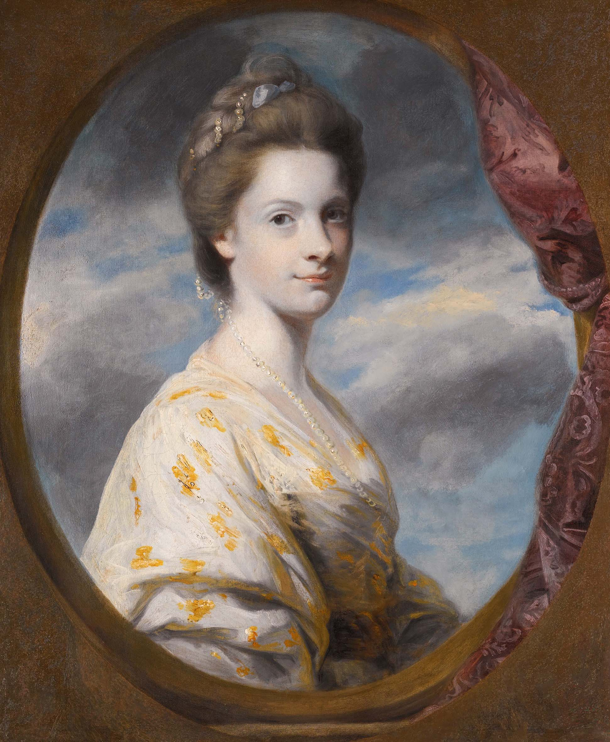
Sophia Southwell, nee Campbell, around the time she Married into the family in 1765.

Another of the fire surrounds commissioned from John Devall dates from the completion of the room in 1765; This was also the year that Edward Southwell III married Sophia.  Careful study of the carving reveals more about the couple’s relationship. Roses cascade  down the pilasters either side of the hearth. Then, as still today, roses are symbolic of passionate love and desire, but the message is even more personal; Amongst the roses, on just one side, one tiny detail changes. Easily overlooked, two tiny flowers lie almost hidden. These are forget-me-nots, the symbolism asking us to forget-not the love between Southwell and his new bride.
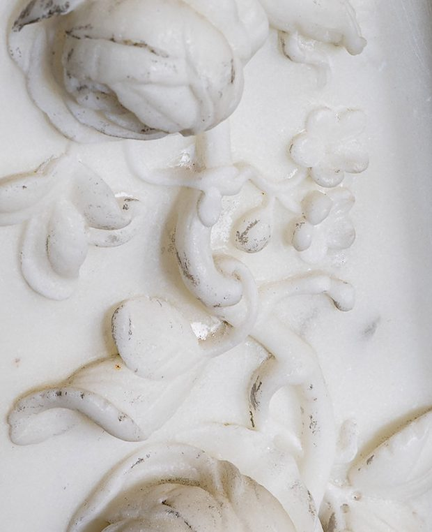
The inclusion of a pair of tiny forget-me-knots in the fire surround design suggests the nature of the couple’s relationship

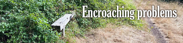
Encroaching problems

As we’ve already seen from our working party progress report, encroachment of undergrowth is a major issue for the Registered Historic Landscape. Looking at Shirehampton Park as a case study reveals the scale of the issue.

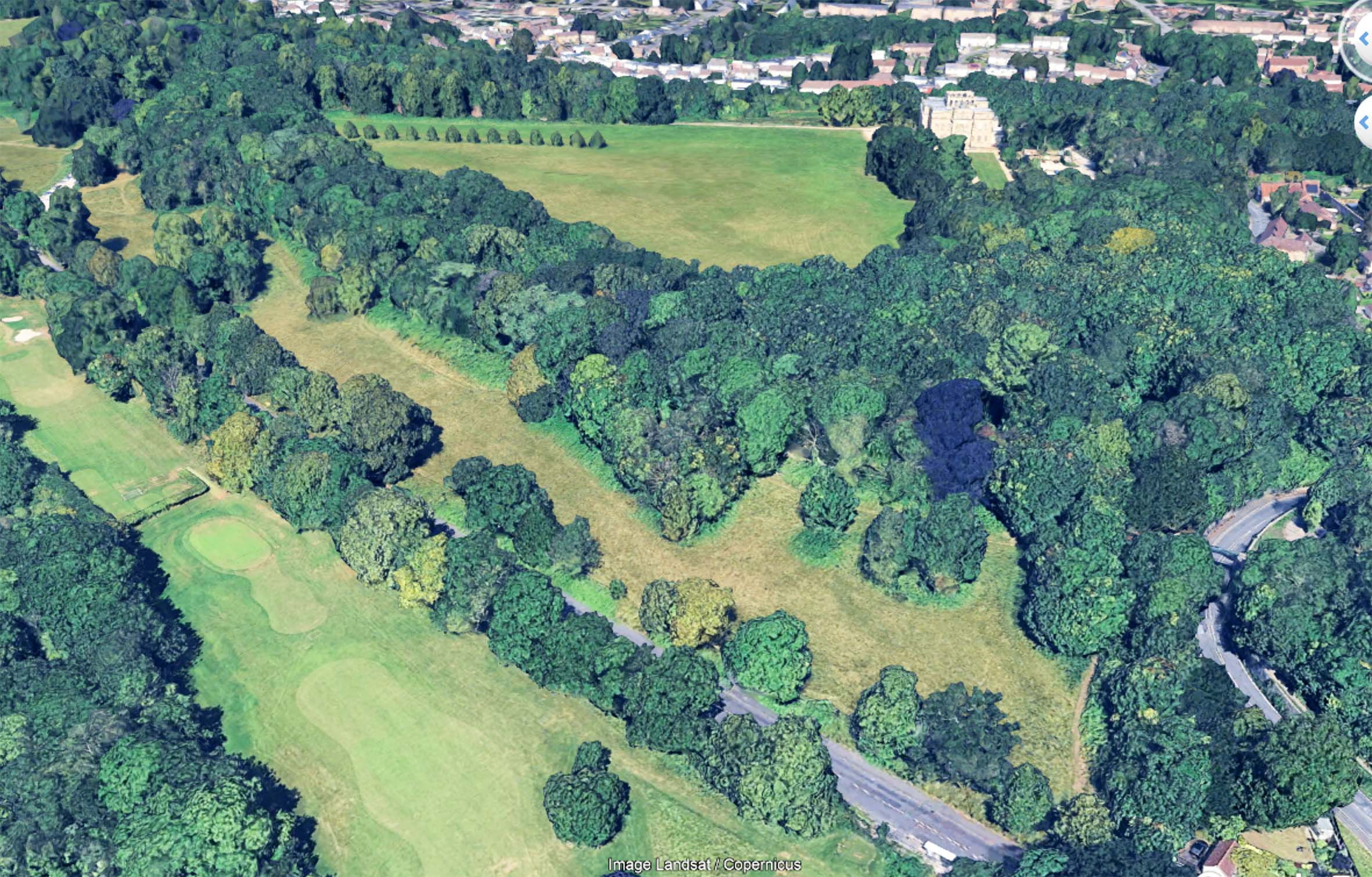
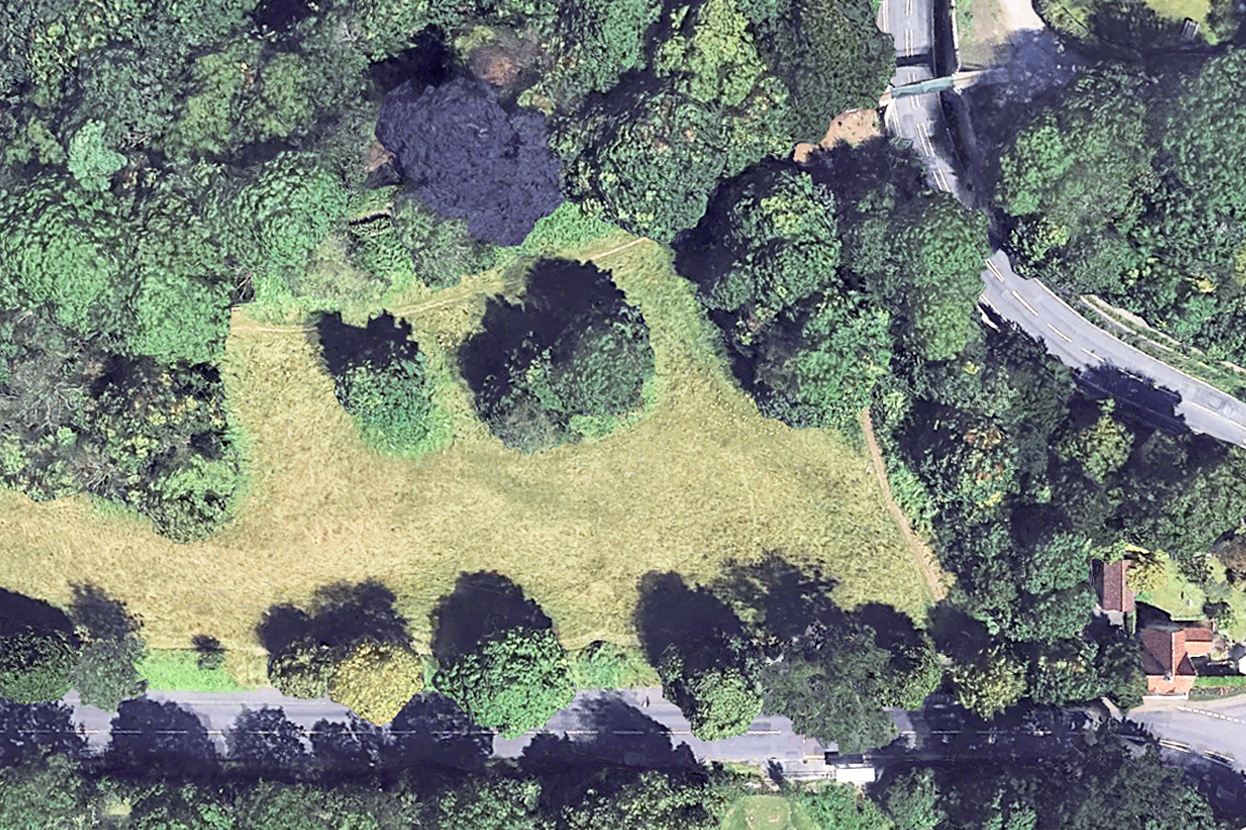
The vibrant green beneath the trees contrasts with the yellower grass. This indicates the extent of the encroachment as it appeared last year.

Using both our own record photos across the years, and aerial photos of the area from the last twenty years, the gradual loss of the meadowland can be starkly illustrated, but why does it matter?

As part of the Bioblitz event held at Kings Weston way back in 2012, the richness and diversity of the meadowland was a noted finding. It was described as some of the most important calcareous grasslands in the region, unique in Bristol. As encroachment bites, this exceptional habitat is gradually being replaced by less diverse habitat that already has wide distribution across the estate.

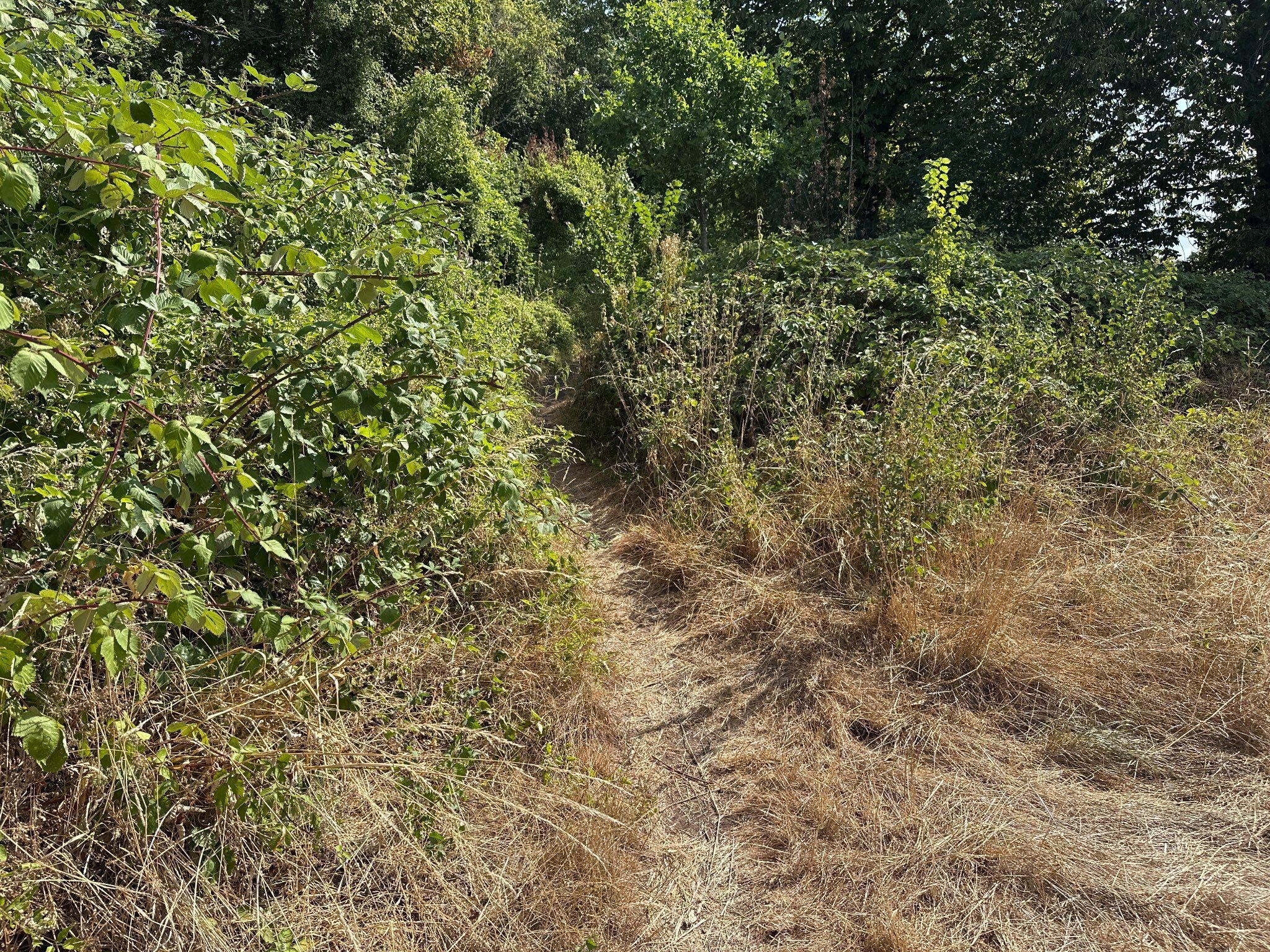
Halfway along the meadow the Public Right of  Way is becoming near impassable.

Encroachment occurs incrementally. The land has been managed by the Council with an annual hay-cut for the last twenty years or so. This is now contracted out and has led to poor implementation and little obvious oversight. Every year another few feet around the perimeter of the area is missed. Spaces between groves of trees are left un-cut. Year after year maintaining the meadowland is getting worse and worse.

It can be difficult to appreciate this incremental change. With only one cut a year few people will recall what its condition had been twelve months ago. It’s a slow decay of both the ecological value and the historic landscape.

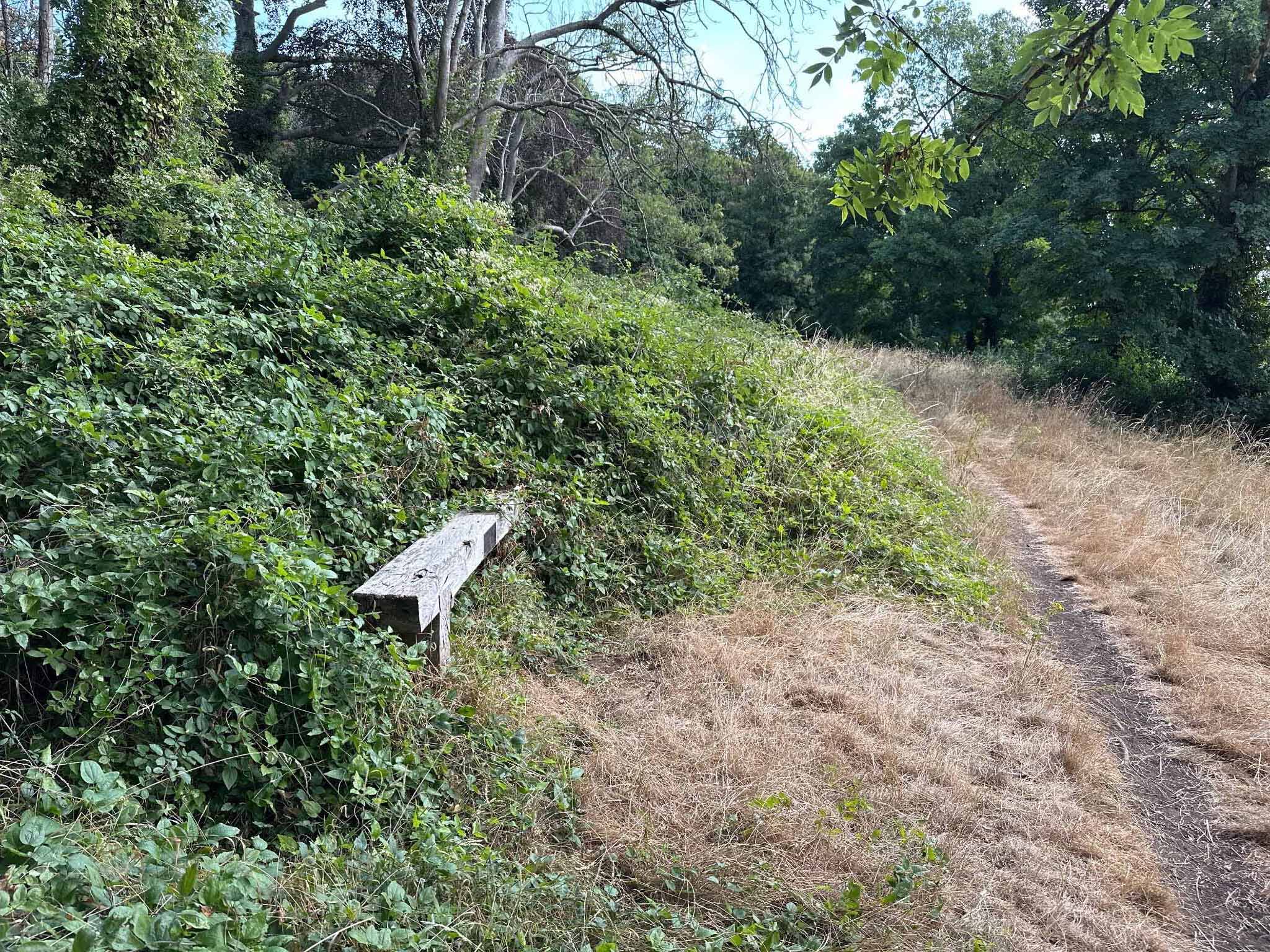
The same scene in 2018 and today, just 8 years later. A mountain of scrub and brambles now occupies the 9m from the treeline and the line of the path has been pushed around 3m downhill.

This year has seen a massive spike in brambles (if you’ll excuse the pun), but elm regrowth and other species are also part of the mix. Whilst tackling brambles is something KWAG has done in the past, we don’t have the resources to attack the current engulfment, nor does it fall into our remit to cover regular maintenance issues for which there should already be management in place.

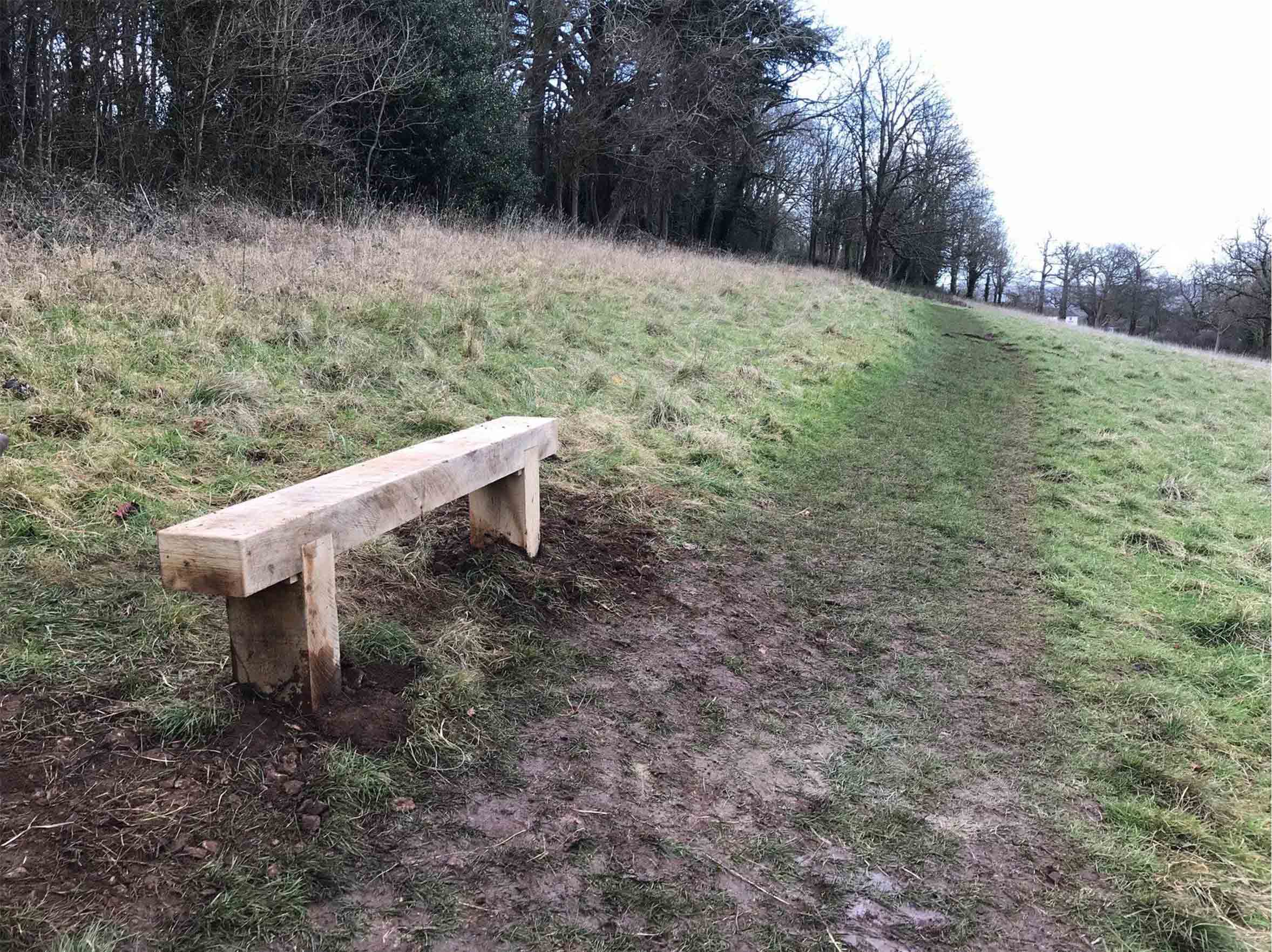
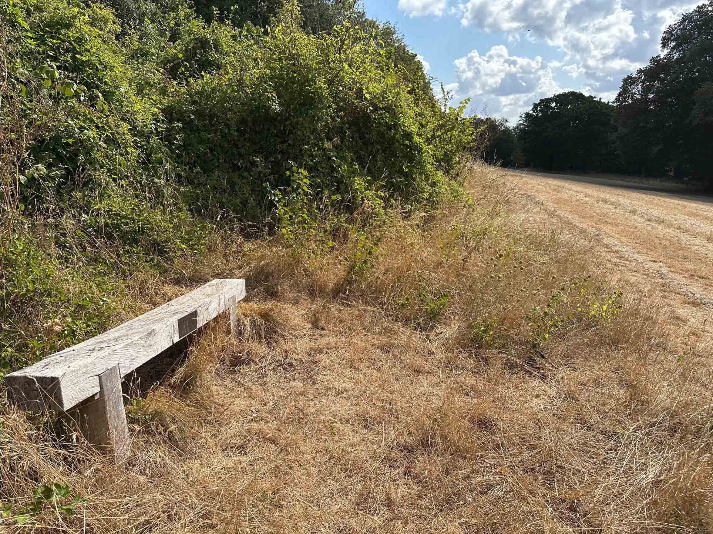
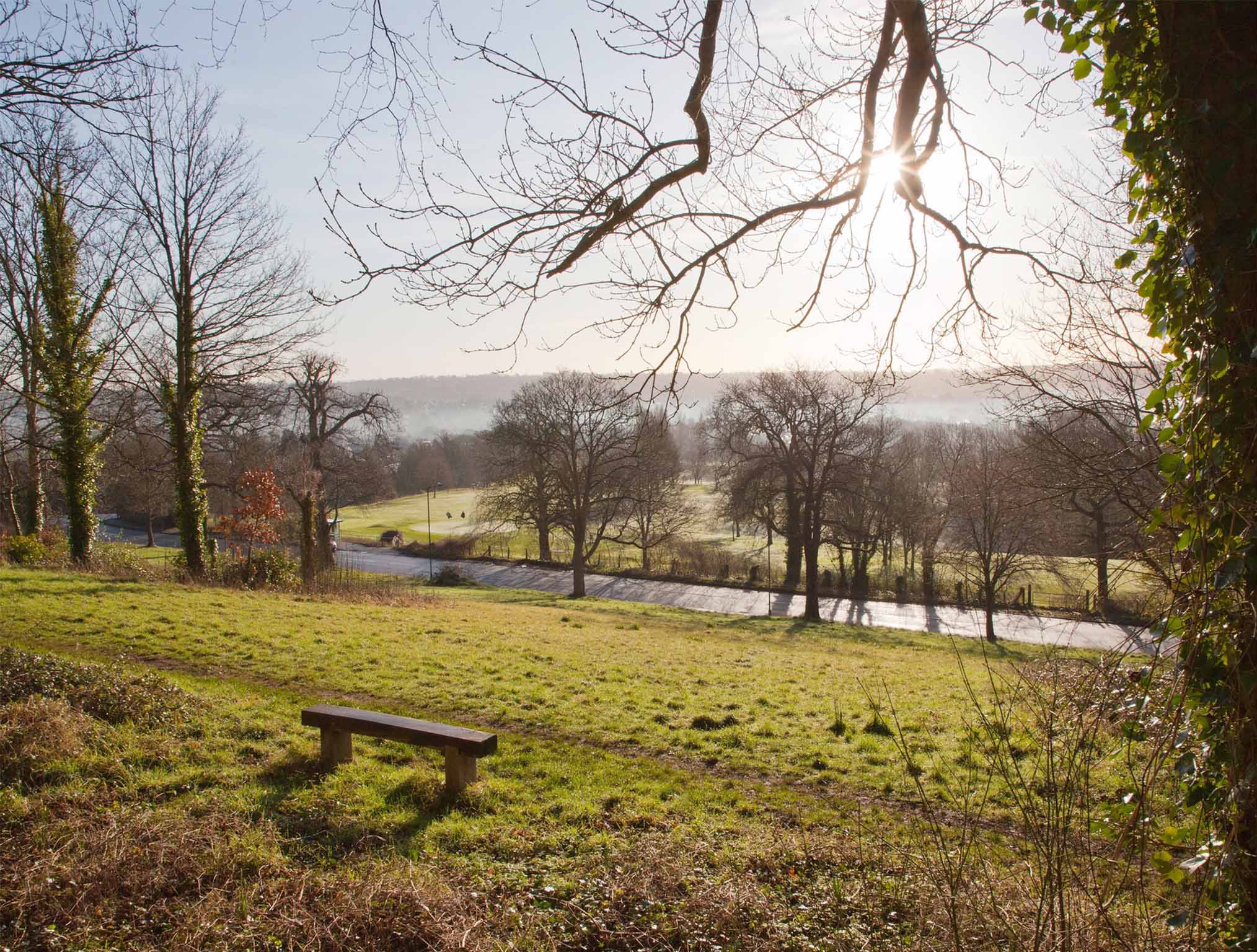
In 2017, from the Grade II Listed Viewing Terrace, the recently installed bench was conveniently positioned beside the path. Today half the bench has been engulfed in brambles and the Public Right of Way has been pushed off-course.

Two benches we installed in 2017 and 2018 are useful markers against which encroachment can be measured. Both were set up immediately adjacent to the Public Right of Way that runs from the Iron Bridge down the ridge to Shirehampton Road car park. Within just eight years, both have gone from being in open meadowland to presently being engulfed by brambles. The footpath that can clearly be seen in front of each bench can be seen pushed downhill by the onslaught of scrub.

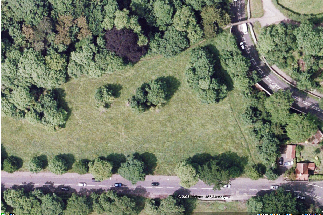
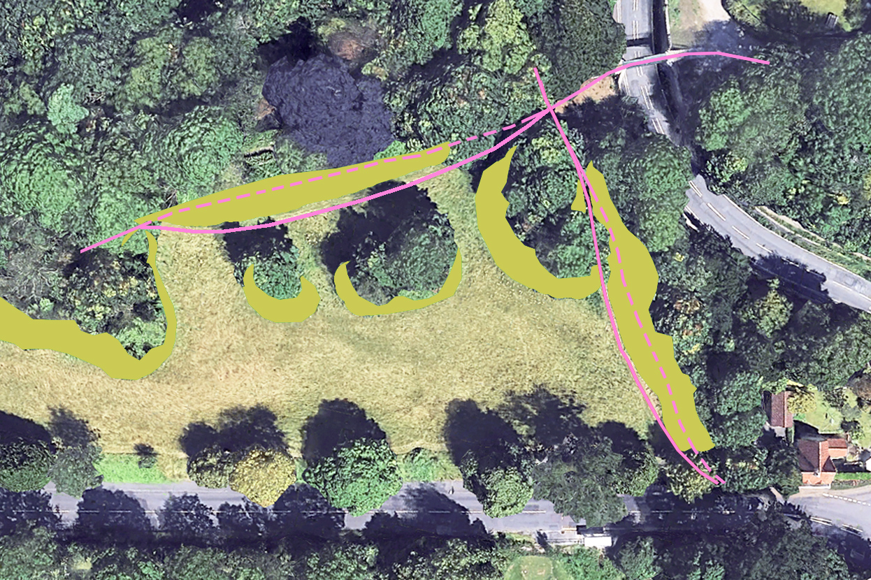
Helpfully, Google Earth has a library of aerial views taken periodically since it was established. These help chart the gradual advance of scrub. Taking past surveys from 2005 and 2006 and comparing them with the most recent aerial survey in 2025, the extent of meadowland loss. In most areas there has been a ribbon of between five and six metres lost to scrub along the top edges of the slope and around outcrops of trees, but in one location undergrowth has come forward more than 20m.

2005: Aerial view looking down on the eastern end of the meadow. Shirehampton Road runs along the bottom of the view and the Iron Bridge is in the top-right corner.
2025: The same scene last year. Scrub and bramble appear as vibrant green areas beneath the trees.
Analysis diagram illustrating the area of encroachment between the two dates. The pink lines show how the Public Rights of Way have been distorted from their 2005 course (dashed) to where they are today (solid line)

We calculate  around 7000 square metres of meadow, or 1.7 acres has been lost from Shirehampton Park alone in the last two decades, most within the last ten years. But the issue is more widespread, with the lawn in front of Kingsweston House, the field below it, Penpole Point, Kingsweston Hill, Napier Miles Fields, the Tump, and event the area in front of The Echo all having their historic character eroded. 

Since KWAG was founded in 2011, we’ve been asking repeatedly for the issues of encroachment to be addressed beyond the basic annual hay cut. Occasionally the ancient Lime Avenue will be dealt with, or parts of the field below the house, perhaps the ridges around Shirehampton Road Car Park, but work is reactive, unpredictable, and to no obvious plan. We remain deeply, and increasingly concerned over the declining condition of the estate in this respect.

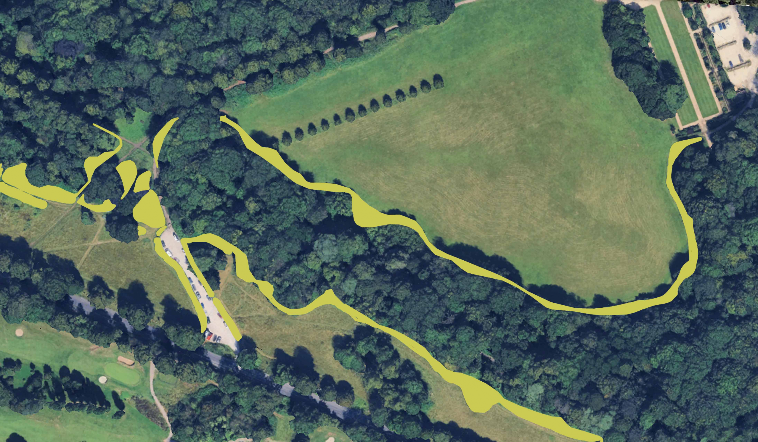
Similar assessment of encroachment around The Circle and along Shirehampton Park edge between 2006 and 2025

Working Party update: Pushing back the tide above Shirehampton Park

Encroachment  of scrub and bramble over much of the estate has been long identified as one of  the biggest threats to the historic designed parkland. Whilst KWAG has sought  to help in small areas, it remains the Council’s duty to deal with the issue at  such a wide scale. Our July Working Party was one small element in addressing  the issue.

Our work focused on the far east end of the meadow overlooking Shirehampton Park. Here, just on the west side of the Iron Bridge, two Public Rights of Way (PROW) join. The one coming directly uphill from Shirehampton Roads being the focus of our attentions.

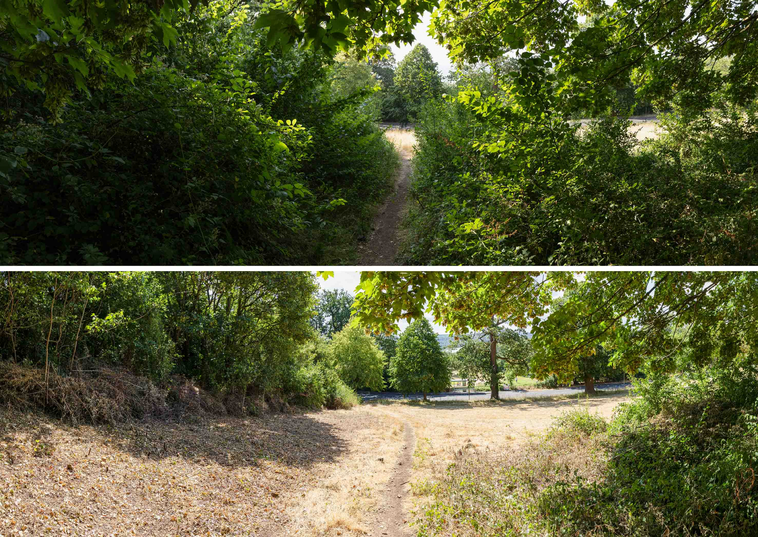
The view downhill towards Shirehampton Road before and after volunteer work last month

Our work focused on the far east end of the meadow overlooking Shirehampton Park. Here, just on the west side of the Iron Bridge, two Public Rights of Way (PROW) join. The one coming directly uphill from Shirehampton Roads being the focus of our attentions.

What’s called the “definitive map” that shows PROW indicates that this should travel in a direct line between the bottom of the bank to the steps behind the Echo, but successive years of sloppy mowing had allowed scrub to grow, progressively pushing the PROW off its legal alignment and threatening the open grassland. Worse, the path itself was threatened with being blocked by the growth.

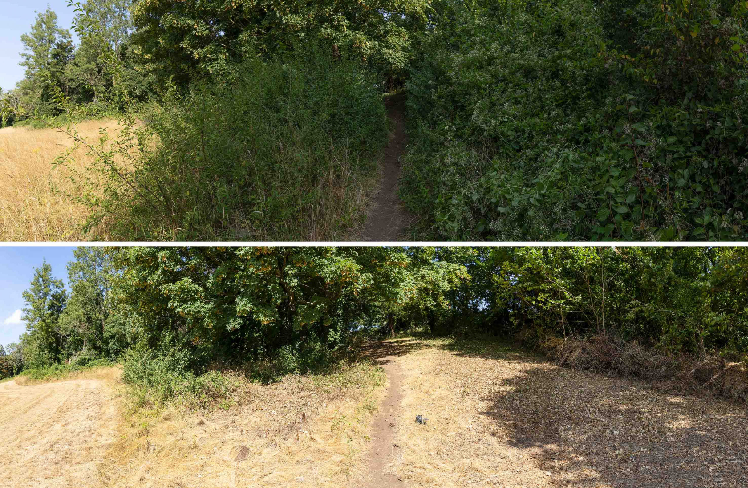
The view in the opposite direction looking along the Public Right of Way heading towards the Echo.

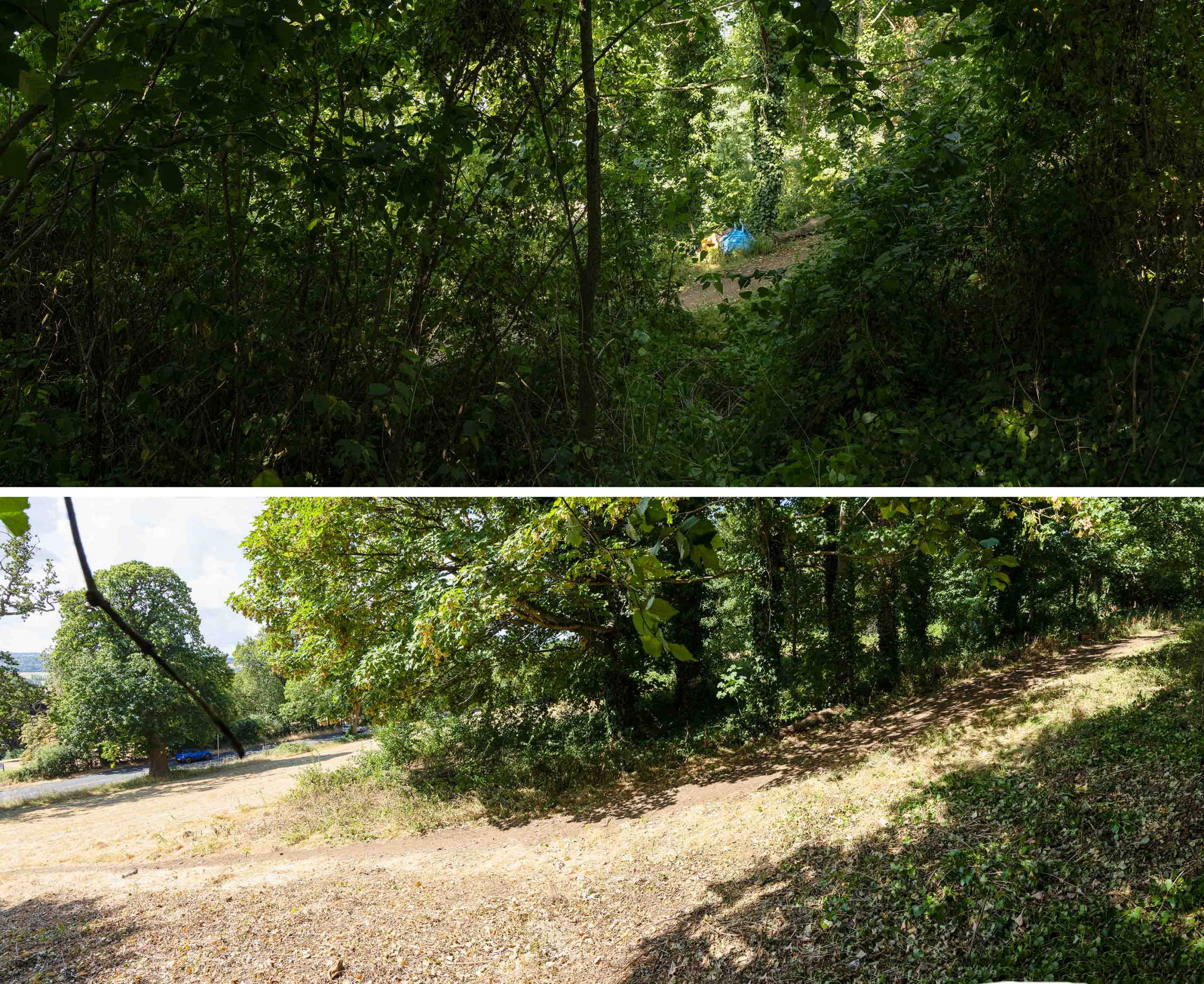
Work focussed on removing this scrub, mostly elm regrowth, Old Man’s Beard, and sloe, and pushing the edges back to their historic extent. The turnout on the day was perfect to tackle the relatively modest area, and we exceeded expectations in how much we’d achieve.

Across the slope, with Shirehampton Road to the left. The treeline has been pushed back to its 2012 extent.

A huge thank you to everyone who made it on a scorching hot day. The group managed to get the work done quickly enough to avoid the worst of the heat, and we were able to retire for a well earned early lunch.

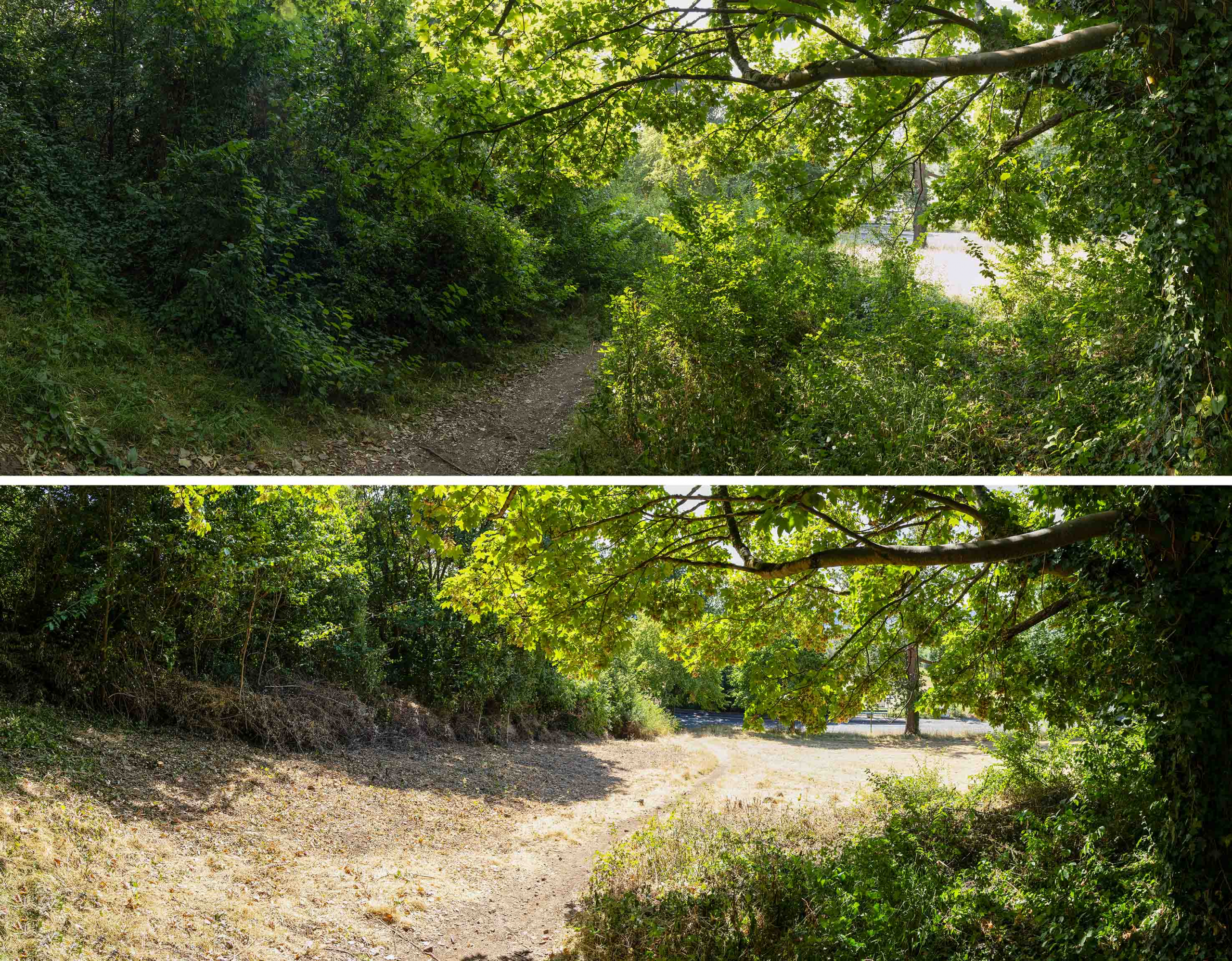
The results speak for themselves. Although the track still meanders around the distorted route, it’s clear and the way opened out to allow the important meadowland more space to regenerate.

Another view looking downslope illustrating how close the path was to becoming blocked