

Anyone with an interest in archaeology will probably have heard of LiDAR before. It’s a technology that uses laser pulses to measure distances and can be used to create complex 3D models and map large areas of land. It has the ability to penetrate trees and vegetation and help reveal what lies beneath. It’s been used in archaeology for a number of years now and has helped discover features as large as cities in Egypt and temples hidden in the Amazonian rainforest.
Lidar mapping of the UK has been publicly accessible for a while, even appearing as a layer of Bristol’s Know Your Place website. We’ve made use of it before, but recently a more detailed and informative new survey has become available through the National Library of Scotland website. This new map has helped reveal some of the hidden features of the estate with new clarity.

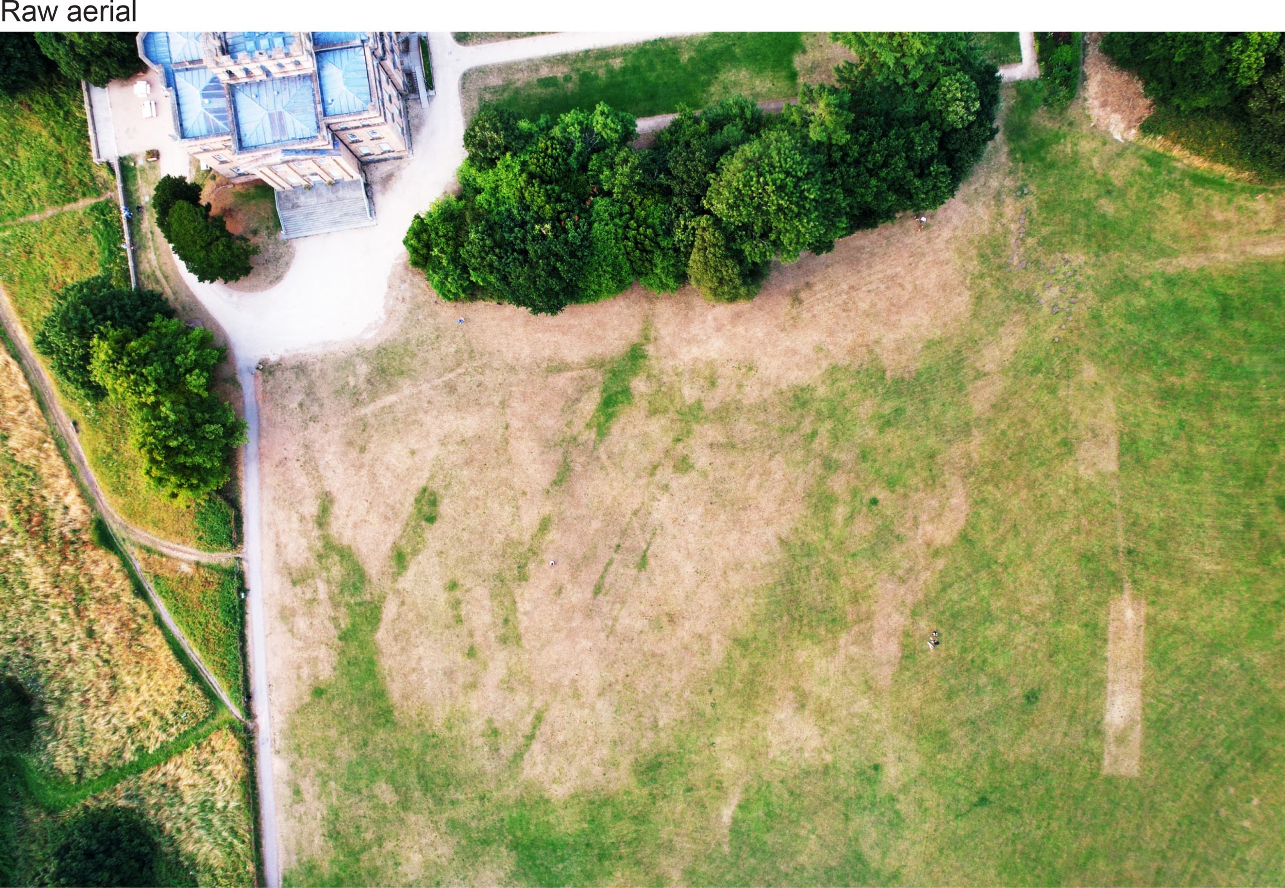
Unfortunately, Penpole Wood and the steep slope down to Lawrence Weston has proved too confusing for useful interrogation, but the lawns around the house, largely flat and open and undeveloped for centuries, prove perfect for enhancing the data to better through features into relief. When compared to documentary sources, what we’ve discovered from this exercise is interesting but throws up new questions over the development of the grounds.
At first glance the plan looks a psychedelic confusion of stripes and rectangles. The location of Kings Weston house has been added to the plans to help orientation. The ancient avenue it a distinctive line running south-west, diagonally from the house to the bottom left-hand corner where it meets The Circle. The South Walk runs through the jumbled ridge along the bottom of the image, and the formal gardens and path to the Echo complete the basic triangle back to the house. Different colours show slopes of land exposed to five different directions, explaining the red, orange, yellow, turquoise, and blue colour scheme.

The lines and stripes can eventually be read, some crossing over the top of others, and some cutting through different layers. Using what we know from maps and other illustrations we can interpret these lines and place them in order of when they were created.
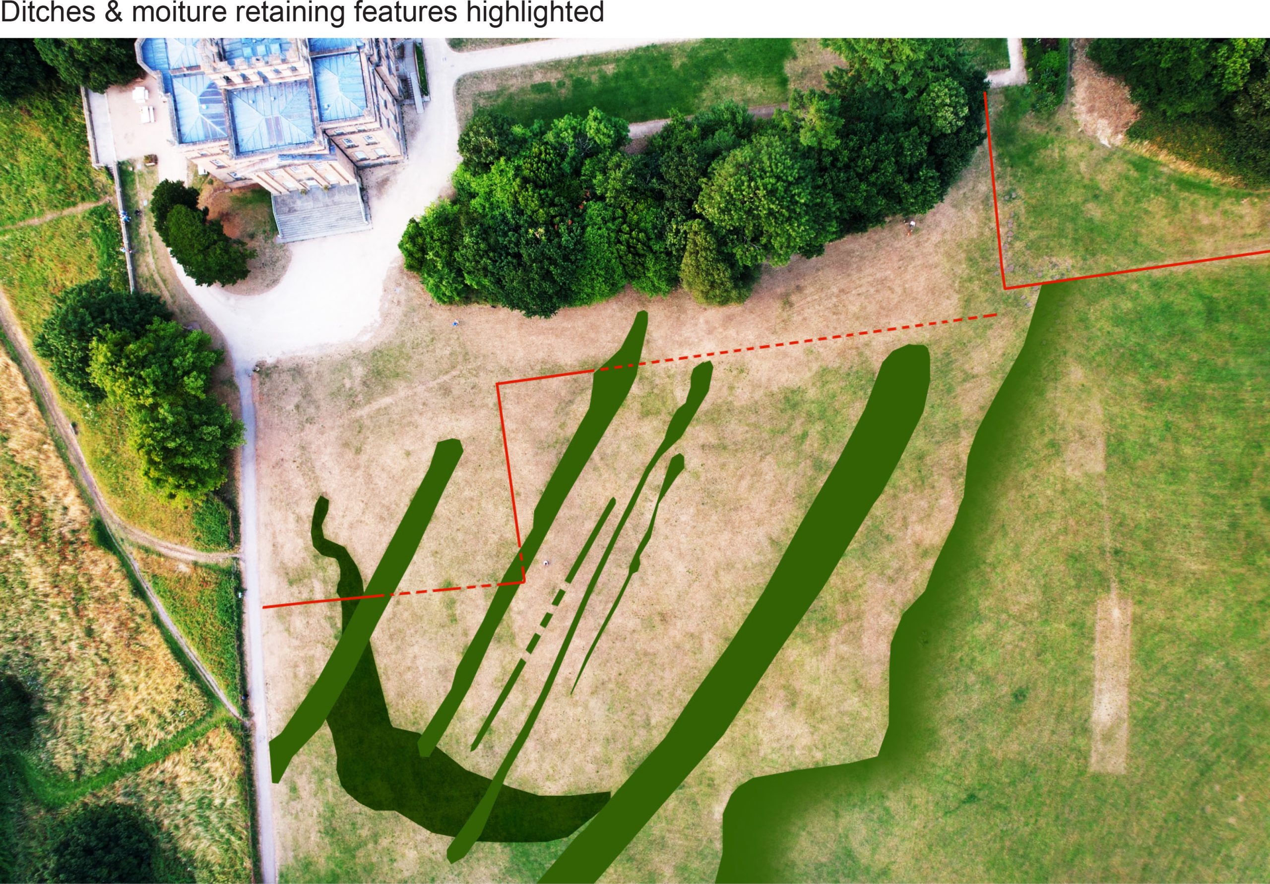
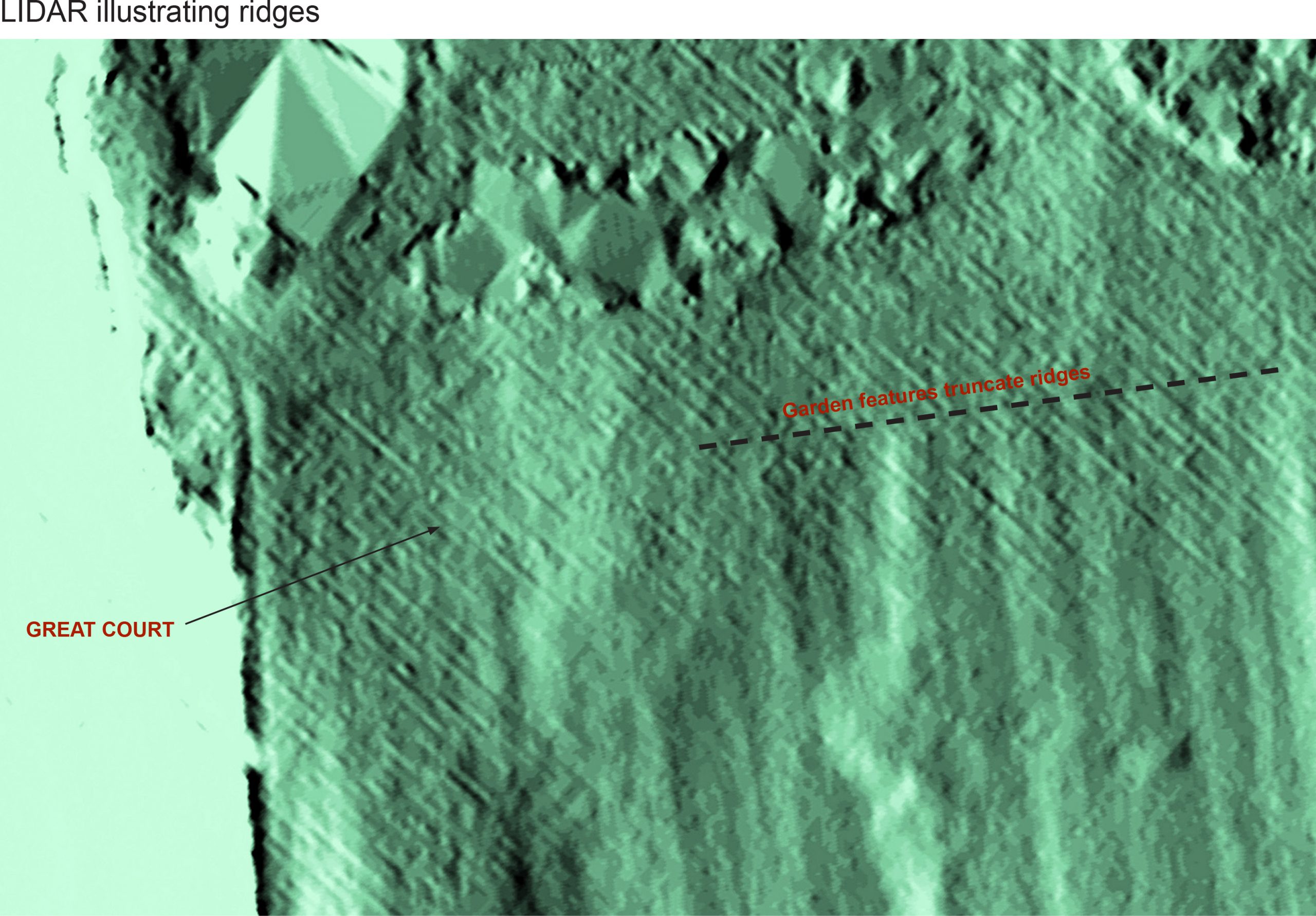
The lowest of these layers, Phase 1, the features which pre-date the historic park, are a series of wide strips running south-west to north-east, roughly the same alignment as the ancient lime avenue, but much earlier. We’ve previously postulated that some of the more significant ridges, visible with the naked eye even, could be the alignment of a roman Road passing through the estate, but the new LiDAR map shows a distinct curve at their south end, definitely not something the Roman engineers would have approved of! Instead this is likely a field boundary or track passing between two fields. South of this, the grain of ridges becomes tighter and less pronounced. The ridges can be traced passing through later features, albeit more faintly, or stop abruptly, showing attempts were made at erasing them later in time. In other areas, such as the south-west corner, they seem to survive ghostly beneath stronger features laid above them.

PHASE I – strip fields and ridge-and-furrow marks are interspersed with field boundaries and, perhaps, a trackway.
These lines represent long field divisions and the tighter-grained likely to ridge-and-furrow agricultural management of the landscape. The City Archaeologist has suggested that these are early-medieval in character, so perhaps established around the Norman Conquest. At this date then, we see that the plateau was principally farmland, though it’s unclear whether a manor house existed, or whether it was even on the same site as the present house. Of course, the ridges do not preclude an earlier, Roman, landscape having existed below them.
The next phase has only become visible using this new edition of the mapping. It also includes lines, but these are of an irregular fan-like pattern bounded by a shallow banked perimeter. This looks to overlay the old field pattern below it, and is interpreted here as the levelling-out of the park, with material being dumped in lines, each line built up from west to east, gradually building up the land before being levelled-out. These features are hardly noticeable when standing there today. That the lines spread out along the ancient lime avenue suggest that it existed as the main access for the work.

PHASE IIA – A levelled area pushes out from the line of the present ancient lime avenue and over earlier agricultural features.
Dating this phase is difficult. There is nothing that documents its formation, but its relationship with the avenue and the apparent intention to landscape the terrain suggest it relates to aesthetic improvements, so possibly the 16th or 17th Century when the agricultural landscape had become the park to the late-Tudor mansion.
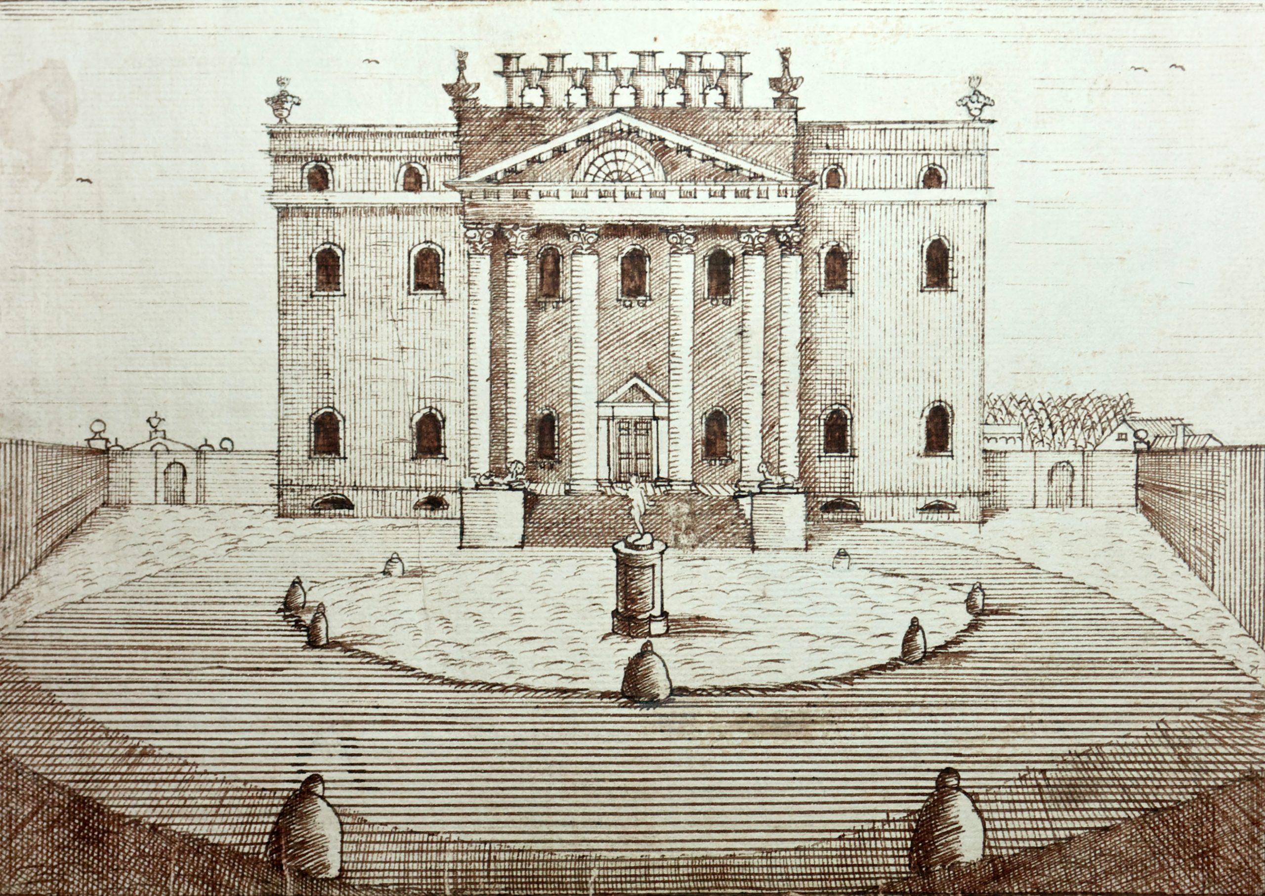
The levelled area was certainly in place before a series of trees were planted in a straight line mirroring the orientation of the ancient lime avenue. These trees can be seen as a series of shallow circular depressions dug through the fan of ridges. From the c.1710 engraving of the house we know that there was an avenue on this alignment, one that stretched as far as the Tudor house. The survival of the avenue depressions on the levelled area, but not closer to the house, might be explained by the softer nature of the made ground.

PHASE IIB – Regular lines of trees and formal garden boundaries redefine the landscape as a parkland focussed on the late-Tudor mansion.
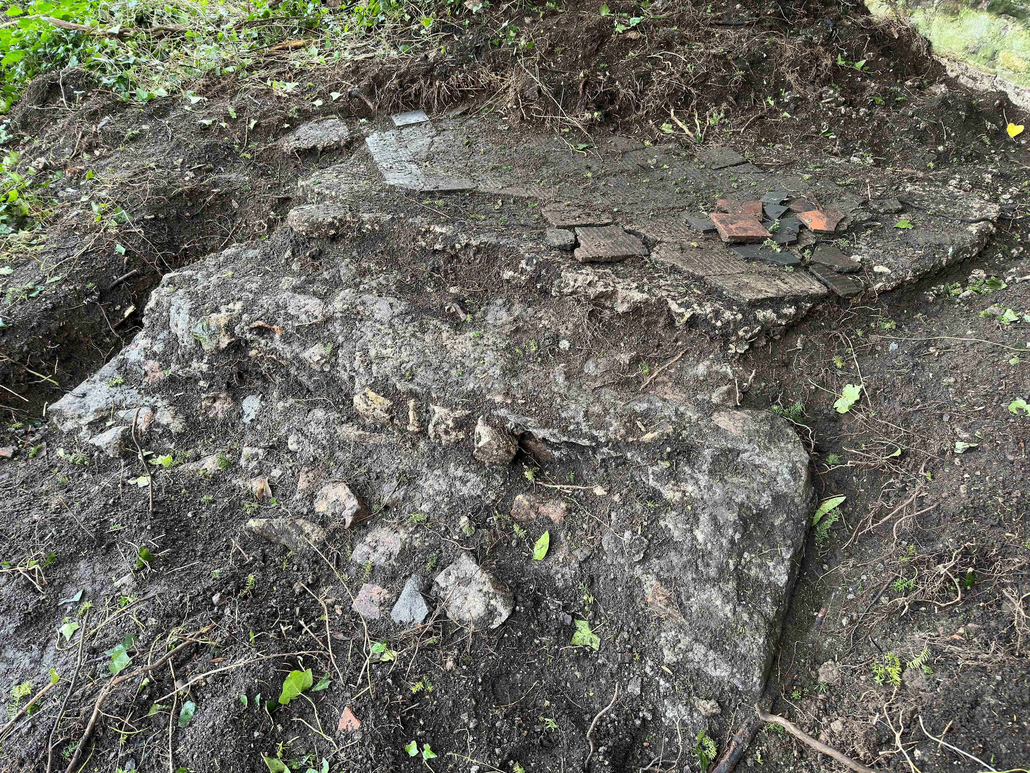
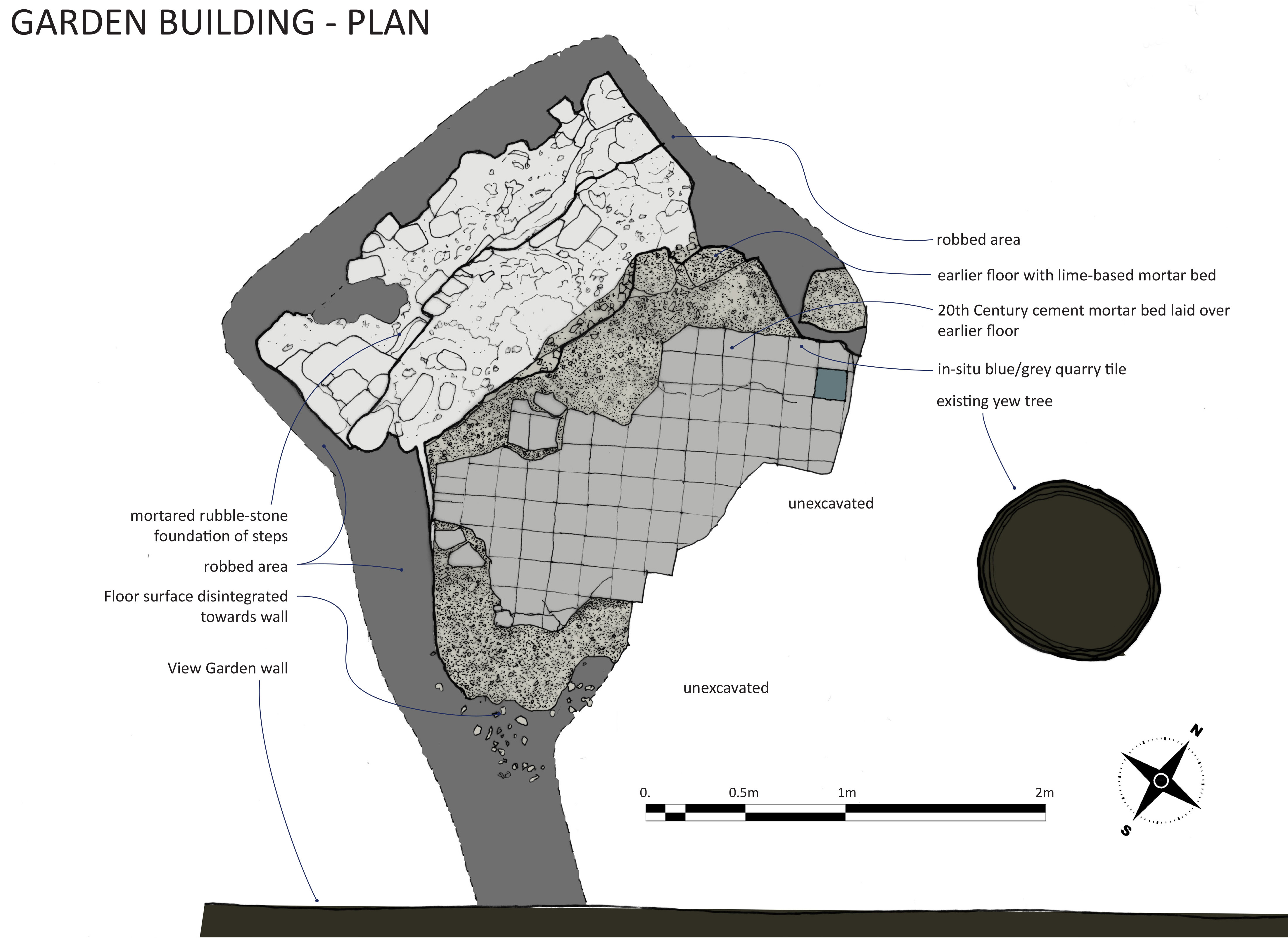
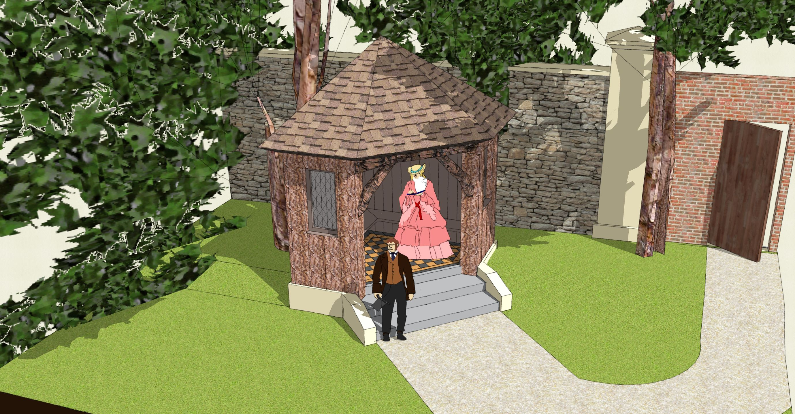
Of this same phase, a long straight bank through the park and more apparent tree pits seem associated with each other; both are noticeably deliberate and linear. They relate to a second line of trees shown in the engraving, and are another designed garden feature. Garden works at this period also involved the north-eastern side where the earlier agricultural formations are sliced through, or heavily overlaid by new rectilinear boundaries aligned with the formal gardens laid out on this side of the house. A formal grove or orchard shown in 1710 seems to have extended closer to the house than shown in this illustration of a plan from a decade later; this was an anomaly noticed a few years ago when dry weather caused parch marks to form.

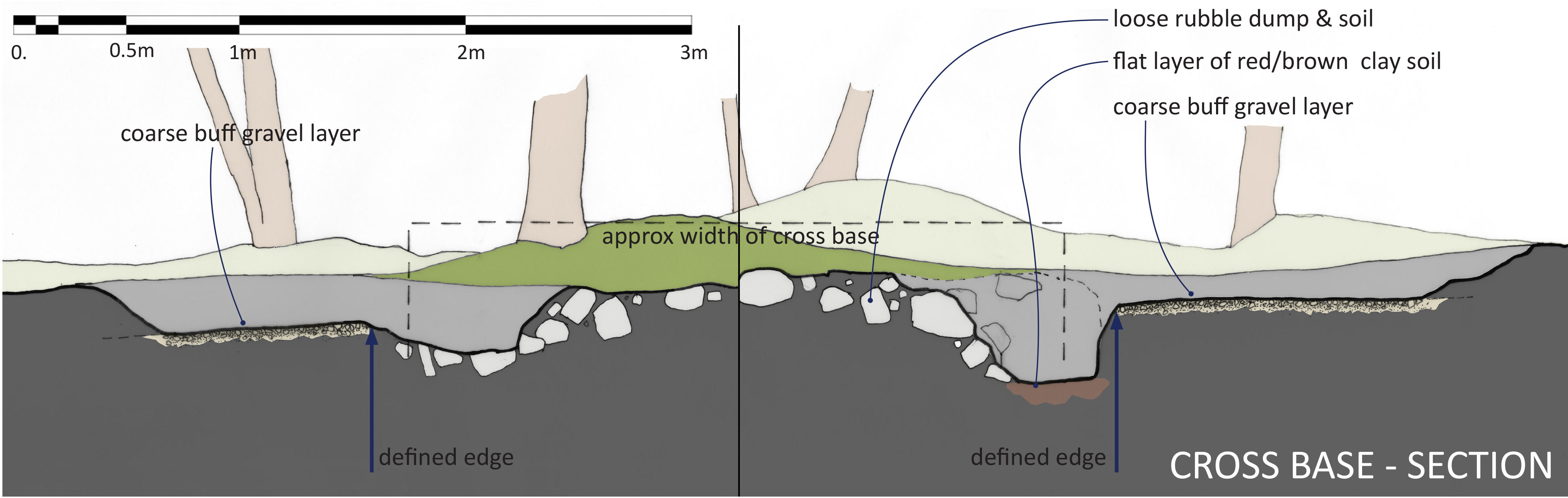
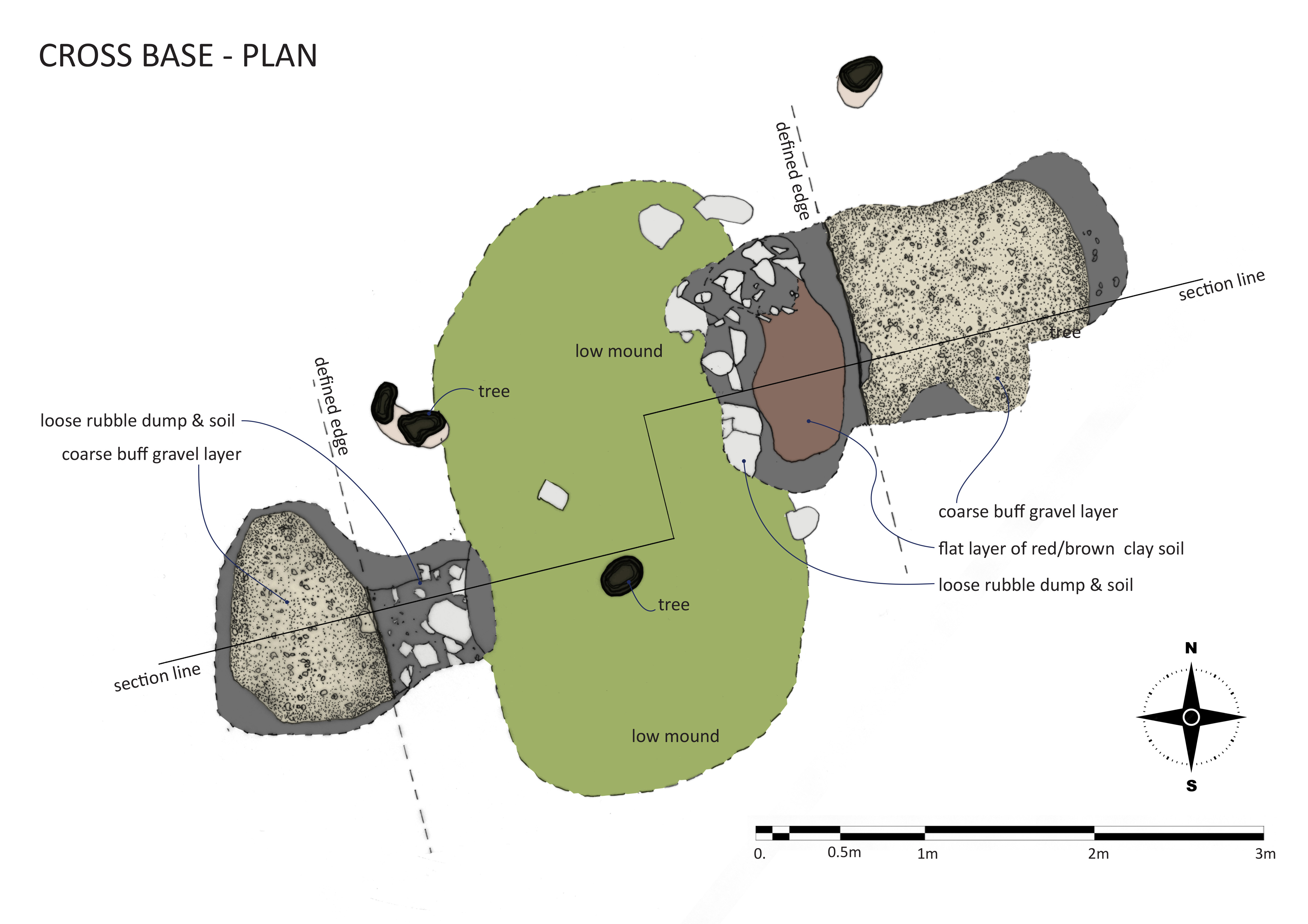
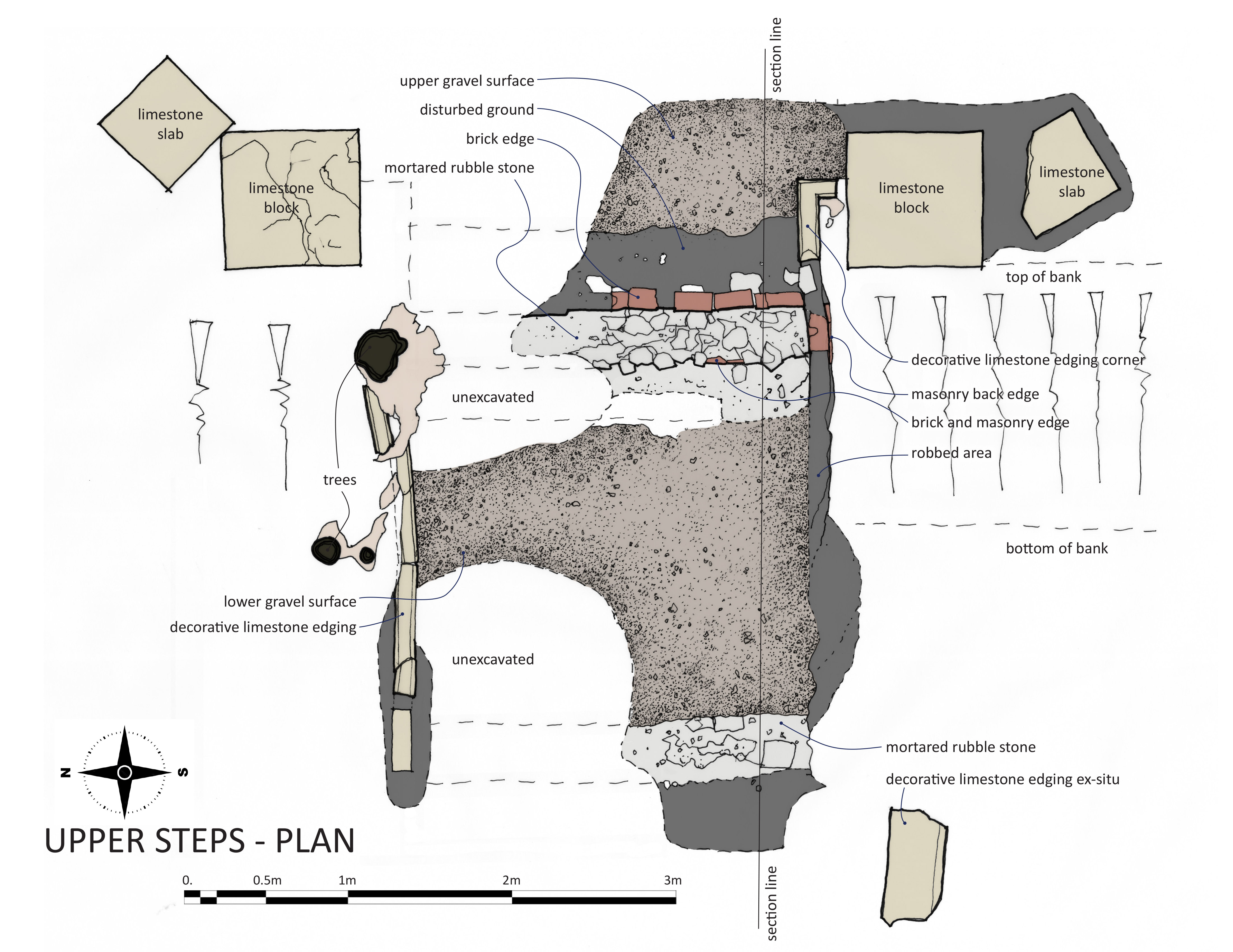
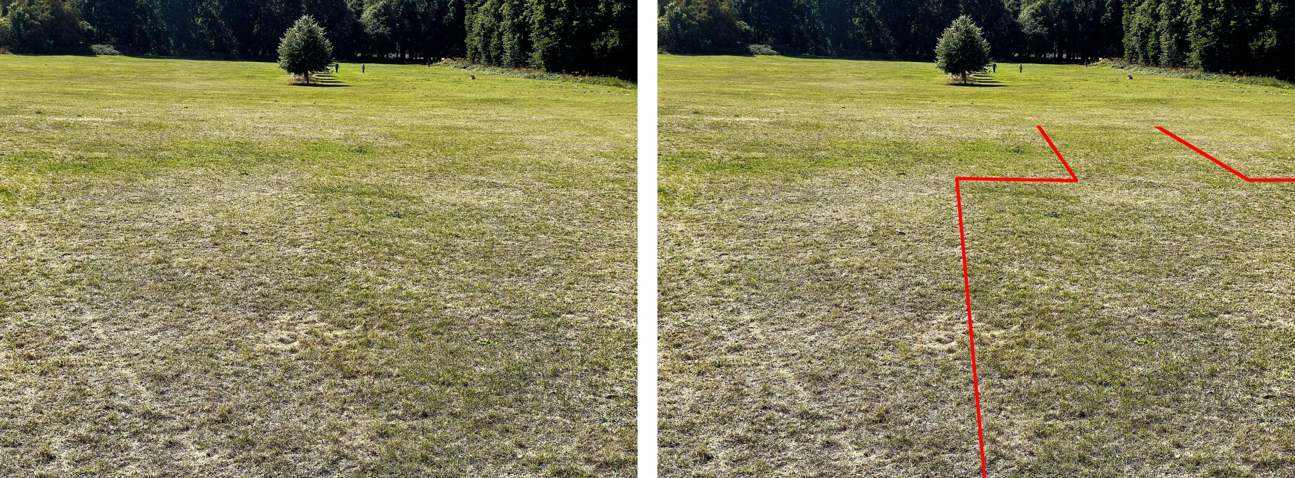
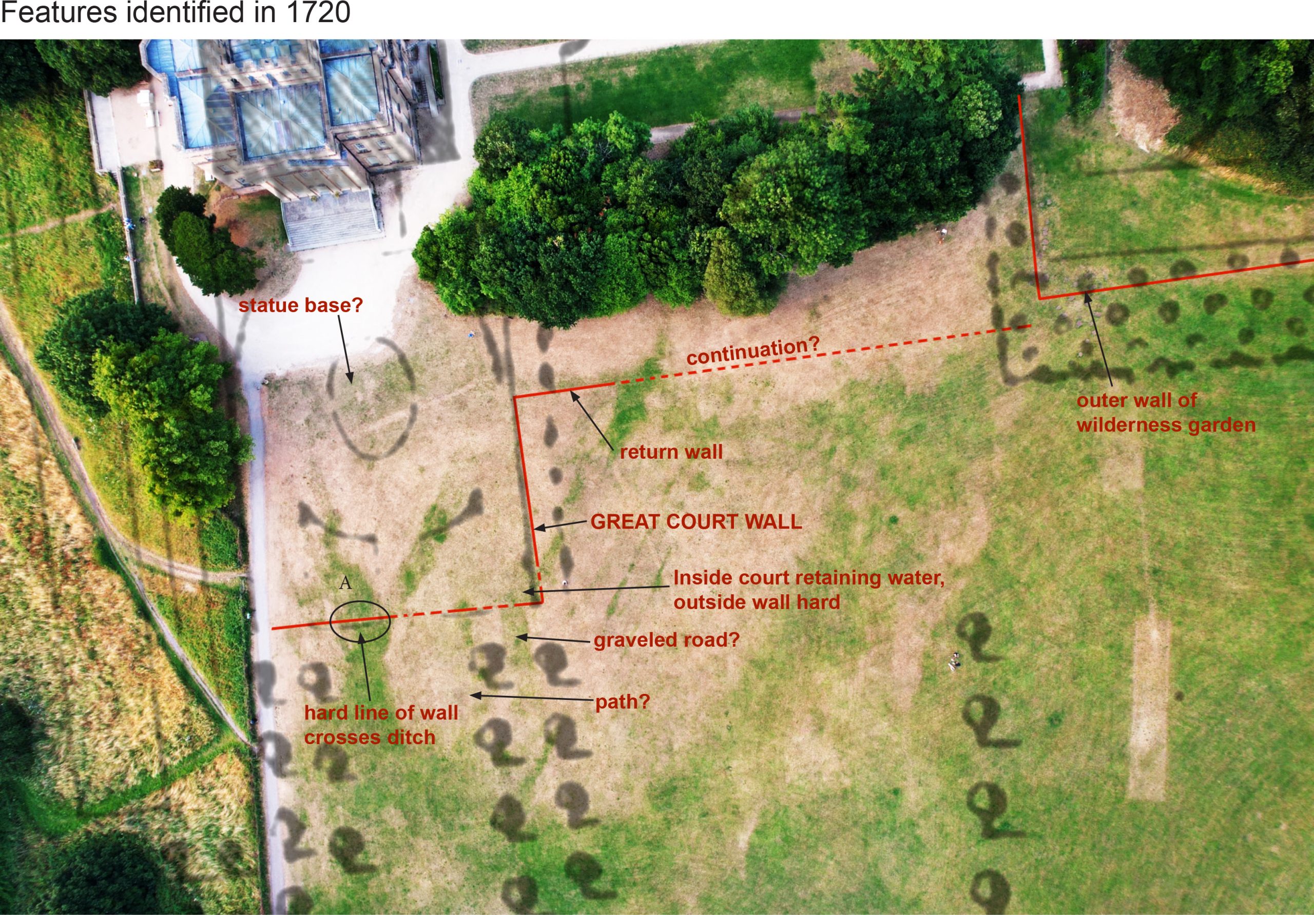
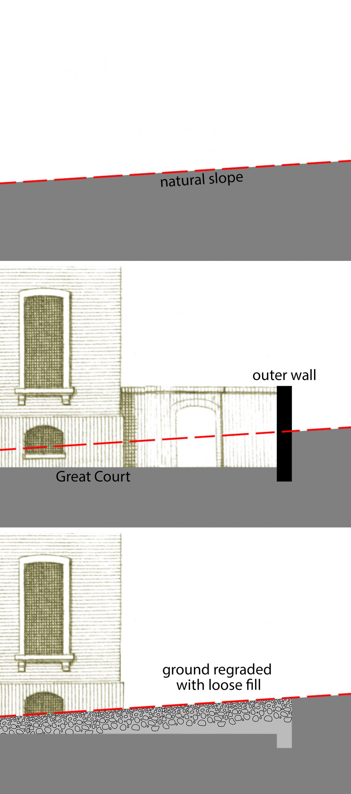
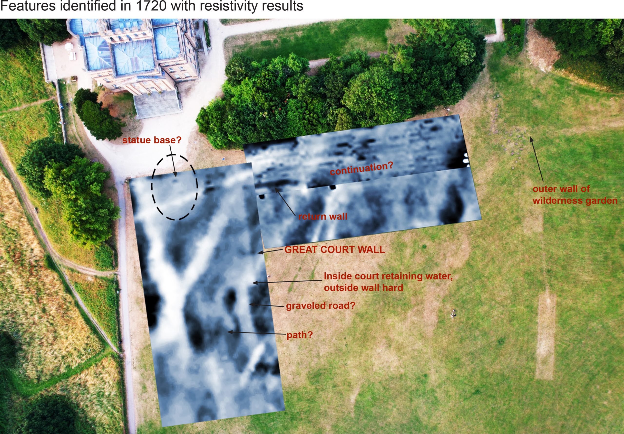
Great changes were wrought across the estate between 1713 and 1728 when Edward Southwell employed the architect Sir John Vanbrugh to redesign his house and parkland. A plan, the Hallett plan, was drawn-up in 1720 and shows many features from the next phase of development. The provision of a grand new frontage facing the old avenues resulted in a new formal court being required to receive guests. Although the carriage drive continued to follow the ancient lime avenue on its northern alignment, substantial works were enacted to excavate and level the new court and create a perfectly flat axial lawn leading up to it. A low causeway was thrown-up to bridge a natural depression in the landscape in the cause of perfection. The embankment and spoil from these works overlaid the medieval field pattern.

PHASE III – Sir John Vanbrugh’s fondness for grand gestures is embodied by the efforts required to excavate a level Great Court and build a perfectly flat causeway leading to its gates.
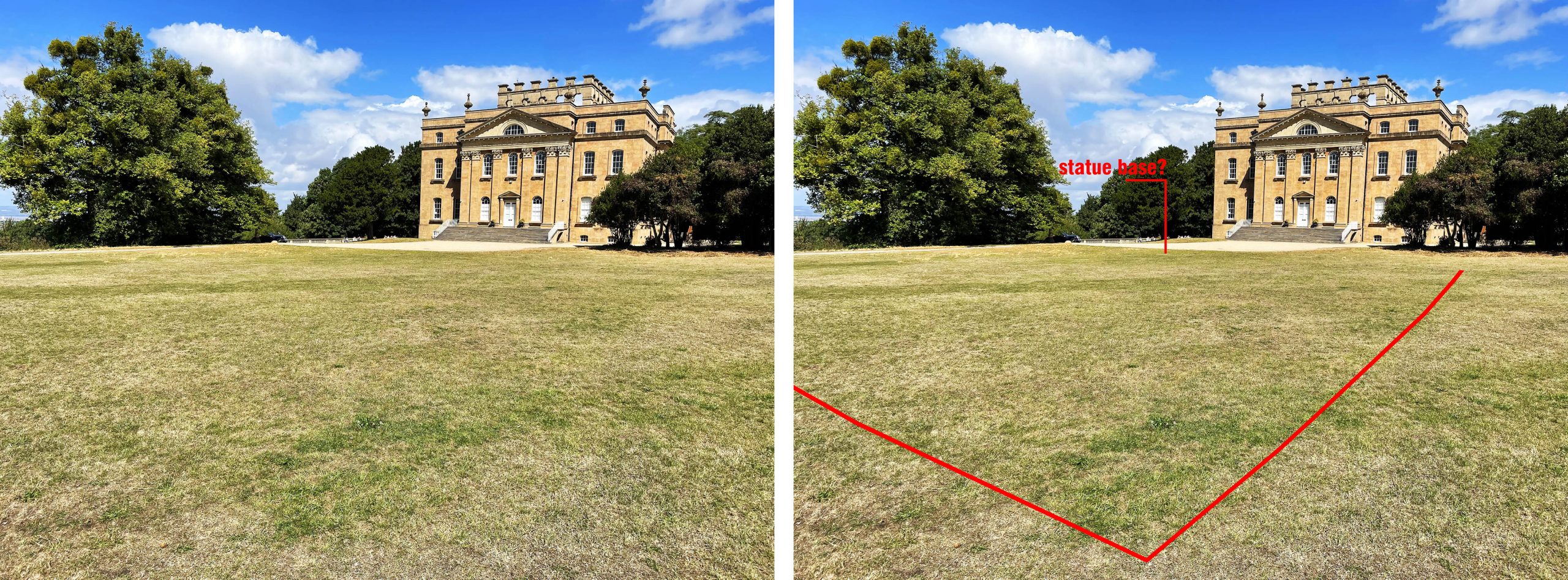
Two other features register faintly from this phase: the vestiges of the Great Terrace and a linear garden feature known only from the 1720 plan. These are both to the north of the ancient avenue and have been heavily impacted by the de-formalisation of the parkland and landscaping that occurred later in the Georgian era. Of these works little can be detected from Lidar, perhaps on account of the intention to naturalise the landscape in the picturesque manner.

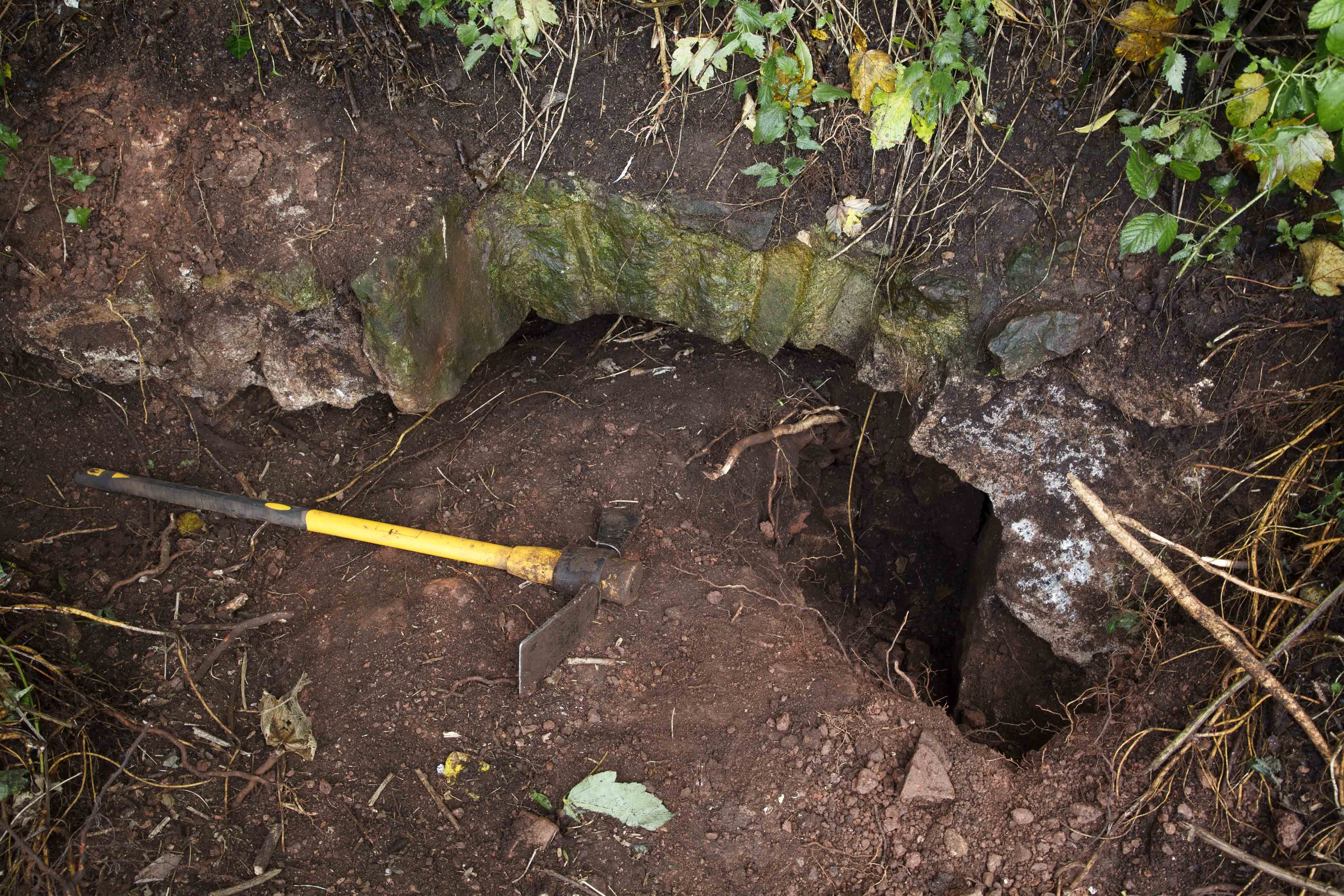
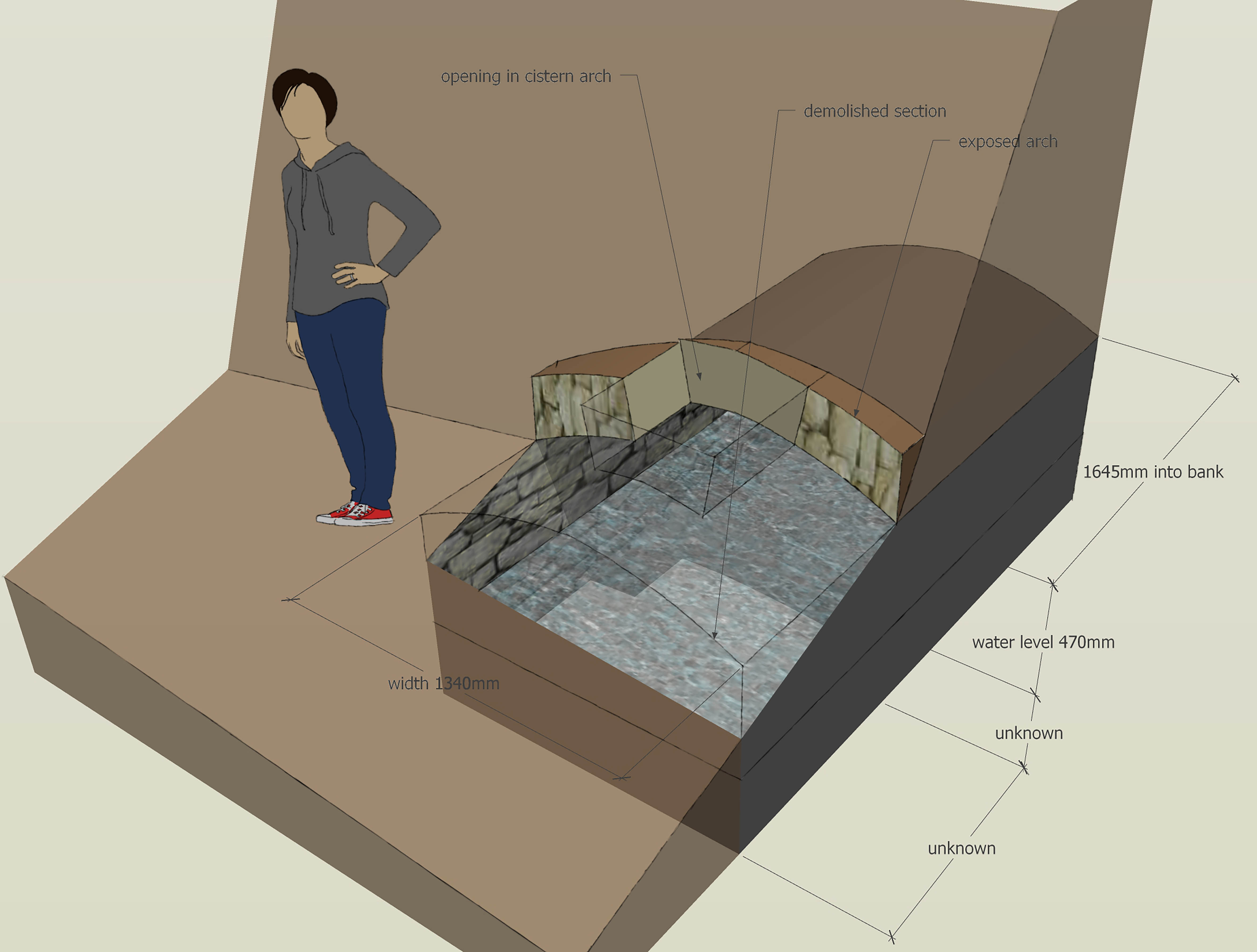
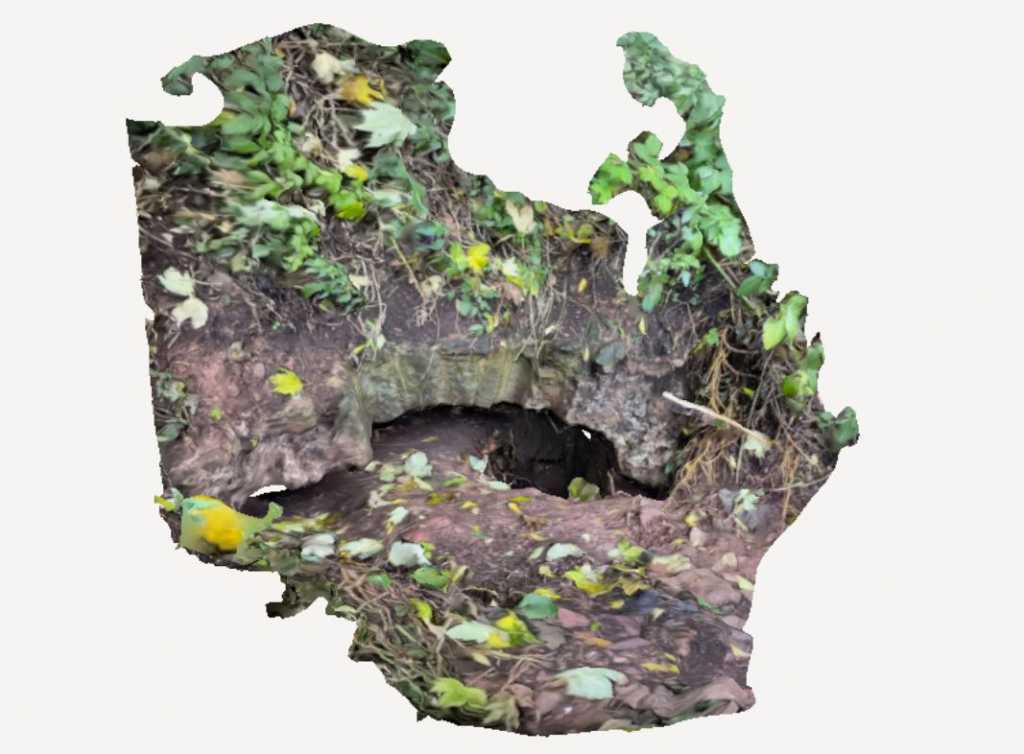
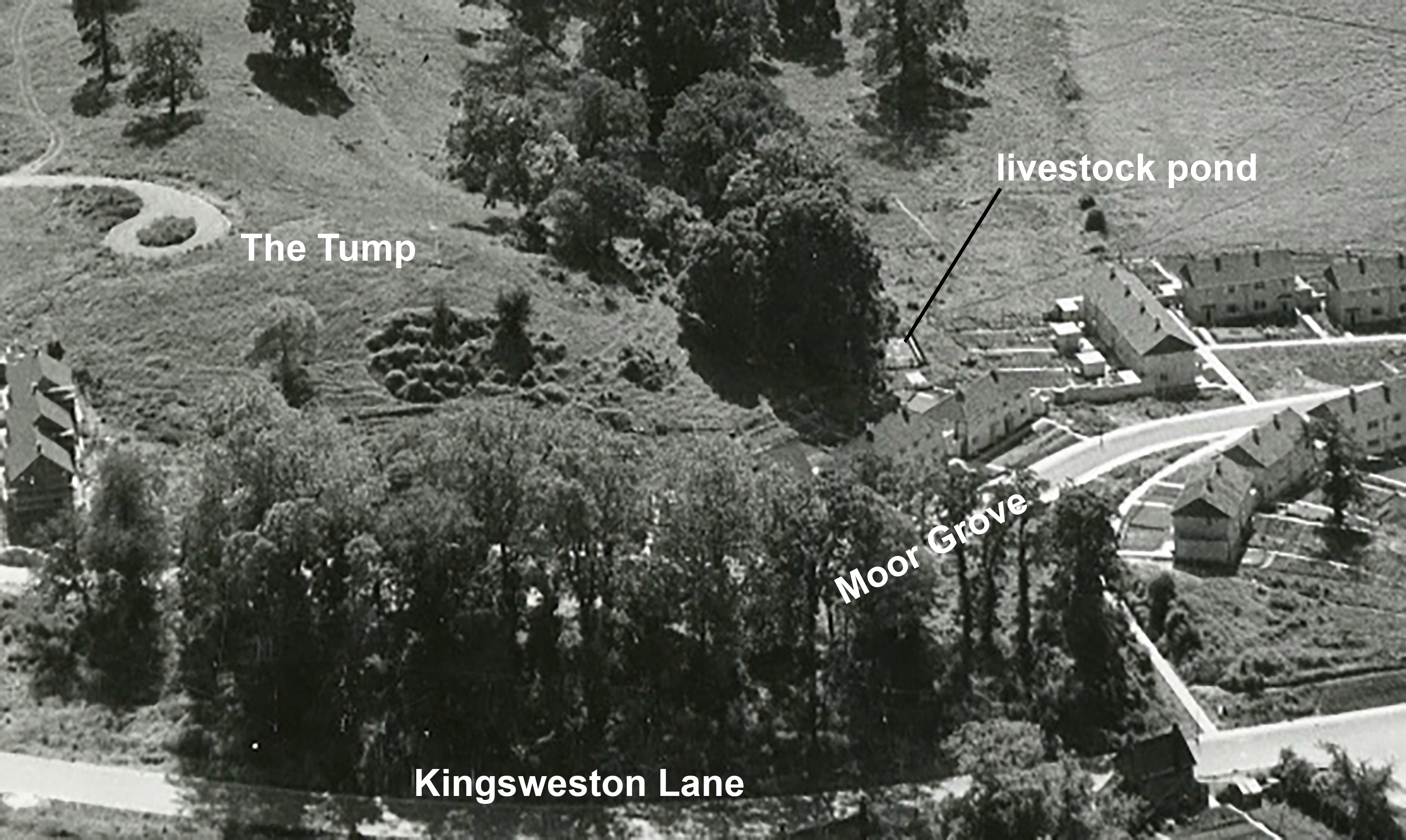
A gap exists in the story LiDAR provides, between the early 18th Century and the 20th. Deformalizing removed formal features rather than creating new ones, and had a generally lighter impact. No great changes were made during the 19th Century, nor early Twentieth. The next obvious mark is a curious dumbbell-shaped feature that, from aerial photos, was constructed in 1947. What this feature was is something of a mystery, but if anyone knows what it was used for, we’d be keen to know! A couple of other features sit outside of the known phases, one amorphous lump lying over the medieval landscape, and a small circular depression further eastward. These, perhaps, will remain a mystery.

PHASE IV and unplaced phases. The dumbbell shaped feature close to The Circle was built immediately after WWII. Does anyone remember what it was?


