We’re aware than many of our followers have fond memories of their time at Kings Weston house when it operated as a school between, 1949 and 1960. We’ve just collected a new photo for our archive showing a school group on the steps of the house in May 1952. All we know is that this was class IX, but does anyone recognise themselves, friends or relatives in this photo?
We’re very grateful for the following short report compiled by Ann Cunningham. Ann contacted us a short time ago and has helped add a new insight into the WWI years:
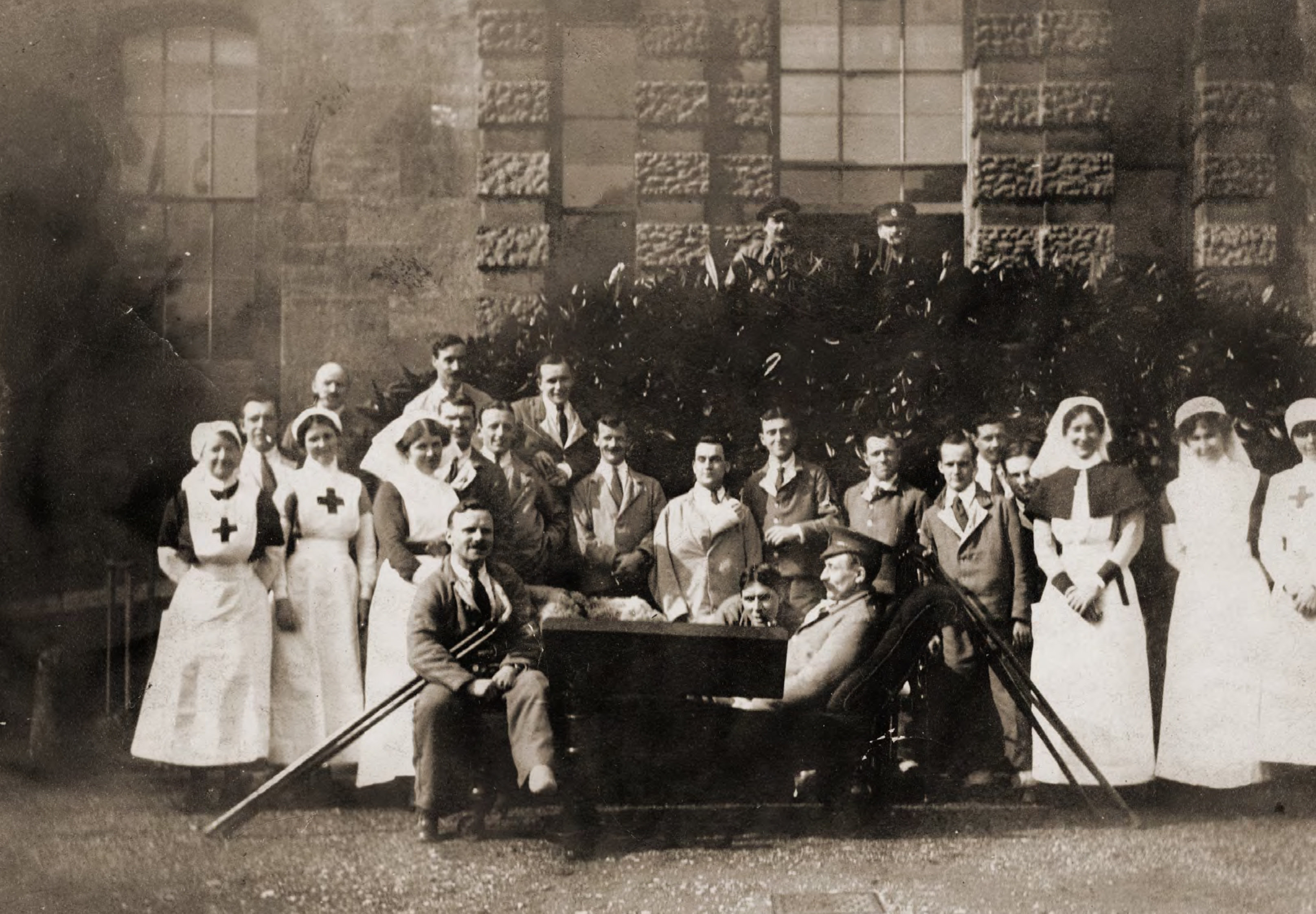
In 1914 Kings Weston House became an auxiliary hospital for wounded soldiers in WW1. From 1914 to 1919 there were many nurses and workers who came here to help and support the injured. After doing some research, I have found the following nurses that worked at the house. There are 7 in total.
Miss Hilda Prance
From May 2nd 1915 until June 1918, Hilda was here for approx 18 months.
Miss Mabel C N Moore
From May 2nd 1915 until June 1919
Miss Frances Geraldine Moore
From May 2 1915 to January 1917
Miss Ethel M. J Moore
From May 3rd 1915 to January 1917
Miss Alice Maud Muriel Borase
From Nov 1st to 18th 1916
Miss Joan Badock
Worked for one year in 1916
Miss Ethel Maud Adams
March 1918 to March 1919. Ethel was a Ward sister and also a night duty nurse.
Ethel was born in 1879 in Long Stock, Hampshire, England. Her parents were James and Susan Adams. She has the following brothers and sisters. Sarah, Annie Elizabeth, John George, and Herbert Evans.
Soldiers and nurses pose on the garden steps of Kings Weston House.
Ethel has been documented as being a Pioneer Nurse. In 1887 the first register for professional nurses was founded. It was the first in the world. It was called the Royal British Nurses’ Association (RBNA). Its aim was to provide a snapshot of the nurses training and qualifications.
Ethel has been documented as registering in 1915, at this time it was voluntary, but by 1919 it was compulsory and finally in this year the Nurses Registration Act became law.
KWAG’s first World War exhibition boards can be viewed here
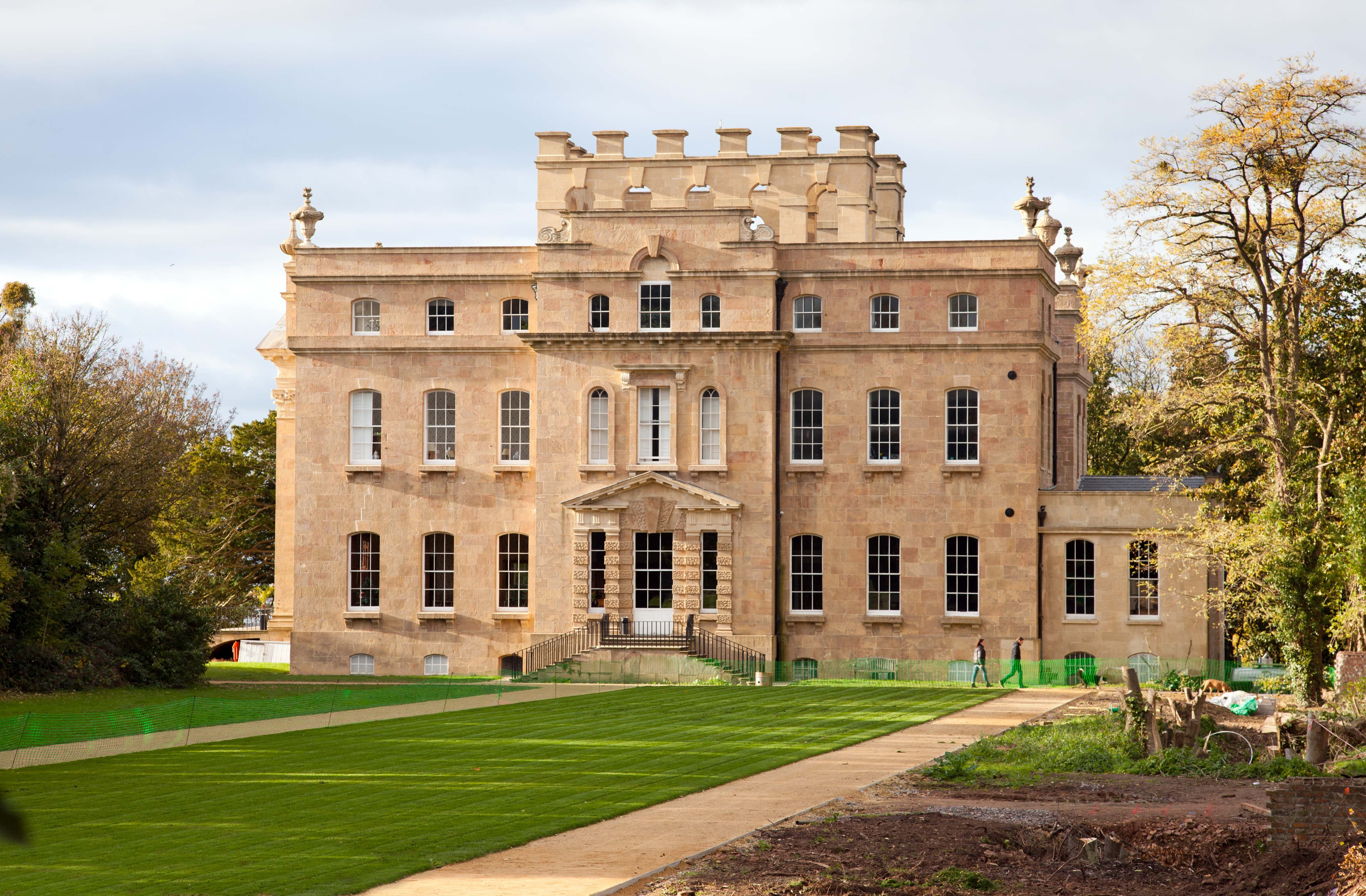
A view from an angle last enjoyed a generation ago; The garden front of Kings Weston over the recently relaid lawn after the ruins of QEH were recently removed.
It is almost a year since the historic Iron Bridge across Kings Weston Road was hit by a lorry and damaged an severed an important footpath. At last we have some good news to report: Bristol City Council highways team have now started commissioning survey work of the Grade II Listed structure in advance of physical work being undertaken to reopen it.
A structural survey is just one element of the package of information needed to ensure the most sensitive approach is taken in making repairs; A Listed building assessment and heritage report is also being undertaken by the city’s conservation team to ensure that the significance of the structure is understood, and to inform best practice in dismantling and reinstating damaged elements.
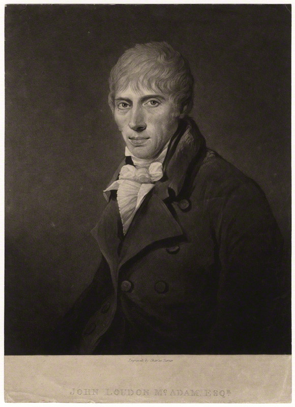
John Loudon McAdam (1756-1836)
The bridge was designed by the eminent highways engineer John Louden McAdam who, at the time, was the engineer tasked with improving the turnpike roads around Bristol. In 1819 the lane, a parish road between Kings Weston and Henbury, was turned into a turnpike road and work commenced to improve standards to justify the tolls levied on such routes.
It wasn’t until 1821 that McAdam noted in his observations that labourers had begun lowering the hill and building walls at Kingsweston Hill. This would have formed the deep cutting through which the current road passes. In the following year he notes the formation of a new footpath in association with the same works which is likely to have been the track approaching the old inn from the Sea Mills direction. It’s probable that the iron bridge was installed at the same time, as the completion of these ambitious works.
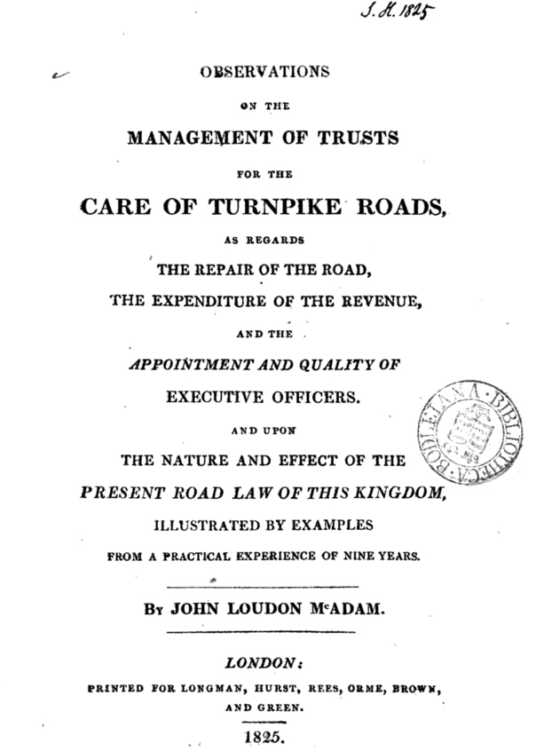
Title page of McAdam’s 1825 Observations
The bridge was constructed of more than 130 individual components of both cast and wrought iron. More technically advanced than most similar structures of the period it used a closed-mould casting technique which allowed the incorporation of strengthening flanges to the structure. New work has been undertaken by KWAG, in cooperation with the Council’s conservation team, that sheds light on the construction and fabrication of the bridge. Following a study of the structure a 3D model has been created which will now be used to inform the best approach to restoration. As you can see, for such a small structure, it’s surprisingly complex!
The city’s highways officers are currently considering options to raise the bridge to remove the possibility of it being hit again in the future. There is also the potential that the whole of the bridge will need to be dismantled and removed before re-installation. As the project develops we hope to be able to report on progress, but physical work is unlikely to begin before spring 2017.
exploded diagram undertaken by KWAG showing the construction of the Iron Bridge
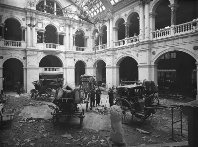
We’ve had many people coming up to us recalling old horse-drawn carriages stored at Kings Weston shortly after the Second World War. It’s been a bit of a puzzle as to what they were, and what happened to them, but this week the story came into sharp focus. A new on-line interface for the collections of Bristol Museum and Art Gallery Provided the answer.
While searching for Kings Weston related items an entry appeared for one of a collection of carriages in the City’s ownership. This was an early Nineteenth Century carriage used by the Duke of Beaufort of Badminton. During the war it had been on display in the rear atrium of the museum when, in 1941, a bomb detonated on the roof, completely destroying a biplane hung from the ceiling, and badly damaging the carriages. They were speedily removed to Kings Weston estate buildings for safe storage for the remainder of the war, where they must have stayed into the early 1950s when people recall seeing them. They reputedly received more damage from damp through the leaky roofs of the stables than they did in the initial blast!
A series of fascinating discoveries have come to light in recent weeks
Surprisingly it’s the more recent history of Kings Weston that we have less historical evidence for than earlier periods. A lack of original material is a particular problem when researching the Second World War at Kings Weston when necessary secrecy meant that fewer records were kept. We know that it played and extremely active role during the war with two army camps; one on the Shirehampton Park Golf Course and one on Penpole Lane. These were “Camp Seamills” A and B respectively and mainly housed regiments of Black US Army soldiers that formed the Port Companies used to unload war supplies and arms arriving in Avonmouth.
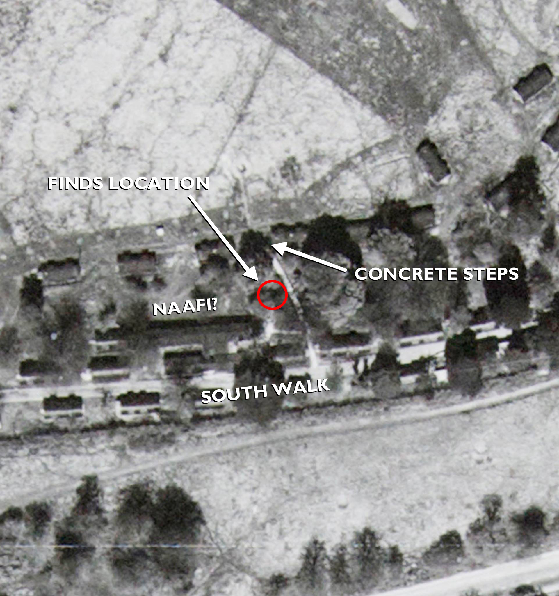
We’re less clear about how Kings Weston house and the surrounding area of the Home Park operated during the War. From contemporary aerial photos, and from the remaining concrete bases, we know that there were several dozen barrack huts built along the South Walk and as far as the Echo, but we’ve yet to establish who they were used by.
Our recent work clearing the area below the South Walk has uncovered a lot of the ruins of the former army camp, but last month we uncovered some interesting artefacts from the area. Close to where the newly-revealed concrete steps descend towards the house there is a very large concrete slab base from a building much larger than the other barrack blocks. It was close-by that we found a rubbish dump with a lot of contemporary finds amongst a lot of tipped ash. You can see where we found it using this link to the Know Your Place website.
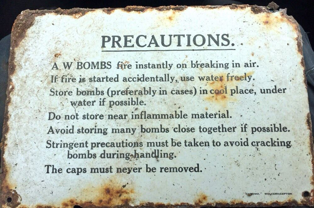
Most interesting was probably this well-preserved enamel sign. Further research has shown that this came from the inside lid of a wooden crate used to store “A W Bombs”. These ‘bombs’ – actually incendiary grenades – were produced in large numbers from 1940 onwards and were issued to the Home Guard in the event of German invasion – a real threat at that point in the war. Fortunately we didn’t find any of the glass flasks that contained the white phosphorous that would still have been dangerous today!
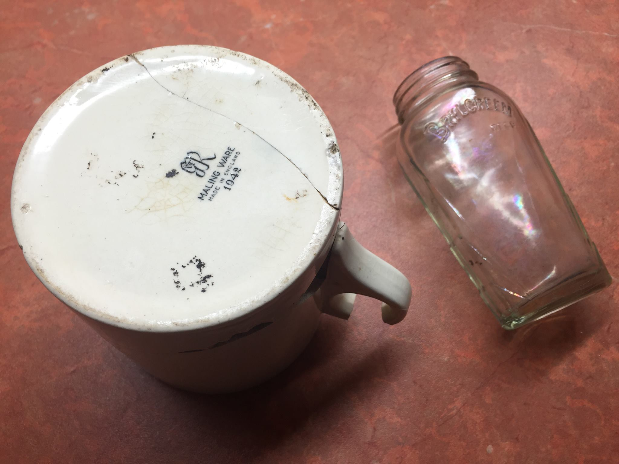
Also uncovered were the shards of a very large mug with the printed date 1942 on the base – could this have been from a nearby N.A.A.F.I canteen? Amongst other artefacts was a 1940s Brylcreem bottle; an evocative reminder that men lived and slept in the huts scattered about the estate.
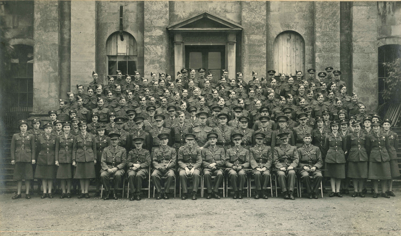
This month seems to have had a WWII theme running through it as we also acquired two period photographs that we are hoping people might be able to help with. The setting for both is clearly on the front steps of Kings Weston House. The front windows have been boarded over as protection against bomb damage for the paintings still in place in the Saloon beyond it. In front are posed British servicemen and women from a wide variety of regiments. One photo shows just the officers, and the other, shown below, shows a wider group of staff. The only clue we have to the event, or organisation represented here is the pencil note on the back of the photographs “Capt’ Myles”.
We’d be really interested to know more about this photo and if you can add anything please let us know. Can you find out who Myles was, what does this group of people represent, or do you even recognise anyone? Please let us know if you can help us. A much larger version of the photos can be found on our website here.
We’re always on the lookout for new historic material relating to the Kings Weston estate. If you have anything you can share with us, photos, memories or artefacts, we’d love to hear from you
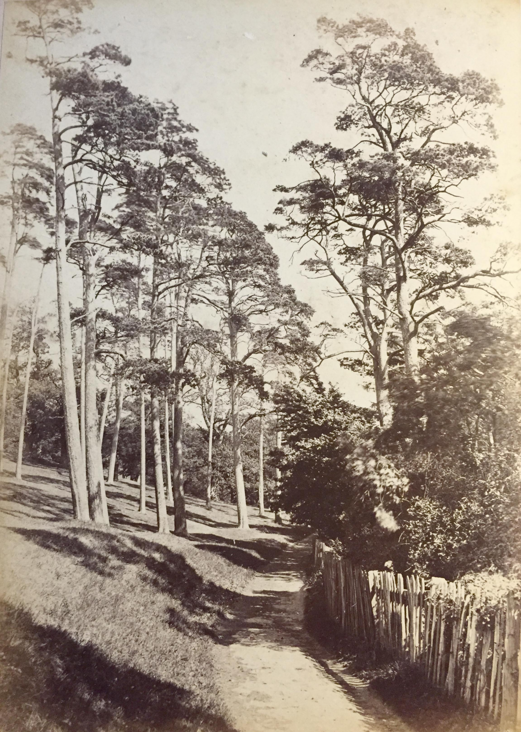
This month several items have come to our attention. Above you’ll see an idyllic photograph of Shirehampton Park looking in the direction of Sea Mills in about 1880. The grove of pines was a popular spot for artists at this time, but the trees were probably planted much earlier, by Sir Robert Southwell in the late Seventeenth Century. They are a constant feature of Shirehampton Park through the 1720 and 1772 estate surveys and successive owners must have replenished and maintained the small plantation. This picturesque view shows the wooden fence that was erected to protect the public from the recently opened railway line that had been threaded through the park, along the banks of the Avon, in 1875.
Sadly this viewpoint and most of the pines were lost in in the 1920s when the Portway cut through this exact location.
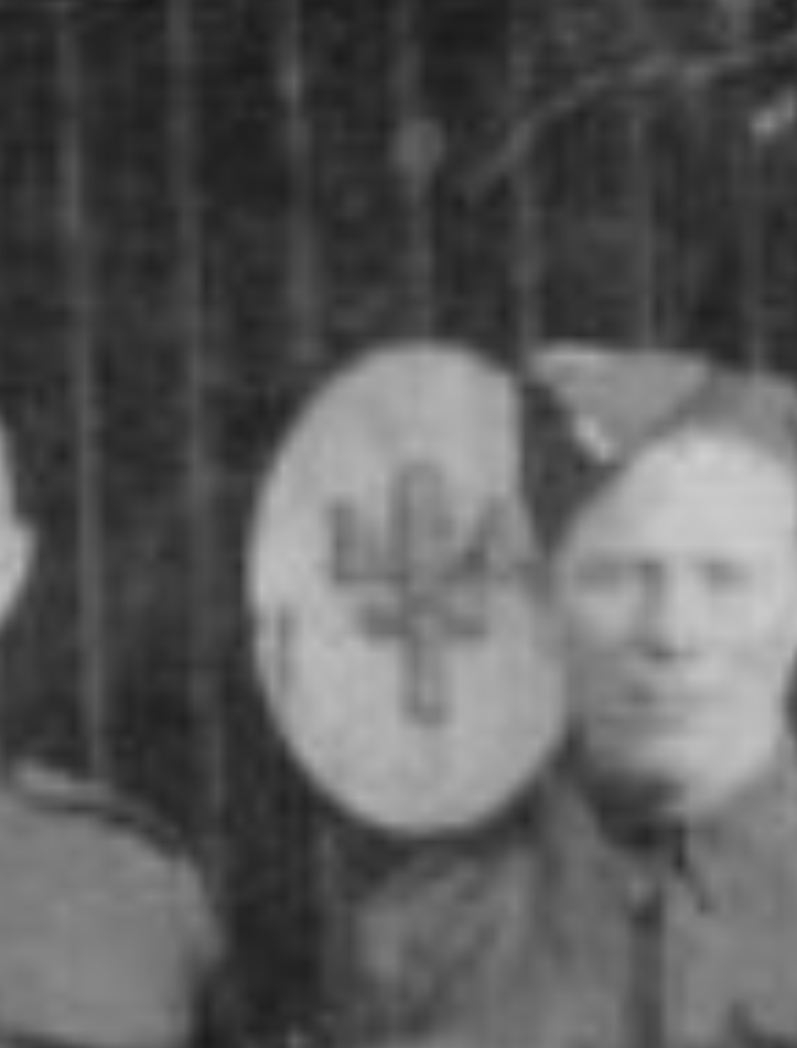
We hope that someone out there can help with another discovery. We’ve acquired the scout badge illustrated here, but we are having difficulty in tracking down its history. Emblazoned with a crown (possibly symbolic of the “King” in Kings Weston?), a pole, and the words ‘Penpole District’ we believe it relates to the Bristol District Scout camp that was based in Penpole Woods between 1937 and 1947. During this time Penpole Lodge became the gateway into the camp site and was used by the older Ranger Scouts as their HQ.
A second image here shows the detail of a wartime photo posed in front of the gates of the now-ruined lodge and shows the plaques the Scouts attached to them. Is this the same logo as the badge we’ve acquired, was there a later Penpole District Scout Group, or is there no connection with the estate at all? We hope that someone out there might know and we hope that any former Scouts that remember their time at the Penpole camp might be able to help us.
Documents reveal new information on New World plantations
Kings Weston has always had some low-key historic connections with the slave trade. Edwards Southwell II was MP for Bristol between 1739 and 1754, during which time he promoted the interests of Bristol’s Africa, Carolina and West India merchants. After the Southwells’ the Miles family had founded their immense fortune in shipping and plantations in the West Indies, but the infamous slave trade had been banned decades before their purchase of Kings Weston in 1835.
However, new information has come to light about actual plantations and slave ownership by Edward Southwell III in the colony of East Florida. Recently catalogued documents in Bristol Record Office tell the story of how Edward Southwell III entered into partnership with his father-in-law Samuel Campbell, and the latter’s brother in law Closworthy Upton, later Baron Templetown, to petition the King to be granted land in East Florida. The territory had entered into British hands in 1763 following the Seven Years’ War and land was progressively allocated by the crown for colonisation.
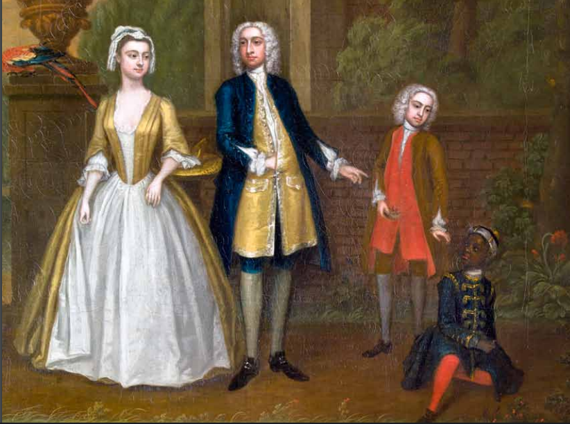
Edward Southwell (II) and his wife Catherine, with their son Edward (III) and a black servant
In 1766 the Crown granted the same amount of land to each of the three petitioners stating “In order to make a settlement thereupon” the King does “cause 20,000 acres of land to be surveyed in one continuous tract in such part of the province as the said Edward Southwell or his attorney shall choose not surveyed or granted to others” and “that the grantee do settle the land with protestant white inhabitants within three years”. The grant further demands that if any of the lands are suitable for hemp or flax production then this use should be given precedence.
With 60,000 acres between them the partnership sought suitable and experienced hands to develop them on their behalf. The services of William MakDougale [sic] were secured and he was dispatched with other eager planters and agents to set-out the claim. Land was secured on the east bank of Lake George, but MakDougale was concerned that the £2000 contributed by each partner would not be sufficient for the venture. In this respect he was entirely correct. The Southwell account books for the following years show a constant flow of large sums of money out to Florida for little return.
Southwell’s land on the east bank of Lake George – still unspoilt today.
There was an enormous amount of fraud and corruption perpetrated by unscrupulous agents and planters in the colony, at the expense of their absentee landlords in England and Scotland. This, combined with the swampy land, poor resources, and occassional attacks by the Spanish, meant that Edward Southwell’s venture was probably doomed from the beginning. To make matters worse their planter, MakDougale, died in 1774 and the 60,00 acres were charged to another planter, James Penman to administer. Little appears to have been produced by the plantations, small quantities of timber and barrels of tar being the only exports, and after the death of Edward Southwell III in 1777 his executors were forced to come to terms with the scale of the losses he’d incurred.
In 1779 the plantation collapsed completely. Writing to Southwell’s executors Penman describes how he abandoned his own plantations, initially to find safer territory to settle following the outbreak of “the Spanish War, and then retreating to the main town St Augustine. He promised to take good care of the partnership’s 20 ‘Negro’ slaves who he took in with his own, but later sold at very poor prices, keeping the money for the expenses he’d incurred.
The venture had led to Edward Southwell becoming heavily indebted, and it is no surprise that the several English and Irish estates he owned, including Kings Weston, all had to be mortgaged for over £30,000 to help support the disastrous endeavour.
A new image has just been acquired of one of the Kings Weston Estate’s 23 individual Listed Buildings. Seen above, this is a pencil drawing of Wood Lodge dates to 1956 and was sketched by local artist, and Bristol Savage, George Holloway. This view looks towards the Grade II Listed building from the east and shows a number of features that have since been lost including the blocked windows and the stone drip-mouldings above others.
The lodge owes much of its ornamental appearance to Philip Skinner Miles during the Victorian era. It was in the 1860s that Miles undertook the refurbishment of a number of the estate’s buildings, including Wood Lodge, and added rustic wood work, decorative barge-boards and a clay pantile roof; Kingsweston Inn Sea Mills Farm, and Henbury Lodge also received similar alterations at this time. However, Wood Lodge has a much earlier origin.
The lodge has always had an important role on the estate; guarding the private parkland to the east from the publicly accessible common land on Penpole Point in the west. It is first depicted on an estate plan of 1772 and is seen in the smaller accompanying image here, by Samuel Hieronymus Grimm, in 1788 (Copyright of the British Library). This earlier view shows the front of the building as it would have appeared from the west. What is obvious is that the present building has very different proportions when viewed from the side, and appears to have shrunk from its original width. The projecting bay on the Penpole Lane side is likely to be the same one as seen today.
From the general appearance of the building, and some of the features shown in these two illustrations, it is possible to attribute this lodge to the architect, garden designer, and mathematician Thomas Wright. We know that Wright was working on designs with Edward Southwell III of Kings Weston House from 1761 and there are strong stylistic similarities between Wood Lodge and some of his other work on the Badminton Estate, Gloucestershire and Tollymore Park in Ireland. At what time the building was so drastically altered it’s not known, and although the thatch has a far more picturesque effect, its present tiled roof must be far easier to maintain!