
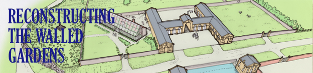
With a renewed focus on the area, it’s worth looking again at the history of the View Garden, once referred to as “the gem of the whole garden”, and lilypond to understand their significance. There’s enough map evidence provided by two important estate surveys of 1720 and 1772 to appreciate the colossal scale of the works undertaken from 1763 to transform the area into the walled garden and stable complex that survives today as a series of Grade II-Star listed buildings split across Napier Mile Road. To help understanding and appreciation we’ve created a short series of sketch views of the area at key moments in their development. Each image has a numbered key with the individual points described below…
1720
Halett’s estate plan of 1720 is an important record of Kings Weston just as the mansion had been completed, and before new garden works were begun. Although broadly accurate it provides scant information on the appearance and use of the area east of the main house. A later engraving gives a bit of detail, but the reconstruction here can only be described as speculative despite being based on these sources. Our reconstruction depicts an agricultural landscape with fields, orchards, and gardens separated be dry stone walls and hedges, with a few scattered traditional vernacular styled buildings. One of these was perhaps the source of a carved window stone, later built into the glasshouse wall in the 1770s.
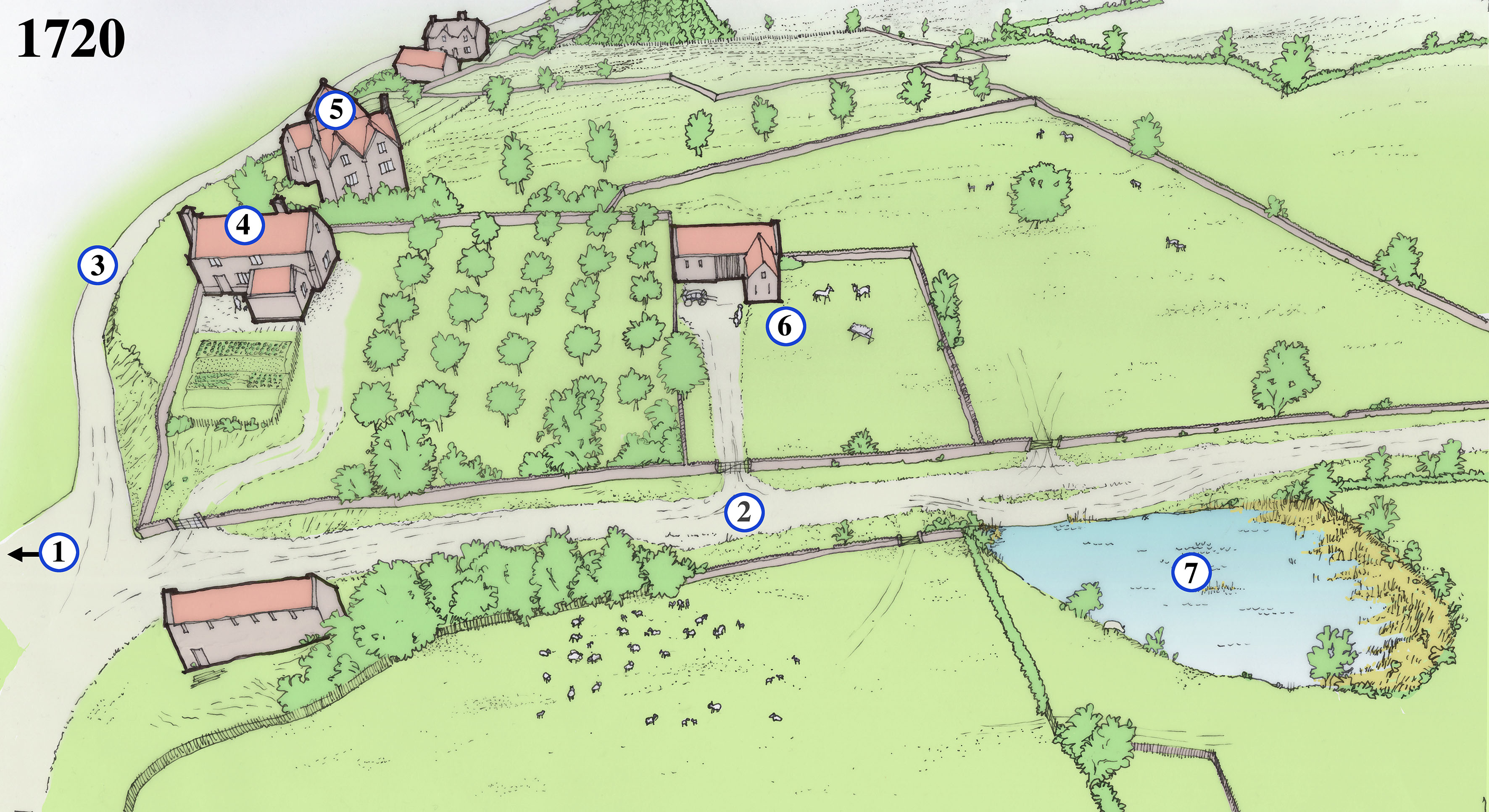
1. The road entrance to Kings Weston house approaches from the east as it does today. The present gatehouse and wall are Victorian and of 1903, and it’s not clear what the gates would have looked like at this time.
2. The present Napier Miles Road is a rural track leading from Kings Weston House to Henbury, and the parish church there.
3. Kings Weston Lane is another agricultural track, leading to a few scattered cottages and farms. The lane passes through an ancient hollow-way where centuries of water have washed off the hill and created a gully. Several gullies like this are distributed along the escarpment edge.
4. A number of houses occupy plots of land to the east of Kings Weston house. Most will have been for labourers tied to the estate. This house was on a roughly east-west alignment, and possibly reused the manor’s medieval chapel that would have fallen out of use at the Reformation. Another medieval chapel survived as a cottage in nearby Lawrence Weston until the mid 20th century.
5. A larger house stands above Kings Weston Lane, uncomfortably built into the steeply sloping land that descends towards the north. From its size it’s likely to be a higher status house than those around it. Could it have been an earlier site of the manor, before the current site was established in the Tudor period? A fragment of stone salvaged from the glasshouse wall was recorded by us in 2016.
6. A smaller building in a small plot in this location may have been a barn or other agricultural structure.
7. Shown on the 1720 plan is a large natural pond to the south of the lane to Henbury. This ill have provided a useful resource for the farms, and likely produced ice in the winter for the earlier ice house behind the mansion.
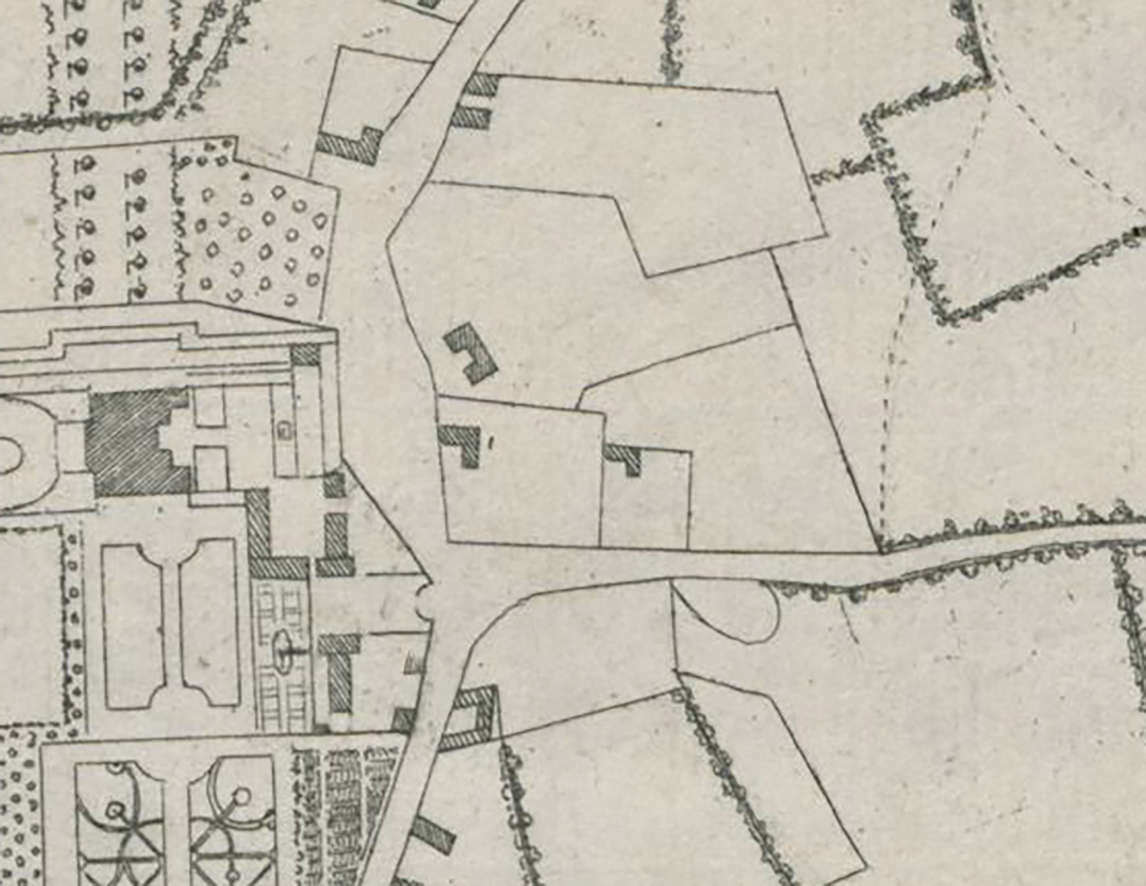
1772
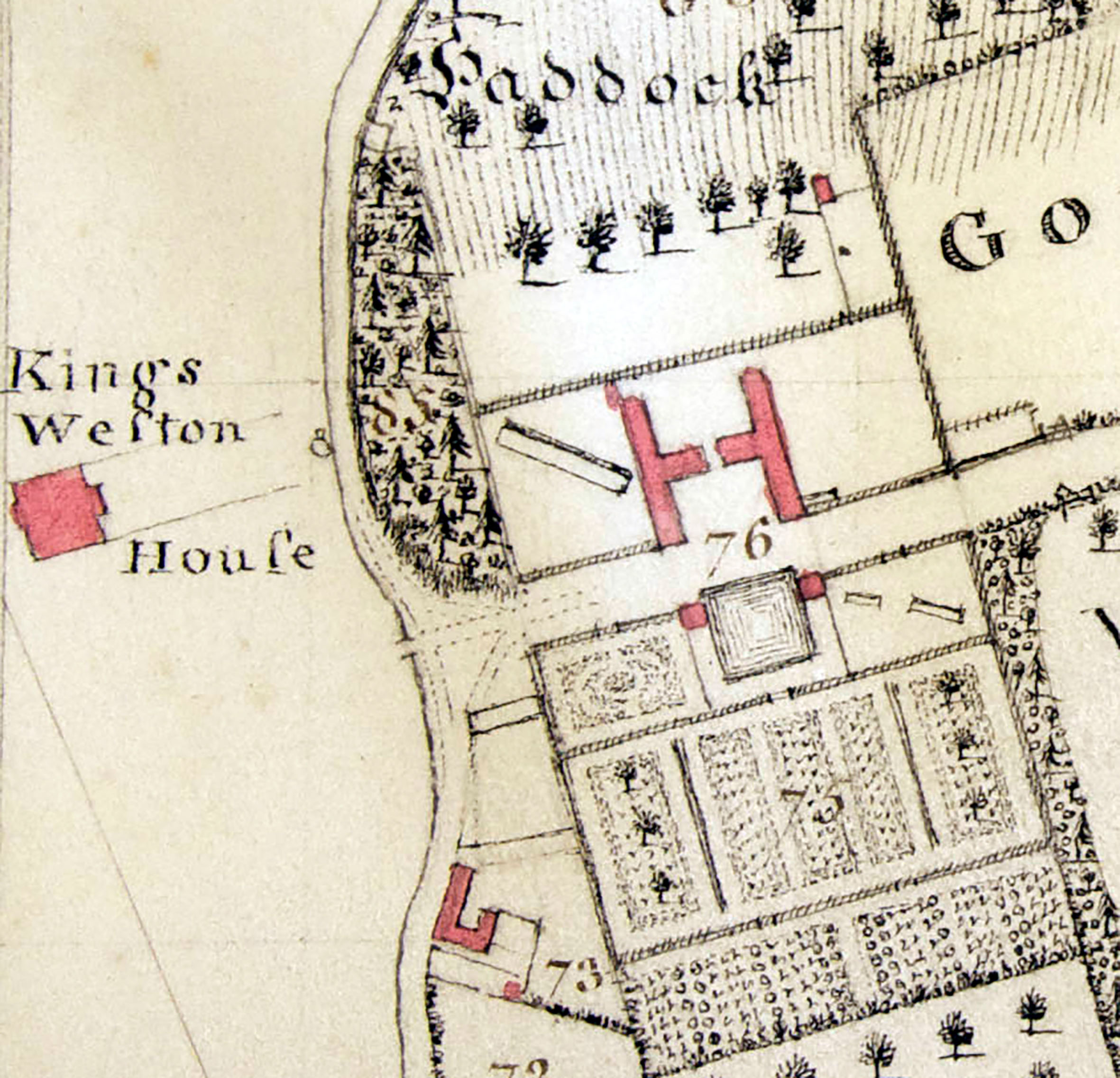
Isaac Taylor’s comprehensive estate survey was undertaken between 1771 and 1772 and includes a number of radical changes east of the house, a striking transformation from rural backwater to thriving estate hub. There are, in fact, two maps of the area drawn by Taylor, each showing slightly different features, perhaps finished at slightly different times. Both show how the old houses and boundaries were largely erased. From 1763 onwards the architect Robert Mylne enacted the third Edward Southwell’s ambition to clear away all the old stables and service buildings from beside Kings Weston house and extend the landscaped parkland to fill their space. Together, architect and client instead created a new set of buildings set in a series of rectangular walled compartments on a grid plan, providing an ambitious integrated design accommodating key estate functions, various gardens, glasshouses, and an impressive carriage house and stables complex. This was all to serve the main house with produce and flowers and service the estate’s transport needs.
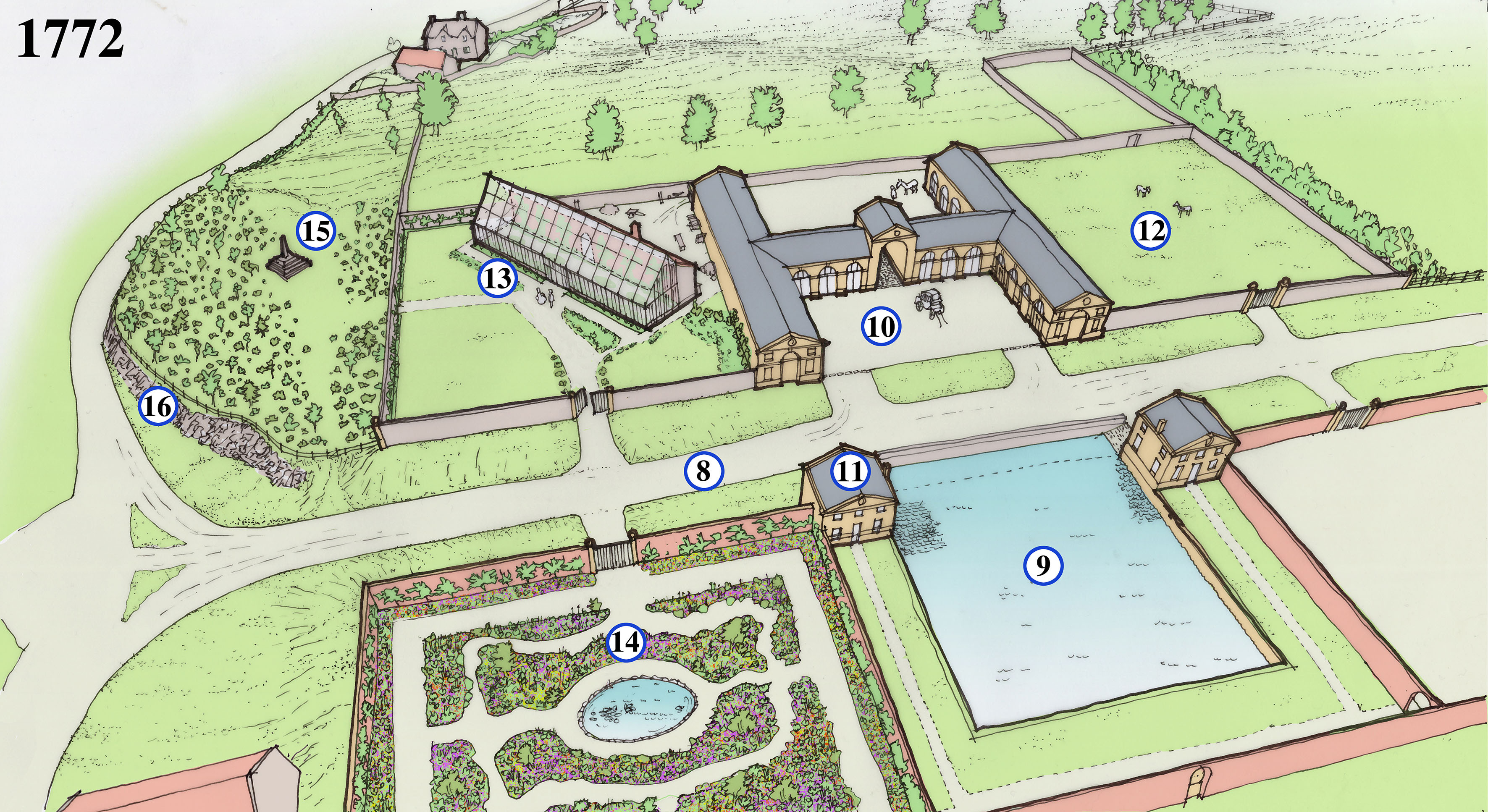
8. The lane to Henbury has been realigned to become a broad straight road with grassy verges either side. The new road is designed to have a visual impact when viewed from the gates to Kings Weston house from the west.
9. The natural pond is formalised into a square pond which could be stocked with fish for the kitchen as well as providing water for the gardens and stables. Ice would be collected here in the winter for storage in the icehouse. Ramps and a platform below water level are designed to wet carriage wheels to prevent them from shrinking in hot weather and losing their metal rims.
10. The centrepiece of the new complex is the grand and formal carriage houses, with stables in the wings beyond the archway.
11. Matching the stable block in style are two lodges built framing the pond; One provides a gardener’s cottage and the other a seed house.
12. Paddocks for horses are probably intended for the north-eastern quarter of the complex.
13. Set in its own compartment and angled to maximise exposure to the sun, the glasshouse at Kings Weston and was one of the largest in the country was built in about 1771. A tall masonry wall at the back incorporated a hidden hot air heating system powered by a furnace at the back. The glasshouse quickly became a focus for Sophie Southwell’s interest in horticulture and where she nurtured her interest in growing exotic plants and flowers. It became a much-remarked feature of the estate during the 18th Century.
14. Produce gardens were kept to the southern compartments behind the pond and this walled area. This area with better access to Kings Weston house was a flower garden, laid out on a broadly regular plan but with eccentric windy paths adding interest. Flowers would have been grown to supply the house with attractive displays and perfumed blooms, but also offered a more intimate garden experience to the landscaped parkland then laid out around the mansion. An oval pond at the centre would have ben used to help watering and create an attractive centrepiece to the garden.
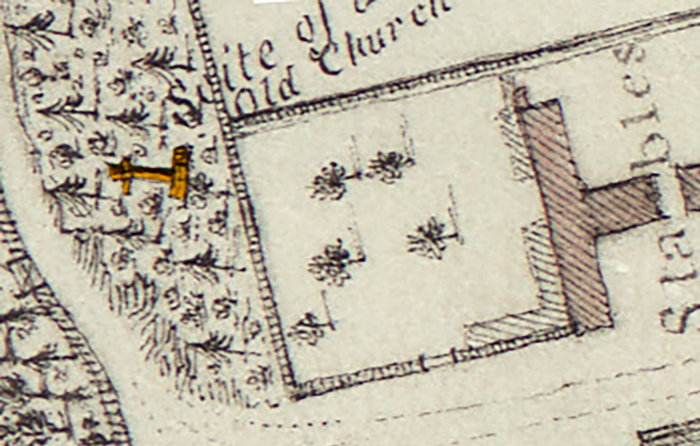
15. One plan of this date shows a cross here and describes a “site of an old church”. Later maps show “Bewy’s Cross” standing here. In 1720 the site was that of a building, so it’s unlikely that the cross was there at the time. It’s speculated that an ancient cross at the mouth of the Avon was relocated to Kings Weston as a garden ornament, though perhaps intended to mark the site of the old chapel. What evidence existed to suggest the church, more accurately chapel, stood here is unknown and lost when the standing buildings were demolished.
16. To create a regular new road to the stables and improve the way down the hill parts of the hill are quarried out and pushed back to leave rugged rocky cliffs against the road. New plantations are planted above them to naturalise their appearance and as a setting for the cross.
1884
The rigid Georgian plan and ambitious scale of the walled garden complex provided well for Kings Weston for over a century, with little change. The ownership of the estate had passed from the Southwell to the wealthy Miles family. Changing fashions in garden design and use and a greater demand for service buildings saw some blurring of the rigid boundaries and expansion into the surrounding landscape. The biggest change was the creation of the View Garden, probably laid out in the 1860s. The name is first recorded in 1916 when it was described as “the gem of the whole garden” at Kings Weston.
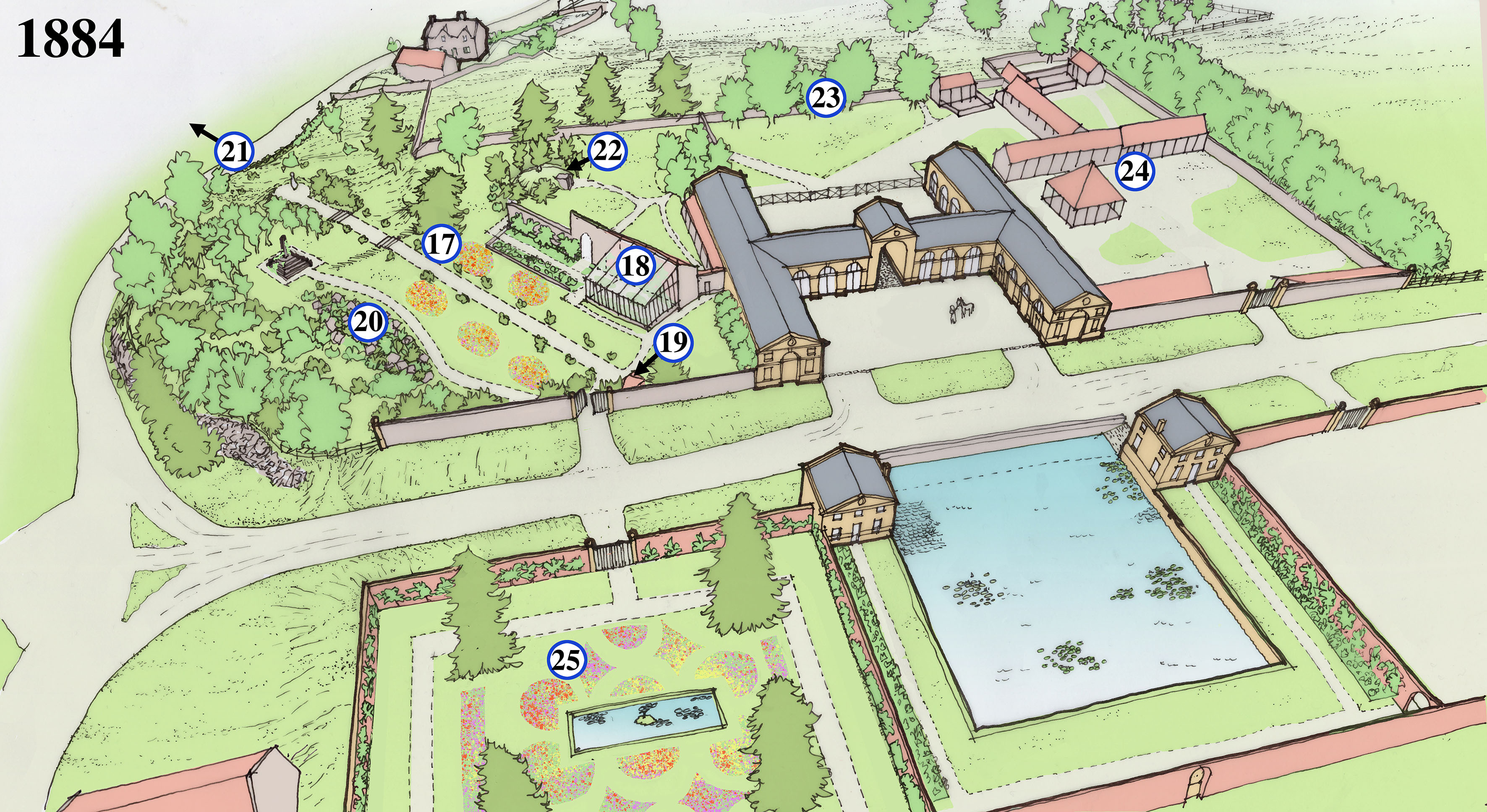
17. By the 1840s the wall of the north-east compartment is thrown down and the glasshouse and cross brought into a single garden space. About 20 years later a long axial path is laid out on the same alignment as the glasshouse, with two sets of stone steps. Fragments of these survive today. The lawns either side of the path were probably set out with ornamental flower beds. The new garden is christened the “View Garden”.
18. The Georgian glass house is passed its prime and has been rebuilt on a less ambitious scale against its original. The parts no longer covered are turned into more planting beds.
19. A covered garden seat or alcove is built at the head of the axial path, just to one side of the entrance gate, and from which to enjoy aligned views through the gardens. Yews and box trees are planted to lead the visitor along the paths and line the back of the main garden wall.
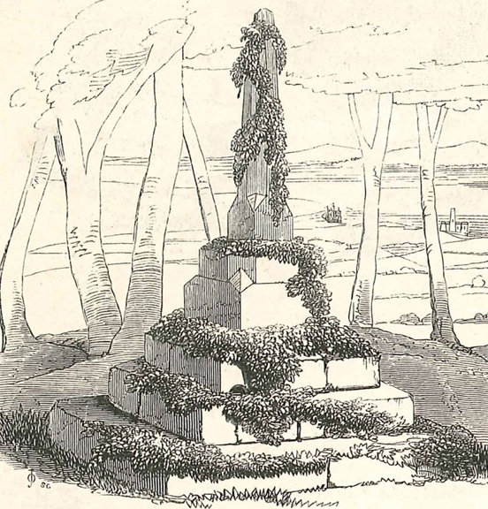
20. Another path is laid out on a more picturesque winding course, taking in a large new rockery on its way to a small clearing around the medieval cross. It may have been whilst creating the rockery or the axial path that foundations of a building were uncovered again in the 1860s and again thought to be the chapel ruins. In 1868 the cross was described and illustrated as covered in ivy, perhaps planted for picturesque affect? The view through the trees here certainly had eye-catching views to the Severn.
21. The axial path culminated in a circular viewing platform elevated above the slope of the hill. It enjoyed distant views across the Severn and Avon towards Portishead and Wales beyond, giving the View Garden its name.
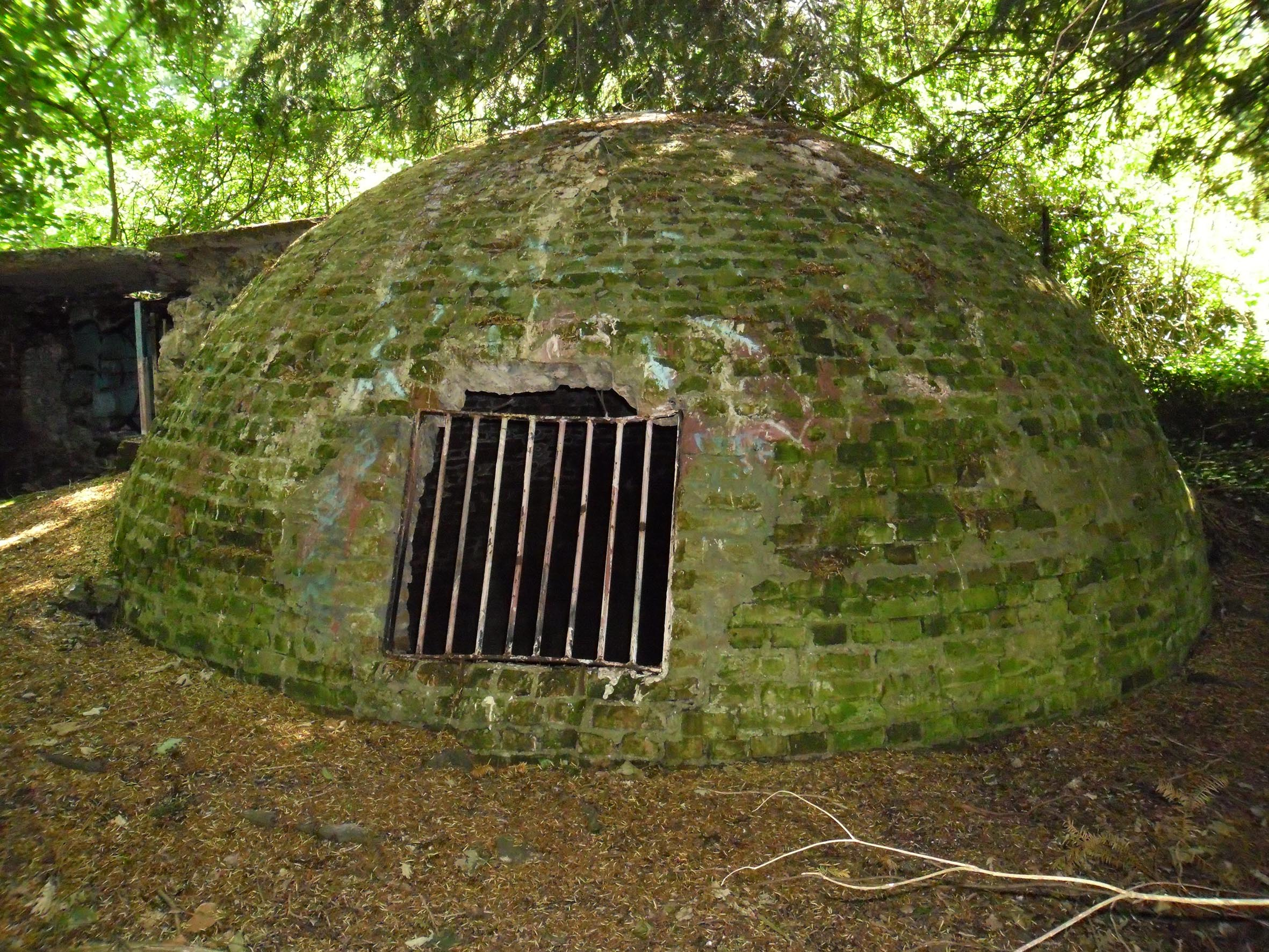
22. The old icehouse behind Kings Weston house was done away with, probably in the mid-Victorian era, and relocated to behind the old glasshouse. It was covered in earth to provide added insulation and planted around with yew trees to protect it from the sun. One yew tree was planted at the very summit of the domed icehouse and remained there until it finally fell in the 1980s, pulling the earth covering with it.
23. The original Georgian rear wall was pushed north with the land built up to form a flat platform, falling away with a steep embankment beyond. The additional space accommodated the icehouse and more paddock and building space.
24. Fox hunting had become a popular recreation activity for the Miles family and more buildings were needed to stable horses and provide storage and dog kennels. These were added to the north of the stables. A woodyard and sawmill were also added in this area.
25. The flower garden had become more formal and less focussed on providing for the house. It’s dominated by four conifers planted around a now-rectangular ornamental pond. Like the View Garden, the lawns were likely planted with floral displays of seasonal bedding plants in the Victorian fashion. This garden would shortly be transformed again, with the conifers felled and a more informal pond and rockery.