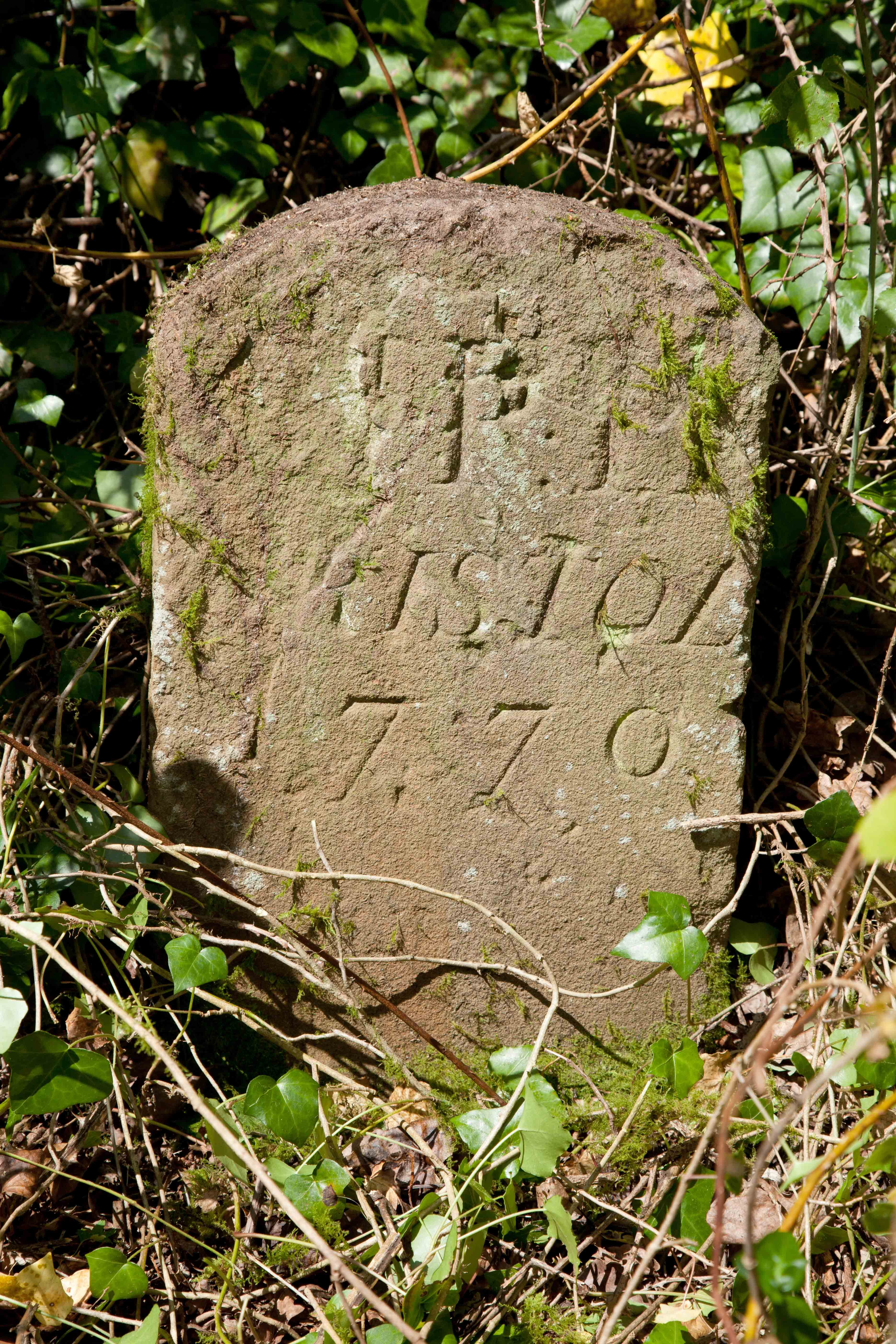
We’ve recently uncovered an Eighteenth Century boundary marker that has been lost for some time. Only know through a photo included in Shirehampton: The continuing story, by local historian Ethel Thomas, the stone lies within the Georgian landscaped Shirehampton Park portion of the estate; or rather it did before both the routing of the railway and then the A4 Portway between the parkland and the river.
Dated 1770 it bears a series of carved letters which Professor Richard Coates of UWE has interpreted as “St. P. H”, though the ‘S’ has been badly eroded. He further suggested that it related to St Peter’s Hospital, a Bristol institution that held a number of parcels of land around Shirehampton in the 1700s.
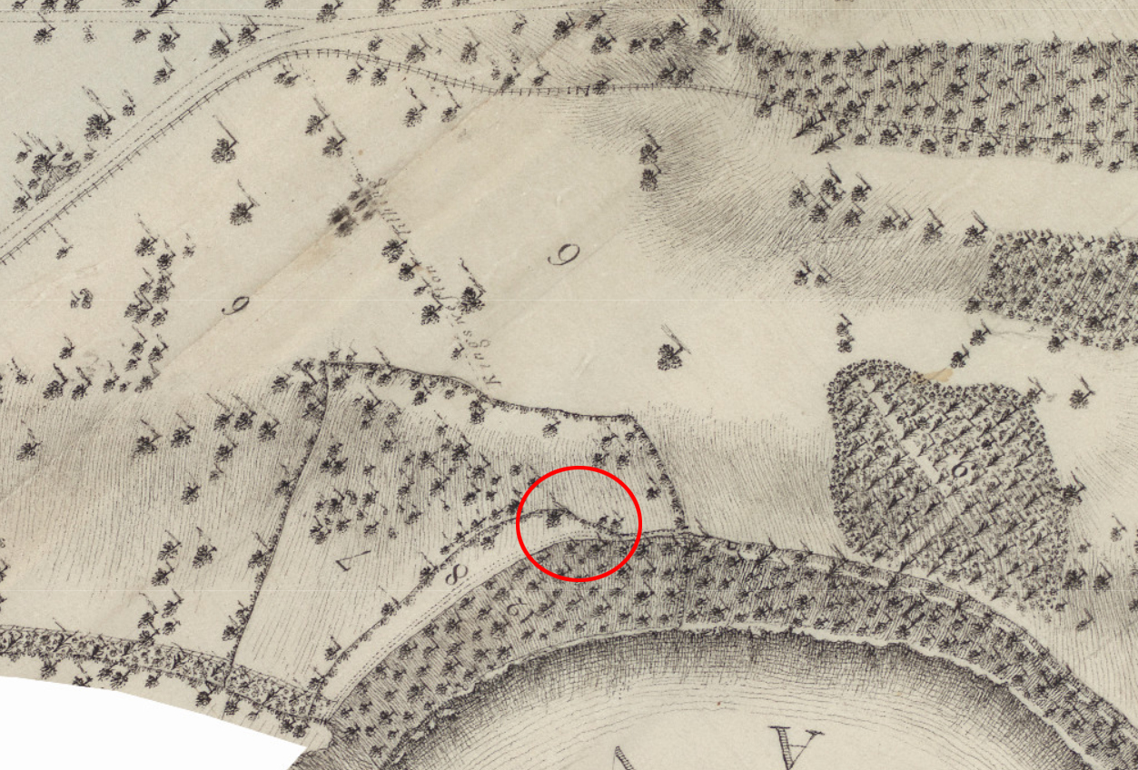
The stone was moved during Twentieth Century and the civil engineering works for the Portway, but it is likely that it stood at one end of a narrow strip of land above the Avon called Bucklewell Field, and marked the point on a footpath between the Kings Weston estate, owned by the Southwell family, and this smaller piece of land.
Though the stone was uncovered again recently the brambles are likely to reclaim it quickly, but we’ve made sure its location is recorded along with a photo on the Councils Know Your Place website HERE.