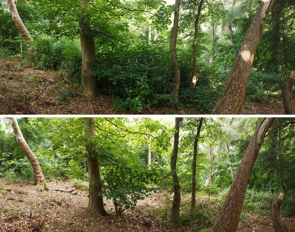
It was one of the hottest days of the year when we met in July for volunteer work in Penpole Woods. Not only was it hot, but the chosen location was distant from all of the usual meeting points. The area, deep in Penpole Wood, was at the bottom of the steps we rebuilt about ten years ago. Until last month they deposited the visitor into a thicket of cherry laurel.
Animated transition showing the view from the bottom of the Penpole Wood steps.
Already, someone had been trying to keep the paths there open, taking out branches overhanging the path, but our ambitions were somewhat greater. Considering the forecast, we had a good turnout, and thank you to all our regulars who made it. We started with the knowledge we’d cut things short to avoid the worst of the heat, but the shady area on the north-facing slope gave us some respite from the worst of it.
The impact of work turned out to be more incredible than expected. A relatively dense cherry laurel gave way quickly, revealing a number of handsome mature trees that hadn’t really been noticeable at the start of work; If we’d have spotted them earlier, we might have been a bit more careful over the location of spoil piles and their visibility.
Animated transition showing the view eastwards along the middle path.
By the end of the day, the section of the middle path we worked on was unrecognisable. Now, coming off the end of the steps, the scene opens out into a light clearing with a backdrop of fine trees. The route up from Lawrence Weston has been cleared of a lot of obstacles and joins the middle path at a junction at the stone steps. Hopefully the path remains traceable through the stone rubble.
We had planned to return here this month to continue work, but an urgent matter has cropped up at the Lilypond. September will be Heritage Open Day, and October is usually the Big Bulb Plant, so continuing the work may take longer than planned.
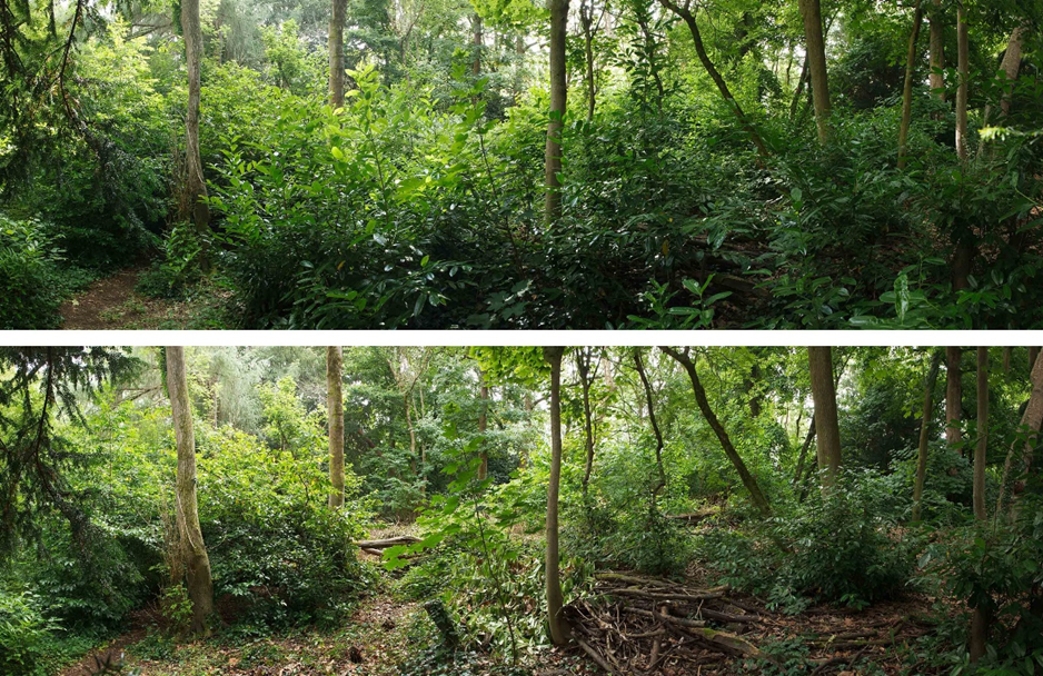
Looking west along the middle path before and after work clearing cherry laurelThe three stone steps between the middle path and main steps appear from beneath the cherry laurel.
Worked carried on into July to clear the regrown cherry laurel in Penpole Wood. Most visitors will see little change from the recent work much is hidden well back from the main path through the woods. However, the impact of cherry laurel on the native woodland is severe if it’s let get out hand.
looking west through the wood before and after the re-trimming of the cherry laurel.
Since we cleared the area in 2016 there has been a lot of regrowth, particularly on the harder to reach area along the top of the former quarry. Because the laurel has historically stunted tree growth in the area an opening had developed in the tree canopy and Brambles had begun to colonise the area aided by the catenary of laurel stems; in short, the area was in a big mess again.
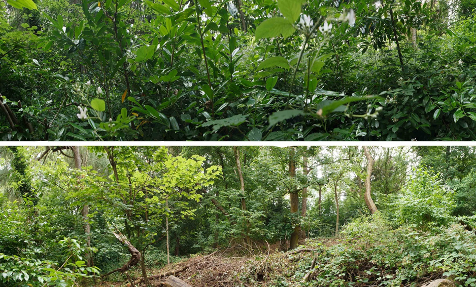
the view east through the working party area.
A relatively small group of volunteers, a usual state of affairs for the holiday season, set about putting things in order and extending the areas cleared in the last few months. Cherry laurel has been felled again, untangled from the brambles and stacked out of the way. More of the saplings planted in 2016 have also been revealed again in thriving condition. Whilst there remain some laurel bushes to the periphery of the area, ones we had neither time nor energy to tackle on a hot day, there’s not enough to occupy a full working party. These will be left for the moment while we focus on new areas.
looking up slope from the edge of the old quarry and towards the main Penpole Wood path.
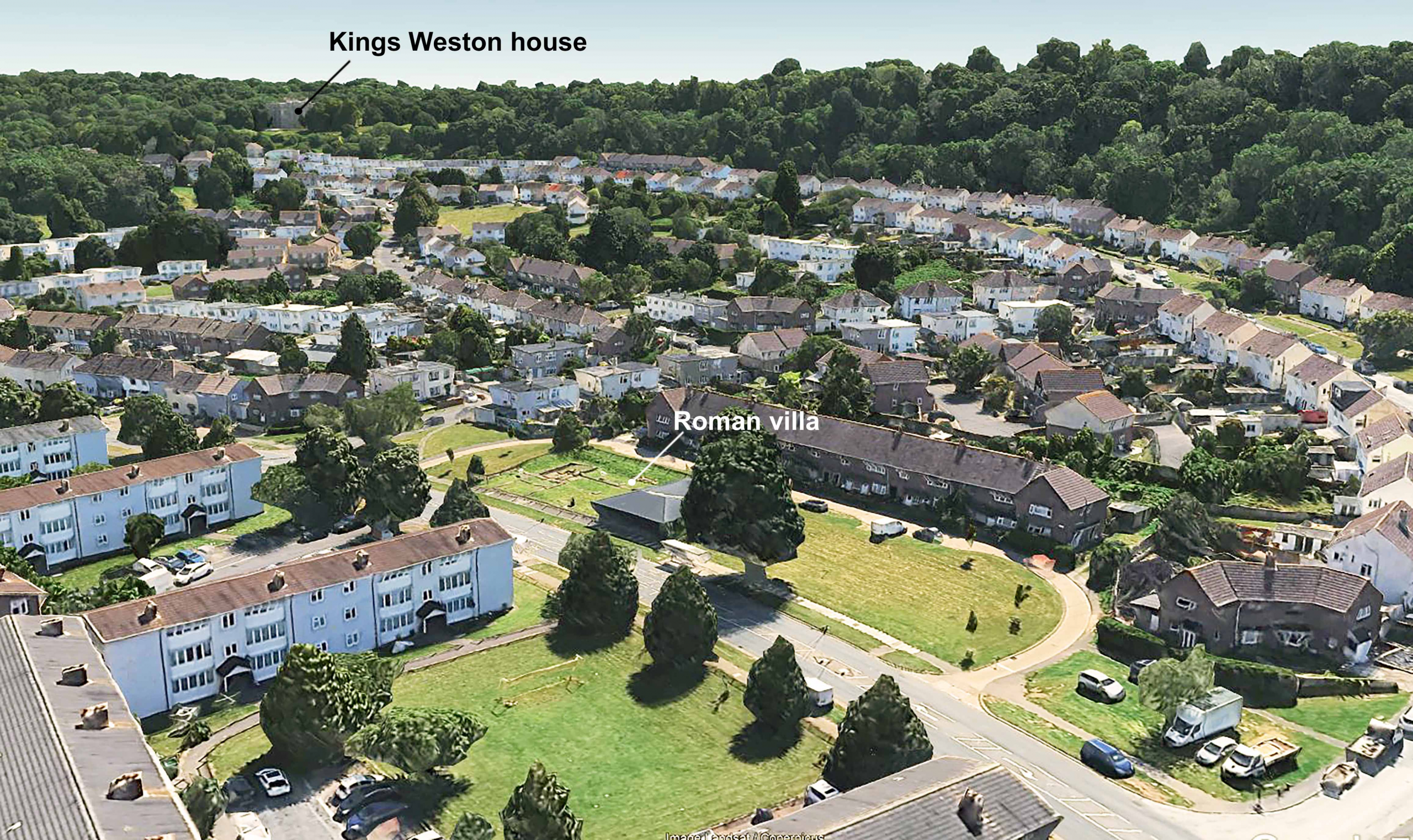
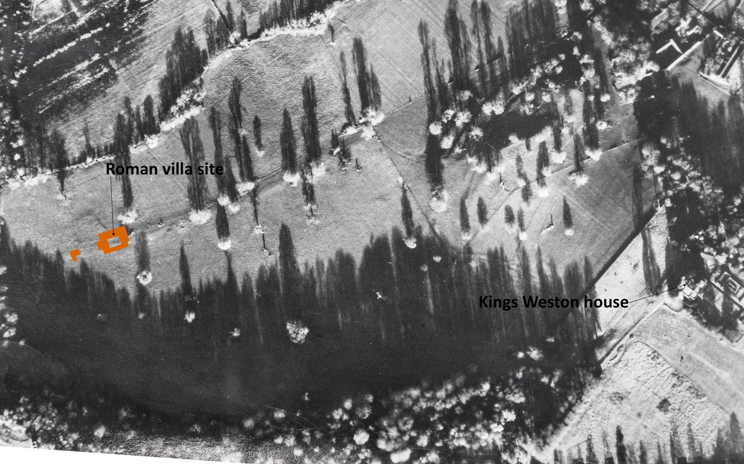
There’s been some exciting developments at the Kings Weston Roman Villa. The ancient ruins lay undisturbed beneath the grounds of Kings Weston house, unknown to its owners for more than 1,500 years, until Lawrence Weston estate was laid out over the northern part of the landscape parkland in the late 1940s. The remains were badly damaged before their significance was realised in 1947. Several seasons of archaeological work between 1948 and 1950 revealed the extent of the main villa building including decorative mosaic pavements and a bath complex. The remains were consolidated and the site made a branch museum of the city’s Museum and Art Gallery. Whilst there’s been regular new work on understanding and interpreting the site and its finds since the 1950s, there’s been little archaeological work done on the site…. Until now!
Aerial view showing the Roman Villa in relation to Kings Weston house.
Some of our Bristol members might have seen an awful accident in October last year reported in the press, when a car came off the road and crashed into the site. Fortunately, the vehicle made little impact on the roman remains themselves, hitting the surrounding fence and timber museum building only. The need to put this damage right, a small grant, and the desire to make the site more accessible has enabled the museum and archaeologists to commission new survey work.
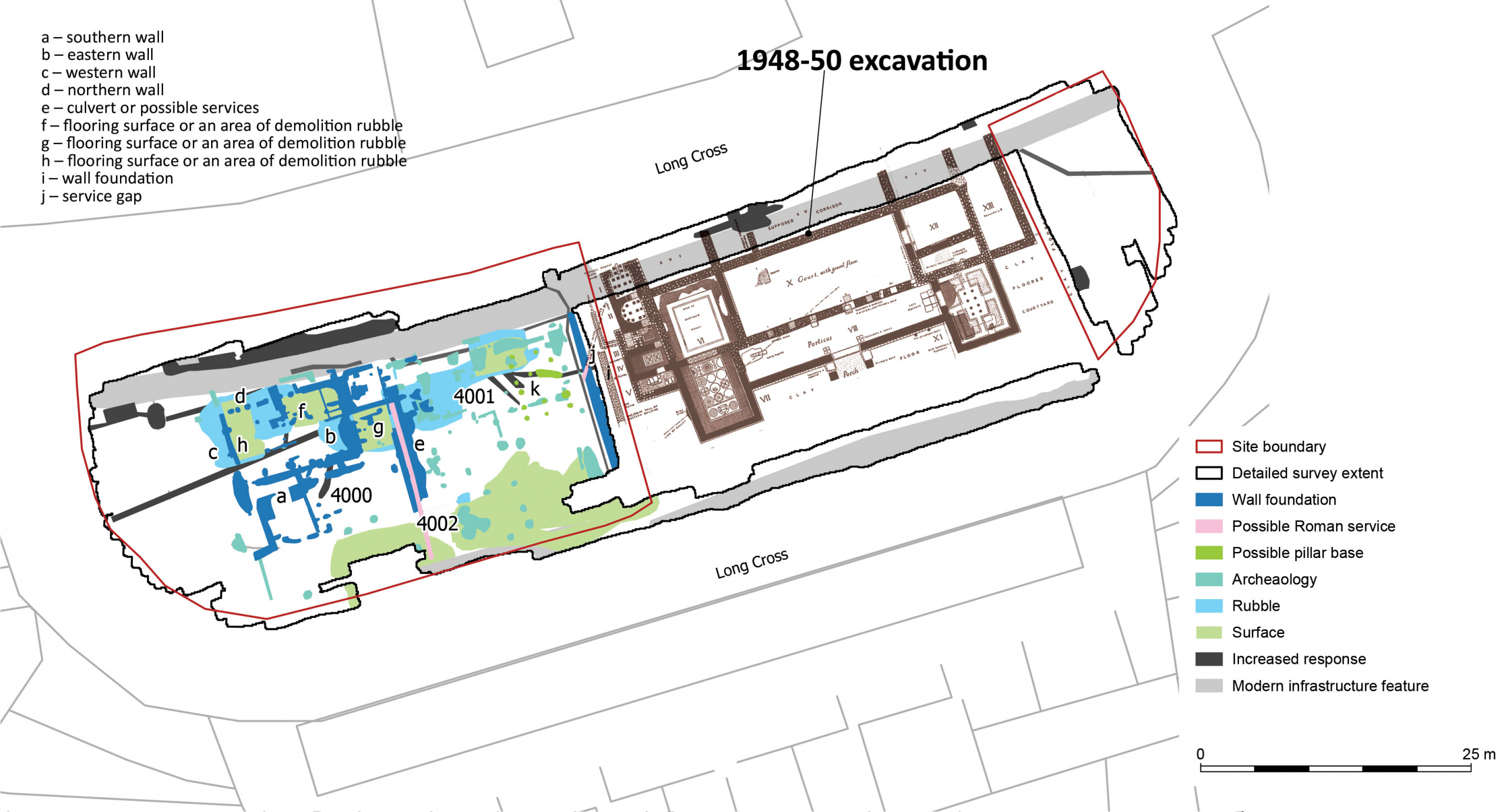
Much modern archaeology depends on non-invasive techniques rather than the traditional digging of trenches. Ground Penetrating Radar is now regularly used to explore below ground; we’ve even had areas around Kings Weston house surveyed before now. It was this type of survey that was recently undertaken by Wessex Archaeology on the open grass areas immediately surrounding the museum’s boundary fence and the results have been remarkable. The full report can be read here.
The new GPR survey in relation to the villa excavated 1948-50
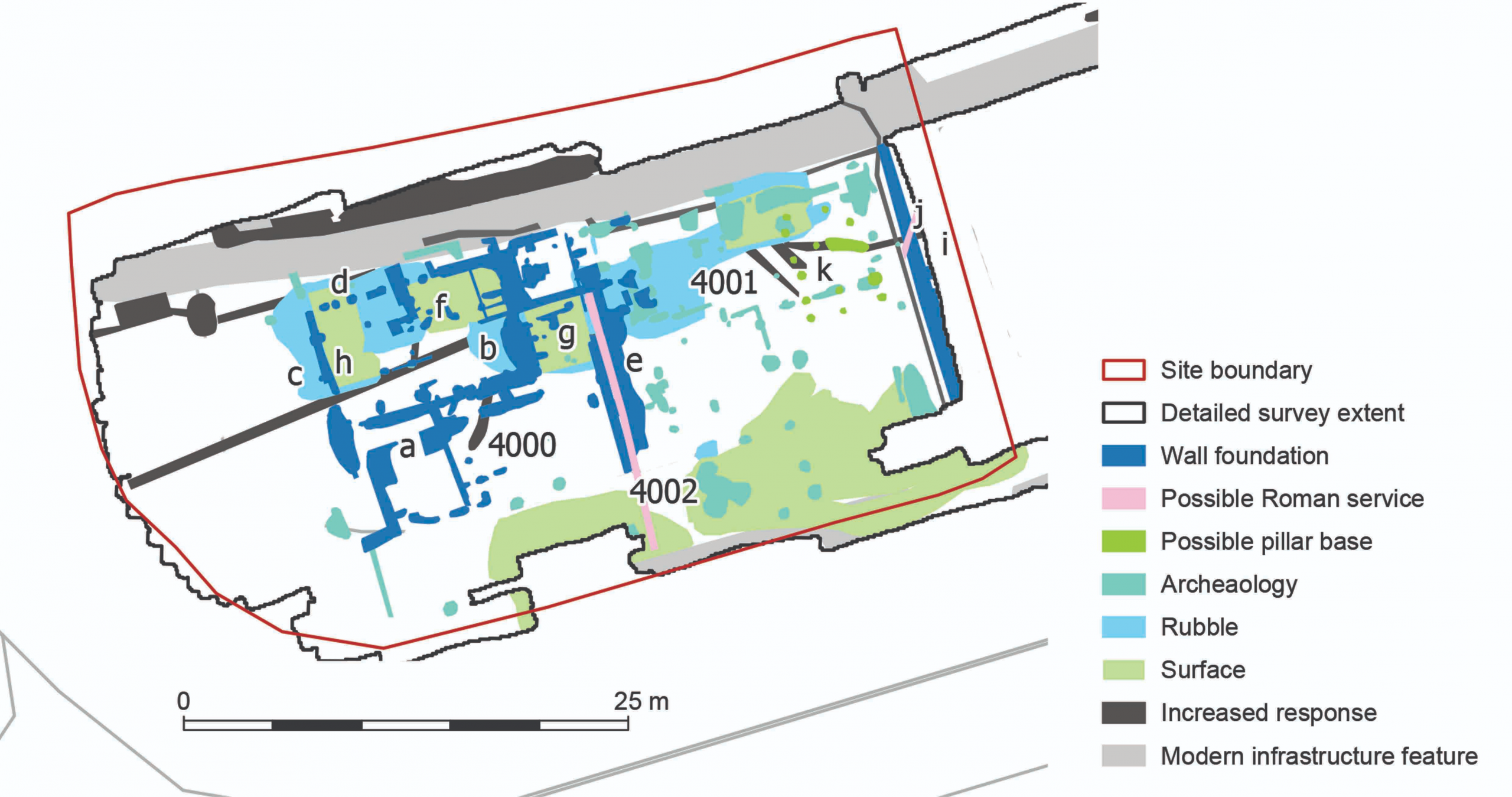
Despite a lot of interference due to modern features like the pavements, the geophys results have identified more buildings to the west of the villa, and of formed surfaces that might be interpreted as trackways, yard surfaces, and internal floors. The remains are at a similar level to the existing Roman structures, so can be confidently dated to about the same era. A few features deserve further focus here.
Detail of the GPR summary diagram showing all the features identified.
The south edge of the site, pale green on the plan, suggests a made surface running east-west across the site and possibly continuous with the clay floor identified in the post-war excavations. The location of the villa in the landscape, and this surface might represent an historic track passing across the front of the villa and perhaps a yard in the newly surveyed area. Projected eastwards, any road may have connected with several other Roman sites identified in Lawrence Weston. It’s a remote possibility that the Roman track alignment perpetuated into the modern era as a farm track known to have been in existence by 1720, and surviving in some form until 1947.
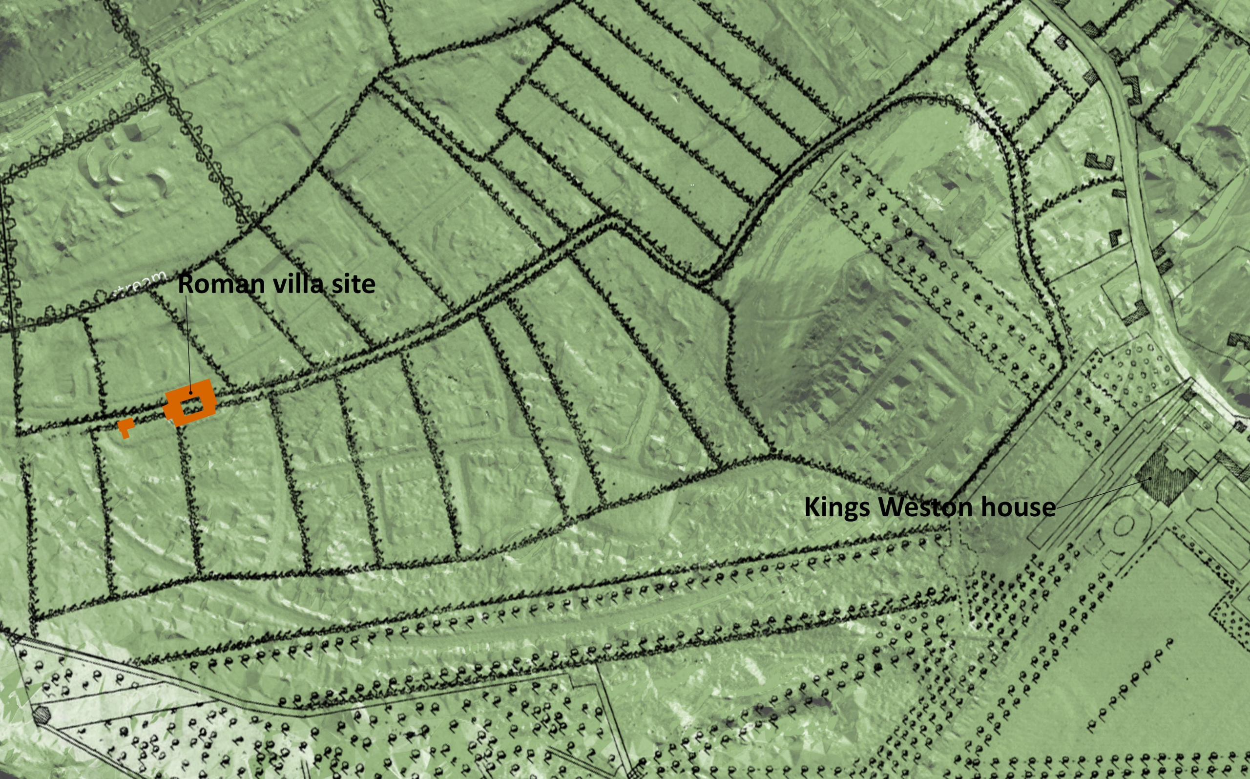
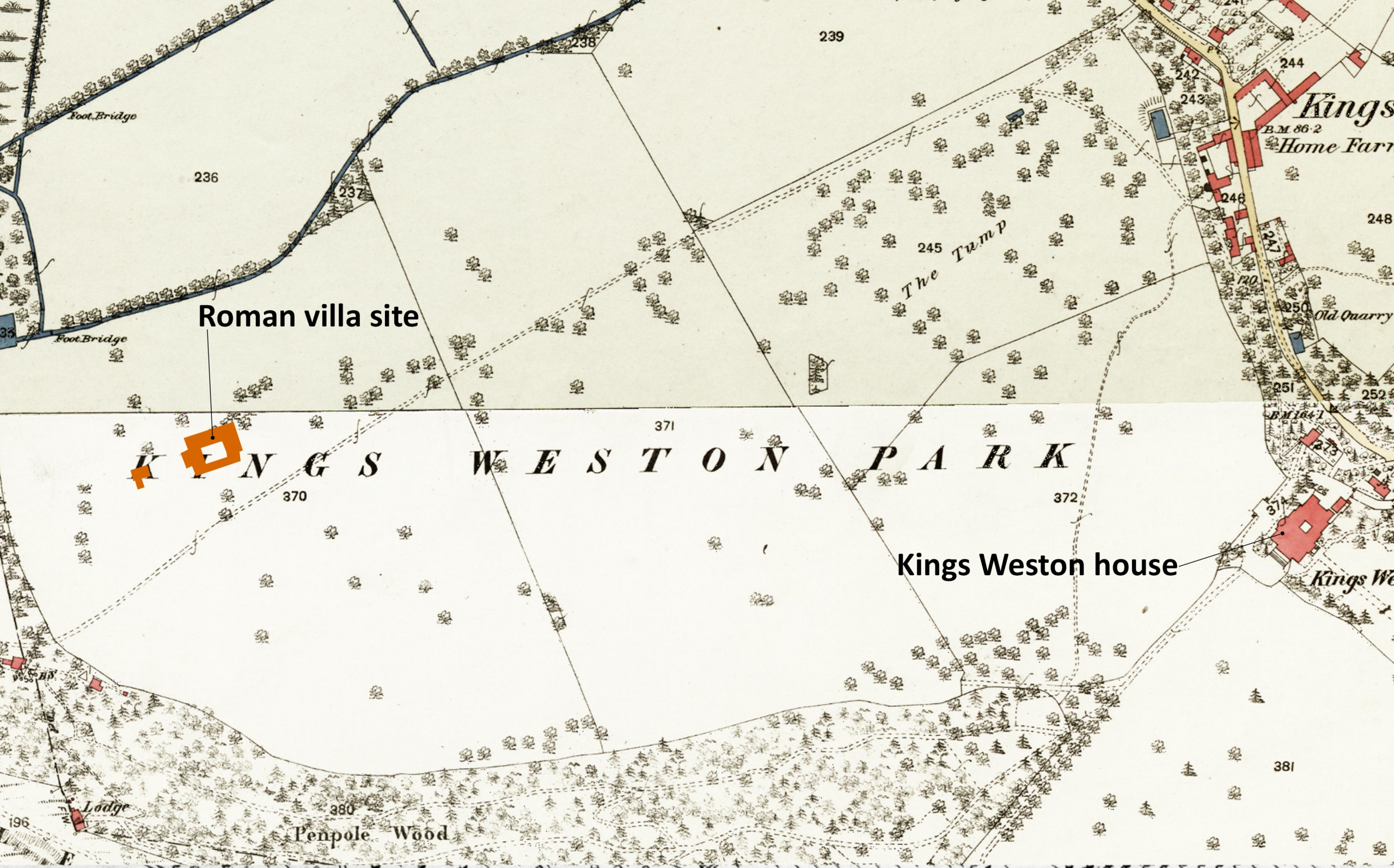
Below: The location of the Roman villa shown on maps of 1720, 1772, and 1946 and its relationship with an historic track passing through the historic parkland.
The location of the Roman villa shown on maps of 1720, 1772, and 1946 and its relationship with an historic track passing through the historic parkland.
The wall foundations, dark blue on the plan, clearly follow the same geometry as the villa itself, a strong indication that they were related and probably existed together. A north-south wall on the east side of the site seems to have matched another in the excavated area, leaving a gap of no more than 2m between them. It’s an odd arrangement; could it have been a narrow passage or lane? A water pipe appears to pass diagonally through both areas, probably feeding the bath house, but from where did the water come?
Another, similar, arrangement of parallel foundation walls occurs halfway across the new survey area with a narrower channel between the two that has been interpreted as a channel or culvert, perhaps another water system. Whether these walls extended above the historic ground level isn’t clear, but a demolition rubble layer was only found associated with the north end of the feature and possibly associated with buildings there that may stand over the channel feature.
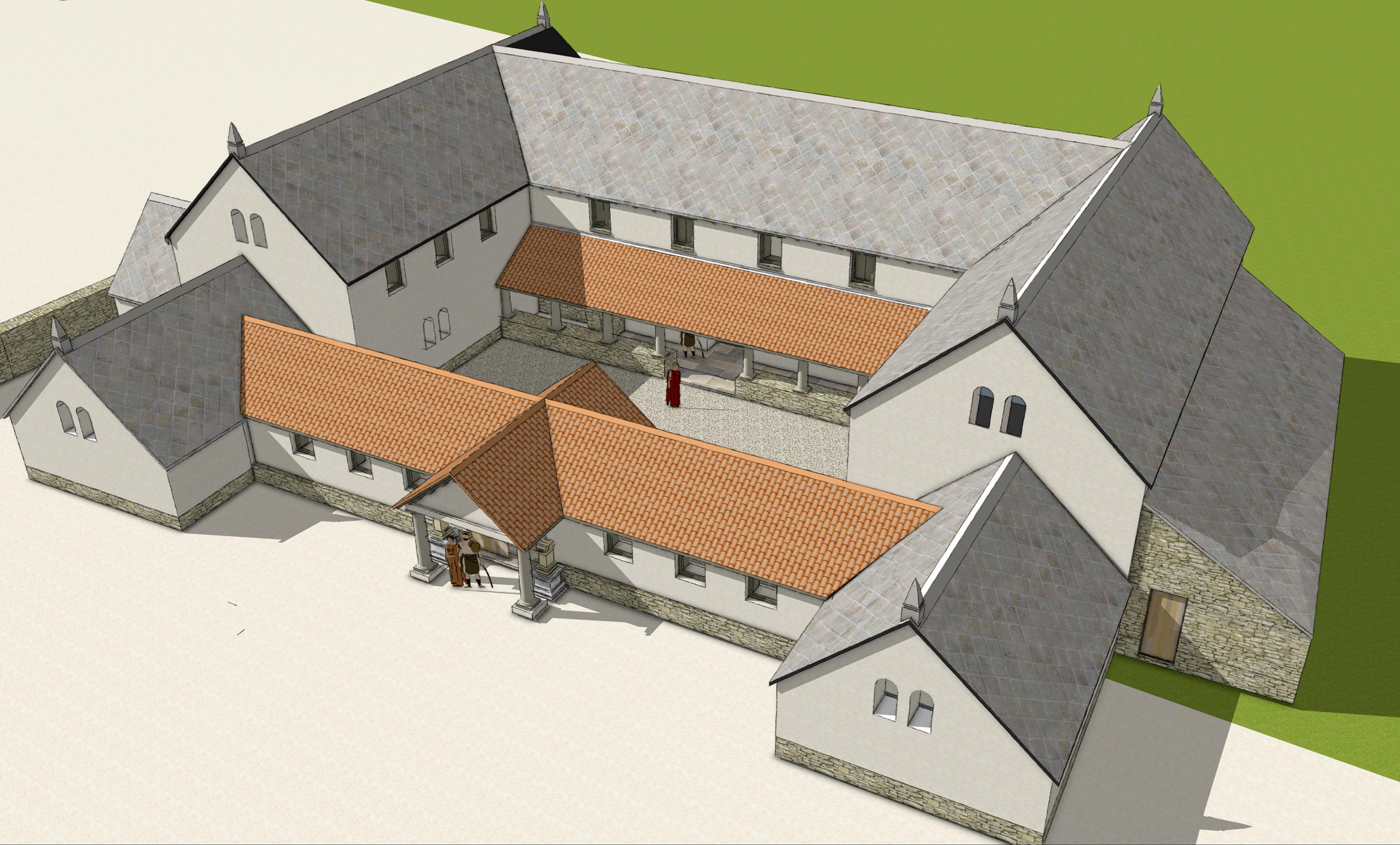
Our reconstruction of the Roman Villa viewed from the south east.
Probably the most exciting discover has been a building or complex of buildings gathered around the north-west corner of the site, structures previously unknown. The main structure is judged to be about 12m east-west and 8m north south, by no means large, but perhaps with attached structures and internal subdividing walls. Three areas of made floor surface have been identified at f,g, & h on the plan.
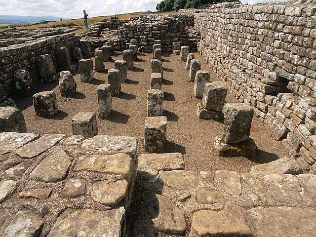
A granary at Housesteads Roman Fort with supporting pillars holding timber floors
Pale blue areas are suggested as loose rubble and debris, perhaps from collapsed buildings, and mainly distributed along the north side of the new area and suggested buildings. The dark green features are peculiar, indicating stacked masonry features like pillar bases or pilae that supported heated hypocaust floors. Without any enclosing walls, it’s possible that they supported a building raised off the ground, like a granary.
The purpose of the buildings will remain a mystery until any physical archaeological intervention takes place, but the villa would have been at the heart of an agricultural estate. It’s barns and other farm buildings have not previously been located, so it’s possible the area to the west provided these functions. The potential identification of a granary supported on piers might support that suggestion; this is, however, all hypothetical at this point.
The museum service hoped to explore this new area more in the future in old-fashioned archaeological dig where they hope to get community involvement. We’ll report more when details are released. But for now, why not take advantage of some forthcoming open days to quiz curators and archaeologists on the new discoveries? The villa will be open later this month as part of the national Festival of Archaeology for three days between 23 July—25 July. Full details can be found here as well as other dates this year when the villa will be open to the public


