During lockdown the cessation of golf on Shirehamton Park gave many the opportunity to take advantage of this less well trodden part of the Kings Weston Estate. Without sports being played families were free to roam across the National Trust owned parkland and take in its beauty. Shirehampton Park is often the forgotten side of the estate, but covers around a third of its area, comprising of around 90 acres. It was donated to the Trust by the last private owner of Kings Weston house, Philip Napier Miles, in 1922 with the proviso that it would be made always accessible to the residents of Shirehampton and Sea Mills for their recreation, and with the golf course’s use of it required. The original intention was expressed in the local papers in 1918, but it’s believed that the ongoing construction of the Portway through the park at the time delayed the final transfer.
But the parkland here has a much longer history. Still today you can trace long ridges across the golf course that represent ancient field systems. Larger ones to the east of the area face south and are likely to have been designed as medieval rabbit warrens, a conyger, that were used to farm the animals for food; coney is an obsolete historical name for rabbits. The long-disused name of a nearby outcrop, Conger Hill, is likely to derive from the adjacent coneyger.

In the Seventeeth Century Sir Robert Southwell set out to establish groves of fir trees here both for pleasure and for timber, and keenly improved the land through careful management. It remained a largely agricultural landscape until the 1720s. By the time of the estate survey at the start of that decade Edward Southwell, Sir Robert’s son, was keen to capitalise on the park’s picturesque rolling landscape, riverfront, and spectacular views across to Somerset. Soon after the completion of Kings Weston house he threw the boundary of Kings Weston’s estate out as far as the Avon and began incorporating it into the landscaped grounds.
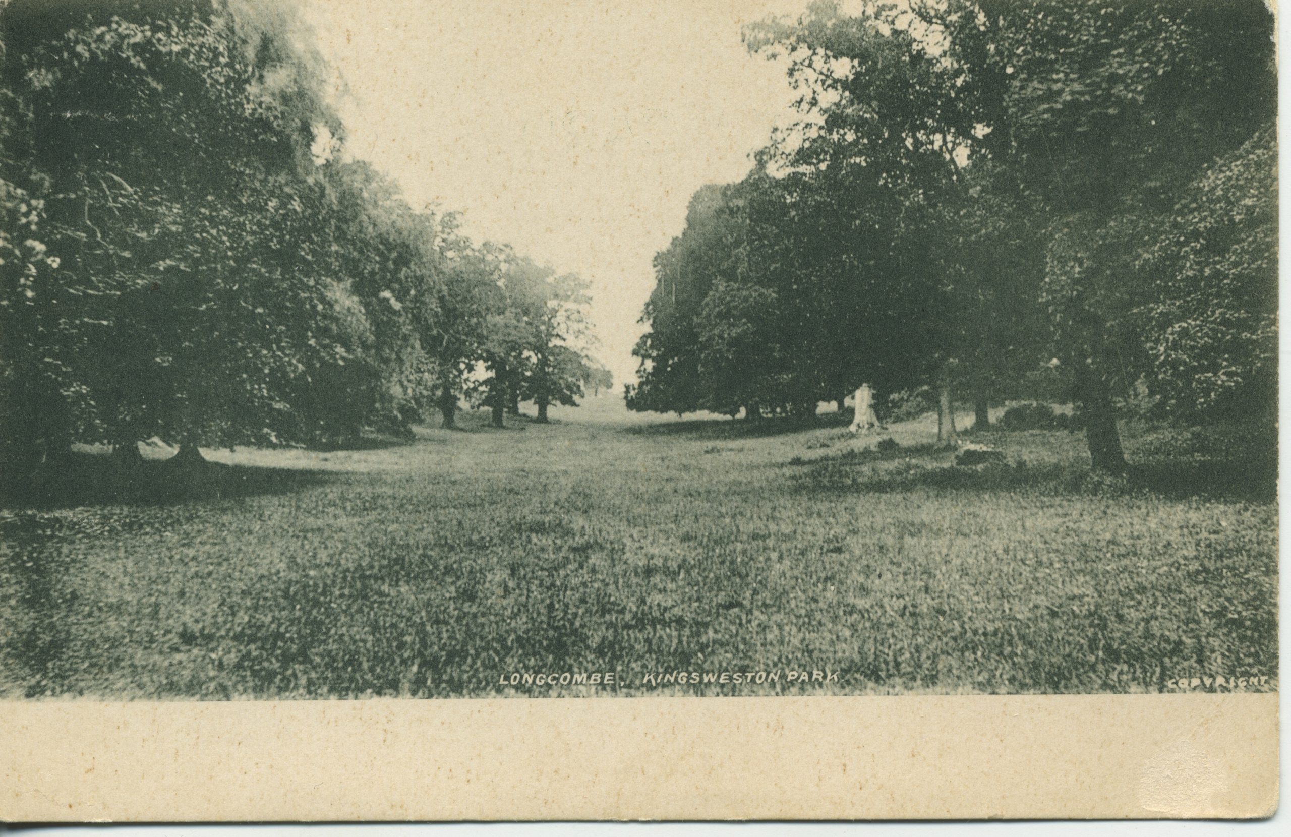
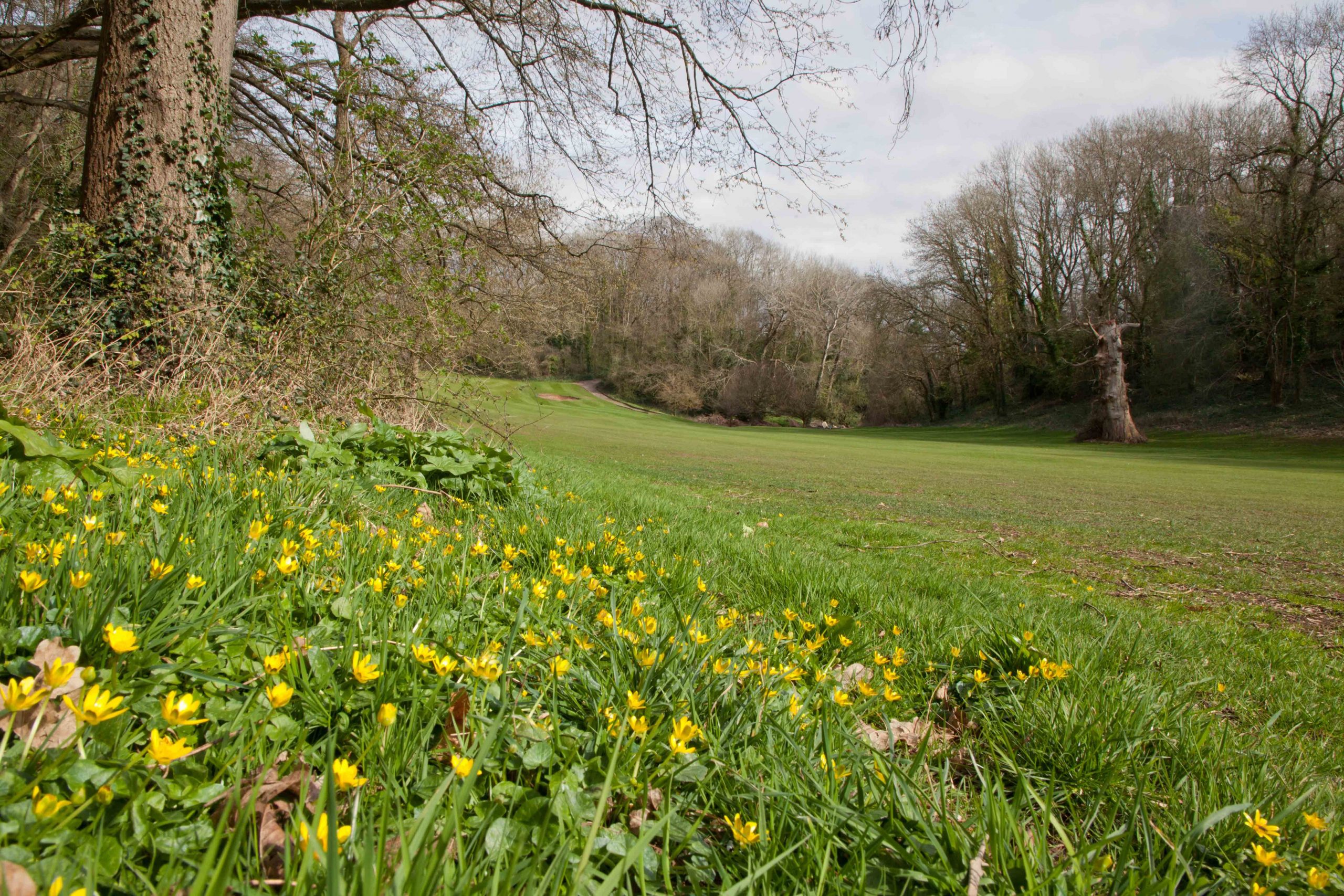
At the heart of Shirehamton Park is Longcombe, a deep hidden valley almost completely enclosed from the outside world, and with considerable picturesque value. There are two early signs of Southwell’s ambitions for this long combe which are included in the Kings Weston Book of Drawings, an album of historical plan and drawings held by Bristol Archives. There are many sketches and drawings for garden buildings amongst its pages, and two of these relate to structures around Longcombe. Both appear to have been designed to capitalise on the topography, focused on aligned views and distant prospects.

The first is, conveniently, dated to 1724, when other parkland developments were already underway elsewhere on the estate. It is a design for a viewing mound with eight individual prospects cut through the trees to focus the eye on distant landmarks. The mound was to be framed with a grove of elms and topped with a cabinet of yew trees accessed by means of a ramped walk from the east. From the mound views were aligned down Longcombe, and towards neighbouring estates at Charlton (Somerset), Leigh Court, Sneyd Park, Cote – an important house on the Downs, as well as views to the river and Westbury on Trym. Exploring the location today there remains an obvious circular prominence amongst the trees, but any framed views have long since been lost.
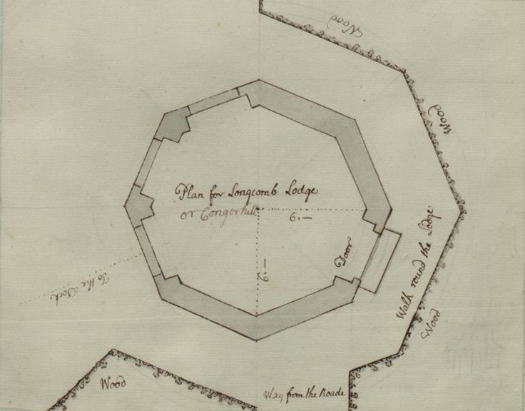
A second, undated, plan shows an octagonal lodge backing onto woodland with views identified in the direction of “the Dock” at Sea Mills. The location for this proposal is less certain. Under the description of “Plan for Longcombe Lodge” there is an addition scrawled in a lighter hand suggesting that an alternative site could be on Conger Hill, one supposes the same spot as the design for the viewing mound. The original intention for this building could have been to command the view along the length of Longcombe from a spot at the head of the valley somewhere. The truth is that we don’t know if either of these designs was executed, but there is some indication that something was made on Conger Hill from a later estate plan of 1772. Its author, Isaac Taylor, illustrated a circular open feature within the woods here, with a linear path approaching it from the high ground to the east, and a viewing corridor cut through the trees looking up Longcombe. Was this the vestige of the many-spoked design of 1724 or something else? There is no sign of the octagonal lodge. A tantalising 1759 memo authored by Edward Southwell II in the interim period notes “The ash trees and the seat in Long Combe to be taken away”; was this connected with one of these features?

By the later Georgian era Shirehampton Park was much admired for its views of the Avon. Although the park offered extensive landscape pasture its main value was as a wider picturesque setting for the mansion house. This continued into the Nineteenth Century long after the estate passed to the Miles Family. A notable event was hosted in Loncombe in 1868 at the behest of Philip Skinner Miles. He was particularly keen on encouraging his tenants to grow their own produce and improve their properties with flowers. His family were instigators of the local horticultural society in the 1850s and flower shows became a regular feature on the estate. These were sometimes held close to the house, but more often in Shirehampton Park. In 1868 the Shirehampton Flower Show was held in the pastoral setting of Longcombe. To serve visitors to the show a temporary railway platform was erected where the recently opened railway crossed the foot of the combe and special trains ran throughout the day from Bristol.