
We’ve been asked on more than one occasion what small square
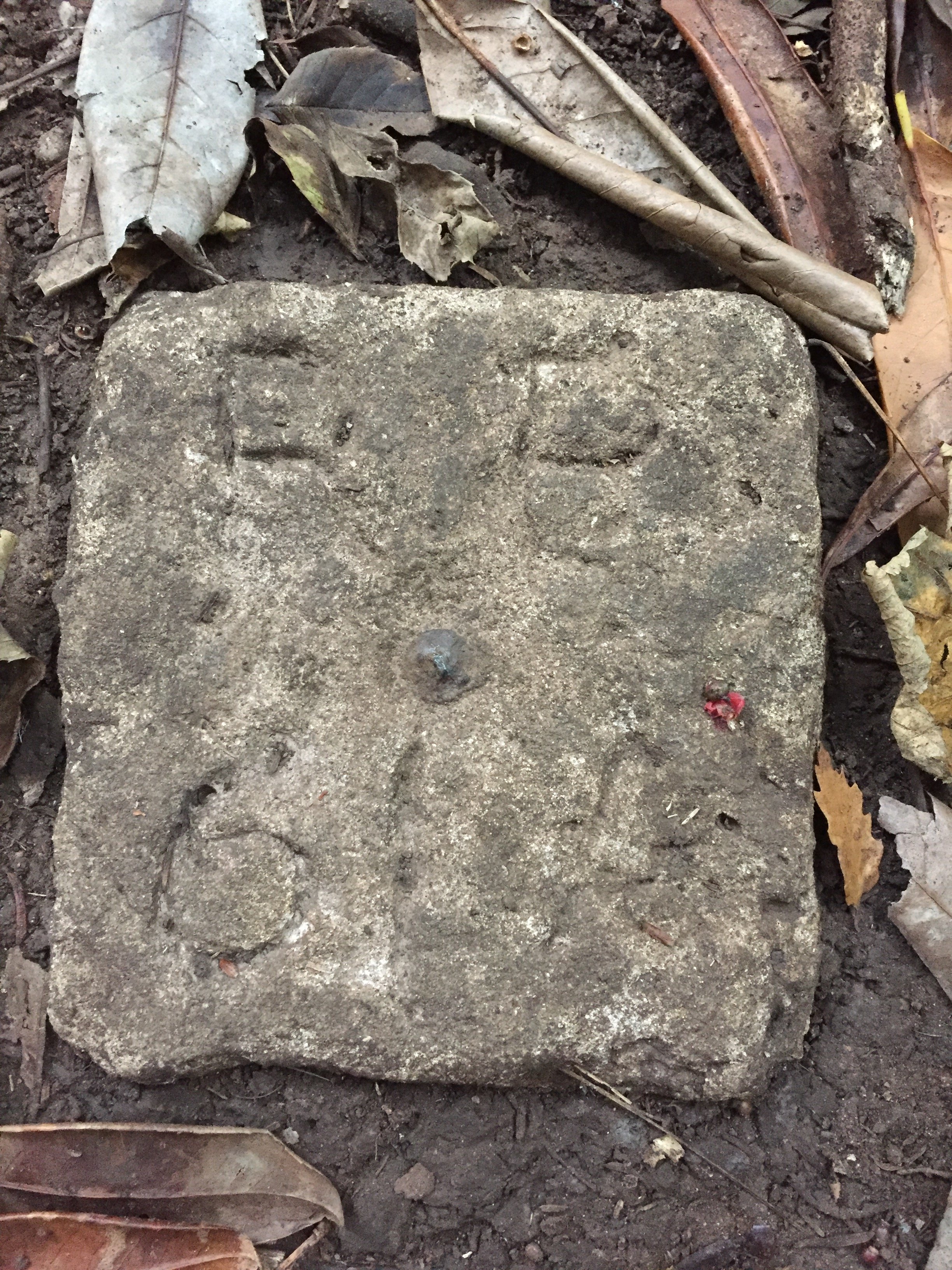
One of the concrete markers with a bronze pin and reference letters
concrete tiles scattered around the estate were for. Until recently we were unable to offer a definite answer. The guesses ranged from drain markers or boundary stones, to something related to the Second World War camps; but the fact is much more curious.
Immediately after the war the Ordnance Survey undertook the large-scale re-surveying of the whole of England. Rather than use more modern methods such as aerial photography, they chose to undertake the survey work by hand. Teams of surveyors were set up around the country and each task with verifying, or correcting, each and every house, fence-line, wall, railway road footpath, and a huge multitude of geographic features on every map on the national grid.
The surveying equipment relied on direct sight-lines between one fixed point and the next. Urban areas offered many building corners, and hard edges in which to fix the small metal surveying point, but in the forest, like in Penpole Wood, the survey teams had to make other arrangements.The local team of surveyors chose to mark these “Revision Points” by setting uniquely referenced concrete blocks set into the ground. At the centre of each was the metal pin representing the centre-point from which all their measurements were taken, and a reference number was marked in the surrounding concrete when still wet.
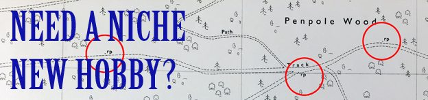
Looking closely at post-war maps of Bristol on the city’s Know Your Place website (The map layer described as “1947-1965 OS National Grid – limited coverage”) you can start picking out the huge number of Revision Points scattered across the estate and marked “r.p.”. So, before the hipsters jump on “Revision Point spotting” as a quirky new hobby why not track them down for yourselves, or just keep your eyes open for one of these odd little historic artefacts underfoot next time you’re walking around the estate.
Revision Points marked throughout Penpole Wood on the post-war ordnance Survey maps.