

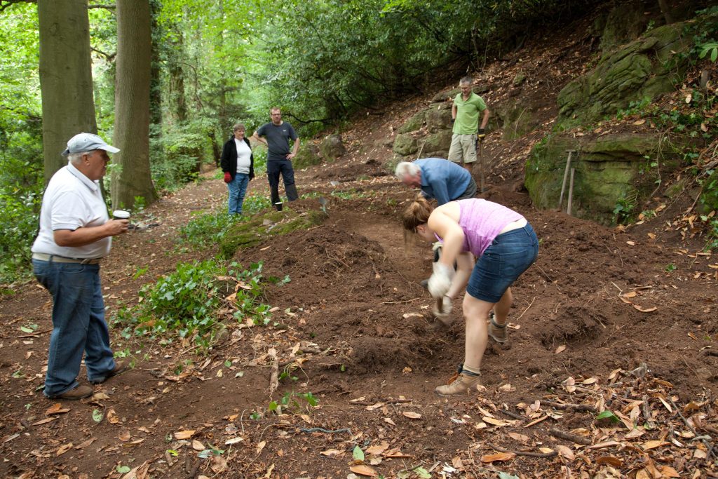
The hope was that trial excavations in August 2018 might uncover some trace of the Georgian arbour suggested in this location by a 1772 estate plan.Once the site was bare of cherry laurel three locations were identified for trial trenches: one at either end of the long site, and one inthe centre to the south of the large flat rocks exposed on the surface. The two outer trenches were excavated to about 18-26 inches each and yielded little more than fine brown natural earth with occasional stones. No interpretable features were observed in either of these trenches and they were quickly closed
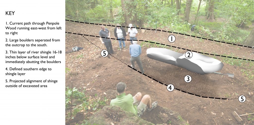
The central trench revealed that the large rocks were not part of the underlying bedrock, but appeared to have separated from the natural outcrops above it and was resting on the level area adjacent to the path. The present path runs immediately along the northern edge of this feature and is built-up on a man-made terrace in areas, though utilises natural topography in others. The trench was dug through rich brown soft earth which appears to have accumulated across the site from wash-off from the slopes above. It was clearly deeper and embanked immediately below the natural rock across the back of the site where deposits naturally collected
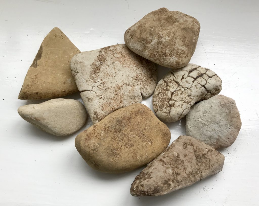
At a depth of approximately 20 inches there was a clear layer of rounded river shingle, unusually pale or white, and smooth in nature. Shingle varied in size between 2-inches to grit. This surface was a distinctive and unbroken horizon which was tracked-back in a northward direction where it met the back edge of the boulders. An abrupt edge in the surface was identified to the south of the trench three feet out from the boulder. The trench was enlarged east,west, and south to discover the extent of the shingle surface and explore the context between it and the natural cliff to the back of the site.
The surface continued east and west, maintaining a clear delineation along its southern edge, and ran approximately parallel to the main path to the North. The eastern end began tracking around the boulder though its southern edge became indistinct and it was not possible to determine if the feature curved northwards with confidence. The west end of the feature continued in a straight line and apparently in alignment with the existing path further off inthe same direction. The discovery of some rocks along the straight edge of the shingle feature could suggest they’d been intended to delineate that edge; although found at depths consistent with the shingle layer these were only haphazardly and sporadically found, and not conclusively associated with the defined edge.
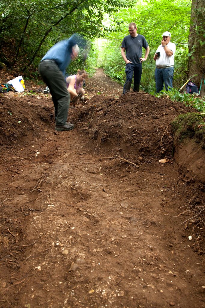
Following recording the trench was locally dug deeper through the shingle layer to establish its depth and any build-dup. The opportunity was also sought to explore whether hole in the shingle surface was a post-hole. The Layer was surprisingly thin, no more than an inch in depth, and with nosub-base. Shingle was spread across the natural earth and no further features were identified below it. The possible post-hole had no corresponding features below the shingle surface that supported that initial interpretation.
Aside from the shingle, and anashy deposit from a bonfire close to the surface in the western trench, there was no stratification, or obvious levels or horizons visible in trench sections; the whole typically being the same consistent soft brown soil. There were no finds recovered associated with any of the features, though there was some isolated fragments of roof slate and a single clay tile in upper layers
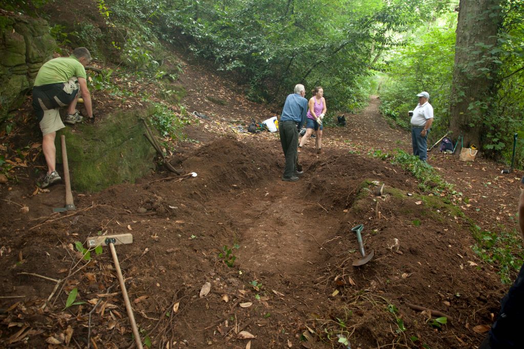
The shingle layer was clearly imported material, possibly from gravel beds around Shirehampton and Avonmouth, and can be interpreted as a path surface. Although a very shallow spread of stone the distinctive edge suggests it’s related to the main path on the north side of the boulder. There was no evidence on the modern path of similar stone being used,but this could have been obscured by later re-surfacing. There are two possibilities regarding the excavated path surface; firstly it could have been an earlier course of the current path passing to the south of the boulder;alternatively the pleasure walk may have split around the boulder, revealing it as a rustic feature within the path. The terracing on the north side of the boulder to accommodate the path, and the regularly planted trees along it supports the latter of these two theories
It was surprising that there were so few features identifiable across the rest of the site; there was certainly nothing that could relate to the distinctively crescent-moon shaped structure shown in the approximate area in 1772.That the excavated path was such a strongly linear feature suggests that the exposed rocks were a feature to be enjoyed as they were passed-by, rather than a place to dwell. If structures, or other designed garden features once occupied this site there was no identifiable remains left to be discovered by our volunteers. It was not practical to continue excavation directly down to find the natural bedrock which was so clearly exposed in the surrounding area,though future exploration may help our understanding of the natural geology and topography, and how it might have been utilised and adapted by Georgian gardendesigners.